
Guide to Driving the Cassiar Highway
Welcome to the Cassiar Highway, a captivating route that winds its way through the untouched wilderness of northwestern British Columbia, Canada. This scenic highway, also known as BC Highway 37, offers a unique and thrilling adventure for those seeking to explore the beauty of remote landscapes and embrace the serenity of nature. From picturesque mountain ranges to shimmering lakes and abundant wildlife, the Cassiar Highway promises an unforgettable journey through a rugged and awe-inspiring region.
Welcome to the Cassiar Highway, a captivating route that winds its way through the untouched wilderness of northwestern British Columbia, Canada. This scenic highway, also known as BC Highway 37, offers a unique and thrilling adventure for those seeking to explore the beauty of remote landscapes and embrace the serenity of nature. From picturesque mountain ranges to shimmering lakes and abundant wildlife, the Cassiar Highway promises an unforgettable journey through a rugged and awe-inspiring region.
As you embark on this road less traveled, it's important to be well-prepared and informed about the challenges and rewards that await you. In this guide, we will delve into the essential information you need to navigate the Cassiar Highway, from understanding the route and road conditions to considering wildlife encounters and planning for limited services. Whether you're a nature enthusiast, an avid photographer, or simply someone looking for a memorable adventure off the beaten path, the Cassiar Highway holds the promise of breathtaking vistas, outdoor activities, and an immersive experience in the heart of British Columbia's wilderness.
Get ready to immerse yourself in the beauty of towering mountains, pristine lakes, and encounters with wildlife. Discover the joys and challenges of traversing a highway that meanders through untamed landscapes, where the allure of the unknown awaits you at every turn. Let us guide you through the essential information and tips to ensure a safe, rewarding, and unforgettable journey on the Cassiar Highway.

Make sure to stop at Boya Lake when driving the Cassiar Highway. Photo by Dalton Johnson
Pros
Scenic Beauty: The Cassiar Highway offers breathtaking views of pristine wilderness, including mountains, lakes, and forests. It's a great opportunity to immerse yourself in nature and enjoy stunning landscapes.
Wildlife Viewing: The highway passes through areas known for abundant wildlife, providing opportunities to spot bears, moose, caribou, and other animals. It can be a thrilling experience for nature enthusiasts and photographers.
Remote Adventure: Driving the Cassiar Highway allows you to explore remote and less-traveled regions of British Columbia. It provides a sense of adventure and an opportunity to get off the beaten path.
Peace and Tranquility: Due to its remote location, the highway offers a sense of solitude and tranquility. You can escape the crowds and enjoy a peaceful driving experience in a beautiful natural setting.
Outdoor Activities: The Cassiar Highway provides access to various recreational activities, such as fishing, hiking, camping, and kayaking. You can indulge in outdoor adventures and explore the wilderness.
Cons
Gravel Road Sections: Certain parts of the Cassiar Highway are unpaved and consist of gravel roads. This can lead to rough driving conditions, potential vehicle damage, and slower travel speeds. It may require extra caution and suitable vehicles for this terrain.
Weather Challenges: The weather in the region can be unpredictable and harsh, especially during winter months. Snow, ice, rain, and fog can create challenging driving conditions, affecting visibility and road safety.
Lack of Amenities: Due to the remote nature of the highway, amenities such as restaurants, shops, and restrooms may be scarce. It's essential to be prepared with food, water, and other necessities for long stretches without services.
Wildlife Hazards: While wildlife viewing can be a positive aspect, it also presents potential hazards. Animals crossing the road or unexpected encounters can pose risks to drivers. Caution and attentiveness are crucial to avoid accidents.
Road Conditions: Some sections of the Cassiar Highway may have rough or uneven surfaces, potholes, or washouts. It's important to drive carefully and be prepared for varying road conditions, especially in remote areas with limited maintenance.
Route and Location:
The Cassiar Highway, also known as BC Highway 37, spans through the stunning and rugged landscapes of northwestern British Columbia, Canada. It serves as a vital transportation link, connecting the towns of Kitimat, located on the coast, and Watson Lake, situated in the southeastern Yukon territory. Stretching for approximately 724 kilometers (450 miles), the highway offers an adventurous route through remote and less-traveled regions.
Route Breakdown:
Distance: The Cassiar Highway, stretching from Kitimat to Watson Lake, covers approximately 724 kilometers (450 miles) in total. This distance can vary depending on the specific starting and ending points chosen for your journey.
Days to Drive: The number of days required to drive the Cassiar Highway can vary based on several factors, including your preferred pace, desired stops, and the amount of time you wish to spend exploring the surrounding areas. It's important to consider that the highway passes through remote regions with limited services, so planning your itinerary accordingly is essential.
Tentative ITINERARY:
Day 1: Kitimat to Meziadin Junction (Approximately 280 kilometers or 175 miles) Start your journey from Kitimat and drive north towards Meziadin Junction. This section of the highway takes you through picturesque coastal landscapes and offers opportunities to explore the Kitimat River Valley and Kitimat-Stikine region. Consider a stop at Terrace, a vibrant town along the way, for a meal or to rest for the night.
Day 2: Meziadin Junction to Dease Lake (Approximately 280 kilometers or 175 miles) Continue north from Meziadin Junction, venturing into the heart of British Columbia's wilderness. This stretch takes you through the stunning Cassiar Mountains and offers access to Boya Lake Provincial Park, known for its crystal-clear waters. Dease Lake serves as a suitable stopping point for the day, providing basic services and accommodations.
Day 3: Dease Lake to Watson Lake (Approximately 164 kilometers or 102 miles) From Dease Lake, head further north towards Watson Lake, located in the southeastern Yukon territory. This section of the highway offers breathtaking mountain vistas and opportunities for wildlife sightings. As you reach Watson Lake, you can explore the famous Sign Post Forest and enjoy the amenities available in this town.
This suggested breakdown spans approximately three days, but feel free to adjust it based on your preferences and available time. Remember to factor in additional time for stops, sightseeing, and potential detours to explore side roads or visit attractions along the way.
Road Conditions:
The Cassiar Highway predominantly consists of paved roads, providing a relatively smooth driving experience for the majority of the journey. However, it's important to be aware that there are sections of gravel road, particularly in more remote and less-traveled areas. These gravel sections can vary in length and condition, presenting different challenges for drivers.
Here are a few key points to consider:
Rough and Uneven Surface: Gravel roads may have a rough and uneven surface, which can affect vehicle stability and traction. It's essential to maintain a controlled speed and drive with caution to minimize the risk of losing control or damaging your vehicle.
Reduced Traction: Gravel surfaces offer less traction compared to paved roads, especially in wet or slippery conditions. Acceleration, braking, and cornering should be done gradually and smoothly to prevent skidding or sliding.
Loose Gravel and Dust: Gravel roads can have loose stones and dust, creating potential hazards. Keep a safe distance from vehicles ahead to avoid damage from flying stones and to maintain visibility in dusty conditions.
Increased Stopping Distance: Due to reduced traction on gravel, the stopping distance is typically longer than on paved roads. Leave ample space between your vehicle and the one in front to allow for safe braking.
Vehicle Preparation: Before driving on gravel, ensure your vehicle is in good condition. Check the tire tread and pressure, as well as the suspension and shock absorbers, to handle the rough terrain. It's also advisable to carry a spare tire, basic tools, and a first aid kit in case of any unforeseen circumstances.
Windshield Protection: Gravel roads can kick up stones, leading to potential windshield damage. Consider applying a protective film or driving with your windows closed to reduce the risk of chips or cracks.
When encountering gravel sections, adjust your driving style to accommodate the different road conditions. Drive at a safe and comfortable speed, be alert to changes in road surface, and maintain a firm grip on the steering wheel.
It's worth noting that road conditions can vary depending on weather, maintenance, and other factors. Stay informed about the latest updates, heed any warnings or advisories, and drive responsibly to ensure a safe and enjoyable journey along the Cassiar Highway.
Fuel and Services:
When driving along the Cassiar Highway, it's important to be aware that fuel stations and services can be limited, especially in more remote and isolated areas. Planning ahead and ensuring you have enough fuel and essential supplies is crucial for a smooth and worry-free journey. Here are some key points to consider:
Fuel Availability: Along the Cassiar Highway, fuel stations may be few and far between, particularly in the more remote stretches. It's essential to plan your fuel stops and monitor your fuel gauge to ensure you have enough gas or diesel to reach the next available station. Researching fuel station locations in advance and noting their operating hours can help you plan your refueling stops effectively.
Fuel Range and Vehicle Capacity: Before embarking on your journey, consider the fuel range of your vehicle and its capacity. Calculate the distance between fuel stations and ensure your vehicle can cover those distances comfortably. If your vehicle has a smaller fuel tank or higher fuel consumption, you may need to plan more frequent stops.
Extra Supplies: Given the limited availability of services along the highway, it's advisable to carry extra supplies to ensure your well-being in case of unexpected delays or emergencies. Carry ample amounts of drinking water, non-perishable food items, and snacks to sustain you during the journey. Having a spare fuel container is also recommended to provide an additional fuel reserve.
Cash and Credit Cards: Some fuel stations along the Cassiar Highway may only accept cash, while others may accept credit cards. It's a good idea to carry both forms of payment to ensure you can purchase fuel at any station you encounter.
Opening Hours and Seasonal Availability: Keep in mind that fuel station opening hours can vary, especially in more remote areas. Some stations may have limited hours of operation or may even close during certain seasons. Plan your stops accordingly, especially if you're traveling during off-peak times or outside of the summer season.
General Supplies and Amenities: In addition to fuel, other services and amenities can also be limited along the Cassiar Highway. This includes accommodations, restaurants, grocery stores, and repair facilities. It's advisable to carry basic supplies such as toiletries, medications, and vehicle maintenance tools to cater to your needs in case of limited access to these services.
Self-Sufficiency: Given the remote nature of certain sections of the highway, it's important to adopt a self-sufficient mindset. Be prepared to handle minor vehicle issues, such as changing a flat tire or addressing mechanical problems, as assistance may not be readily available in some areas. Carrying a basic toolkit, spare tire, and necessary vehicle fluids is recommended.
By planning ahead, monitoring your fuel levels, and carrying extra supplies, you can navigate the limited availability of fuel and services along the Cassiar Highway with confidence. Stay prepared, be mindful of your fuel consumption, and enjoy the stunning scenery and wilderness that the highway has to offer.
One of the many bear encounters while driving to Alaska. Photo by Dalton Johnson
Wildlife:
One of the remarkable aspects of driving the Cassiar Highway is the opportunity to encounter and appreciate the abundant wildlife that inhabits the surrounding pristine wilderness. From bears to moose and caribou, this region is teeming with diverse animal species. However, it's important to exercise caution and respect the animals and their natural habitats. Here are some important considerations when it comes to wildlife:
Wildlife Awareness: Stay vigilant and be aware that wildlife may be present on or near the road. Keep an eye out for signs indicating wildlife crossings and be prepared to slow down or stop if necessary. Wildlife can appear suddenly, so maintain a safe driving speed that allows you to react appropriately.
Drive Cautiously: Reduce your speed when driving through areas known for wildlife activity, especially during dawn and dusk when animals are more active. This not only increases your reaction time but also minimizes the risk of collisions with wildlife.
Avoid Sudden Stops: Sudden stops can startle wildlife and potentially cause accidents. If you spot an animal near the road, slow down gradually and maintain a safe distance. Do not approach or try to feed the animals. Observe them from a distance while respecting their natural behavior.
Wildlife Viewing Etiquette: If you wish to observe wildlife, do so responsibly. Use binoculars or a camera with a telephoto lens to maintain a safe distance. Do not disturb or disrupt their natural behavior by making loud noises, honking, or throwing objects. Keep in mind that wildlife should not be approached or fed, as it can disrupt their natural foraging patterns and may lead to habituation, posing risks to both animals and humans.
Bear Safety: Bears are a common sight along the Cassiar Highway. If you encounter a bear, remain calm and avoid sudden movements. Back away slowly without turning your back on the bear. Keep a safe distance and never attempt to approach or feed them. It's advisable to carry bear spray and know how to use it effectively in case of an encounter.
Nighttime Driving: Wildlife activity tends to increase during the nighttime hours. If you're driving after dark, exercise extra caution and be attentive to potential wildlife on the road. Use your high beams when there is no oncoming traffic to improve visibility, but be prepared to dim them promptly if you spot an animal.
Reporting Wildlife Sightings: Consider reporting any significant wildlife sightings, particularly those involving rare or endangered species, to local wildlife authorities or conservation organizations. This helps in monitoring population dynamics and maintaining the ecological balance of the region.
Remember, wildlife encounters are a privilege and a unique aspect of the Cassiar Highway experience. By driving cautiously, respecting their space, and appreciating their presence from a safe distance, you can enjoy the beauty of wildlife while contributing to their conservation and well-being.


Communication and Connectivity:
When traveling along the Cassiar Highway, it's important to be aware that cell phone coverage can be unreliable or completely absent in certain sections. This limited connectivity can pose challenges for staying in touch and accessing emergency services if needed. Here are some key points to consider regarding communication and connectivity along the Cassiar Highway:
Informing Others: Before embarking on your journey, make sure to inform someone you trust about your travel plans and approximate schedule. Provide them with details such as your intended route, expected stops, and estimated arrival times. This way, in case of any unforeseen circumstances, someone will be aware of your whereabouts and can notify authorities if necessary.
Limited Cell Phone Coverage: Keep in mind that cell phone coverage along the Cassiar Highway can be unreliable, especially in more remote and sparsely populated areas. Expect gaps in coverage where you may not have a signal at all. It's important to set realistic expectations and be prepared for limited or no cellular service during certain portions of your trip.
Satellite Phones: Consider carrying a satellite phone as an alternative means of communication in case of emergencies. Satellite phones rely on satellite networks instead of cellular towers, allowing for communication even in areas without cell coverage. This can be especially valuable in remote and isolated stretches of the Cassiar Highway where conventional cell phones may not work.
Two-Way Radios: Another communication option is to use two-way radios, also known as walkie-talkies, which operate on a short-range frequency. This can be helpful for keeping in touch with travel companions or communicating with others in your group during the journey.
Roadside Emergency Assistance: Along the Cassiar Highway, roadside emergency assistance may be limited or take longer to arrive compared to more populated areas. In case of a breakdown or emergency, having alternative means of communication, such as a satellite phone or two-way radios, can be vital for reaching out for help and staying connected until assistance arrives.
Spotting Services: Consider utilizing devices like SPOT or similar satellite-based tracking and messaging devices. These devices allow you to send pre-programmed messages or emergency distress signals via satellite, enabling you to communicate your location and situation to emergency services or designated contacts.
Local Information: Take advantage of any opportunities to gather local information about communication and connectivity along the highway. This could include speaking with locals, staff at visitor centers, or park rangers who may have insights on areas with better cell phone coverage or other means of communication.
Being prepared for limited connectivity and having alternative communication options can enhance your safety and peace of mind while traveling the Cassiar Highway. Stay informed, plan accordingly, and prioritize the necessary means of communication to ensure a smooth and secure journey.
Going for a stormy paddle on Lake Boya in British Columbia. Photo by Dalton Johnson
Accommodation:
When traveling along the Cassiar Highway, it's important to be prepared for limited accommodation options, particularly in more remote and less-populated areas. Here are some key points to consider when it comes to finding a place to stay along the highway:
Planning Ahead: Given the scarcity of accommodations, it's advisable to plan your stops in advance, especially if you have specific preferences or requirements. Consider the distances between towns and plan your itinerary accordingly, taking into account the driving time and any desired sightseeing or activities along the way.
Reservations: Making reservations ahead of time can help ensure you have a place to stay, particularly during peak travel seasons or in popular locations. Some lodges, hotels, or campsites along the Cassiar Highway may have limited availability due to their remote nature or small capacity. Contact the accommodations directly or utilize online booking platforms to secure your reservation.
Campgrounds: Camping is a popular option along the Cassiar Highway, offering an opportunity to immerse yourself in the natural beauty of the region. There are several campgrounds available along the route, typically managed by provincial or territorial authorities. These campgrounds often provide basic amenities such as picnic tables, fire pits, and restroom facilities. Be sure to check the availability and any reservation requirements for the specific campgrounds you wish to stay at.
Meziadin Lake Provincial Park - Located near Meziadin Junction, this park offers camping facilities and stunning views of Meziadin Lake. It's known for its fishing opportunities and beautiful scenery.
Jade City RV Park & Campground - Situated in Jade City, this campground provides facilities for both RV and tent camping. It's a convenient stopover point along the highway.
Bell II RV Park & Campground - Found near Bell II Lodge, this campground offers a tranquil setting amidst the mountains. It provides RV and tent camping options, along with amenities such as showers and a store.
Dease Lake RV Park & Campground - Located near Dease Lake, this campground provides facilities for RVs and tents. It's a convenient spot for exploring the surrounding area.
Boya Lake Provincial Park - This park features a picturesque campground on the shores of Boya Lake. It offers stunning views, hiking trails, and water activities. It's a popular spot for camping and enjoying the natural beauty of the region.
Kinaskan Lake Provincial Park - Situated along Kinaskan Lake, this park offers campsites and access to fishing, boating, and hiking. It's known for its scenic beauty and serenity.
Strawberry Flats Provincial Park - This small park provides basic camping facilities along the highway. It's a quiet spot to rest and enjoy the peaceful surroundings.
Remote Lodges and Cabins: In some areas along the highway, you may find remote lodges or cabins that offer accommodations. These establishments are often nestled within the wilderness and provide a unique and secluded experience. Keep in mind that availability can be limited, and booking in advance is recommended.
Bell 2 Lodge - Located near Bell II, this remote lodge offers accommodations and services for travelers. It provides a comfortable retreat in the wilderness, with amenities such as lodging, dining, and outdoor recreational opportunities.
Meziadin Lake Lodge - Situated near Meziadin Junction, this lodge offers rustic cabins for a cozy and secluded experience. It provides access to Meziadin Lake and the surrounding natural beauty.
Dease Lake Lodge - Found near Dease Lake, this lodge offers accommodations in a remote setting. It's a convenient stopover point for travelers along the Cassiar Highway.
Cassiar Mountain Jade Store & Lodging - Located in Jade City, this establishment offers lodging options along with its jade store. It provides a unique experience in the heart of the Cassiar Mountains.
Kinaskan Lake Lodge - Situated near Kinaskan Lake, this lodge offers remote accommodations with a focus on outdoor activities such as fishing, boating, and wildlife viewing.
Services at Towns and Junctions: While accommodations may be scarce in remote areas, towns and junctions along the Cassiar Highway often provide a few options for lodging. Places such as Dease Lake and Watson Lake offer hotels or motels, providing a comfortable overnight stay for travelers. However, it's important to note that these towns may still have limited capacity, so making reservations is advisable.
Self-Sufficiency: Due to the limited accommodation options, it's important to be self-sufficient and carry essential supplies for your trip. This includes food, water, and other necessities. Having a well-equipped vehicle or camping gear can also provide flexibility in finding suitable places to stay, as you can take advantage of dispersed camping opportunities in certain areas.
Remember to factor in the distance and driving time between your desired stops when planning your accommodations along the Cassiar Highway. Flexibility and preparedness will be key in ensuring a comfortable and enjoyable journey. By planning ahead, making reservations when necessary, and embracing the camping options available, you can navigate the limited accommodation landscape and make the most of your adventure on the Cassiar Highway.
Scenic Attractions:
Driving along the Cassiar Highway presents a feast for the eyes, with numerous scenic attractions and natural wonders to explore. Here are some of the highlights that make the journey along the Cassiar Highway truly captivating:
Boya Lake Provincial Park: Located along the highway, Boya Lake Provincial Park is a gem nestled amidst the picturesque Cassiar Mountains. The park is renowned for its stunning turquoise-colored lake, surrounded by dense forests. Take a break and indulge in activities such as swimming, canoeing, or hiking along the park's well-maintained trails.
Cassiar Mountains: The Cassiar Highway weaves its way through the awe-inspiring Cassiar Mountains. These majestic peaks, often snow-capped, create a dramatic backdrop for your journey. Admire the towering summits, deep valleys, and cascading waterfalls as you traverse this mountainous region.
Jade City: As you drive along the highway, you'll come across Jade City, a small community that has gained fame for its jade mining industry. This unique attraction allows you to learn about the fascinating world of jade and explore jewelry shops showcasing exquisite jade products. It's an excellent opportunity to admire the vibrant green hues and intricate craftsmanship associated with this precious gemstone.
Scenic Overlooks: The Cassiar Highway offers several pullouts and scenic viewpoints where you can stop to take in the breathtaking vistas. These overlooks provide panoramic views of the surrounding mountains, valleys, and pristine wilderness. Make sure to have your camera ready to capture the awe-inspiring landscapes.
Wildlife Viewing: The wildlife along the Cassiar Highway is not only a safety consideration but also a scenic delight. Keep an eye out for bears, moose, caribou, eagles, and other animals that call this region home. Spotting these majestic creatures against the backdrop of the untouched wilderness adds to the allure of the journey.
Camping and Hiking: The Cassiar Highway offers various camping opportunities, allowing you to immerse yourself in the natural beauty of the region. Set up camp at designated campgrounds along the route and enjoy the tranquility of the wilderness. Additionally, hiking trails are available in certain areas, offering opportunities for exploration and closer encounters with nature.
Fall Foliage: If you happen to travel during the autumn season, you'll be treated to a breathtaking display of colors as the forests transition to vibrant shades of red, orange, and gold. The scenic beauty of the Cassiar Highway is further enhanced during this time, creating a picturesque and enchanting experience.
Take your time to soak in the natural beauty of the Cassiar Highway. Pause at viewpoints, embark on short hikes, and allow yourself to be captivated by the stunning landscapes that unfold before you. Whether it's the glistening waters of Boya Lake or the grandeur of the Cassiar Mountains, the scenic attractions along the highway are sure to leave you in awe and create lasting memories of your journey.
A quick side trip off the Cassiar Highway. Photo by Dalton Johnson
The Cassiar Highway offers a remarkable and adventurous journey through the stunning wilderness of northwestern British Columbia. As we've explored in this blog, driving this scenic route requires careful planning and consideration of various factors. From the breathtaking landscapes and encounters with abundant wildlife to the challenges of limited services and communication, the Cassiar Highway presents a unique and awe-inspiring experience for travelers.
Navigating the Cassiar Highway demands a balance between preparedness and an open spirit of exploration. It's essential to ensure your vehicle is in good condition, carry extra supplies, and plan fuel stops wisely due to the limited availability of services along the route. Respecting the natural environment, including wildlife and the remote landscapes, is crucial for both your safety and the preservation of the region's beauty.
Despite the potential challenges, the Cassiar Highway rewards intrepid adventurers with unforgettable sights, outdoor activities, and the opportunity to disconnect from the modern world and reconnect with nature. Whether camping under the stars, capturing the perfect wildlife photograph, or simply enjoying the tranquility of the mountains, this journey promises a remarkable escape into the untamed wilderness of British Columbia. Embark on the Cassiar Highway with careful preparation, an adventurous spirit, and a deep appreciation for the breathtaking landscapes that await you.
Discover more of Alaska

How to Road Trip to Alaska
Buckle up and prepare for an unforgettable journey as we explore the wonders of the great North by embarking on a road trip to Alaska! Nestled beyond the majestic mountains and pristine wilderness, Alaska beckons adventurers with its untamed beauty and breathtaking landscapes. Whether you're an intrepid explorer seeking new horizons or simply yearning for a road trip of a lifetime, driving to Alaska from the lower 48 states offers an extraordinary experience like no other.
Buckle up and prepare for an unforgettable journey as we explore the wonders of the great North by embarking on a road trip to Alaska! Nestled beyond the majestic mountains and pristine wilderness, Alaska beckons adventurers with its untamed beauty and breathtaking landscapes. Whether you're an intrepid explorer seeking new horizons or simply yearning for a road trip of a lifetime, driving to Alaska from the lower 48 states offers an extraordinary experience like no other.
We'll delve into the logistics, routes, and considerations for driving to Alaska, unraveling the charm and allure of the renowned Alaska Highway, also known as the Alcan Highway. We'll discuss the various routes available, the documents required, estimated costs, and the time it takes to embark on this epic adventure. So fasten your seatbelts, open your map, and let's begin our virtual expedition to the Last Frontier!
Embark on an epic road trip to Alaska and immerse yourself in the stunning beauty of the Last Frontier, where adventure and awe-inspiring landscapes await at every turn.
One of many bear encounters while driving to Alaska. Photo by Dalton Johnson
Can You Drive to Alaska
Yes, you can drive to Alaska from the lower 48 states of the United States. However, it's important to note that Alaska is not directly connected to the rest of the U.S. mainland by a road network. To reach Alaska by road, you would need to go through Canada.
The most common route for driving to Alaska from the lower 48 is known as the Alaska Highway or the Alcan Highway. It begins in Dawson Creek, British Columbia, Canada, and extends northwest to Delta Junction, Alaska. From Delta Junction, it's possible to continue driving to various destinations within Alaska.
The Alaska Highway covers a distance of approximately 1,387 miles (2,232 kilometers) and takes you through beautiful landscapes, including mountains, forests, and vast wilderness areas. It's important to note that the road conditions can vary, and some sections may be rough or unpaved, especially in more remote areas.
Traveling to Alaska by road requires careful planning, as you'll need to consider factors such as border crossings, documentation (passports, visas, etc.), road conditions, fuel availability, accommodation, and weather conditions, especially during the winter months when certain parts of the highway may be closed or more challenging to navigate.
It's recommended to research and plan your route in advance, take necessary supplies and emergency equipment, and be prepared for long stretches without services or amenities. Additionally, it's a good idea to check with official sources and local authorities for the most up-to-date information and any specific requirements or restrictions before embarking on a road trip to Alaska.
Driving Routes to Alaska
There are several routes you can take to drive to Alaska from the lower 48 states. The most popular route is the Alaska Highway, also known as the Alcan Highway. Here are the main routes you can consider:
Alaska Highway (Alcan Highway):
Start: Dawson Creek, British Columbia, Canada
End: Delta Junction, Alaska
Distance: Approximately 1,387 miles (2,232 kilometers)
Cassiar Highway (BC Highway 37):
Start: Junction with the Alaska Highway near Watson Lake, Yukon, Canada
End: Junction with the Yellowhead Highway near Kitwanga, British Columbia, Canada
Distance: Approximately 450 miles (724 kilometers)
This route offers a scenic alternative to the Alaska Highway and rejoins the main highway system in British Columbia.
Top of the World Highway:
Start: Junction with the Taylor Highway near Tetlin Junction, Alaska
End: Junction with the Klondike Highway near Dawson City, Yukon, Canada
Distance: Approximately 79 miles (127 kilometers)
This route provides a unique and picturesque drive, but note that it includes unpaved sections and can be challenging in adverse weather conditions.
Stewart-Cassiar Highway (BC Highway 37):
Start: Junction with the Yellowhead Highway near Kitwanga, British Columbia, Canada
End: Junction with the Alaska Highway near Watson Lake, Yukon, Canada
Distance: Approximately 450 miles (724 kilometers)
This is an alternate route to the Cassiar Highway, passing through beautiful scenery and connecting to the Alaska Highway.
These are the primary routes, but there may be other variations or side roads you can explore depending on your preferences and the areas you want to visit. It's important to plan your route, consider road conditions and services, and check for any closures or construction before you embark on your journey.


How long does it take to road trip to ALaska
The duration of a road trip to Alaska depends on several factors, including your starting point, the route you choose, the driving conditions, your driving speed, and how much time you allocate for sightseeing and rest stops. Here are some general estimates for driving times:
Alaska Highway (Alcan Highway):
The Alaska Highway itself is approximately 1,387 miles (2,232 kilometers) long.
Driving time: It typically takes around 3-5 days to drive the entire Alaska Highway, depending on your pace and the time spent at various stops along the way. This estimate allows for a reasonable amount of driving each day while accounting for breaks, sightseeing, and overnight stays.
Cassiar Highway (BC Highway 37):
The Cassiar Highway is approximately 450 miles (724 kilometers) long.
Driving time: It usually takes around 1-2 days to drive the Cassiar Highway, depending on your driving speed and the time spent at stops or attractions.
Other routes:
Driving times for alternative routes such as the Top of the World Highway or the Stewart-Cassiar Highway will vary based on their respective lengths and road conditions. These routes may require additional time due to unpaved sections or more challenging terrain.
It's important to note that these estimates are general and can vary depending on your individual travel preferences and circumstances. It's advisable to plan your itinerary in advance, considering the distances, desired stops, and available accommodations along the way. Additionally, unforeseen circumstances such as weather conditions or road construction can affect travel times, so it's important to stay updated on the latest information and be prepared for any potential delays.
Do I Need a Passport to Drive to Alaska?
Yes, you will need a passport to drive to Alaska from the lower 48 states. Even though you'll be traveling through Canada, which is a separate country, you will still need to go through Canadian border checkpoints when entering and exiting Canada. A valid passport is the most common and widely accepted form of identification for international travel.
When crossing the U.S.-Canada border, whether by land, air, or sea, a passport is required for U.S. citizens. This applies to both entering Canada and re-entering the United States. In addition to a passport, you may also need other documentation, such as a visa or an Electronic Travel Authorization (eTA), depending on your citizenship. It's important to check the specific entry requirements for both the United States and Canada before your trip.
It's worth noting that as of my knowledge cutoff in September 2021, U.S. citizens traveling by land or sea between the United States and Canada can also use an enhanced driver's license (EDL) or a Trusted Traveler Program card, such as a NEXUS card, as an alternative to a passport. However, it's always best to verify the current requirements with the appropriate authorities or consult official government websites for the most accurate and up-to-date information regarding travel documents.
Calculate your cost to drive to Alaska
The cost of driving to Alaska can vary depending on various factors such as the distance you need to travel, the route you choose, the type of vehicle you're driving, fuel prices, accommodation costs, food expenses, and any additional activities or sightseeing you plan to do along the way. Here are some cost considerations to keep in mind:
Fuel: Calculate the approximate distance of your route and estimate your vehicle's fuel efficiency to determine the amount of fuel you'll need. Fuel prices can vary, so consider the current rates and budget accordingly.
Accommodation: If you plan to stay overnight during your journey, accommodation costs can add up. Consider options such as hotels, motels, campgrounds, or RV parks. The number of nights you'll spend on the road will affect this expense.
Food and Meals: Factor in the cost of meals during your trip. Depending on your preferences, you may choose to eat at restaurants, pack your own meals, or a combination of both.
Border Crossing Fees: Be aware that there may be fees associated with crossing the U.S.-Canada border. These fees can vary, so it's important to research and budget accordingly.
Activities and Sightseeing: If you plan to visit attractions, national parks, or engage in recreational activities along the way, consider the entrance fees, parking fees, and any additional costs associated with those activities.
Vehicle Maintenance: Ensure your vehicle is in good condition before embarking on a long road trip. Consider any necessary maintenance or repairs, which may include oil changes, tire checks, or general vehicle inspections.
It's challenging to provide an exact cost estimate as it depends on individual circumstances and choices. It's recommended to plan a budget by considering these factors, researching costs along your chosen route, and accounting for any personal preferences or specific needs. Additionally, keeping some extra funds for unexpected expenses or emergencies is always a good idea.
Enjoying the Alaska views while road tripping to Alaska for the summer. Photo by Dalton Johnson
Whether you're enticed by the prospect of traversing the Alaska Highway's winding roads, capturing breathtaking vistas of snow-capped peaks, or immersing yourself in the untamed beauty of this vast region, this thread aims to provide you with valuable insights and information to plan your own road trip to Alaska. Get ready to witness the awe-inspiring landscapes, encounter wildlife in their natural habitats, and create memories that will last a lifetime. So join us as we unlock the gateway to one of the world's most captivating road trips. The open road awaits, and the journey to Alaska begins now!
Discover more of Alaska

Everything You Need to Know to Day Hike Half Dome
Embarking on a day hike to Half Dome in Yosemite National Park is a thrilling adventure that promises awe-inspiring views and a true test of endurance. As you prepare for this iconic trek, it's crucial to equip yourself with the right gear to ensure a safe and enjoyable experience. From sturdy footwear to navigation tools and sun protection, each item plays a vital role in your journey through the breathtaking landscapes of Half Dome. In this comprehensive guide, we will walk you through the essential gear you need to pack for a successful day hike to Half Dome, providing you with the knowledge and confidence to tackle this challenging endeavor with ease.
Embarking on a day hike to Half Dome in Yosemite National Park is a thrilling adventure that promises awe-inspiring views and a true test of endurance. As you prepare for this iconic trek, it's crucial to equip yourself with the right gear to ensure a safe and enjoyable experience. From sturdy footwear to navigation tools and sun protection, each item plays a vital role in your journey through the breathtaking landscapes of Half Dome. As you ascend the rugged trails and face the formidable ascent up the Half Dome cables, having the right gear can make all the difference. We will explore the necessary clothing layers to keep you comfortable in changing weather conditions, the importance of proper footwear for navigating various terrains, and the vital role of hydration and nutrition.
Hiking Half Dome offers stunning panoramic views of Yosemite Valley, including iconic landmarks like El Capitan and Yosemite Falls. It provides a physically and mentally challenging experience, pushing hikers to their limits and instilling a sense of accomplishment upon reaching the summit. The adventure and natural beauty of Half Dome make it a bucket-list destination for outdoor enthusiasts seeking an unforgettable hiking experience.
Embarking on the adventure of a lifetime requires careful planning and preparation, and having the right gear is a crucial aspect of your readiness. So, whether you're a seasoned hiker or embarking on your very first Half Dome hike, join us as we delve into the essential gear that will ensure your safety, comfort, and success on this epic journey to the top of Half Dome in Yosemite National Park.

Half Dome glowing in an orange-red sunset. Photo by Dalton Johnson
Pros of day hiking Half Dome:
Spectacular views: The summit of Half Dome offers panoramic views of Yosemite Valley, including iconic landmarks like El Capitan and Yosemite Falls. The scenery is awe-inspiring and provides a unique perspective of the park's beauty.
Physical challenge: Day hiking Half Dome is a strenuous activity that requires physical fitness and endurance. Successfully conquering the trail provides a sense of accomplishment and personal satisfaction.
Iconic experience: Half Dome is one of Yosemite's most famous attractions, and reaching its summit is a bucket-list achievement for many outdoor enthusiasts. Day hiking allows you to experience the renowned granite monolith firsthand.
Efficient time management: Unlike overnight hikes, day hiking Half Dome allows you to complete the trek in a single day, saving you the need for camping gear and permits. This can be convenient for those with limited time or those who prefer not to camp.
Shared experience: The Half Dome trail is popular among hikers, and you'll likely encounter fellow outdoor enthusiasts along the way. This can provide a sense of community and camaraderie as you share the challenge and triumph together.
Cons of day hiking Half Dome:
Physical demands: Day hiking Half Dome involves a total round-trip distance of approximately 16-17 miles (25-27 km), with significant elevation gain. It requires excellent physical fitness, endurance, and proper preparation. Inadequate training or pushing beyond your limits can lead to fatigue, injuries, or other health issues.
Crowded trail: Half Dome is a popular attraction, and the trail can become crowded, especially during peak season. This can diminish the sense of solitude and require patience when navigating congested areas or waiting to ascend the cables.
Weather considerations: Weather conditions in Yosemite can be unpredictable, and storms or inclement weather can make the hike dangerous or even impossible. It's crucial to check the forecast and be prepared for changing weather conditions, including thunderstorms, lightning, or high winds.
Permit requirement: To hike Half Dome, you need a permit, regardless of whether you choose a day hike or an overnight stay. Securing a permit can be competitive due to high demand, and obtaining one may require planning well in advance or entering the lottery system.
Physical and mental strain: The strenuous nature of the hike, particularly the final ascent up the Half Dome cables, can be physically and mentally demanding. The steep and exposed sections may trigger fear of heights or anxiety in some individuals.
Hike OVerview:
Distance: The round-trip distance of the hike is approximately 16-17 miles (25-27 km).
Elevation Gain: The total elevation gain is around 4,800 feet (1,463 meters).
Trailhead: The hike starts from Yosemite Valley, typically from the Happy Isles trailhead.
Permits: A permit is required to hike Half Dome, regardless of whether it's a day hike or overnight stay. Permits can be obtained through the lottery system or as part of the daily lottery during the hiking season.
Route: The trail follows the Mist Trail or John Muir Trail (JMT) to reach the base of Half Dome. From there, hikers ascend the famous cables to reach the summit.
Cables: The cables section is the most challenging part of the hike. It involves a steep ascent using metal cables to assist climbers. Gloves are recommended for a better grip.
Time: Day hiking Half Dome can take anywhere from 10 to 14 hours, depending on your pace and fitness level. Start early in the morning to allow enough time for the hike and descent before dark.
HOW HARD IS THE HALF DOME DAY HIKE?
The Half Dome day hike in Yosemite National Park is widely recognized as a challenging and strenuous endeavor. It requires a significant level of physical fitness, mental determination, and careful preparation. The difficulty of the hike primarily stems from its length, elevation gain, and the final ascent up the iconic cables.
Firstly, the length of the hike itself is a significant factor contributing to its difficulty. The round-trip distance is approximately 16-17 miles (25-27 km), making it a long day on the trail. This extended distance requires sustained physical endurance and the ability to maintain a steady pace for an extended period. It's essential to be prepared for the long haul and pace yourself accordingly.
Secondly, the elevation gain on the Half Dome hike is considerable, totaling around 4,800 feet (1,463 meters). The trail winds its way up from Yosemite Valley, ascending gradually and sometimes steeply. The continuous uphill sections can put a strain on the leg muscles and cardiovascular system. Adequate training, including regular cardiovascular exercise and strength training, can help prepare your body for the ascent.
Lastly, the most notorious section of the hike is the final ascent up the Half Dome cables. The cables are metal supports that assist hikers in scaling the steep and exposed granite face of Half Dome. This section requires physical strength, balance, and a head for heights. It can be mentally challenging for those with a fear of heights or vertigo. It's important to wear sturdy footwear and use proper climbing techniques while navigating the cables.
Additionally, factors such as weather conditions and trail congestion can further impact the difficulty of the hike. Yosemite's weather can be unpredictable, and hikers should be prepared for various conditions, including rain, thunderstorms, or high winds. Storms and lightning can make the cables section extremely dangerous and should be avoided. Furthermore, the popularity of Half Dome means that the trail can become crowded, especially during peak season. This can add a level of complexity to the hike, as hikers may need to navigate congested areas and potentially wait in line for the cables.
Overall, the Half Dome day hike is considered a challenging endeavor that requires physical fitness, mental fortitude, and careful planning. It is not recommended for inexperienced hikers or those with health conditions that could be exacerbated by strenuous physical activity. Adequate training, preparation, and respect for the trail and its challenges are essential for a safe and enjoyable experience on the Half Dome hike.


WHY day HIKE Half Dome?
Hiking Half Dome as a day hike offers numerous compelling reasons to embark on this challenging adventure. From the physical and mental benefits it provides to the sense of accomplishment and the opportunity to share the experience with friends, day hiking Half Dome offers a unique and rewarding outdoor experience.
Firstly, day hiking Half Dome provides significant physical and mental benefits. The demanding nature of the hike requires you to be in good physical condition, and the rigorous trail provides an excellent workout. The long distance, steep climbs, and final ascent up the cables engage your muscles, improve cardiovascular endurance, and enhance overall fitness. Moreover, being surrounded by the stunning natural beauty of Yosemite National Park can have positive effects on mental well-being, reducing stress and fostering a sense of tranquility.
Related Read: Mental and Physical benefits of hiking
Secondly, successfully completing the day hike to Half Dome offers an unparalleled feeling of accomplishment. The trail poses challenges, both physical and mental, and conquering them instills a sense of personal achievement. Standing atop the iconic summit of Half Dome after the arduous journey is a testament to your determination, resilience, and dedication. The sense of triumph and self-confidence gained from conquering such a formidable hike can be life-affirming and inspire you to take on new challenges in other aspects of your life.
Furthermore, day hiking Half Dome presents a wonderful opportunity to share the experience with friends. The trail attracts outdoor enthusiasts from all walks of life, and embarking on this adventure together can create lasting memories and strengthen bonds. The camaraderie and support shared among friends during the hike can make the journey more enjoyable and motivate each other to reach the summit. Sharing the awe-inspiring views, overcoming obstacles together, and celebrating the achievement as a group can deepen friendships and create a shared story to cherish.
WHAT TO SEE while day hiking half dome?
While hiking Half Dome in Yosemite National Park, you will encounter a diverse and breathtaking array of natural scenery. Here are some of the notable sights you can expect to see along the trail:
Yosemite Valley: As you start the hike, you'll be surrounded by the picturesque beauty of Yosemite Valley. This iconic valley is characterized by towering granite cliffs, lush meadows, and the meandering Merced River.
Vernal Fall and Nevada Fall: The trail to Half Dome passes by two spectacular waterfalls: Vernal Fall and Nevada Fall. These cascades are at their most powerful during the spring snowmelt and offer awe-inspiring views and refreshing mist. Be prepared for some wet and slippery sections of the trail near the falls. Interested in hiking the Mist Trail? Here is a full write up on day hiking the Mist Trail in Yosemite
Liberty Cap: As you ascend the trail, you'll notice the distinctive rock formation known as Liberty Cap. This dome-shaped peak stands prominently and adds to the dramatic landscape of Half Dome's surroundings.
Sublime Views: Throughout the hike, you'll be treated to numerous scenic vistas and viewpoints. As you gain elevation, you'll be able to see the grandeur of Yosemite Valley unfolding beneath you, with famous landmarks such as El Capitan and Yosemite Falls visible in the distance. These panoramic views provide a unique perspective of the park's beauty.
Half Dome Cables: As you near the summit, you will encounter the most challenging and thrilling part of the hike—the Half Dome cables. These metal cables assist hikers in making the final ascent up the steep granite face of Half Dome. As you navigate the cables, you'll have sweeping views of the surrounding mountains, valleys, and forests.
Half Dome Summit: Reaching the summit of Half Dome is the ultimate reward for your efforts. From the top, you'll be greeted with a 360-degree view that encompasses the entirety of Yosemite National Park. You'll have an unparalleled vantage point to admire the vast wilderness, granite peaks, and the breathtaking landscape stretching as far as the eye can see.
Remember to take breaks and soak in the beauty of your surroundings throughout the hike. While the trail can be physically demanding, the stunning natural scenery along the way makes it a truly memorable and rewarding experience.
how to get Permits for hiking Half Dome?
There are two ways to get permits to hike Half Dome:
Preseason lottery: The preseason lottery for Half Dome permits takes place in March. To apply, you must create an account on Recreation.gov and submit an application. The application period is open from March 1 to March 31. Results of the lottery will be announced in mid-April.
Daily lottery: If you don't win a permit in the preseason lottery, you can try your luck in the daily lottery. The daily lottery takes place every day the cables are up, which is typically from May to October. To apply, you must go to Recreation.gov and submit an application two days before your desired hiking date. Results of the daily lottery will be announced the evening of the day you apply.
Here are some tips for increasing your chances of getting a permit:
Apply early in the lottery period. The sooner you apply, the better your chances of winning.
Apply for multiple days. You can apply for up to three days in the preseason lottery and up to five days in the daily lottery.
Be flexible with your dates. If you're not able to hike on your first choice of dates, try applying for other dates.
Here are some additional things to keep in mind:
Permits are required for everyone, including children.
Permits are non-transferable.
Permits are not refundable.
The cost of a permit is $10 per person.
For more information on how to get Half Dome permits, please visit the Yosemite National Park website.
Gear List
When preparing for a day hike to Half Dome in Yosemite National Park, it's crucial to pack the right gear to ensure a safe and enjoyable experience. Here's a gear list to consider:
Hiking Backpack: A comfortable and appropriately sized backpack to carry all your gear. Opt for one with a hip belt and chest strap for added support.
Hiking Shoes or Boots: Sturdy footwear with good traction to navigate the varied terrain. Choose footwear that you have previously worn and are comfortable in to prevent blisters and discomfort.
Clothing Layers: Dress in layers to accommodate changing weather conditions. Include moisture-wicking and quick-drying materials. Recommended clothing items include:
Moisture-wicking base layer
Insulating mid-layer (fleece or down jacket)
Waterproof and breathable outer shell (jacket and pants)
Hiking pants or convertible pants
Moisture-wicking hiking socks
Hat for sun protection
Food and Water: Carry enough food and water to sustain you throughout the hike. Pack high-energy snacks, such as trail mix, energy bars, or dried fruit. Aim to carry at least 2-3 liters of water or a water filtration system to refill along the trail.
Headlamp or Flashlight: Essential in case your hike takes longer than expected and you end up hiking in low-light conditions.
Sun Protection: Protect yourself from the sun's rays by wearing sunscreen (SPF 30 or higher), sunglasses, and a hat. Consider bringing a lightweight sun umbrella for additional shade.
Trekking Poles: Optional but recommended for added stability, especially during the descent.
Gloves: Sturdy gloves with a good grip for navigating the Half Dome cables.
Remember, this gear list is a general guide, and you may need to modify it based on personal preferences, weather conditions, and the time of year you plan to hike Half Dome. Always prioritize safety and be prepared for the challenging conditions you may encounter on the trail.
Training for Hiking Half Dome
Preparing for a hike to Half Dome requires careful planning and adequate physical and mental preparation. By taking the necessary steps to get ready, you can enhance your safety, enjoyment, and overall experience on the trail. Here's a section on how to prepare for hiking Half Dome:
Physical Conditioning: Half Dome is a demanding hike that requires excellent physical fitness and endurance. Start preparing well in advance by engaging in regular cardiovascular exercises, such as hiking, running, or cycling, to improve your stamina. Incorporate strength training exercises to build the necessary leg and core muscles. Gradually increase the intensity and duration of your workouts to simulate the demands of the trail.
Hiking Practice: Familiarize yourself with hiking on varied terrain to prepare for the challenges you'll encounter on Half Dome. Seek out local trails with similar elevation gains and descents to train your muscles and test your endurance. Practice hiking with a loaded backpack to get accustomed to carrying the weight of your gear.
Gear Selection: Ensure you have the appropriate gear for the hike. Invest in sturdy hiking shoes or boots with good traction to navigate the rocky terrain. Choose moisture-wicking clothing layers suitable for the expected weather conditions. Opt for a comfortable backpack that fits well and distributes the weight evenly. Don't forget essential items like a hat, sunglasses, sunscreen, and a headlamp or flashlight.
Navigation and Safety: Familiarize yourself with the trail and study maps of the area. Understand the route, trail junctions, and landmarks along the way. Carry a compass or GPS device and learn how to use them effectively. Check the weather forecast before your hike and be prepared for changing conditions. Pack a comprehensive first aid kit, emergency whistle, and other safety essentials.
Permits and Regulations: Obtain the necessary permits for hiking Half Dome. Permits are required for both day hikes and overnight stays. Be aware of the regulations and follow Leave No Trace principles to preserve the natural environment. Respect trail closures or restrictions due to weather, wildlife, or other safety concerns.
Mental Preparedness: Half Dome can be mentally challenging, especially during the final ascent up the cables. Prepare yourself for exposed sections, heights, and the physical exertion required. Practice mental resilience, positive self-talk, and a mindset of perseverance. Visualize yourself successfully completing the hike and overcoming any obstacles along the way.
Hydration and Nutrition: Proper hydration and nutrition are crucial for a successful hike. Drink plenty of water in the days leading up to the hike and carry an ample supply on the trail. Pack high-energy snacks, electrolyte-rich drinks, and lightweight, nutritious meals to fuel your body during the hike.
Safety in Numbers: Consider hiking with a partner or a group for added safety and support. If hiking alone, inform someone of your plans and expected return time. Share your itinerary and estimated time of arrival with them.
By following these preparation guidelines, you'll be better equipped to tackle the challenges of hiking Half Dome. Remember to start your preparations early, listen to your body during training, and be mindful of your limitations. With proper physical conditioning, gear, and mental readiness, you'll enhance your chances of having a safe, enjoyable, and rewarding experience on the trail to Half Dome.
One of the many amazing views on the way to the summit of Half Dome. Photo by Dalton Johnson
Whether you're driven by the physical and mental benefits of hiking, the desire for personal accomplishment, or the camaraderie shared with friends, the day hike to Half Dome is an opportunity to push your limits and immerse yourself in the natural wonders that surround you. The rewarding views, the triumphant sense of achievement, and the memories forged along the way will stay with you long after you descend from the summit.
As you prepare to embark on your adventure, ensure that your backpack is stocked with the essentials: from reliable footwear and weather-appropriate clothing to sustenance and safety gear. Tailor your gear selection to your specific needs, taking into account the time of year, weather conditions, and personal preferences.
Now, it's time to step onto the trail, to ascend the granite monolith, and to experience the magic that awaits you on the summit of Half Dome. May your journey be filled with breathtaking views, personal triumphs, and memories that will last a lifetime. Safe travels and happy hiking!
Discover More of Yosemite Valley

What is Bikepacking
Embarking on a bikepacking adventure is an invitation to embrace the thrill of exploration, the freedom of the open road, and the challenge of self-sufficiency. It's a journey that combines the raw power of pedaling with the simplicity of backpacking, creating an immersive outdoor experience like no other. As you set off on your two-wheeled expedition, the world unfolds before you, revealing breathtaking landscapes, hidden gems, and the wonders of nature.
Embarking on a bikepacking adventure is an invitation to embrace the thrill of exploration, the freedom of the open road, and the challenge of self-sufficiency. It's a journey that combines the raw power of pedaling with the simplicity of backpacking, creating an immersive outdoor experience like no other. As you set off on your two-wheeled expedition, the world unfolds before you, revealing breathtaking landscapes, hidden gems, and the wonders of nature.
Bikepacking is a new style of travel within adventure cycle-touring or expedition touring that involves exploring remote regions of the world on sturdy bicycles designed for the purpose. Off-road adventure cycling with lightweight gear, and often a rackless system, is now known as bikepacking. Bikepacking is not a new phenomenon though, as lightweight, soft-luggage touring has been in use for well over a century.
Whether you seek the rugged mountain trails, scenic coastal roads, or remote paths less traveled, this guide will introduce you to some of the best places for bikepacking, offering a tantalizing glimpse into the incredible destinations that await.
Soaking in the New Zealand views while bikepacking around the South Island of New Zealand. Photo by Dalton Johnson
Pros:
Adventure and Exploration: Bikepacking allows you to venture into remote and less-traveled areas, giving you a sense of exploration and adventure. You can discover hidden gems, beautiful landscapes, and experience nature in a unique way.
Physical Fitness: Bikepacking is an excellent form of exercise. It combines cycling, which provides cardiovascular benefits and works your leg muscles, with the physical demands of carrying gear and navigating different terrains. It can help improve your stamina, strength, and overall fitness level.
Cost-effective: Compared to other outdoor activities or forms of travel, bikepacking can be relatively cost-effective. Once you have your bike and necessary gear, the ongoing expenses can be minimal, primarily consisting of food, water, and occasional equipment maintenance.
Self-sufficiency and Freedom: Bikepacking allows you to be self-sufficient and independent. You have the freedom to choose your own route, set your own pace, and make decisions based on your preferences. It offers a sense of freedom and autonomy in exploring the outdoors.
Minimalist Lifestyle: Bikepacking encourages a minimalist approach. Since you have limited space on your bike, you need to carefully consider and pack only essential items. This can be a refreshing break from the materialistic world and teach you to appreciate simplicity.
Cons:
Physical Demands: Bikepacking can be physically demanding, especially if you're covering long distances or navigating challenging terrains. It requires a certain level of fitness and endurance. Steep climbs, rough trails, or adverse weather conditions can add to the physical challenges.
Gear Limitations: Due to the limited space on a bike, you have to prioritize your gear and carry only the essentials. This can be a disadvantage if you require specialized equipment or have specific comfort needs. Packing efficiently and making do with limited resources can be a learning curve.
Exposure to Elements: Unlike traditional backpacking, bikepacking exposes you more directly to the elements. You are constantly outside, which means you'll be exposed to weather changes, temperature fluctuations, rain, wind, or extreme conditions. Proper gear and preparation are crucial to handle such situations.
Safety Concerns: Bikepacking, particularly on remote routes, can pose safety concerns. You may encounter wildlife, encounter unpredictable road conditions, or face challenges in terms of navigation and communication. It's important to research and plan your routes carefully, consider safety precautions, and have contingency plans.
Limited Carrying Capacity: While the minimalist approach is an advantage, the limited carrying capacity of a bike can be a disadvantage if you need to carry bulky or heavy items. This may limit the duration of your trip or require additional logistical planning for resupplying food, water, or other essentials.
What is bikepacking
Bikepacking is a combination of cycling and backpacking, where individuals or groups travel long distances on bicycles while carrying all their necessary gear and supplies for self-supported outdoor adventures. It's a blend of the freedom and exploration offered by cycling with the simplicity and self-sufficiency of backpacking.
In bikepacking, riders use specialized lightweight bicycles and bags that are designed to carry gear efficiently. These bags are attached to various parts of the bicycle, such as the frame, handlebars, and seat post, to distribute the weight and maintain balance. The gear typically includes camping equipment, food, water, clothing, and any other essentials needed for the trip.
Bikepacking routes can vary widely, ranging from off-road trails and rugged mountainous terrain to paved roads and gravel paths. Riders often seek out scenic routes, remote areas, and nature trails to immerse themselves in the natural surroundings. The duration of a bikepacking trip can range from a single day to several weeks, depending on the distance covered and the goals of the rider.
Bikepacking offers a unique way to explore and experience the outdoors, allowing riders to cover longer distances compared to traditional backpacking. It provides a sense of adventure, independence, and the opportunity to connect with nature while traveling on two wheels.
BIKEPACKING VS CYCLE-TOURING
There are many definitions of what bikepacking is and what your bike set up should look like. Because of this, you will often find the water is muddied between cycle-touring and bikepacking, however there is an obvious difference; what is your bike capable of doing. If you can go off paved roads, maybe down single track, you have a bikepacking set up. If you are restricted to cycling on the road, you are cycle-touring.
Bikepacking and cycle touring are both forms of long-distance bicycle travel, but there are some key differences between the two:
Gear and Setup: Bikepacking typically involves using lightweight gear and specialized bags that attach directly to the bike frame, handlebars, and seat post. This setup allows for off-road riding and navigating rough terrain. In contrast, cycle touring often involves using panniers or racks that attach to the front and rear of the bicycle, allowing for more storage space and the ability to carry larger loads. Cycle touring setups are better suited for paved roads and smoother surfaces.
Terrain and Routes: Bikepacking is often associated with off-road and mixed-terrain routes. Bikepackers seek out trails, gravel roads, and more rugged environments, allowing them to explore remote areas and venture into nature. Cycle touring, on the other hand, tends to focus on paved roads and established cycling routes. Cycle tourists may prioritize scenic roadways, bike paths, or touring routes that pass through towns and cities.
Speed and Distance: Bikepacking tends to emphasize a faster pace and covering longer distances in a shorter period. It's not uncommon for bikepackers to cover 80-100 kilometers (50-62 miles) per day, or even more, depending on the terrain. Cycle touring, while still covering substantial distances, often places more emphasis on enjoying the journey and taking in the sights. Cyclists may travel at a more leisurely pace, stopping frequently to explore attractions or interact with local communities.
Self-sufficiency: Both bikepacking and cycle touring involve self-supported travel, but the degree of self-sufficiency can vary. Bikepacking typically requires a higher level of self-sufficiency, as the focus is on carrying minimal gear and supplies due to weight constraints. Bikepackers often rely on lightweight camping equipment and pack food and water for several days. Cycle touring allows for more storage capacity, enabling cyclists to carry more provisions or rely on services and amenities available along the route.
Experience and Objectives: Bikepacking often attracts riders seeking a more adventurous and rugged experience. It's popular among those who enjoy mountain biking, exploring remote trails, and immersing themselves in nature. Cycle touring, on the other hand, is often chosen by cyclists looking to cover long distances while enjoying the scenery, culture, and local experiences. It may involve staying in campgrounds, hostels, or even hotels along the way.
It's worth noting that the line between bikepacking and cycle touring can be blurry, and there can be overlap between the two. Some bicycle travelers may combine elements of both approaches depending on the terrain, their preferences, and the specific trip objectives. Ultimately, the choice between bikepacking and cycle touring depends on personal preferences, the desired experience, and the type of adventure one seeks on two wheels.


Best Places for Bikepacking:
Bikepacking offers an incredible opportunity to explore the world on two wheels, immersing yourself in nature, and experiencing unforgettable adventures. From rugged mountain trails to scenic coastal routes, there are countless destinations around the world that are perfect for bikepacking. Here is a list of some of the best places for bikepacking, each offering unique landscapes, cultural experiences, and thrilling cycling opportunities.
Great Divide Mountain Bike Route (United States) - This iconic 2,700-mile (4,345-kilometer) route follows the spine of the Rocky Mountains from Canada to Mexico, offering stunning landscapes and challenging terrain.
The Silk Road (Central Asia) - Follow in the footsteps of ancient traders on this epic bikepacking route that traverses through several countries including Kyrgyzstan, Tajikistan, and Uzbekistan, showcasing breathtaking mountain ranges and cultural wonders.
The North Coast 500 (Scotland) - This Scottish route takes you on a 500-mile (805-kilometer) loop around the northern Highlands, providing a mix of coastal views, rugged landscapes, and charming villages.
Annapurna Circuit (Nepal) - Explore the majestic Himalayas on this bikepacking route that circles the Annapurna mountain range, offering awe-inspiring scenery, diverse cultures, and challenging mountain passes.
Carretera Austral (Chile) - This famous road winds through Chilean Patagonia, showcasing pristine fjords, snow-capped peaks, and lush forests. The rugged terrain offers an unforgettable bikepacking adventure.
The Great Ocean Road (Australia) - Along the southern coast of Victoria, this scenic road offers stunning ocean views, beautiful beaches, and the chance to encounter unique wildlife while bikepacking.
The Pamir Highway (Tajikistan) - Known as one of the highest and most remote roads in the world, this bikepacking route offers unparalleled mountain vistas, challenging altitudes, and a glimpse into the local nomadic cultures.
Trans-Ecuador Mountain Bike Route (Ecuador) - Explore the diverse landscapes of Ecuador, from high-altitude volcanoes to lush rainforests, on this bikepacking route that spans the length of the country.
The West Coast of New Zealand's South Island (New Zealand) - Bikepack along the rugged West Coast, experiencing rainforests, glaciers, and dramatic coastal scenery, with the opportunity to explore remote wilderness areas.
The Trans-Pyrenees (France/Spain) - Cross the stunning Pyrenees mountain range, journeying from the Atlantic to the Mediterranean, and be rewarded with breathtaking views, charming villages, and a mix of challenging terrain.
These are just a few examples of the many incredible destinations for bikepacking around the world. If you are looking for more, check out this rad book, Bikepacking: Exploring the Roads Less Traveled, with several ideas Remember to research and plan your trip thoroughly, considering factors like weather, accessibility, and safety, to ensure an enjoyable and rewarding experience.
BIKE PACKING ESSENTIALS:
When you go Bikepacking the goal, at least for myself, is to bring as little as possible to rekindle the connection I have with mother nature, without sacrificing, too much, comfort. This balance between to much gear and not enough is a serious issue, but it shouldn’t be if you plan well. Why? Well, you never want your bike to be too heavy, but you also don’t want to freeze/go hungry, so do your research and find that middle ground. Here are some of the bikpacking essentials I suggest you always consider bringing with you:
Bicycle
Coffee (this stuff will get your heart PUMPING!)
Bikeshorts (very optional)
Enjoying the light bike while on a supported bikepacking trip from Lake Tahoe to Mount Whitney. Photo by Dalton Johnson
Bikepacking opens up a world of adventure, allowing you to embark on unforgettable journeys, explore remote landscapes, and immerse yourself in different cultures. From the rugged trails of the Great Divide Mountain Bike Route to the historical Silk Road and the breathtaking beauty of Iceland, there is a wide array of destinations that cater to the desires of bikepacking enthusiasts.
The best places for bikepacking offer a mix of challenging terrains, stunning scenery, and unique cultural experiences. Whether you seek the solitude of remote wilderness or the charm of vibrant towns along the way, each destination on our list provides an opportunity to create lasting memories and push your limits.
However, it's important to remember that bikepacking can be physically demanding and requires careful planning, preparation, and adherence to safety guidelines. Research your chosen destination, understand the terrain and weather conditions, and ensure you have the necessary equipment and skills to navigate the challenges you may encounter.
Bikepacking is more than just a means of transportation; it's a way to connect with nature, challenge yourself, and discover the beauty of our planet. So, saddle up, pack your gear, and embark on an adventure of a lifetime. The open road awaits, ready to take you on a journey that will leave you with stories to share and a deep appreciation for the world around you. Happy bikepacking!
Discover more Bikepacking adventures

Day Hike into a Better You: Rejuvenate Your Mind, Body, and Soul
In our fast-paced and hectic lives, finding moments to reconnect with ourselves and recharge can be challenging. The constant demands of work, technology, and responsibilities can leave us feeling overwhelmed and disconnected from our true selves. However, there is a simple yet powerful solution to this problem: a day hike. Stepping out into nature, breathing in the fresh air, and immersing ourselves in the beauty of the great outdoors can do wonders for our well-being.
In our fast-paced and hectic lives, finding moments to reconnect with ourselves and recharge can be challenging. The constant demands of work, technology, and responsibilities can leave us feeling overwhelmed and disconnected from our true selves. However, there is a simple yet powerful solution to this problem: a day hike. Stepping out into nature, breathing in the fresh air, and immersing ourselves in the beauty of the great outdoors can do wonders for our well-being.
Day hiking offers numerous health benefits, including improved cardiovascular health, increased physical fitness, and reduced stress levels. Regular day hiking can strengthen muscles, boost endurance, and promote weight loss. Additionally, the fresh air and natural surroundings can enhance mental well-being, improve mood, and increase overall happiness.
Join me on a transformative journey as we explore how a day hike can help us become a better version of ourselves.
Talking a sunrise hike in the dunes of Death Valley. Photo by Dalton Johnson
Escape the Everyday Routine:
Day hiking provides a remarkable opportunity to break free from the confines of our everyday routines and immerse ourselves in the wonders of nature. Stepping away from the demands of work, technology, and responsibilities allows us to disconnect from the constant buzz of our modern lives. The serene and unspoiled environment of the hiking trail offers a refreshing change of scenery, stimulating our senses and awakening our innate connection with the natural world.
As we venture into the wilderness, our minds start to unwind, shedding the accumulated stress and worries that accompany our daily grind. The rustling of leaves, the babbling of a nearby stream, and the sweet fragrance of wildflowers create a symphony that drowns out the noise of our busy lives. In this tranquil setting, we find solace and tranquility, allowing us to recharge and rejuvenate our mental state.
The act of walking amidst nature's beauty provides a valuable opportunity for introspection and reflection. As we navigate the trail, our thoughts can wander freely, untethered by the demands and distractions that often consume our minds. We can ponder life's deeper questions, reassess our priorities, and gain a fresh perspective on our goals and aspirations. The simple act of putting one foot in front of the other becomes a metaphor for progress, as each step takes us further away from the mundane and closer to a more profound sense of self.
In this escape from the everyday routine, we become fully present in the moment. The worries and preoccupations that normally weigh us down gradually fade into the background, allowing us to appreciate the beauty and serenity that surrounds us. Our senses become attuned to the smallest details—a delicate flower blooming beside the trail, a bird's melodious song, or the warm touch of sunlight filtering through the trees. By immersing ourselves in the present moment, we cultivate mindfulness and develop a heightened awareness of our surroundings and ourselves.
Day hiking not only offers an escape but also provides an opportunity to prioritize what truly matters. Freed from the distractions of technology and the pressures of productivity, we can focus on the essential elements of our lives—our health, relationships, personal growth, and connection with the natural world. It is during these moments of respite that we can gain clarity, make important decisions, and rediscover our true passions and values.
In essence, a day hike serves as a gateway to liberating ourselves from the confines of our everyday routines. It allows us to reset our minds, find balance, and gain a fresh perspective on life. By escaping into nature, we embark on a journey of self-discovery, reconnection, and renewal. So, lace up your boots, leave behind the stresses of daily life, and let the trail guide you towards a more profound understanding of yourself and the world around you.
Reconnect with Nature:
Modern society has distanced us from the natural world, leading to a disconnection that affects our overall well-being. A day hike serves as a powerful reminder of the beauty and power of nature. The awe-inspiring vistas, majestic mountains, tranquil lakes, and vibrant flora and fauna have a profound impact on our senses, revitalizing our spirit and renewing our appreciation for the Earth's wonders. As we reconnect with nature, we also reconnect with ourselves, rediscovering our place in the larger tapestry of life.
Reconnecting with nature through day hiking opens up a world of immersive experiences and activities that deepen our appreciation for the natural world. Here are some captivating activities that can enhance our connection with nature during a day hike:
Bird Watching:
As we traverse the hiking trails, we enter the domain of various bird species. With binoculars in hand, we can observe and identify a myriad of birds perched on branches, soaring through the sky, or serenading us with their melodic songs. Bird watching not only ignites our curiosity but also cultivates a sense of wonder as we witness the intricate behaviors and captivating beauty of these winged creatures.
Foraging:
Nature's bounty awaits those who venture off the beaten path. Engaging in responsible foraging allows us to connect with the environment in a unique way. Guided by knowledge and respect for the ecosystem, we can seek out wild edible plants, berries, mushrooms, and herbs, appreciating their flavors, textures, and medicinal properties. Foraging nurtures a profound connection with the land while fostering a sustainable and harmonious relationship with nature.
Plant Identifying:
Embarking on a day hike provides an opportunity to sharpen our botanical knowledge and engage in plant identifying. Equipped with field guides or smartphone apps, we can learn to distinguish different species of trees, flowers, and foliage along the trail. This activity not only enriches our understanding of the natural world but also encourages us to notice the intricate details and patterns that make each plant unique. By connecting with the plant kingdom, we develop a deeper appreciation for its essential role in sustaining life on Earth.
Stargazing:
As the day transitions into night, the wilderness unveils a breathtaking celestial display. Far away from light pollution, the night sky emerges in all its glory, sparkling with stars, constellations, and celestial wonders. Taking a moment to lie back, gaze at the vastness of the universe, and contemplate our place within it can be a profoundly humbling and awe-inspiring experience. Stargazing during a day hike allows us to reconnect with the cosmos and find solace in the beauty of the night sky.
Engaging in these activities while day hiking allows us to deepen our connection with nature on multiple levels. We become attuned to the rhythms and cycles of the natural world, fostering a sense of harmony and interdependence. By immersing ourselves in bird watching, foraging, plant identifying, or stargazing, we forge a more intimate relationship with the Earth, recognizing the delicate balance and intrinsic value of every living being and ecosystem.
Reconnecting with nature through these activities awakens our senses, cultivates curiosity, and nourishes our souls. It reminds us of the intricate web of life that we are a part of and encourages us to be better stewards of the environment. So, on your next day hike, be open to the wonders that nature offers and let these activities spark a deeper connection with the natural world.
Nurture Physical Fitness:
Engaging in a day hike offers a multifaceted approach to nurturing physical fitness. The diverse terrain encountered while hiking presents a natural and dynamic workout for our bodies. Ascending steep inclines activates our leg muscles, particularly the quadriceps and glutes, building strength and improving overall lower body endurance. Descending slopes engages different muscle groups, such as the calves and hamstrings, contributing to muscular balance and stability.
The cardiovascular benefits of hiking are equally significant. As we navigate through trails and conquer elevation changes, our heart rate increases, promoting a healthy cardiovascular system. The sustained aerobic exercise of hiking stimulates blood circulation, enhancing the delivery of oxygen and nutrients to our muscles and organs. Over time, consistent hiking can improve cardiovascular endurance, lowering the risk of heart disease and improving overall cardiovascular health.
Beyond the physical aspects, hiking also has a profound impact on our mental well-being. The release of endorphins during physical activity helps alleviate stress, boost mood, and improve overall mental health. The serene environment of nature further contributes to a sense of relaxation and tranquility, allowing us to find solace amidst the natural beauty surrounding us. Engaging in a day hike can be a rejuvenating experience, providing a much-needed break from the demands of daily life and fostering a positive mindset.
Furthermore, hiking offers a versatile range of intensities and durations, accommodating people of various fitness levels. Beginners can start with shorter, less challenging hikes, gradually building stamina and strength. More experienced hikers can take on more demanding trails, conquering greater distances and elevations to continuously challenge themselves. The adaptability of hiking makes it an inclusive and accessible activity for individuals seeking to improve their physical fitness, regardless of their starting point.
Practice Mindfulness:
In our hyperconnected world, we rarely have a moment of true silence and stillness. Hiking offers a sanctuary of peace and tranquility, allowing us to practice mindfulness. As we wander through the wilderness, we can tune into our surroundings, savoring the gentle rustling of leaves, the chirping of birds, and the whisper of the wind. Mindful hiking enables us to be fully present, letting go of distractions and nurturing a sense of inner calm. This practice not only reduces stress and anxiety but also enhances our ability to appreciate the beauty of the world around us.
With each step along the trail, we can consciously shift our focus from the incessant chatter of our minds to the symphony of nature. The gentle rustling of leaves beneath our feet, the melodious songs of birds echoing through the trees, and the soothing rhythm of a flowing stream—all become invitations to be fully present. Engaging our senses, we savor the subtle nuances and details that often go unnoticed in the hustle and bustle of daily life.
Mindful hiking encourages us to release the grip of past and future thoughts, anchoring ourselves in the here and now. By redirecting our attention to the present moment, we detach from the worries and anxieties that often consume our minds. The serenity of nature serves as a backdrop for inner reflection and introspection, allowing us to tap into a sense of inner calm and balance. With each breath of fresh air, we invite a renewed perspective and an opportunity for self-discovery.
Practicing mindfulness while hiking not only reduces stress and anxiety but also opens our hearts to a deeper appreciation for the beauty of the world around us. We become attuned to the intricate interplay of colors, shapes, and textures that make up the natural landscape. The vibrant hues of wildflowers, the majesty of towering trees, and the awe-inspiring vistas that stretch before us all become sources of inspiration and wonder.
Through the lens of mindfulness, a day hike becomes more than just a physical activity; it transforms into a meditative experience. The rhythm of our footsteps merges with the pulse of nature, creating a harmonious symphony that resonates within us. In this state of heightened awareness, we find solace, clarity, and a profound connection with the earth beneath our feet.
So, as you embark on your next day hike, embrace the practice of mindfulness. Let nature be your guide as you slow down, breathe deeply, and tune into the present moment. Allow yourself to be fully present, releasing the burdens of the past and the worries of the future. By engaging in mindful hiking, you cultivate a deep sense of peace, restore balance, and foster a greater appreciation for the simple yet extraordinary wonders that surround us.
Cultivate Self-Reflection:
The solitude of a day hike offers an ideal environment for self-reflection. Away from the noise and demands of everyday life, we can engage in introspection and delve into our inner thoughts and emotions. As we traverse the trail, we may find ourselves pondering life's big questions, setting goals, or contemplating our personal growth. The stillness of nature provides the perfect backdrop for self-discovery and self-improvement. By the time we return from our hike, we often have a clearer vision of who we are and where we want to be.
Here are some tips for cultivating self-reflection during a day hike:
Set an Intention: Before starting your hike, take a moment to set an intention for your journey. It could be to gain clarity on a specific issue, to reconnect with your values, or simply to create space for self-exploration. By setting an intention, you bring focus and purpose to your hike, providing a guiding thread for your reflections along the way.
Find a Quiet Spot: As you hike, be mindful of moments when you feel drawn to a particular spot. It could be a serene overlook, a peaceful meadow, or a secluded stream. Allow yourself to pause and spend some time in this quiet spot, away from the noise of the trail. Find a comfortable spot to sit or stand, and let the stillness of nature envelop you.
Engage in Journaling: Bring a journal and pen with you to capture your thoughts and insights. Take breaks along the trail to jot down reflections, observations, and any significant moments that resonate with you. Writing allows for a deeper exploration of your thoughts and emotions, providing a tangible record of your self-reflection journey.
Practice Active Listening: As you hike, tune in not only to your internal thoughts but also to the sounds of nature. Be present and listen attentively to the rustling leaves, birdsong, and the gentle flow of water. By practicing active listening, you invite a deeper connection with the natural world and open yourself to the wisdom it has to offer.
Embrace Mindful Walking: While hiking, shift your attention to the physical sensations of walking. Feel the earth beneath your feet, notice the rhythm of your steps, and become aware of the muscles engaged in each stride. By fully embodying the act of walking, you create a meditative state that facilitates introspection and self-awareness.
Ask Meaningful Questions: Use your hike as an opportunity to ask yourself thought-provoking questions. Reflect on your values, dreams, and aspirations. Consider what brings you joy, what challenges you, and what changes you want to make in your life. By asking meaningful questions, you encourage deep introspection and invite insights that can guide your personal growth.
Embrace Solitude: Embrace the solitude of the trail and give yourself permission to disconnect from external influences. Use this time to reconnect with your inner self without distractions. Allow your thoughts to flow freely, and be open to the wisdom that emerges when you give yourself space to just be.
By incorporating these tips into your day hike, you create a conducive environment for self-reflection and personal growth. The beauty and stillness of nature serve as catalysts for introspection, enabling you to gain valuable insights, clarify your values, and envision your path forward. As you return from your hike, carry the lessons and revelations with you, nurturing a sense of empowerment and a deeper understanding of yourself.
Day hiking during a gorgeous sunset in Alabama Hills, CA. Photo by Dalton Johnson
Embarking on a day hike is more than just an outdoor adventure; it's a transformative experience that can lead us on a path to becoming a better version of ourselves. From escaping the daily grind to reconnecting with nature, nurturing physical fitness, practicing mindfulness, and fostering self-reflection, a day hike offers numerous benefits for our mind, body, and soul. So, lace up your boots, pack your backpack, and embark on a journey that promises not only scenic beauty but also personal growth. Get ready to hike your way into a better you!
Discover more of Day Hike

Vanlife in South Lake Tahoe: Exploring Nature's Playground
Living life on the road has become an increasingly popular choice for adventurers and those seeking a break from the monotony of traditional living. One destination that has captured the hearts of many vanlifers is the stunning South Lake Tahoe. Nestled in the Sierra Nevada Mountains and straddling the state line between California and Nevada, this picturesque town offers a perfect blend of natural beauty, outdoor activities, and a vibrant community.
Living life on the road has become an increasingly popular choice for adventurers and those seeking a break from the monotony of traditional living. One destination that has captured the hearts of many vanlifers is the stunning South Lake Tahoe. Nestled in the Sierra Nevada Mountains and straddling the state line between California and Nevada, this picturesque town offers a perfect blend of natural beauty, outdoor activities, and a vibrant community.
Vanlife in South Lake Tahoe can be done, but it is tricky. With its stunning natural beauty, outdoor recreation opportunities, and a vibrant vanlife community, South Lake Tahoe offers an ideal setting for vanlifers. However, be aware of parking restrictions and seasonal crowds that may require planning and flexibility.
In this blog, we will delve into the pros and cons of vanlife in South Lake Tahoe, share a list of activities to enjoy in the area, suggest spots to sleep and places to avoid, highlight some great cafes to work at, and reveal the best time of year to experience the magic of this enchanting destination.
Rock jumping into the clear waters of Lake Tahoe. Photo by Dalton Johnson
Pros:
Unparalleled Natural Beauty: South Lake Tahoe is blessed with awe-inspiring landscapes, including the crystal-clear waters of Lake Tahoe, pristine forests, and majestic mountains. As a vanlifer, you can wake up to breathtaking vistas right outside your doorstep every morning.
Outdoor Recreation: Whether you're into hiking, mountain biking, rock climbing, water sports, or skiing and snowboarding in the winter, South Lake Tahoe has it all. There are endless opportunities to explore nature and indulge in thrilling adventures.
Vanlife Community: South Lake Tahoe has a thriving vanlife community, where like-minded individuals share stories, experiences, and tips. You'll have the chance to connect with fellow vanlifers and build lasting friendships.
Access to Amenities: Despite its natural allure, South Lake Tahoe also provides the convenience of modern amenities. You'll find grocery stores, laundromats, showers, and other facilities to ensure your vanlife experience is comfortable.
Cons:
Seasonal Crowds: South Lake Tahoe can get quite crowded during peak tourist seasons, especially in summer and winter. Finding parking spots or secluded areas might be more challenging, and popular attractions can become crowded. Plan accordingly to avoid frustration.
Weather Extremes: The weather in South Lake Tahoe can be unpredictable. Winters bring heavy snowfall, while summers are warm and dry. Be prepared for fluctuating temperatures and plan your vanlife setup accordingly.
Parking Restrictions: While South Lake Tahoe offers many beautiful spots to park and sleep in your van, there are also strict regulations in place to preserve the environment and manage overcrowding. Make sure to research designated areas and adhere to parking rules to avoid fines or other penalties.
Spots to Sleep:
When it comes to finding a place to sleep during your vanlife adventure in South Lake Tahoe, you have several options to consider.
Campgrounds: South Lake Tahoe is home to several campgrounds that provide designated spaces for van camping. Fallen Leaf Campground, nestled near the southern shore of Lake Tahoe, offers picturesque surroundings and a tranquil atmosphere. Nevada Beach Campground, located on the eastern shore, boasts stunning lake views and convenient access to the sandy beach. Meeks Bay Campground, situated on the western shore, offers a serene setting and is ideal for those seeking a more secluded experience. Keep in mind that these campgrounds can be popular, especially during peak seasons, so be sure to book your spot in advance to secure a place.
Free Dispersed Camping: For a more off-grid and adventurous experience, you can explore the option of dispersed camping in the surrounding national forests, such as the Eldorado National Forest. Dispersed camping allows you to find secluded spots in the wilderness where you can set up camp for free. However, it's crucial to research the rules and regulations of the specific forest area you plan to camp in. Remember to practice Leave No Trace principles by leaving the area as you found it and respecting the natural environment.
Parking Lots: In some cases, larger parking lots in South Lake Tahoe may allow overnight parking for vans. Heavenly Mountain Resort, for example, offers parking options where you can spend the night. Additionally, certain casinos in the area may have designated areas for overnight parking. Before settling in a parking lot, always check with the establishment beforehand to ensure that overnight parking is permitted and to inquire about any specific rules or restrictions that may apply.
Regardless of the option you choose, it's essential to be mindful of your surroundings, respect the environment, and follow any posted regulations. Remember that South Lake Tahoe is a popular destination, and parking availability can vary, especially during peak seasons. Planning ahead and being flexible will help you secure a comfortable and safe place to sleep during your vanlife experience in South Lake Tahoe.
Places to Avoid:
When vanlifing in South Lake Tahoe, it's crucial to be aware of the places to avoid to ensure a positive experience for both yourself and the local community.
Residential Areas: While South Lake Tahoe is known for its welcoming community, it's important to respect the privacy and tranquility of local residents. Avoid parking and camping in residential neighborhoods unless you have explicit permission or there are designated areas for overnight stays. Being considerate and mindful of noise levels and personal space will help maintain a harmonious relationship with the locals and preserve the peaceful atmosphere of residential areas.
Private Property: It's essential to steer clear of private properties unless you have explicit permission from the owner to park or camp on their land. Trespassing on private property can lead to legal consequences and may tarnish the reputation of the vanlife community as a whole. Always seek proper authorization or seek out established camping spots and designated areas to ensure you're respecting the boundaries of private landowners.
By avoiding residential areas and private property without permission, you'll not only abide by the rules and regulations but also foster a positive relationship with the local community. It's vital to leave a positive impression and uphold the values of responsible vanlifing, allowing everyone to enjoy the beauty of South Lake Tahoe in a sustainable and respectful manner.
Good Cafes to Work at:
When you're in South Lake Tahoe and in need of a cozy spot to set up your laptop and get some work done, there are a few standout cafes that cater to remote workers.
Revive Coffee & Wine: Nestled in the heart of South Lake Tahoe, Revive Coffee & Wine is a beloved café that offers a warm and inviting atmosphere. With its comfortable seating options, including cozy couches and communal tables, it's an ideal place to settle in for a productive work session. Savor their delicious coffee creations, indulge in a selection of wines, and enjoy the complimentary Wi-Fi to stay connected while you work.
Alpina Coffee Café: For those seeking a rustic and serene environment to enhance their productivity, Alpina Coffee Café is the perfect choice. This charming café exudes a cozy ambiance, with wooden accents and a fireplace that adds to its allure. Treat yourself to their expertly crafted beverages, such as specialty coffees and teas, while immersing yourself in your work. The peaceful atmosphere and friendly staff make Alpina Coffee Café an excellent option for remote work sessions.
Cup of Tahoe: A popular local favorite, Cup of Tahoe offers a welcoming atmosphere and a dedicated space for work. The café features ample seating, including cozy nooks and outdoor patio areas, where you can find a comfortable spot to set up your workspace. Their menu boasts an impressive selection of coffee drinks, smoothies, and light bites to keep you fueled and focused. The café also provides reliable Wi-Fi, making it an excellent spot for digital nomads and remote workers.
Freebird Tahoe: Known for its vibrant atmosphere and welcoming vibe, Freebird Tahoe is a go-to spot for both locals and visitors. The café offers plenty of seating options, including communal tables and comfortable lounge areas, making it a popular choice for those looking to work remotely. The high-speed Wi-Fi ensures a seamless connection, allowing you to stay productive while enjoying their extensive menu of coffee, tea, smoothies, and light bites. The relaxed ambiance and friendly staff make Freebird Tahoe an inviting place to work and socialize.
These cafes not only provide a comfortable and inspiring work environment but also offer delectable beverages and treats to keep you energized throughout the day. Whether you're seeking a cozy atmosphere, rustic charm, or a vibrant setting, these cafes in South Lake Tahoe cater to the needs of remote workers, allowing you to strike a balance between work and enjoyment.


Activities to Do in the Area:
South Lake Tahoe, nestled amidst the breathtaking Sierra Nevada Mountains, is a haven for outdoor enthusiasts and adventure seekers. With its crystal-clear lake, towering peaks, and lush forests, this captivating destination offers a wide array of activities to satisfy every adventurer's craving. From exhilarating water sports and world-class skiing to scenic hikes and relaxing beach days, South Lake Tahoe promises an unforgettable playground where nature's wonders take center stage.
Explore Emerald Bay State Park: No visit to South Lake Tahoe is complete without a visit to the breathtaking Emerald Bay State Park. Discover the stunning beauty of Emerald Bay, a picturesque inlet known for its vibrant turquoise waters. Explore Fannette Island, the only island in Lake Tahoe, and marvel at Vikingsholm Castle, a Scandinavian-inspired mansion nestled on the shores of the bay. Embark on the scenic Rubicon Trail, which winds along the shoreline, offering panoramic views of the lake. Enjoy a leisurely picnic on the pristine beaches or go paddleboarding to fully immerse yourself in the park's natural splendor.
Hit the Slopes: With its proximity to the Sierra Nevada Mountains, South Lake Tahoe is a paradise for winter sports enthusiasts. Indulge in world-class skiing and snowboarding at renowned resorts such as Heavenly Mountain Resort and Sierra-at-Tahoe. Whether you're a seasoned pro or a beginner, the slopes offer a wide range of terrain suitable for all skill levels. Soak in the stunning alpine scenery as you carve down the mountainside, creating unforgettable memories in the winter wonderland.
Enjoy Water Sports: South Lake Tahoe's crystal-clear waters provide the perfect playground for water sports enthusiasts. Rent a kayak or paddleboard and glide across the serene lake surface, taking in the panoramic views of the surrounding mountains. Feel the thrill of jet skiing as you zip across the sparkling waters or embark on a relaxing boat cruise to explore the lake from a different perspective. Whether you prefer adrenaline-pumping activities or a leisurely day on the water, South Lake Tahoe offers endless opportunities for aquatic adventures.
Hike to Mount Tallac: For outdoor enthusiasts seeking a challenging but rewarding hike, the Mount Tallac Trail is a must-do adventure. This strenuous trail takes you through diverse terrain, including lush forests, alpine meadows, and rocky slopes, culminating in breathtaking panoramic views of Lake Tahoe and the surrounding mountains from the summit. As you ascend, you'll be rewarded with ever-changing vistas and the sense of accomplishment that comes with conquering one of the region's most iconic peaks.
Relax at the Beaches: South Lake Tahoe is blessed with several beautiful beaches, providing the perfect setting to unwind and soak up the sun. Pope Beach offers a wide sandy shoreline, ideal for leisurely walks and sunbathing, while Zephyr Cove Beach boasts stunning views of the lake and a range of water activities. Take a refreshing dip in the clear waters or simply bask in the serene atmosphere, enjoying the tranquility of these idyllic lakeside spots.
Mountain Biking: The area surrounding South Lake Tahoe is a haven for mountain biking enthusiasts. Explore the thrilling trails of the Tahoe Rim Trail, a 165-mile loop that showcases the natural beauty of the region. Whether you're a beginner looking for scenic paths or an experienced rider seeking adrenaline-pumping descents, there are trails suited to all skill levels. The Corral Loop is a popular choice, offering a variety of terrain and breathtaking vistas as you navigate through the forests and meadows on two wheels.
In South Lake Tahoe, adventure awaits at every turn. From exploring the stunning Emerald Bay to embracing the thrill of winter sports, enjoying water activities on the lake, embarking on challenging hikes, relaxing at the beaches, or immersing yourself in the exhilaration of mountain biking, this captivating destination offers an array of activities to suit every taste and preference.
Best Time of Year:
South Lake Tahoe's charm extends throughout the seasons, each offering unique experiences and opportunities for vanlife enthusiasts.
Summer (June to August):
Summer in South Lake Tahoe is a bustling and vibrant time. The warm temperatures make it ideal for water activities, including kayaking, paddleboarding, swimming, and boating. The beaches come alive with sunbathers and picnickers, and the lake beckons visitors to cool off in its crystal-clear waters. Hiking trails are open and accessible, allowing you to explore the surrounding mountains and take in the breathtaking vistas. The longer days provide ample time to soak up the sun, enjoy outdoor festivals and events, and connect with the lively vanlife community.
Winter (December to February):
Winter transforms South Lake Tahoe into a snowy wonderland, making it a paradise for snow enthusiasts. The area is renowned for its world-class ski resorts, such as Heavenly Mountain Resort and Sierra-at-Tahoe, where you can hit the slopes and indulge in thrilling skiing and snowboarding adventures. The picturesque landscape is blanketed in snow, creating a serene and magical atmosphere. Vanlifers can embrace the cozy ambiance of the winter season, snuggling up in their vans and enjoying the beauty of snow-capped mountains. Winter also offers opportunities for snowshoeing, cross-country skiing, and snowmobiling, allowing you to explore the winter wonderland in unique ways.
Spring (March to May):
As winter gives way to spring, South Lake Tahoe experiences milder weather and a sense of renewal. Spring brings the gradual melting of snow, leading to rushing waterfalls and blooming wildflowers. This is an excellent time for vanlifers to enjoy quieter trails, as the crowds of summer and winter have yet to arrive. You can take advantage of the moderate temperatures to embark on scenic hikes, bike rides, or nature walks, immersing yourself in the area's natural beauty as it awakens from its winter slumber. Spring is also a time for special events, such as wildflower festivals and outdoor concerts, where you can immerse yourself in the local culture.
Fall (September to November):
Fall paints South Lake Tahoe in a breathtaking palette of red, orange, and gold as the leaves change colors. The region's forests and mountains come alive with vibrant hues, creating a stunning backdrop for vanlife adventures. Fall is an excellent time for hiking, as the temperatures are cooler and the trails are less crowded. You can witness the changing foliage and capture Instagram-worthy photos of the landscape. The fall season also offers a sense of tranquility, as the summer crowds disperse, allowing you to savor the serenity of the area.
Regardless of the season you choose for your vanlife adventure in South Lake Tahoe, you'll be rewarded with unique experiences and the opportunity to immerse yourself in the area's natural beauty and vibrant community.
Hiking in South Lake Tahoe. Photo by Dalton Johnson
Embarking on a vanlife adventure in South Lake Tahoe opens the door to a world of natural wonders, exhilarating outdoor activities, and a warm community of fellow vanlifers. Despite a few challenges, the pros far outweigh the cons, making this destination a top choice for those seeking an unforgettable vanlife experience. From the awe-inspiring landscapes to the endless recreational opportunities, South Lake Tahoe is a true haven for nature enthusiasts and adventurers alike. So, pack your bags, hit the road, and immerse yourself in the beauty of vanlife in South Lake Tahoe.
Discover more of Vanlife

The Ultimate Hiking Guide to the Eastern Sierra
Welcome to the Eastern Sierra, a hidden gem nestled in the heart of California's captivating landscape. Here, amidst towering peaks, glistening lakes, and untouched wilderness, awaits an outdoor haven that beckons hikers from far and wide. With its unparalleled beauty and a tapestry of breathtaking trails, the Eastern Sierra is a hiker's paradise like no other.
Welcome to the Eastern Sierra, a hidden gem nestled in the heart of California's captivating landscape. Here, amidst towering peaks, glistening lakes, and untouched wilderness, awaits an outdoor haven that beckons hikers from far and wide. With its unparalleled beauty and a tapestry of breathtaking trails, the Eastern Sierra is a hiker's paradise like no other.
This comprehensive hiking guide invites you to explore the wonders of the Eastern Sierra, where every step unveils new vistas and every ascent leads to awe-inspiring panoramas. Traverse rugged mountain paths, meander through alpine meadows painted with wildflowers, and witness the raw power of cascading waterfalls. Whether you're a seasoned trekker seeking a challenging summit or a leisurely adventurer in search of serenity, the Eastern Sierra offers an array of trails to suit every skill level and desire.
Immerse yourself in the natural wonders of this pristine region as you embark on epic hikes. Marvel at the renowned John Muir Trail, tracing its legendary path through rugged terrain and pristine wilderness. Discover hidden gems like the Convict Lake Loop, where tranquility and reflection abound. Challenge yourself on the Bishop Pass Trail, rewarded with sweeping vistas that stir the soul. And be captivated by the mystical beauty of Devils Postpile and Rainbow Falls, where nature's artwork takes center stage.
This guide goes beyond trail descriptions; it's a compass for your hiking journey. With safety as our utmost priority, we'll equip you with essential knowledge on preparation, gear, and navigating the rugged terrain. Learn how to adapt to higher elevations, stay hydrated, and respect the delicate balance of nature. We'll also share invaluable insights into the region's rich history, wildlife encounters, and nearby attractions, ensuring your adventure is as immersive as it is unforgettable.
So, lace up your boots, let the mountain air invigorate your spirit, and embark on a trek through the Eastern Sierra—a land of grandeur, tranquility, and infinite exploration. Let this guide be your companion, guiding you to hidden trails, panoramic vistas, and the raw beauty that lies within the Eastern Sierra's embrace. Get ready to create memories that will linger in your heart long after you've left these hallowed paths. Your journey begins now, amidst the majesty of the Eastern Sierra.
Setting off on a hiking trip in the Eastern Sierra. Photo by Dalton Johnson
Pros:
Breathtaking Scenery: The Eastern Sierra boasts awe-inspiring landscapes, including majestic peaks, pristine lakes, and alpine meadows. The region's natural beauty is a treat for the eyes and offers countless opportunities for stunning photographs and unforgettable vistas.
Diverse Trail Options: From leisurely strolls to challenging summit hikes, the Eastern Sierra caters to hikers of all skill levels. The region offers a wide range of trails, allowing you to choose the one that matches your fitness level and desired difficulty.
Wildlife Encounters: The Eastern Sierra is home to a variety of wildlife species, including deer, marmots, birds, and sometimes even bears. Hiking in this region provides a chance to witness these creatures in their natural habitats, offering memorable wildlife encounters and photography opportunities.
Solitude and Tranquility: While popular, the Eastern Sierra still offers ample opportunities to find solitude and tranquility on the trails. You can escape the crowds and immerse yourself in the peaceful serenity of nature, allowing for a more immersive and reflective hiking experience.
Rich Natural and Cultural History: The Eastern Sierra is steeped in natural and cultural history. From ancient geological formations to indigenous traditions, the region holds stories waiting to be discovered. Hiking through the Eastern Sierra allows you to connect with this heritage and gain a deeper appreciation for the area's significance.
Cons:
High Elevation and Weather Variability: The Eastern Sierra's high elevation can pose challenges for hikers, particularly those who are not acclimated to altitude. The weather in the region can also be unpredictable, with sudden temperature drops, high winds, and the potential for thunderstorms. Proper preparation and awareness of changing conditions are essential.
Limited Accessibility: Some areas in the Eastern Sierra, especially remote backcountry trails, may have limited accessibility due to seasonal road closures or trail conditions. It's important to check for any restrictions or closures and plan accordingly.
Crowded Trails in Popular Areas: Certain trails and destinations in the Eastern Sierra, especially during peak seasons, can experience high visitor traffic. Popular sites like Mammoth Lakes or well-known trails may be crowded, impacting the sense of solitude and tranquility that some hikers seek.
Permit Requirements and Regulations: Some hiking trails in the Eastern Sierra, particularly in wilderness areas, require permits for overnight trips. Securing permits in advance and adhering to regulations may require additional planning and coordination.
Seasonal Considerations: The Eastern Sierra experiences distinct seasons, each with its own characteristics. Winter brings snow and limited access to higher elevation trails, while summer can bring hot temperatures and increased wildfire risk. It's important to plan your hikes accordingly and be aware of any seasonal challenges or hazards.
Destination Overview: Unveiling the Eastern Sierra's Natural Splendor
Nestled within the embrace of California's majestic mountains, the Eastern Sierra region stands as a testament to nature's unrivaled artistry. Its breathtaking landscapes, pristine lakes, and awe-inspiring peaks attract outdoor enthusiasts seeking a communion with the wild. Embark on a journey through this remarkable region, where adventure awaits at every turn.
At the heart of the Eastern Sierra lies Mammoth Lakes, a haven for outdoor enthusiasts. This captivating destination boasts a collection of shimmering alpine lakes, including the iconic Twin Lakes and the picturesque Lake Mary. The surrounding mountains provide a backdrop of unparalleled beauty, with Mammoth Mountain standing tall as a sentinel over the valley. From hiking and fishing to mountain biking and skiing, Mammoth Lakes offers year-round adventures for nature enthusiasts.
Further south, the town of Bishop awaits, serving as a gateway to the Eastern Sierra's natural wonders. Nestled along the picturesque Owens River, Bishop exudes a charming small-town atmosphere. Prepare to be captivated by the dramatic scenery as the towering peaks of the Sierra Nevada Mountains dominate the horizon. Bishop offers access to an array of hiking trails, rock climbing routes, and fishing spots that attract adventurers and nature lovers alike.
No exploration of the Eastern Sierra would be complete without a mention of the renowned John Muir Wilderness. Named in honor of the famed naturalist and preservationist, this sprawling wilderness area covers over half a million acres of pristine terrain. Encompassing towering granite peaks, alpine meadows painted with vibrant wildflowers, and remote lakes reflecting the sky above, the John Muir Wilderness beckons intrepid explorers seeking solitude and serenity in nature's embrace.
As you traverse the Eastern Sierra, prepare to be enchanted by its natural beauty and diverse landscapes. Discover hidden gems tucked away in remote corners, encounter wildlife in their natural habitats, and find solace amidst towering forests and alpine vistas. The Eastern Sierra region is a testament to the wonders of the natural world, where each destination reveals a unique chapter of its captivating story.
So, lace up your boots, pack your sense of wonder, and get ready to embark on an unforgettable journey through the Eastern Sierra. From the enchanting Mammoth Lakes to the charming town of Bishop, and the wild expanses of the John Muir Wilderness, this region offers a tapestry of outdoor experiences that will leave an indelible mark on your soul. Prepare to immerse yourself in the grandeur of the Eastern Sierra—a land where nature's beauty knows no bounds.
Doing some extreme hiking in the Eastern Sierra. Photo by Dalton Johnson
Popular Hiking Trails: Exploring the Eastern Sierra's Spectacular Routes
In the Eastern Sierra, a treasure trove of hiking trails awaits, each offering its own unique blend of natural wonders and unforgettable experiences. Lace up your boots and embark on these remarkable trails that showcase the region's diverse landscapes and breathtaking beauty.
The John Muir Trail: Spanning a legendary 211 miles, the John Muir Trail is an iconic backpacking route that traverses the heart of the Sierra Nevada. This world-class trail takes hikers through breathtaking alpine landscapes, crossing high mountain passes, pristine meadows, and glacial lakes. Prepare for an epic journey that immerses you in the splendor of the Eastern Sierra's wilderness.
Convict Lake Loop Trail: Offering a scenic and accessible hike suitable for all skill levels, the Convict Lake Loop Trail captivates with its picturesque 2.5-mile loop around a pristine mountain lake. Immerse yourself in the serenity of towering peaks reflected in the crystal-clear waters as you meander through aspen groves and enjoy panoramic vistas. This trail is perfect for a leisurely stroll or a peaceful picnic by the lakeshore.
Bishop Pass Trail: For seasoned hikers seeking a challenging adventure and breathtaking rewards, the Bishop Pass Trail is an 18-mile round trip that leaves an indelible impression. As you ascend through alpine terrain and cross over the 11,972-foot Bishop Pass, be prepared to be awe-struck by the beauty of sparkling alpine lakes, cascading waterfalls, and panoramic views of the rugged granite peaks that define the Eastern Sierra.
Devils Postpile to Rainbow Falls: Step into a geological wonderland on the moderate 5-mile trail from Devils Postpile to Rainbow Falls. Marvel at the unique hexagonal basalt columns of Devils Postpile National Monument before continuing your journey to witness the awe-inspiring 101-foot Rainbow Falls, where the Middle Fork of the San Joaquin River plummets in a glorious display. This trail offers a perfect blend of natural beauty and geological fascination.
Big Pine Lakes Trail: Prepare to be enchanted by the stunning beauty of the Big Pine Lakes Trail, an 8-mile hike that leads you to a series of glacial lakes nestled beneath the majestic Palisade Range. Immerse yourself in a world of turquoise waters, cascading waterfalls, and towering granite walls. Each lake along the trail reveals its own unique charm, offering hikers a tranquil escape into the high alpine wilderness.
McGee Creek Trail: Situated near Mammoth Lakes, the McGee Creek Trail is a picturesque 7-mile out-and-back trail that meanders along the banks of McGee Creek. Immerse yourself in the beauty of the Eastern Sierra as you hike through dense forests, cross wooden bridges, and witness stunning views of the surrounding peaks. This trail is renowned for its vibrant fall foliage and offers a peaceful retreat into nature.
Sabrina Basin Trail: Discover alpine wonders on the Sabrina Basin Trail, an 11-mile round trip that showcases the beauty of high mountain lakes and towering granite peaks. As you ascend through the breathtaking scenery of the Eastern Sierra, you'll encounter pristine lakes such as Blue Lake and Dingleberry Lake, offering a true wilderness experience and a chance to witness the region's natural splendor.
Each of these trails in the Eastern Sierra invites hikers to immerse themselves in the region's natural beauty, discover hidden gems, and forge unforgettable memories.
Family Hiking in the Eastern Sierra: Adventures for All Ages
The Eastern Sierra is not only a haven for experienced hikers and outdoor enthusiasts but also a perfect destination for families seeking memorable adventures amidst nature's embrace. With its diverse range of trails and captivating landscapes, the Eastern Sierra offers hiking experiences that cater to all ages and skill levels. Here's a guide to help you plan a remarkable family hiking trip in this stunning region:
Choose Family-Friendly Trails:
Opt for trails that are suitable for children, considering distance, elevation gain, and difficulty level. Look for shorter and less strenuous hikes that provide opportunities for exploration and enjoyment.
Some recommended family-friendly trails in the Eastern Sierra include:
Convict Lake Loop Trail: This scenic 2.5-mile loop offers stunning lake views and gentle terrain, making it accessible for young children.
Rainbow Falls Nature Trail: Located near Devils Postpile National Monument, this easy 1.5-mile trail leads to the majestic Rainbow Falls, captivating visitors of all ages.
Little Lakes Valley Trail: Situated in the Rock Creek area, this picturesque trail provides a gentle, 5-mile round trip journey through a stunning alpine valley, showcasing beautiful lakes and breathtaking mountain views.
Safety and Preparation:
Prioritize safety by packing essential items such as sunscreen, insect repellent, first aid supplies, and extra layers of clothing.
Ensure everyone in your family wears appropriate footwear for the trail conditions. Consider trekking poles for added stability, especially for younger children.
Stay hydrated and bring plenty of water and snacks to keep everyone energized during the hike. Encourage children to drink regularly and take breaks as needed.
Engage in Nature Education:
Make the hiking experience educational and fun by engaging children in nature exploration. Encourage them to observe and identify plants, animals, and geological features along the trail.
Bring guidebooks or smartphone apps that help identify local flora and fauna, allowing kids to learn about the environment and foster a sense of curiosity.
Plan for Picnics and Rest Stops:
Take advantage of scenic viewpoints or designated picnic areas along the trail. These breaks provide opportunities for the family to rest, enjoy snacks, and soak in the natural beauty surrounding them.
Involve children in packing and preparing a picnic lunch before the hike. Let them choose their favorite trail snacks and encourage them to embrace the outdoor dining experience.
Foster Environmental Stewardship:
Teach children the importance of respecting nature and practicing Leave No Trace principles. Emphasize the significance of packing out trash, staying on designated trails, and minimizing disturbance to wildlife and their habitats.
Encourage kids to pick up any litter they encounter on the trail, instilling a sense of responsibility and environmental stewardship from an early age.
Capture Memories:
Bring a camera or smartphone to capture special moments along the trail. Encourage children to take photos of their favorite views or interesting discoveries, fostering their appreciation for the beauty of the Eastern Sierra.
Enjoy Nearby Family-Friendly Activities:
Extend your family adventure by exploring nearby attractions and activities. Visit educational visitor centers, enjoy a family-friendly nature walk, or take part in ranger-led programs that offer interactive learning experiences.
The Eastern Sierra is a gateway to endless family adventures in the great outdoors. By choosing family-friendly trails, emphasizing safety and education, and fostering a love for nature, you can create lasting memories and instill a lifelong appreciation for the natural world. So, gather your loved ones, embark on a family hiking journey, and discover the wonders of the Eastern Sierra together.


Everything Permit Related
The Eastern Sierra is a hiker's paradise, with stunning scenery and a variety of trails to choose from. However, some of the most popular trails require permits. Permits are required to protect the wilderness and ensure that everyone has a safe and enjoyable experience. Additionally, permits are used to manage the number of people on the trails, which helps to protect the environment. If you are planning a hike in the Eastern Sierra, be sure to check the permit requirements before you go.
Permits are required for hiking in the Eastern Sierra Mountains in the following areas:
John Muir Wilderness
Ansel Adams Wilderness
Dinkey Lakes Wilderness
Kaiser Wilderness
Sequoia National Park
Kings Canyon National Park
Yosemite National Park
Permits can be obtained online or in person at the following locations:
Inyo National Forest Visitor Center in Bishop
Mammoth Lakes Welcome Center
Yosemite Valley Lodge
Tuolumne Meadows Lodge
Permits are required for all overnight trips, regardless of the length of the hike. Day hikes do not require permits.
The cost of a permit varies depending on the area and the number of people in your group. Permits can be purchased up to six months in advance of your trip.
For more information on permits and hiking in the Eastern Sierra Mountains, please visit the following websites:
Inyo National Forest: https://www.fs.usda.gov/main/inyo
Sequoia National Park: https://www.nps.gov/seki
Kings Canyon National Park: https://www.nps.gov/cany
Yosemite National Park: https://www.nps.gov/yose
Here are some tips for obtaining a permit:
Start planning your trip early. Permits are often in high demand, and it is best to start planning your trip at least six months in advance.
Check the availability of permits online. The availability of permits is updated regularly, so it is a good idea to check the website before you start planning your trip.
Be prepared to pay a fee. Permits are not free, and the cost varies depending on the area and the number of people in your group.
Be prepared to provide information about your trip. When you apply for a permit, you will need to provide information about your trip, including the dates of your trip, the trailhead you will be using, and the number of people in your group.
By following these tips, you can increase your chances of obtaining a permit for hiking in the Eastern Sierra Mountains.
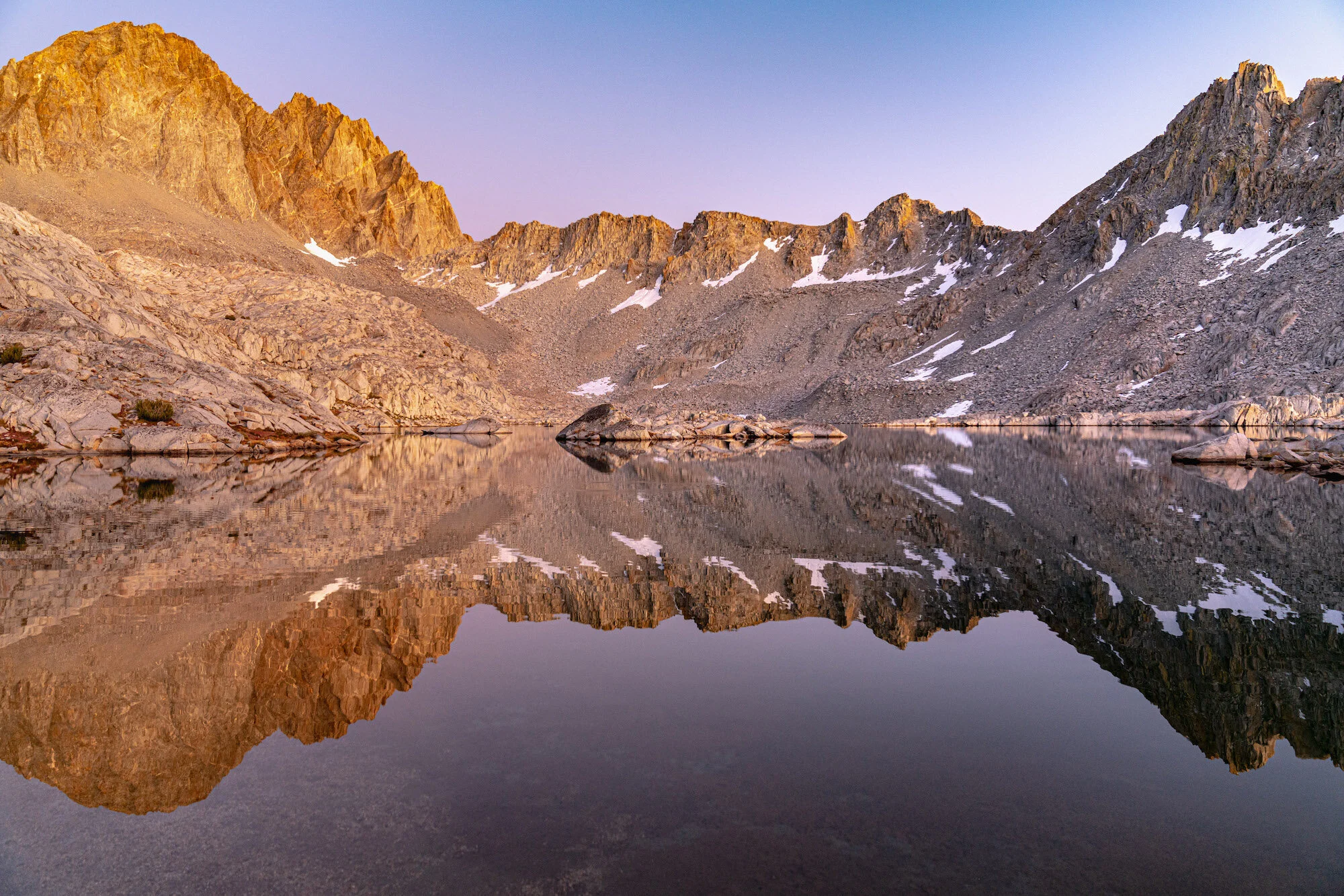
A stunning reflection of the Palisade Range found while hiking in the Eastern Sierra Mountains. Photo by Dalton Johnson
Tips for a Successful Hike: Maximizing Your Eastern Sierra Adventure
Embarking on a hike in the Eastern Sierra is an opportunity to connect with nature, challenge yourself, and create unforgettable memories. To ensure a successful and enjoyable experience, here are some valuable tips to consider:
Pace Yourself and Take Regular Breaks:
Hiking in the Eastern Sierra often involves varied terrain and elevation changes. Pace yourself according to your fitness level and the difficulty of the trail.
Take regular breaks to rest, hydrate, and appreciate the stunning surroundings. Listen to your body and avoid pushing yourself beyond your limits.
Practice Leave No Trace Principles:
The Eastern Sierra's pristine wilderness deserves our utmost respect. Follow Leave No Trace principles to minimize your impact on the environment.
Pack out all trash, dispose of waste properly, and leave natural features undisturbed. Respect wildlife and their habitats by observing from a distance.
Camping Tips:
If planning an overnight adventure, select designated campsites whenever possible to minimize your impact on fragile ecosystems.
Choose a level, durable surface for pitching your tent, and be mindful of any regulations or restrictions regarding camping and campfire usage.
Pack lightweight camping gear and essential items such as a reliable tent, sleeping bag, cooking equipment, and appropriate food storage containers.
Altitude and Acclimatization:
The Eastern Sierra's high elevation can pose challenges for hikers. Gradually acclimate to higher altitudes to reduce the risk of altitude sickness.
Stay well-hydrated, eat nutritious meals, and listen to your body's signals. If experiencing symptoms like headaches or dizziness, descend to a lower elevation.
Injury Prevention:
Prioritize safety by wearing appropriate footwear with ankle support to prevent sprains or twists on uneven terrain.
Use trekking poles for stability and to reduce strain on your joints. Take care with each step, especially on steep or rocky sections of the trail.
Warm up before hiking and stretch your muscles afterward to minimize the risk of strains or muscle fatigue.
Weather Awareness:
Check the weather forecast before heading out and be prepared for sudden changes in mountainous environments.
Dress in layers to accommodate temperature fluctuations. Pack rain gear and a warm jacket even on clear days, as conditions can change rapidly.
Navigation and Trail Knowledge:
Familiarize yourself with trail maps, guidebooks, or GPS devices to navigate effectively. Study the trail's topography and notable landmarks before setting off.
Pay attention to trail markers, cairns, or signs to stay on the designated path. If unsure, it's better to retrace your steps than risk getting lost.
Remember, proper preparation and respect for the wilderness will enhance your hiking experience in the Eastern Sierra. By following these tips, you'll be equipped to tackle the trails, immerse yourself in nature's splendor, and create cherished memories that will last a lifetime. So, lace up your boots, embrace the adventure, and savor every step along the remarkable trails of the Eastern Sierra.
Gear Guide for Hiking in the Eastern Sierra
Essentials
Backpack: A backpack that is the right size for your needs and comfortable to wear.
Food: Enough food for your trip, plus snacks.
Water: Enough water for your trip, plus a water filter or purifier.
First-aid kit: A first-aid kit with bandages, antibiotic ointment, pain relievers, and other basic supplies.
Sunscreen: Sunscreen with an SPF of 30 or higher.
Sunglasses: Sunglasses with 100% UV protection.
Hat: A hat with a wide brim to protect your face from the sun.
Rain gear: Rain gear, including a rain jacket and rain pants.
Flashlight or headlamp: A flashlight or headlamp for use in the dark.
Toilet paper: Toilet paper and a trowel for digging a cathole.
Trash bags: Trash bags for packing out your trash.
Personal items: Any other personal items you may need, such as a camera, binoculars, or a book.
Optional Items
GPS unit: A GPS unit can be helpful for navigation, especially in areas with poor cell reception.
Satellite phone: A satellite phone can be a lifesaver in an emergency.
Hiking poles: Hiking poles can help you conserve energy and prevent injuries.
Camera: A camera can capture memories of your trip.
Binoculars: Binoculars can be used for wildlife viewing.
Book: A book can provide entertainment on long hikes.
Soaking in the gorgeous views while hiking deep in Eastern Sierra Mountains. Photo by Dalton Johnson
The Eastern Sierra offers a myriad of awe-inspiring hiking trails, where you can immerse yourself in the beauty of nature and create lasting memories. By following this comprehensive hiking guide, you'll be well-prepared to explore the wonders of the Eastern Sierra and embark on unforgettable adventures in this remarkable outdoor playground. Lace up your hiking boots, pack your essentials, and get ready for an incredible journey through the Eastern Sierra.
Discover more of the Eastern Sierra

Hike to New Heights: Discover Eastern Sierra Challenging Hiking Gems
Embarking on a challenging hike in the Eastern Sierra is not for the faint of heart. This rugged and majestic region of California offers a plethora of trails that will push your limits and reward you with awe-inspiring views and a profound sense of accomplishment. From towering peaks to alpine lakes and dramatic canyons, the Eastern Sierra presents hikers with a playground of adventure and natural beauty.
Embarking on a challenging hike in the Eastern Sierra is not for the faint of heart. This rugged and majestic region of California offers a plethora of trails that will push your limits and reward you with awe-inspiring views and a profound sense of accomplishment. From towering peaks to alpine lakes and dramatic canyons, the Eastern Sierra presents hikers with a playground of adventure and natural beauty.
The Eastern Sierra offers a variety of challenging hikes for adventurous hikers. Some notable options include Mount Whitney, the highest peak in the contiguous United States; Bishop Pass, with its stunning vistas of surrounding peaks and valleys; and the rugged Taboose Pass trail, offering panoramic views of the John Muir Wilderness.
In this blog we will cover several more difficult hikes in the Eastern Sierra, so lace up your boots, brace yourself for the challenge, and let's dive into the world of challenging hikes in the Eastern Sierra.
Hiking up one of the many challenging hikes in the High Sierra. Photo by Dalton Johnson
Mount Whitney:
The magnificent Mount Whitney, a hike that will test your limits and reward you with breathtaking views. As we ascend this towering peak, get ready to immerse yourself in awe-inspiring vistas that will leave you in utter wonder. From the summit, you'll be treated to a panoramic vista of the rugged Sierra Nevada range, with sweeping views of the Eastern Sierra, deep valleys, and the vast expanse of the surrounding wilderness.
Now, let's delve into the specifics of this extraordinary hike:
Elevation: Mount Whitney stands proudly as the highest summit in the contiguous United States, soaring to an impressive elevation of 14,505 feet (4,421 meters). The sheer magnitude of this elevation adds an extra layer of grandeur to the journey, as you find yourself surrounded by the majestic peaks of the Sierra Nevada.
Distance: The classic route to Mount Whitney via the Whitney Portal covers approximately 22 miles (35 kilometers) round trip. This distance allows you to fully immerse yourself in the changing landscapes, from dense forests to alpine meadows and, eventually, the rocky terrain near the summit. Each step brings you closer to the pinnacle of this majestic mountain.
Time to Hike: Typically, hikers complete the Mount Whitney hike in a day, starting early in the morning to maximize daylight hours. The total hiking time varies depending on individual fitness levels, pace, and the number of breaks taken along the way. It's essential to plan for a full day of hiking to ensure a safe and enjoyable experience.
Difficulty: The hike to Mount Whitney is renowned for its challenging nature, both in terms of elevation gain and overall distance. The high altitude, long trek, and steep sections demand physical endurance, mental resilience, and careful preparation. It's crucial to acclimatize to the altitude, stay well-hydrated, and be prepared for rapid weather changes, as conditions can vary dramatically throughout the day.
So, why go on this awe-inspiring hike to Mount Whitney? The answer lies in the unrivaled sense of accomplishment and the breathtaking beauty that awaits you. Standing atop the highest peak in the contiguous United States is an experience that will leave you humbled and in awe of nature's grandeur. The journey itself tests your physical and mental limits, as you push through the challenges and reach new heights.
Beyond the personal triumph, hiking Mount Whitney offers an intimate connection with the untamed wilderness of the Eastern Sierra. It is a chance to witness the rugged beauty, to breathe in the pure mountain air, and to be surrounded by the awe-inspiring landscapes that have captivated explorers for centuries.
Bishop Pass:
The breathtaking beauty of Bishop Pass is a trail that will immerse you in stunning vistas and unforgettable landscapes. As we make our way through this awe-inspiring hike, get ready to be captivated by panoramic views that stretch as far as the eye can see. From the summit of Bishop Pass, you'll be treated to breathtaking vistas of the surrounding peaks and valleys, where the raw beauty of the Eastern Sierra unfolds before your eyes.
Now, let's explore the specifics of this remarkable hike:
Elevation: Bishop Pass reaches an elevation of approximately 11,972 feet (3,649 meters), making it a high-altitude adventure that allows you to witness the grandeur of the Eastern Sierra from a lofty vantage point. The towering peaks and expansive vistas create a scene of unparalleled beauty.
Distance: The Bishop Pass trail covers a round-trip distance of approximately 9.6 miles (15.5 kilometers). This moderate distance provides a fulfilling hike that takes you through changing landscapes, from dense forests to open alpine meadows. The journey unveils a tapestry of natural wonders that will leave you in awe.
Time to Hike: The time required to hike Bishop Pass varies depending on your pace, the amount of time you spend admiring the scenery, and the number of breaks you take along the way. On average, hikers can complete the hike in around 6 to 8 hours, allowing for plenty of time to soak in the beauty and enjoy the views from the pass.
Difficulty: The hike to Bishop Pass is considered moderate to strenuous, mainly due to the high elevation gain and some steep sections of the trail. It demands physical endurance, proper acclimatization to the altitude, and basic hiking experience. However, the well-defined trail and the awe-inspiring views make it a highly rewarding and achievable adventure for hikers with determination and a moderate level of fitness.
So, why go on this incredible hike to Bishop Pass? The answer lies in the unparalleled views and the sense of accomplishment that awaits you at the summit. Standing atop Bishop Pass, surrounded by towering peaks and vast expanses of untouched wilderness, is an experience that will leave you humbled and in awe of the raw beauty of the Eastern Sierra.
Beyond the visual rewards, hiking Bishop Pass offers a chance to connect with nature in its purest form. The trail takes you through breathtaking landscapes, including serene lakes, pristine meadows, and the rugged beauty of the Eastern Sierra. It's an opportunity to find solace, challenge yourself physically and mentally, and forge a deeper connection with the untamed wilderness.
Taboose Pass:
Hiking Taboose Pass is a trail that will take you through stunning vistas and push your limits. As we embark on this challenging hike, get ready to be captivated by panoramic views that will leave you in awe. From the summit of Taboose Pass, you'll be rewarded with breathtaking vistas of the surrounding peaks and valleys, immersing yourself in the raw beauty of the Eastern Sierra.
Now, let's explore the specifics of this exhilarating hike:
Elevation: Taboose Pass reaches an elevation of approximately 11,375 feet (3,468 meters), making it a high-altitude adventure that allows you to witness the grandeur of the Eastern Sierra from a lofty vantage point. The towering peaks, rugged ridges, and expansive views create a scene of unparalleled beauty.
Distance: The Taboose Pass trail covers a round-trip distance of approximately 14 miles (22.5 kilometers). This challenging distance takes you through diverse landscapes, from desert-like canyons to alpine meadows, showcasing the rich variety of the Eastern Sierra. Each step unveils new wonders that will leave you in awe.
Time to Hike: The time required to hike Taboose Pass varies depending on your pace, the amount of time you spend taking in the scenery, and the number of breaks you take along the way. On average, hikers can complete the hike in around 8 to 10 hours, allowing for ample time to immerse yourself in the beauty and savor the views from the pass.
Difficulty: The hike to Taboose Pass is considered strenuous due to its high elevation gain, rugged terrain, and the long distance covered. It demands physical endurance, proper acclimatization to the altitude, and advanced hiking experience. The trail is challenging, but the incredible views and sense of accomplishment make it a highly rewarding adventure for experienced hikers seeking a thrilling challenge.
So, why go on this exhilarating hike to Taboose Pass? The answer lies in the unrivaled views and the profound sense of achievement that await you at the summit. Standing atop Taboose Pass, surrounded by towering peaks, vast expanses of untouched wilderness, and breathtaking panoramas, is an experience that will leave you humbled and in awe of the raw beauty of the Eastern Sierra.
Beyond the visual rewards, hiking Taboose Pass allows you to immerse yourself in the pristine wilderness of the Eastern Sierra. The trail takes you through diverse landscapes, from lush meadows to rocky ridges, and offers a chance to witness the untouched beauty of this remarkable region. It's an opportunity to push your limits, challenge yourself physically and mentally, and forge a deeper connection with nature.
Sawtooth Pass:
Sawtooth Pass is a trail that offers stunning views and a thrilling adventure. As we make our way through this rugged hike, get ready to be mesmerized by breathtaking vistas that will leave you in awe. From the summit of Sawtooth Pass, you'll be rewarded with panoramic views of the surrounding peaks, dramatic canyons, and the untouched beauty of the Eastern Sierra.
Now, let's explore the specifics of this remarkable hike:
Elevation: Sawtooth Pass reaches an elevation of approximately 11,600 feet (3,536 meters), immersing you in the grandeur of the Eastern Sierra. The towering peaks, rugged ridges, and expansive vistas create a scene of unparalleled beauty.
Distance: The Sawtooth Pass trail covers a round-trip distance of approximately 10 miles (16 kilometers). This moderate distance allows you to fully immerse yourself in the changing landscapes, from dense forests to open alpine meadows. Each step brings you closer to the breathtaking views that await at the pass.
Time to Hike: The time required to hike Sawtooth Pass varies depending on your pace, the amount of time you spend admiring the scenery, and the number of breaks you take along the way. On average, hikers can complete the hike in around 6 to 8 hours, allowing for plenty of time to soak in the beauty and enjoy the views from the pass.
Difficulty: The hike to Sawtooth Pass is considered moderate to strenuous due to its elevation gain and rugged terrain. It demands physical endurance, proper acclimatization to the altitude, and basic hiking experience. While challenging, the rewarding views and sense of accomplishment make it a highly fulfilling adventure for hikers seeking a thrilling and scenic experience.
So, why go on this incredible hike to Sawtooth Pass? The answer lies in the unparalleled views and the opportunity for a thrilling adventure. Standing atop Sawtooth Pass, surrounded by towering peaks and vast expanses of untouched wilderness, is an experience that will leave you humbled and in awe of the raw beauty of the Eastern Sierra.
Beyond the visual rewards, hiking Sawtooth Pass allows you to connect with nature in its purest form. The trail takes you through breathtaking landscapes, including serene lakes, lush meadows, and the rugged beauty of the Eastern Sierra. It's an opportunity to challenge yourself physically and mentally, to find solace in nature's embrace, and to create lasting memories in a remarkable corner of the world.
Palisade Glacier:
Hiking to Palisade Glacier, a trail that promises breathtaking views and an awe-inspiring adventure. As we make our way through this captivating hike, get ready to be mesmerized by the stunning vistas that will leave you in awe. From the trailhead to the grandeur of Palisade Glacier, you'll witness towering peaks, rugged terrain, and a sense of untouched beauty in the heart of the Eastern Sierra.
Now, let's explore the specifics of this remarkable hike:
Elevation: The hike to Palisade Glacier takes you to an elevation of approximately 11,100 feet (3,383 meters), immersing you in the raw beauty of the Eastern Sierra. The towering peaks, dramatic ridges, and the icy expanse of the glacier create a scene of unparalleled grandeur.
Distance: The trail to Palisade Glacier covers a round-trip distance of approximately 15 miles (24 kilometers), allowing you to fully immerse yourself in the changing landscapes. From dense forests to alpine meadows, and eventually the glacier itself, each step brings you closer to the breathtaking views that await.
Time to Hike: The time required to hike to Palisade Glacier varies depending on your pace, the amount of time you spend exploring, and the number of breaks you take along the way. On average, hikers can expect to spend around 10 to 12 hours on the trail, including time to savor the beauty and marvel at the glacier.
Difficulty: The hike to Palisade Glacier is considered strenuous due to its length, elevation gain, and rugged terrain. It demands physical endurance, proper acclimatization to the altitude, and intermediate to advanced hiking experience. The challenging aspects are well worth it, as the rewarding views and the experience of standing before the majestic glacier make it an unforgettable adventure.
So, why go on this incredible hike to Palisade Glacier? The answer lies in the unmatched views and the chance to witness the raw power of nature. Standing before Palisade Glacier, surrounded by towering peaks, icy slopes, and the untouched beauty of the Eastern Sierra, is an experience that will leave you humbled and in awe of the grandeur of the natural world.
Beyond the visual rewards, hiking to Palisade Glacier offers a profound connection with nature. The trail takes you through diverse landscapes, from serene lakes to rocky slopes, showcasing the unspoiled beauty of the Eastern Sierra. It's an opportunity to challenge yourself physically and mentally, to find solace in the remote wilderness, and to witness the resilience of nature in the face of changing climates.
Mount Langley:
Hiking Mount Langley is a trail that promises breathtaking views and a thrilling adventure. As we make our way through this majestic hike, get ready to be mesmerized by the stunning vistas that will leave you in awe. From the summit of Mount Langley, you'll be rewarded with panoramic views of the surrounding peaks, expansive valleys, and the remarkable beauty of the Eastern Sierra.
Now, let's explore the specifics of this remarkable hike:
Elevation: Mount Langley stands proudly as one of the southernmost fourteeners in the Sierra Nevada range, reaching an elevation of 14,026 feet (4,275 meters). As you ascend the trail, you'll find yourself surrounded by towering peaks, rugged ridges, and breathtaking views that extend as far as the eye can see.
Distance: The classic route to Mount Langley covers a round-trip distance of approximately 22 miles (35 kilometers), allowing you to fully immerse yourself in the changing landscapes. From serene lakes to alpine meadows and rocky slopes, each step reveals new wonders that will leave you in awe.
Time to Hike: The time required to hike Mount Langley varies depending on your pace, the amount of time you spend admiring the scenery, and the number of breaks you take along the way. On average, hikers can expect to spend around 12 to 14 hours on the trail, including time to savor the beauty and reach the summit.
Difficulty: The hike to Mount Langley is considered strenuous due to its elevation gain, length, and rugged terrain. It demands physical endurance, proper acclimatization to the altitude, and intermediate to advanced hiking experience. The challenging aspects of the hike are well worth it, as the rewarding views and the accomplishment of summiting a fourteener make it a truly memorable adventure.
So, why go on this incredible hike to Mount Langley? The answer lies in the unparalleled views and the sense of achievement that await you at the summit. Standing atop Mount Langley, surrounded by towering peaks, vast valleys, and the untouched beauty of the Eastern Sierra, is an experience that will leave you humbled and in awe of the raw grandeur of the natural world.
Beyond the visual rewards, hiking Mount Langley offers an opportunity to challenge yourself both physically and mentally. It's a chance to push your limits, conquer a fourteener, and experience the exhilaration of reaching new heights. Additionally, the journey allows you to immerse yourself in the pristine wilderness of the Eastern Sierra, disconnect from the daily routine, and find solace in nature's embrace.
White Mountain Peak:
The exhilarating journey of hiking White Mountain Peak, a trail that promises stunning views and a memorable adventure. As we make our way through this captivating hike, get ready to be awed by the breathtaking vistas that will surround us. From the summit of White Mountain Peak, you'll be treated to panoramic views of the Eastern Sierra, neighboring mountain ranges, and the vast expanse of the surrounding region.
Now, let's delve into the specifics of this remarkable hike:
Elevation: White Mountain Peak stands tall at an elevation of 14,252 feet (4,344 meters), making it one of the towering peaks in the Eastern Sierra. As we ascend the trail, the landscape will transform, revealing the raw beauty of the high alpine environment and the surrounding peaks.
Distance: The hike to White Mountain Peak covers a round-trip distance of approximately 14 miles (22.5 kilometers), allowing us to fully immerse ourselves in the changing landscapes. From arid desert-like terrain to rugged slopes, each step unveils new wonders that will leave us in awe.
Time to Hike: The time required to hike White Mountain Peak varies depending on our pace, the amount of time we spend soaking in the scenery, and the number of breaks we take along the way. On average, hikers can expect to spend around 6 to 8 hours on the trail, including time to savor the beauty and reach the summit.
Difficulty: The hike to White Mountain Peak is considered moderately difficult due to its elevation gain, length, and rugged terrain. It demands physical endurance, proper acclimatization to the altitude, and intermediate hiking experience. While challenging, the incredible views and the accomplishment of summiting a high peak make it a highly rewarding adventure.
So, why go on this incredible hike to White Mountain Peak? The answer lies in the unparalleled views and the sense of accomplishment that await us at the summit. Standing atop White Mountain Peak, surrounded by vast expanses of untouched wilderness, towering peaks, and the endless beauty of the Eastern Sierra, is an experience that will leave us humbled and in awe of the grandeur of the natural world.
Beyond the visual rewards, hiking White Mountain Peak allows us to challenge ourselves both physically and mentally. It's an opportunity to push our limits, conquer a high summit, and experience the exhilaration of reaching new heights. Moreover, the journey allows us to immerse ourselves in the serenity of the high alpine environment, disconnect from the daily hustle, and connect with the awe-inspiring landscapes that make the Eastern Sierra a hiker's paradise.
Piute Pass:
Hiking Piute Pass is another trail that offers breathtaking views and an unforgettable adventure. As we make our way through this captivating hike, get ready to be immersed in stunning vistas that will leave you in awe. From the start of the trail to the summit of Piute Pass, you'll be rewarded with panoramic views of the John Muir Wilderness, Humphreys Basin, and the majestic peaks of the Eastern Sierra.
Now, let's explore the specifics of this remarkable hike:
Elevation: Piute Pass reaches an elevation of approximately 11,423 feet (3,482 meters), allowing you to witness the grandeur of the Eastern Sierra from a lofty vantage point. The towering peaks, alpine lakes, and the vastness of the surrounding wilderness create a scene of unparalleled beauty.
Distance: The Piute Pass trail covers a round-trip distance of approximately 10 miles (16 kilometers), taking you through diverse landscapes and showcasing the natural wonders of the Eastern Sierra. From dense forests to picturesque meadows, each step reveals new breathtaking views.
Time to Hike: The time required to hike Piute Pass varies depending on your pace, the amount of time you spend taking in the scenery, and the number of breaks you take along the way. On average, hikers can complete the hike in around 6 to 8 hours, allowing for ample time to enjoy the beauty and soak in the vistas from the pass.
Difficulty: The hike to Piute Pass is considered moderate in difficulty, making it accessible to hikers with varying experience levels. It involves a gradual ascent, some rocky sections, and moderate elevation gain. With proper preparation and basic hiking skills, it offers a rewarding and enjoyable adventure for hikers seeking a taste of the Eastern Sierra's beauty.
So, why go on this incredible hike to Piute Pass? The answer lies in the unparalleled views and the sense of serenity that await you at the summit. Standing atop Piute Pass, surrounded by majestic peaks, pristine alpine lakes, and the untouched wilderness of the Eastern Sierra, is an experience that will leave you humbled and in awe of the raw beauty of nature.
Beyond the visual rewards, hiking Piute Pass allows you to connect with nature on a profound level. The trail takes you through diverse ecosystems, offering glimpses of wildlife, vibrant wildflowers, and tranquil lakes along the way. It's an opportunity to find solace in the serenity of the wilderness, to disconnect from the noise of everyday life, and to rejuvenate your mind and spirit in the embrace of nature.
Mather Pass:
The exhilarating journey of hiking Mather Pass is a trail that promises stunning views and a thrilling adventure. As we venture on this captivating hike, get ready to be awe-inspired by the breathtaking vistas that will surround us. From the ascent to the top of Mather Pass, you'll be rewarded with panoramic views of the surrounding peaks, alpine lakes, and the raw beauty of the Eastern Sierra.
Now, let's explore the specifics of this remarkable hike:
Elevation: Mather Pass sits at an elevation of approximately 12,100 feet (3,688 meters), allowing us to witness the grandeur of the Eastern Sierra from a lofty vantage point. The towering peaks, deep valleys, and the vastness of the surrounding wilderness create a scene of unparalleled beauty.
Distance: The hike to Mather Pass covers a round-trip distance that varies depending on the starting point. Generally, it ranges from 16 to 20 miles (25 to 32 kilometers). Throughout the hike, we'll encounter diverse landscapes, from lush meadows to rocky slopes, showcasing the remarkable variety of the Eastern Sierra.
Time to Hike: The time required to hike Mather Pass varies depending on our pace, the amount of time we spend admiring the scenery, and the number of breaks we take along the way. On average, hikers can expect to spend around 8 to 12 hours on the trail, including time to savor the beauty and conquer the pass.
Difficulty: The hike to Mather Pass is considered challenging due to its elevation gain, length, and rugged terrain. It demands physical endurance, proper acclimatization to the altitude, and intermediate to advanced hiking experience. The challenging aspects are well worth it, as the rewarding views and the accomplishment of reaching the pass make it an unforgettable adventure.
So, why go on this incredible hike to Mather Pass? The answer lies in the unparalleled views and the sense of achievement that await us at the summit. Standing atop Mather Pass, surrounded by the majestic peaks, alpine lakes, and the untamed beauty of the Eastern Sierra, is an experience that will leave us humbled and in awe of the grandeur of nature.
Beyond the visual rewards, hiking Mather Pass offers an opportunity to challenge ourselves physically and mentally. It allows us to push our limits, conquer a high mountain pass, and experience the exhilaration of reaching new heights. Moreover, the journey allows us to immerse ourselves in the serenity of the wilderness, disconnect from the chaos of daily life, and connect with the awe-inspiring landscapes that make the Eastern Sierra a hiker's paradise.
Lamarck Col:
Lamarck Col is a challenging trail that promises breathtaking views and an unforgettable adventure. As we make our way through this captivating hike, get ready to be awe-inspired by the stunning vistas that will surround us. From the ascent to the top of Lamarck Col, you'll be rewarded with panoramic views of the surrounding peaks, glacial lakes, and the raw beauty of the Eastern Sierra.
Now, let's explore the specifics of this remarkable hike:
Elevation: Lamarck Col reaches an elevation of approximately 12,960 feet (3,950 meters), allowing us to witness the grandeur of the Eastern Sierra from a lofty vantage point. The towering peaks, deep valleys, and the vastness of the surrounding wilderness create a scene of unparalleled beauty.
Distance: The hike to Lamarck Col covers a round-trip distance of approximately 11 miles (17.7 kilometers), taking us through diverse landscapes and showcasing the natural wonders of the Eastern Sierra. From lush meadows to rocky slopes, each step unveils new breathtaking views.
Time to Hike: The time required to hike Lamarck Col varies depending on our pace, the amount of time we spend soaking in the scenery, and the number of breaks we take along the way. On average, hikers can complete the hike in around 7 to 9 hours, allowing for ample time to enjoy the beauty and reach the col.
Difficulty: The hike to Lamarck Col is considered moderately difficult due to its elevation gain, length, and rugged terrain. It demands physical endurance, proper acclimatization to the altitude, and intermediate hiking experience. While challenging, the incredible views and the sense of accomplishment make it a highly rewarding adventure.
So, why go on this incredible hike to Lamarck Col? The answer lies in the unparalleled views and the chance to experience the pristine beauty of the Eastern Sierra. Standing atop Lamarck Col, surrounded by majestic peaks, glacial lakes, and the untouched wilderness, is an experience that will leave us humbled and in awe of the grandeur of the natural world.
Beyond the visual rewards, hiking Lamarck Col allows us to challenge ourselves both physically and mentally. It's an opportunity to push our limits, conquer a high mountain pass, and experience the exhilaration of reaching new heights. Moreover, the journey allows us to immerse ourselves in the serenity of the wilderness, disconnect from the noise of everyday life, and find solace in the awe-inspiring landscapes of the Eastern Sierra.
Enjoying the lakeside view during a morning hike up Kearsarge Pass. Photo by Dalton Johnson
As we conclude our exploration of the challenging hikes in the Eastern Sierra, we leave behind a trail of unforgettable memories, exhilarating adventures, and a deeper connection with the raw and untamed beauty of this remarkable region. From conquering the heights of Mount Whitney to navigating the remote passes and breathtaking vistas, these challenging hikes have tested our limits, rewarded our efforts, and left an indelible mark on our souls.
The Eastern Sierra has proven time and again to be a haven for adventurers seeking thrilling trails, stunning scenery, and a sense of accomplishment. It is a place where we have pushed our boundaries, challenged ourselves physically and mentally, and discovered the incredible resilience within us. With each step, we have been treated to panoramic vistas, hidden alpine lakes, and rugged landscapes that have left us in awe of nature's grandeur.
So, whether you are an experienced hiker looking for your next great challenge or someone seeking to push beyond your comfort zone, the challenging hikes of the Eastern Sierra beckon you. As you navigate the steep trails, rocky terrain, and high altitudes, remember to respect the wilderness, prepare diligently, and stay safe. The rewards are plentiful - breathtaking views, personal triumphs, and a profound connection with the raw and untamed wilderness of the Eastern Sierra.
Discover more of the Eastern Sierra

Microadventures for Spring: Embrace the Season's Beauty
As the flowers bloom and the weather turns warmer, spring invites us to step outside and embark on new adventures. While big trips and long vacations may not always be feasible, microadventures offer the perfect solution to satisfy your wanderlust. These bite-sized experiences are designed to fit into a single day or a weekend, allowing you to explore, discover, and rejuvenate without extensive planning or time commitments.
As the flowers bloom and the weather turns warmer, spring invites us to step outside and embark on new adventures. While big trips and long vacations may not always be feasible, microadventures offer the perfect solution to satisfy your wanderlust. These bite-sized experiences are designed to fit into a single day or a weekend, allowing you to explore, discover, and rejuvenate without extensive planning or time commitments.
Microadventures in the spring offer a myriad of benefits. Firstly, the season showcases nature's vibrant rebirth with blooming flowers, lush greenery, and pleasant weather, creating a picturesque backdrop for outdoor activities. Secondly, spring microadventures allow for quick getaways that fit into busy schedules, providing a refreshing break from daily routines without the need for extensive planning or time commitments. Lastly, embracing microadventures in the spring allows individuals to experience the beauty and rejuvenating effects of nature firsthand, fostering a sense of exploration, connection, and well-being.
In this article, we'll guide you through a selection of delightful microadventures tailored specifically for the spring season. Get ready to embrace the beauty of spring in exciting and memorable ways!
Going for a bike ride along the California Coast. Photograph by Dalton Johnson
Pros:
Beautiful Natural Settings: Spring brings forth colorful blossoms, lush green landscapes, and mild temperatures, creating stunning backdrops for your microadventures. You'll have the opportunity to immerse yourself in the vibrant beauty of nature.
Mild Weather: Spring typically offers pleasant and comfortable weather conditions, making outdoor activities more enjoyable. You can engage in various adventures without extreme heat or cold, allowing you to fully embrace the experience.
Time Efficiency: Microadventures are designed to be short and convenient, fitting into a single day or a weekend. Spring microadventures provide a perfect opportunity to make the most of limited time, allowing you to escape, explore, and rejuvenate without extensive planning or long vacations.
Renewal and Rejuvenation: Spring symbolizes renewal and growth, and immersing yourself in the season's energy can have a positive impact on your well-being. Microadventures in the spring can help you recharge, reduce stress, and increase your overall sense of happiness and contentment.
Cons:
Unpredictable Weather: While spring is generally pleasant, it can also bring unpredictable weather patterns such as sudden rain showers or temperature fluctuations. It's important to stay prepared and pack accordingly to ensure your comfort and safety during your microadventures.
Crowded Locations: Spring is a popular time for outdoor activities, and popular destinations can get crowded, especially during weekends or holidays. You may encounter larger crowds and have to share space with other adventurers, which can impact the tranquility and solitude you seek.
Limited Activities: Depending on your location, certain spring microadventures may have limitations or restrictions. For example, some trails or camping areas may be closed due to weather conditions or conservation efforts. It's essential to research and plan accordingly to ensure the availability of your desired activities.
Allergies and Insects: Springtime can bring an increase in pollen levels, triggering allergies for some individuals. Additionally, insects may become more active during this season. It's advisable to take necessary precautions, such as carrying antihistamines or insect repellent, to mitigate any discomfort caused by allergies or insect bites.
Picnic in the Park:
Pack a delicious picnic basket, grab a blanket, and head to your local park. Spring brings lush greenery, blossoming flowers, and vibrant wildlife, making it an ideal time to connect with nature. Enjoy a leisurely afternoon surrounded by the sights and sounds of the season. Bask in the sun, savor tasty treats, and appreciate the simple joy of being outdoors.
Hiking and Nature Trails:
Spring breathes life into forests, hills, and mountains. Lace up your hiking boots and explore the nearby trails that come alive during this season. Witness the colorful tapestry of wildflowers, listen to the melodies of chirping birds, and breathe in the fresh scent of blooming trees. Choose a trail that suits your fitness level and immerse yourself in the rejuvenating embrace of nature.
Sunrise or Sunset Photography:
Capture the magic of spring's golden hours by engaging in sunrise or sunset photography. Choose a picturesque location, be it a hilltop, a beach, or a serene lake. Watch as the sky transforms into a canvas of vibrant colors, painting a breathtaking backdrop for your photographs. Whether you're a seasoned photographer or a novice with a smartphone, witnessing the beauty of a sunrise or sunset is an experience worth cherishing.
Visit a Botanical Garden:
Botanical gardens are a treasure trove of spring's natural wonders. These carefully curated spaces showcase an array of flowers and plants in full bloom. Take a leisurely stroll along winding pathways, learn about different species, and indulge in the fragrant scents that fill the air. Many botanical gardens also host seasonal exhibitions and events, allowing you to delve deeper into the world of horticulture.
Bike Rides and Cycling:
Dust off your bicycle and hit the road for a springtime cycling adventure. Explore your neighborhood or venture further afield along scenic routes. Feel the cool breeze against your face as you pedal past blossoming trees and fields painted with wildflowers. Cycling not only offers a great workout but also allows you to cover more ground and experience the beauty of spring from a different perspective.
Camping Under the Stars:
Escape the noise and routine of daily life by spending a night under the stars. Spring evenings are often mild and perfect for camping. Pitch your tent in a serene campground, build a cozy campfire, and enjoy the soothing crackle of flames. Gaze at the starry sky, tell stories, and let the peaceful ambiance of nature envelop you. Wake up to the gentle songs of birds and the promise of a new day.
Canoeing or Kayaking:
Take to the water and explore lakes, rivers, or even coastal areas by canoe or kayak. Springtime offers calm waters and picturesque views, perfect for a peaceful and scenic paddling adventure. Navigate through gentle currents, observe wildlife along the shores, and revel in the serenity of being surrounded by nature's beauty. Don't forget to bring your camera to capture memorable moments on the water.
Fruit Picking:
Spring is the season when many fruits start to ripen, offering a fantastic opportunity for fruit picking adventures. Find local orchards or farms that allow visitors to pick their own strawberries, cherries, or other seasonal fruits. Not only will you get to enjoy the delicious flavors of freshly picked produce, but you'll also have a chance to engage in a fun and hands-on activity with family or friends. Support local agriculture and savor the sweet rewards of your harvest.
Nature Photography Scavenger Hunt:
Combine your love for photography and the thrill of a scavenger hunt by organizing a nature photography scavenger hunt. Create a list of specific natural elements or features to capture, such as a blooming flower, a babbling brook, or a curious woodland creature. Head out to a nearby park or nature reserve and embark on a quest to capture as many items on your list as possible. This activity encourages creativity, observation skills, and appreciation for the small wonders of nature.
Outdoor Yoga or Meditation:
Springtime provides the perfect backdrop for a mindful and rejuvenating experience through outdoor yoga or meditation. Find a tranquil spot in a park, garden, or even your backyard. Roll out your yoga mat or simply sit comfortably and let the soothing sounds of nature guide you into a state of relaxation and inner peace. Feel the gentle breeze on your skin, connect with the earth beneath you, and let go of stress as you embrace the present moment.
Explore Local Festivals and Events:
Spring is a season filled with vibrant festivals and events celebrating various cultural, artistic, and natural aspects. Research and explore what's happening in your area during springtime. Whether it's a cherry blossom festival, a music concert, a farmers market, or an outdoor art exhibition, attending these local events can add a touch of excitement and community spirit to your microadventures. Immerse yourself in the festivities, connect with like-minded individuals, and celebrate the unique flavors of spring.
Mental health benefits of springtime microadventures
Microadventuring in the spring offers a multitude of mental health benefits that can greatly enhance your overall well-being. Here are three key reasons why engaging in microadventures during this season can have a positive impact on your mental health:
Connection with Nature: Spring is a time of renewal and awakening in the natural world. By immersing yourself in springtime microadventures, you can foster a deep connection with nature. Research has shown that spending time in natural environments can reduce stress, improve mood, and enhance mental clarity. The vibrant colors, fresh scents, and soothing sounds of spring can have a calming effect on the mind, providing a much-needed respite from the demands of daily life. Connecting with nature during microadventures can promote relaxation, mindfulness, and a sense of peace, ultimately boosting your mental well-being.
Increased Physical Activity: Microadventures often involve physical activities such as hiking, biking, or kayaking. Engaging in these activities during the spring season offers additional benefits for mental health. Physical exercise has been shown to release endorphins, the body's natural mood-boosting chemicals, which can reduce symptoms of anxiety and depression. Spring's mild weather and pleasant temperatures make it an inviting time to engage in outdoor activities, motivating you to move your body and reap the mental health rewards. Whether it's a brisk hike through blooming trails or a leisurely bike ride amidst picturesque landscapes, the physical exertion and exposure to nature will contribute to a healthier mind.
Stress Reduction and Mental Rejuvenation: Microadventures in the spring provide an opportunity to escape the hustle and bustle of everyday life and immerse yourself in a different environment. Stepping away from routine and immersing yourself in the wonders of spring can help reduce stress and rejuvenate your mental state. The change of scenery, combined with the thrill of exploration and discovery, can provide a sense of novelty and excitement, boosting your mood and revitalizing your perspective. Microadventures allow you to break free from the monotony, experience new challenges, and return with a renewed sense of energy, clarity, and resilience.
Microadventures in the spring offer a unique opportunity to enhance your mental health. The connection with nature, increased physical activity, and stress reduction provided by these adventures can significantly improve your overall well-being. By engaging in spring microadventures, you can cultivate a sense of calm, find joy in the beauty of nature, and revitalize your mind, ultimately leading to a happier and more balanced life.
Enjoying an afterwork fishing session before the sun sets. Photograph by Dalton Johnson
Spring is a time of renewal, growth, and boundless beauty. Microadventures allow us to fully immerse ourselves in the wonders of the season, even with limited time and resources. From picnics in the park to camping under the stars, these bite-sized escapades offer endless opportunities to reconnect with nature, discover hidden gems, and create lasting memories. So, make the most of the season and embark on your own microadventures this spring. Embrace the outdoors, revel in the beauty that surrounds you, and let the spirit of adventure ignite your soul. Happy exploring!
Discover more Microadventures

Top Action-Packed Stops along Your Highway 395 Road Trip
Highway 395 is an adventurer's paradise, providing access to the breathtaking Eastern Sierra Mountains. This scenic road trip route is a playground for outdoor enthusiasts, offering a wide array of activities and attractions along the way. If you're planning a journey along Highway 395 and find yourself unsure of where to stop, this blog is here to help.
Highway 395 is an adventurer's paradise, providing access to the breathtaking Eastern Sierra Mountains. This scenic road trip route is a playground for outdoor enthusiasts, offering a wide array of activities and attractions along the way. If you're planning a journey along Highway 395 and find yourself unsure of where to stop, this blog is here to help.
Road tripping along Highway 395 is a must for nature enthusiasts and outdoor adventurers. This scenic route showcases the stunning beauty of the Eastern Sierra Mountains, offering breathtaking vistas, alpine lakes, and unique geological formations. Whether you're seeking ghost towns, ancient trees, or outdoor activities like hiking, skiing, and fishing, Highway 395 provides an unparalleled experience that will leave you in awe of nature's wonders.
Read on to discover a list of 10 must-stop places that will make your road trip an unforgettable experience.
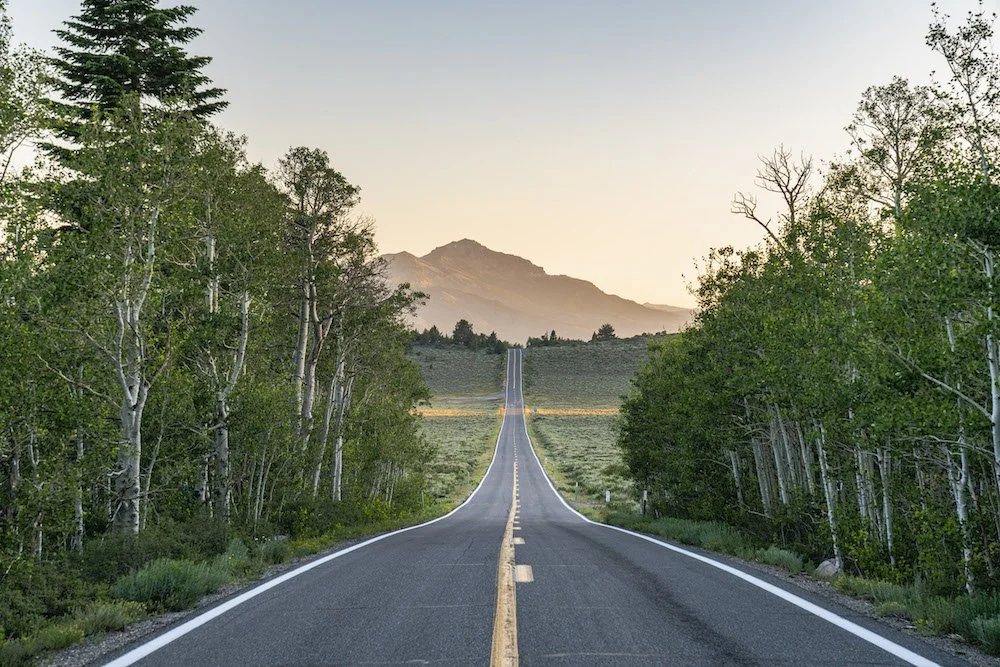
Exploring the backroads off Highway 395. Photo by Dalton Johnson
Pros of Road Tripping Highway 395:
Scenic Beauty: Highway 395 offers stunning natural beauty at every turn. From the majestic Eastern Sierra Mountains to picturesque lakes, you'll be treated to breathtaking vistas and landscapes throughout your journey.
Outdoor Adventure: The highway provides access to numerous outdoor activities. Whether you enjoy hiking, camping, rock climbing, skiing, or simply immersing yourself in nature, Highway 395 offers a wide range of opportunities to indulge in your favorite outdoor pursuits.
Unique Stops: Along Highway 395, you'll encounter charming towns, historic sites, and unique attractions. From exploring the ghost town of Bodie to soaking in natural hot springs, there are plenty of interesting and offbeat stops to add variety and excitement to your road trip.
Less Crowded: Compared to more popular tourist routes, Highway 395 is relatively less crowded. This means you can enjoy a more peaceful and relaxed journey, with fewer traffic jams and shorter lines at attractions, making for a more enjoyable road trip experience.
Cons of Road Tripping Highway 395:
Limited Amenities: While Highway 395 offers breathtaking natural beauty, it may lack the same level of amenities and services found in more populated areas. Remote stretches of the highway can have limited options for gas, food, and accommodations, so it's essential to plan accordingly and be prepared for potential scarcity.
Seasonal Limitations: Certain activities and attractions along Highway 395 are highly seasonal. For example, winter snowfall can limit access to higher elevation areas, and some campsites or hiking trails may be closed during certain times of the year. It's important to check seasonal conditions and plan your trip accordingly to avoid disappointment.
Long Distances: Highway 395 stretches for over 550 miles, which means long driving distances between some of the key attractions. This may require careful planning and consideration of your travel time and energy levels to ensure you have ample time to explore and enjoy each destination without feeling rushed.
Limited Cellular Coverage: In some remote areas along Highway 395, cellular coverage may be limited or non-existent. This can pose challenges for navigation, communication, and accessing online resources. It's advisable to have offline maps and plan your stops and accommodations in advance to mitigate any connectivity issues.
1. Rock Climbing at Owens River Gorge:
If you're an avid rock climber or simply seeking a thrilling challenge, Owens River Gorge is a must-visit destination. This dramatic canyon boasts over 500 climbing routes with varying difficulty levels, making it a paradise for climbers of all skill levels.
10 must climb routes at Owen’s River Gorge:
Fish Crack (5.10a): A classic crack climb with sustained hand jams and finger locks. It's a great introduction to the gorge's crack climbing style.
Pop Rocks (5.10c): This route offers technical face climbing with thin crimps and delicate footwork. It's a test of balance and precision.
Broken Brain (5.11a): A steep and pumpy route with powerful moves on pockets and crimps. It requires endurance and good route-reading skills.
Flower of Power (5.11c): This route features sustained climbing on small edges and pockets. It rewards climbers with intricate sequences and technical footwork.
Perpetual Motion (5.12a): A challenging route with sustained climbing on steep terrain. It demands strength, endurance, and precise movement.
Heinous Cling (5.12b): This route lives up to its name, offering a strenuous series of long reaches and powerful moves. It's a great test for experienced climbers.
Ironman Traverse (5.12c): A traverse that requires strength, finger strength in particular, and careful foot placement. It's a classic testpiece at the gorge.
Loompa (5.12d): A sustained and technical climb with intricate sequences and tricky cruxes. It's a rewarding challenge for advanced climbers.
Flyin' Hawaiian (5.13a): A steep and powerful route featuring big moves between pockets and edges. It demands strength, finger strength, and dynamic movement.
Iron Curtain (5.13b): A demanding and technical climb on overhanging terrain. It requires strength, endurance, and precise footwork.
2. Great Hikes in the Ancient Bristlecone Pine Forest:
Hiking in the Ancient Bristlecone Pine Forest is a truly remarkable experience that takes you into the realm of some of the oldest living trees on Earth. Located in the White Mountains of California, this ancient forest is home to the renowned Bristlecone Pine trees, some of which have been standing for thousands of years. The unique and rugged landscape, combined with the ethereal presence of these ancient trees, creates an atmosphere of awe and wonder that is unmatched.
One of the best parts of hiking in the Ancient Bristlecone Pine Forest is the opportunity to witness these ancient trees up close. As you venture along the trails, you'll encounter gnarled and twisted bristlecone pines, their weathered trunks revealing the stories of centuries past. The Methuselah Trail, named after the oldest known bristlecone pine, offers a moderate hike that showcases the incredible resilience and beauty of these ancient trees. The high altitude and thin air add an extra sense of adventure to your journey, as you navigate the rocky terrain and take in breathtaking views of the surrounding mountains.
If you're a nature enthusiast or simply appreciate the wonders of the natural world, a visit to the Ancient Bristlecone Pine Forest is an absolute must. The combination of stunning vistas, ancient trees, and a serene atmosphere make it a unique destination that will leave a lasting impression. As you walk among these ancient sentinels, you can't help but feel a sense of reverence and connection to the immense timeline of our planet's history. The Ancient Bristlecone Pine Forest is a place that invites reflection, awe, and an appreciation for the beauty and resilience of nature. Don't miss the chance to experience this magical and ancient forest for yourself.
3. Camping Spots at Convict Lake:
For a memorable camping experience, head to Convict Lake. Nestled in a picturesque valley, this serene lake offers a tranquil setting for camping enthusiasts. Set up your tent by the lakeshore, enjoy stunning views of the surrounding peaks, and spend your days fishing, hiking, or simply soaking in the natural beauty of the area.
4. Alabama Hills:
Calling all photography enthusiasts! The iconic Alabama Hills offer a stunning backdrop for capturing breathtaking images. With its majestic rock formations and panoramic views of the Sierra Nevada Mountains, this area has been a favorite location for countless films and photographers. Don't forget your camera as you explore the trails and capture the beauty of this rugged landscape.
Here are four must-visit photo spots in the Alabama Hills:
Mobius Arch: One of the most iconic and photographed arches in the Alabama Hills, Mobius Arch provides a natural frame for the majestic Sierra Nevada Mountains. Capture the sunrise or sunset through the arch, and you'll be rewarded with breathtaking shots. Experiment with different angles and perspectives to create stunning compositions.
Lone Pine Peak Reflection: Head to the eastern end of the Alabama Hills, where you can find reflective pools after rain or snowmelt. This area offers the perfect opportunity to capture the reflection of the towering Lone Pine Peak against the calm waters. The contrast between the rugged mountains and the mirrored surface creates a striking image.
Movie Road Panoramas: Along Movie Road, you'll find several spots that offer expansive panoramas of the Alabama Hills. Look for vantage points where you can capture the vastness of the landscape, the unique rock formations, and the rugged beauty of the surrounding mountains. These panoramic shots are great for showcasing the grandeur of the area.
The Eye of Alabama: Located in the heart of the Alabama Hills, the Eye of Alabama is a distinctive rock formation that resembles an eye. This natural wonder makes for an intriguing subject, especially during golden hour when the warm light bathes the landscape. Experiment with different compositions and perspectives to capture the mystique of this unique formation.
5. Skiing at Mammoth Mountain:
Skiing at Mammoth Mountain is a dream come true for winter sports enthusiasts. Located in the Eastern Sierra Nevada range of California, Mammoth Mountain is renowned for its vast skiable terrain, reliable snowfall, and breathtaking scenery. With over 3,500 acres of skiable terrain, including steep chutes, wide-open bowls, and perfectly groomed runs, there is something for everyone, from beginners to expert skiers and snowboarders.
One of the best parts of skiing at Mammoth Mountain is the sheer variety of terrain it offers. Whether you prefer cruising down long groomed slopes, seeking adrenaline-pumping steeps and moguls, or exploring powder-filled backcountry areas, you'll find it all at Mammoth. The mountain's diverse terrain is complemented by its state-of-the-art lift system, which allows for efficient access to the slopes and minimal wait times. With an average annual snowfall of over 400 inches, Mammoth Mountain ensures excellent snow conditions throughout the winter season.
Aside from the exceptional skiing and snowboarding, Mammoth Mountain boasts stunning alpine vistas that will take your breath away. On clear days, you can enjoy panoramic views of the snow-capped Sierra Nevada Mountains, including the iconic Minarets. The combination of pristine white slopes and the beauty of the surrounding natural landscape creates a truly magical setting for your skiing adventures.
If you're a skiing or snowboarding enthusiast, a trip to Mammoth Mountain is an absolute must. The combination of diverse terrain, reliable snow, and breathtaking scenery makes it a premier destination for winter sports. Whether you're a seasoned pro or a beginner looking to improve your skills, Mammoth Mountain offers an unforgettable experience. So, grab your gear, hit the slopes, and immerse yourself in the exhilarating world of skiing at Mammoth Mountain.
6. Soak in Hot Springs at Travertine:
Treat yourself to a rejuvenating experience at the Travertine Hot Springs. Located just outside of Bridgeport, these natural hot springs offer a serene oasis amidst the Eastern Sierra landscape. Relax in the warm mineral-rich waters while taking in the panoramic views of snow-capped peaks and alpine meadows.
Also, make sure to check out the plethora of hot springs around the Mammoth area like these ones outlined in DISCOVERING HWY 395'S HOT SPRING HAVEN
7. Hiking at Devils Postpile National Monument:
Hiking at Devils Postpile National Monument is a remarkable experience that takes you through a landscape shaped by volcanic activity and reveals the stunning beauty of the unique geological formation known as the Devils Postpile. Located in the Eastern Sierra Nevada of California, this national monument offers a variety of trails that cater to hikers of all skill levels, allowing you to explore the natural wonders and rich history of the area.
One of the best parts of hiking at Devils Postpile National Monument is the opportunity to witness the extraordinary geological formation of the Devils Postpile up close. This rare formation consists of towering hexagonal basalt columns that were formed over thousands of years by volcanic activity. The Main Trail takes you to the base of the formation, allowing you to marvel at the intricacy and symmetry of these natural pillars. It's a sight that will leave you in awe of the forces of nature.
In addition to the Devils Postpile, the area is also home to picturesque waterfalls, tranquil meadows, and dense forests, creating a diverse and scenic hiking environment. The trails in the monument lead you through stunning landscapes, offering opportunities for wildlife spotting, wildflower viewing, and breathtaking views of the surrounding mountains. Whether you choose a short stroll or a longer hike, there is no shortage of natural beauty to discover and enjoy.
8. Explore Bodie State Historic Park:
Explore Bodie State Historic Park and step back in time to the captivating era of the Wild West. Located in the eastern Sierra Nevada Mountains of California, Bodie is a well-preserved ghost town that offers a unique glimpse into the lives and stories of the people who once inhabited this bustling gold-mining community. Designated as a State Historic Park, Bodie provides visitors with an immersive experience, transporting them to the late 19th century and showcasing the town's well-preserved buildings, artifacts, and remnants of a bygone era.
One of the best parts of exploring Bodie State Historic Park is the opportunity to wander through the weathered buildings and imagine what life was like during the town's heyday. From saloons and general stores to homes and schools, the preserved structures offer a fascinating insight into the challenges and triumphs of a thriving mining town. Visitors can explore the interiors, peer into the past through the preserved furnishings, and gain a deeper understanding of the daily lives of the people who lived here.
In addition to the authentic buildings, Bodie's remote location amidst a vast expanse of high desert creates a hauntingly beautiful backdrop. The surrounding landscape, with its rolling hills and expansive vistas, adds to the atmospheric charm of the ghost town. The park also hosts various events and guided tours, providing further opportunities to learn about the history and cultural significance of Bodie.
9. Explore Bishop:
Explore Bishop, a charming town nestled in the Owens Valley of California, and discover a hidden gem for outdoor enthusiasts and nature lovers. Known as a gateway to the stunning Eastern Sierra Nevada Mountains, Bishop offers a unique blend of small-town charm, breathtaking landscapes, and a myriad of outdoor activities. Whether you're seeking adventure or a tranquil retreat, Bishop has something to offer for everyone.
One of the best parts of exploring Bishop is the abundance of outdoor activities available in the surrounding area. From world-class rock climbing in the nearby Owens River Gorge to hiking and backpacking in the stunning Sierra Nevada Mountains, Bishop serves as a basecamp for a wide range of adventures. Cast your fishing line in the pristine waters of the Owens River or nearby alpine lakes, explore the countless hiking trails that lead to breathtaking vistas and hidden gems, or simply soak in the serenity of the natural surroundings.
Beyond its natural beauty, Bishop also boasts a vibrant and welcoming community. Take a leisurely stroll along Main Street and discover a variety of local shops, art galleries, and eateries that showcase the town's unique character. Indulge in delicious baked goods from the world-famous Erick Schat's Bakkerÿ, browse through local boutiques, or engage in conversation with friendly locals who embody the warm hospitality that Bishop is known for.
10. Backpacking in the John Muir Wilderness:
Backpacking in the John Muir Wilderness is a transformative experience that allows you to immerse yourself in the awe-inspiring beauty of one of California's most pristine wilderness areas. Named after the renowned naturalist and conservationist, the John Muir Wilderness encompasses over 581,000 acres of rugged terrain, majestic peaks, crystal-clear lakes, and meandering rivers. With its remote location in the Sierra Nevada Mountains, backpacking in this wilderness provides an opportunity to disconnect from the modern world and reconnect with nature in its purest form.
One of the best parts of backpacking in the John Muir Wilderness is the incredible diversity of landscapes that await you. From towering granite peaks to tranquil alpine meadows, the wilderness offers a variety of ecosystems to explore. Traverse challenging mountain passes, witness dramatic waterfalls, and camp by pristine alpine lakes that reflect the surrounding peaks. The John Muir Trail, which passes through the wilderness, offers an iconic long-distance hiking experience, allowing you to embark on a multi-day journey through some of the most breathtaking scenery in the world.
Beyond the stunning landscapes, backpacking in the John Muir Wilderness provides a sense of solitude and serenity that is increasingly rare in our busy lives. With limited access and strict wilderness regulations, you can find peace and tranquility as you navigate the trails and camp under the star-filled night sky. The wilderness also offers ample opportunities for wildlife encounters, from glimpses of marmots and deer to the possibility of spotting majestic creatures like black bears or bighorn sheep. It's an immersive experience that fosters a deep appreciation for the natural world and a connection to the legacy of conservation that John Muir himself championed.
Backpacking in the Eastern Sierra Mountains. Photo by Dalton Johnson
Highway 395 is a road trip destination that caters to the desires of outdoor enthusiasts and nature lovers alike. From thrilling rock climbing adventures in Owens River Gorge to serene hikes amidst the Ancient Bristlecone Pine Forest, this scenic route offers a plethora of experiences that will leave you in awe.So, pack your bags, hit the road, and let Highway 395 be your guide to adventure and exploration. Discover the hidden gems, embrace the majestic landscapes, and immerse yourself in the rich outdoor offerings of this remarkable region. Whether you're an adrenaline junkie, a nature enthusiast, or a history buff, Highway 395 is sure to captivate your spirit and leave you yearning for more. So, buckle up and get ready for an incredible journey along one of California's most breathtaking highways.
Discover more of Eastern Sierra

How To Vanlife the Pacific Coast Highway
Embarking on a vanlife journey is an exhilarating experience, and when it comes to iconic road trips, few can rival the beauty and allure of the Pacific Coast Highway (PCH). Stretching along the stunning coastline of California, this scenic route offers breathtaking views, charming towns, and unforgettable experiences.
Embarking on a vanlife journey is an exhilarating experience, and when it comes to iconic road trips, few can rival the beauty and allure of the Pacific Coast Highway (PCH). Stretching along the stunning coastline of California, this scenic route offers breathtaking views, charming towns, and unforgettable experiences.
Vanlife the PCH combines the freedom of the open road with the breathtaking beauty of the Pacific Coast. It allows you to wake up to stunning coastal views, explore hidden gems, and create unforgettable memories at your own pace. Vanlife on the PCH offers a unique opportunity to immerse yourself in nature, connect with a vibrant community, and experience the magic of this iconic coastal route.
In this blog post, we'll delve into the magic of vanlife on the Pacific Coast Highway, sharing stories and tips to inspire your own adventure.
Taking in the last few glances of a Big Sur sunrise. Photo by Dalton Johnson
Pros of Vanlife Road Trip Down the PCH:
Flexibility and Freedom: One of the major advantages of vanlife on the Pacific Coast Highway is the freedom it offers. You have the flexibility to set your own itinerary, explore at your own pace, and make spontaneous stops along the way. Whether you want to spend an extra day at a scenic beach or take a detour to a hidden gem, the freedom of vanlife allows you to make those decisions on the fly.
Cost-Effectiveness: Vanlife can be a budget-friendly way to travel the PCH. By having your accommodation and kitchen on wheels, you can save on lodging and dining expenses. You have the option to cook your own meals, reducing the need for eating out constantly. Additionally, many campsites and RV parks along the PCH offer affordable camping options, allowing you to stretch your travel budget further.
Connection with Nature: Vanlife allows you to immerse yourself in nature and enjoy the stunning landscapes along the PCH. Waking up to breathtaking ocean views, falling asleep under starry skies, and having the flexibility to camp in picturesque locations gives you a unique connection to the natural beauty of the coast. You can explore national parks, hike scenic trails, and enjoy outdoor activities in some of the most captivating settings.
Cons of Vanlife Road Trip Down the PCH:
Limited Space: The limited living space in a van can be a challenge, especially if you are traveling with a group or have a lot of gear. Storage can be limited, and it's important to plan and pack efficiently to make the most of the available space. The compact living quarters may require some adjustments and compromises in terms of comfort and convenience.
Basic Amenities: Vanlife often means living with basic amenities compared to traditional accommodations. While modern van conversions can provide certain comforts, such as a bed, a small kitchenette, and portable toilets, they may not offer the same level of convenience as hotels or vacation rentals. Limited bathroom facilities, showers, and the need to be self-sufficient in terms of water and electricity can be a trade-off for the freedom of vanlife.
Driving and Parking Challenges: Navigating the PCH in a van can present some driving and parking challenges. The road can be narrow and winding in certain areas, requiring attentiveness and caution. Finding suitable parking spots for larger vans can sometimes be a challenge, especially in popular tourist destinations or during peak travel periods. It's important to plan ahead, be mindful of local regulations, and be prepared for potentially limited parking options.
Why Vanlife the PCH?
Vanlife on the Pacific Coast Highway offers a unique and immersive experience that allows you to fully embrace the freedom, flexibility, and beauty of the journey. Here are three compelling reasons why vanlife is the perfect way to explore the PCH.
Firstly, traveling in a van provides unparalleled freedom and convenience. With a van, you have the flexibility to set your own pace, stop at scenic viewpoints, and camp in breathtaking locations along the coast. You have the freedom to choose your own schedule and can adjust it as you go, allowing for spontaneous detours and unexpected adventures. Additionally, having your accommodation on wheels means you can wake up to stunning ocean views or fall asleep under starry skies, creating a truly immersive experience with nature.
Secondly, vanlife offers the ideal way to road trip, combining comfort and convenience. A well-equipped van can provide a cozy sleeping area, a small kitchenette for preparing meals, and storage space for your gear. This means you can bring all your essentials with you, have the convenience of cooking your own meals, and save on accommodation costs. With a van, you have the luxury of having everything you need within arm's reach, making it a comfortable and self-contained home on wheels.
Lastly, vanlife on the PCH is an invitation to embrace a simpler and more adventurous lifestyle. It allows you to disconnect from the hustle and bustle of everyday life and reconnect with nature. You can wake up to the sound of crashing waves, chase sunsets along the coast, and immerse yourself in the breathtaking landscapes that the PCH offers. The vanlife community is vibrant and supportive, providing opportunities to meet like-minded adventurers, share stories, and create lasting memories.
How Long Does It Take to Road Trip the PCH?
Embarking on a road trip along the Pacific Coast Highway (PCH) is an adventure that allows you to soak in the stunning coastal landscapes and explore charming towns along the way. The duration of your PCH road trip can vary depending on several factors, including the stops you plan to make, your preferred pace, and the amount of time you have available. Here's a general idea of the time you might need to allocate for your journey.
Full Route: If you aim to cover the entire Pacific Coast Highway, starting from Leggett, California, in the north and ending at Dana Point, near Los Angeles, the distance spans approximately 600 miles. A direct drive from start to finish without any stops would take around 10-12 hours, depending on traffic conditions. However, it is highly recommended to take your time and savor the journey, making stops along the way.
Days Needed: To truly experience the beauty and attractions along the PCH, it's ideal to allocate at least five to seven days for your road trip. This allows for a more relaxed pace, allowing you to explore key destinations, take scenic detours, and engage in activities such as hiking, surfing, and enjoying the local culture.
Highlights and Priorities: If you have limited time, it's essential to prioritize the highlights you wish to experience along the PCH. Identify the must-see attractions, towns, and natural wonders that you don't want to miss and plan your route accordingly. For example, you might choose to focus on exploring Big Sur, Santa Barbara, and the iconic cities of San Francisco and Los Angeles, allowing you to complete the journey in around three to four days.
Flexibility and Side Trips: Keep in mind that road trips are often about flexibility and spontaneity. The PCH offers numerous opportunities for scenic detours, such as visiting the charming coastal towns of Mendocino, Santa Cruz, or Carmel-by-the-Sea. These side trips can extend the duration of your road trip, but they provide unique experiences and hidden gems that are worth exploring if time permits.
Traffic and Seasonal Considerations: It's important to consider the potential impact of traffic and the time of year you plan your PCH road trip. Popular summer months, weekends, and holiday periods may see increased traffic and longer travel times, particularly in more congested areas. Additionally, be aware of any road closures or restrictions due to weather conditions or construction work that could affect your journey.
Ultimately, the length of your PCH road trip is a personal decision based on your preferences and available time. Whether you have a few days or a couple of weeks, embracing the freedom of the open road and immersing yourself in the beauty of the Pacific Coast Highway is an experience that will create lasting memories.
The PCH from the sky. Photo by Dalton Johnson
Planning your Route:
Before hitting the road, it's essential to plan your route along the Pacific Coast Highway. The journey typically begins in the north at Leggett, California, and winds its way down to Dana Point, near Los Angeles, covering approximately 600 miles. Research the highlights you don't want to miss, such as the majestic Redwood National and State Parks, the artistic haven of Big Sur, and the vibrant cities of San Francisco and Los Angeles.
Here's a suggested 10-day itinerary for your vanlife adventure along the Pacific Coast Highway:
Day 1: Start in San Francisco
Explore iconic attractions like the Golden Gate Bridge, Fisherman's Wharf, and Alcatraz Island.
Enjoy the vibrant food scene and cultural landmarks of the city.
Day 2: Drive to Santa Cruz
Visit the Santa Cruz Beach Boardwalk and take a ride on the historic Giant Dipper roller coaster.
Explore the beautiful beaches and go surfing or paddleboarding.
Take a scenic hike in the nearby redwood forests.
Day 3: Explore Big Sur
Drive along the stunning coastal stretch of Big Sur, stopping at viewpoints like Bixby Creek Bridge and McWay Falls.
Hike in Pfeiffer Big Sur State Park or explore Julia Pfeiffer Burns State Park's trails.
Camp at a scenic campground in Big Sur and enjoy the serene surroundings.
Day 4: Arrive in San Simeon and Morro Bay
Visit Hearst Castle in San Simeon for a fascinating glimpse into California's history.
Explore the charming town of Morro Bay, known for its iconic Morro Rock and beautiful waterfront.
Relax on the beach, go kayaking, or take a scenic boat tour.
Day 5: Discover Santa Barbara
Spend the day exploring the Spanish-influenced architecture, vibrant downtown area, and beautiful beaches of Santa Barbara.
Visit the Santa Barbara Mission, stroll along Stearns Wharf, and enjoy the local cuisine and wine scene.
Day 6: Continue to Malibu and Los Angeles
Drive through Malibu and enjoy the stunning coastal scenery.
Arrive in Los Angeles and explore popular attractions like Hollywood Walk of Fame, Griffith Observatory, or Universal Studios.
Experience the vibrant food, art, and cultural scenes of the city.
Day 7: Explore Los Angeles
Visit iconic landmarks such as the Getty Center, Venice Beach, or the Santa Monica Pier.
Explore the trendy neighborhoods of Hollywood, Beverly Hills, and Downtown LA.
Take a hike in Runyon Canyon or visit one of the city's beautiful parks.
Day 8: Head to Orange County
Drive south to Orange County and explore the picturesque beaches and charming towns like Newport Beach and Huntington Beach.
Enjoy surfing, beach activities, and relaxing on the sandy shores.
Indulge in the vibrant dining and shopping scenes of Orange County.
Day 9: Journey to San Diego
Drive to San Diego and explore attractions like Balboa Park, the San Diego Zoo, or Old Town San Diego State Historic Park.
Relax on the beautiful beaches, visit the famous Coronado Island, or take a harbor cruise.
Enjoy the vibrant nightlife and diverse culinary offerings of San Diego.
Day 10: Depart from San Diego
Take your final day to explore any remaining sights in San Diego.
Reflect on your amazing vanlife adventure along the Pacific Coast Highway.
Return the van or continue your travels beyond the PCH.
Remember to adjust the itinerary based on your personal preferences and interests. Allow for flexibility and spontaneous detours along the way to truly enjoy the beauty and surprises the Pacific Coast Highway has to offer.
Sunset at pigeon point lighthouse near Santa Cruz, CA. Photo by Dalton Johnson
Essential Vanlife Preparations:
Vanlife on the Pacific Coast Highway requires careful preparations to ensure a smooth and enjoyable trip. Consider equipping your van with the necessary amenities like a comfortable sleeping area, cooking facilities, and storage solutions. Stock up on camping gear, including a reliable stove, cooler, and camping chairs. Since the route takes you through diverse climates, pack accordingly with layers of clothing, including rain gear.
Essentials:
Driver's license, registration, and insurance documents
Vehicle manuals and maintenance records
Roadside emergency kit (including jumper cables, tire repair kit, and roadside flares)
Spare tire and necessary tools
Camping Gear:
Tent or camper van with a comfortable sleeping setup
Sleeping bags, blankets, and pillows
Camping chairs and a portable table
Lanterns or headlamps for nighttime illumination
Camping stove and fuel
Cookware, utensils, and dishes
Cooler or fridge for storing food and drinks
Portable water container and water purification system
Camping hammock for relaxation
Camping shower and toiletries
Clothing and Personal Items:
Weather-appropriate clothing (including layers, rain gear, and swimwear)
Sturdy hiking shoes or boots
Flip flops or sandals for beach outings
Hat, sunglasses, and sunscreen
Personal hygiene items (toothbrush, toothpaste, soap, etc.)
Towels and washcloths
First aid kit
Insect repellent
Kitchen Supplies:
Food supplies (non-perishable items, snacks, and cooking essentials)
Food storage containers and ziplock bags
Reusable water bottles and travel mugs
Cutting board and knife set
Can opener and bottle opener
Cooking utensils (spatula, tongs, whisk, etc.)
Plates, bowls, and utensils
Coffee maker or portable coffee press
Electronics and Entertainment:
Cell phone and charger
Portable power bank
GPS navigation device or smartphone app
Camera and extra batteries
Portable speakers or Bluetooth speaker
Books, magazines, or e-books
Outdoor games or sporting equipment (frisbee, football, etc.)
Musical instruments, if desired
Miscellaneous Items:
Camping and hiking guidebooks or maps
Travel pillows and blankets for added comfort
Cash and credit cards
Trash bags and recycling bags
Laundry supplies (detergent, clothesline, etc.)
Travel adapters and extension cords
Multi-tool or Swiss Army knife
Firewood and fire starter for campfires (where permitted)
Remember to pack according to your specific needs and preferences. Consider the duration of your trip, the weather conditions, and any specific activities you plan to engage in along the Pacific Coast Highway. Adapt the packing list accordingly and make sure to double-check it before hitting the road for a memorable vanlife adventure!


Camping Spots Along the PCH
Camping along the Pacific Coast Highway (PCH) is an incredible way to fully immerse yourself in the natural beauty of the region and create lasting memories. From beachside campsites to serene forested areas, the PCH offers a wide range of camping spots that cater to different preferences and budgets. Here are a few notable camping spots along the PCH to consider for your road trip:
Jedediah Smith Redwoods State Park (Northern California): Located near Crescent City, Jedediah Smith Redwoods State Park offers a truly magical camping experience amidst towering ancient redwoods. Campgrounds such as Jedediah Smith Campground and Mill Creek Campground provide a serene atmosphere surrounded by lush greenery. Take nature walks, hike among the giants, and enjoy the peaceful ambiance of this pristine park.
Kirk Creek Campground (Big Sur): Perched on a cliff overlooking the Pacific Ocean, Kirk Creek Campground is a popular camping spot in Big Sur. The ocean views and stunning sunsets make it a favorite among visitors. Facilities are basic, but the breathtaking scenery and proximity to iconic attractions like McWay Falls make it a memorable place to spend a night or two.
Carpinteria State Beach (Carpinteria): Just south of Santa Barbara, Carpinteria State Beach offers a beautiful coastal camping experience. With its sandy beach, calm waves, and mild climate, it's an ideal spot for swimming and beach activities. The campground provides picnic tables, fire rings, and modern restroom facilities, making it a comfortable place to stay while enjoying the beauty of the Central Coast.
Crystal Cove State Park (Laguna Beach): Located in Orange County, Crystal Cove State Park offers an enchanting camping experience along the PCH. Choose between tent camping or reserve one of the vintage coastal cottages for a unique glamping experience. Enjoy beachcombing, hiking the park's trails, and stargazing under the clear night sky.
San Elijo State Beach (Encinitas): Situated in the laid-back beach town of Encinitas, San Elijo State Beach offers a picturesque camping setting with direct beach access. The campground sits atop a bluff overlooking the Pacific Ocean, providing stunning ocean views. Surrounded by coastal beauty, you can relax on the beach, go for a surf, or explore the charming town of Encinitas.
Campland on the Bay (San Diego): For those seeking a more resort-like camping experience, Campland on the Bay in San Diego offers a wide array of amenities and activities. Enjoy waterfront camping, access to a marina, swimming pools, recreational activities, and live entertainment. It's a family-friendly option that provides a range of facilities and services to enhance your camping experience.
Pismo State Beach (Pismo Beach): Located in the charming town of Pismo Beach, Pismo State Beach offers a range of camping opportunities. Choose from four campgrounds: North Beach, Oceano, Pismo Sands, and Dunes. Enjoy the sandy beaches, scenic dunes, and the chance to observe wildlife such as snowy plovers and monarch butterflies. Campers can indulge in activities like beachcombing, fishing, and horseback riding.
Leo Carrillo State Park (Malibu): Nestled in the picturesque coastal landscape of Malibu, Leo Carrillo State Park provides a serene camping experience. The campground is shaded by sycamore trees and offers easy access to pristine beaches, tide pools, and breathtaking ocean views. Explore the park's hiking trails, go for a swim, or simply relax and enjoy the natural beauty of the area.
San Mateo Campground (San Onofre State Beach): Situated in San Clemente, San Mateo Campground is part of the larger San Onofre State Beach. This campground offers a tranquil setting with spacious campsites nestled among trees and shrubs. It provides access to beautiful beaches, including Trestles Beach, a renowned surf spot. Enjoy the coastal scenery, go hiking, have a beach picnic, and witness stunning sunsets along this scenic stretch of the PCH.
Remember to check availability and make reservations in advance, especially during peak travel seasons. Additionally, be sure to familiarize yourself with campground regulations, including check-in times, pet policies, and fire restrictions, to ensure a smooth and enjoyable camping experience.
Camping along the PCH allows you to wake up to the sound of crashing waves, enjoy stunning sunsets, and connect with nature in a truly immersive way. So, pack your camping gear, set up your tent or park your camper van, and get ready to enjoy the beauty and tranquility of these coastal camping spots along the Pacific Coast Highway.
Pumping winter surf in Santa Cruz during a vanlife road trip down the PCH. Photo by Dalton Johnson
Surfing Along the PCH
The Pacific Coast Highway (PCH) is not only renowned for its breathtaking scenery but also for its world-class surf breaks. If you're a surfing enthusiast or aspire to catch your first wave, the PCH offers an incredible array of surf spots catering to surfers of all levels. Get ready to paddle out and experience the thrill of surfing along this iconic coastal route.
Santa Cruz:
Known as the surf capital of Northern California, Santa Cruz offers a variety of surf breaks suitable for beginners and advanced surfers alike. Cowell's Beach is an excellent spot for beginners, with its mellow waves and sandy bottom. For a more challenging ride, head to Steamer Lane, where you'll find a powerful reef break that attracts experienced surfers from around the world. Santa Cruz's vibrant surf culture and beautiful coastline make it a must-visit destination for surfers traveling along the PCH.
Malibu:
As you venture further south on the PCH, the iconic surf breaks of Malibu come into view. Malibu's First Point, located at Surfrider Beach, is famous for its long, peeling right-hand waves that offer an ideal canvas for longboarders and stylists. Zuma Beach and Topanga Beach also provide excellent surfing opportunities with a more relaxed atmosphere. Catch a wave against the backdrop of stunning cliffs and mansions that define the Malibu coastline.
Huntington Beach:
Known as Surf City USA, Huntington Beach is a surfing mecca and home to numerous world-class breaks. The iconic Huntington Beach Pier offers consistent waves, making it a great spot for surfers of all levels. Advanced surfers can challenge themselves at the infamous Huntington Beach break known as "The Wedge," which produces massive shore-breaking waves that attract thrill-seekers and photographers alike. With its lively surf culture and annual surfing competitions, Huntington Beach is a must-visit destination for surf enthusiasts.
San Clemente:
Nestled between Los Angeles and San Diego, San Clemente boasts a variety of surf breaks catering to different skill levels. Trestles, located at San Onofre State Beach, is one of the most renowned surf spots in Southern California. Its five main breaks—Cottons, Uppers, Lowers, Middles, and Church—offer consistent waves and a vibrant surf atmosphere. San Clemente's laid-back vibe, beautiful beaches, and surf-friendly community make it a favorite destination among surfers traveling the PCH.
Encinitas:
As you approach San Diego County, Encinitas emerges as a surf haven with a relaxed beach town atmosphere. Swami's Beach is a popular spot known for its long, peeling right-hand waves, making it a favorite among longboarders. Moonlight Beach and Cardiff Reef are also worth exploring, offering excellent waves and a welcoming surf community. After a surf session, explore the charming coastal town of Encinitas, known for its vibrant surf culture and eclectic local shops.
Friends on a chilly Big Sur hike while road tripping the PCH together. Photo by Dalton Johnson
Hiking Along the PCH
For nature enthusiasts and adventure seekers, hiking along the Pacific Coast Highway is an absolute must. The route is lined with numerous hiking trails that offer breathtaking views, diverse ecosystems, and an opportunity to connect with the natural wonders of the region. Lace up your hiking boots and get ready to explore some of the most scenic trails along the PCH.
Point Reyes National Seashore:
Located just north of San Francisco, Point Reyes National Seashore boasts a stunning coastline and an extensive network of hiking trails. The 150-mile trail system offers options for hikers of all levels. Take a leisurely stroll along the Earthquake Trail or challenge yourself with the steep and rewarding trek to the Point Reyes Lighthouse. Marvel at the coastal cliffs, observe diverse wildlife, and soak in the awe-inspiring beauty of this protected natural area.
Big Sur:
Renowned for its rugged cliffs and dramatic landscapes, Big Sur is a hiker's paradise. The region offers a range of trails that cater to different skill levels. One iconic hike is the McWay Falls Trail, leading you to a picturesque waterfall cascading onto a secluded beach. For a more challenging adventure, explore the 19-mile round-trip hike to Cone Peak, the highest coastal mountain in the contiguous United States. As you hike, be prepared to encounter breathtaking vistas of the Pacific Ocean and lush forests that will leave you in awe.
Julia Pfeiffer Burns State Park:
Located in Big Sur, Julia Pfeiffer Burns State Park is home to the renowned McWay Falls and several stunning coastal trails. The Overlook Trail offers a short but rewarding hike with panoramic views of the coastline, while the Ewoldsen Trail takes you deeper into the redwood forest, offering a mesmerizing blend of towering trees and ocean vistas. Don't forget to explore the Partington Cove Trail, a hidden gem that takes you through a tunnel and onto a rocky beach.
Torrey Pines State Natural Reserve:
Situated near San Diego, Torrey Pines State Natural Reserve is a coastal haven featuring unique Torrey Pine trees and breathtaking ocean views. The reserve offers several trails that wind through sandstone canyons and along the bluffs. The Guy Fleming Trail is a popular choice, providing an easy 0.7-mile loop with panoramic vistas of the coastline and the opportunity to spot unique plant and bird species. For a longer and more challenging hike, embark on the Beach Trail, which leads you down to the stunning Torrey Pines State Beach.
Point Lobos State Natural Reserve:
Just south of Carmel, Point Lobos State Natural Reserve is a true gem along the Pacific Coast Highway. The reserve encompasses a variety of hiking trails that meander through coastal cliffs, hidden coves, and lush forests. The Cypress Grove Trail takes you through a grove of majestic Monterey cypress trees, while the Sea Lion Point Trail offers breathtaking views of the ocean and a chance to observe playful sea lions. With its abundant marine life and captivating landscapes, Point Lobos is a paradise for nature lovers and photographers alike.
Snacking and enjoying the view along Highway 1 while vanlife road tripp’n. Photo by Dalton Johnson
Embarking on a vanlife journey along the Pacific Coast Highway is an adventure like no other. From the jaw-dropping natural landscapes to the vibrant coastal towns, this iconic route offers an immersive experience that will leave you with unforgettable memories. Whether you're an outdoor enthusiast, a food lover, or a photography enthusiast, the PCH has something for everyone. So, grab your keys, hit the road, and embrace the freedom and beauty of vanlife on the Pacific Coast Highway. Happy travels!
Discover more of Highway 1

The Ultimate Guide to Road Tripping the Pacific Coast Highway
Embarking on a road trip along the Pacific Coast Highway (PCH) is a classic American adventure filled with stunning coastal views, quaint seaside towns, and untouched natural beauty. This iconic highway, also known as Highway 1, stretches over 650 miles along the California coast, from its southern point in Dana Point to its northern terminus in Leggett. It offers a unique perspective of the diverse landscapes and cultures of the Golden State. Whether you're an avid nature lover, a foodie, a history buff, or simply someone looking for an unforgettable journey, a road trip on the Pacific Coast Highway promises a wealth of experiences that will make you fall in love with the Californian coast.
Embarking on a road trip along the Pacific Coast Highway (PCH) is a classic American adventure filled with stunning coastal views, quaint seaside towns, and untouched natural beauty. This iconic highway, also known as Highway 1, stretches over 650 miles along the California coast, from its southern point in Dana Point to its northern terminus in Leggett. It offers a unique perspective of the diverse landscapes and cultures of the Golden State. Whether you're an avid nature lover, a foodie, a history buff, or simply someone looking for an unforgettable journey, a road trip on the Pacific Coast Highway promises a wealth of experiences that will make you fall in love with the Californian coast.
The Pacific Coast Highway offers a visually stunning journey through diverse landscapes from towering redwoods to sun-soaked beaches, each mile bursting with adventure. It's a journey that allows you to explore at your own pace, with numerous opportunities for spontaneous detours and discoveries. Additionally, the PCH is an iconic route steeped in history and culture, offering a unique perspective on the Californian way of life.
Discover the allure of the Pacific Coast Highway and prepare yourself for the road trip of a lifetime in our ultimate guide below.
The rugged Big Sur Coastline looking towards Bixby Bridge. Photograph by Dalton Johnson
Pros:
Breathtaking scenery and diverse landscapes: The PCH takes you through stunning coastal views, towering redwoods, sun-soaked beaches, and more. Each mile offers a visual feast for nature lovers and photography enthusiasts.
Numerous opportunities for outdoor activities: Along the route, you can engage in activities like hiking, surfing, whale watching, and camping, allowing you to immerse yourself in the natural beauty of the California coast.
Rich cultural and historical sites: The PCH is not only a road trip but also a journey through California's history and culture. You can explore charming seaside towns, visit historic landmarks, and learn about the diverse heritage of the region.
An array of delicious food options along the coast: From food trucks to fine dining establishments, the PCH offers a variety of culinary experiences. You can indulge in fresh seafood, farm-to-table delights, and diverse cuisines influenced by the local culture.
Plenty of photo opportunities for photography enthusiasts: The scenic vistas, coastal cliffs, and iconic landmarks along the PCH provide countless opportunities to capture stunning photographs and create lasting memories.
Cons:
Crowded during peak travel seasons: The PCH can get busy during peak travel seasons, so it's important to plan accordingly and be prepared for potential traffic congestion at popular tourist spots.
Some stretches of the highway can be challenging to drive: Certain sections of the PCH have narrow, winding roads, steep cliffs, and sharp curves. It's essential to drive cautiously, follow traffic rules, and be mindful of the challenging road conditions.
Accommodation can be expensive if not planned in advance: The popularity of the PCH means that accommodations along the route can be pricey, especially if you don't book in advance. Planning your accommodations ahead of time will help ensure you have a place to stay within your budget.
The journey may take longer than expected due to frequent stops: The PCH is not just about getting from point A to point B—it's about enjoying the journey and making stops at various points of interest. This means that your travel time may be longer than expected, so it's important to factor in extra time for exploring and taking in the sights.
The History and Significance of the Pacific Coast Highway
The Pacific Coast Highway, also known as the PCH, holds a rich history and significant cultural significance. This iconic highway stretches over 650 miles along the breathtaking California coast, making it one of the most famous and scenic road trip routes in the world. Born out of the early 20th century's boom in automobile culture, the PCH was initially constructed as a coastal road to connect various communities and offer stunning views of the Pacific Ocean. Today, it has become synonymous with the quintessential Californian road trip experience, attracting adventure seekers, nature enthusiasts, and those seeking a taste of the laid-back coastal lifestyle.
The Pacific Coast Highway holds immense importance as more than just a road. It serves as a thread that weaves together California's diverse landscapes, cultures, and history. Driving along the PCH, you'll pass through iconic cities like Los Angeles, San Francisco, and San Diego, as well as charming coastal towns that have preserved their unique identities over the years. Along the way, you'll encounter historic landmarks, such as the famous Bixby Creek Bridge and the enchanting Hearst Castle, offering glimpses into the state's architectural and cultural heritage. The highway's breathtaking vistas and access to stunning natural wonders, like Big Sur and the Redwood Forests, provide an opportunity to appreciate and protect the state's remarkable biodiversity.
The Pacific Coast Highway is more than just a road; it is a symbol of the California dream and a gateway to the Golden State's unparalleled beauty. Its history as a coastal road connects us to the pioneers of early automobile travel and represents the freedom and adventure associated with the open road. The PCH's significance lies not only in its stunning vistas and diverse landscapes but also in the stories and memories that have been etched into its pavement over the years. So, buckle up, embark on this remarkable journey, and prepare to create your own chapter in the colorful history of the Pacific Coast Highway. Just remember, if you spot a breathtaking view, don't forget to pull over and take it all in. And hey, maybe even snap a selfie or two – after all, memories and laughs are the best souvenirs of any road trip adventure!
Timeline for the Creation of the Pacific Coast Highway:
Early 20th Century: The idea of a coastal highway along the California coast begins to take shape as the popularity of automobile travel grows. Visionaries recognize the potential for a scenic road that connects coastal communities and provides access to the stunning Pacific Ocean views.
1919: The State of California officially designates a route along the coastal region as the Pacific Coast Highway, which would later become Highway 1. Initial construction efforts focus on improving existing roads and creating new sections to establish a continuous coastal route.
1928-1937: Construction on the Pacific Coast Highway progresses, with various sections being completed during this period. Challenging terrain, including steep cliffs and rugged coastline, poses significant engineering obstacles, but the determination to create a scenic coastal road keeps the project moving forward.
1937: The completion of the Bixby Creek Bridge in Big Sur marks a significant milestone in the development of the Pacific Coast Highway. This iconic bridge not only enhances the safety and accessibility of the route but also becomes a symbol of the PCH's engineering prowess and aesthetic beauty.
Mid-20th Century: The Pacific Coast Highway gains popularity among travelers as a scenic route that showcases California's natural wonders and coastal charm. The highway becomes an integral part of the state's tourism industry, attracting visitors from around the world and contributing to the local economies of the communities along its path.
Late 20th Century: Preservation efforts and ongoing maintenance ensure the longevity and accessibility of the Pacific Coast Highway. The route's cultural and historical significance is recognized, leading to the inclusion of various landmarks, such as Hearst Castle, in its vicinity.
Present Day: The Pacific Coast Highway remains an iconic road trip route and a symbol of California's natural beauty. It continues to inspire travelers to embark on unforgettable journeys along the picturesque coastline, connecting them to the state's rich history and diverse landscapes.
The creation of the Pacific Coast Highway involved years of planning, engineering feats, and a vision to provide travelers with a scenic coastal road. Today, this historic highway stands as a testament to human ingenuity and the enduring allure of California's breathtaking coastline.
Vanlife and the PCH are a match made in heaven. Photograph by Dalton Johnson
Choosing the Best Time of Year for Your PCH Road Trip
Choosing the best time of year for your Pacific Coast Highway road trip depends on your preferences and the experiences you seek. The PCH offers stunning coastal views, diverse landscapes, and charming towns year-round, but each season brings its own unique charm and considerations. Whether you're looking for pleasant weather, fewer crowds, or specific events, understanding the characteristics of each season will help you plan your ideal PCH adventure.
Winter
Winter along the PCH, spanning from December to February, offers a quieter and more serene experience. While the weather can be cooler and rainier during this time, it also means fewer crowds and lower accommodation rates. You can enjoy the dramatic coastal scenery, witness migratory whale sightings, and explore coastal towns adorned with festive holiday decorations. Just be prepared for potential road closures and check weather conditions before embarking on your journey.
Spring
Spring, from March to May, brings new life and vibrant blooms to the PCH. It's a delightful time to witness wildflowers in full bloom, especially in areas like Big Sur and the Central Coast. The weather is generally mild and pleasant, making it perfect for outdoor activities like hiking and exploring the coastal trails. Spring also offers the opportunity to visit local farmers' markets, where you can taste fresh produce and regional specialties.
Summer
Summer, from June to August, is the peak tourist season along the PCH. The weather is generally warm and sunny, making it ideal for beach visits and water activities. It's a great time to enjoy coastal towns bustling with energy, attend outdoor festivals, and indulge in delicious seafood. However, be prepared for larger crowds, heavier traffic, and higher accommodation prices. Making reservations in advance is highly recommended during this popular travel period.
Fall
Fall, from September to November, brings a sense of tranquility and stunning autumn colors to the PCH. The weather remains pleasant, and you can experience beautiful sunsets and cooler temperatures. Fall is a fantastic time for coastal hikes, exploring vineyards and wineries, and enjoying the fall harvest season. It's also a great time for whale watching as gray whales migrate along the coast. Additionally, with fewer crowds compared to summer, you can enjoy a more relaxed road trip experience.
While I wish I could tell you the best time to hit the road for the PCH, but the reality is the best time for your PCH road trip depends on your preferences and priorities. Winter offers tranquility and lower rates, while spring brings blooming landscapes and milder weather. Summer is perfect for beach lovers and festive atmospheres, but be prepared for crowds. Fall provides a mix of mild weather, vibrant colors, and harvest festivities. Ultimately, any time of year can be an incredible time to explore the PCH, so consider the unique offerings of each season and plan accordingly to create unforgettable memories along the stunning California coastline.
Planning Your PCH Itinerary: Must-See Stops and Hidden Gems
Planning your Pacific Coast Highway itinerary is an exciting part of your road trip adventure. With so much to see and do along the route, it's essential to have a well-thought-out plan that includes both must-see stops and hidden gems. Your itinerary can be customized based on your interests, time constraints, and the pace at which you want to explore. Whether you're interested in natural wonders, cultural landmarks, or charming coastal towns, the PCH offers a wide range of experiences that will leave you in awe of California's beauty and diversity.
List of Stellar Stops:
Dana Point: Start your journey at the southern terminus of the PCH and explore the picturesque Dana Point Harbor.
Laguna Beach: Visit Laguna Beach for its stunning beaches, art galleries, and charming downtown area.
Crystal Cove State Park: Experience coastal hiking trails and a beautiful beach in this preserved natural park.
Huntington Beach: Known as "Surf City USA," Huntington Beach offers a vibrant surfing culture and a lively pier.
Newport Beach: Enjoy the upscale coastal community, Newport Beach, with its yacht-filled harbor and pristine beaches.
Santa Monica: Visit the iconic Santa Monica Pier, explore the lively Third Street Promenade, and soak up the beach vibes.
Malibu: Drive through Malibu and catch glimpses of celebrity homes, beautiful beaches, and the stunning coastline.
Point Mugu State Park: Discover scenic hiking trails, coastal cliffs, and picturesque beaches in this state park.
Santa Barbara: Immerse yourself in the Spanish colonial architecture, visit the Old Mission, and explore the vibrant downtown area.
Solvang: Experience a taste of Denmark in this charming Danish village known for its unique architecture and bakeries.
Pismo Beach: Relax on the beautiful sandy beaches or explore the nearby Pismo Beach Monarch Butterfly Grove.
Hearst Castle: Marvel at the grandeur of Hearst Castle, a historic mansion showcasing opulent architecture and stunning gardens.
Big Sur: Drive along the iconic Big Sur coastline, stopping at McWay Falls and Pfeiffer Beach for breathtaking views.
Monterey: Explore the famous Monterey Bay Aquarium, Cannery Row, and take a scenic drive along the 17-Mile Drive.
Santa Cruz: Enjoy the beach town atmosphere, visit the Santa Cruz Beach Boardwalk, and explore the Santa Cruz Mountains.
These are just a few of the many incredible stops along the PCH. Remember to consider your interests, travel preferences, and available time as you create your personalized itinerary. Don't be afraid to venture off the beaten path and discover hidden gems that make your journey even more memorable.
Surfing near Santa Cruz at sunset while road tripping the PCH with friends. Photograph by Dalton Johnson
Crafting the Perfect Itinerary: Designing Your Ideal Pacific Coast Highway Road Trip Route
Planning a road trip along the Pacific Coast Highway requires careful consideration and thoughtful planning to ensure a smooth and enjoyable journey. Here are some tips and tricks to help you design your ideal PCH road trip itinerary:
Research and prioritize: Start by researching the various attractions, landmarks, and towns along the PCH. Make a list of the must-see stops that align with your interests. Consider both popular tourist destinations and lesser-known hidden gems to get a well-rounded experience.
Determine your travel duration: Decide how much time you have available for your road trip. The length of your journey will impact the number of stops you can make and the pace at which you can travel. Be realistic about how much ground you can cover within your timeframe.
Plan your route: Map out your desired route along the PCH, marking the key stops you want to make. Consider the distance between each stop and factor in driving time. It's important to strike a balance between covering enough ground and allowing ample time for exploration at each destination.
Be flexible: While having a planned itinerary is essential, leave room for flexibility and spontaneity. Be open to detours, unexpected discoveries, and additional stops along the way. Some of the most memorable experiences can come from unplanned adventures.
Consider the seasons: Take into account the time of year you'll be traveling and how it might impact your itinerary. Consider factors such as weather conditions, potential road closures, and the presence of crowds during peak travel seasons. Adjust your plans accordingly to maximize your enjoyment.
Plan for breaks and rest days: Road trips can be tiring, so make sure to plan for breaks and rest days along the way. Allow yourself time to relax, explore local attractions, or simply enjoy the beautiful coastal views without being rushed.
Balance popular and off-the-beaten-path destinations: The PCH offers a mix of popular tourist spots and lesser-known gems. Strike a balance between the two to experience both the iconic attractions and the unique charm of hidden places. This will give you a well-rounded perspective of the region.
Consider your budget: Road trips can involve various expenses, such as accommodation, meals, and activities. Set a budget for your trip and plan accordingly. Look for affordable accommodation options, consider picnics or local eateries for meals, and prioritize the experiences that matter most to you.
Pack strategically: Be mindful of the essentials you'll need during your road trip, such as comfortable clothing, road maps, snacks, and any necessary equipment or gear. Pack efficiently to make the most of your available space.
Leave room for spontaneity: While it's important to have an itinerary, leave some gaps in your schedule for spontaneous adventures. Be open to recommendations from locals, fellow travelers, or chance encounters along the way. Some of the best memories can be made when you allow yourself to go with the flow.
By following these tips and tricks, you can create a well-planned itinerary for your Pacific Coast Highway road trip. Remember to enjoy the journey, take in the stunning coastal scenery, and embrace the freedom of the open road.
Soaking in the beauty at the Bixby Bridge for sunrise while road tripping Highway 1. Photograph by Dalton Johnson
Navigating the Challenging Sections: Tips for Driving Big Sur
Driving through Big Sur along the Pacific Coast Highway is undoubtedly one of the highlights of a road trip on the California coast. However, it's essential to be prepared for the unique challenges that this section of the PCH presents. Here are some tips to help you navigate Big Sur with confidence:
Be aware of road conditions: Big Sur is known for its winding roads, steep cliffs, and narrow sections. Stay informed about road conditions and any closures before your trip by checking official websites or contacting local authorities. Inclement weather, landslides, or construction work can impact the accessibility of certain areas, so it's crucial to stay updated.
Take your time and drive cautiously: Due to the twisting nature of the road and the potential presence of oncoming traffic, it's important to drive at a safe and comfortable speed. Use turnouts to allow faster traffic to pass and always keep a lookout for cyclists and pedestrians. Big Sur's breathtaking scenery can be distracting, so pull over at designated viewpoints to fully enjoy the vistas without compromising safety.
Plan for fuel and supplies: Big Sur has limited services, including gas stations and grocery stores. Fill up your gas tank before entering Big Sur and ensure you have enough supplies, snacks, and water to last until the next available amenities. It's a good idea to stock up on essentials in towns before entering this remote section of the PCH.
Be prepared for limited cell phone reception: In many parts of Big Sur, cell phone reception can be sporadic or nonexistent. Plan your route in advance, carry a printed map or a GPS device, and download offline maps or directions on your mobile device if possible. This will ensure you can navigate the area even without reliable cellular service.
Watch for wildlife: Big Sur is home to a diverse range of wildlife, including deer, elk, and occasionally, California condors. Be alert for animal crossings and take caution when driving during dusk and dawn, as animals are more active during these times. Maintain a safe distance and never approach or feed wildlife.
Pack essentials for emergencies: It's wise to be prepared for unexpected situations. Pack a roadside emergency kit that includes essentials such as a spare tire, jack, jumper cables, flashlight, basic tools, and first aid supplies. Additionally, carry extra water, food, and warm clothing in case of unforeseen delays or emergencies.
By following these tips and exercising caution, you can navigate Big Sur and fully appreciate its stunning beauty and dramatic coastline. Take your time, enjoy the breathtaking views, and create lasting memories along this iconic stretch of the Pacific Coast Highway.
Make sure to stop and go hiking in Big Sur. Photograph by Dalton Johnson
Road Trip Budgeting: Cost-Saving Tips for the PCH
Embarking on a road trip along the Pacific Coast Highway doesn't have to break the bank. With some careful planning and budgeting, you can have an amazing adventure without overspending. Here are some cost-saving tips to help you make the most of your PCH road trip:
Set a budget: Before your trip, determine how much you can afford to spend overall and allocate funds for different categories like accommodation, meals, activities, and fuel. Having a clear budget in mind will help you make informed decisions along the way.
Travel during the shoulder seasons: Consider planning your trip during the shoulder seasons, which are the periods just before and after the peak travel season. This way, you can enjoy milder weather, fewer crowds, and potentially lower prices for accommodations and activities.
Opt for camping or RVing: If you enjoy the outdoors, consider camping or renting an RV instead of staying in hotels. There are several campgrounds and RV parks along the PCH where you can stay at a fraction of the cost. Plus, camping allows you to immerse yourself in nature and enjoy scenic locations.
Prepare your own meals: Eating out for every meal can quickly add up. Save money by packing a cooler with groceries and snacks for the road. Take advantage of picnic areas and beachfront spots to enjoy scenic meals. When you do dine out, look for local eateries or food trucks for affordable and delicious options.
Take advantage of free attractions: Along the PCH, you'll find several free attractions and points of interest. Enjoy the scenic viewpoints, walk along the beaches, explore state parks, and take advantage of hiking trails—all without spending a dime.
Research discounts and deals: Look for discounts or special offers for attractions, activities, and accommodations. Check websites, travel guides, or local visitor centers for coupons, promotional codes, or discounted rates. It's worth doing some research to find the best deals available.
Utilize loyalty programs and memberships: If you have memberships or loyalty programs with hotels, rental car agencies, or other travel-related companies, make sure to take advantage of any discounts, rewards, or perks they offer. These can help reduce your overall expenses.
Share expenses with travel companions: If you're traveling with others, consider sharing costs like accommodations, car rental, and food. Splitting expenses can significantly reduce individual costs and help everyone stay within their budget.
Plan ahead for gas prices: Gas prices can vary along the PCH. Before your trip, research the average fuel prices in different areas and plan your refueling stops accordingly. Also, consider using gas station apps or websites to find the cheapest gas stations along your route.
Be mindful of parking costs: Parking fees can add up, especially in popular tourist areas or city centers. Look for free or lower-cost parking options like street parking or parking lots located slightly farther away from popular attractions. Consider using public transportation or walking when exploring cities to save on parking fees.
Avoid unnecessary souvenirs: While it's tempting to buy souvenirs at every stop, be mindful of your budget. Focus on collecting meaningful and memorable items or take plenty of photos to capture the essence of your journey instead.
Stay hydrated with a reusable water bottle: Rather than buying bottled water throughout your trip, carry a reusable water bottle and refill it at water fountains or from tap water. This small change can save you money and help reduce plastic waste.
By incorporating these budgeting tips into your PCH road trip planning, you can make the most of your experience without overspending. Remember, the journey itself is the ultimate reward, and with some smart financial choices, you can enjoy the beauty of the California coast while staying within your means.
Solo Travel on the PCH: Tips, Safety, and Solo-Friendly Activities
Embarking on a solo road trip along the Pacific Coast Highway (PCH) can be an incredibly rewarding and liberating experience. It allows you to set your own pace, indulge in self-discovery, and fully immerse yourself in the stunning coastal landscapes. Here are some tips, safety measures, and solo-friendly activities to make the most of your solo adventure on the PCH:
Plan and communicate: Before setting off on your journey, make sure to plan your route, research accommodations, and check for any safety advisories. Inform a trusted friend or family member about your travel plans, including your itinerary, accommodations, and estimated arrival times at each destination.
Stay in well-reviewed accommodations: Opt for accommodations with positive reviews and good security measures, especially if you're traveling alone. Look for options with well-lit parking areas, secure entrances, and good guest feedback regarding safety and comfort.
Be aware of your surroundings: While solo traveling, it's important to stay vigilant and aware of your surroundings. Trust your instincts and exercise caution when interacting with strangers. Stay in public, well-populated areas, especially during nighttime.
Solo-friendly activities: The PCH offers a plethora of solo-friendly activities that cater to different interests. Explore picturesque hiking trails, soak up the sun on stunning beaches, visit museums, enjoy photography opportunities, or simply indulge in peaceful moments of self-reflection amidst nature's beauty. Try out some of these ideas:
Coastal Hiking: Explore the numerous coastal hiking trails along the PCH, such as the Point Lobos State Natural Reserve or the Andrew Molera State Park. Enjoy the serenity of nature, breathtaking views, and the chance to spot local wildlife.
Photography Excursions: The PCH offers countless opportunities for photography enthusiasts. Capture the scenic beauty of the coastline, dramatic cliffs, iconic bridges, and vibrant sunsets. Take your time to frame the perfect shot and unleash your creativity.
Beach Meditation and Yoga: Find a secluded spot on one of the beautiful beaches along the PCH and indulge in a serene meditation or yoga session. Listen to the crashing waves, feel the sand beneath your toes, and embrace the tranquility of the coastal environment.
Visit Cultural Landmarks: Explore cultural landmarks like the historic Hearst Castle or the iconic Santa Barbara Mission. Immerse yourself in the rich history and architectural wonders that dot the PCH, allowing for a deeper understanding of the region's heritage.
Wine Tasting in the Central Coast: The Central Coast region along the PCH is known for its exceptional wineries. Embark on a solo wine-tasting adventure, exploring vineyards, tasting exquisite wines, and enjoying the peaceful ambiance of the rolling hills and vine-covered landscapes.
Join organized tours or activities: Consider joining organized tours or activities along the PCH. This allows you to meet fellow travelers and explore the area with knowledgeable guides who can enhance your experience. It also adds an extra layer of safety and companionship during your solo adventure.
Connect with fellow travelers: Solo travel doesn't mean you have to be alone the entire time. Utilize social media platforms or online travel communities to connect with fellow travelers who may be exploring the PCH during the same time. Meeting up for a meal or sharing a portion of your journey with like-minded individuals can add to the richness of your experience.
Practice self-care and self-reflection: Solo travel provides an excellent opportunity for self-care and self-reflection. Take time to engage in activities that bring you joy, such as reading a book on the beach, meditating at a scenic spot, or treating yourself to a spa day. Embrace the solitude and use it as an opportunity for personal growth and rejuvenation.
Prioritize safety on the road: As a solo traveler, ensure your vehicle is in good condition before the trip and have necessary emergency supplies, including a spare tire, jumper cables, and a roadside assistance kit. Take regular breaks during long drives to prevent fatigue and stay hydrated.
Engage with the locals: Interacting with locals can provide valuable insights into the area's culture, history, and hidden gems. Strike up conversations at local establishments, ask for recommendations, and participate in community events or activities.
Trust yourself and be open to new experiences: Solo travel empowers you to make decisions on your own and embrace new experiences. Trust your instincts, step out of your comfort zone, and be open to opportunities that may arise along the journey.
Remember, solo travel on the PCH can be a truly transformative experience. Embrace the freedom, enjoy the breathtaking coastal views, and create memories that are entirely your own. By prioritizing safety, being prepared, and engaging in solo-friendly activities, you'll embark on an unforgettable adventure along one of the most scenic routes in the world.
Road Trip Essentials: What to Pack for Your PCH Adventure
Clothing:
Comfortable and versatile clothing suitable for various weather conditions
Light jackets or sweaters for cooler coastal breezes
Swimwear and beach cover-ups for beach visits
Sturdy walking shoes or hiking boots for outdoor activities
Flip flops or sandals for beach or relaxation
Hat or cap for sun protection
Rain jacket or waterproof outer layer
Toiletries and Personal Care:
Travel-sized toiletries (shampoo, conditioner, soap, toothpaste, etc.)
Toothbrush and toothpaste
Deodorant
Sunscreen (with a high SPF)
Insect repellent
Medications and any necessary prescriptions
First-aid kit with band-aids, pain relievers, and any essential medications
Personal hygiene products
Electronics and Accessories:
Mobile phone and charger
Camera or smartphone for capturing memories
Portable power bank for charging devices on the go
GPS or navigation device (if not using a smartphone)
Adapters for charging devices in the car
Headphones or earphones for entertainment during the journey
Miscellaneous Items:
Road map or printed directions
Reusable water bottle for staying hydrated
Snacks for the journey
Cooler or insulated bag for storing perishable snacks and drinks
Travel pillow and blanket for added comfort during long drives
Cash and cards for emergencies and purchases at places that don't accept cards
Travel guidebooks or information about the PCH
Binoculars for wildlife or scenic viewing
Road Trip Essentials:
Driver's license, identification, and necessary travel documents
Vehicle registration and insurance information
Roadside emergency kit (spare tire, jack, jumper cables, etc.)
Portable tire inflator or air compressor
Car manual and any necessary maintenance tools
Reusable shopping bags for groceries or souvenirs
Travel-sized laundry detergent for washing clothes on the go
Travel umbrella for unexpected rain
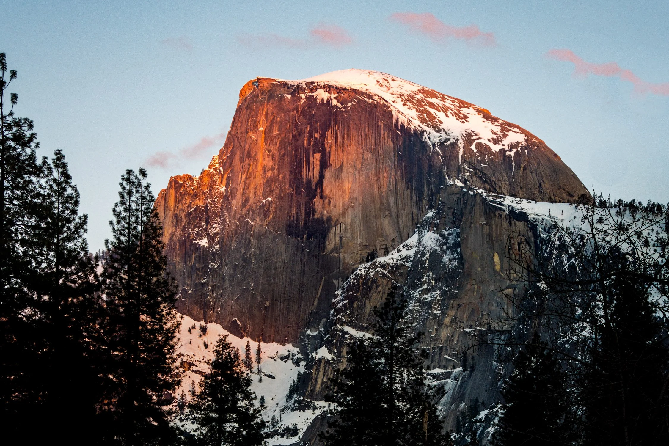
Make a detour to Yosemite Valley if you have the time while you are road tripping the PCH. Photograph by Dalton Johnson
Taking a Detour: Unique Side Trips off the PCH
While the Pacific Coast Highway (PCH) itself offers incredible beauty and countless attractions, don't be afraid to venture off the main road and explore the unique side trips that lie just beyond the PCH. These detours will add depth and diversity to your road trip experience, allowing you to discover hidden gems and off-the-beaten-path destinations. Here are a few ideas for side trips worth considering:
Joshua Tree National Park: Located east of the PCH, Joshua Tree National Park is a desert paradise with unique flora, stunning rock formations, and wide-open spaces. Explore the park's hiking trails, marvel at the iconic Joshua Trees, and enjoy stargazing in one of the best dark sky regions in Southern California.
Channel Islands National Park: Take a detour to the coast near Ventura and embark on a ferry ride to the Channel Islands. These remote islands offer untouched natural beauty, pristine beaches, and abundant marine life. Enjoy activities like hiking, kayaking, snorkeling, and wildlife watching in this tranquil and secluded paradise.
Napa Valley: For wine enthusiasts, a detour to Napa Valley is a must. Located north of San Francisco, this world-renowned wine region boasts picturesque vineyards, charming towns, and exceptional wineries. Take a break from the coastal scenery and indulge in wine tastings, vineyard tours, and gourmet dining experiences.
Yosemite National Park: While not directly off the PCH, Yosemite National Park is worth the detour for its awe-inspiring landscapes. Drive inland from the PCH to experience towering granite cliffs, majestic waterfalls, and breathtaking valleys. Hike to iconic landmarks like Half Dome or explore the valley floor for unparalleled natural beauty.
Santa Ynez Valley: Located near Santa Barbara, the Santa Ynez Valley offers a tranquil retreat filled with rolling hills, vineyards, and quaint towns. Enjoy wine tasting at local wineries, savor farm-to-table cuisine, and soak in the relaxed atmosphere of this charming wine country region.
Point Reyes National Seashore: Just north of San Francisco, Point Reyes National Seashore beckons with its rugged coastline, dramatic cliffs, and diverse wildlife. Take a detour to explore the park's scenic trails, visit historic lighthouses, and spot seals and whales along the shore.
Lake Tahoe: Venture inland from the PCH to the magnificent Lake Tahoe, situated in the Sierra Nevada Mountains. This stunning alpine lake offers crystal-clear waters, sandy beaches, and numerous outdoor recreational activities. Enjoy swimming, boating, hiking, or simply relax and take in the breathtaking mountain scenery.
Hearst San Simeon State Park: Pay a visit to Hearst San Simeon State Park, located near San Simeon. Explore the rugged coastline, walk along the sandy beaches, and witness the fascinating Elephant Seal Rookery, where you can observe these massive creatures in their natural habitat.
Redwood National and State Parks: Take a detour to experience the towering giants of the Redwood National and State Parks. Located in Northern California, these ancient forests are home to some of the world's tallest trees. Hike among the majestic redwoods, visit Fern Canyon, and immerse yourself in the peacefulness of this remarkable natural wonder.
Monterey Bay Aquarium and Cannery Row: Make a stop at Monterey Bay to visit the renowned Monterey Bay Aquarium, known for its stunning exhibits showcasing marine life. Explore Cannery Row, lined with shops, restaurants, and historic buildings, offering a glimpse into the area's rich maritime heritage.
Remember to plan your side trips in advance, considering the time and distance it will take to reach these destinations. Be prepared for varying road conditions and check for any specific permits or reservations required. These detours will offer unique experiences and a deeper appreciation for the diverse landscapes and attractions that lie beyond the PCH.
Sam Coffey airing out at Steamer Lane for the camera. Photograph by Dalton Johnson
Outdoor Adventures: Hiking, Surfing, and Wildlife Spotting
One of the greatest joys of embarking on a Pacific Coast Highway (PCH) road trip is the opportunity to engage in thrilling outdoor adventures. From hiking along scenic trails to catching epic waves and spotting diverse wildlife, the PCH offers an array of activities for nature enthusiasts. Here's a deeper dive into the exciting outdoor adventures you can experience along the PCH:
Hiking:
The PCH is dotted with numerous hiking trails that showcase the natural beauty of California's coastline. In Big Sur, explore the renowned McWay Falls Trail or venture into Julia Pfeiffer Burns State Park to witness breathtaking coastal views. In Point Reyes National Seashore, hike the Tomales Point Trail for a chance to spot tule elk or explore the Alamere Falls Trail, which culminates in a stunning waterfall cascading onto the beach. The PCH also grants access to hiking trails in Redwood National and State Parks, where you can immerse yourself in the enchanting redwood forests and feel dwarfed by their towering presence. Make sure to check out these hiking trails:
McWay Falls Trail (Big Sur): This short but stunning trail in Julia Pfeiffer Burns State Park leads you to a picturesque waterfall cascading onto a pristine beach, offering breathtaking coastal views.
Tomales Point Trail (Point Reyes National Seashore): Embark on this scenic hike to Tomales Point, where you can spot tule elk grazing amidst coastal grasslands and enjoy panoramic views of the Pacific Ocean.
Fern Canyon Trail (Redwood National and State Parks): Walk through a lush, narrow canyon adorned with ferns and moss-covered walls in this enchanting trail, immersing yourself in the magical ambiance of the redwood forest.
Devil's Slide Trail (Montara): Enjoy panoramic ocean views along this converted stretch of the historic Highway 1. This pedestrian and bike-friendly trail provides a safe and scenic route with interpretive signs highlighting local history and wildlife.
Solstice Canyon Trail (Malibu): Explore the picturesque Solstice Canyon, home to a shaded creek, cascading waterfalls, and remnants of a historical ranch. This trail offers a mix of natural beauty and cultural history.
Surfing:
The California coast is renowned for its world-class surf breaks, and the PCH is no exception. Surfers of all levels can find waves suited to their abilities along the route. From iconic breaks like Malibu, where you can catch long rides in a classic Californian setting, to Santa Cruz, known for its consistent surf and vibrant surf culture, there are plenty of spots to paddle out and ride the waves. Other notable surf breaks along the PCH include Rincon Point, Pismo Beach, and Pleasure Point. Whether you're a seasoned surfer or eager to try it for the first time, the PCH offers an unforgettable surfing experience. Make sure to check out these spots as well:
Malibu Surfrider Beach (Malibu): Known for its long, peeling waves and iconic pier, Malibu is a classic surf spot that caters to surfers of all skill levels. Its consistent waves and picturesque setting make it a favorite among locals and visitors alike.
Pleasure Point (Santa Cruz): Located in the heart of Santa Cruz, Pleasure Point is renowned for its consistent surf breaks and fun, rippable waves. It offers a mix of reef and beach breaks, making it suitable for various surfing styles.
Rincon Point (Carpinteria): Widely considered one of the best right-hand point breaks in California, Rincon Point offers long rides and world-class waves. It attracts experienced surfers seeking epic rides along its rocky bottom point break.
Mavericks (Half Moon Bay): Mavericks is legendary in the world of big-wave surfing. Known for its massive, powerful waves that can reach up to 60 feet, it is a destination for skilled and experienced big-wave surfers seeking a thrilling challenge.
County Line Beach (Malibu): Located near the Ventura-Los Angeles county line, this popular surf spot offers consistent waves suitable for beginners and intermediate surfers. It's a great place to catch fun and manageable waves while enjoying the scenic coastline.
Wildlife Spotting:
The PCH provides ample opportunities for wildlife enthusiasts to observe a diverse range of species. Along the coastline, keep an eye out for sea otters, harbor seals, and dolphins frolicking in the waves. Whale watching is particularly popular during migration seasons, with gray whales and humpback whales frequently spotted from various viewpoints. In the Channel Islands National Park, take a boat tour to witness sea lions, seals, and seabird colonies up close. Additionally, Point Reyes National Seashore is home to an abundance of wildlife, including Tule elk, foxes, and migratory birds.
As you embark on these outdoor adventures, ensure you prioritize safety and adhere to any regulations or guidelines in place. Carry appropriate gear, such as hiking boots, wetsuits, or binoculars, depending on the activity. Research local conditions, tides, and weather forecasts to make informed decisions. Respect wildlife and their habitats, keeping a safe distance at all times. By immersing yourself in these outdoor experiences, you'll create lifelong memories and gain a deeper appreciation for the natural wonders along the Pacific Coast Highway.

Once you make it to San Diego, make sure to stop at the Scripps Pier for sunset. Photograph by Dalton Johnson
Capturing the Beauty: Photography Tips for the Pacific Coast Highway
The Pacific Coast Highway (PCH) is a photographer's dream, offering endless opportunities to capture the breathtaking beauty of the California coastline. Whether you're a professional photographer or an amateur enthusiast, here are some tips to help you make the most of your photography journey along the PCH:
Golden Hour Magic: Take advantage of the soft, warm light during the golden hours, which occur shortly after sunrise and before sunset. The stunning coastal landscapes along the PCH are bathed in golden hues during these times, creating a magical atmosphere for your photographs. Plan your shoots accordingly to capture the best lighting conditions.
Experiment with Composition: The PCH offers a diverse range of subjects and landscapes, from dramatic cliffs to secluded beaches. Experiment with different compositions to create visually striking images. Use leading lines, such as the curves of the road or the edges of the cliffs, to draw the viewer's eye into the frame. Include interesting foreground elements to add depth and scale to your photos.
Capture the Coastal Majesty: The PCH is renowned for its breathtaking coastal views. Use wide-angle lenses to capture the grandeur of the expansive vistas. Look for interesting rock formations, crashing waves, or patterns in the sand to add visual interest. Play with different perspectives, such as shooting from a low angle to emphasize the height of cliffs or from higher vantage points to showcase the sweeping coastline.
Long Exposures for Dynamic Shots: Experiment with long exposure photography to create dynamic and ethereal images. Capture the motion of crashing waves or flowing rivers by using a tripod and setting a slow shutter speed. This technique can add a sense of movement and create a dreamy atmosphere in your photos.
Seek Unique Perspectives: Don't hesitate to explore off-the-beaten-path locations or viewpoints to find unique perspectives. Venture down less-traveled trails, climb hills, or explore hidden coves to discover hidden gems. Look for opportunities to shoot from high viewpoints or get up close to capture the intricate details of seashells, flora, or wildlife.
Capture Local Life and Culture: While the landscapes steal the spotlight, don't forget to capture the local life and culture along the PCH. Photograph charming seaside towns, vibrant street scenes, or local events to showcase the authentic California coastal experience. Engage with locals, learn their stories, and capture candid moments that reflect the region's unique charm.
Pack Essential Gear: Ensure you have the necessary photography gear for your PCH journey. Along with your camera body and lenses, bring a sturdy tripod for stability, neutral density filters for long exposures, lens filters for managing light and reflections, and extra memory cards and batteries. Protect your gear from the coastal elements by using weather-sealed equipment or carrying protective covers.
Embrace Post-Processing: Post-processing is an integral part of digital photography. Once you've captured your images, use editing software to enhance and fine-tune your photos. Adjust the exposure, contrast, and colors to bring out the best in your images while maintaining a natural and balanced look.
Most importantly, enjoy the process of capturing the beauty along the Pacific Coast Highway. Take your time to soak in the stunning vistas, embrace the coastal ambiance, and let your creativity guide you in capturing images that truly reflect the awe-inspiring landscapes and unforgettable moments of your PCH journey.
Family-Friendly Activities and Attractions for Kids on the PCH
Embarking on a Pacific Coast Highway road trip with your family is an exciting adventure filled with opportunities for creating lifelong memories. From stunning natural wonders to interactive museums, the PCH offers a plethora of family-friendly activities and attractions that will delight kids of all ages. Here are some highlights to consider when planning a family trip along the PCH:
Monterey Bay Aquarium (Monterey): Dive into the wonders of the ocean at the Monterey Bay Aquarium, a world-class facility that showcases a diverse range of marine life. Kids can marvel at the mesmerizing exhibits featuring playful sea otters, colorful fish, and majestic sharks. Interactive touch pools and educational presentations make it a memorable experience for children.
Santa Cruz Beach Boardwalk (Santa Cruz): Let the kids unleash their inner thrill-seekers at the Santa Cruz Beach Boardwalk, one of California's oldest amusement parks. From classic rides like the Ferris wheel and carousel to exhilarating roller coasters, there's something for every age. Enjoy arcade games, cotton candy, and the sandy beach just steps away.
Natural Bridges State Beach (Santa Cruz): Visit Natural Bridges State Beach to explore fascinating rock formations and witness a natural bridge created by the crashing waves. Kids will love exploring tide pools teeming with marine life, spotting shorebirds, and enjoying a picnic on the beach. Keep an eye out for migrating monarch butterflies in the winter months.
Point Lobos State Natural Reserve (Carmel): Take a family-friendly hike at Point Lobos State Natural Reserve, where breathtaking coastal views and abundant wildlife await. Explore easy trails like the Cypress Grove Trail or the Bird Island Trail, where kids can spot seals, sea lions, and numerous bird species. Don't forget to bring binoculars for a closer look.
Children's Discovery Museum (San Jose): Make a stop at the Children's Discovery Museum in San Jose, offering hands-on exhibits and interactive learning experiences. Kids can engage in imaginative play, experiment with science, explore a pretend farmer's market, and even climb a giant jungle gym.
Santa Barbara Zoo (Santa Barbara): Let the little ones get up close with exotic animals at the Santa Barbara Zoo. This small and family-friendly zoo offers a variety of species, including giraffes, lions, and elephants. Kids can enjoy a train ride, feed the giraffes, and learn about wildlife conservation.
Charles Paddock Zoo (Atascadero): Visit the Charles Paddock Zoo, a small yet charming zoo nestled in the Central Coast. Kids will delight in seeing animals like lemurs, meerkats, and reptiles up close. The zoo also features a playground and picnic areas for added family fun.
The Tech Interactive (San Jose): Spark curiosity and creativity at The Tech Interactive, a science and technology museum in San Jose. Interactive exhibits, virtual reality experiences, and hands-on workshops make it an engaging destination for kids of all ages.
Hearst Castle (San Simeon): Take a guided tour of Hearst Castle, the opulent estate of media tycoon William Randolph Hearst. Kids will be fascinated by the grandeur of the castle and its vast collection of art and artifacts. Explore the beautiful gardens and learn about the castle's history during a family-friendly tour.
Santa Monica Pier (Santa Monica): End your PCH journey with a visit to the iconic Santa Monica Pier. Kids can enjoy amusement rides, play games at the arcade, and indulge in sweet treats like cotton candy and ice cream. The sandy beach provides an opportunity for some family fun in the sun.
These family-friendly activities and attractions along the PCH ensure that kids will have a blast throughout the journey. From engaging museums and thrilling amusement parks to captivating wildlife encounters and natural wonders, the Pacific Coast Highway offers a wealth of experiences that will leave lasting impressions on children of all ages.
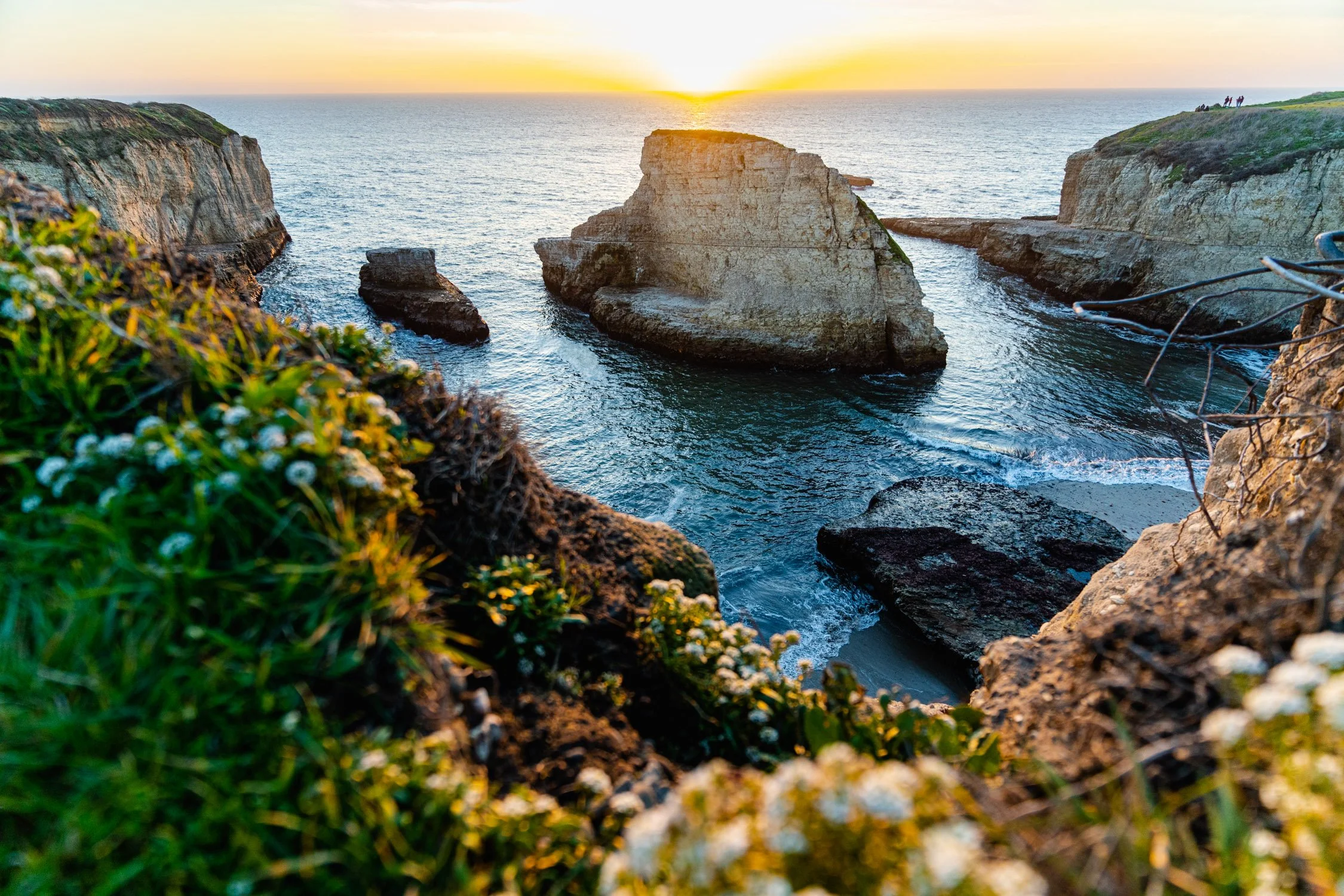
One of the best hidden gems along the PCH is Shark Fin Cove photographed here. Photograph by Dalton Johnson
Exploring the Natural Wonders Along the PCH: Beaches, Redwoods, and More
A road trip along the Pacific Coast Highway presents an incredible opportunity to immerse yourself in the natural wonders of the California coast. From pristine beaches to towering redwood forests and everything in between, the PCH showcases a diverse array of breathtaking landscapes. Here's a closer look at the natural wonders you can explore along the PCH:
Stunning Beaches: The PCH is famous for its stunning beaches, each offering its own unique charm. From the golden sands of Malibu to the rugged shores of Big Sur, you'll find an abundance of picturesque spots to relax, play, and soak up the sun. Don't miss iconic beaches like Zuma Beach, Pfeiffer Beach, and Carmel Beach, where you can unwind, stroll along the shoreline, or catch breathtaking sunsets over the Pacific Ocean.
Majestic Redwood Forests: Venture inland from the PCH to discover the majestic beauty of the towering redwood forests. These ancient giants, some of the tallest trees on Earth, create an enchanting atmosphere that is simply awe-inspiring. Visit places like Redwood National and State Parks, where you can walk among these magnificent trees, hike scenic trails, and witness the serene beauty of the forest.
Breathtaking Coastal Cliffs: The PCH winds along dramatic coastal cliffs, offering stunning vistas that will leave you breathless. From the rugged cliffs of Big Sur to the iconic Bixby Bridge, the coastline boasts awe-inspiring views at every turn. Don't forget to stop at viewpoints like Point Lobos or Julia Pfeiffer Burns State Park to marvel at the rugged beauty of the cliffs and the crashing waves below.
Scenic Coastal Drives: The PCH itself is a scenic wonder, providing countless opportunities for awe-inspiring drives. The winding road hugs the coastline, offering panoramic views of the Pacific Ocean. Cruise along the cliffside stretch between Carmel and San Simeon, known as the Big Sur Coast, where every bend reveals a new postcard-worthy view. Be prepared to stop at turnouts, soak in the vistas, and capture the beauty of the coastline.
Vibrant Wildlife: The Pacific Coast Highway is home to a diverse array of wildlife, both on land and at sea. Keep an eye out for seals and sea lions sunbathing on rocks, dolphins playing in the surf, and whales breaching offshore during migration seasons. Explore tide pools teeming with colorful marine life, or visit areas like the Channel Islands National Park, where you can witness seabird colonies and spot seals, sea lions, and possibly even whales up close.
Coastal State Parks: The PCH is dotted with coastal state parks that offer a chance to experience the natural beauty of the California coast. Places like Point Reyes National Seashore, Andrew Molera State Park, and Crystal Cove State Park provide opportunities for hiking, picnicking, wildlife spotting, and immersing yourself in the coastal environment.
Immerse yourself in the natural wonders along the PCH, from the tranquil beaches and rugged cliffs to the ancient redwood forests and vibrant wildlife. Take the time to explore these remarkable landscapes, engage in outdoor activities, and capture the awe-inspiring beauty of the California coast. The natural wonders along the PCH are sure to create unforgettable moments and leave you with a deep appreciation for the incredible diversity of the Golden State's landscapes.
Preparing for Unexpected Situations: Emergency Preparedness on the PCH
When embarking on a road trip along the Pacific Coast Highway (PCH), it's essential to be prepared for unexpected situations that may arise during your journey. While the PCH offers breathtaking views and memorable experiences, it's important to prioritize safety and be equipped to handle emergencies. Here are ten tips to help you prepare for unforeseen circumstances on the PCH:
Roadside Emergency Kit: Pack a well-stocked roadside emergency kit that includes essentials such as a spare tire, jack, jumper cables, flashlight, basic tools, and a reflective triangle. Familiarize yourself with how to use these items and be prepared to handle minor vehicle issues if they occur.
Vehicle Maintenance: Before setting off on your PCH adventure, ensure your vehicle is in good working condition. Check the tires, brakes, fluid levels, and lights. If needed, get a thorough inspection from a trusted mechanic. This can help prevent breakdowns and keep you safe on the road.
Communication and Navigation: Make sure you have reliable communication tools such as a charged mobile phone and car charger. Consider downloading offline maps or a GPS navigation app to ensure you can navigate even if you encounter areas with limited or no cell service. Carry a physical road map as a backup.
Weather Awareness: Stay informed about weather conditions along your route, especially if you're traveling during seasons when storms or extreme weather are possible. Check weather forecasts regularly and be prepared to adjust your plans or seek shelter if needed. Pay attention to any road condition advisories or closures due to inclement weather.
First Aid Kit and Medications: Pack a well-stocked first aid kit that includes bandages, antiseptic ointment, pain relievers, and any necessary prescription medications. Familiarize yourself with basic first aid procedures. If you or your travel companions have specific medical needs, ensure you have an ample supply of necessary medications.
Emergency Contacts and Travel Documents: Carry a list of emergency contact numbers, including roadside assistance and local authorities along the PCH. Keep a copy of your driver's license, identification, vehicle registration, and insurance documents in a secure place. It's also a good idea to have digital copies stored on your phone or in cloud storage.
Stay Hydrated and Stocked with Essentials: Keep a supply of drinking water and non-perishable snacks in your vehicle. Staying hydrated and having nourishing food available is important, especially if you encounter unexpected delays or find yourself in remote areas without immediate access to amenities.
Be Aware of Your Surroundings: While the PCH is renowned for its beauty, it's important to be aware of your surroundings and take necessary precautions. Park in well-lit areas, lock your vehicle when unattended, and be cautious of your belongings. Stay on designated trails when hiking and respect wildlife habitats.
Stay Updated on Local Regulations and Guidelines: Familiarize yourself with local regulations and guidelines along the PCH, including camping restrictions, beach rules, and wildlife protection measures. Observe posted signs and practice responsible tourism to ensure the safety of both yourself and the environment.
Trust Your Instincts and Seek Help if Needed: If you encounter an emergency or feel unsafe, trust your instincts and seek assistance. Call emergency services or roadside assistance if necessary. Don't hesitate to reach out to local authorities or fellow travelers for help or guidance if you require assistance.
By being prepared and taking necessary precautions, you can better handle unexpected situations and ensure a safer and more enjoyable journey along the Pacific Coast Highway. Remember to prioritize safety, stay vigilant, and embrace the adventure while being ready for any challenges that may come your way.

Embracing the wild times the PCH has to offer on a side hike in Big Sur. Photograph by Dalton Johnson
Embarking on a road trip along the Pacific Coast Highway is an adventure that promises stunning natural beauty, captivating landscapes, and unforgettable experiences. From the pristine beaches and towering redwoods to the charming coastal towns and vibrant cultural attractions, the PCH showcases the best of what California has to offer. This ultimate guide has provided you with insights into the diverse landscapes, family-friendly activities, photography tips, emergency preparedness, and so much more.
As you plan your journey along the PCH, remember to consider the best time of year to travel, take detours to explore hidden gems, and craft the perfect itinerary that suits your interests. Be prepared for challenging sections, budget wisely, and prioritize safety at all times. Whether you're traveling solo, with friends, or as a family, there are countless opportunities for adventure, relaxation, and discovery along the way.
Capture the beauty of the PCH with your camera, savor the culinary delights, and immerse yourself in the rich history and culture that make this route so special. Embrace the breathtaking views, the soothing sound of crashing waves, and the warmth of the coastal communities you encounter. The memories made on this iconic highway will stay with you for a lifetime.
As you hit the open road, keep in mind the essence of a road trip – the freedom to explore, the joy of spontaneity, and the opportunity to create lasting connections with the people and places you encounter. Let the Pacific Coast Highway be your gateway to adventure, inspiration, and a deeper appreciation for the natural wonders and diverse tapestry of California's coastal beauty.
So, buckle up, set your playlist, and embark on an extraordinary journey along the Pacific Coast Highway. Let the allure of the open road guide you as you create cherished memories and experience the undeniable magic of this classic American adventure. The Pacific Coast Highway awaits, ready to reveal its wonders and make your road trip dreams come true.
Discover more of Highway One

Discover the Hidden Gem: Shark Fin Cove - Where Photography and Nature Collide
If you're seeking a destination that combines natural beauty, unique rock formations, and captivating landscapes, then Shark Fin Cove is an absolute must-visit. This hidden gem, nestled along the rugged coastline north of Santa Cruz, offers an enchanting backdrop that is truly a photographer's paradise. From the iconic rock formation resembling a shark fin rising from the ocean to the dramatic cliffs and serene beach, Shark Fin Cove provides an abundance of opportunities to capture awe-inspiring shots. Whether you're an amateur or a seasoned professional, the combination of golden hour lighting, stunning natural features, and a tranquil atmosphere make Shark Fin Cove an irresistible destination for photographers looking to create breathtaking images.
If you're seeking a destination that combines natural beauty, unique rock formations, and captivating landscapes, then Shark Fin Cove is an absolute must-visit. This hidden gem, nestled along the rugged coastline north of Santa Cruz, offers an enchanting backdrop that is truly a photographer's paradise. From the iconic rock formation resembling a shark fin rising from the ocean to the dramatic cliffs and serene beach, Shark Fin Cove provides an abundance of opportunities to capture awe-inspiring shots. Whether you're an amateur or a seasoned professional, the combination of golden hour lighting, stunning natural features, and a tranquil atmosphere make Shark Fin Cove an irresistible destination for photographers looking to create breathtaking images.
Discover the hidden beauty of Shark Fin Cove, a secluded coastal paradise north of Santa Cruz. With its iconic rock formation, dramatic cliffs, and serene beach, Shark Fin Cove offers photographers a captivating backdrop for their creativity. Explore the breathtaking landscapes, capture the golden hour magic, and unlock your artistic vision at this picturesque location. Plan your visit to Shark Fin Cove and indulge in a photography experience like no other.
In this blog post, we'll explore the pros and cons of visiting Shark Fin Cove, reasons why someone would visit, and answer some frequently asked questions. We'll also give you tips on photographing this beautiful location.

A magical sunset at Shark Fin Cove filled with wildflowers. Photograph by Dalton Johnson
Pros:
The cove is a hidden gem, so it's not as crowded as other popular destinations.
The rock formation looks like a shark fin and makes for a unique and striking photo subject.
The beach is secluded and peaceful, making it a great spot for a picnic or to enjoy the sunset.
The surrounding cliffs and rock formations provide a stunning backdrop for photos.
Cons:
The beach can be difficult to access as there is a steep path down to the cove.
There are no facilities, so visitors need to bring everything they need with them, including water, food, and sunscreen.
The weather can be unpredictable, so it's important to check the forecast and dress accordingly.
Why Visit Shark Fin Cove?
Shark Fin Cove is a great destination for anyone who loves nature, photography, or just wants to get away from the crowds. The cove's secluded location and striking natural beauty make it an ideal spot for a day trip. Visitors can hike down to the cove and enjoy a picnic on the beach, explore the surrounding cliffs, or simply soak in the stunning views.
If you're a photographer, Shark Fin Cove offers a wealth of opportunities. The unique rock formation and surrounding cliffs provide an ever-changing backdrop for stunning landscape shots. Whether you're a professional photographer or just starting out, Shark Fin Cove is a must-visit location.
Photographing Shark Fin Cove
When it comes to photography, Shark Fin Cove offers a plethora of captivating subjects and compositions. Here's a closer look at what you can expect when photographing this stunning location:
Gear Needed: To capture the beauty of Shark Fin Cove, it's recommended to bring a few essential pieces of photography gear. A wide-angle lens is particularly useful for capturing the expansive scenery and incorporating the impressive rock formation into your shots. Additionally, a tripod will help you achieve stable and sharp images, especially during low-light conditions or long exposure shots. Consider using a polarizing filter to reduce glare and enhance colors, particularly when photographing the ocean and surrounding cliffs.
Best Time of Day: Timing is crucial for landscape photography, and Shark Fin Cove is no exception. The golden hour, which refers to the hour before sunset or after sunrise, offers magical lighting conditions with warm, soft hues that can elevate your photos to another level. During this time, the sun casts a gentle glow, casting long shadows and creating a dreamy atmosphere. Take advantage of the golden hour to capture the cove in its most enchanting state.
Note: Sunset is better, but the shadows can be harsh and there will be more people
What is There to Photograph: Shark Fin Cove presents a diverse range of photographic opportunities. The focal point of the cove is undoubtedly the rock formation that resembles a shark fin rising from the ocean. This unique feature can serve as a captivating centerpiece for your compositions. Additionally, the surrounding cliffs, rugged coastline, and dramatic waves crashing against the rocks offer stunning elements to incorporate into your frames. Don't forget to explore the beach itself, as it provides a tranquil foreground against the backdrop of the majestic cliffs and horizon.
Different Spots to Photograph: While the rock formation is an iconic subject, don't limit yourself to a single perspective. Explore the various vantage points available at Shark Fin Cove to unleash your creativity. Consider shooting from different angles along the beach, experimenting with low and high angles to highlight different aspects of the cove. Venture up to the cliffs to capture breathtaking panoramic views of the coastline or find elevated positions that offer unique perspectives. Remember, each spot offers its own charm and can result in distinctive and captivating photographs.
By taking advantage of the right gear, timing, and exploring the different photography spots, you'll be able to capture the awe-inspiring beauty of Shark Fin Cove. Let your artistic vision guide you as you compose your shots, and don't be afraid to experiment with different techniques to create truly remarkable images. Ultimately, Shark Fin Cove's natural splendor provides a fantastic canvas for photographers to express their creativity and capture breathtaking moments in time.
FAQ
Where is Shark Fin Cove?
Shark Fin Cove is located north of Santa Cruz in the small town of Davenport along Highway One.
What to Do at Shark Fin Cove?
Visitors can hike down to the cove and enjoy a picnic on the beach, explore the surrounding cliffs, or take photographs of the stunning scenery.
What Do I Need to Visit Shark Fin Cove?
Visitors need to bring everything they need with them, including water, food, and sunscreen. Comfortable hiking shoes are also recommended.
Is Shark Fin Cove Free?
Yes, Shark Fin Cove is free to visit.
Can I Camp at Shark Fin Cove?
No, camping is not allowed at Shark Fin Cove.
Is the Hike Hard to Shark Fin Cove?
The hike down to the cove can be steep and challenging, so comfortable hiking shoes and caution are recommended.
Is Shark Fin Cove Family Friendly?
Yes, Shark Fin Cove is family-friendly, but young children should be supervised due to the steep paths and cliffs.
Can You Surf at Shark Fin Cove?
Yes, surfers can access the beach at Shark Fin Cove, but the conditions can be unpredictable and this spot is rarely ever surfed.
Sunset Picnic Packing List
When preparing for a sunset picnic at Shark Fin Cove, it's essential to pack the right items to ensure a comfortable and enjoyable experience. Here's a packing list to help you make the most of your time:
Picnic Blanket or Beach Towel: A comfortable blanket or beach towel to sit on will provide a cozy spot to relax and enjoy the sunset.
Portable Chairs: If you prefer a bit of back support, consider bringing lightweight, foldable chairs for added comfort.
Food and Drinks: Pack a delicious assortment of snacks, sandwiches, fruits, and finger foods. Don't forget to bring plenty of water or other refreshing beverages to stay hydrated.
Picnic Utensils and Plates: Disposable or reusable plates, cups, cutlery, and napkins will make it easy to enjoy your picnic treats.
Sunscreen and Sun Protection: Shield yourself from harmful UV rays with sunscreen, sunglasses, and hats. The coastal breeze can be deceiving, so ensure you're adequately protected.
Warm Clothing and Blankets: Evenings can get chilly near the coast, so bring layers such as sweaters, jackets, and cozy blankets to keep warm as the sun sets.
Camera and Tripod: Don't forget your camera gear to capture the stunning sunset and scenic beauty of Shark Fin Cove. A tripod will help steady your shots, especially during low-light conditions.
Trash Bags: Help keep the area clean by bringing small trash bags to dispose of any waste properly.
Extra Essentials: It's always a good idea to bring some additional items like a first aid kit, wet wipes, hand sanitizer, and a portable phone charger.
Remember to pack light and be mindful of your surroundings, as there are no trash or recycling bins available at Shark Fin Cove. Leave no trace and take all your belongings and trash with you when you leave.
Embracing the beauty of Shark Fin Cove with a playful cartwheel. Photograph by Dalton Johnson
Shark Fin Cove is a hidden gem for landscape photography, located north of Santa Cruz in Davenport, California. With its unique rock formation, stunning cliffs, and secluded beach, it offers a wealth of opportunities for photographers and nature enthusiasts alike. While the hike down to the cove may be challenging, the reward of capturing breathtaking photos and enjoying the peaceful surroundings makes it well worth the effort. So grab your camera, pack your gear, and head to Shark Fin Cove for an unforgettable photography experience.
Discover more of Highway One

Exit Glacier and Harding Icefield Hike | Hike Alaska
The Exit Glacier and Harding Icefield hike is a one-two hit combo in the Kenai Fjord National Park just outside of Seward, Alaska. Most hikers decide to day hike to Exit Glacier to see this massive frozen river up close, but few push onward and upward to the Harding Icefield. If you have the time and energy, you should hike up the switchbacks to the Harding Icefield so you can soak in the United States largest icefield.
The Exit Glacier and Harding Icefield hike is a one-two hit combo in the Kenai Fjord National Park just outside of Seward, Alaska. Most hikers decide to day hike to Exit Glacier to see this massive frozen river up close, but few push onward and upward to the Harding Icefield. If you have the time and energy, you should hike up the switchbacks to the Harding Icefield so you can soak in the United States largest icefield.
Hiking Exit Glacier and the Harding Icefield offers an unparalleled opportunity to immerse yourself in the breathtaking beauty of Alaska's Kenai Fjords National Park. The experience allows you to witness the immense power and wonder of glacial landscapes up close, surrounded by towering peaks and pristine wilderness. The journey rewards you with awe-inspiring views, a deeper appreciation for nature's forces, and a chance to create lasting memories in one of the most remarkable natural settings on Earth.
Discover the awe-inspiring beauty of Alaska's Kenai Fjords National Park as you delve into the essential guide for hiking Exit Glacier and the Harding Icefield, unlocking a world of breathtaking landscapes and unforgettable wilderness adventures.
Hiking Exit Glacier with my Dad. Photo by Dalton Johnson
EXIT GLACIER AND HARDING ICEFIELD HIKE OVERVIEW:
Distance: 9.2 miles round trip
Time needed: 6-7 hours
Elevation change: 3,600 feet
Type of terrain: Maintained trail
Difficulty of hike: Hard
WHERE IS EXIT GLACIER AND HARDING ICEFIELD?
Exit Glacier is located within Kenai Fjords National Park, which is situated in the state of Alaska, United States. The park is located on the Kenai Peninsula, near the town of Seward. Exit Glacier is easily accessible from the Seward Highway (Alaska Route 9) and is approximately 12 miles (19 kilometers) northwest of the town of Seward. The glacier is nestled within the ruggedly beautiful Kenai Mountains and is a prominent feature of the park's landscape.
Click here for direction to Exit Glacier and Harding Icefield Trailhead
HOW LONG DOES IT TAKE TO HIKE EXIT GLACIER AND HARDING ICEFIELD?
The duration of the hike to Exit Glacier and the Harding Icefield can vary depending on several factors, including individual fitness levels, pace, weather conditions, and the chosen route. Here is a general estimate of the time it may take to complete the hike:
Exit Glacier: The hike to Exit Glacier itself is relatively short, with a round trip distance of approximately 2.8 miles (4.5 kilometers). Most hikers can complete this portion of the hike in about 1 to 2 hours, including time spent exploring viewpoints and taking in the scenery. However, if you decide to extend your exploration or take additional side trails, it may take longer.
Harding Icefield: The hike to the Harding Icefield is a more challenging endeavor. The round trip distance is approximately 8.2 miles (13.2 kilometers), and the trail involves a steep incline. The average time needed to complete the Harding Icefield hike is around 6 to 8 hours. However, it's important to consider your physical fitness, hiking experience, and the pace at which you feel comfortable. Some hikers may take longer, especially if they want to spend additional time enjoying the panoramic views at the top.
Keep in mind that these time estimates are approximate and can vary depending on the factors mentioned earlier. It's essential to plan accordingly, allowing for breaks, rest stops, and time to appreciate the remarkable scenery along the way. It is also crucial to consider daylight hours, especially if you're hiking during the shorter days of winter or if you plan to start the hike late in the day.
Need to Know Before You Go:
Hiking through the rugged wilderness of Kenai Fjords National Park to witness the stunning beauty of Exit Glacier and the Harding Icefield is a memorable adventure for outdoor enthusiasts. However, before setting foot on the trails, there are important things to know to ensure a safe and enjoyable experience such as:
Trail Conditions: Before embarking on your hike, it is essential to check the current trail conditions and any advisories issued by Kenai Fjords National Park. Weather and trail conditions can change rapidly, so it is crucial to be prepared and informed.
Permits: No permits are required for day hiking to Exit Glacier or the Harding Icefield. However, if you plan to camp overnight in the backcountry, you will need to obtain a backcountry camping permit from the park's visitor center.
Safety Precautions: Hiking in remote areas such as Exit Glacier and the Harding Icefield requires proper preparation. Notify someone about your hiking plans, carry a map and compass (or GPS device), and be aware of your limitations. Remember that weather conditions can be unpredictable, and the terrain can be challenging. Always prioritize safety and be prepared to turn back if conditions become unfavorable.
Leave No Trace: Kenai Fjords National Park is a pristine wilderness area, and it is essential to practice Leave No Trace principles. Pack out all trash, respect wildlife and their habitats, and stay on designated trails to minimize your impact on the environment.
Bear Safety: Kenai Fjords National Park is home to black bears and occasionally brown bears. Carry bear spray, make noise while hiking to alert bears of your presence, and be familiar with proper bear encounter protocols. It is advisable to hike in groups and stay vigilant, especially in areas with dense vegetation or where visibility is limited.
Hiking with Children: While the hike to Exit Glacier is generally considered kid-friendly, the hike to the Harding Icefield is more challenging and may not be suitable for younger children or inexperienced hikers. Assess your children's hiking abilities, endurance, and overall fitness before attempting the longer and more strenuous Harding Icefield hike.
Visitor Center: Make a stop at the Kenai Fjords National Park Visitor Center in Seward before your hike. The knowledgeable park rangers can provide up-to-date information on trail conditions, safety tips, and any specific recommendations for your hiking plans.


IS EXIT GLACIER AND HARDING ICEFIELD hike kid friendly?
The Exit Glacier and Harding Icefield hike is a popular and breathtaking adventure located in Kenai Fjords National Park in Alaska. While the hike offers incredible views and an opportunity to witness the awe-inspiring beauty of the Harding Icefield, it is important to consider its suitability for children.
The hike to Exit Glacier is generally considered kid-friendly. The trail leading to the glacier is well-maintained and offers various viewpoints along the way, allowing hikers of all ages to appreciate the glacier's majesty. Children can learn about the glacial landscape, witness the effects of climate change firsthand, and explore the area's unique flora and fauna. The trail is relatively short, with a round trip distance of approximately 2.8 miles (4.5 kilometers), making it manageable for most children.
However, it's important to note that the hike to the Harding Icefield is significantly more challenging and may not be suitable for younger children or those who are inexperienced hikers. The trail to the icefield is strenuous, with a steep incline and a total round trip distance of about 8.2 miles (13.2 kilometers). The hike typically takes several hours to complete and involves navigating rocky terrain and potentially encountering adverse weather conditions. Therefore, it is advisable to assess your children's hiking abilities, endurance, and overall fitness before attempting this hike with them.
What to bring while hiking EXIT GLACIER AND HARDING ICEFIELD?
When embarking on a hike to Exit Glacier and the Harding Icefield in Kenai Fjords National Park, it is important to come prepared with the right gear and supplies. Here is a list of essential items to bring along:
Hiking boots or sturdy footwear: Choose comfortable, well-fitting hiking boots or shoes that provide good ankle support and traction on varied terrain.
Hat and sunglasses: Protect your face and eyes from the sun's rays and glare off the snow and ice. A wide-brimmed hat can also provide shade during sunny weather.
Backpack: Carry a lightweight backpack to store your essentials and distribute the weight evenly. Ensure it has a comfortable fit and adjustable straps.
Water and snacks: Stay hydrated throughout the hike by carrying an adequate supply of water. Pack energy-boosting snacks such as granola bars, nuts, and dried fruits to keep your energy levels up.
Sunscreen and insect repellent: Apply a broad-spectrum sunscreen with a high SPF to protect your skin from the sun's rays. Use insect repellent to ward off mosquitoes and other bugs, especially during the summer months.
First aid kit: Pack a basic first aid kit containing bandages, antiseptic wipes, pain relievers, blister pads, and any necessary prescription medications.
Extra clothing and rain gear: Bring an extra set of clothing in case of unexpected weather changes or if you get wet. A lightweight, waterproof rain jacket and pants can protect you from rain or wind.
Camera and binoculars: Capture the stunning scenery and wildlife sightings along the way. Binoculars can enhance your experience by allowing you to observe distant wildlife or details of the landscape.
Trekking poles: Consider bringing trekking poles to provide stability and reduce strain on your knees and joints, especially during the more challenging sections of the hike.
Remember, safety is paramount when hiking in remote areas. Be aware of your limitations, check weather conditions, and inform someone about your plans before heading out. Enjoy the beauty of Exit Glacier and the Harding Icefield while respecting the environment and leaving no trace behind.
Other Adventures Near EXIT GLACIER AND HARDING ICEFIELD Hike:
Flightseeing Tours: Hop on a small aircraft or seaplane for a flightseeing tour that offers breathtaking aerial views of the Kenai Peninsula's glaciers, fjords, and mountains. Capture unforgettable photos and experience the vastness of this pristine wilderness.
Camping and Backcountry Exploration: The Kenai Peninsula offers numerous camping opportunities amidst stunning natural landscapes. Set up camp in one of the designated campgrounds or venture into the backcountry for a more rugged and immersive experience.
Fishing: The Kenai Peninsula is renowned for its world-class fishing opportunities. Whether it's salmon, halibut, trout, or other species, embark on a fishing excursion and try your luck in the region's abundant rivers, lakes, and coastal waters.
ATV and Off-Roading: Discover the rugged terrain and explore remote areas of the Kenai Peninsula on an ATV or off-road adventure. Ride through forests, climb hills, and revel in the sense of freedom and exploration.
Kayaking and Canoeing: In addition to glacier kayaking, there are other waterways on the Kenai Peninsula that are perfect for kayaking and canoeing. Paddle along the peaceful lakes, rivers, and coastal areas, taking in the breathtaking scenery and wildlife.
Birdwatching: The Kenai Peninsula is a haven for birdwatching enthusiasts. Visit the Kenai National Wildlife Refuge or other designated birding spots to observe a wide variety of bird species in their natural habitats.
Rock Climbing: For those seeking vertical adventures, the Kenai Peninsula offers excellent rock climbing opportunities. Scale the cliffs and granite walls while surrounded by stunning scenery.
Scenic Drives: Enjoy the scenic beauty of the Kenai Peninsula through a leisurely drive along the Seward Highway or other picturesque routes. Marvel at the coastal views, towering mountains, and charming small towns along the way.
Enjoying the wildlife around Seward before hiking to Exit Glacier. Photo by Dalton Johnson
Hiking Exit Glacier and the Harding Icefield in Kenai Fjords National Park is an extraordinary experience that brings you face-to-face with the raw power and splendor of nature. From the stunning vistas and fascinating glacial formations to the sense of adventure and connection with the pristine wilderness, this journey offers a profound appreciation for Alaska's natural wonders. By following the provided information and embracing the necessary preparations, you can embark on a safe and rewarding hiking adventure, creating memories that will last a lifetime. So, lace up your boots, immerse yourself in the beauty of Exit Glacier and the Harding Icefield, and let the magic of this remarkable corner of the world leave an indelible mark on your soul.
Discover more of Alaska
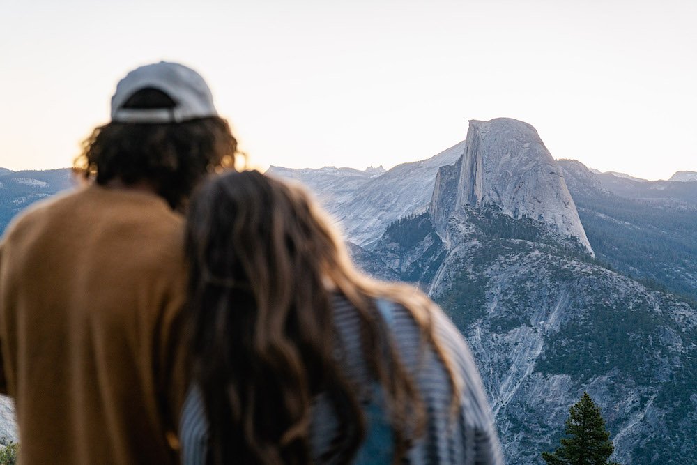
Day Hike the Panorama Trail
For those who are motivated for a full-day of hiking there’s arguably not a better trail to showcase the park’s natural treasures. There are several ways to enjoy this trail. For a moderate hike, start at Glacier Point and hike down to the Valley Floor. For a personal challenge, hike the Panorama trail from the Yosemite Valley floor out and back for a total of 18 miles, often taking all day. Regardless of how you hike this trail, the panoramic views of Yosemite Valley give the Panorama Trail its namesake.
For those who are motivated for a full-day of hiking there’s arguably not a better trail to showcase the park’s natural treasures. There are several ways to enjoy this trail. For a moderate hike, start at Glacier Point and hike down to the Valley Floor. For a personal challenge, hike the Panorama trail from the Yosemite Valley floor out and back for a total of 18 miles, often taking all day. Regardless of how you hike this trail, the panoramic views of Yosemite Valley give the Panorama Trail its namesake.
Hiking the Panorama Trail in Yosemite offers breathtaking panoramic views of the park's iconic landmarks, including Half Dome, Nevada Fall, and Yosemite Valley. The trail showcases the stunning beauty of the wilderness, with cascading waterfalls, lush meadows, and towering granite cliffs. It provides an unforgettable adventure, allowing hikers to immerse themselves in the awe-inspiring natural wonders of Yosemite National Park.
Embark on the Panorama Trail in Yosemite National Park for a captivating journey through breathtaking vistas, iconic landmarks, and the awe-inspiring beauty of nature.
Immerse yourself in incredible views when you day hike Panoramic Trail in Yosemite Valley. Photograph by Dalton Johnson
HOW LONG IS THE PANORAMA TRAIL DAY HIKE?
The Panorama Trail is approximately 8.5 miles (13.7 kilometers) long if hiked one way, starting from Glacier Point and ending at the Yosemite Valley floor. It involves a descent of about 3,200 feet (975 meters). The trail is primarily downhill when hiked from Glacier Point to the valley, which can make the hike somewhat easier in terms of effort required. However, keep in mind that you will need to climb uphill if you choose to hike back up to Glacier Point.
HOW LONG DOES IT TAKE TO DAY HIKE THE PANORAMA TRAIL?
The Panorama Trail day hike typically takes around 6-8 hours to complete, depending on your pace and the time you spend enjoying the viewpoints and attractions along the way. It's essential to plan accordingly and allocate enough time for breaks, rest, and taking in the scenery.
HOW HARD IS THE PANORAMA TRAIL DAY HIKE?
Panorama Trail day hike can be considered moderately to strenuously difficult, especially if you choose to hike it one way from Glacier Point to the Yosemite Valley. It requires a decent level of physical fitness, endurance, and a willingness to tackle some steep sections. Proper preparation, including wearing comfortable hiking shoes, carrying sufficient water and supplies, and being mindful of safety precautions, is crucial for a successful and enjoyable hike.
Steep Sections:
While the trail is not consistently steep, there are sections that involve significant elevation changes. The initial descent from Glacier Point can be quite steep, requiring careful footing. Additionally, if you decide to include the optional side trip to the top of Nevada Fall via the Mist Trail, you will encounter a steep and strenuous ascent with many steps.
Trail Conditions:
The trail conditions can vary throughout the year, and certain sections may be more challenging depending on weather conditions. In spring, you might encounter wet and slippery areas due to melting snow or increased water flow from the waterfalls. It's essential to check with the park authorities for current trail conditions before embarking on the hike.
Eight, Yes 8, Reasons WHY day HIKE THE PANORAMA Trail?
Hiking the Panorama Trail in Yosemite National Park offers a remarkable and immersive experience, showcasing the awe-inspiring beauty of the park's natural wonders. Here are several compelling reasons why you should consider hiking the Panorama Trail:
Spectacular Views: The Panorama Trail lives up to its name, offering breathtaking panoramic vistas of Yosemite Valley, Glacier Point, Half Dome, Yosemite Falls, and other iconic landmarks. As you ascend higher on the trail, you'll be treated to ever-expanding views of the surrounding granite cliffs, lush meadows, cascading waterfalls, and the expansive wilderness of the park.
Iconic Landmarks: The trail takes you past some of Yosemite's most famous landmarks, allowing you to see them from unique perspectives. You'll witness the grandeur of Half Dome as you hike along the Illilouette Ridge, and you'll get an incredible view of Yosemite Falls, the highest waterfall in North America, as it plunges down from above.
Diverse Terrain: The Panorama Trail traverses a variety of terrains, providing a dynamic hiking experience. You'll trek through shady forests of fir and pine trees, traverse rocky slopes, and walk across open meadows blanketed with vibrant wildflowers during the summer months. This diversity adds to the visual appeal of the hike.
Waterfalls and Streams: Along the trail, you'll encounter several enchanting waterfalls and streams, including Illilouette Fall, Nevada Fall, and Vernal Fall. The rushing waters create a refreshing atmosphere, and you'll have opportunities to rest and enjoy the serenity of these natural features.
Wildlife Encounters: Yosemite National Park is renowned for its rich biodiversity. While hiking the Panorama Trail, you may encounter a variety of wildlife, such as mule deer, black bears, coyotes, and a plethora of bird species. Keep your eyes peeled for these fascinating creatures as you explore the trail.
Photography Opportunities: If you're an avid photographer or simply enjoy capturing the beauty of nature, the Panorama Trail offers numerous opportunities to capture stunning photographs. The ever-changing vistas, dramatic cliffs, waterfalls, and vibrant flora make for compelling subjects to create lasting memories.
Challenging and Rewarding: The Panorama Trail is a moderate to strenuous hike, depending on your fitness level and the direction you choose. It covers approximately 8.5 miles (13.7 kilometers) if hiked one way, starting from Glacier Point and ending at the Yosemite Valley floor. The trail includes both uphill and downhill sections, making it a challenging but immensely rewarding endeavor.
Connecting Trails: The Panorama Trail is part of a network of trails in Yosemite, and you can easily connect it with other popular hikes in the area. For instance, you can continue on from the end of the Panorama Trail to reach the Mist Trail, leading to the top of Vernal Fall and Nevada Fall. This allows you to extend your adventure and explore more of Yosemite's natural wonders.
WHAT TO SEE ALONG THE PANORAMA trail?
The Panorama Trail in Yosemite offers a plethora of breathtaking sights and natural wonders to behold. Here are some notable attractions and viewpoints you can expect to encounter along the trail:
Glacier Point: If you start your hike from Glacier Point, you'll be treated to stunning panoramic views of Yosemite Valley, Half Dome, Yosemite Falls, and the surrounding peaks. Glacier Point is an iconic overlook that provides a fantastic vantage point to appreciate the grandeur of the park.
Illilouette Falls: As you descend from Glacier Point, you'll catch glimpses of Illilouette Falls in the distance. This waterfall cascades down the Illilouette Creek, creating a beautiful and picturesque sight.
Panoramic Point: Located along the Illilouette Ridge, Panoramic Point lives up to its name. It offers sweeping views of Yosemite Valley, including El Capitan, Half Dome, and the Merced River winding its way through the landscape. This viewpoint is an excellent spot to take a break and soak in the breathtaking scenery.
Nevada Fall: If you choose to include the optional side trip to Nevada Fall via the Mist Trail, you'll witness the thunderous beauty of this iconic waterfall. Nevada Fall drops approximately 594 feet (181 meters) and is surrounded by towering granite cliffs. Prepare for a steep and challenging ascent to the top, rewarded by magnificent views.
Vernal Fall: Another optional side trip from the Panorama Trail leads to Vernal Fall, the smaller but equally impressive sibling of Nevada Fall. This waterfall plunges about 317 feet (96 meters) and offers a closer and more intimate experience with the cascading waters. The Mist Trail takes you right to the base of Vernal Fall, where you can feel the refreshing spray and marvel at its power.
Yosemite Valley Views: As you near the end of the Panorama Trail, you'll descend into Yosemite Valley. Along the way, you'll be treated to ever-changing views of the valley floor, the meandering Merced River, and the towering granite cliffs that surround the valley. The trail offers numerous viewpoints where you can pause and appreciate the beauty of this iconic valley from different angles.
Flora and Fauna: Throughout the hike, you'll have the opportunity to appreciate Yosemite's diverse flora and fauna. Keep an eye out for wildflowers, including lupines, Indian paintbrush, and dogwood blooms during the spring and summer months. You may also spot wildlife such as mule deer, black bears, squirrels, and various bird species along the trail.
Essentials for Hiking the Panorama Trail
When embarking on the Panorama Trail hike in Yosemite National Park, it's important to be prepared and bring essential items to ensure a safe and enjoyable experience. Here's a list of essentials to consider bringing:
Hiking Backpack: A comfortable backpack to carry all your essential items during the hike.
Water: Sufficient water to stay hydrated throughout the trail. Carry at least 2-3 liters of water per person, as water sources along the trail may be limited or unreliable.
Snacks/Energy Food: Pack lightweight, high-energy snacks like trail mix, energy bars, and fruits to keep you fueled during the hike.
Maps and Navigation Tools: Carry a detailed map or guidebook of the trail, and consider bringing a compass or GPS device for navigation assistance.
Sun Protection: Protect yourself from the sun's rays with sunscreen, sunglasses, and a wide-brimmed hat to shield your face and neck.
Clothing Layers: Dress in layers to accommodate changing weather conditions. Bring a moisture-wicking base layer, insulating mid-layer, and a waterproof and windproof outer layer. Consider packing extra clothing in case of emergencies or unexpected weather changes.
Sturdy Hiking Shoes: Wear comfortable, well-fitting hiking shoes with good traction to navigate the varied terrain of the trail.
First Aid Kit: Carry a basic first aid kit with essentials such as band-aids, antiseptic ointment, pain relievers, and any necessary personal medications.
Trekking Poles: Optional but highly recommended for stability and reducing strain on your knees and joints during the hike, especially during steep sections or descents.
Headlamp/Flashlight: A lightweight headlamp or flashlight is crucial if you plan to hike during low-light conditions or if the hike takes longer than expected.
Extra Batteries/Power Bank: If you rely on electronic devices such as a smartphone or GPS, bring spare batteries or a portable power bank to ensure they stay charged.
Multi-tool/Knife: A versatile tool or knife can be handy for various tasks or emergencies.
Remember to check the weather forecast, trail conditions, and any park regulations before your hike. Always prioritize safety and be prepared for unexpected situations by carrying necessary supplies.
Enjoying the sunrise views at Glacier Point before starting the Panoramic Hike. Photograph by Dalton Johnson
Hiking the Panorama Trail in Yosemite National Park is a captivating and rewarding experience that offers a captivating journey through some of nature's most awe-inspiring landscapes. From the breathtaking vistas at Glacier Point to the thunderous waterfalls of Nevada and Vernal Falls, every step along this trail unveils new wonders and panoramic views of Yosemite Valley. The diverse terrain, abundant wildlife, and the opportunity to connect with other iconic trails make the Panorama Trail an unforgettable adventure for hikers of varying skill levels. Whether you seek the challenge of a strenuous hike or simply wish to immerse yourself in the beauty of Yosemite's natural wonders, the Panorama Trail promises a remarkable journey filled with jaw-dropping vistas, serene moments, and an unmatchable sense of awe.
Discover More of Yosemite Valley

Discover This Hot Spring Haven Along Highway 395
From Lake Tahoe to Alabama Hills, Highway 395 has become a destination for adventure seekers, offering stunning landscapes and thrilling outdoor activities. But what do you do with all those sore muscles after a long day of hiking, skiing, or exploring? Fortunately, sprinkled throughout the 215-mile stretch of road and mountains, you'll find six different mineral-rich hot springs waiting to soothe and rejuvenate your adventure-beaten body.
From Lake Tahoe to Alabama Hills, Highway 395 has become a destination for adventure seekers, offering stunning landscapes and thrilling outdoor activities. But what do you do with all those sore muscles after a long day of hiking, skiing, or exploring? Fortunately, sprinkled throughout the 215-mile stretch of road and mountains, you'll find six different mineral-rich hot springs waiting to soothe and rejuvenate your adventure-beaten body.
The hot springs along Highway 395 offer a natural sanctuary for travelers seeking relaxation and rejuvenation amidst their adventures. From the picturesque Travertine Hot Springs near Bridgeport to the secluded Hilltop Hot Springs overlooking the Owens Valley, each hot spring along this route offers a unique and therapeutic experience. Soaking in these mineral-rich waters while surrounded by breathtaking landscapes is a perfect way to unwind and connect with nature along the scenic Highway 395.
Join us as we embark on a journey along HWY 395, exploring these natural wonders that make it a hot springers paradise.
Enjoying Wild Willy Hot Spring on a cold fall day along Highway 395. Photograph by Dalton Johnson
Travertine Hot Springs:
Located just outside the town of Bridgeport, California, the Travertine Hot Springs offer breathtaking views of the Sierra Nevada Mountains. These natural pools are formed by the flow of geothermal waters over mineral-rich rocks, creating a unique blend of hot water and scenic beauty. Soak in the warm waters while taking in the panoramic vistas, making this a popular stop for locals and travelers alike.
Pros of Travertine Hot Springs:
Breathtaking Views: One of the major pros of Travertine Hot Springs is the stunning views it offers. Located near Bridgeport, California, these hot springs provide a picturesque backdrop of the Sierra Nevada Mountains, enhancing the overall experience of relaxation and tranquility.
Natural Beauty: The hot springs at Travertine are naturally formed and surrounded by beautiful rock formations, creating a visually appealing environment. This natural setting adds to the charm and uniqueness of the hot springs, making it an attractive destination for nature enthusiasts.
Accessibility: Travertine Hot Springs are easily accessible, as they are located just outside the town of Bridgeport. Visitors can conveniently reach the hot springs, making it a popular stop for both locals and travelers exploring Highway 395.
Cons of Travertine Hot Springs:
Crowded at Times: Due to its popularity and accessibility, Travertine Hot Springs can get crowded, especially during peak seasons or weekends. The limited space and high visitor volume might reduce the privacy and tranquility of the experience.
Variable Water Temperature: The water temperature in the pools at Travertine Hot Springs can vary, ranging from hot to warm. While some may enjoy the variety, others might prefer consistent temperatures for a more controlled and predictable soaking experience.
Limited Amenities: The facilities at Travertine Hot Springs are relatively basic, with minimal amenities available. Visitors should be prepared for rustic conditions, such as no changing rooms or showers, which may be less comfortable for those seeking more convenience and amenities during their hot springs experience.
Buckeye Hot Springs:
Continuing south along HWY 395, you'll find Buckeye Hot Springs nestled in the Toiyabe National Forest near the town of Bridgeport. These rustic pools are surrounded by lush greenery and provide a tranquil escape from the bustling world. The combination of the soothing hot water and the serene surroundings creates an idyllic experience that will leave you feeling refreshed and revitalized.
Pros of Buckeye Hot Springs:
Serene Natural Setting: Buckeye Hot Springs is known for its serene and peaceful atmosphere. Surrounded by lush greenery and nestled in the Toiyabe National Forest near Bridgeport, California, the hot springs offer a tranquil escape from the hustle and bustle of daily life, allowing visitors to fully relax and unwind in a beautiful natural setting.
Rustic Charm: Buckeye Hot Springs exudes a rustic charm that appeals to nature enthusiasts and those seeking an authentic hot springs experience. The pools are more natural and less developed, giving a sense of immersion in the wilderness. This simplicity can enhance the connection to nature and provide a unique and raw hot springs experience.
Lower Crowds: Compared to some other hot springs along Highway 395, Buckeye Hot Springs tends to attract fewer crowds. Its location and less commercialized nature make it a more secluded and peaceful spot to enjoy the hot springs, allowing visitors to have a more private and intimate soaking experience.
Cons of Buckeye Hot Springs:
Variable Water Temperature: The temperature of the hot springs at Buckeye can vary, which may not be ideal for those who prefer a consistent and predictable soaking experience. It's recommended to test the waters before fully immersing yourself to find a comfortable spot.
Limited Facilities: Buckeye Hot Springs has minimal facilities and amenities available. There are no changing rooms or showers, and visitors should be prepared for the rustic conditions that come with a more undeveloped hot springs site. This lack of amenities might be a downside for those who prefer more convenience and comfort during their hot springs visit.
Challenging Access: Getting to Buckeye Hot Springs may require some effort and hiking. The trail to the hot springs can be rocky and uneven, and it's important to be cautious while navigating the terrain. The challenging access might make it less accessible for individuals with mobility issues or those seeking a more easily reachable hot springs experience.
Crab Cooker Hot Spring:
If you're looking for a unique hot spring experience, make sure to include Crab Cooker Hot Spring on your HWY 395 adventure. Located near Mammoth Lakes, this hot spring gets its name from its distinctive rock formation resembling a crab cooker. While smaller in size compared to other hot springs, it compensates with its bubbling and geyser-like qualities. The water temperature can vary, so be prepared for a mix of hot and cooler pockets. This hidden gem provides a fun and memorable soak, surrounded by the rugged beauty of the Eastern Sierra landscape.
Pros of Crab Cooker Hot Spring:
Unique Rock Formation: Crab Cooker Hot Spring stands out for its distinct rock formation that resembles a crab cooker. This unique feature adds a sense of novelty and intrigue to the hot springs experience, making it a memorable destination for visitors looking for something out of the ordinary.
Bubbling and Geyser-Like Qualities: Unlike traditional hot springs, Crab Cooker Hot Spring has bubbling and geyser-like qualities. The dynamic nature of the hot spring, with intermittent bursts of water and steam, adds an element of excitement and unpredictability to the soaking experience, making it a thrilling and immersive adventure.
Scenic Eastern Sierra Landscape: Located near Mammoth Lakes, Crab Cooker Hot Spring offers breathtaking views of the Eastern Sierra landscape. As you soak in the hot springs, you'll be surrounded by rugged mountains, majestic forests, and stunning natural beauty, providing a picturesque backdrop that enhances the overall experience.
Cons of Crab Cooker Hot Spring:
Size and Capacity: Crab Cooker Hot Spring is relatively small compared to other hot springs in the area. Its limited size may lead to crowding, especially during peak times, which can diminish the privacy and tranquility of the experience for those seeking a more secluded and intimate soak.
Fluctuating Water Temperature: The water temperature at Crab Cooker Hot Spring can vary, ranging from hot to cooler pockets. While some visitors may enjoy the mix of temperatures, others may find it less comfortable or prefer a more consistent and controlled soaking experience.
Challenging Accessibility: Accessing Crab Cooker Hot Spring may require some effort and caution. The terrain leading to the hot spring can be rough and uneven, requiring careful navigation. Visitors should be prepared for a potentially challenging hike or climb to reach the hot spring, which may limit its accessibility for individuals with mobility issues or those seeking easier-to-reach hot springs.
Wild Willy's Hot Springs:
Tucked away in the volcanic region of the Long Valley Caldera near Mammoth Lakes, Wild Willy's Hot Springs offer a unique experience for hot spring enthusiasts. These hot pools emerge from the ground, providing an opportunity to soak in the warm waters while gazing at the stunning mountain scenery. Despite their remote location, these natural springs attract adventurers seeking a truly immersive and unforgettable experience.
Pros of Wild Willy's Hot Springs:
Unique Geothermal Experience: Wild Willy's Hot Springs offer a distinctive geothermal experience due to their location in the volcanic region of the Long Valley Caldera near Mammoth Lakes. The hot pools emerge from the ground, creating a natural and raw hot springs experience that connects visitors with the geothermal activity of the area.
Scenic Mountain Views: Nestled in a picturesque setting, Wild Willy's Hot Springs provide breathtaking mountain views. Soaking in the warm waters while surrounded by stunning natural landscapes adds to the overall relaxation and enjoyment of the hot springs, making it a perfect spot for nature lovers.
Adventurous and Remote Location: Wild Willy's Hot Springs are known for their remote location, attracting adventurous travelers who are willing to explore off-the-beaten-path destinations. This secluded nature allows for a more intimate and immersive hot springs experience, away from the crowds and closer to the untamed beauty of the Eastern Sierra.
Cons of Wild Willy's Hot Springs:
Limited Amenities and Facilities: Due to its remote location, Wild Willy's Hot Springs have limited facilities and amenities. Visitors should be prepared for a more rustic experience, without conveniences such as changing rooms, showers, or well-maintained paths. It's important to be self-sufficient and respectful of the natural surroundings while visiting.
Variable Water Conditions: The water conditions at Wild Willy's Hot Springs can be unpredictable, with changing temperatures and water levels. The availability and comfort of the hot springs can be affected by natural factors, such as weather and seasonal variations. Visitors should exercise caution and adaptability when visiting to ensure a safe and enjoyable experience.
Challenging Access: Getting to Wild Willy's Hot Springs may require navigation through uneven terrain and potentially challenging hiking conditions. The journey to reach the hot springs can be demanding, and visitors should be prepared with proper footwear, supplies, and navigation tools. This limited accessibility may not be suitable for everyone, particularly individuals with mobility issues or those seeking easier-to-reach hot springs.
Hilltop Hot Springs:
Continuing southward, you'll discover Hilltop Hot Springs near the small town of Mammoth Lakes. Situated high above the Owens Valley, these secluded hot springs provide a serene and intimate setting for relaxation. As you soak in the mineral-rich waters, you'll be rewarded with awe-inspiring views of the surrounding mountains and valleys, making it a perfect spot to unwind and connect with nature.
Pros of Hilltop Hot Springs:
Spectacular Views: Hilltop Hot Springs offer breathtaking panoramic views of the surrounding mountains and valleys. The elevated location provides a vantage point to immerse yourself in the natural beauty of the Eastern Sierra landscape while enjoying a relaxing soak. The scenic vistas enhance the overall experience and create a serene atmosphere.
Secluded and Tranquil: Hilltop Hot Springs are known for their secluded and intimate setting. Unlike some of the more popular hot springs along HWY 395, Hilltop offers a quieter and more serene experience. This seclusion allows visitors to enjoy a sense of tranquility and privacy, making it an ideal spot for relaxation and introspection.
Natural Connection: The Hilltop Hot Springs offer a raw and unadulterated hot springs experience, blending harmoniously with the natural surroundings. The pools are not heavily developed, preserving the natural integrity of the site. Visitors can connect with nature on a deeper level, immersing themselves in the therapeutic mineral-rich waters while being enveloped by the beauty of the Eastern Sierra.
Cons of Hilltop Hot Springs:
Limited Accessibility: Accessing Hilltop Hot Springs can be challenging, as it requires a hike and some navigation through potentially rugged terrain. The trail leading to the hot springs may not be suitable for individuals with mobility issues or those seeking an easily accessible hot springs experience. Proper planning, adequate footwear, and physical preparedness are necessary to reach the destination.
Basic Facilities: Hilltop Hot Springs have limited facilities and amenities available. Visitors should come prepared with their own supplies, such as water, towels, and suitable clothing, as there are no changing rooms or showers. The rustic conditions may not cater to those seeking more convenience and comfort during their hot springs visit.
Weather Dependency: The conditions at Hilltop Hot Springs can be influenced by weather and seasonal variations. Changes in weather, such as rain or snowfall, can affect the accessibility and comfort of the hot springs. Visitors should stay informed about the weather forecast and be prepared for potential alterations to their plans based on the prevailing conditions.
Keough Hot Springs:
As you venture further south, just outside of Bishop, California, lies Keough Hot Springs. With its inviting geothermal pools and well-maintained facilities, this hot spring is a favorite among locals and visitors. Whether you're seeking relaxation or therapeutic benefits, Keough Hot Springs has it all. Soak in the warm mineral-rich waters, indulge in a massage, or unwind in the sauna, and let the stress of the day melt away.
Pros of Keough Hot Springs:
Natural Mineral Springs: Keough Hot Springs is known for its natural mineral-rich waters, which are believed to have therapeutic properties. The mineral content, including sulfur, can provide potential health benefits such as relaxation, improved circulation, and relief from muscle aches and pains.
Well-Maintained Facilities: Keough Hot Springs offers well-maintained facilities, including clean changing rooms, showers, and restroom facilities. Visitors can enjoy the convenience and comfort of modern amenities while indulging in the hot springs experience.
Variety of Soaking Options: Keough Hot Springs provides a range of soaking options to suit different preferences. The hot springs feature a large main pool, private soaking tubs, and a cool plunge pool, allowing visitors to customize their experience and find the perfect temperature and setting for relaxation.
Cons of Keough Hot Springs:
Crowded During Peak Times: Keough Hot Springs can get crowded, especially during weekends or peak seasons. The popularity of the hot springs may result in a higher number of visitors, reducing the overall tranquility and privacy of the experience.
Paid Admission: Unlike some natural hot springs, Keough Hot Springs requires paid admission for entry. While this helps maintain the facilities and amenities, it may be a downside for visitors seeking free or more budget-friendly hot springs options.
Limited Natural Surroundings: Keough Hot Springs are located in a more developed area, which means the immediate surroundings may lack the untouched beauty and wilderness found in some other hot springs along HWY 395. The focus here is more on the amenities and facilities rather than a remote and natural setting.
Hot Spring Etiquette: Ensuring a Respectful and Enjoyable Experience
When visiting hot springs, it's essential to practice proper etiquette to ensure a respectful and enjoyable experience for everyone. Here are some guidelines to follow:
Respect Nature and the Environment: Hot springs are often located in pristine natural settings. Help preserve the beauty of these areas by leaving no trace behind. Avoid littering and dispose of any trash properly. Respect any posted signs or guidelines that are in place to protect the environment and wildlife.
Maintain Personal Hygiene: Before entering a hot spring, it's customary to rinse off any lotions, oils, or perfumes that can contaminate the water. This helps to maintain the natural purity of the hot spring and ensures a more enjoyable experience for everyone. Additionally, bathing suits or appropriate swimwear are generally required, so be mindful of cultural norms and any specific rules at the particular hot spring you are visiting.
Be Mindful of Others: Hot springs can attract a diverse group of people seeking relaxation and tranquility. Respect the space and privacy of others by keeping noise levels down and refraining from disruptive activities. Remember that hot springs can be a place of serenity and reflection for many, so be considerate of the atmosphere and respect the desire for a peaceful experience.
Follow Safety Guidelines: Hot springs can vary in temperature and depth, so exercise caution and adhere to any safety guidelines provided. Avoid submerging your head in the water, as hot springs may contain bacteria that can cause infections. Keep an eye on children and ensure their safety at all times.
Practice Leave No Trace Principles: Leave the hot springs and surrounding areas as you found them. Avoid damaging vegetation, disturbing rocks, or altering the natural landscape. Take any personal belongings with you when you leave and refrain from carving or marking rocks or trees.
Be Mindful of Soaking Duration: To allow others to enjoy the hot springs, be mindful of your soaking time. If the hot springs are crowded, consider limiting your stay to a reasonable duration, allowing others the opportunity to experience the healing waters.
By adhering to these hot spring etiquette guidelines, you can contribute to a positive and respectful atmosphere for all visitors. Remember, the goal is to preserve the natural beauty of these magical places and create a harmonious environment where everyone can enjoy the serenity and therapeutic benefits of the hot springs.
What to Bring for a Comfortable Soaking Experience
When planning a visit to hot springs, it's important to pack the essentials to ensure a comfortable and enjoyable soaking experience. Here are some items to consider bringing:
Towels and Robes: Pack a large towel or two to dry off after soaking in the hot springs. Opt for quick-drying towels that are lightweight and compact for easier transportation. Additionally, bringing a robe or a comfortable cover-up can provide added warmth and privacy while moving between pools or changing areas.
Swimsuits or Swim Trunks: Most hot springs require appropriate swimwear. Pack your favorite swimsuit or swim trunks to ensure you can fully enjoy the therapeutic waters while adhering to any dress code or cultural norms. Consider bringing an extra swimsuit in case the one you're wearing gets wet or for hygiene purposes.
Footwear: Wear comfortable and sturdy footwear suitable for walking on various terrains. Hot springs are often located in natural settings, so having proper footwear can protect your feet from sharp rocks or uneven surfaces when navigating around the pools or trails leading to the hot springs.
Water and Snacks: Stay hydrated during your hot springs visit by bringing a water bottle. Soaking in hot water can cause dehydration, so it's important to drink plenty of fluids. Additionally, pack some light snacks or energy bars to keep yourself nourished and energized while enjoying the hot springs.
Sun Protection: If the hot springs are outdoors and exposed to the sun, it's crucial to protect your skin. Pack sunscreen with a high SPF to apply before soaking. Don't forget to bring a wide-brimmed hat, sunglasses, and a lightweight cover-up to shield yourself from harmful UV rays.
Personal Care Items: Consider bringing personal care items such as biodegradable soap, shampoo, and conditioner if you plan to rinse off after soaking. Some hot springs have shower facilities, so having these items on hand can enhance your post-soak cleanliness. Don't forget to bring a waterproof bag to carry wet items back with you.
Extra Layers and Blankets: Even if the hot springs are warm, it's a good idea to bring extra layers of clothing or a cozy blanket for when you finish soaking. The temperature can drop as the day progresses or during cooler seasons, and having something warm to wrap yourself in will help maintain comfort.
Cash or Card: Some hot springs may charge an admission fee or offer additional services such as towel rentals or concessions. Bring cash or a credit card to cover any expenses you may encounter during your visit.
Remember to check the specific requirements and amenities of the hot springs you plan to visit, as they can vary. Packing these essentials will help ensure you have a comfortable and enjoyable time while soaking in the healing waters of the hot springs.
Enjoying one of the many hot springs along Highway 395 after a long day of driving. Photograph by Dalton Johnson
Highway 395 is not just a road for adventure seekers; it's a treasure trove of natural hot springs that provide solace and relaxation to weary travelers and wellness seekers. Whether you're seeking healing properties or simply a place to unwind, these seven hot springs along HWY 395 offer a range of experiences, from scenic vistas to secluded retreats and even unique formations like Crab Cooker Hot Spring. So, next time you embark on an adventure along this iconic highway, don't forget to take a dip in one of these mineral-rich pools and discover the paradise that awaits you.
Discover more of Hwy 395
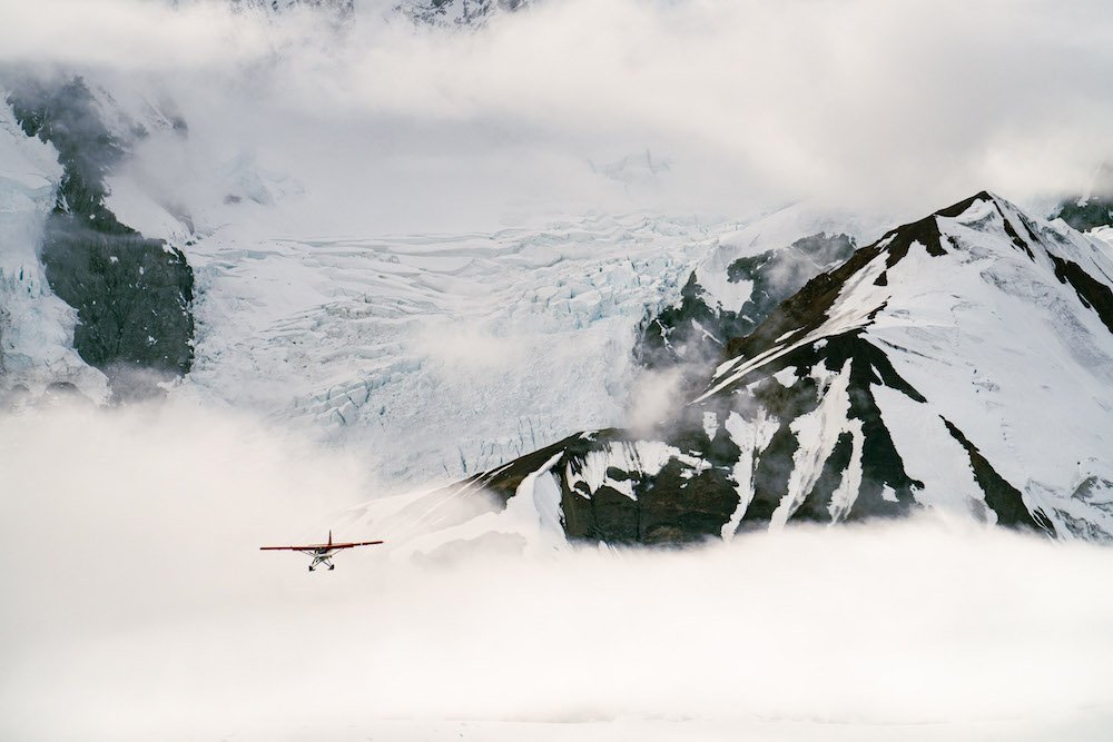
Unveiling Alaska's Frozen Giants: Exploring the Majestic Glaciers
Alaska has 664 named glaciers, and several more unnamed, that will change your perspective on this planet. Glaciers are massive ice fields, often called a frozen river, that are always moving and changing, making them special. With this change, seeing a glacier several times won’t get old. So, if it is your first glacier, or your 664th glacier, it will still be an experience.
Alaska has 664 named glaciers, and several more unnamed, that will change your perspective on this planet. Glaciers are massive ice fields, often called a frozen river, that are always moving and changing, making them special. With this change, seeing a glacier several times won’t get old. So, if it is your first glacier, or your 664th glacier, it will still be an experience.
There are several ways to see glaciers in Alaska, but the best ways are flightseeing, hiking on a glacier, taking an ocean cruise, exploring ice caves on a glacier, and kayaking to a glacier. By doing all of these, you will see glaciers from the air, from the ground, from the inside, and from the water. If I could only chose one way to see a glacier, I would chose to go hiking on a glacier.
Read on to discover the best ways to see and experience glaciers in Alaska.

Kayaking to Portage Glacier in Alaska. Photograph by Dalton Johnson
Pros of Seeing Glaciers in Alaska:
Majestic Beauty: Alaska is home to some of the most breathtaking glaciers in the world. Witnessing these massive ice formations up close offers a profound appreciation for the awe-inspiring beauty of nature.
Unique Experience: Seeing glaciers in Alaska provides a once-in-a-lifetime opportunity to witness the power and grandeur of these natural wonders. It's an experience that few people get to have and creates lasting memories.
Environmental Awareness: Glaciers are powerful indicators of climate change. Seeing them firsthand in Alaska can deepen your understanding of the impact of global warming and inspire a greater commitment to environmental conservation.
Wildlife Viewing: Glaciers in Alaska attract a diverse array of wildlife. While observing glaciers, you may have the chance to see seals, sea lions, whales, eagles, and other marine and bird species in their natural habitats.
Adventure Activities: Alaska offers a range of adventure activities related to glaciers, such as glacier hiking, flightseeing tours, dog sledding, and kayaking. These activities allow you to explore the glaciers in unique and exciting ways.
Cons of Seeing Glaciers in Alaska:
Accessibility Challenges: Getting to some of the more remote glacier locations in Alaska can be challenging and may require additional time, effort, and expenses for transportation.
Weather Conditions: Alaska's climate can be unpredictable, with cold temperatures, rain, fog, and wind being common. It's important to be prepared for changing weather conditions, which can impact visibility and outdoor activities.
Environmental Impact: The popularity of glacier tourism in Alaska can contribute to increased foot traffic and potential environmental impacts if not managed responsibly. It's essential to choose reputable tour operators and follow guidelines to minimize any negative effects.
Cost: Visiting glaciers in Alaska can be costly, especially when considering transportation, accommodations, and guided tours. It's important to budget accordingly and plan ahead to ensure a fulfilling experience within your financial means.
Seasonal Limitations: Glacial activities in Alaska are typically limited to the summer months when access is safer and more feasible. If you visit during other seasons, you may have fewer opportunities for glacier-related experiences.
Cruise through Glacier Bay:
Embarking on a cruise through Glacier Bay National Park is an extraordinary way to witness the splendor of Alaska's glaciers. This iconic national park, located in southeastern Alaska, encompasses over 3.3 million acres of stunning natural landscapes. As you sail through the icy waters of Glacier Bay, you'll be surrounded by towering glaciers, snow-capped mountains, and pristine wilderness. The park is home to numerous glaciers, including the famous Margerie Glacier and Grand Pacific Glacier, which offer breathtaking displays of calving and shimmering blue ice formations.
Before setting off on your Glacier Bay cruise, it's important to be aware of a few key details. First, access to the park is limited to boats and planes, as there are no roads leading to Glacier Bay. Therefore, joining a cruise tour is the most common and convenient way to explore the area. Cruise itineraries typically include stops at various glaciers within the park, providing ample opportunities for up-close encounters with these magnificent icy wonders. It's advisable to book your cruise well in advance, especially during the peak summer season, as availability may be limited.
Cruising through Glacier Bay is a once-in-a-lifetime experience that offers a myriad of reasons why it should be on every adventure traveler's bucket list. Firstly, the sheer beauty and grandeur of the glaciers are simply awe-inspiring. Witnessing these massive ice formations, with their radiant blue hues and thunderous calving, evokes a sense of wonder and appreciation for the raw power of nature. Secondly, Glacier Bay National Park is an ecological treasure trove, teeming with diverse wildlife. From humpback whales breaching in the distance to playful sea otters and soaring bald eagles, the park offers abundant opportunities for wildlife sightings. Finally, the sense of serenity and tranquility that permeates Glacier Bay is truly unparalleled. The untouched wilderness, interrupted only by the occasional crackling of ice or the distant call of a seabird, provides a meditative atmosphere, allowing visitors to disconnect from the modern world and connect with the raw beauty of nature.
Explore Kenai Fjords National Park:
Nestled on the southeastern coast of Alaska, Kenai Fjords National Park is a captivating destination renowned for its magnificent glaciers and abundant marine life. Spanning over 600,000 acres, this national park offers a stunning blend of icy fjords, rugged coastline, and towering mountains. Exploring Kenai Fjords allows you to witness the relentless power of nature as glaciers calve into the sea, listen to the crackling sounds of icebergs, and marvel at the diverse wildlife that calls this park home.
When planning a visit to Kenai Fjords National Park, there are a few essential details to consider. The gateway to the park is the town of Seward, located approximately 125 miles south of Anchorage. From Seward, you can embark on boat tours that take you into the heart of the fjords, where you'll encounter awe-inspiring glaciers such as the iconic Exit Glacier and the massive Aialik Glacier. It's advisable to book your boat tour in advance, as they can fill up quickly, especially during the peak summer season. Additionally, be prepared for variable weather conditions and dress in layers to ensure comfort throughout the day.
Exploring Kenai Fjords National Park offers an unparalleled opportunity to witness the raw beauty of Alaska's glaciers and coastal landscapes. The sight of massive glaciers calving into the sea, creating thunderous echoes and towering icebergs, is an awe-inspiring experience that leaves a lasting impression. Beyond the glaciers, the park is a haven for marine wildlife. Keep your eyes peeled for playful sea otters, graceful seals, and majestic whales as they navigate the chilly waters. The park's rugged coastline also provides excellent opportunities for birdwatching, with puffins, bald eagles, and other seabirds soaring overhead. Whether you choose to hike to an overlook, embark on a boat tour, or camp under the starry Alaskan sky, Kenai Fjords National Park offers a truly immersive and unforgettable experience in the heart of Alaska's natural wonders.
Take a Flightseeing Tour:
If you're seeking a truly extraordinary way to witness the breathtaking beauty of Alaska's glaciers, a flightseeing tour is an adventure not to be missed. Taking to the skies in a small plane or a helicopter allows you to gain a unique and awe-inspiring perspective of Alaska's vast icy landscapes. From the towering Juneau Icefield to the stunning Hubbard Glacier, a flightseeing tour provides an unparalleled opportunity to soak in the immensity and grandeur of these frozen wonders from above.
When planning a flightseeing tour in Alaska, there are a few essential details to keep in mind. First and foremost, it's important to choose a reputable tour operator with experienced pilots who prioritize safety. Be sure to check reviews and certifications before making your booking. Flightseeing tours are available in various locations across Alaska, including Juneau, Denali, and Talkeetna. These tours range in duration and can be customized to suit your preferences. It's advisable to dress warmly, as the temperatures can be colder at higher altitudes, and consider wearing comfortable clothing that allows you to move freely in the aircraft.
Embarking on a flightseeing tour in Alaska offers a truly unforgettable experience that combines the thrill of flying with the awe-inspiring beauty of the state's glaciers. From the moment you take off, you'll be treated to breathtaking panoramic views that reveal the sheer magnitude and intricate details of Alaska's icy landscapes. The perspective from above allows you to grasp the vastness of the glaciers, witness their ever-changing forms, and appreciate the awe-inspiring shades of blue that radiate from the ice. The exhilaration of soaring above these majestic natural wonders and capturing incredible aerial photographs is an adventure that will leave you with a profound sense of wonder and a lifelong appreciation for the power of nature.
A flightseeing tour in Alaska is a unique opportunity to witness the splendor of the state's glaciers in a way that few others get to experience. The combination of thrilling aerial perspectives, the sheer beauty of the icy landscapes, and the informative commentary from experienced pilots creates a truly immersive adventure. It's a chance to see Alaska from a whole new angle, gaining a deeper understanding and appreciation for the pristine wilderness that makes this region so remarkable. So buckle up, brace yourself for an unforgettable journey, and prepare to be amazed as you take to the skies for a flightseeing tour of Alaska's glaciers.
Hike to Glacier Viewpoints:
Embarking on a hike to glacier viewpoints in Alaska is an exhilarating and rewarding way to experience the majesty of these icy giants up close. Alaska is home to numerous hiking trails that lead to stunning viewpoints overlooking glaciers, offering breathtaking vistas and a profound connection to the natural beauty of the region. Whether you choose to explore the trails near McCarthy, Juneau, or other glacier-rich areas, hiking to glacier viewpoints provides a unique opportunity to witness the raw power and awe-inspiring beauty of these frozen wonders.
Before setting off on a hike to glacier viewpoints, there are a few essential details to consider. Firstly, research the trail you plan to hike and ensure it is suitable for your fitness level and experience. Some trails may require a moderate to advanced level of hiking ability, while others offer more accessible options for beginners. It's crucial to pack appropriate gear, including sturdy hiking boots, layered clothing, and essential supplies such as water, snacks, and a map or navigation tools. Additionally, be aware of any safety considerations specific to the area, such as bear encounters, weather changes, or glacier hazards. It is often recommended to hike with a knowledgeable guide or join guided tours to ensure safety and maximize your experience.
Embarking on a hike to glacier viewpoints in Alaska offers an unparalleled adventure and a deep connection to the natural world. Witnessing the enormity and beauty of a glacier in person is a transformative experience that leaves a lasting impact. Hiking through pristine wilderness and reaching a viewpoint where you can gaze upon the icy expanse is a reward in itself, reminding us of the grandeur and resilience of nature. Along the way, you may encounter stunning vistas, alpine meadows, and even wildlife, creating a multi-faceted experience that combines physical exertion, natural beauty, and a sense of exploration. Hiking to glacier viewpoints allows you to become a part of the landscape, immerse yourself in the quietude of nature, and appreciate the intricate details of these frozen wonders that cannot be fully captured from a distance. It's an adventure that encourages personal growth, fosters a sense of adventure, and provides a deeper understanding of the delicate balance between humans and the natural world.
Go Dog Sledding on Glaciers:
Imagine the thrill of racing across vast expanses of pristine snow and ice, pulled by a team of enthusiastic sled dogs. Dog sledding on glaciers in Alaska is a remarkable adventure that allows you to experience the true spirit of the Last Frontier. As you glide through the icy landscapes, guided by expert mushers, you'll witness the untouched beauty of Alaska's glaciers while forging a unique bond with these incredible canine athletes.
Before embarking on a dog sledding adventure on glaciers, there are a few key details to keep in mind. Firstly, choose a reputable tour operator that prioritizes the well-being of their dogs and follows ethical practices. Tour operators in Juneau, Skagway, and other glacier-rich regions offer dog sledding experiences that cater to different skill levels and durations. Be prepared for varying weather conditions and dress warmly in layers, as temperatures can be cold, especially on the glaciers. Most tours provide all the necessary equipment, such as warm gear and boots, but it's always a good idea to confirm what is included. Lastly, remember to listen to your guides' instructions and treat the dogs with kindness and respect throughout the experience.
Embarking on a dog sledding adventure on glaciers is an opportunity to step into the shoes of an Alaskan musher and be a part of a time-honored tradition. Beyond the thrill of the ride itself, dog sledding allows you to forge a bond with these incredible animals, witnessing their strength, agility, and teamwork firsthand. You'll learn about the rich history and heritage of dog sledding in Alaska, and gain a deeper appreciation for the symbiotic relationship between musher and sled dog. Moreover, dog sledding on glaciers offers a unique perspective of the surrounding landscapes. As you glide across the icy terrain, you'll be surrounded by towering glaciers, snow-covered peaks, and pristine wilderness, creating a magical and unforgettable experience. Whether you're an adventure seeker, a nature lover, or simply curious about Alaskan traditions, dog sledding on glaciers is an adventure that combines exhilaration, natural beauty, and the chance to connect with the spirit of the North.
Kayak Among Glacial Ice:
Immerse yourself in the stunning beauty of Alaska's glaciers by embarking on a kayaking adventure among glacial ice. Kayaking allows you to navigate the serene waters surrounding the glaciers, getting up close and personal with the towering ice formations. Paddling through pristine fjords and witnessing the vibrant blue hues of the icebergs creates an unforgettable experience that showcases the raw power and majesty of these natural wonders.
Before venturing out on a kayak journey among glacial ice, it's important to have some essential information. First, choose a reputable kayak tour operator that provides experienced guides and quality equipment to ensure safety and a memorable experience. No prior kayaking experience is usually required, as many tours cater to beginners and provide basic instruction. Dress appropriately for the weather conditions, wearing layers to adapt to changing temperatures. It's also essential to have waterproof gear and a dry bag to protect personal belongings. Keep in mind that weather conditions and glacial activity can affect the itinerary, so be flexible and prepared for potential changes.
Kayaking among glacial ice offers a truly immersive and awe-inspiring experience that allows you to intimately connect with the beauty and power of Alaska's glaciers. Paddling through tranquil waters surrounded by towering ice formations, listening to the gentle creaking of ice and witnessing the occasional calving event create moments of wonder and serenity. The vibrant blue colors of the icebergs, contrasting against the surrounding landscapes, provide a visual feast for the senses. Moreover, kayaking allows you to explore areas inaccessible by larger vessels, providing a sense of discovery and a unique perspective on the glaciers and their environment. It's an adventure that combines physical activity, natural beauty, and a deep appreciation for the fragility and resilience of the glacial ecosystem.
Kayaking among glacial ice is an extraordinary experience that offers a profound connection to the pristine wilderness of Alaska. It allows you to escape the crowds, immerse yourself in the tranquility of the fjords, and witness the extraordinary beauty of these frozen landscapes up close. The sense of peace and solitude that comes with gliding through the calm waters, surrounded by glacial ice, creates a truly transformative experience. Whether you're an outdoor enthusiast, a nature lover, or simply seeking a unique adventure, kayaking among glacial ice promises unforgettable moments and the chance to forge a deep connection with Alaska's majestic glaciers.
Mount Denali seen out the front window of a flight-seeing plane. Photograph by Dalton Johnson
Alaska's glaciers offer a majestic and unforgettable experience for adventure travelers. Whether you choose to cruise, hike, fly, or engage in other activities, witnessing the grandeur of Alaska's frozen landscapes will leave you in awe. Remember to plan your trip well in advance, prioritize safety, and respect the fragile nature of these remarkable icy wonders. So pack your sense of adventure and embark on a journey that will take you closer to the magnificent glaciers of Alaska.
Discover more of Alaska

Summer Thrills Await: Unleash Your Inner Adventurer in Lake Tahoe
When it comes to beauty and adventure, Lake Tahoe in the summer is an absolute gem. Imagine standing on the shores of the crystal-clear lake, surrounded by towering mountains and vibrant green forests. The breathtaking scenery alone is enough to take your breath away. Lake Tahoe offers more than just stunning vistas, it's a playground for thrill-seekers and nature enthusiasts alike.
When it comes to beauty and adventure, Lake Tahoe in the summer is an absolute gem. Imagine standing on the shores of the crystal-clear lake, surrounded by towering mountains and vibrant green forests. The breathtaking scenery alone is enough to take your breath away. Lake Tahoe offers more than just stunning vistas, it's a playground for thrill-seekers and nature enthusiasts alike.
From hiking through picturesque trails and discovering hidden waterfalls to diving into the refreshing waters for exhilarating water sports, the possibilities for adventure are endless. Whether you're kayaking on the calm surface of the lake, mountain biking through rugged terrains, or embarking on epic rock climbing expeditions, Lake Tahoe provides the perfect backdrop for unforgettable experiences. Soak up the sun, challenge yourself, and embrace the beauty of nature as you create lasting memories in this adventure-filled paradise.
From heart-pounding water sports to exhilarating mountain excursions, this blog will guide you through an unforgettable journey filled with thrilling activities in Lake Tahoe.
Hiking down to Emerald Bay with foldable kayaks. Photo by Dalton Johnson
Pros of Summers in Lake Tahoe:
Spectacular Natural Beauty: Lake Tahoe boasts breathtaking landscapes with its crystal-clear waters, majestic mountains, and lush forests. The scenic beauty of the area creates a perfect backdrop for outdoor activities and relaxation.
Outdoor Adventure Opportunities: Summer in Lake Tahoe offers a plethora of adventure activities. From hiking, biking, and water sports to fishing, golfing, and rock climbing, there's something for every adventure enthusiast.
Pleasant Weather: The summer weather in Lake Tahoe is generally mild and comfortable, with warm temperatures during the day and cooler evenings. It's the ideal climate for enjoying outdoor pursuits without extreme heat or humidity.
Beautiful Beaches: Lake Tahoe is home to several stunning beaches with soft sand and pristine waters. Whether you want to swim, sunbathe, or have a picnic by the lakeside, the beaches of Lake Tahoe provide the perfect setting.
Vibrant Social Scene: During the summer months, Lake Tahoe comes alive with festivals, concerts, and events. From art and music festivals to outdoor movie nights and farmers markets, there are numerous opportunities to engage with the local community and experience the lively atmosphere.
Cons of Summers in Lake Tahoe:
Crowded Tourist Season: Lake Tahoe is a popular summer destination, which means it can get crowded with tourists. Expect heavier traffic, longer lines at popular attractions, and busier beaches during peak times.
Higher Prices: Due to the high demand during summer, accommodation rates, dining costs, and activity prices tend to be higher compared to other seasons. It's important to budget accordingly or plan ahead for more affordable options.
Potential for Afternoon Thunderstorms: While summer weather in Lake Tahoe is generally pleasant, it's worth noting that afternoon thunderstorms can occur, especially in the mountains. These storms can bring brief periods of rain, thunder, and lightning, so it's essential to stay informed and prepared for changing weather conditions.
Limited Availability: Popular activities, tours, and accommodations can get booked up quickly, particularly during weekends and holidays. It's advisable to make reservations well in advance to secure your preferred options.
Dry Conditions and Fire Hazards: As Lake Tahoe experiences a drier season in summer, there is an increased risk of wildfires. It's important to stay updated on any fire restrictions or warnings in the area and follow local guidelines to ensure safety.
Water Sports Extravaganza: Jet Skiing, Wakeboarding, and more!
Lake Tahoe is a haven for water sports enthusiasts, offering a thrilling array of activities that are sure to get your adrenaline pumping. From jet skiing to wakeboarding and beyond, the lake provides the perfect playground for a water sports extravaganza. Here are some exciting water sports to try during your visit:
Jet Skiing: Hop on a jet ski and feel the wind in your hair as you zoom across the sparkling waters of Lake Tahoe. Jet skiing offers an exhilarating experience, allowing you to explore the vastness of the lake at high speeds. Rent a jet ski from one of the many rental companies around the lake and enjoy the freedom of riding the waves.
Wakeboarding: Strap on a wakeboard and prepare for an adrenaline-fueled adventure. Wakeboarding involves being pulled behind a boat while standing on a board, performing tricks and jumps on the wake created by the boat. Whether you're a seasoned pro or a beginner, Lake Tahoe's calm waters and stunning backdrop make it an ideal spot for wakeboarding.
Water Skiing: If you prefer a classic water sport, give water skiing a try. Glide across the surface of the lake while being towed by a boat, using your skills to maintain balance and carve through the water. It's a fantastic way to enjoy the beauty of Lake Tahoe while engaging in a fun and challenging activity.
Parasailing: Take to the skies and witness the breathtaking views of Lake Tahoe while parasailing. Strap into a harness attached to a colorful parachute and get lifted into the air by a boat. As you soar above the lake, you'll enjoy a unique perspective of the surrounding mountains and shimmering waters.
Tubing: Grab a tube, hold on tight, and get ready for an exciting ride behind a speedboat. Tubing involves being pulled on an inflatable tube as you glide across the water, experiencing twists, turns, and even catching some air. It's a fun and thrilling activity for individuals or groups of friends and family.
Whether you're seeking an adrenaline rush or a more relaxed water experience, Lake Tahoe offers a plethora of water sports to suit every taste. From jet skiing and wakeboarding to paddleboarding and kayaking, the possibilities for water sports fun are endless. So dive in, make a splash, and create unforgettable memories during your water sports extravaganza at Lake Tahoe!
Rock climbing at Lover’s Leap. Photo by Dalton Johnson
Conquer the Heights: Rock Climbing in Lake Tahoe
For those seeking a vertical adventure, Lake Tahoe provides a stunning backdrop for rock climbing and bouldering enthusiasts. With its majestic granite cliffs, rugged peaks, and abundant granite boulders, the region offers a diverse range of climbing opportunities for all skill levels. Whether you're a seasoned climber or a beginner looking to try something new, Lake Tahoe's rock climbing and bouldering scene is sure to impress.
Granite Chief Wilderness: Located near the Squaw Valley area, Granite Chief Wilderness offers a variety of granite cliffs and walls suitable for traditional climbing. With routes ranging from beginner-friendly to more challenging, climbers can test their skills while enjoying the scenic beauty of the surrounding wilderness.
Lover's Leap: Situated near Strawberry in the Eldorado National Forest, Lover's Leap is a renowned climbing destination that attracts climbers from far and wide. This granite formation features multi-pitch routes and a range of difficulty levels, making it a popular choice for trad climbers. The breathtaking views from the top are an added bonus.
Donner Summit: Known for its impressive granite walls, Donner Summit is a historic climbing area with a rich climbing heritage. The Summit offers a mix of single-pitch sport routes, trad climbs, and bouldering opportunities. From cracks to slabs, climbers of all abilities will find routes to challenge and inspire them.
Luther Spires: Situated in the Luther Pass area, Luther Spires is a lesser-known climbing area that offers a variety of crack and face climbing routes. This granite crag provides a quieter and more secluded climbing experience, ideal for those looking to escape the crowds and enjoy the serenity of the mountains.
When embarking on a climbing adventure in Lake Tahoe, it's important to come prepared with the necessary gear, including a helmet, harness, ropes, and climbing shoes. Additionally, be mindful of local regulations and respect the environment by following Leave No Trace principles.
Whether you're scaling the granite walls of Lover's Leap, conquering the challenges of Donner Summit, or exploring the boulders at Emerald Bay, Lake Tahoe's rock climbing and bouldering scene offers endless opportunities for adventure. So gear up, harness your inner strength, and prepare to conquer the heights while surrounded by the breathtaking beauty of Lake Tahoe.
High-Octane Fun: Off-Roading and ATV Adventures
If you're seeking an adrenaline-pumping adventure during your summer visit to Lake Tahoe, look no further than off-roading and ATV (All-Terrain Vehicle) adventures. The rugged terrain surrounding the lake provides the perfect playground for high-octane fun and thrilling experiences. Get ready to rev your engines and embark on an unforgettable adventure in the great outdoors.
Off-Roading Trails: Lake Tahoe boasts an extensive network of off-roading trails that cater to all skill levels. From rocky mountain paths to dusty desert-like terrain, there's something for every off-road enthusiast. Head to the Rubicon Trail, one of the most renowned off-roading trails in the area. This challenging route takes you through breathtaking landscapes, offering a mix of obstacles, creek crossings, and panoramic vistas.
ATV Rentals and Tours: If you don't have your own off-road vehicle, don't worry. Lake Tahoe offers ATV rentals and guided tours, allowing you to experience the thrill of off-roading without the need for equipment. Several local outfitters provide a range of ATVs suitable for beginners and experienced riders alike. Join a guided tour to explore the backcountry and receive expert guidance on navigating the trails safely.
Scenic Off-Roading Excursions: Off-roading adventures in Lake Tahoe are not just about the thrill; they also provide an opportunity to soak in the stunning scenery. Traverse mountain trails and witness breathtaking views of the lake, lush forests, and towering peaks. Capture the beauty of Lake Tahoe from vantage points that are inaccessible by regular vehicles, and immerse yourself in the rugged charm of the surrounding landscapes.
Safety First: Off-roading and ATV adventures come with inherent risks, so it's crucial to prioritize safety. Always wear appropriate safety gear, including helmets and protective clothing. Familiarize yourself with the rules and regulations of off-roading in the area and follow them diligently. Additionally, be respectful of private property, wildlife, and other outdoor enthusiasts.
Environmental Stewardship: When enjoying off-roading adventures in Lake Tahoe, it's essential to practice environmental stewardship. Stay on designated trails to minimize the impact on the fragile ecosystem. Leave no trace by packing out any trash and respecting the natural surroundings. By being responsible off-roaders, we can preserve the beauty of Lake Tahoe for future generations.
Whether you're a seasoned off-roader or new to the world of ATV adventures, Lake Tahoe offers a playground for high-octane fun and thrilling experiences. Feel the rush of adrenaline as you navigate challenging terrain, conquer obstacles, and immerse yourself in the natural beauty of the area. So buckle up, rev your engines, and embark on an off-roading or ATV adventure that will leave you with lifelong memories of your summer escapades in Lake Tahoe.
Sky's the Limit: Paragliding and Skydiving Over Lake Tahoe
If you're craving a unique and unforgettable experience during your summer visit to Lake Tahoe, why not take to the skies? Paragliding and skydiving offer an exhilarating way to soar above the breathtaking landscapes of Lake Tahoe, providing a bird's-eye view of the crystal-clear waters and majestic mountains. Get ready to unleash your adventurous spirit and make memories that will last a lifetime.
Paragliding: Imagine running off a mountain slope and feeling the rush of air as you glide through the sky like a bird. Paragliding in Lake Tahoe offers an incredible opportunity to experience the freedom of flight. Launch from one of the scenic mountainsides and soar above the picturesque lake, taking in the panoramic views of the surrounding wilderness. Whether you're an experienced paraglider or trying it for the first time, Lake Tahoe provides the ideal conditions for a thrilling and memorable adventure.
Tandem Paragliding: If you're new to paragliding or prefer to have an expert guide you through the experience, tandem paragliding is the way to go. With a certified instructor by your side, you'll be securely harnessed in and ready to embark on an awe-inspiring tandem flight. Enjoy the sensation of floating through the air, all while taking in the stunning vistas of Lake Tahoe. Tandem paragliding is a fantastic option for those seeking an adrenaline rush and a unique perspective of the area.
Skydiving: For the ultimate adrenaline-pumping experience, few activities can compare to skydiving. Lake Tahoe offers the perfect backdrop for an exhilarating skydiving adventure. Feel the anticipation build as you board the plane, ascend to an altitude of thousands of feet, and then take the leap into the sky. As you freefall, the adrenaline rush will be unmatched, and once the parachute opens, you'll have a chance to peacefully glide through the sky, marveling at the beauty of Lake Tahoe below.
Embarking on a paragliding or skydiving adventure over Lake Tahoe is an extraordinary way to appreciate the beauty of the region from a unique perspective. Soaring through the sky, feeling the rush of wind, and taking in the stunning vistas will create memories that will last a lifetime. Whether you choose paragliding or skydiving, Lake Tahoe's skies are yours to explore. So unleash your inner adventurer, spread your wings, and experience the thrill of flight over the awe-inspiring landscapes of Lake Tahoe.
Paddle Your Way: Kayaking and Stand-Up Paddleboarding
For those seeking a more serene and immersive experience on the waters of Lake Tahoe, kayaking and stand-up paddleboarding (SUP) offer the perfect blend of exploration and tranquility. These water activities allow you to connect with nature, discover hidden gems along the shoreline, and enjoy the serenity of the lake at your own pace. Grab your paddle, don your life jacket, and get ready to embark on a paddling adventure like no other.
Kayaking: Kayaking is a popular activity on the calm and pristine waters of Lake Tahoe. Whether you're a beginner or an experienced kayaker, there are plenty of opportunities to paddle your way through the stunning landscapes. Rent a kayak from one of the many outfitters around the lake or bring your own. Launch from one of the public beaches or marinas and set out on a journey of exploration. Glide through the crystal-clear waters, pass by rocky coves, and venture close to the towering cliffs that line the shoreline. Keep an eye out for wildlife, such as bald eagles soaring overhead or fish swimming beneath your kayak. Kayaking allows you to embrace the tranquility of Lake Tahoe and immerse yourself in its natural beauty.
Stand-Up Paddleboarding (SUP): Stand-up paddleboarding has gained popularity in recent years and is a fantastic way to enjoy the beauty of Lake Tahoe while getting a full-body workout. Stand atop a sturdy paddleboard, hold your paddle, and gently glide across the calm waters. SUP offers a unique perspective as you stand taller, allowing you to spot marine life and take in panoramic views. Lake Tahoe's clear waters make it easy to see the lake floor beneath you, adding to the sense of awe and wonder. Whether you're exploring secluded coves, cruising along the shoreline, or practicing yoga on your paddleboard, stand-up paddleboarding offers a peaceful and meditative experience on the water.
Guided Tours and Rentals: If you're new to kayaking or stand-up paddleboarding, guided tours and rentals are available to help you get started. Professional guides can provide instruction on paddling techniques, safety tips, and knowledge about the area's natural history. They'll take you to the best spots, ensuring you make the most of your time on the water. Rental shops offer a range of equipment, including kayaks and paddleboards of various sizes, making it convenient to embark on your paddling adventure.
Sunset Paddles and Full Moon Excursions: One of the most magical ways to experience kayaking or stand-up paddleboarding in Lake Tahoe is during sunset or under the light of the full moon. Watch as the sun paints the sky with vibrant hues, casting a golden glow on the water. Alternatively, paddle under the moonlight and witness the shimmering reflections on the lake's surface. These special outings offer a sense of tranquility and a chance to connect with the beauty of Lake Tahoe in a whole new way.
Safety and Conservation: While kayaking and stand-up paddleboarding are generally safe activities, it's important to prioritize safety on the water. Wear a personal flotation device (PFD) at all times and familiarize yourself with the rules and regulations for paddling on Lake Tahoe. Additionally, be mindful of the delicate ecosystem and practice Leave No Trace principles by minimizing your impact and preserving the natural beauty of the lake.
Kayaking and stand-up paddleboarding allow you to immerse yourself in the serenity of Lake Tahoe, discover hidden coves, and connect with the awe-inspiring surroundings. So grab your paddle, embrace the tranquility, and paddle your way to unforgettable memories on the shimmering waters of Lake Tahoe.
Seek the Rapids: Whitewater Rafting in the Surrounding Rivers
If you're an adventure seeker looking for an adrenaline-pumping experience near Lake Tahoe, whitewater rafting is an activity that should be on your bucket list. The surrounding rivers offer thrilling rapids, breathtaking scenery, and a chance to conquer the wild waters. Strap on your life jacket, grab your paddle, and get ready for an exhilarating ride through the heart of nature.
Truckee River: The Truckee River is a popular destination for whitewater rafting near Lake Tahoe. Flowing from the lake's outlet, it offers exciting Class II-III rapids that are suitable for beginners and experienced rafters alike. Traverse through scenic canyons, navigate the twists and turns, and feel the rush of the rapids as you work together with your team to conquer the river. The Truckee River provides a memorable whitewater rafting experience with stunning views of the surrounding mountains and forests.
American River: For those looking for a more challenging whitewater adventure, the American River is a fantastic choice. Located a bit farther from Lake Tahoe, it offers thrilling Class III-IV rapids that will put your skills to the test. Divided into three forks - North, Middle, and South - the American River provides options for various skill levels. Raft down the tumultuous rapids, paddle through narrow gorges, and experience the rush of adrenaline as the river churns around you. The American River offers a true whitewater enthusiast's dream.
Rafting Safety: Whitewater rafting is an adventure sport that involves certain risks, so safety should always be a priority. Listen carefully to your guide's instructions, follow their commands during the trip, and wear all recommended safety equipment. Be aware of the river's current, potential hazards, and practice proper paddling techniques. Remember that while rafting can be thrilling, it's essential to respect the power of the river and work together with your team to navigate it safely.
Whitewater rafting in the surrounding rivers of Lake Tahoe offers an adrenaline rush like no other. As you paddle through the rapids, you'll feel the power of the water, witness stunning landscapes, and create memories that will last a lifetime. So if you're up for an adventure that combines nature's forces with teamwork and excitement, grab your paddle, rally your crew, and seek the rapids for an unforgettable whitewater rafting experience near Lake Tahoe.
Mountain biking in Meyers. Photo by Dalton Johnson
Hit the Trails: Mountain Biking in the Sierra Nevada Mountains
Calling all mountain biking enthusiasts! Lake Tahoe and its surrounding Sierra Nevada Mountains offer an extensive network of thrilling trails that cater to riders of all levels. With breathtaking scenery, challenging terrain, and a variety of trail options, mountain biking in this region is an adventure you won't want to miss. Strap on your helmet, hop on your bike, and get ready to hit the trails for an unforgettable experience.
Trail Diversity: The Sierra Nevada Mountains boast a wide range of trails, catering to every skill level and riding style. From smooth and flowing singletrack to technical descents and challenging climbs, there's something for everyone. Beginners can find gentle trails with manageable terrain, while advanced riders can test their skills on steep and rocky paths. With a plethora of options, you can tailor your mountain biking experience to suit your preferences and abilities.
Epic Scenery: Prepare to be awestruck by the stunning natural beauty that surrounds the mountain biking trails in the Sierra Nevada Mountains. Ride through dense pine forests, traverse alpine meadows adorned with wildflowers, and witness panoramic vistas of the snow-capped peaks and glistening lakes. The region's breathtaking scenery adds an extra layer of enjoyment to your mountain biking adventure, providing a feast for the eyes at every turn.
Lake Tahoe Rim Trail: The Lake Tahoe Rim Trail is a popular choice for mountain biking enthusiasts. This 165-mile trail system circumnavigates Lake Tahoe, offering incredible views and a mix of terrain. Portions of the trail are open to mountain biking, allowing riders to experience the beauty of the lake from different vantage points. From smooth sections to technical challenges, the Lake Tahoe Rim Trail has something for riders of all skill levels.
Downhill Thrills: If you're an adrenaline junkie seeking an extra dose of excitement, Lake Tahoe has some excellent downhill mountain biking options. Resorts in the area offer lift-accessed trails, allowing you to skip the uphill climb and focus on the exhilarating descents. Take advantage of the purpose-built trails with berms, jumps, and technical features, providing an adrenaline-fueled ride down the mountainside.
Trail Networks and Parks: Lake Tahoe and its neighboring towns have established trail networks and parks dedicated to mountain biking. These well-maintained areas provide a variety of trails suitable for different skill levels. Local bike shops and visitor centers can provide information on trail maps, difficulty levels, and trail conditions, ensuring you have a smooth and enjoyable ride.
Bike Rentals and Guided Tours: Don't have a mountain bike or want expert guidance? No worries! Lake Tahoe offers bike rental shops and guided tours to make your mountain biking experience hassle-free. Rent top-quality bikes suited to the terrain and receive professional advice on trail selection. Guided tours provide an opportunity to explore the best trails with the expertise of a knowledgeable guide, who can share local insights and enhance your overall experience.
Safety First: Before heading out on the trails, prioritize safety. Always wear a helmet, carry essential safety gear, and bring plenty of water and snacks. Familiarize yourself with trail etiquette, respect other trail users, and be mindful of wildlife and environmental conservation efforts. It's also wise to inform someone about your planned route and expected return time for added precaution.
Mountain biking in the Sierra Nevada Mountains is a thrilling adventure that allows you to connect with nature, challenge your skills, and immerse yourself in the spectacular landscapes surrounding Lake Tahoe. So grab your bike, explore the diverse trails, and get ready to experience the joy of pedaling through one of the most picturesque mountain biking destinations in the world.
REach New Heights: Hiking, Backpacking, and Camping in Lake Tahoe
When the summer sun blankets the stunning landscape of Lake Tahoe, it's the perfect time to lace up your hiking boots, strap on a backpack, and immerse yourself in the natural wonders that await. Whether you're seeking a leisurely stroll along the lakeshore or a challenging multi-day backpacking adventure, Lake Tahoe offers a wealth of opportunities for hiking, backpacking, and camping enthusiasts. Let's delve into the joys and experiences that await those who choose to explore the great outdoors in this picturesque region.
Scenic Trails: Lake Tahoe is home to a vast network of trails that wind through forests, meadows, and rugged terrain, providing hikers with breathtaking views at every turn. From leisurely hikes suitable for all skill levels to more strenuous treks that lead to majestic peaks, there's a trail to match every adventurer's desires. Discover hidden alpine lakes, traverse wildflower-filled meadows, and witness panoramic vistas that showcase the beauty of the lake and its surrounding mountains.
Backcountry Bliss: For those seeking a more immersive experience, backpacking in the backcountry is an excellent option. The rugged wilderness of the Sierra Nevada Mountains provides an opportunity to disconnect from the hustle and bustle of everyday life and reconnect with nature. The Desolation Wilderness, located southwest of Lake Tahoe, is a popular destination for backpackers. Obtain a wilderness permit, strap on your backpack, and venture into this pristine wilderness, where shimmering lakes, granite peaks, and tranquil meadows await.
Camping Delights: Camping is an integral part of the Lake Tahoe experience, allowing you to fully immerse yourself in the natural beauty of the region. The area offers a range of campgrounds, both developed and primitive, catering to various preferences. Set up your tent under the starlit sky, gather around a crackling campfire, and wake up to the symphony of birdsong. Campgrounds provide basic amenities such as picnic tables, fire pits, and restroom facilities, ensuring your comfort while still allowing you to feel connected to nature.
Must-Visit Spots: When planning your hiking, backpacking, and camping adventures in Lake Tahoe, there are a few iconic spots that should be on your list. The Emerald Bay State Park, with its stunning views of the bay and the famous Vikingsholm castle, offers picturesque hiking trails that lead to hidden coves and overlooks. For panoramic vistas of the lake, the Mount Tallac Trail is a challenging yet rewarding hike that takes you to the summit of a towering peak. Don't forget to explore the Tahoe Rim Trail, a 165-mile loop that circumnavigates the lake and offers a variety of trail sections suitable for day hikes or multi-day backpacking excursions.
Safety Precautions: While exploring the great outdoors, it's crucial to prioritize safety. Research your chosen trail, assess its difficulty level, and be aware of any potential hazards or trail conditions. Carry essentials such as maps, navigation tools, extra clothing layers, ample water, and food supplies. Be prepared for changing weather conditions, as mountain weather can be unpredictable. Respect wildlife and adhere to Leave No Trace principles to minimize your impact on the environment and preserve the pristine beauty of Lake Tahoe for future generations.
Hiking, backpacking, and camping in Lake Tahoe during the summer months offer an opportunity to escape into nature, embrace adventure, and discover the wonders that lie within this breathtaking region. So pack your gear, embark on a hike that suits your preferences and abilities, and create memories that will last a lifetime as you connect with the pristine beauty of Lake Tahoe's outdoors.
How to Get to Lake Tahoe
Getting to Lake Tahoe is easier than you might think, and the journey itself can be part of the adventure. Here are some popular ways to reach this picturesque destination:
Fly: The closest major airport to Lake Tahoe is Reno-Tahoe International Airport (RNO), located approximately 60 miles away. Several major airlines offer direct flights to Reno from various cities across the United States. From the airport, you can rent a car or take a shuttle service to reach your desired location in Lake Tahoe.
Drive: If you prefer a road trip, driving to Lake Tahoe is a fantastic option. Interstate 80 and US Highway 50 are the main routes that connect the area to major cities like Sacramento, San Francisco, and Las Vegas. The scenic drive through the Sierra Nevada Mountains is a treat in itself, with breathtaking views along the way.
Shuttle Services: There are several shuttle services available that provide transportation to Lake Tahoe from nearby cities and airports. These services offer convenient and hassle-free options, allowing you to sit back, relax, and enjoy the scenic ride without worrying about driving or navigating unfamiliar roads.
Public Transportation: Lake Tahoe can also be reached by public transportation. Amtrak operates the California Zephyr train, which stops in Truckee, a town close to Lake Tahoe. From there, you can take a local bus or arrange for a shuttle service to reach your final destination.
No matter which mode of transportation you choose, the journey to Lake Tahoe is part of the adventure. So pack your bags, choose your route, and get ready to embark on an incredible journey to this stunning destination.
Rock jumping in Lake Tahoe at Bonsai Rock. Photo by Dalton Johnson
What is the summer weather like in Lake Tahoe?
The weather in Lake Tahoe during the summer is absolutely delightful, making it the perfect time to explore and engage in outdoor activities. With its high elevation, the region enjoys mild and comfortable temperatures. During the day, you can expect temperatures to range from the mid-70s to mid-80s Fahrenheit (around 24-30 degrees Celsius). It's a great time to soak up the sunshine and enjoy the refreshing mountain air.
One of the highlights of Lake Tahoe's summer weather is the low humidity, which creates a pleasant and dry atmosphere. This allows for clear skies and excellent visibility, providing stunning panoramic views of the surrounding mountains and the sparkling lake. Be sure to pack sunscreen, sunglasses, and a hat to protect yourself from the sun's rays while enjoying outdoor activities.
Although the days are warm, it's important to note that the evenings can be cooler, especially at higher elevations. As the sun sets, temperatures can drop into the 40s to 50s Fahrenheit (around 5-15 degrees Celsius). It's a good idea to bring a light jacket or sweater for the evenings, especially if you plan to stay out late or engage in stargazing.
Lake Tahoe's summer weather also brings a lower chance of rainfall compared to other seasons. However, it's always wise to be prepared for sudden changes in weather, as mountainous regions can experience brief afternoon thunderstorms. Having a light rain jacket or umbrella on hand can come in handy during these occasional showers.
Overall, the summer weather in Lake Tahoe is incredibly inviting and sets the stage for a fantastic outdoor adventure. So whether you're hiking, swimming, or simply basking in the natural beauty of the area, the pleasant temperatures and clear skies will enhance your experience and make your visit to Lake Tahoe truly unforgettable.
Great Places to Eat Around Lake Tahoe
Lake Tahoe is not only a paradise for outdoor enthusiasts but also a culinary haven with a diverse range of dining options. Here are some of the best places to eat in Lake Tahoe, where you can satisfy your taste buds and indulge in delicious flavors:
Sunnyside Restaurant & Lodge: Located on the West Shore, Sunnyside offers breathtaking lake views and a relaxed atmosphere. Their menu features a blend of California and mountain cuisine, including fresh seafood, juicy steaks, and delectable desserts.
Evan's American Gourmet Cafe: Situated in South Lake Tahoe, Evan's is known for its innovative and upscale American cuisine. With a focus on locally sourced ingredients, their dishes are beautifully presented and bursting with flavor. Be sure to try their renowned lobster bisque and mouthwatering entrées.
Edgewood Tahoe: This stunning lakeside restaurant in Stateline offers a memorable fine dining experience. With panoramic views of the lake, Edgewood serves up an array of gourmet dishes, including seafood, prime steaks, and creative vegetarian options. Don't miss the chance to enjoy a romantic sunset dinner on their outdoor terrace.
Artemis Lakefront Cafe: Located in Tahoe City, Artemis is a charming café that combines Mediterranean flavors with California flair. Their menu features delicious breakfast and lunch options, including Greek-inspired dishes, fresh salads, and flavorful sandwiches. Sit outside on their patio and enjoy the scenic lakefront views.
The Sage Room Steakhouse: Nestled within Harvey's Lake Tahoe Hotel & Casino, The Sage Room is a classic steakhouse that has been a local favorite since 1947. Known for its perfectly aged steaks, prime rib, and mouthwatering sides, this establishment offers a nostalgic dining experience with a touch of elegance.
Mamasake Sushi & Sake: If you're in the mood for sushi, head to Mamasake in Squaw Valley. This hip and modern sushi restaurant offers a wide selection of fresh and creative rolls, sashimi, and Japanese-inspired dishes. Pair your meal with their impressive sake collection for a complete culinary experience.
The Lake House: Situated on the shores of Lake Tahoe in South Lake Tahoe, The Lake House serves up American cuisine with a contemporary twist. Their menu features a range of flavorful dishes made with locally sourced ingredients, and their outdoor patio offers stunning views of the lake.
Moody's Bistro Bar & Beats: Located in Truckee, Moody's is a popular spot for food and live music. The bistro offers a diverse menu with dishes inspired by various cuisines, including mouthwatering appetizers, flavorful entrees, and delicious desserts. Enjoy the vibrant atmosphere and catch a live performance while savoring your meal.
The Drunken Monkey: For a unique culinary experience, visit The Drunken Monkey in South Lake Tahoe. This Asian fusion restaurant serves up a delectable blend of flavors from various Asian cuisines. From sushi and ramen to Thai curry and Vietnamese pho, there's something for every palate.
With its diverse culinary scene, Lake Tahoe offers a wide range of dining options to suit every taste and craving. Whether you're seeking fine dining with a view, casual cafes, or international flavors, these top eateries in Lake Tahoe will leave you satisfied and eager to explore more of the region's gastronomic delights.
Local Breweries Perfect for End of Day relaxation
Looking for a place to quinch your thirst after a long day? Lake Tahoe is home to several local breweries that offer a diverse selection of craft beers, unique flavors, and a vibrant beer culture. Here are some notable breweries to explore around Lake Tahoe:
Alibi Ale Works: With locations in Incline Village and Truckee, Alibi Ale Works is a beloved brewery known for its innovative and delicious brews. They offer an extensive rotating tap list featuring a wide range of styles, from hop-forward IPAs to smooth stouts and refreshing sours. The friendly atmosphere and welcoming spaces make it a great spot to relax and savor some locally crafted beers.
South Lake Brewing Company: Located in the heart of South Lake Tahoe, South Lake Brewing Company is a community-focused brewery that takes pride in creating high-quality beers. Their taproom offers a cozy and inviting ambiance where you can sample their diverse selection of beers, including classic styles and experimental brews. Don't miss their outdoor patio, perfect for enjoying a cold pint on a sunny day.
FiftyFifty Brewing Co.: Situated in Truckee, FiftyFifty Brewing Co. has gained a reputation for its exceptional barrel-aged beers and creative brews. They have won numerous awards for their innovative approach to brewing, and their taproom provides a welcoming space to enjoy their unique creations. Whether you're a fan of traditional styles or enjoy exploring new flavor profiles, FiftyFifty Brewing Co. has something to offer.
Tahoe Mountain Brewing Co.: Tahoe Mountain Brewing Co. has two locations, one in Tahoe City and another in Truckee. They specialize in Belgian-inspired ales, barrel-aged beers, and wild ales. Their commitment to quality and their passion for experimentation shines through in their diverse lineup of beers. The rustic and laid-back atmosphere of their taprooms adds to the overall charm of the experience.
Stateline Brewery & Restaurant: Located near the Nevada state line in South Lake Tahoe, Stateline Brewery is a popular spot for both beer and food enthusiasts. This brewery-restaurant combo offers a selection of handcrafted beers alongside a diverse menu featuring classic pub fare and delicious entrees. Enjoy a pint of their freshly brewed beer while savoring a hearty meal.
Sidellis Lake Tahoe: Sidellis Lake Tahoe, located in South Lake Tahoe, is a family-owned brewery that combines passion for brewing with a commitment to creating a welcoming community space. Their taproom features a rotating selection of beers, including IPAs, stouts, and lagers. Sidellis also hosts events like trivia nights and live music, adding to the lively atmosphere.
These local breweries in and around Lake Tahoe offer a taste of the region's vibrant craft beer scene. Whether you're a beer connoisseur or simply enjoy trying new flavors, visiting these breweries provides a unique opportunity to savor delicious brews while immersing yourself in the local culture. Cheers to exploring the flavors and craftsmanship of Lake Tahoe's breweries!
Hiking Freel Peak in Lake Tahoe for sunset. Photo by Dalton Johnson
Lake Tahoe is a playground for adventure seekers, offering a wide array of heart-pounding activities to satisfy your craving for excitement. Whether you're soaring above the lake in a paraglider, conquering rock faces, or tackling exhilarating water sports, Lake Tahoe has it all. Embrace the thrill of adventure while surrounded by the awe-inspiring beauty of nature. So pack your gear, get ready for an adrenaline rush, and make unforgettable memories as you explore the adventurous side of Lake Tahoe this summer! And remember, life is too short to be bored—so go out there and have a lake-tastic time!