
How to Find the Perfect Stargazing Spot
Do you ever find yourself gazing up at the night sky, captivated by the twinkling stars and the vastness of the universe? Maybe pondering existential questions of existence, UFO's, and aliens? Well, we might be alike, for better or worse.
The good news, stargazing has a magical way of connecting us to the cosmos and reminding us of our place in the grand scheme of things. But here's the truth: if you're attempting to do this from the comfort of your couch, you're missing out on the true celestial experience.
Finding the perfect stargazing spot requires a little more effort, but the rewards are astronomically worth it.
No, Your Couch Doesn't Count
Let's get one thing straight: your couch is not a suitable stargazing platform (unless you are in a fraternity and your couch is located on your roof).
To truly immerse yourself in the beauty of the night sky, you need to distance yourself from the artificial lights that dominate our cities. Seek out locations that offer a clear and unobstructed view of the heavens. Parks, beaches, and even your own backyard can be excellent choices, provided they're far away from the glare of city lights.
Make sure to pack a constellation book to learn about what's overhead. Here are two of our favorite books to learn the night sky:
Night Sky - A Field Guide to the Constellations my personal favorite book to learn the night sky. Easy to use, lightweight (making it easy to take backpacking), and great graphics
National Geographic Backyard Guide to the Night Sky, 2nd Edition is a staple, but it can be hard to use and understand for novice/kids.
Darkness Beckons
Darkness is your ally when it comes to stargazing. The less light pollution, the more stars you'll be able to witness. Venture to areas that are removed from the city's luminous embrace. Parks, especially those on the outskirts of town, can provide pockets of darkness perfect for your stargazing adventure.
If you're in a rural area, you're already at an advantage – the natural darkness of the countryside is a treasure trove of celestial wonders. And don't underestimate your backyard; if it offers an unobstructed view, it might just be the stargazing haven you've been searching for.
To identify these pockets of darkness, consider using light pollution maps or smartphone apps. These tools can guide you to locations where the stars shine brightest, helping you make the most of your stargazing experience. Another option is to seek out dark sky sanctuaries.
Here are a 5 dark sky destinations in the United States:
Death Valley National Park, California
Sedona, Arizona
Denali National Park, Alaska
Acadia National Park, Maine


The Sky's the Limit, Literally
Altitude plays a pivotal role in your stargazing escapade. Higher elevations often mean clearer skies and reduced atmospheric interference. If you have the opportunity, seek out hilltops or mountain lookouts that provide an elevated vantage point. Not only will this improve your visibility, but it will also immerse you in a truly breathtaking panoramic experience.
However, it's not just about how high you are – it's also about what's around you. Surroundings like trees, buildings, and mountains can obstruct your view of the horizon. When scouting for the perfect stargazing spot, prioritize locations with a wide and unobstructed view. This will ensure that you're able to catch every shooting star and distant planet that graces the night sky.
Light the Night Right
While darkness is key, it's not just about avoiding external light sources. Even the light you bring with you can impact your stargazing experience.
Flashlights and cell phone screens emit white light that can disrupt your night vision and diminish the beauty of the stars. Instead, opt for red lights, which have a lesser effect on your ability to see in the dark.
You can find headlamps, like the rechargeable Nite Ize, with red light settings or simply cover your flashlight with red cellophane. This small adjustment will allow your eyes to maintain their sensitivity to the darkness, enabling you to see more stars with greater clarity.
Safety Amidst the Stars
Stargazing might seem like a peaceful pursuit, but safety should always be a priority. When selecting your stargazing spot, choose a location that's easily accessible and well-lit. This will ensure that you can navigate your way back when your celestial adventure comes to an end.
Before you set out, let someone know about your plans and your expected return time – it's a simple precaution that can provide peace of mind.
Especially if you're venturing into a secluded area, be vigilant about your surroundings. It's wise to take necessary precautions to ensure your personal safety. While the stars above may hold fascination, it's the world around you that requires your attention.
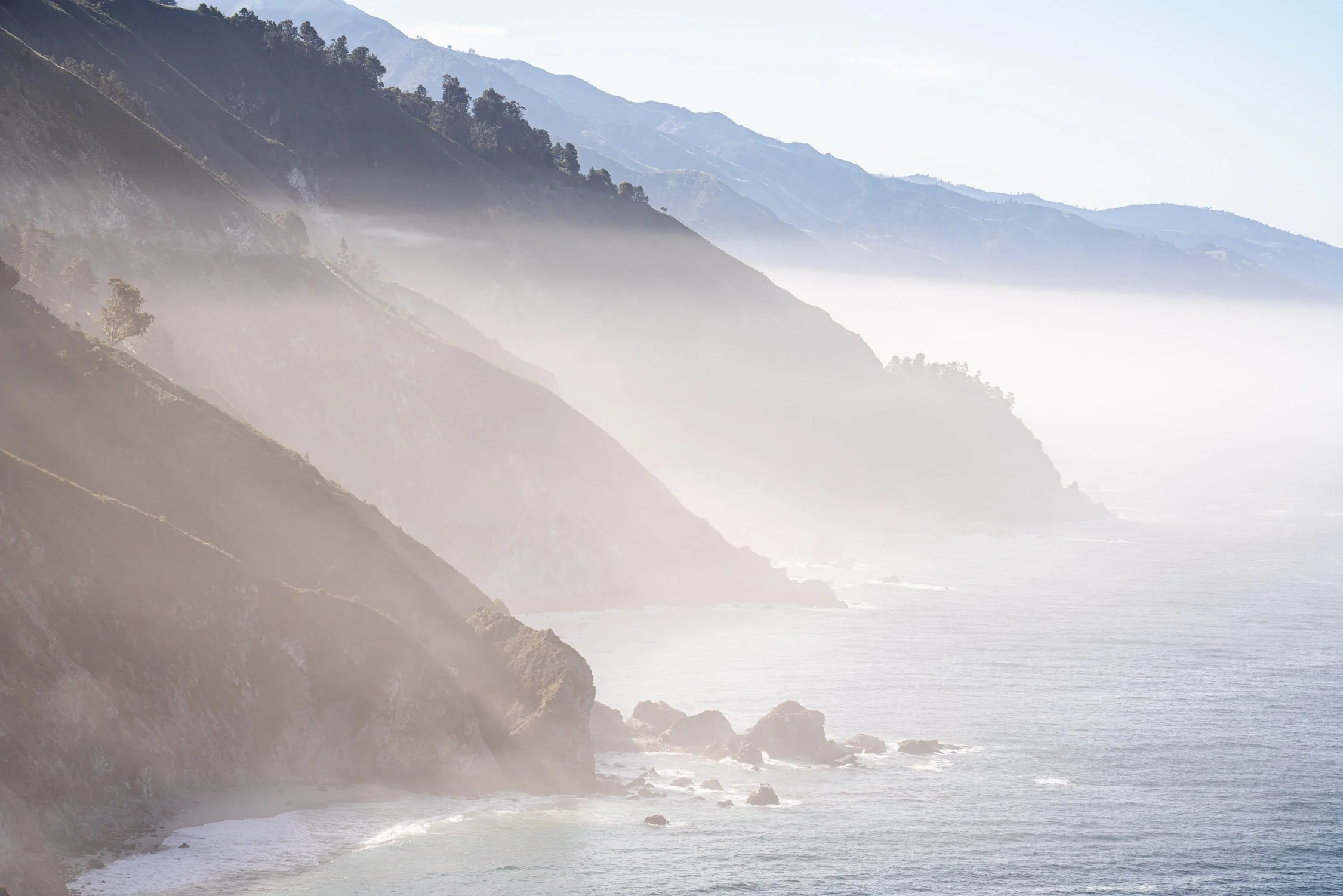
The milkyway creating a moonbow in California. Photo by Dalton Johnson
So, are you ready to elevate your stargazing experience? Say goodbye to your couch and embrace the beauty of the night sky from the perfect vantage point.
Seek out darkness, check the weather, consider altitude and terrain, minimize light sources, and never compromise on safety. With these tips in your cosmic toolkit, you're well on your way to unlocking the wonders of the universe from a front-row seat in nature's own theater.
Discover more of the Night Sky

Using Microadventures As a Reset Button
Do you ever find yourself yearning for a break from the monotonous rhythm of daily life? The endless cycle of work, home, and repeat can leave even the most steadfast individual feeling a little...stifled.
That's where microadventures come in – those tantalizing, bite-sized adventures that infuse a spark of excitement into the routine.
Imagine a spontaneous hike through the woods, a refreshing dip in a serene lake, or a night under the stars with your closest friends. These pocket-sized experiences offer more than just a fleeting thrill; they can completely transform your perspective on life.
Escaping after a day of working and hIking in the Eastern Sierra. Photo by Dalton Johnson
Pros
Accessible Adventures: Microadventures bring adventure to your doorstep. They don't require elaborate planning, extended time off, or expensive gear. Whether it's a hike, a swim, or a night camping under the stars, you can squeeze these experiences into your busy schedule without hassle. This accessibility means you can infuse excitement into your routine life without a major overhaul.
Mental and Emotional Rejuvenation: Spending time in nature, even for a short period, can have profound effects on your mental health. Microadventures provide an immediate escape from the stresses of daily life, allowing you to disconnect from screens, deadlines, and responsibilities. The calming effects of nature, coupled with the release of endorphins during physical activity, leave you feeling refreshed, recharged, and ready to face challenges with a clearer mind.
Stronger Bonds and Memories: Microadventures are perfect for forging connections with loved ones. Sharing an adventure, even a small one, creates unique memories that strengthen relationships. The challenges and triumphs you face together – whether it's navigating a new trail or setting up camp – foster a sense of camaraderie and provide ample opportunities for bonding, communication, and shared laughter.
Cons
Time Constraints: While microadventures are designed to be time-efficient, they may still require carving out specific hours from your schedule. This can be challenging for those with extremely tight routines, demanding jobs, or family responsibilities. The perceived pressure to make the most of limited time might overshadow the enjoyment of the experience.
Weather and Environmental Limitations: Nature is unpredictable, and microadventures are no exception. Unfavorable weather conditions, from sudden rainstorms to extreme temperatures, can quickly turn a promising adventure into a less-than-ideal situation. Being exposed to the elements without proper gear or preparation can lead to discomfort and safety concerns. It's crucial to stay informed about local conditions and pack accordingly.
Breaking Boundaries, One Step at a Time
From the bustling cityscape to the tranquil countryside, microadventures pave the way for embracing the unfamiliar. Shake off the shackles of predictability and dive headfirst into the uncharted territories right on your doorstep.
Whether you're hiking a new trail or embracing the exhilaration of open-water swimming, these mini escapades allow you to see the world through a different lens.
Every microadventure is an invitation to venture beyond your comfort zone. That creek you never noticed, the grove of trees you drove by countless times – these hidden gems are waiting to be discovered.
By injecting spontaneity into your routine, you'll unlock a renewed sense of wonder, and who knows what incredible sights you'll stumble upon?
Nature's Remedy: Microadventures and Mental Health
Picture this: the scent of pine in the air, the soothing lullaby of a bubbling brook, and the sensation of cool water against your skin. These sensory experiences aren't just fleeting pleasures; they're powerful tools for enhancing your mental health. Science has shown that spending time in nature can work wonders for your mind and body.
Microadventures, with their compact yet immersive nature, are tailor-made for stress reduction. They offer a temporary escape from the demands of modern life, allowing you to decompress and recharge.
As you hike, swim, or camp your way through these compact adventures, your brain releases a flood of endorphins – those delightful chemicals that elevate your mood. Feel the weight of your worries melt away as you bask in the therapeutic embrace of the great outdoors.
Moreover, these pint-sized exploits boost cognitive function, enhancing creativity and problem-solving skills. Nature's tranquil ambiance acts as a reset button for your brain, untangling the mental knots that often accumulate during the hustle and bustle of daily life. So, if you've been battling with burnout or seeking a new perspective, consider the healing power of a microadventure.


Microadventures: Forging Bonds and Crafting Memories
In a world increasingly dominated by screens and virtual interactions, the value of genuine human connection cannot be overstated. Microadventures present a unique opportunity to strengthen the bonds with those closest to you. Imagine gathering around a campfire, swapping stories, and sharing laughter under the canopy of stars.
These moments, unburdened by the distractions of the digital realm, create lasting memories that transcend time.
Whether you're heading out with friends or embarking on a family escapade, microadventures provide the ideal backdrop for quality time. The shared challenges and triumphs – whether it's erecting a tent in record time or navigating an unfamiliar trail – foster a sense of camaraderie that's hard to replicate elsewhere. These are the experiences that weave the tapestry of relationships, enriching your connections with every step taken together.
Setting Sail on Your Microadventure Journey
In a world where the vast expanse of adventure awaits, microadventures offer an enticing gateway. They beckon you to reclaim your sense of wonder, to break free from the ordinary, and to embrace the extraordinary waiting just beyond your doorstep.
With each microadventure, you're not just embarking on a physical journey; you're nourishing your mental and emotional well-being.
So, gather your friends, lace up your boots, and prepare to redefine your limits. Whether it's the thrill of exploring the unknown or the solace of nature's embrace, microadventures have something to offer everyone. Unearth the magic of the world in its most condensed, exhilarating form.
Your next microadventure is but a step away – where will it take you?
Discover more Microadventures

Surfing and Road Tripping the PCH
The Pacific Coast Highway (PCH), a ribbon of road that winds along the stunning Californian coastline, is not only a feast for the eyes but a playground for both surf enthusiasts and road trip aficionados. Imagine a journey where the thrill of catching the perfect wave meets the exhilaration of cruising along the open road.
The Pacific Coast Highway (PCH), a ribbon of road that winds along the stunning Californian coastline, is not only a feast for the eyes but a playground for both surf enthusiasts and road trip aficionados. Imagine a journey where the thrill of catching the perfect wave meets the exhilaration of cruising along the open road.
If you're ready to embark on a unique adventure that combines the freedom of the highway with the rush of the surf, then fasten your seatbelt and wax your surfboard – we're diving into the world of surfing and road tripping along the PCH.
Getting barreled while surfing along the Pacific Coast Highway. Photo by Dalton Johnson
The Highway Beckons: Unveiling the PCH's Beauty
Driving along the PCH is like navigating a path to paradise. As you set off on your journey, the grandeur of the Pacific Ocean stretches beside you, while craggy cliffs and charming coastal towns offer picturesque pit stops.
The road weaves through a patchwork of landscapes, from the rugged beauty of Big Sur's cliffs to the golden beaches of Southern California. Each turn reveals a new facet of the Californian coastline, making every mile traveled a memory to cherish.
Suggested Stops to Savor the Beauty:
McWay Falls, Big Sur: A mesmerizing sight awaits as you stop to witness McWay Falls, a stunning 80-foot waterfall cascading onto a pristine beach. This hidden gem is a snapshot of Big Sur's breathtaking allure.
Bixby Creek Bridge, Big Sur: An iconic landmark, Bixby Creek Bridge offers panoramic views of the rugged coastline and the vast expanse of the Pacific Ocean. It's a spot that's perfect for both admiration and photography.
Julia Pfeiffer Burns State Park, Big Sur: Explore the scenic trails of this state park, leading you through redwoods to overlooks that provide a dramatic view of the coastline, offering a unique perspective on the meeting of land and sea.
Point Dume State Beach, Malibu: Stop at Point Dume to take in the majestic sea cliffs and serene ocean vistas. A short hike rewards you with a panoramic view that extends along the coastline, making it an ideal spot for whale watching.
La Jolla Cove, San Diego: As you approach San Diego, make a detour to La Jolla Cove. This protected marine reserve is not only a haven for marine life but also offers tide pools and stunning underwater scenery for snorkelers.
Seasons Along the Coast:
Spring: Spring brings blooming wildflowers, mild temperatures, and clearer skies. It's a perfect time for road tripping, as the landscapes are vibrant and inviting. Surf conditions vary from spot to spot, with more consistent swells on the northern coast.
Summer: The classic beach weather of summer is well-suited for both road trips and surfing. Expect warmer waters and larger crowds at popular surf breaks. It's an excellent time for beginners to learn the ropes and for experienced surfers to enjoy a variety of waves.
Fall: Fall offers fewer crowds and still-warm temperatures. While the waters begin to cool, the surf remains inviting. As the Santa Ana winds pick up, some areas experience offshore winds that create clean wave conditions, especially in Southern California.
Winter: Winter brings bigger swells and powerful waves, making it a prime time for experienced surfers seeking a challenge. The water might be colder, but with the right wetsuit, you can still catch some epic waves. Additionally, it's a quieter time for road tripping, allowing you to enjoy the beauty of the coastline with fewer tourists.


Chasing Waves Along the PCH
For surfers, the PCH is a canvas of possibilities. From the northern waves of Santa Cruz to the sun-kissed breaks of San Diego, the PCH serves up an assortment of surf spots suitable for all skill levels.
Santa Cruz: Begin your surfing escapade at Santa Cruz's Cowell's Beach – a friendly spot for beginners to conquer their first waves. For those seeking a challenge, the legendary Steamer Lane awaits, promising powerful waves for the more experienced.
Malibu: Venture south to Malibu, where First Point beckons longboarders with its iconic waves. As you ride, cast your gaze toward the cliffs and mansions that epitomize Malibu's coastal elegance.
Huntington Beach: Surf City USA lives up to its reputation with waves that cater to all. Whether you're riding the consistent breaks by the pier or daring the excitement of "The Wedge," Huntington Beach is a surfer's playground.
San Clemente: Trestles, the crown jewel of San Clemente, offers a quintessential SoCal surf experience. With its assortment of breaks, it's a magnet for wave enthusiasts of all levels.
Encinitas: As your journey draws to a close, the laid-back vibes of Encinitas welcome you. Discover the beauty of Swami's Beach and Cardiff Reef before exploring the town's artsy, surf-centric charm.
Crafting Your PCH Surfing Road Trip
Combining the thrill of surfing with the freedom of a road trip creates a symphony of adventure. Spend your days chasing waves and mastering the art of the ride, then wind down by indulging in local flavors, exploring hidden gems, and marveling at fiery sunsets over the water. This balance of action and relaxation forms the heart of the PCH experience.
Tips for Your Epic Journey: Waves and Wheels
Plan Ahead: Research surf conditions and road trip stops to make the most of your adventure.
Pack Smart: Ensure you have your surf gear, a well-equipped road trip kit, and essentials for a comfortable journey.
Embrace Flexibility: While planning is important, leave room for spontaneous stops and extra surf sessions.
Respect Nature: Preserve the beauty of the coastline by following eco-friendly practices and respecting local regulations.
Create Memories: Keep a travel journal, snap photos of your best waves, and capture the essence of each destination.
Tucking into a barrel at a secret spot along the PCH. Photo by Dalton Johnson
Riding the waves and the open road along the PCH offers a unique blend of adventure and serenity. It's a journey that marries the call of the surf with the allure of the highway, creating an experience that's as invigorating as it is unforgettable.
So, whether you're a seasoned surfer seeking new breaks or a traveler yearning for the perfect road trip, the PCH promises a fusion of waves, wind, and wonder that will leave you longing for more.
Discover more Of the Pacific Coast Highway

Timing Your PCH Road Trip: How Long Does It Take?
As the sun dances upon the waves of the Pacific Ocean and a gentle breeze rustles the palm fronds along the coast, the allure of the Pacific Coast Highway (PCH) beckons with promises of unforgettable vistas, charming hamlets, and a sense of adventure that only a road trip can offer. Yet, how long does it actually take to road trip the iconic 668 mile stretch of California Coastline?
In this article, we lay out what you need to know while you plan your road trip along the PCH to make sure you allocate enough time for adventure and leisure.
Checking the waves along a PCH road trip. Photo by Dalton Johnson
In A Perfect World Without Traffic
The question on every traveler's lips is, "How long does it take to traverse the enchanting PCH?" Ah, my fellow road trippers, the answer is a symphony of possibilities.
Picture yourself on a journey stretching just over 600 miles, an orchestration that waltzes from Leggett, California, in the north to Dana Point, a sun-kissed haven near the sprawling megalopolis of Los Angeles.
In a perfect world devoid of traffic snarls and earthly obligations, a direct voyage along this ribbon of coastal ecstasy could unfold in a mere 10 to 12 hours. But who among us would be content with such brevity on a canvas as vast and mesmerizing as the PCH?
From Utopia to Reality
Let us cast aside haste and embrace the art of savoring moments. A road trip along the PCH is a journey for the senses, where each curve of the road unveils breathtaking panoramas, and every stop invites you to delve into local treasures.
To dance with the true spirit of the PCH, a gracious allocation of five to seven days is recommended.
Sample 5 to 7 Day PCH Road Trip Itinerary
Day 1: Embarking on Coastal Magic (120 miles)
Start: Leggett, California
Stop: Mendocino
Begin your journey at the northern tip of the PCH in Leggett. Wind through the towering redwoods and feel the thrill of the open road. Your first stop is Mendocino, a quaint coastal town known for its rugged beauty and artistic charm. Explore the village's galleries, stroll along dramatic bluffs, and savor a taste of local cuisine.
Day 2: Spectacular Scenery of the North (150 miles)
Start: Mendocino
Stop: Fort Bragg
Continue south, tracing the contours of the coast. Admire the jaw-dropping vistas as you cruise through picturesque villages. Today's highlight is Glass Beach in Fort Bragg, a shore adorned with vibrant sea glass. Immerse yourself in the sparkling shoreline and breathe in the ocean breeze.
Day 3: Big Sur's Majesty (120 miles)
Start: Fort Bragg
Stop: Big Sur
The drive southward leads to the crown jewel of the PCH: Big Sur. Traverse iconic Bixby Creek Bridge and marvel at the rugged cliffs plunging into cerulean waters. Take time for scenic overlooks, hiking, and perhaps a dip in McWay Falls' turquoise cove. Settle in for the night amidst this natural masterpiece.
Day 4: Seaside Serenity (110 miles)
Start: Big Sur
Stop: San Simeon
Wind your way along the coast, leaving Big Sur's allure behind and arriving in San Simeon. Explore the renowned Hearst Castle, a monument to opulence nestled in the hills. As you drive, the shoreline serenades you, reminding you of the ocean's timeless melody.
Day 5: The Coastal Classic (110 miles)
Start: San Simeon
Stop: Santa Barbara
Today's journey gifts you the essence of PCH splendor. Cruise along iconic vistas, pass through charming towns, and feel the warmth of the Californian sun. Arrive in Santa Barbara, where Spanish architecture meets the sea. Indulge in local cuisine, explore art galleries, and bask on the sandy shores.
Day 6: The Essence of SoCal (100 miles)
Start: Santa Barbara
Stop: Malibu
As the landscape transforms, venture into the heart of Southern California. Malibu's golden sands and celebrity hideaways beckon. Embrace the laid-back vibe, surf the waves, and unwind as the sun dips below the Pacific horizon.
Day 7: Journey's End (90 miles)
Start: Malibu
Stop: Dana Point
In the final stretch, meander down the coast toward Dana Point. The PCH's enchanting spell will linger as you reach journey's end. Bask in the coastal charm of Dana Point, reflecting on the miles traveled, the memories forged, and the beauty of the Pacific Coast Highway imprinted in your heart.
Crafting Your Itinerary: Balancing Desire and Reality
The conundrum of time—a precious currency that demands allocation. For those whose affairs are conducted at a pace swifter than the glistening waves below, fear not.
Should you find yourself entrapped in the rigors of time constraints, yet yearning for the PCH's embrace, a shorter sojourn is attainable. Let your compass guide you toward the crowning jewels: Big Sur's majestic cliffs, Santa Barbara's riviera charm, and the iconic urban embrace of San Francisco and Los Angeles.
Three to four days of this curated symphony will leave you captivated, thirsting for more, and promising to return.
Sample 4-Day PCH Road Trip Itinerary
Day 1: From Rugged Beginnings to Seaside Charms (180 miles)
Start: Leggett, California
Stop: Mendocino
Your whirlwind adventure begins at the northern end of the PCH. Immerse yourself in the towering redwoods before coasting down to Mendocino. Unwind in this coastal gem with its art galleries, oceanfront trails, and cozy cafes. Let the soothing waves set the rhythm for your journey.
Day 2: Big Sur Dreams and Ocean Gleams (150 miles)
Start: Mendocino
Stop: Big Sur
Embark on a day of stunning landscapes and iconic views. As you drive the captivating PCH, you'll cross the awe-inspiring Bixby Creek Bridge and encounter the majesty of Big Sur. Revel in the sights, snap photos at McWay Falls, and let the beauty of the coast envelop you.
Day 3: Sunshine, Serenity, and a Dash of Hollywood (140 miles)
Start: Big Sur
Stop: Santa Barbara
Bid farewell to Big Sur and journey south. Delight in the rugged cliffs and charming towns en route to Santa Barbara. Indulge in the city's Mediterranean charm, explore its historical sites, and soak up the vibrant atmosphere. The day blends coastal beauty with a touch of Southern California allure.
Day 4: Coastal Culmination and Journey's End (130 miles)
Start: Santa Barbara
Stop: Dana Point
As your adventure draws to a close, savor the final stretch along the PCH. Cruise through Malibu's iconic coastline, feeling the sun's warmth on your skin. The journey ends in Dana Point, where you can relish the coastal ambiance, reflect on your brief but unforgettable escapade, and cherish the memories you've created.
Standing on the Bixby Bridge at sunrise. Photo by Dalton Johnson
As the sun dips beneath the horizon, casting its golden embrace across the sea, the truth becomes evident: the length of your PCH sojourn is as unique as your soul's melody. Whether a brief interlude or an extended symphony, the PCH journey is not merely a traversal of miles, but a passage through time itself. With each heartbeat of the road, with each caress of the wind, you etch your story onto the tapestry of this coastal realm.
In your hands, dear traveler, lies the wand that conducts this journey. Let time be your canvas, your brush strokes guided by curiosity, reverence, and an insatiable hunger for the beauty that the PCH unfurls. For in the end, as the road stretches before you and the ocean sings its eternal ballad, you shall know that the PCH is not a destination; it's a journey that resides in the heart forever.
Discover more of Pacific Coast Highway

Three Reasons to Vanlife the PCH
The allure of the open road, the gentle whispers of the ocean breeze, and the promise of ever-changing horizons—these are the siren calls that draw adventurous souls to the Pacific Coast Highway (PCH).
For those seeking an experience stretching 668 miles that encapsulates freedom, convenience, and a deeper connection with nature, embarking on a vanlife journey along this iconic route offers an unparalleled adventure.
If any of these three reasons spike your interest, you know it is time for you to start planning your PCH road trip.
The foggy layers of Big Sur on a crisp morning. Photo by Dalton Johnson
1. Freedom Unleashed
Picture yourself cruising along the rugged coastline, the rhythmic crash of waves in the background and the endless stretch of highway before you.
Traveling in a van on the PCH gifts you an irreplaceable sense of freedom. Unlike traditional travel methods, vanlife empowers you with the ability to set your own pace and wander as your heart desires. Pause at a viewpoint that catches your eye, linger a little longer at that charming seaside town, or pull over to relish a spontaneous sunset.
The road is your canvas, and the van is your mobile studio.
The beauty of this journey lies in the flexibility to tailor your schedule. Unlike rigid itineraries, vanlife lets you embrace the unexpected. Whether it's an impromptu hike through a coastal trail or an unplanned detour to a hidden cove, you have the autonomy to shape your adventure.
Additionally, with your accommodation always in tow, you're free to awaken to breathtaking ocean vistas or slumber beneath a canopy of stars. The van becomes your cocoon of comfort as you soak in the natural wonders around you.
2. Comfort Meets Convenience
Vanlife isn't just about rugged exploration—it's a harmony of comfort and convenience.
Imagine a cozy sleeping nook where the lull of the waves serenades you to sleep. Envision a compact kitchenette that transforms meal preparation into a culinary adventure, with the freshest ingredients and the most scenic backdrop. Visualize storage solutions that effortlessly accommodate your gear, ensuring that every tool for your journey is within arm's reach.
This can be your reality of vanlife on the PCH.
With a well-equipped van, you're not just a traveler; you're a self-sufficient nomad. The ability to cook your own meals doesn't just save on dining costs—it fosters a deeper connection with the places you visit. As you craft dishes using local produce, you become part of the environment, adding another layer to your immersive journey. Moreover, having your shelter and possessions in one mobile haven ensures that you're always comfortable, whether you're nestled in a redwood forest or parked by the shimmering coastline.
Check out this article on the challenges of vanlife to make sure you have the best experience vanlifing the PCH
3. A Tapestry of Simplicity and Adventure
The modern world's pace can be relentless, but the PCH offers a remedy—a chance to embrace a simpler, more adventurous way of life.
Vanlife on this legendary highway is an invitation to unplug from the digital chatter and connect with nature's symphony. Imagine waking up to the symphony of waves or witnessing the sun dip beneath the horizon from your front-row seat on the coast. Vanlife provides an immersive portal into the natural world, a reminder that life's most precious moments often unfold far from the noise of the city.
Check out this article on best sunset locations while road tripping the PCH.
As you journey along the PCH, you'll find yourself immersed in a vibrant community of fellow travelers. The vanlife culture is a supportive tapestry of kindred spirits who share stories, swap tips, and create lifelong memories. From impromptu beach bonfires to shared hikes along rugged trails, the camaraderie forged on the road amplifies the richness of your adventure.
Headed for a surf along the PCH. Photo by Dalton Johnson
Vanlife along the PCH is a symphony of freedom, comfort, and adventure. It beckons those who yearn for a journey unbound by convention and a life enriched by experiences.
The Pacific Coast Highway is not just a road—it's a passage to self-discovery, an invitation to let go of the mundane and embrace the extraordinary.
So, pack your sense of wonder, fuel your curiosity, and hit the road for an unforgettable vanlife expedition along the majestic PCH. The freedom to explore, the comfort of home on wheels, and the enchantment of the open road await you.
Discover more of Pacific Coast Highway

How to See Horsetail Fall, Better Known as Firefalls, in Yosemite
Nestled within the awe-inspiring landscapes of Yosemite National Park lies a mesmerizing natural phenomenon that captivates the hearts of all who witness it - the legendary Firefalls. Every year, as winter bids farewell and spring heralds its arrival, a cascade of fiery molten lava appears to flow down the granite cliffs of El Capitan, creating an ethereal spectacle that seems almost magical. For nature enthusiasts, photographers, and adventurers alike, experiencing this phenomenon is a bucket-list-worthy endeavor.
Nestled within the awe-inspiring landscapes of Yosemite National Park lies a mesmerizing natural phenomenon that captivates the hearts of all who witness it - the legendary Firefalls. Every year, as winter bids farewell and spring heralds its arrival, a cascade of fiery molten lava appears to flow down the granite cliffs of El Capitan, creating an ethereal spectacle that seems almost magical. For nature enthusiasts, photographers, and adventurers alike, experiencing this phenomenon is a bucket-list-worthy endeavor.
In this guide, we'll delve into the art of witnessing Yosemite's enchanting Firefalls, offering insights into the best times to visit, strategic vantage points for optimal views, and tips for capturing this breathtaking phenomenon through the lens.
Amidst the grandeur of Yosemite's towering sequoias and sculpted valleys, the Firefalls stand as a testament to the profound beauty of our natural world. Often compared to cascading liquid gold, the Firefalls are a unique interplay of natural elements and celestial precision. As the sun sets low on the horizon, its rays illuminate the water of Horsetail Fall, transforming it into a brilliant cascade of reds and oranges.
The result is a visual masterpiece that evokes wonder and amazement, drawing in spectators from across the globe. This article serves as your comprehensive companion, offering essential advice on planning your pilgrimage to witness this extraordinary phenomenon and providing valuable insights into making the most of your journey into the heart of Yosemite's fiery spectacle.

Firefalls in Yosemite Valley. Photo by Dalton Johnson
WHERE IS HORSETAIL FALL?
CLICK HERE to discover which waterfall is to Horsetail Fall
BEST SEASON FOR HORSETAIL FALL:
The best season to watch Horsetail Fall is during the winter months. This Yosemite waterfall does not flow year round as it depends on snowmelt to flow. If there is a light snow year in California, Horsetail Fall might now be running come summer.
Winter season after a snow storm to guarantee Horsetail Fall is flowing
For the last two weeks of February, Horsetail Fall, at sunset flows lava red creating Fire Falls
Spring season if California has a hardy snow year
BEST PLACES TO SEE HORSETAIL FALL:
CAN YOU HIKE TO HORSETAIL FALL?
There is no established trail to the base, or top, of Horsetail Fall. I would not suggest trying to hike to this falls unless you have a good plan of action and experience blazing your own trail.
FUN FACTS ABOUT HORSETAIL FALLS:
Horsetail Fall's claim to fame is the legend of the Horsetail Fall Event. It's a natural phenomenon that occurs typically in mid-February when all meteorological and hydrological formations align to create what looks like a ribbon of fire when the rays of the setting winter sun light up the water and mist first golden and then fiery red Horsetail Fall drops off the east side of El Capitan and was known in Ansel Adams's time as El Capitan Fall. Now, this event is called Firefall.
Total Height of Horsetail Fall: 1,000 Feet
Fire Fall only occurs during the last two weeks of February
Horesetail Falls is second highest fully airborne waterfall in Yosemite

As the curtain falls on our exploration of Yosemite's mesmerizing Firefalls, one thing becomes clear: the world's wonders are often beyond human creation, existing as manifestations of nature's intricate artistry. The annual dance of fire and water against the backdrop of El Capitan serves as a reminder of the profound beauty that surrounds us, waiting to be discovered by those willing to venture into the heart of the wilderness. Whether you're an intrepid traveler or a passionate photographer, witnessing this enchanting phenomenon is an experience that lingers in memory and ignites a renewed connection with the planet we call home.
With each passing year, as the cycle of seasons and celestial alignments bring forth the Firefalls, Yosemite's allure remains timeless. It beckons to adventurers and dreamers, offering a chance to glimpse a fleeting moment when the elements converge to create magic. So, as you plan your pilgrimage to witness the ethereal cascade, remember to embrace the unpredictability of nature, to cherish every stolen glance of the molten glow, and to carry the spirit of the Firefalls' fleeting grandeur back with you, inspiring a deeper reverence for the world's untamed beauty.
Discover More of Yosemite Valley

6 Bucket List Adventures in the Rocky Mountains
The Rocky Mountains span over 3,000 miles from upper British Columbia, Canada to New Mexico, USA and are a haven for adventure seekers and nature enthusiasts alike, but where do you begin? With their towering peaks, pristine alpine lakes, National Parks, diverse wildlife, and a plethora of ecosystems, these mountains are a playground for outdoor exploration.
The Rocky Mountains span over 3,000 miles from upper British Columbia, Canada to New Mexico, USA and are a haven for adventure seekers and nature enthusiasts alike, but where do you begin? With their towering peaks, pristine alpine lakes, National Parks, diverse wildlife, and a plethora of ecosystems, these mountains are a playground for outdoor exploration.
If you're looking to create unforgettable memories and tick off some bucket list adventures, the Rocky Mountains have something for everyone. From mountain biking the CDT to rock climbing, rafting rushing rivers to skiing covered slopes, wildlife viewing to berry picking, the Rocky Mountains have a little something for every adventurer.
Here are six must-do experiences that should be on every adventurer's list.
1. Summiting a Fourteener:
For those seeking an adrenaline rush and a sense of accomplishment, summiting a "Fourteener" is a must. The Rocky Mountains are home to 53 peaks (some argue 58) that exceed 14,000 feet in elevation, providing a challenging and rewarding trek to the top. Each peak offers a unique experience, from the iconic Longs Peak in Colorado to the rugged beauty of Wyoming's Grand Teton (standing just short of 14k at 13,775 feet). Whether you're an experienced mountaineer or a novice hiker, conquering a Fourteener is an achievement that will stay with you forever.
Check out the list of all of the Sawatch 14ers in Colorado here
2. Exploring Rocky Mountain National Park:
Rocky Mountain National Park is a paradise for nature lovers. With its diverse landscapes, ranging from lush meadows to snow-capped peaks, the park offers endless opportunities for exploration. Hike along the famous Trail Ridge Road, which offers stunning panoramic views of the surrounding valleys and peaks. Keep an eye out for elk, bighorn sheep, and other wildlife that call the park home. For a more immersive experience, consider camping under the stars or embarking on a backpacking adventure through the park's pristine wilderness.
3. Rafting the Arkansas River:
If you're a water enthusiast, the Arkansas River is your playground for heart-pounding rafting adventures. Known for its world-class whitewater, the river winds through the Rocky Mountains, offering a range of difficulty levels suitable for both beginners and experienced rafters. Navigate through exhilarating rapids while taking in the breathtaking scenery that surrounds you. Whether you opt for a gentle float or a wild ride, rafting on the Arkansas River is an adventure you won't soon forget.


4. Skiing in the Winter Wonderland:
The Rocky Mountains are a haven for winter sports enthusiasts, and skiing in this region is a truly magical experience. With renowned ski resorts like Aspen, Vail, and Breckenridge, you'll have access to powdery slopes, well-groomed trails, and a vibrant après-ski culture. Whether you're a seasoned skier or a beginner eager to learn, the Rocky Mountains offer a variety of terrain to suit all skill levels. Embrace the thrill of carving down pristine slopes surrounded by stunning alpine vistas.
5. Soaking in Natural Hot Springs:
After all the adrenaline-pumping adventures, take a moment to relax and rejuvenate in the natural hot springs that dot the Rocky Mountain landscape. Places like Glenwood Springs and Hot Sulphur Springs offer soothing pools of warm mineral water set against a backdrop of snow-covered peaks. Immerse yourself in the therapeutic waters and let the stress melt away as you reflect on your mountain escapades.
6. Mountain Biking the Continental Divide Trail (CDT):
For avid mountain bikers seeking the ultimate off-road adventure, bikepacking along the Continental Divide Trail (CDT) is an experience that combines the thrill of biking with the breathtaking beauty of the Rocky Mountains. The CDT stretches approximately 3,100 miles (5,000 kilometers) along the crest of the Rocky Mountains, traversing through five states: Montana, Idaho, Wyoming, Colorado, and New Mexico.
Thinking about getting into bikepacking? Read this article first.
The CDT is not only a renowned long-distance hiking trail but also an emerging destination for mountain biking enthusiasts looking to tackle challenging terrain, rugged landscapes, and remote backcountry trails. While the entire trail may be more suitable for experienced mountain bikers due to its technical difficulties and elevation changes, there are plenty of sections that offer diverse riding experiences for bikers of varying skill levels.
Staring into the eyes of mountain goat. Photo by Dalton Johnson
The Rocky Mountains stand as a veritable playground for adventurers seeking a diverse array of experiences that capture the essence of the natural world. From summiting majestic Fourteeners to capturing the elusive wildlife through a camera lens, these mountains offer an array of activities that cater to every adventurer's desires. Whether it's the heart-pounding rush of rafting down the Arkansas River, the serene relaxation of soaking in natural hot springs, or the sheer exhilaration of skiing down powdery slopes, the Rocky Mountains provide a canvas upon which bucket list dreams come to life.
Embracing these six bucket list adventures, from conquering physical challenges to immersing oneself in the untamed beauty of nature, offers more than just fleeting thrills; it provides a chance to form lasting connections with the environment, create indelible memories, and uncover a renewed appreciation for the vast wonders that our planet has to offer. The Rocky Mountains beckon to those who seek not only adventure but also a profound sense of awe and wonder, reminding us of the breathtaking power and beauty that nature generously bestows upon those who dare to explore its heights and depths.
Discover more of the Rocky Mounains

Choosing the Best Month to Visit Grand Teton National Park
Grand Teton National Park stands as a breathtaking testament to nature's grandeur. With its towering mountain peaks, pristine lakes, and diverse wildlife, it's no wonder that this park draws in visitors year-round.
However, choosing the right time to visit can greatly impact your experience. From the snow-capped splendor of winter to the vibrant blooms of summer, each season offers a unique charm. So, what is the best month to visit Grand Teton National Park?
Let's explore the pros and cons of each season to help you make an informed decision.
Backflipping into Phelps Lake during the warm summer. Photo by Dalton Johnson
Spring (April - May):
Spring is a time of renewal in Grand Teton National Park. As the snow begins to melt and temperatures rise, the landscape awakens with the vibrant hues of emerging wildflowers. April and May offer a quieter experience with fewer crowds, making it an excellent time for hikers and photographers seeking serenity. However, some hiking trails and higher elevation areas might still be snow-covered during the early part of spring, limiting accessibility.
Pros:
Wildflower Blooms: Witness the park's stunning transformation as wildflowers blanket the landscape, creating a colorful and picturesque setting.
Serene Atmosphere: Experience a quieter and more peaceful environment with fewer crowds, allowing for a deeper connection with nature.
Milder Weather: Enjoy comfortable temperatures for hiking and outdoor activities, without the intense heat of summer.
Photography Opportunities: Capture unique shots of the snow-capped peaks juxtaposed with vibrant spring colors.
Cons:
Limited Accessibility: Some hiking trails and higher elevation areas might still be covered in snow, restricting access to certain parts of the park.
Unpredictable Weather: Spring weather can be unpredictable, with sudden temperature changes and potential rain showers.
Delayed Park Services: Some visitor services might be limited or not fully operational until later in the season.
Summer (June - August):
Summer is undoubtedly the peak tourist season in Grand Teton National Park, and for good reason. The weather is generally warm and inviting, allowing for a wide range of outdoor activities like hiking, camping, and wildlife spotting. During these months, most of the park's trails and attractions are easily accessible. The iconic Jenny Lake boat shuttle is also in operation, offering stunning views of the Teton Range. However, be prepared for larger crowds, increased traffic, and the need to secure accommodations well in advance.
Pros:
Wide Range of Activities: Engage in various outdoor activities, from hiking and camping to boating and wildlife viewing.
Optimal Accessibility: Most trails and attractions are open and accessible, making it easier to explore the park's diverse landscapes.
Mild Weather: Enjoy warm and pleasant temperatures, making it comfortable for a wide range of activities.
Jenny Lake Boat Shuttle: Experience the scenic boat shuttle across Jenny Lake, providing stunning views of the Tetons.
Cons:
Crowded Conditions: Expect larger crowds during the summer months, resulting in busier trails, parking lots, and popular viewpoints.
Higher Prices: Accommodation and services might be more expensive due to peak tourist season demand.
Limited Availability: Popular accommodations and campsites fill up quickly, requiring advanced reservations.
Fall (September - October):
Fall is a photographer's dream in Grand Teton National Park. As the foliage transitions to brilliant shades of gold and red, the landscape becomes a visual masterpiece. September and October bring cooler temperatures and thinner crowds compared to summer. It's a prime time for wildlife enthusiasts, as animals like elk engage in their mating rituals. The fall season offers a unique blend of mild weather, stunning colors, and opportunities for observing the park's iconic wildlife.
Pros:
Spectacular Foliage: Witness the landscape transform into a vibrant palette of red, orange, and gold as the leaves change color.
Mild Weather: Experience comfortable temperatures during the day, ideal for outdoor activities like hiking and wildlife spotting.
Wildlife Viewing: Witness the annual elk rutting season, offering unique opportunities to observe wildlife behaviors.
Fewer Crowds: Enjoy a quieter atmosphere compared to summer, allowing for a more relaxed experience.
Cons:
Changing Conditions: Weather can be unpredictable in the fall, with temperature variations and potential early snowfall affecting plans.
Limited Services: Some visitor centers, facilities, and services might start to close as the season winds down.
Winter (November - March):
For those seeking a quieter and more serene experience, winter is an exceptional time to visit Grand Teton National Park. The park's snow-covered peaks and frozen lakes create a magical, otherworldly atmosphere. Cross-country skiing, snowshoeing, and wildlife tracking are popular activities. However, winter visits come with challenges. Some facilities and roads might be closed, and the weather can be unpredictable and harsh. It's crucial to be well-prepared and informed about road closures and safety measures.
Pros:
Serene Winter Wonderland: Experience the park's quiet and magical ambiance as snow blankets the landscape, creating a serene atmosphere.
Unique Activities: Engage in winter-specific activities like cross-country skiing, snowshoeing, and wildlife tracking.
Minimal Crowds: Enjoy a peaceful and secluded experience due to the limited number of visitors during this season.
Photography Opportunities: Capture the park's iconic landmarks in their snow-covered splendor.
Cons:
Limited Accessibility: Many roads, facilities, and services are closed during winter, limiting the areas you can explore.
Harsh Weather: Winter weather can be extremely cold and challenging, requiring proper clothing and preparation.
Shorter Days: With fewer daylight hours, you'll need to plan your activities accordingly.
Variable Conditions: Weather can change rapidly, impacting travel plans and safety considerations.
The Teton Range during late summer with a cloud bank below. Photo by Dalton Johnson
The best month to visit Grand Teton National Park ultimately depends on your preferences and priorities. If you're drawn to blooming wildflowers and a quieter atmosphere, spring might be your ideal choice. Summer is perfect for outdoor adventurers and families, despite the larger crowds. Fall offers a combination of beautiful foliage and wildlife activity. Meanwhile, winter provides a unique and tranquil experience for those willing to embrace the cold.
Before planning your trip, consider the activities you want to engage in, your tolerance for crowds, and your willingness to adapt to changing weather conditions. Regardless of the season, Grand Teton National Park promises an unforgettable journey into the heart of nature's beauty.
Discover more National Parks

How To Explore Lake Tahoe's Only Island: Fannette Island
Nestled amidst the crystal-clear waters of Lake Tahoe, Fannette Island stands as an enchanting testament to the natural beauty and allure of this iconic alpine lake. With a history rich in Native American lore, stunning surroundings, and adventurous activities like kayaking, stand-up paddleboarding (SUP), boating, and even cliff jumping, Fannette Island offers an unforgettable experience for both nature enthusiasts and thrill-seekers.
Nestled amidst the crystal-clear waters of Lake Tahoe, Fannette Island stands as an enchanting testament to the natural beauty and allure of this iconic alpine lake. With a history rich in Native American lore, stunning surroundings, and adventurous activities like kayaking, stand-up paddleboarding (SUP), boating, and even cliff jumping, Fannette Island offers an unforgettable experience for both nature enthusiasts and thrill-seekers.

Fannette Island reflecting in the calms waters of Emerald Bay at sunrise. Photo by Dalton Johnson
Pros
Natural Beauty: Fannette Island is situated in the stunning Emerald Bay of Lake Tahoe, offering breathtaking views of the surrounding mountains and crystal-clear waters.
Historical Significance: The island has a rich history, with ties to Native American culture and the Vikingsholm Castle, providing a unique opportunity to explore a blend of natural and cultural heritage.
Adventure Activities: Visitors can engage in a variety of activities such as kayaking, stand-up paddleboarding, boating, and even cliff jumping for an adrenaline rush.
Cons
Crowds: Especially during peak tourist seasons, Fannette Island can attract a high number of visitors, leading to congestion on the water and on the island itself.
Safety Concerns: Cliff jumping can be dangerous if not done with proper caution and understanding of the water's depth and conditions. Visitors must prioritize safety at all times.
Limited Facilities: As a natural island, Fannette Island lacks amenities such as restrooms, food vendors, and shade, requiring visitors to be prepared with their own supplies.
A Glimpse into History
Fannette Island's history dates back centuries, with the Washoe Native American tribe considering Lake Tahoe and its surrounding areas as sacred grounds. The island was a part of their spiritual beliefs and served as a place for reflection and connection with nature.
Later, during the late 19th century, the illustrious Emerald Bay estate was constructed on the shores of Lake Tahoe by the wealthy socialite Mrs. Lora Josephine Knight. The Vikingsholm Castle, a Scandinavian-style mansion, adds a touch of elegance to the landscape and is now a National Historic Landmark.
Location and Access
Fannette Island can be found in the heart of Emerald Bay, one of Lake Tahoe's most breathtaking locations. Emerald Bay itself is located on the west shore of the lake, making it easily accessible from various points around the lake.
Visitors can reach Fannette Island by kayak, SUP, or boat. The island's central location within the bay offers spectacular views of the surrounding mountainous terrain, including the impressive Cascade Falls, which cascade down the granite cliffs into the emerald waters.
Kayaking and Stand-Up Paddleboarding (SUP) Adventure
For those seeking a more immersive experience, kayaking and stand-up paddleboarding are perfect options to explore Fannette Island. The calm, clear waters of Lake Tahoe provide an ideal environment for beginners and experienced paddlers alike. The hike down to the water can be a challenge if you have to carry your kayak, so I suggest using an Oru Kayak or an inflatable SUP.
Rental facilities are available around the lake, ensuring that adventurers have access to the necessary equipment for a memorable journey to the island.


Boating Bliss
Boaters can also revel in the splendor of Fannette Island. Cruising the pristine waters of Lake Tahoe provides a different perspective, allowing visitors to marvel at the island's rugged rock formations and lush greenery from the comfort of a boat.
Numerous boat rental services and guided tours offer visitors the chance to customize their experience and create lasting memories.
The Thrill of Cliff Jumping
For the adrenaline junkies, Fannette Island is known for its popular cliff jumping spots. Adventurers can hike to the highest point of the island to reach the renowned "Tea House," an abandoned stone building that was once used as a summer retreat.
Nearby, the island's cliffs beckon daredevils to take the plunge into the refreshing waters below. It's important to exercise caution and adhere to safety guidelines when participating in cliff jumping to ensure a thrilling yet secure experience.
One of the most popular places to jump into the water is near to "typical" boat parking. The cliffs are roughly 15-20 feet and the water is deep.

Hiking down to Emerald Bay to kayak to Fannette Island. Photo by Dalton Johnson
Fannette Island stands as an emblem of the captivating allure that Lake Tahoe holds. Its storied history, stunning location, and diverse range of activities make it an ideal destination for anyone seeking adventure, natural beauty, and a connection with the rich history of the area.
From kayaking and stand-up paddleboarding to boating and the excitement of cliff jumping, Fannette Island offers an unforgettable journey into the heart of Lake Tahoe's enchanting landscape. So, gear up, embrace the spirit of exploration, and immerse yourself in the magic of Fannette Island.
Discover more of Lake Tahoe
Overlooked, yet Amazing, Road Trips in California
When it comes to scenic road trips, California offers an array of well-known routes that take travelers through some of the most iconic landscapes in the world. However, beyond the beaten path lie road trips that are just as spectacular, if not more so and the crowds are minimal.
In this article, we'll explore four such road trips that often don't get the attention they deserve, showcasing the hidden gems of the Golden State.
Emerald Bay coated in a blanket of snow. Photo by Dalton Johnson
1. Lake Tahoe Loop: Circumnavigating Tranquility
Distance: Approximately 72 miles
Time Required: About 2-3 hours, excluding stops
Lake Tahoe, with its sapphire-blue waters and surrounding pine-covered mountains, is often revered as a vacation spot. But the Lake Tahoe Loop road trip presents a breathtaking journey that takes you around the entire lake. This overlooked drive offers stunning vistas, serene beaches, and a chance to immerse yourself in the grandeur of the Sierra Nevada.
Three Important Stops:
Emerald Bay State Park: This stop presents a postcard-worthy view of the lake. Hike down to the shoreline or take a boat tour to explore the iconic Fannette Island and its charming Tea House.
Sand Harbor: Known for its white-sand beaches and crystal-clear waters, Sand Harbor offers an ideal spot for relaxation, paddleboarding, and enjoying the beauty of Lake Tahoe.
Hiking Mount Rose: Trade in historical visits for an exhilarating hiking experience up Mount Rose. As the second highest peak in the Lake Tahoe Basin at an elevation of 10,776 feet, Mount Rose offers panoramic views that stretch from the lake to the surrounding mountains.
2. Highway 395: Eastern Sierra Adventure
Distance: Varies depending on route, approximately 250-300 miles
Time Required: About 5-7 days for a comprehensive exploration
Highway 395 runs along the eastern side of the Sierra Nevada mountains, offering a diverse array of landscapes. From the surreal beauty of Mono Lake to the majesty of Mammoth Lakes and the towering peaks of the Eastern Sierra, this road trip showcases nature's grandeur in every direction.
Three Important Stops:
Mono Lake: Witness the bizarre tufa towers rising from the lake's salty waters, a testament to the region's unique geology and ecology. Don't miss the South Tufa Reserve for a closer look.
Bodie State Historic Park: Step back in time at this well-preserved ghost town, capturing the essence of California's Gold Rush era. It's a photographer's dream and a historical delight.
Alabama Hills: Just west of Lone Pine, this unique geological formation offers stunning landscapes and is a popular location for movies and TV shows. Hike the Mobius Arch Loop Trail for incredible views of the Sierras framed by natural arches.


3. Wine Country Loop: A Gourmet Getaway
Distance: Varies based on chosen wineries, approximately 50-100 miles
Time Required: About 2-3 days to fully appreciate the experience
California's wine regions, including Napa Valley and Sonoma County, are celebrated for their world-class wines and picturesque vineyards. The Wine Country Loop road trip takes you through these regions, allowing you to indulge in wine tastings, savor gourmet meals, and soak in the countryside's beauty.
Three Important Stops:
Napa Valley: The crown jewel of California's wine country, Napa Valley offers a plethora of wineries and charming towns. Consider visiting the famous Castello di Amorosa, a medieval-style castle winery.
Sonoma Plaza: Explore historic Sonoma Plaza, home to a variety of tasting rooms, boutique shops, and galleries. Don't miss the Sonoma Mission, the last of the 21 missions built in California.
Russian River Valley: Known for its world-class Pinot Noir and Chardonnay, this region offers a more relaxed and rustic atmosphere. Enjoy a leisurely float down the Russian River or explore local breweries and eateries.
4. Death Valley Scenic Byway: Desert Majesty
Distance: Approximately 146 miles (one way)
Time Required: About 2-3 days, considering exploration time
In the heart of the Mojave Desert lies Death Valley National Park, a place of unparalleled beauty and extremes. The Death Valley Scenic Byway road trip takes you through this unique landscape, showcasing mesmerizing sand dunes, dramatic canyons, and the lowest point in North America.
Three Important Stops:
Badwater Basin: Marvel at the surreal landscape of the salt flats at Badwater Basin, the lowest point in North America at 282 feet below sea level.
Mesquite Flat Sand Dunes: Experience the ethereal beauty of these rolling sand dunes, especially during sunrise or sunset when the colors are most vibrant.
Zabriskie Point: Enjoy panoramic views of the badlands and golden rock formations. This spot is particularly captivating during sunrise, as the early light paints the landscape in hues of orange and red.
Mesquite sand dunes at sunrise. Photo by Dalton Johnson
While California's well-known road trips have rightfully earned their fame, there are hidden road trip treasures that offer equally remarkable experiences.
From the serene shores of Lake Tahoe to the otherworldly landscapes of Death Valley, these overlooked road trips invite you to discover the lesser-known wonders that the state has to offer. So, the next time you're planning a road trip in California, consider these routes for an unforgettable journey off the beaten path.
Discover more of Road Trips

Do You Know Your Big Waves Spots?
When I learned how to surf at 8 years old, I was captivated by the legends of barrels so big they can swallow freighters, wipeouts that surfers never returned from, and the relentless raw power of the ocean. For my landlocked 8-year-old brain, I couldn't fathom this.
Yet, as I write, I know, first hand, all of these can be true.
What my mind still can not comprehend, is how a growing handful of surfers dedicate their lives to finding and surfing these waves. So, let's tip our hats to the big wave surfers and check out the main Big Wave spots sprinkled across the globe.

A surfer enjoying the view from the shoulder as a massive Mavericks wave breaks. Photo by Dalton Johnson
Mavericks (Half Moon Bay, California, USA)
Biggest Size Wave: Over 60 feet
Paddle-in or Tow: Paddle-in
Mavericks is a legendary big wave spot characterized by its massive waves that can reach heights of over 60 feet. Located off the coast of Half Moon Bay, it's known for its unpredictable and challenging conditions, making it a destination for fearless surfers seeking an adrenaline rush and a test of their skills.
Pipeline (Oahu, Hawaii, USA)
Biggest Size Wave: Over 20 feet
Paddle-in or Tow: Paddle-in
Pipeline is one of the most iconic and revered waves in the world. Known for its powerful and perfectly cylindrical barrels, it breaks over a shallow reef, creating fast and hollow waves that challenge even the most skilled surfers. The Banzai Pipeline is a proving ground for tube riding and is a highlight of the North Shore's winter surf season.
While most would not put Pipe in the XXL category, it is still a big wave that demands respect.
Nazaré (Nazaré, Portugal)
Biggest Size Wave: Over 70 feet
Paddle-in or Tow: Tow
Nazaré is famous for producing some of the largest waves in the world, with record setting heights of 86 feet. The underwater Nazaré Canyon amplifies the swell, creating monstrous waves that draw big wave surfers and tow teams. It's a unique spot that attracts those looking to ride the biggest waves on the planet.
Jaws (Peahi, Maui, Hawaii, USA)
Biggest Size Wave: Over 60 feet
Paddle-in or Tow: Paddle-in and Tow
Jaws, or Peahi, is a legendary big wave spot on Maui's north shore. It's known for its massive waves that can reach heights of over 60 feet and its challenging paddle-in and tow-in conditions. The powerful waves at Jaws attract top big wave surfers seeking to push their limits and ride some of the most formidable waves in the world.
Teahupo'o (Tahiti, French Polynesia)
Biggest Size Wave: Over 20 feet
Paddle-in or Tow: Paddle-in
Teahupo'o is famous for its heavy and shallow reef break that creates thick, barreling waves. These waves can reach heights of over 20 feet and offer surfers the chance to ride deep and challenging barrels. The break is renowned for its beauty and intensity, making it a must-visit spot for experienced surfers.
Islas de Todos Santos (Ensenada, Baja California, Mexico)
Biggest Size Wave: Over 30 feet
Paddle-in or Tow: Paddle-in
Islas de Todos Santos, also known as Todos Santos Island, is home to a powerful reef break that produces waves exceeding 30 feet. Located off the coast of Baja California, it's a prime spot for big wave surfers looking to challenge themselves on heavy and hollow waves in a stunning natural setting.
Cortes Bank (Off the coast of California, USA)
Biggest Size Wave: Over 100 feet (rumored)
Paddle-in or Tow: Tow
Cortes Bank is an underwater seamount located off the coast of Southern California. When the conditions align, it can produce waves that are rumored to surpass 100 feet, attracting tow-in surfers and adrenaline seekers. The remote location and challenging conditions make it one of the most extreme big wave spots in the world.
Puerto Escondido (Oaxaca, Mexico)
Biggest Size Wave: Over 25 feet
Paddle-in or Tow: Paddle-in
Puerto Escondido is known for its heavy beach break that produces powerful waves, especially during the summer months. These waves can exceed 25 feet and offer surfers the opportunity to ride massive barrels. The Mexican Pipeline, as it's often called, is a favorite among skilled tube riders.
Belharra (Biarritz, France)
Biggest Size Wave: Over 60 feet
Paddle-in or Tow: Paddle-in
Belharra is a reef break located off the coast of Biarritz in France. It's renowned for its colossal waves that can reach heights of over 60 feet during big swells. The challenging paddle-in conditions and heavy waves attract experienced surfers seeking the thrill of riding massive walls of water.
The Right (Western Australia, Australia)
Biggest Size Wave: Over 20 feet
Paddle-in or Tow: Paddle-in
The Right is a unique and powerful slab wave located in Western Australia. It's known for its incredibly hollow and fast barrels that can reach heights of over 20 feet. The wave breaks over a shallow reef and is famous for its intense drop-ins and challenging tube rides.


Shipstern Bluff (Tasmania, Australia)
Biggest Size Wave: Over 20 feet
Paddle-in or Tow: Paddle-in
Shipstern Bluff is a remote and notorious big wave spot in Tasmania. It's known for its heavy and intimidating waves that break over a shallow reef, producing thick barrels and challenging drops. The cold water and rugged coastline add to the raw and adventurous nature of this surf spot.
Punta de Lobos (Pichilemu, Chile)
Biggest Size Wave: Over 30 feet
Paddle-in or Tow: Paddle-in
Punta de Lobos is a picturesque point break in Chile that transforms into a powerful big wave spot during larger swells. Waves here can exceed 30 feet, offering experienced surfers the chance to ride long and fast walls with the iconic Lobos Rock in the background.
Dungeons (Cape Town, South Africa)
Biggest Size Wave: Over 25 feet
Paddle-in or Tow: Paddle-in
Dungeons is a big wave spot off the coast of Cape Town, South Africa. It's known for its heavy and fast-moving waves that can reach heights of over 25 feet. The cold water and challenging conditions make it a demanding spot for big wave surfers.
Nelscott Reef (Lincoln City, Oregon, USA)
Biggest Size Wave: Over 40 feet
Paddle-in or Tow: Paddle-in
Nelscott Reef is located off the coast of Lincoln City in Oregon and is known for producing waves that can exceed 40 feet. The reef break can offer powerful and challenging waves, attracting experienced surfers looking for big wave action in the Pacific Northwest.
Mullaghmore Head (County Sligo, Ireland)
Biggest Size Wave: Over 50 feet
Paddle-in or Tow: Paddle-in
Mullaghmore Head is a big wave spot on the west coast of Ireland. It's renowned for its heavy and cold water waves that can reach heights of over 50 feet. The spot offers a unique blend of rugged beauty and challenging surf conditions, drawing big wave surfers from around the world.
Ghost Trees (Monterey, California, USA)
Biggest Size Wave: Over 30 feet
Paddle-in or Tow: Paddle-in (due to new laws)
Ghost Trees is a big wave spot located off the coast of Monterey, California. The waves here can reach heights of over 30 feet and are known for their fast and powerful nature. The spot was historically know for tow-in surfing due to its distance from the shore and challenging conditions.
Note: This break no longer permits tow-in surfing due to new environmental laws. Surfing this wave is now more dangerous.
Pico Alto (Lima, Peru)
Biggest Size Wave: Over 30 feet
Paddle-in or Tow: Paddle-in
Pico Alto is one of Peru's premier big wave spots, featuring waves that can exceed 30 feet. It's a consistent spot for large swells, and its heavy, hollow waves break over a reef, offering experienced surfers a chance to ride long and intense barrels.
The Box (Western Australia, Australia)
Biggest Size Wave: Over 15 feet
Paddle-in or Tow: Paddle-in
The Box is a powerful and hollow reef break located in Western Australia. The waves here can reach heights of over 15 feet and are known for their intense barrels and challenging drops. It's a favorite spot for skilled tube riders seeking an adrenaline-pumping experience.

Dropping in on a proper day at Mavericks. Photo by Dalton Johnson
Discover more of Surfing

Organizing Your Van for a Simpler Life
In a world filled with consumerism and material possessions, many individuals are seeking a simpler, more intentional way of living. Embracing minimalism has become a popular lifestyle choice, emphasizing the importance of living with less and focusing on what truly matters. For those who have chosen to live on the road in their vans, minimalism can be the key to unlocking a more fulfilling and purposeful existence.
In a world filled with consumerism and material possessions, many individuals are seeking a simpler, more intentional way of living. Embracing minimalism has become a popular lifestyle choice, emphasizing the importance of living with less and focusing on what truly matters. For those who have chosen to live on the road in their vans, minimalism can be the key to unlocking a more fulfilling and purposeful existence.
To declutter and organize your van effectively, start by assessing your belongings and categorizing them into essentials and non-essentials. Utilize storage solutions such as collapsible containers and hanging organizers to maximize space. Prioritize essential items for easy access and embrace a regular cleaning routine to maintain tidiness on your van life journey.
In this blog, we will explore the art of decluttering and organizing your van to embrace minimalism and enjoy the freedom of a simpler life.
When life becomes simple, you are capable of enjoying the small moments in life. Photo by Dalton Johnson
Pros
Simplified Living: Embracing minimalism in van life allows you to focus on the essentials and live with fewer distractions. This simplicity can lead to reduced stress, increased mental clarity, and a greater sense of contentment.
Financial Freedom: With fewer material possessions, van dwellers can save money on buying and maintaining unnecessary items. This financial freedom enables them to allocate resources to experiences, travel, and personal growth.
Environmental Impact: Minimalistic van life often goes hand in hand with conscious and sustainable living. By owning fewer belongings and reducing consumption, van lifers can lower their environmental footprint and contribute to a greener planet.
Cons
Limited Space: Living in a van means sacrificing the abundance of space found in traditional homes. This limited space may lead to challenges in storing belongings and finding room for essential amenities.
Comfort and Convenience: While minimalism promotes a simpler lifestyle, some individuals may miss the comforts and conveniences of a traditional home, such as a spacious kitchen, larger bathroom, or dedicated living areas.
Social Connections: Constantly being on the move can make it challenging to establish long-lasting relationships and maintain strong social connections. Van life can sometimes lead to feelings of isolation or loneliness for those who thrive on regular interactions with others.
The Benefits of Minimalism in Van Life
Living in a van already implies a certain level of simplicity, but the additional benefits of adopting a minimalist lifestyle are manifold. By decluttering and organizing your van, you can:
Increase space and mobility: Removing unnecessary possessions frees up valuable space in your van, making it more comfortable to live and travel in. A clutter-free environment also enables easy navigation and access to your essentials.
Reduce stress and anxiety: A cluttered environment can lead to feelings of overwhelm and stress. Minimalism promotes a calming and serene atmosphere, making van life more enjoyable and relaxing.
Save money: Owning fewer possessions means spending less on buying, maintaining, and storing them. With fewer material needs, you can redirect your financial resources toward experiences and adventures.
Improve focus and productivity: A simplified living space can enhance your focus and creativity, allowing you to fully engage in activities you're passionate about, whether it's photography, writing, or exploring nature.
Decluttering Your Van
Before you can fully embrace minimalism, you need to declutter your van effectively. Here are some steps to get you started:
Assess your belongings: Take inventory of everything in your van and categorize items into essentials and non-essentials. Be honest with yourself about what you truly need on a daily basis.
Apply the "one in, one out" rule: For every new item you acquire, remove an equivalent item from your van. This approach helps maintain a clutter-free space over time.
Donate or sell unused items: Let go of items you rarely use but are still in good condition. Donate them to charity or sell them to someone who might benefit from them.
Utilize storage solutions: Invest in collapsible containers, hanging organizers, and multi-functional furniture to maximize storage space and keep your van tidy.
Organizing Your Minimalist Van Life
Once you've decluttered your van, it's time to organize it thoughtfully:
Prioritize essentials: Arrange your essential items in a way that is easily accessible. Keep frequently used items close at hand and store seasonal or occasional items in separate containers.
Adopt a minimalist décor: Choose simple and functional furnishings that enhance your living space without adding unnecessary visual clutter.
Keep a cleaning routine: Embrace a regular cleaning schedule to maintain the simplicity and tidiness of your van. A clean environment contributes to a clearer mind.
Embrace digital storage: Minimize the need for physical documents and opt for digital storage of important files, such as travel documents, insurance papers, and photographs.
15 Helpful products to improve your van’s organization
Keeping a van organized can greatly enhance the van life experience. Here's a list of helpful products to help you stay organized on the road:
Collapsible Storage Bins: These versatile containers are perfect for keeping clothes, kitchen supplies, and other essentials organized while maximizing space when not in use.
Hanging Organizers: Utilize over-the-door or wall-mounted organizers to store small items like toiletries, electronics, and travel documents neatly and within reach. The best spot for this is on the back doors.
Magnetic Spice Jars: Optimize kitchen space with magnetic spice jars that stick to metal surfaces, such as the refrigerator or the side of cabinets, keeping your spices organized and accessible.
Multi-Functional Furniture: Choose furniture pieces that serve multiple purposes, such as a foldable table that doubles as a workspace or a bed with built-in storage compartments or an ottoman that doubles as storage.
Cargo Nets and Bungee Cords: Secure loose items and prevent them from shifting during travel by using cargo nets and bungee cords in the cargo area.
Overhead Storage Bags: Utilize overhead space with hanging storage bags for clothes or lightweight items, freeing up floor and seating areas.
Compact Foldable Chairs and Table: Invest in lightweight, collapsible camping chairs and tables for outdoor relaxation and dining without taking up much space.
Travel Packing Cubes: Keep clothes and accessories organized in packing cubes to minimize clutter and make it easier to find what you need.
Cable Organizers: Manage charging cables, cords, and electronics with cable organizers or Velcro straps to avoid tangling and mess.
Shower Caddy: For those with onboard showers, or stop for showers on the road, a portable shower caddy keeps toiletries organized and within reach during bathroom stops.
Compact Vacuum Cleaner: Opt for a handheld, cordless vacuum to keep the van clean and tidy without taking up too much space.
Foldable Drying Rack: Air-dry your dishes efficiently with a compact drying rack that can be easily stowed away when not in use.
Portable Trash Can: Use a small, collapsible trash can with a lid to keep waste contained and maintain a clean living space.
First Aid Kit: Keep a well-stocked first aid kit on hand for emergencies and minor injuries, ensuring safety and peace of mind on the road.
Rooftop Cargo Carrier: If you need extra storage space, consider installing a rooftop cargo carrier to store bulkier items and outdoor gear.
Soaking in the sunrise views along the Sea of Cortez in Baja Mexico while enjoying the simplicities of vanlife. Photo by Dalton Johnson
Embracing minimalism in your van life journey can lead to a more intentional, meaningful, and fulfilling existence. By decluttering and organizing your living space, you'll create room for new experiences, personal growth, and a deeper connection with the world around you. As you embark on this minimalist path, remember that it's not about sacrificing comfort but rather about focusing on what truly matters and finding contentment in the simplicity of van life. Happy travels on your minimalist adventure!
Discover more of vanlife

Vanlife Maintenance 101: Essential Tips for Keeping Your Vehicle in Top Shape
The allure of van life has captured the hearts of adventurers worldwide. Whether you're a weekend road tripper or a full-time nomad, your van is not only your means of transportation but also your home on wheels. As with any vehicle, regular maintenance is crucial to ensure smooth travels and prevent breakdowns.
The allure of van life has captured the hearts of adventurers worldwide. Whether you're a weekend road tripper or a full-time nomad, your van is not only your means of transportation but also your home on wheels. As with any vehicle, regular maintenance is crucial to ensure smooth travels and prevent breakdowns.
In this blog, we'll explore essential vanlife maintenance tips to help you keep your vehicle in top shape, ensuring that your vanlife journey remains safe, comfortable, and stress-free.
Enjoying the view out the back of the van while road tripping in Alaska. Photo by Dalton Johnson
1. Regular Oil Changes
Estimated Mileage: Every 5,000 to 7,500 miles
Estimated Cost: $30 - $100 (depending on oil type and location)
Estimated Time Needed: 30 minutes
Just like any other vehicle, the engine is the heart of your van. Regular oil changes are the lifeblood that keeps it running smoothly. Depending on your van's make and model, consult the owner's manual for the recommended oil change interval. Adhering to this schedule will not only improve engine performance but also extend its lifespan.
2. Keep an Eye on Fluid Levels
Estimated Mileage: Every 50,000 to 100,000 miles
Estimated Cost: $100 - $300
Estimated Time Needed: 1 - 3 hours
Monitoring fluid levels is another vital aspect of vanlife maintenance. In addition to engine oil, regularly check the coolant, transmission fluid, power steering fluid, and brake fluid. Low fluid levels can lead to overheating, poor shifting, steering issues, and compromised braking performance. Always carry spare fluids with you during your travels to top up if needed.
3. Tire Care and Rotation
Estimated Mileage: Every 5,000 to 7,000 miles
Estimated Cost: $0 (if done at home) - $50 (professional service)
Estimated Time Needed: 30 minutes
Tires are your van's contact with the road, so proper maintenance is essential for safety and fuel efficiency. Regularly inspect your tires for signs of wear, bulges, or cracks. Ensure they are inflated to the manufacturer's recommended pressure, and don't forget to include the spare tire in your inspection routine. Additionally, rotating your tires at regular intervals helps to distribute wear evenly, extending their lifespan.
4. Brake Inspection and Pad Replacement
Estimated Mileage: Every 10,000 to 15,000 miles
Estimated Cost: $150 - $300
Estimated Time Needed: 1 - 2 hours
Brakes are a critical safety component of any vehicle. Listen for any unusual noises, vibrations, or brake pedal resistance. Have your brakes inspected regularly and replace brake pads before they wear down completely. Being proactive with brake maintenance can prevent costly repairs and ensure reliable stopping power.


5. Check the Battery
Estimated Mileage: Every 3 to 5 years
Estimated Cost: $100 - $300
Estimated Time Needed: 30 minutes - 1 hour
Your van's battery is essential for starting the engine and powering various electrical components. Regularly inspect the battery terminals for corrosion and clean them if necessary. Keep an eye on the battery's charge level, especially if you rely heavily on electrical devices in your van. Consider carrying a portable jump starter or a set of jumper cables as a backup precaution.
6. Air Filter Replacement
Estimated Mileage: Every 15,000 to 30,000 miles
Estimated Cost: $10 - $30
Estimated Time Needed: 10 - 15 minutes
The air filter prevents dirt and debris from entering your van's engine, ensuring it runs efficiently. Regularly check and replace the air filter as needed, especially if you travel in dusty or polluted environments. A clean air filter enhances fuel efficiency and protects the engine from damage.
7. Check the Belts and Hoses
Estimated Mileage: Every 60,000 to 100,000 miles
Estimated Cost: $50 - $150
Estimated Time Needed: 1 - 2 hours
Inspect your van's belts and hoses regularly for signs of wear, cracks, or fraying. These components play critical roles in powering various systems, such as the alternator, power steering, and cooling. Replacing worn-out belts and hoses can prevent unexpected breakdowns and save you from more extensive repairs.
8. Address Minor Issues Promptly
Addressing minor issues promptly is a key principle of responsible vanlife maintenance. Procrastinating or neglecting small problems can lead to more significant and costly repairs down the road. Whether it's a minor oil leak, a squeaky belt, or a loose screw, attending to these issues as soon as they arise can prevent them from escalating into major breakdowns during your travels.
Regularly inspecting your van and promptly addressing any minor issues ensures a safe and smooth journey, allowing you to focus on the joys of vanlife without worrying about unexpected and preventable complications. Remember, a stitch in time saves nine, and this proactive approach will ultimately extend the longevity and reliability of your cherished nomadic companion.
Mountain views out the back of the van. Photo by Dalton Johnson
Keeping your van in top shape is essential for a seamless and enjoyable vanlife experience. Regular maintenance not only improves reliability but also extends the life of your vehicle. By following these essential maintenance tips and recommended intervals, you can hit the road with confidence and focus on creating unforgettable memories. Happy vanlife adventures!
Discover more of vanlife


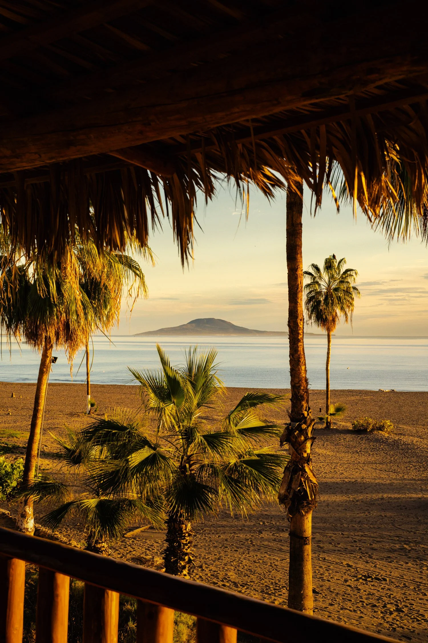
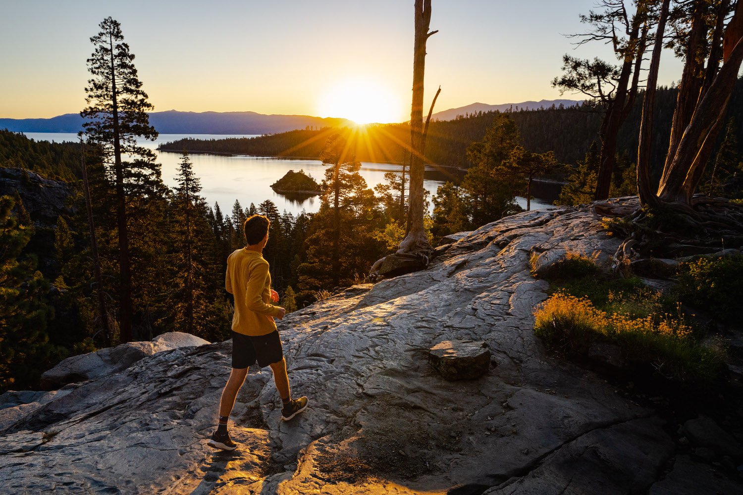
5 Stunning Hikes Along Lake Tahoe's West Shore
If you crave breathtaking scenery, peaceful serenity, and a sense of awe-inspiring adventure, Lake Tahoe's west shore is the place for you. The trails in this region offer a diverse range of landscapes, from towering pine forests to rugged mountain ridges. As you hike along the west shore, you'll witness the crystal-clear waters of Lake Tahoe, explore hidden coves, and discover pristine alpine meadows.
If you crave breathtaking scenery, peaceful serenity, and a sense of awe-inspiring adventure, Lake Tahoe's west shore is the place for you. The trails in this region offer a diverse range of landscapes, from towering pine forests to rugged mountain ridges. As you hike along the west shore, you'll witness the crystal-clear waters of Lake Tahoe, explore hidden coves, and discover pristine alpine meadows.
Whether you're an avid hiker or a casual nature enthusiast, the west shore's trails cater to all skill levels, making it an accessible and rewarding destination for everyone.
Make sure to sit and enjoy the alpine lake views while you hike along the West Shore of Lake Tahoe. Photo by Dalton Johnson
Pros
Breathtaking Scenery: The west shore of Lake Tahoe is known for its stunning panoramic views of the crystal-clear lake and the surrounding Sierra Nevada mountains. The scenery alone makes the hike worth it.
Varied Trail Options: There are numerous hiking trails to choose from, catering to hikers of all skill levels. Whether you're a beginner or an experienced hiker, you can find a trail that suits your preferences.
Opportunities for Water Activities: Hiking along the west shore also provides easy access to the lake, where you can enjoy water activities like swimming, kayaking, or paddleboarding after your hike.
Wildlife and Flora: The area is abundant in diverse wildlife and flora, offering opportunities to observe birds, small animals, and various plant species along the trails.
Seasonal Beauty: The changing seasons bring unique beauty to the region. From lush greenery in the spring and summer to vibrant fall colors, each season offers a different and stunning landscape.
Photography Opportunities: With such magnificent landscapes and scenic vistas, the west shore of Lake Tahoe provides ample photo opportunities for photography enthusiasts.
Proximity to Amenities: The west shore is relatively close to several towns and resorts, providing access to restaurants, accommodations, and other amenities to enhance your hiking experience.
Cons
Crowds: Due to its popularity, hiking trails along Lake Tahoe's west shore can get crowded, especially during peak seasons and weekends. If you prefer solitude, consider hiking on weekdays or exploring lesser-known trails.
Parking Challenges: Limited parking spaces at popular trailheads can be a challenge, particularly during peak times. Arriving early or utilizing shuttle services can help mitigate this issue.
Trail Conditions: Depending on the time of year, some trails may be affected by snow, mud, or fallen debris. Always check trail conditions before heading out and be prepared for changing weather.
Bugs and Wildlife Encounters: During certain seasons, you may encounter bugs or wildlife on the trails. It's essential to be aware of your surroundings and take precautions to avoid any negative encounters.
Trail Maintenance: With heavy foot traffic, some trails may experience wear and tear, leading to uneven paths or deteriorated sections. Always watch your step and be cautious in potentially hazardous areas.
Rubicon Trail:
The Rubicon Trail is an iconic shoreline trail that winds 15 miles along Lake Tahoe's west shore, offering stunning views at every turn. With options for both short and long hikes, you can explore hidden beaches, admire granite cliffs, and take a dip in the inviting waters of the lake.
Trailhead: The Rubicon Trail can be accessed from various points along the west shore of Lake Tahoe, including D.L. Bliss State Park and Emerald Bay State Park.
Distance: The full Rubicon Trail is approximately 15 miles long as a one-way hike, but shorter sections can be hiked as well.
Elevation Gain: The elevation gain can vary depending on the section of the trail you choose, but it's generally moderate.
Time to Hike: The full 15-mile hike could take around 6 to 8 hours to complete.
What You See: The Rubicon Trail offers stunning views of Lake Tahoe's crystal-clear waters, rocky cliffs, and dense forests.
Eagle Falls Trail:
Beginning at Emerald Bay, the Eagle Falls trail takes you on a journey through a picturesque forest, leading you to the breathtaking Eagle Falls. Continue your adventure to Eagle Lake, a tranquil alpine oasis that rewards hikers with mesmerizing views of the surrounding peaks.
Trailhead: The Eagle Falls Trailhead is located near Emerald Bay State Park on the southwest shore of Lake Tahoe.
Distance: The trail is approximately 2.5 miles round trip.
Elevation Gain: It has an elevation gain of around 600 feet.
Time to Hike: The hike usually takes around 1.5 to 2 hours to complete.
What You See: Eagle Falls Trail takes you to Eagle Lake, offering beautiful views of the waterfall and Lake Tahoe from various vantage points.
Paige Meadows Loop:
Perfect for those seeking a peaceful escape, the Paige Meadows loop trail meanders through expansive meadows dotted with wildflowers. As you wander through the serene landscape, soak in panoramic views of Lake Tahoe and the surrounding mountains.
Trailhead: The Paige Meadows Loop can be accessed from several points, with the main trailhead located near the town of Tahoe City.
Distance: The loop is approximately 6 miles long.
Elevation Gain: It has a relatively gentle elevation gain, making it suitable for most hikers.
Time to Hike: The hike usually takes around 2.5 to 3.5 hours, depending on how much time you spend enjoying the meadows.
What You See: Paige Meadows is known for its picturesque alpine meadows, wildflowers, and beautiful views of the surrounding mountains.
Mount Tallac Trail:
For those seeking a more challenging hike, the Mount Tallac Trail is a must. Starting just outside of South Lake Tahoe at 6,500 feet, ascend to the summit of Mount Tallac, standing at 9,735 feet, and be rewarded with awe-inspiring panoramic views of the entire Lake Tahoe basin.
Trailhead: The Mount Tallac Trailhead is located near the southwestern shore of Lake Tahoe, off Highway 89.
Distance: The round-trip hike to the summit and back is approximately 10 miles.
Elevation Gain: The trail gains around 3,200 feet in elevation.
Time to Hike: The hike can take around 6 to 8 hours to complete.
What You See: The Mount Tallac Trail offers breathtaking panoramic views of Lake Tahoe, Desolation Wilderness, and the surrounding Sierra Nevada mountains.
Ellis Peak Trail:
Offering a less crowded experience, the Ellis Peak Trail rewards hikers with sweeping views of the lake and surrounding peaks. This moderate to challenging trail takes you through fragrant forests and opens up to stunning vistas that make the effort well worth it.
Trailhead: The Ellis Peak Trailhead is usually accessed from Barker Pass, located on the western shore of Lake Tahoe.
Distance: The round-trip hike is around 6 to 7 miles long.
Elevation Gain: It has an elevation gain of approximately 1,500 to 1,800 feet.
Time to Hike: The hike typically takes around 3 to 4 hours to complete.
What You See: From the summit of Ellis Peak, hikers can enjoy stunning vistas of Lake Tahoe and the surrounding mountain ranges.
Hiking to watch the sunrise at Eagle Falls along the West Shore of Lake Tahoe. Photo by Dalton Johnson
Hiking along Lake Tahoe's west shore promises an unforgettable experience for nature enthusiasts and adventurers alike. With its awe-inspiring scenery, diverse trails, and proximity to the stunning lake, this destination offers a perfect blend of outdoor exploration and relaxation. While managing crowds and staying prepared for changing weather are essential, the rewards of witnessing the breathtaking beauty of Lake Tahoe and its surrounding landscapes make every step along the west shore well worth the journey. So, lace up your hiking boots, immerse yourself in the natural wonders, and create lasting memories in this picturesque haven of wilderness and tranquility.
Discover more of Lake Tahoe

The Top 10 Hikes in Big Sur Has To Offer
Venturing into the untamed wilderness of Big Sur is akin to embarking on an otherworldly odyssey, where the forces of nature have converged to create a masterpiece of awe-inspiring landscapes. Nestled along California's iconic Highway 1, this rugged stretch of coastline beckons adventurers with its diverse array of hiking trails, weaving a tapestry of enchantment from coastal marvels to majestic redwood realms. Whether it's the rhythmic symphony of crashing waves against rocky cliffs or the whispering secrets of ancient giants in the heart of a redwood forest, Big Sur promises an expedition that stirs the soul and leaves an indelible mark on the intrepid traveler.
Venturing into the untamed wilderness of Big Sur is akin to embarking on an otherworldly odyssey, where the forces of nature have converged to create a masterpiece of awe-inspiring landscapes. Nestled along California's iconic Highway 1, this rugged stretch of coastline beckons adventurers with its diverse array of hiking trails, weaving a tapestry of enchantment from coastal marvels to majestic redwood realms. Whether it's the rhythmic symphony of crashing waves against rocky cliffs or the whispering secrets of ancient giants in the heart of a redwood forest, Big Sur promises an expedition that stirs the soul and leaves an indelible mark on the intrepid traveler.
Discover the magic of Big Sur's hiking trails, where the beauty of coastal vistas intertwines with the grandeur of ancient redwood groves. Explore breathtaking landscapes along California's Highway 1, from iconic landmarks like McWay Falls to hidden gems like Sykes Hot Springs. Immerse yourself in nature's sanctuary, where serenity and splendor converge for an unforgettable hiking experience.
As you step foot onto the verdant trails of Big Sur, the diversity of its landscapes instantly captivates the senses. The rugged coastline beckons, with trails like the McWay Falls Overlook offering an effortless glimpse of nature's artistry as the waterfall cascades onto a pristine beach. For those craving a deeper communion with nature, the Ewoldsen Trail leads into the heart of ancient redwood forests, where towering trees create a cathedral-like atmosphere of wonder. Such diversity of terrain sets the stage for an epic journey, and with every step, Big Sur unveils a new chapter in its enthralling narrative.
That moment you see an otter while hiking in Big Sur. Photo by Dalton Johnson
Pros
Spectacular Scenery: Big Sur boasts breathtaking coastal views, towering redwood forests, cascading waterfalls, and rugged cliffs, providing hikers with a visual feast at every turn.
Diverse Trails: The region offers a wide variety of hiking trails, catering to different fitness levels and interests, from easy coastal strolls to challenging backcountry treks.
Rich Biodiversity: Big Sur is a haven for wildlife, with opportunities to spot various species of birds, marine life, and occasionally, larger mammals like deer and even condors.
Serenity and Solitude: Hiking in Big Sur allows you to immerse yourself in nature, providing a peaceful escape from the hustle and bustle of everyday life.
Iconic Landmarks: Many trails lead to famous landmarks such as McWay Falls, Bixby Bridge, and Pfeiffer Falls, providing opportunities to witness some of California's most iconic natural treasures.
Mild Climate: The coastal climate in Big Sur is generally pleasant year-round, making it possible to hike in most seasons.
Adventure and Exploration: The rugged terrain and diverse landscapes offer a sense of adventure, encouraging hikers to explore hidden gems and lesser-known trails.
Cons
Crowds: Big Sur's popularity means that some of the more famous trails can get crowded, especially during peak tourist seasons, which may impact the serenity of the experience.
Limited Parking: Parking at popular trailheads can be limited, leading to congestion and potentially long wait times to access the trails.
Weather Variability: While the coastal climate is generally mild, weather conditions can change quickly, leading to unexpected rain or fog that may impact visibility and trail conditions.
Trail Closures: Due to wildfires, landslides, or other natural events, some trails may be closed for safety reasons, limiting hiking options during specific times.
Terrain Challenges: Some trails in Big Sur can be quite steep and rugged, requiring a reasonable level of fitness and proper footwear for safe hiking.
Wildlife Encounters: While wildlife sightings can be thrilling, hikers should be cautious and respectful of animals, especially if they encounter larger creatures like bears or mountain lions.
Limited Facilities: The remote nature of Big Sur means that facilities such as restrooms, drinking water, and cell phone reception may be scarce on some trails.
McWay Falls Overlook Trail:
Nestled within the enchanting Julia Pfeiffer Burns State Park, the McWay Falls Overlook Trail beckons adventurers with its effortless charm and captivating beauty. A mere half-mile round trip unveils the splendid spectacle of McWay Falls, gracefully plunging 80 feet into the azure embrace of a pristine cove. Gaze in awe at the ethereal Bixby Creek Bridge gracefully arching in the distance. This easily accessible hike is a quick immersion into the quintessential Big Sur coastal magic, leaving you spellbound by nature's artistic prowess.
Trailhead: McWay Falls Trailhead, Julia Pfeiffer Burns State Park.
Length: 0.6 miles (round trip).
Elevation Gain: Minimal (mostly flat).
Time to Hike: Approximately 30 minutes.
3 Things You Can See:
McWay Falls cascading onto the sandy beach
the turquoise waters of the cove
the iconic Bixby Creek Bridge in the distance
Ewoldsen Trail:
Embrace the allure of ancient redwood groves and sweeping coastal panoramas on the Ewoldsen Trail, a true gem of Julia Pfeiffer Burns State Park. Wandering through lush forests and ascending to majestic heights, this 4.5-mile loop presents hikers with a multifaceted journey of natural wonder. Admire the colossal redwood sentinels standing tall for centuries and relish breathtaking views of the Pacific Ocean, a dazzling canvas of cerulean hues. A moderate undertaking rewards the intrepid with nature's sublime symphony, harmonizing the grandeur of the forest with the song of the sea.
Trailhead: Ewoldsen Trailhead, Julia Pfeiffer Burns State Park.
Length: 4.5 miles (loop).
Elevation Gain: About 1,300 feet.
Time to Hike: Around 2.5 to 3 hours.
3 Things You Can See:
Towering redwood trees
Coastal vistas with breathtaking ocean views
Glimpses of McWay Falls from a distance
Partington Cove Trail:
A hidden treasure awaiting discovery within Julia Pfeiffer Burns State Park, the Partington Cove Trail offers a brief yet captivating glimpse into California's coastal history and scenic splendor. Venture through a historic tunnel leading to a secluded cove, where rugged cliffs embrace the vast expanse of the Pacific. In a mere mile, this trail unveils fascinating remnants of the past, complemented by awe-inspiring vistas of the untamed sea. Let the whispers of a bygone era and the majesty of the coastline leave an indelible impression on your soul.
Trailhead: Partington Cove Trailhead, Julia Pfeiffer Burns State Park.
Length: 1 mile (round trip).
Elevation Gain: Approximately 100 feet.
Time to Hike: About 45 minutes.
3 Things You Can See:
Historic tunnel leading to Partington Cove
The dramatic coastal cliffs
Views of the sparkling Pacific Ocean
Pfeiffer Falls and Valley View Trail:
Embark on an enchanting sojourn through the heart of Pfeiffer Big Sur State Park on the Pfeiffer Falls and Valley View Trail. A 2.4-mile loop promises a captivating fusion of verdant landscapes and serene river views, allowing travelers to embrace the essence of Big Sur's diverse ecosystem. Behold the grandeur of ancient redwoods, their towering embrace guiding you to the picturesque Pfeiffer Falls, where glistening waters cascade into a tranquil pool. Ascend to the Valley Viewpoint, where the Big Sur River meanders through the lush valley, inviting a moment of serene contemplation amidst nature's symphony.
Trailhead: Pfeiffer Big Sur State Park - Lodgepole Picnic Area.
Length: 2.4 miles (loop).
Elevation Gain: Around 500 feet.
Time to Hike: Approximately 1.5 hours.
3 Things You Can See:
Towering redwoods
The picturesque Pfeiffer Falls
Panoramic views of the Big Sur River Valley
Tanbark Trail to Tin House:
Venture into the untamed beauty of Andrew Molera State Park on the Tanbark Trail to Tin House, a captivating journey for the intrepid explorer. Amidst sprawling coastal meadows, this 5.2-mile out-and-back hike unveils awe-inspiring views of the Pacific Ocean and beckons adventurers to discover a hidden historical gem – the Tin House. Perched on the rugged bluffs, this rustic structure once witnessed the toils of pioneers, and now, it affords a breathtaking vantage point over the vast expanse of the sea. This challenging yet rewarding trail offers an evocative blend of nature and history, creating an unforgettable Big Sur experience.
Trailhead: Andrew Molera State Park - Creamery Meadow.
Length: 5.2 miles (out and back).
Elevation Gain: Approximately 1,300 feet.
Time to Hike: About 3 to 4 hours.
3 Things You Can See:
Coastal meadows and bluffs
The historic Tin House with stunning ocean vistas
Possible wildlife sightings
Sykes Hot Springs Trail:
Venture deep into the untamed wilderness of the Ventana Wilderness on the Sykes Hot Springs Trail, an immersive journey that rewards the intrepid with soothing hot springs amid nature's pristine embrace. Embarking from Big Sur Station, this 10-mile out-and-back hike follows the melodious melody of the Big Sur River, leading to the therapeutic allure of the hot springs. Enveloped by ancient redwoods and serene vistas, the journey tests the mettle of explorers before granting rejuvenating respite in the rejuvenating waters. Surrender to the embrace of the wilderness and let the enchantment of Sykes Hot Springs revive your senses.
Trailhead: Big Sur Station (Ventana Wilderness).
Length: 10 miles (out and back).
Elevation Gain: About 1,000 feet.
Time to Hike: Full-day hike, approximately 6 to 8 hours.
3 Things You Can See:
Majestic redwoods
The picturesque Big Sur River
The soothing natural hot springs
Limekiln State Park Falls Trail:
Delight in the timeless charm of Limekiln State Park on the Falls Trail, a 1.7-mile out-and-back hike through majestic redwood groves to a captivating waterfall. Wander beneath towering trees, accompanied by the soft murmur of Limekiln Creek, as it meanders through the heart of this coastal paradise. Behold the breathtaking sight of Limekiln Falls, a 100-foot cascade gracefully flowing into a rocky pool. With nature's grandeur and the park's historic lime kilns as your companions, this hike weaves an enchanting tapestry of beauty and heritage.
Trailhead: Limekiln State Park - Day Use Area.
Length: 1.7 miles (out and back).
Elevation Gain: Around 250 feet.
Time to Hike: About 1 to 1.5 hours.
3 Things You Can See:
Limekiln Creek flowing through redwood groves
Limekiln Falls
The rugged coastal landscape
Salmon Creek Falls Trail:
Immerse yourself in the rugged allure of the Los Padres National Forest on the Salmon Creek Falls Trail, a 2.5-mile out-and-back journey to a captivating waterfall nestled amidst lush canyons. Setting off from the Salmon Creek Trailhead, this hike offers a moderate adventure through diverse flora, enhancing the journey's charm. Arriving at Salmon Creek Falls, let the rhythmic symphony of water tumbling down the rocks transport you to a serene sanctuary amidst the wilderness. An expedition for nature enthusiasts, this trail promises to leave you mesmerized by its untamed beauty.
Trailhead: Salmon Creek Trailhead, Los Padres National Forest.
Length: 2.5 miles (out and back).
Elevation Gain: Approximately 500 feet.
Time to Hike: Around 1.5 to 2 hours.
3 Things You Can See:
Salmon Creek Falls
Lush canyons with diverse flora
Potential wildlife encounters.
Andrew Molera Loop Trail:
Unveil the multifaceted beauty of Andrew Molera State Park on the Andrew Molera Loop Trail, a 5.2-mile trek that celebrates the coastal splendor and serenity of the Big Sur River. Wander along coastal bluffs adorned with coastal flora and catch glimpses of the boundless ocean's turquoise expanse. Crossing the Big Sur River, the trail offers serene riverside moments before looping back through the meadows. Be serenaded by the soft rustle of grasses and the soothing sound of the river, creating a symphony of tranquility in this nature-lover's haven.
Trailhead: Andrew Molera State Park - Parking Lot.
Length: 5.2 miles (loop).
Elevation Gain: About 200 feet.
Time to Hike: Approximately 2 to 2.5 hours.
3 Things You Can See:
Coastal bluffs with ocean vistas
Big Sur River
Diverse birdlife
Cone Peak Trail:
Ascend to the summit of the majestic Cone Peak, the crowned jewel of the Silver Peak Wilderness and the highest coastal mountain in the contiguous United States. This 5.5-mile out-and-back trek is a challenging yet invigorating endeavor that leads intrepid hikers through diverse terrain, from shaded forests to sun-kissed ridges. Reaching the pinnacle rewards the endeavor with breathtaking panoramic views, showcasing the rugged coastline, Santa Lucia Mountains, and an expansive stretch of the Pacific Ocean. For those seeking an unforgettable adventure, the Cone Peak Trail stands as a testament to Big Sur's untamed allure.
Trailhead: Cone Peak Trailhead, Los Padres National Forest.
Length: 5.5 miles (out and back).
Elevation Gain: Around 1,550 feet.
Time to Hike: Full-day hike, approximately 6 to 8 hours.
3 Things You Can See:
Panoramic views of the rugged coastline and Pacific Ocean
Santa Lucia Mountains
Unique flora and fauna along the trail
Passing through the tunnel headed to a secret cove you can only hike to in Big Sur. Photo by Dalton Johnson
As our trailblazing adventure through the captivating landscapes of Big Sur draws to a close, we are left with an overwhelming sense of wonder and connection to the natural world. From the ethereal coastal vistas that beckon us to the edge of infinity to the ancient redwood realms that stand as timeless sentinels, each step has been a revelation of beauty and grace. Big Sur, with its diverse tapestry of trails and untamed wilderness, has reminded us of the magic that lies within the embrace of nature.
As we bid farewell to this enchanting corner of California, let us carry the memories of our journey, the echoes of crashing waves, the whispers of the wind through redwood boughs, and the sense of peace that can only be found in the wilderness. May the spirit of Big Sur continue to inspire us to seek out new horizons, to tread lightly on this wondrous Earth, and to cherish the sanctuaries of nature that offer solace and serenity. Until we meet again on the trails of another untamed paradise, may the memory of Big Sur's beauty be etched forever in our hearts, calling us back to the wild, where the soul finds its true home.
Discover more of Big SUr

Backpacking the North Lake to South Lake Loop in the High Sierra
The High Sierra, a majestic mountain range stretching along the eastern border of California, is a backpacker's paradise. Its rugged terrain, glacial lakes, and breathtaking vistas beckon adventure enthusiasts from all over the world. Among the many iconic trails in the region, the North Lake to South Lake Loop stands out as a challenging yet rewarding journey that showcases the best of the Sierra Nevada.
The High Sierra, a majestic mountain range stretching along the eastern border of California, is a backpacker's paradise. Its rugged terrain, glacial lakes, and breathtaking vistas beckon adventure enthusiasts from all over the world. Among the many iconic trails in the region, the North Lake to South Lake Loop stands out as a challenging yet rewarding journey that showcases the best of the Sierra Nevada.
Backpacking the North Lake to South Lake Loop offers a breathtaking wilderness adventure through the stunning High Sierra landscape. This iconic trail promises awe-inspiring vistas, glacial lakes, and a sense of accomplishment, making it a must-do journey for outdoor enthusiasts seeking an unforgettable experience in nature.
In this blog, we'll embark on a virtual expedition through this extraordinary wilderness experience, discovering the natural wonders and unforgettable moments that await those who dare to venture into the heart of the High Sierra.
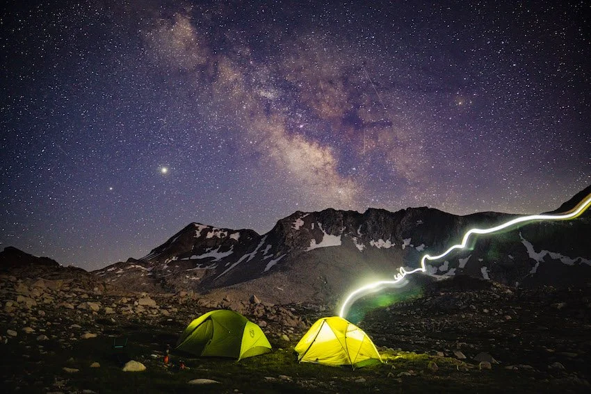
A starry night in the Eastern Sierra while backpacking the North to South Lake Loop. Photo by Dalton Johnson
Pros
Breathtaking Scenery: The High Sierra landscape offers unparalleled beauty, including majestic granite peaks, crystal-clear alpine lakes, and lush meadows adorned with wildflowers, making every step a feast for the eyes.
Iconic High Sierra Experience: The trail takes you through some of the most iconic locations in the Sierra Nevada, such as Dusy Basin, Muir Pass, and Evolution Basin, providing an opportunity to immerse yourself in the rich natural history of the region.
Wilderness Escape: Backpacking this loop allows you to disconnect from the hustle and bustle of everyday life and immerse yourself in the tranquility of the wilderness. It offers a chance to find solitude and serenity amidst the vastness of the High Sierra.
Challenging Adventure: The North Lake to South Lake Loop is a physically demanding trek, presenting a challenge that hikers crave. Conquering high mountain passes and steep ascents provides a sense of accomplishment and personal growth.
Wildlife Encounters: The High Sierra is home to diverse wildlife, including marmots, deer, golden eagles, and even the elusive black bear. Backpackers may have the opportunity to observe these creatures in their natural habitats.
Cons
Physical Demands: The trail's steep ascents and descents, combined with high elevations, can be physically demanding and challenging, especially for those who are not acclimated to higher altitudes.
Weather Variability: The High Sierra weather can be unpredictable, even during the summer months. Backpackers must be prepared for sudden changes in conditions, including thunderstorms, rain, or even snow at higher elevations.
Permits and Regulations: Backpacking in the High Sierra typically requires obtaining wilderness permits, which can be limited in availability during peak seasons. Additionally, visitors must adhere to Leave No Trace principles and follow specific wilderness regulations to protect the fragile ecosystem.
Remote and No Cell Reception: Parts of the trail are remote, and hikers should be prepared for limited or no cell phone reception. This lack of communication can be both a pro and a con, as it enhances the wilderness experience but also requires extra precaution and self-reliance.
Physical Preparedness: The North Lake to South Lake Loop is not recommended for beginners or those with little backpacking experience. Proper physical conditioning and hiking skills are necessary to ensure a safe and enjoyable journey.
Overview of the North Lake to South Lake Loop:
Distance: The North Lake to South Lake Loop is approximately 50 miles long, making it a moderate to strenuous multi-day backpacking trip.
Elevation Gain: The trail involves a total elevation gain of around 8,000 to 9,000 feet, with several steep ascents and descents as it traverses various high mountain passes.
Starting Trailhead: The journey begins at North Lake, a picturesque alpine lake located at an elevation of roughly 9,350 feet. The trailhead can be accessed from the town of Bishop in the Eastern Sierra region of California.
Ending Trailhead: The loop concludes at South Lake, another stunning alpine lake situated at approximately 9,760 feet. South Lake is also accessible from Bishop, creating a looped route.
Days Needed: Completing the North Lake to South Lake Loop typically requires 4 to 7 days, depending on individual hiking
The Starting Point: North Lake
The journey begins at North Lake, a serene alpine gem situated at an elevation of approximately 9,350 feet. To reach this starting point, you may have driven along winding mountain roads, surrounded by pine forests and glimpses of the rugged peaks that lie ahead. As you lace up your hiking boots and hoist your backpack, excitement and anticipation course through your veins.
The Ascent: Bishop Pass Trail
The first leg of the journey takes you along the Bishop Pass Trail, a steady climb that showcases breathtaking views of the surrounding valleys and distant peaks. The trail winds through lush meadows adorned with vibrant wildflowers, adding splashes of color to the otherwise muted landscape. As you gain elevation, the air becomes crisp, and you'll feel the immensity of the Sierra Nevada enveloping you.
Dusy Basin: A High Sierra Gem
Upon reaching the high-altitude Dusy Basin, you'll be greeted by a stunning alpine landscape unlike any other. Towering granite peaks, glacial-carved cirques, and mirror-like lakes form a dramatic backdrop that seems straight out of a postcard. This is the perfect place to pitch your tent, allowing you to witness the sunset and sunrise painting the mountains with a warm glow.
Crossroads: PCT Junction
Continuing on the trail, you'll encounter the junction with the Pacific Crest Trail (PCT). This intersection marks a crucial moment, where you'll meet thru-hikers and fellow adventurers sharing tales of their journeys along the iconic long-distance trail. Take a moment to reflect on the camaraderie of the trail and the interconnectedness of the wilderness community.


The Challenge: Muir Pass
As you venture deeper into the wilderness, the ascent to Muir Pass awaits—a challenging but awe-inspiring section of the hike. Ascending to an elevation of over 11,970 feet, you'll cross the fabled Muir Hut, a historic stone shelter named after renowned naturalist John Muir. The view from the pass reveals a landscape of glaciers, jagged peaks, and alpine lakes, making the arduous climb well worth the effort.
Evolution Basin: Where Time Stands Still
Descending from Muir Pass, the trail leads to the enchanting Evolution Basin. This section of the loop showcases an ecological wonderland, where lush meadows meet towering granite cliffs. The Evolution Creek meanders through the basin, and the sight of its crystal-clear waters flowing with force is a testament to the relentless power of nature.
Descending to South Lake
As the journey nears its conclusion, the trail takes you through scenic alpine forests, tracing the path of South Fork Bishop Creek. The sound of rushing water becomes a constant companion, providing a soothing soundtrack to your trek. Descending to South Lake, you'll encounter picturesque vistas of the glaciated Palisades, a fitting finale to this epic adventure.
Diving into a brisk lake with the Evolution Range in the background while hiking the North to South Lake Loop. Photo by Dalton Johnson
Backpacking the North Lake to South Lake Loop in the High Sierra is a journey of a lifetime. Immersed in the untamed beauty of the wilderness, you'll discover an unbreakable bond with nature and an appreciation for the vastness of the High Sierra. As you bid farewell to the mountains and return to civilization, you'll carry with you cherished memories, a sense of accomplishment, and a newfound respect for the wild places that define our planet.
So, if you're seeking a transformative wilderness adventure, lace up your hiking boots and embark on the unforgettable journey through the North Lake to South Lake Loop in the High Sierra. Your soul will thank you for it. Happy backpacking!
Discover more of Eastern Sierra

Kayak, Fish, and Unwind: Discover Tranquility at Sabrina Lake
Welcome to the pristine haven of Sabrina Lake, where adventure meets serenity and nature beckons you to unwind. Nestled in the heart of the majestic Eastern Sierra Nevada, this stunning alpine lake offers a retreat for outdoor enthusiasts seeking a blend of exhilarating activities and unparalleled tranquility.
Welcome to the pristine haven of Sabrina Lake, where adventure meets serenity and nature beckons you to unwind. Nestled in the heart of the majestic Eastern Sierra Nevada, this stunning alpine lake offers a retreat for outdoor enthusiasts seeking a blend of exhilarating activities and unparalleled tranquility.
Visit Lake Sabrina to immerse yourself in the serenity of the Eastern Sierra Nevada, where kayaking amidst glacial waters and fishing for abundant trout promise unforgettable outdoor experiences. Also, reconnect with nature's beauty, unwind by the shore, and create lasting memories in this unspoiled gem.
Read on to learn about all that Lake Sabrina has to offer.
Jumping into the chilly waters of Lake Sabrina on a warm summer day. Photo by Dalton Johnson
Pros
Breathtaking Scenery: Lake Sabrina's stunning alpine setting, surrounded by majestic peaks and pristine forests, offers a picturesque backdrop for outdoor enthusiasts and nature lovers.
Kayaking and Fishing Paradise: With calm waters ideal for kayaking and a thriving trout population, the lake provides an excellent opportunity for both kayaking adventures and fishing escapades.
Tranquil Retreat: Escape the hustle and bustle of city life and immerse yourself in the peaceful ambiance of Sabrina Lake. Enjoy quiet moments by the shore, stargazing under the night sky, and the calming sounds of nature.
Hiking Opportunities: The surrounding Eastern Sierra region boasts numerous hiking trails of varying difficulties, allowing visitors to explore the breathtaking wilderness and discover hidden gems.
Campground Experience: Camping near the lake allows you to experience the full wonder of the wilderness, with campfire gatherings and the chance to bond with fellow nature enthusiasts.
Cons
Seasonal Limitations: Access to Lake Sabrina may be limited during winter due to snowfall, and some facilities may be closed during the off-season.
Altitude and Weather: The high elevation of the lake (around 9,000 feet) can be challenging for those not acclimated to such altitudes. Additionally, weather conditions can change rapidly, so visitors must come prepared for potential temperature fluctuations.
Limited Amenities: While Lake Sabrina offers a genuine wilderness experience, the lack of modern amenities and services nearby may be a drawback for some travelers seeking more convenience.
Fishing Regulations: Visitors planning to fish in the lake must ensure they have a valid California fishing license and comply with fishing regulations, which may be restrictive for some anglers.
Crowds During Peak Season: As a popular destination, Lake Sabrina can attract a significant number of visitors during peak season, potentially impacting the sense of seclusion and tranquility.
Kayaking Amidst Nature's Masterpiece
Embark on a kayaking adventure like no other, as Sabrina Lake unveils its awe-inspiring splendor. The glacial waters, crystal clear and shimmering under the sun's embrace, invite you to paddle along its shoreline and explore hidden coves. Glide over the mirror-like surface, embraced by the majestic peaks that encircle the lake, creating an enchanting amphitheater of natural beauty.
Whether you are an experienced kayaker or a novice seeking a peaceful paddle, Sabrina Lake offers something for everyone. The calm waters close to the shore provide a perfect learning ground for beginners, while the more adventurous can venture further, discovering secluded spots and breathtaking vistas.
The Ultimate Fishing Paradise
For anglers, Sabrina Lake is nothing short of a dream destination. As you cast your line, the lake's abundant trout population beckons with the promise of a rewarding catch. Rainbow, brown, and brook trout thrive in these pristine waters, making it an ideal spot for both novice and seasoned fishermen.
Picture yourself sitting on the edge of the boat, the reflection of snow-capped peaks dancing on the water's surface. The gentle breeze carries the scent of pine, and your fishing rod trembles with anticipation. Time seems to slow down as you connect with nature, becoming one with the tranquil environment.


Reconnect with Nature's Rhythms
Beyond the adrenaline-fueled activities, Sabrina Lake invites you to embrace the art of relaxation. As the sun dips below the horizon, paint the sky with hues of crimson and gold, signaling the arrival of the magical twilight hour. Sit by the shore, marvel at the changing colors, and let the stress of the modern world melt away.
Campfire tales under the starlit canopy are a cherished tradition here. Share stories with fellow adventurers, old and new, as the crackling fire warms your soul and the distant calls of nocturnal wildlife serenade you.
Adventures Big and Small from Lake Sabrina:
Popular Day Hikes: Explore the breathtaking Eastern Sierra scenery by embarking on some popular day hikes from Lake Sabrina. The Bishop Pass Trail, which starts near the lake, leads you through alpine meadows and past pristine lakes, culminating in a stunning view of the surrounding peaks. For a shorter hike with rewarding vistas, the Chocolate Lakes Trail offers a delightful experience that's perfect for families and casual hikers.
Mountains to Climb: For the adventurous mountaineers, Lake Sabrina acts as a gateway to conquering some notable peaks in the Sierra Nevada. Mount Darwin and Mount Powell, both towering over 13,000 feet, present challenging yet exhilarating climbs for experienced mountaineers seeking to test their skills and endurance.
Rock Climbing: Lake Sabrina's rugged terrain also offers opportunities for rock climbing enthusiasts. The nearby Cardinal Pinnacle and the Clyde Minaret, known for their striking granite faces, beckon climbers to test their abilities in this stunning alpine environment.
Skiing and Snowboarding: During the winter months, when snow blankets the landscape, Lake Sabrina transforms into a wonderland for skiing and snowboarding aficionados. Nearby ski resorts like Mammoth Mountain and June Mountain provide world-class slopes for all skill levels, ensuring a thrilling snow-filled adventure.
Exploring Other Lakes: Lake Sabrina is part of the High Sierra Lake Loop, making it an excellent starting point to explore other nearby lakes. Take a scenic drive to South Lake, where you can embark on a picturesque hike to Long Lake or treasure some quiet moments by Bishop Lake.
Backpacking Ideas: For backpacking enthusiasts seeking a multi-day adventure, Lake Sabrina serves as a gateway to various wilderness areas. Plan an extended backpacking trip along the John Muir Trail, which takes you through some of the Sierra's most iconic landscapes, including Kings Canyon and Sequoia National Parks. Alternatively, the North Lake to South Lake Loop offers a challenging yet rewarding trek through rugged wilderness, passing by several pristine alpine lakes.
Practical Tips for Your Journey
Season and Weather: Sabrina Lake's peak season runs from late spring through early fall, when the weather is milder and access is more reliable. Keep in mind that temperatures can drop significantly at night, even during summer, so pack accordingly.
Accommodation: Camping grounds around the lake offer a true wilderness experience. Alternatively, nearby Bishop town provides a range of accommodation options for those seeking modern comforts.
Fishing Licenses: Ensure you have a valid California fishing license before casting your line into the lake's sparkling waters.
Leave No Trace: Embrace responsible outdoor practices. Respect the environment and wildlife, and leave no trace of your presence.
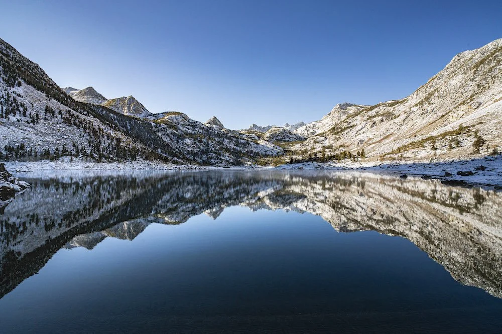
A perfect reflection of the Evolution Range on Lake Sabrina. Photo by Dalton Johnson
Sabrina Lake remains an unspoiled gem nestled within the Eastern Sierra Nevada. Whether you seek exhilarating adventures, peaceful communion with nature, or a chance to reel in the catch of a lifetime, this magical destination promises an unforgettable experience. So, pack your bags, prepare your fishing gear, and embark on a journey to reconnect with nature's rhythm at Sabrina Lake.
Discover more of Eastern Sierra
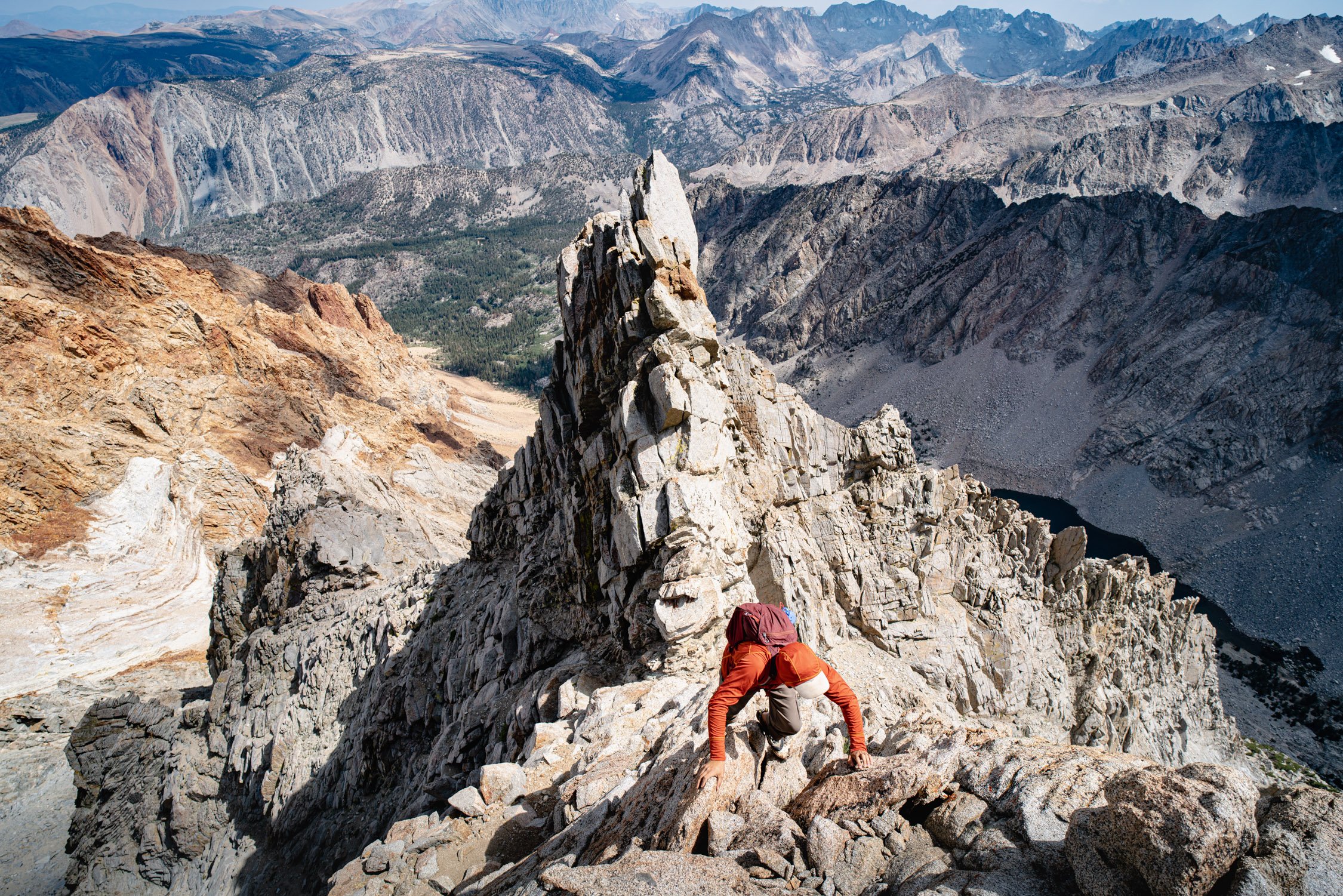
Finding Serenity on the Ridgeline: A Journey up Mount Emerson
When it comes to the High Sierra, adventurers often gravitate towards the more famous peaks like Mount Whitney or Half Dome. However, hidden amidst the rugged beauty of this vast mountain range lies a gem that demands attention: Mount Emerson. Rising majestically to an elevation of 13,204 feet, this formidable peak offers a thrilling challenge for climbers seeking a less-trodden path and a unique connection with the wilderness.
When it comes to the High Sierra, adventurers often gravitate towards the more famous peaks like Mount Whitney or Half Dome. However, hidden amidst the rugged beauty of this vast mountain range lies a gem that demands attention: Mount Emerson. Rising majestically to an elevation of 13,204 feet, this formidable peak offers a thrilling challenge for climbers seeking a less-trodden path and a unique connection with the wilderness.
Climbing Mount Emerson in the High Sierra offers a captivating adventure through the pristine wilderness, where the beauty of the Eastern Sierra's granite peaks awaits. The rugged ridgeline and untouched splendor provide climbers with a unique and awe-inspiring experience, making it an unforgettable journey for those seeking a genuine connection with nature.
Join me as we embark on an unforgettable journey to summit Mount Emerson.
Scott traversing the final ridgeline of Mount Emerson. Photo by Dalton Johnson
Pros
Scenic Beauty: As you ascend Mount Emerson, you'll be treated to breathtaking vistas of the High Sierra's rugged landscapes, alpine lakes, and sprawling valleys, offering a visual feast for nature enthusiasts.
Less Crowded: Compared to more popular peaks in the region, Mount Emerson sees fewer climbers, providing a serene and solitary experience in the wilderness, away from the bustling crowds.
A True Wilderness Challenge: Climbing Mount Emerson demands advanced mountaineering skills and route-finding abilities, making it an ideal expedition for seasoned adventurers seeking a challenging and authentic backcountry experience.
Unique Connection with Nature: The unmarked trails and untamed terrain on Mount Emerson allow you to forge a deeper connection with nature, fostering a sense of appreciation and respect for the wilderness.
Panoramic Summit Views: Reaching the summit rewards climbers with panoramic views of the Eastern Sierra's granite peaks, offering a profound sense of accomplishment and an opportunity for stunning landscape photography.
Cons
Technical Difficulty: Mount Emerson's ascent involves navigating challenging rock faces, steep slopes, and exposed ridgelines, requiring climbers to possess adequate mountaineering experience and gear. Be prepared for some low 5th class and a lot of 4th class.
Route Finding Challenges: The lack of marked trails can make route finding on Mount Emerson difficult, especially for those without prior experience in alpine navigation.
Weather Uncertainties: Like any high-altitude endeavor, the weather on Mount Emerson can be unpredictable and rapidly change, presenting potential hazards and safety concerns.
Remote Location: Situated deep within the John Muir Wilderness, Mount Emerson's remote location can make access more time-consuming and may require multi-day trips.
Physical and Mental Demands: Climbing Mount Emerson is a physically demanding undertaking that necessitates endurance, stamina, and mental resilience to tackle the rugged terrain and elevation gain.
A Wilderness Calling
While some locals boast “Mount Emerson is a great after work jaunt” don’t be fooled. Mount Emerson will take a full day for those who are competent in the mountains. Additionally, for those who yearn for a genuine backcountry experience, Mount Emerson's allure is undeniable. The mountain, named after renowned American writer and philosopher Ralph Waldo Emerson, beckons adventurers with its raw, untouched beauty. Located in the heart of the John Muir Wilderness, the approach to the peak offers a splendid opportunity to immerse oneself in the High Sierra's untamed wilderness.
Preparation: The Path Less Traveled
Unlike the well-beaten trails leading to other popular peaks in the region, summiting Mount Emerson requires a higher level of mountaineering prowess. As an aspirant, be prepared to trade the comfort of established paths for the excitement of navigating unmarked terrain. Serious mountaineering skills, comfort on low-5th class, and climbing gear are essential, as you'll be facing scree fields, easy chimney’s, and a exposed ridgeline.
Climbers should acquaint themselves with the basic principles of alpine climbing and ensure they have proper training and safety equipment. Ropes, harnesses, helmets, and trad-gear should be part of your essential checklist. While some individuals freesolo this route, many rescues occur every year because people get in over their heads, especially on the descent. A clear understanding of route-finding and navigation is crucial, as the path to Mount Emerson is neither straightforward nor well-defined.
The Ascent: Where Adventure Meets Serenity
As the dawn breaks and the alpenglow kisses the Sierra's granite spires, the ascent of Mount Emerson begins. Setting off from the North Lake trailhead, you'll gradually leave the comforts of civilization behind as you venture deeper into the wilderness. This summit outing isn't for the faint-hearted, as you'll need to muster both physical endurance and mental fortitude.
Following the trail, you'll begin to gain elevation steadily, while in the trees. At this time you can’t see the route, nor the mountain, but it is there, waiting for you. As you depart treeline, you’ll notice the dark streak on a mountain to the east. This is your start. From time to time, there is a climbers trail off the end of a switchback, but don’t rely on that. Point your nose towards the streak and begin scrambling over loose tallus. From here, the climb begins.
Vertical Symphony: The Climbing Challenge
Once your reach the base of the dark streak, you’re ready to being. Good and bad news; the start is the crux. From the base, the chimney you are staring up at doesn’t look inviting, but the holds are there, just look around. If you are soloing with several people, make sure to go one at a time up this section.
As your climb continues, the surrounding landscape becomes more evident. The High Sierra's grandeur comes alive as you gaze across the vast wilderness from ever-increasing heights. Mount Emerson’s blend of jagged cliffs and rugged rock faces, keeps you on your toes, demanding respect and focus, but, it’s all 4th class from here. If you chose the easiest way.
I wish I could give you more detailed directions from here, but the honesty is that you just keep going up. Every year these slopes change, so there is no prescription besides go up. Be safe and make good decisions as you climb. If the terrain feels harder than 4th class, look around, there will be an easier route, somewhere.
Summit Triumph: A Reward Beyond Words
After hours of toil and determination, you'll finally reach the crown jewel—the summit ridgeline of Mount Emerson. This knife-edge ridge made me smile as I walked across the top. I couldn’t help myself. The views are incredible and it just feels wrong that you are there. But, we are curious monkeys just climbing to the top to see what is there.
At the summit, the panorama from the top is breathtaking, a visual symphony of alpine lakes, sprawling valleys, and the distant peaks of the High Sierra. With each breath, you feel a profound connection to the world around you, realizing that this is nature at its most powerful and humbling state.
Leave No Trace: Preserving the Wilderness
As seasoned outdoor enthusiasts, it's imperative that we acknowledge our responsibility to preserve the wilderness for future generations. The John Muir Wilderness and Mount Emerson deserve our utmost respect and care. Let's follow the Leave No Trace principles diligently, ensuring that our journey leaves minimal impact on this pristine environment.
Climbing 4th class on Mount Emerson. Photo by Dalton Johnson
Conquering Mount Emerson is a rite of passage for those who seek an unparalleled adventure away from the beaten path. This hidden gem in the High Sierra rewards those with the courage to venture into the unknown, offering a deep connection with nature and the satisfaction of overcoming formidable challenges. Remember, climbing Mount Emerson isn't just about reaching the summit; it's about embracing the journey, immersing yourself in the wilderness, and finding your place among the giants of the High Sierra.
So, are you ready to rise to the occasion and embrace the extraordinary? Pack your gear, gather your courage, and let Mount Emerson show you the way to an unforgettable experience in the heart of the High Sierra.