
Your Guide To Successful Peak Bagging
Welcome to the world of peak bagging! If you have a passion for adventure, breathtaking views, and the thrill of conquering new heights, peak bagging is the perfect pursuit for you. Whether you're an avid hiker, a seasoned mountaineer, or simply someone seeking a new challenge, peak bagging offers a unique and rewarding experience. From the rugged peaks of the Himalayas to the stunning ranges of California, there are countless mountains waiting to be conquered.
Welcome to the world of peak bagging! If you have a passion for adventure, breathtaking views, and the thrill of conquering new heights, peak bagging is the perfect pursuit for you. Whether you're an avid hiker, a seasoned mountaineer, or simply someone seeking a new challenge, peak bagging offers a unique and rewarding experience. From the rugged peaks of the Himalayas to the stunning ranges of California, there are countless mountains waiting to be conquered.
Peak bagging is the pursuit of summiting multiple peaks or mountains within a specific region or timeframe. It involves setting goals and challenges to reach the summits of various mountains, often guided by predefined lists. Popular among outdoor enthusiasts, peak bagging requires physical fitness, navigation skills, and careful planning to conquer these majestic summits.
In this guide, we'll explore what peak bagging is, popular mountains for this activity, training tips to prepare yourself physically and mentally, as well as the essential gear you'll need for a successful and safe journey. So, lace up your boots, strap on your backpack, and get ready to embark on a thrilling adventure of peak bagging. The mountains are calling, and it's time to answer.
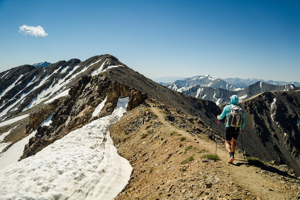
Ridgeline movement while seeking out a summit near Bishop, CA. Photo by Dalton Johnson
What is Peak Bagging?
Peak bagging refers to the activity of summiting or climbing multiple peaks or mountains within a specific region or during a particular period. It typically involves setting a goal to reach the summits of a predefined list of peaks, either within a geographical area or a specific mountain range.
Peak bagging is popular among outdoor enthusiasts, hikers, mountaineers, and climbers who enjoy the challenge and adventure of reaching the summits of various peaks. The activity often involves navigating diverse terrains, including hiking trails, rocky slopes, glaciers, and sometimes even technical climbing routes.
The motivation behind peak bagging can vary from personal achievement and exploration of new areas to pursuing a particular challenge or completing a predefined list of peaks. Some regions or mountain ranges have established peak-bagging lists, such as the Adirondack High Peaks in New York, the Colorado Fourteeners (mountains exceeding 14,000 feet) in the United States, or the Munros in Scotland (mountains over 3,000 feet).
Peak bagging can be a long-term goal, with individuals aiming to summit all the peaks on a specific list over months or even years. It requires physical fitness, navigation skills, appropriate gear, and careful planning, taking into account factors like weather conditions, seasonality, and difficulty levels of the peaks.
While peak bagging can be a fulfilling and rewarding pursuit, it's crucial to prioritize safety and adhere to ethical practices, including Leave No Trace principles and respecting local regulations and restrictions. It's also advisable to acquire the necessary skills, experience, and equipment or consider joining guided trips or expeditions if you're new to mountaineering or unfamiliar with the area you plan to explore.
Making a summit push on Mount Shasta when the weather is good. Photo by Dalton Johnson
Popular mountains for Peak bagging
There are numerous mountains around the world that are popular for peak bagging. Here are a few notable examples:
Himalayas:
Mount Everest (8,848 meters) in Nepal/Tibet.
K2 (8,611 meters) in Pakistan/China.
Kangchenjunga (8,586 meters) in Nepal/India.
Seven Summits:
Aconcagua (6,960 meters) in Argentina, the highest peak in South America.
Mount Kilimanjaro (5,895 meters) in Tanzania, the highest peak in Africa.
Mount Elbrus (5,642 meters) in Russia, the highest peak in Europe.
Denali/Mount McKinley (6,190 meters) in Alaska, the highest peak in North America.
Mount Vinson (4,892 meters) in Antarctica.
Mount Kosciuszko (2,228 meters) in Australia, or Carstensz Pyramid (4,884 meters) in Indonesia/Oceania (depending on the list).
Colorado, USA:
Colorado Fourteeners: A collection of 58 peaks in Colorado exceeding 14,000 feet (4,267 meters) in elevation. Some popular ones include Longs Peak, Pikes Peak, and Mount Bierstadt.
Adirondack Mountains, USA:
Adirondack High Peaks: A group of 46 peaks in the Adirondack Park in Upstate New York. Mount Marcy, Algonquin Peak, and Cascade Mountain are among the popular ones.
Scottish Highlands, Scotland:
Munros: A list of 282 mountains in Scotland with an elevation of at least 3,000 feet (914 meters). Examples include Ben Nevis, Ben Macdui, and Cairn Gorm.
Japan:
Japan's 100 Famous Mountains: A list of notable peaks in Japan, including Mount Fuji, Mount Tateyama, and Mount Yari.
These are just a few examples, and there are many more mountain ranges and regions worldwide that offer fantastic opportunities for peak bagging. Each region has its own unique challenges, landscapes, and requirements, so it's essential to research and plan accordingly before embarking on any peak bagging adventure.
Is Peak Bagging a Sport?
Peak bagging is often considered an outdoor activity or pursuit rather than a sport in the traditional sense. While it involves physical activity and challenges, it doesn't typically involve competitive elements or structured rules that are associated with sports.
Peak bagging is more akin to a personal endeavor or goal-driven activity, where individuals set out to summit multiple peaks or mountains. It focuses on exploration, achievement, and experiencing the outdoors rather than competing against others. The primary motivation for peak bagging is often self-fulfillment, pushing one's limits, and enjoying the natural beauty and adventure of mountains.
However, it's worth mentioning that certain aspects of peak bagging, such as speed climbing or setting records for summiting specific peaks, can incorporate competitive elements. Some individuals engage in timed or speed attempts to complete a particular list of peaks, but these activities are not as widespread or mainstream as traditional sports.
Overall, while peak bagging involves physical exertion and challenges, it is more commonly regarded as an outdoor activity or personal pursuit rather than a traditional sport.


Is there peak bagging in California?
Yes, California offers ample opportunities for peak bagging due to its diverse and expansive mountain ranges. Here are some popular regions for peak bagging in California:
Cascade Range:
Mount Lassen (3,187 meters): A volcanic peak in Lassen Volcanic National Park.
Mount Shasta (4,322 meters): A majestic stratovolcano in Northern California.
San Gabriel Mountains:
Mount San Antonio (also known as Mount Baldy) (3,068 meters): The highest peak in the San Gabriel Mountains.
San Bernardino Mountains:
San Gorgonio Mountain (3,503 meters): The highest peak in Southern California.
Eastern Sierra:
Mount Whitney (4,421 meters): The highest peak in the contiguous United States.
Split Mountain (4,009 meters): Located in the Eastern Sierra, it is another prominent peak.
Mount Langley (4,282 meters): One of the California Fourteeners in the southern Sierra Nevada.
White Mountains:
White Mountain Peak (4,237 meters): The highest peak in the White Mountains and the third-highest peak in California.
These are just a few examples, and California offers numerous other peaks and mountain ranges that are suitable for peak bagging. The state's diverse geography provides a range of challenging and rewarding experiences for outdoor enthusiasts and mountaineers. As always, it's important to research and plan your trips carefully, considering factors like seasonal conditions, trail accessibility, and necessary permits or regulations.
Putting our training to good use in the Eastern Sierra Mountains. Photo by Dalton Johnson
Training For Peak Bagging
Training for peak bagging involves a combination of cardiovascular fitness, strength training, endurance building, and specific preparation for the challenges you might encounter during your climbs. Here are some tips to help you train effectively:
Cardiovascular Fitness:
Engage in aerobic activities such as running, hiking, cycling, or stair climbing to improve your cardiovascular endurance. Gradually increase the intensity and duration of your workouts over time.
Strength Training:
Focus on building overall strength, especially in your lower body and core muscles, which are essential for climbing and navigating uneven terrain. Incorporate exercises like squats, lunges, step-ups, and core exercises like planks and mountain climbers.
Endurance Building:
Incorporate long-duration activities to build endurance. Plan regular hikes or long-distance walks to simulate the demands of sustained climbing. Increase the distance and elevation gradually to challenge yourself.
Altitude Training:
If you plan to climb at high altitudes, consider incorporating altitude training techniques. This can include training hikes at progressively higher elevations or using simulated altitude training systems.
Trail Specific Training:
If possible, train on trails that mimic the terrain and conditions you expect to encounter during peak bagging. This can help prepare your body for the challenges of steep ascents, descents, rocky terrain, or high-altitude conditions.
Pack Training:
Practice hiking with a backpack filled with the gear you plan to carry during your climbs. Gradually increase the weight in your backpack to simulate the load you'll be carrying during your peak bagging adventures.
Flexibility and Mobility:
Incorporate stretching exercises and activities like yoga to improve flexibility and mobility, which can help prevent injuries and improve your agility on the trail.
Mental Preparation:
Peak bagging can be mentally demanding. Develop mental resilience, focus, and positive mindset through techniques like visualization, meditation, and mental training exercises. Mental preparation is crucial for tackling challenges and maintaining motivation during difficult climbs.
Remember to consult with a healthcare professional before starting any new exercise or training program, especially if you have pre-existing medical conditions. Gradually progress your training and listen to your body to avoid overexertion and minimize the risk of injuries. Also, consider working with a qualified trainer or joining a mountaineering club to gain further guidance and expertise.
Peak Bagging Gear Lists
When engaging in peak bagging or mountaineering activities, having the appropriate gear is essential for safety, comfort, and efficiency. Here is a list of essential gear for peak bagging:
Clothing:
Moisture-wicking base layers: Synthetic or merino wool shirts and leggings to manage sweat and maintain insulation.
Insulating layers: Fleece jackets or down jackets to provide warmth in cold conditions.
Waterproof and breathable shell jacket and pants: Protect against wind, rain, and snow.
Insulated and waterproof gloves: Keep your hands warm and protected.
Warm hat or beanie: Retain heat and protect your head from cold temperatures.
Sturdy and comfortable hiking boots: Provide ankle support and traction on varied terrain.
Moisture-wicking socks: Avoid blisters and keep your feet dry.
Backpack:
A durable and properly fitted backpack with sufficient capacity to carry your gear, food, water, and clothing layers.
Consider a backpack with compression straps and attachment points for securing additional equipment.
Navigation:
Topographic maps: Carry detailed maps of the area you plan to explore.
Compass: Learn how to use a compass for navigation.
GPS device: Optional but can be helpful for navigation and tracking.
Safety Equipment:
Headlamp: Provide hands-free lighting during early morning starts or in low-light conditions.
First aid kit: Carry essential medical supplies and medications.
Emergency shelter: Lightweight bivvy sack or emergency blanket for protection in case of unexpected situations.
Whistle: Signal for help in emergencies.
Sun protection: Sunglasses, sunscreen, and sun hat.
Climbing Gear (if applicable):
Helmet: Protect your head from falling objects or impacts.
Harness: Required for technical climbs or glacier travel.
Crampons: Provide traction on icy or snowy terrain.
Ice axe: Used for self-arrest and stability on steep slopes.
Rope and protective gear: Necessary for technical climbing or roped team travel.
Hydration and Nutrition:
Water bottles or hydration reservoir: Carry enough water for your planned route.
Energy-rich snacks and meals: Pack lightweight, high-calorie food for sustenance.
Other Essentials:
Trekking poles: Help with stability and reduce strain on your knees during descents.
Multi-tool or knife: Useful for various tasks and repairs.
Duct tape: Versatile for gear repairs.
Camera: Capture memories and document your journey.
It's important to note that gear requirements may vary based on the specific peak or mountain, as well as the season and conditions. Conduct thorough research, consult experienced climbers, and consider the recommendations of local guides or authorities to ensure you have the appropriate gear for your peak bagging adventures.
Taking in the view and scoping the line before heading making a push for the summit. Photo by Dalton Johnson
Peak bagging is the activity of climbing multiple peaks or mountains within a specific region or timeframe. It involves setting goals to summit various peaks, often guided by established lists or challenges. Peak bagging is popular among outdoor enthusiasts and requires physical fitness, navigation skills, and careful planning.
Some popular regions for peak bagging include the Himalayas, Seven Summits, Colorado Fourteeners, Adirondack High Peaks, Scottish Munros, and mountains in Japan. California also offers numerous opportunities for peak bagging, with peaks like Mount Whitney, Mount Shasta, and others in the Sierra Nevada, Cascade Range, San Gabriel Mountains, and more.
Training for peak bagging involves cardiovascular fitness, strength training, endurance building, and specific preparation for the challenges of climbing. It's important to gradually increase intensity, engage in aerobic activities, strength train, build endurance, and consider altitude and trail-specific training. Mental preparation, flexibility, and mobility exercises are also valuable.
When it comes to gear, essential items include appropriate clothing (base layers, insulating layers, waterproof shell, gloves, hat, hiking boots, socks), a backpack, navigation tools (maps, compass, GPS), safety equipment (headlamp, first aid kit, emergency shelter), climbing gear (helmet, harness, crampons, ice axe), hydration and nutrition supplies, trekking poles, and other essentials like a multi-tool or knife and camera.
Remember to adapt your gear choices to the specific peak, season, and conditions, and always prioritize safety, proper planning, and respectful outdoor practices.
Discover more Mountains


The Ultimate Hiking Guide to the Eastern Sierra
Welcome to the Eastern Sierra, a hidden gem nestled in the heart of California's captivating landscape. Here, amidst towering peaks, glistening lakes, and untouched wilderness, awaits an outdoor haven that beckons hikers from far and wide. With its unparalleled beauty and a tapestry of breathtaking trails, the Eastern Sierra is a hiker's paradise like no other.
Welcome to the Eastern Sierra, a hidden gem nestled in the heart of California's captivating landscape. Here, amidst towering peaks, glistening lakes, and untouched wilderness, awaits an outdoor haven that beckons hikers from far and wide. With its unparalleled beauty and a tapestry of breathtaking trails, the Eastern Sierra is a hiker's paradise like no other.
This comprehensive hiking guide invites you to explore the wonders of the Eastern Sierra, where every step unveils new vistas and every ascent leads to awe-inspiring panoramas. Traverse rugged mountain paths, meander through alpine meadows painted with wildflowers, and witness the raw power of cascading waterfalls. Whether you're a seasoned trekker seeking a challenging summit or a leisurely adventurer in search of serenity, the Eastern Sierra offers an array of trails to suit every skill level and desire.
Immerse yourself in the natural wonders of this pristine region as you embark on epic hikes. Marvel at the renowned John Muir Trail, tracing its legendary path through rugged terrain and pristine wilderness. Discover hidden gems like the Convict Lake Loop, where tranquility and reflection abound. Challenge yourself on the Bishop Pass Trail, rewarded with sweeping vistas that stir the soul. And be captivated by the mystical beauty of Devils Postpile and Rainbow Falls, where nature's artwork takes center stage.
This guide goes beyond trail descriptions; it's a compass for your hiking journey. With safety as our utmost priority, we'll equip you with essential knowledge on preparation, gear, and navigating the rugged terrain. Learn how to adapt to higher elevations, stay hydrated, and respect the delicate balance of nature. We'll also share invaluable insights into the region's rich history, wildlife encounters, and nearby attractions, ensuring your adventure is as immersive as it is unforgettable.
So, lace up your boots, let the mountain air invigorate your spirit, and embark on a trek through the Eastern Sierra—a land of grandeur, tranquility, and infinite exploration. Let this guide be your companion, guiding you to hidden trails, panoramic vistas, and the raw beauty that lies within the Eastern Sierra's embrace. Get ready to create memories that will linger in your heart long after you've left these hallowed paths. Your journey begins now, amidst the majesty of the Eastern Sierra.
Setting off on a hiking trip in the Eastern Sierra. Photo by Dalton Johnson
Pros:
Breathtaking Scenery: The Eastern Sierra boasts awe-inspiring landscapes, including majestic peaks, pristine lakes, and alpine meadows. The region's natural beauty is a treat for the eyes and offers countless opportunities for stunning photographs and unforgettable vistas.
Diverse Trail Options: From leisurely strolls to challenging summit hikes, the Eastern Sierra caters to hikers of all skill levels. The region offers a wide range of trails, allowing you to choose the one that matches your fitness level and desired difficulty.
Wildlife Encounters: The Eastern Sierra is home to a variety of wildlife species, including deer, marmots, birds, and sometimes even bears. Hiking in this region provides a chance to witness these creatures in their natural habitats, offering memorable wildlife encounters and photography opportunities.
Solitude and Tranquility: While popular, the Eastern Sierra still offers ample opportunities to find solitude and tranquility on the trails. You can escape the crowds and immerse yourself in the peaceful serenity of nature, allowing for a more immersive and reflective hiking experience.
Rich Natural and Cultural History: The Eastern Sierra is steeped in natural and cultural history. From ancient geological formations to indigenous traditions, the region holds stories waiting to be discovered. Hiking through the Eastern Sierra allows you to connect with this heritage and gain a deeper appreciation for the area's significance.
Cons:
High Elevation and Weather Variability: The Eastern Sierra's high elevation can pose challenges for hikers, particularly those who are not acclimated to altitude. The weather in the region can also be unpredictable, with sudden temperature drops, high winds, and the potential for thunderstorms. Proper preparation and awareness of changing conditions are essential.
Limited Accessibility: Some areas in the Eastern Sierra, especially remote backcountry trails, may have limited accessibility due to seasonal road closures or trail conditions. It's important to check for any restrictions or closures and plan accordingly.
Crowded Trails in Popular Areas: Certain trails and destinations in the Eastern Sierra, especially during peak seasons, can experience high visitor traffic. Popular sites like Mammoth Lakes or well-known trails may be crowded, impacting the sense of solitude and tranquility that some hikers seek.
Permit Requirements and Regulations: Some hiking trails in the Eastern Sierra, particularly in wilderness areas, require permits for overnight trips. Securing permits in advance and adhering to regulations may require additional planning and coordination.
Seasonal Considerations: The Eastern Sierra experiences distinct seasons, each with its own characteristics. Winter brings snow and limited access to higher elevation trails, while summer can bring hot temperatures and increased wildfire risk. It's important to plan your hikes accordingly and be aware of any seasonal challenges or hazards.
Destination Overview: Unveiling the Eastern Sierra's Natural Splendor
Nestled within the embrace of California's majestic mountains, the Eastern Sierra region stands as a testament to nature's unrivaled artistry. Its breathtaking landscapes, pristine lakes, and awe-inspiring peaks attract outdoor enthusiasts seeking a communion with the wild. Embark on a journey through this remarkable region, where adventure awaits at every turn.
At the heart of the Eastern Sierra lies Mammoth Lakes, a haven for outdoor enthusiasts. This captivating destination boasts a collection of shimmering alpine lakes, including the iconic Twin Lakes and the picturesque Lake Mary. The surrounding mountains provide a backdrop of unparalleled beauty, with Mammoth Mountain standing tall as a sentinel over the valley. From hiking and fishing to mountain biking and skiing, Mammoth Lakes offers year-round adventures for nature enthusiasts.
Further south, the town of Bishop awaits, serving as a gateway to the Eastern Sierra's natural wonders. Nestled along the picturesque Owens River, Bishop exudes a charming small-town atmosphere. Prepare to be captivated by the dramatic scenery as the towering peaks of the Sierra Nevada Mountains dominate the horizon. Bishop offers access to an array of hiking trails, rock climbing routes, and fishing spots that attract adventurers and nature lovers alike.
No exploration of the Eastern Sierra would be complete without a mention of the renowned John Muir Wilderness. Named in honor of the famed naturalist and preservationist, this sprawling wilderness area covers over half a million acres of pristine terrain. Encompassing towering granite peaks, alpine meadows painted with vibrant wildflowers, and remote lakes reflecting the sky above, the John Muir Wilderness beckons intrepid explorers seeking solitude and serenity in nature's embrace.
As you traverse the Eastern Sierra, prepare to be enchanted by its natural beauty and diverse landscapes. Discover hidden gems tucked away in remote corners, encounter wildlife in their natural habitats, and find solace amidst towering forests and alpine vistas. The Eastern Sierra region is a testament to the wonders of the natural world, where each destination reveals a unique chapter of its captivating story.
So, lace up your boots, pack your sense of wonder, and get ready to embark on an unforgettable journey through the Eastern Sierra. From the enchanting Mammoth Lakes to the charming town of Bishop, and the wild expanses of the John Muir Wilderness, this region offers a tapestry of outdoor experiences that will leave an indelible mark on your soul. Prepare to immerse yourself in the grandeur of the Eastern Sierra—a land where nature's beauty knows no bounds.
Doing some extreme hiking in the Eastern Sierra. Photo by Dalton Johnson
Popular Hiking Trails: Exploring the Eastern Sierra's Spectacular Routes
In the Eastern Sierra, a treasure trove of hiking trails awaits, each offering its own unique blend of natural wonders and unforgettable experiences. Lace up your boots and embark on these remarkable trails that showcase the region's diverse landscapes and breathtaking beauty.
The John Muir Trail: Spanning a legendary 211 miles, the John Muir Trail is an iconic backpacking route that traverses the heart of the Sierra Nevada. This world-class trail takes hikers through breathtaking alpine landscapes, crossing high mountain passes, pristine meadows, and glacial lakes. Prepare for an epic journey that immerses you in the splendor of the Eastern Sierra's wilderness.
Convict Lake Loop Trail: Offering a scenic and accessible hike suitable for all skill levels, the Convict Lake Loop Trail captivates with its picturesque 2.5-mile loop around a pristine mountain lake. Immerse yourself in the serenity of towering peaks reflected in the crystal-clear waters as you meander through aspen groves and enjoy panoramic vistas. This trail is perfect for a leisurely stroll or a peaceful picnic by the lakeshore.
Bishop Pass Trail: For seasoned hikers seeking a challenging adventure and breathtaking rewards, the Bishop Pass Trail is an 18-mile round trip that leaves an indelible impression. As you ascend through alpine terrain and cross over the 11,972-foot Bishop Pass, be prepared to be awe-struck by the beauty of sparkling alpine lakes, cascading waterfalls, and panoramic views of the rugged granite peaks that define the Eastern Sierra.
Devils Postpile to Rainbow Falls: Step into a geological wonderland on the moderate 5-mile trail from Devils Postpile to Rainbow Falls. Marvel at the unique hexagonal basalt columns of Devils Postpile National Monument before continuing your journey to witness the awe-inspiring 101-foot Rainbow Falls, where the Middle Fork of the San Joaquin River plummets in a glorious display. This trail offers a perfect blend of natural beauty and geological fascination.
Big Pine Lakes Trail: Prepare to be enchanted by the stunning beauty of the Big Pine Lakes Trail, an 8-mile hike that leads you to a series of glacial lakes nestled beneath the majestic Palisade Range. Immerse yourself in a world of turquoise waters, cascading waterfalls, and towering granite walls. Each lake along the trail reveals its own unique charm, offering hikers a tranquil escape into the high alpine wilderness.
McGee Creek Trail: Situated near Mammoth Lakes, the McGee Creek Trail is a picturesque 7-mile out-and-back trail that meanders along the banks of McGee Creek. Immerse yourself in the beauty of the Eastern Sierra as you hike through dense forests, cross wooden bridges, and witness stunning views of the surrounding peaks. This trail is renowned for its vibrant fall foliage and offers a peaceful retreat into nature.
Sabrina Basin Trail: Discover alpine wonders on the Sabrina Basin Trail, an 11-mile round trip that showcases the beauty of high mountain lakes and towering granite peaks. As you ascend through the breathtaking scenery of the Eastern Sierra, you'll encounter pristine lakes such as Blue Lake and Dingleberry Lake, offering a true wilderness experience and a chance to witness the region's natural splendor.
Each of these trails in the Eastern Sierra invites hikers to immerse themselves in the region's natural beauty, discover hidden gems, and forge unforgettable memories.
Family Hiking in the Eastern Sierra: Adventures for All Ages
The Eastern Sierra is not only a haven for experienced hikers and outdoor enthusiasts but also a perfect destination for families seeking memorable adventures amidst nature's embrace. With its diverse range of trails and captivating landscapes, the Eastern Sierra offers hiking experiences that cater to all ages and skill levels. Here's a guide to help you plan a remarkable family hiking trip in this stunning region:
Choose Family-Friendly Trails:
Opt for trails that are suitable for children, considering distance, elevation gain, and difficulty level. Look for shorter and less strenuous hikes that provide opportunities for exploration and enjoyment.
Some recommended family-friendly trails in the Eastern Sierra include:
Convict Lake Loop Trail: This scenic 2.5-mile loop offers stunning lake views and gentle terrain, making it accessible for young children.
Rainbow Falls Nature Trail: Located near Devils Postpile National Monument, this easy 1.5-mile trail leads to the majestic Rainbow Falls, captivating visitors of all ages.
Little Lakes Valley Trail: Situated in the Rock Creek area, this picturesque trail provides a gentle, 5-mile round trip journey through a stunning alpine valley, showcasing beautiful lakes and breathtaking mountain views.
Safety and Preparation:
Prioritize safety by packing essential items such as sunscreen, insect repellent, first aid supplies, and extra layers of clothing.
Ensure everyone in your family wears appropriate footwear for the trail conditions. Consider trekking poles for added stability, especially for younger children.
Stay hydrated and bring plenty of water and snacks to keep everyone energized during the hike. Encourage children to drink regularly and take breaks as needed.
Engage in Nature Education:
Make the hiking experience educational and fun by engaging children in nature exploration. Encourage them to observe and identify plants, animals, and geological features along the trail.
Bring guidebooks or smartphone apps that help identify local flora and fauna, allowing kids to learn about the environment and foster a sense of curiosity.
Plan for Picnics and Rest Stops:
Take advantage of scenic viewpoints or designated picnic areas along the trail. These breaks provide opportunities for the family to rest, enjoy snacks, and soak in the natural beauty surrounding them.
Involve children in packing and preparing a picnic lunch before the hike. Let them choose their favorite trail snacks and encourage them to embrace the outdoor dining experience.
Foster Environmental Stewardship:
Teach children the importance of respecting nature and practicing Leave No Trace principles. Emphasize the significance of packing out trash, staying on designated trails, and minimizing disturbance to wildlife and their habitats.
Encourage kids to pick up any litter they encounter on the trail, instilling a sense of responsibility and environmental stewardship from an early age.
Capture Memories:
Bring a camera or smartphone to capture special moments along the trail. Encourage children to take photos of their favorite views or interesting discoveries, fostering their appreciation for the beauty of the Eastern Sierra.
Enjoy Nearby Family-Friendly Activities:
Extend your family adventure by exploring nearby attractions and activities. Visit educational visitor centers, enjoy a family-friendly nature walk, or take part in ranger-led programs that offer interactive learning experiences.
The Eastern Sierra is a gateway to endless family adventures in the great outdoors. By choosing family-friendly trails, emphasizing safety and education, and fostering a love for nature, you can create lasting memories and instill a lifelong appreciation for the natural world. So, gather your loved ones, embark on a family hiking journey, and discover the wonders of the Eastern Sierra together.


Everything Permit Related
The Eastern Sierra is a hiker's paradise, with stunning scenery and a variety of trails to choose from. However, some of the most popular trails require permits. Permits are required to protect the wilderness and ensure that everyone has a safe and enjoyable experience. Additionally, permits are used to manage the number of people on the trails, which helps to protect the environment. If you are planning a hike in the Eastern Sierra, be sure to check the permit requirements before you go.
Permits are required for hiking in the Eastern Sierra Mountains in the following areas:
John Muir Wilderness
Ansel Adams Wilderness
Dinkey Lakes Wilderness
Kaiser Wilderness
Sequoia National Park
Kings Canyon National Park
Yosemite National Park
Permits can be obtained online or in person at the following locations:
Inyo National Forest Visitor Center in Bishop
Mammoth Lakes Welcome Center
Yosemite Valley Lodge
Tuolumne Meadows Lodge
Permits are required for all overnight trips, regardless of the length of the hike. Day hikes do not require permits.
The cost of a permit varies depending on the area and the number of people in your group. Permits can be purchased up to six months in advance of your trip.
For more information on permits and hiking in the Eastern Sierra Mountains, please visit the following websites:
Inyo National Forest: https://www.fs.usda.gov/main/inyo
Sequoia National Park: https://www.nps.gov/seki
Kings Canyon National Park: https://www.nps.gov/cany
Yosemite National Park: https://www.nps.gov/yose
Here are some tips for obtaining a permit:
Start planning your trip early. Permits are often in high demand, and it is best to start planning your trip at least six months in advance.
Check the availability of permits online. The availability of permits is updated regularly, so it is a good idea to check the website before you start planning your trip.
Be prepared to pay a fee. Permits are not free, and the cost varies depending on the area and the number of people in your group.
Be prepared to provide information about your trip. When you apply for a permit, you will need to provide information about your trip, including the dates of your trip, the trailhead you will be using, and the number of people in your group.
By following these tips, you can increase your chances of obtaining a permit for hiking in the Eastern Sierra Mountains.
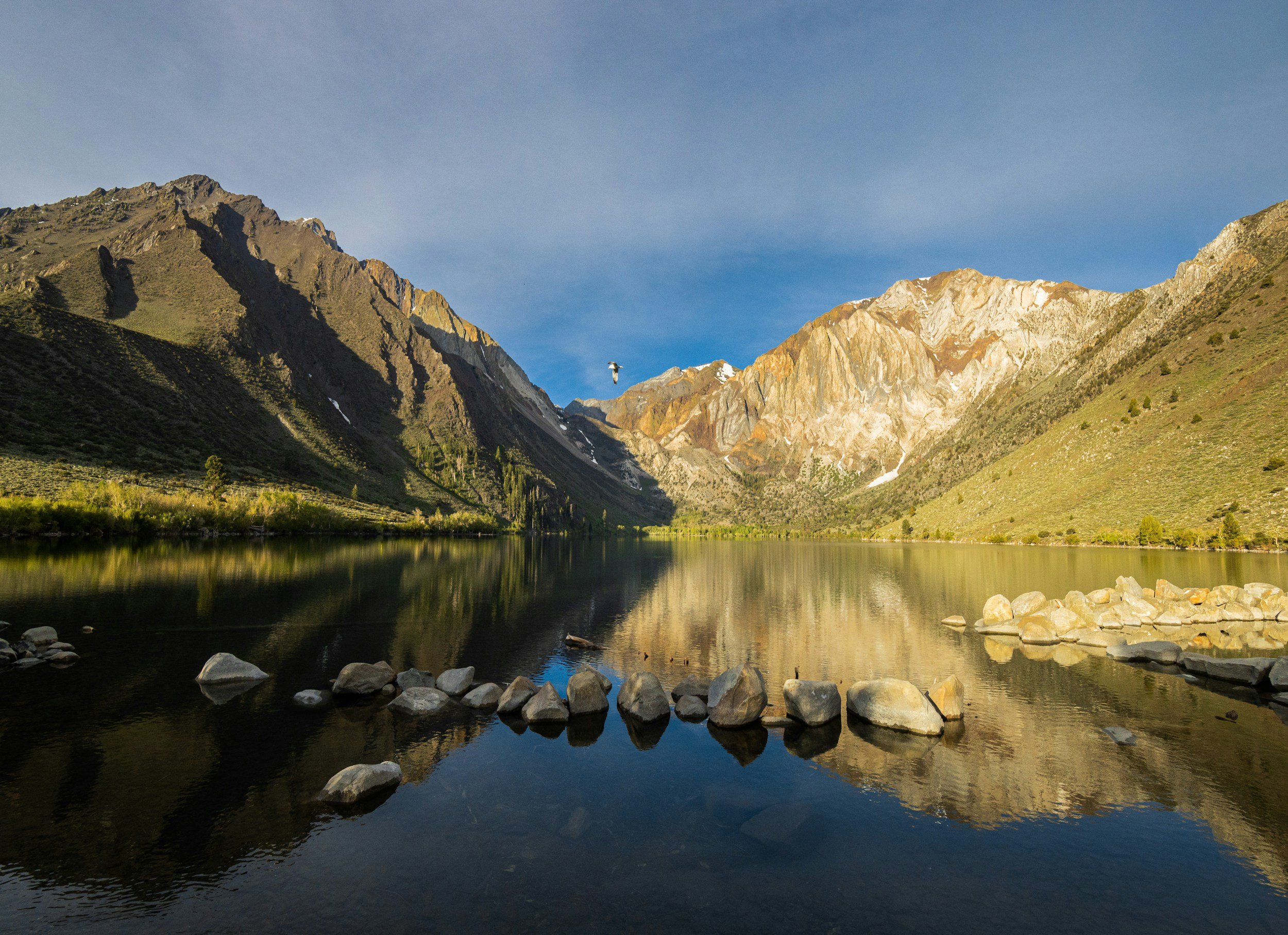
A stunning reflection of the Palisade Range found while hiking in the Eastern Sierra Mountains. Photo by Dalton Johnson
Tips for a Successful Hike: Maximizing Your Eastern Sierra Adventure
Embarking on a hike in the Eastern Sierra is an opportunity to connect with nature, challenge yourself, and create unforgettable memories. To ensure a successful and enjoyable experience, here are some valuable tips to consider:
Pace Yourself and Take Regular Breaks:
Hiking in the Eastern Sierra often involves varied terrain and elevation changes. Pace yourself according to your fitness level and the difficulty of the trail.
Take regular breaks to rest, hydrate, and appreciate the stunning surroundings. Listen to your body and avoid pushing yourself beyond your limits.
Practice Leave No Trace Principles:
The Eastern Sierra's pristine wilderness deserves our utmost respect. Follow Leave No Trace principles to minimize your impact on the environment.
Pack out all trash, dispose of waste properly, and leave natural features undisturbed. Respect wildlife and their habitats by observing from a distance.
Camping Tips:
If planning an overnight adventure, select designated campsites whenever possible to minimize your impact on fragile ecosystems.
Choose a level, durable surface for pitching your tent, and be mindful of any regulations or restrictions regarding camping and campfire usage.
Pack lightweight camping gear and essential items such as a reliable tent, sleeping bag, cooking equipment, and appropriate food storage containers.
Altitude and Acclimatization:
The Eastern Sierra's high elevation can pose challenges for hikers. Gradually acclimate to higher altitudes to reduce the risk of altitude sickness.
Stay well-hydrated, eat nutritious meals, and listen to your body's signals. If experiencing symptoms like headaches or dizziness, descend to a lower elevation.
Injury Prevention:
Prioritize safety by wearing appropriate footwear with ankle support to prevent sprains or twists on uneven terrain.
Use trekking poles for stability and to reduce strain on your joints. Take care with each step, especially on steep or rocky sections of the trail.
Warm up before hiking and stretch your muscles afterward to minimize the risk of strains or muscle fatigue.
Weather Awareness:
Check the weather forecast before heading out and be prepared for sudden changes in mountainous environments.
Dress in layers to accommodate temperature fluctuations. Pack rain gear and a warm jacket even on clear days, as conditions can change rapidly.
Navigation and Trail Knowledge:
Familiarize yourself with trail maps, guidebooks, or GPS devices to navigate effectively. Study the trail's topography and notable landmarks before setting off.
Pay attention to trail markers, cairns, or signs to stay on the designated path. If unsure, it's better to retrace your steps than risk getting lost.
Remember, proper preparation and respect for the wilderness will enhance your hiking experience in the Eastern Sierra. By following these tips, you'll be equipped to tackle the trails, immerse yourself in nature's splendor, and create cherished memories that will last a lifetime. So, lace up your boots, embrace the adventure, and savor every step along the remarkable trails of the Eastern Sierra.
Gear Guide for Hiking in the Eastern Sierra
Essentials
Backpack: A backpack that is the right size for your needs and comfortable to wear.
Food: Enough food for your trip, plus snacks.
Water: Enough water for your trip, plus a water filter or purifier.
First-aid kit: A first-aid kit with bandages, antibiotic ointment, pain relievers, and other basic supplies.
Sunscreen: Sunscreen with an SPF of 30 or higher.
Sunglasses: Sunglasses with 100% UV protection.
Hat: A hat with a wide brim to protect your face from the sun.
Rain gear: Rain gear, including a rain jacket and rain pants.
Flashlight or headlamp: A flashlight or headlamp for use in the dark.
Toilet paper: Toilet paper and a trowel for digging a cathole.
Trash bags: Trash bags for packing out your trash.
Personal items: Any other personal items you may need, such as a camera, binoculars, or a book.
Optional Items
GPS unit: A GPS unit can be helpful for navigation, especially in areas with poor cell reception.
Satellite phone: A satellite phone can be a lifesaver in an emergency.
Hiking poles: Hiking poles can help you conserve energy and prevent injuries.
Camera: A camera can capture memories of your trip.
Binoculars: Binoculars can be used for wildlife viewing.
Book: A book can provide entertainment on long hikes.
Soaking in the gorgeous views while hiking deep in Eastern Sierra Mountains. Photo by Dalton Johnson
The Eastern Sierra offers a myriad of awe-inspiring hiking trails, where you can immerse yourself in the beauty of nature and create lasting memories. By following this comprehensive hiking guide, you'll be well-prepared to explore the wonders of the Eastern Sierra and embark on unforgettable adventures in this remarkable outdoor playground. Lace up your hiking boots, pack your essentials, and get ready for an incredible journey through the Eastern Sierra.
Discover more of the Eastern Sierra


Best Hikes in the Eastern Sierra
Embarking on a hiking adventure in the Eastern Sierra is like stepping into a realm of untamed beauty and boundless exploration. This extraordinary region, nestled along the eastern edge of the Sierra Nevada mountain range in California, offers a hiker's paradise with its diverse landscapes, breathtaking vistas, and an extensive network of trails to suit all skill levels.
Embarking on a hiking adventure in the Eastern Sierra is like stepping into a realm of untamed beauty and boundless exploration. This extraordinary region, nestled along the eastern edge of the Sierra Nevada mountain range in California, offers a hiker's paradise with its diverse landscapes, breathtaking vistas, and an extensive network of trails to suit all skill levels.
Whether you yearn to conquer towering peaks, discover hidden alpine lakes, or wander through pristine wilderness, hiking in the Eastern Sierra is an immersive experience that allows you to forge a deep connection with nature and unravel the secrets of this captivating wilderness. So, lace up your boots, breathe in the crisp mountain air, and let the trails of the Eastern Sierra lead you on an unforgettable journey of discovery, solitude, and awe-inspiring beauty.
Hiking in the Eastern Sierra offers unparalleled natural beauty, from towering peaks to pristine alpine lakes, making it a paradise for outdoor enthusiasts. With its extensive network of trails, the region provides a diverse range of hiking experiences suitable for all skill levels, from challenging summit climbs to tranquil lakeside strolls. Immerse yourself in the breathtaking landscapes, forge a deep connection with nature, and create lasting memories in this captivating wilderness of the Eastern Sierra.
Read on to discover the best 15 hikes of the Eastern Sierra:

Braving the cold plunge while hiking in the Eastern Sierra. Photo by Dalton Johnson
Mount Whitney:
As you ascend this majestic peak, prepare to be captivated by the breathtaking views that unfold before your eyes. From the summit, you'll be treated to a panoramic vista of the rugged Sierra Nevada range, with sweeping vistas of the Eastern Sierra, deep valleys, and the vast expanse of the surrounding wilderness.
Now, let's dive into the specifics of this remarkable hike:
Elevation: Mount Whitney stands tall at an impressive elevation of 14,505 feet (4,421 meters), making it the highest summit in the contiguous United States. The sheer magnitude of this elevation adds an extra element of grandeur to the journey.
Distance: The classic route to Mount Whitney via the Whitney Portal covers approximately 22 miles (35 kilometers) round trip. This distance allows you to immerse yourself in the changing landscapes and experience the gradual transition from dense forests to alpine meadows and, eventually, the rocky terrain near the summit.
Time to Hike: Typically, hikers complete the Mount Whitney hike in a day, starting early in the morning to maximize daylight hours. The total hiking time varies depending on individual fitness levels and the pace you choose, but it's essential to plan for a full day of hiking to ensure a safe and enjoyable experience.
Difficulty: The hike to Mount Whitney is renowned for its challenging nature. The high elevation, long distance, and steep sections demand physical endurance and mental resilience. It's crucial to acclimatize to the altitude, stay hydrated, and be prepared for rapid weather changes, as conditions can vary dramatically throughout the day.
So, why embark on the hike to Mount Whitney? The answer lies in the unparalleled sense of accomplishment and the overwhelming beauty that awaits you. Standing atop the highest peak in the contiguous United States is an experience that will leave you in awe of nature's grandeur. The journey itself is a testament to your strength and determination, as you push your limits and conquer challenges along the way. The rewards are not only the stunning vistas but also the sense of fulfillment and the memories you'll carry with you for a lifetime. Hiking Mount Whitney is a true adventure that allows you to connect with the wilderness, test your limits, and find inspiration in the raw beauty of the Eastern Sierra.
The John Muir Trail:
Let me introduce you to the iconic John Muir Trail, a trek that will take you through some of the most breathtaking landscapes the Eastern Sierra has to offer. As you traverse this legendary long-distance trail, prepare to be immersed in a world of awe-inspiring vistas and diverse natural beauty. From towering peaks to pristine alpine lakes, the John Muir Trail promises a visual feast at every step.
Now, let's delve into the details of this remarkable hike:
Elevation: The John Muir Trail spans a significant elevation range, starting around 4,000 feet (1,200 meters) and reaching heights of over 14,000 feet (4,200 meters) at its highest point, Mount Whitney. This elevation gain and loss along the trail allow you to witness the stunning transitions between different ecosystems and experience the majesty of high alpine landscapes.
Distance: Stretching approximately 211 miles (340 kilometers) from its northern terminus at Happy Isles in Yosemite National Park to its southern terminus at Mount Whitney, the John Muir Trail offers a substantial trek. This distance allows you to immerse yourself in the wilderness and witness the ever-changing beauty of the Eastern Sierra.
Time to Hike: The time required to complete the John Muir Trail varies depending on your pace, experience, and overall hiking plan. Most hikers typically take around three weeks to complete the entire trail, but it can be customized to fit your preferences and available time. It's important to plan accordingly, considering resupply points, permits, and potential side trips to scenic attractions along the way.
Difficulty: The John Muir Trail is considered a challenging hike due to its length, elevation changes, and remote wilderness sections. It demands physical endurance, mental resilience, and prior backpacking experience. However, with proper preparation, training, and a well-thought-out itinerary, this trail is an achievable and immensely rewarding adventure for those seeking an unforgettable wilderness experience.
So, why embark on the hike along the John Muir Trail? It offers a transformative journey through some of the most pristine and awe-inspiring landscapes in the Eastern Sierra. You'll have the opportunity to immerse yourself in the footsteps of the great naturalist John Muir, exploring the same wild wonders he once marveled at. The trail allows you to disconnect from the modern world and reconnect with nature, experiencing solitude, serenity, and a profound sense of accomplishment. From cascading waterfalls and glacier-carved valleys to alpine meadows and dramatic mountain peaks, the John Muir Trail is a pilgrimage for nature lovers and adventure seekers alike.
Lake Sabrina Basin seen from the sky. Photo by Dalton Johnson
Sabrina Basin:
Sabrina Basin, a remote wilderness area that promises awe-inspiring views and a true escape into nature. As you embark on this adventure, prepare to be mesmerized by the stunning vistas that unfold before your eyes. From pristine alpine lakes to towering granite peaks, Sabrina Basin offers a visual feast that will leave you in awe at every turn.
Now, let's explore the specifics of this remarkable hike:
Elevation: Sabrina Basin sits at an elevation ranging from approximately 9,000 feet (2,700 meters) to over 11,000 feet (3,400 meters). As you ascend into the basin, you'll be greeted by towering granite peaks and panoramic vistas that showcase the raw beauty of the Eastern Sierra.
Distance: The distance of the hike in Sabrina Basin can vary depending on your chosen route and exploration preferences. Popular trailheads like North Lake or South Lake offer access to the area, and trails can range from several miles to longer backpacking trips that allow you to fully immerse yourself in the wilderness. Whether you opt for a day hike or a multi-day adventure, Sabrina Basin has options to suit your desired level of exploration.
Time to Hike: The time required to hike in Sabrina Basin depends on the specific trail and your chosen itinerary. Day hikes can be completed within a few hours, while longer backpacking trips may span several days. Take into account your fitness level, the distance you plan to cover, and the time you want to spend savoring the beauty of the area.
Difficulty: The difficulty of hiking in Sabrina Basin can vary depending on the specific trail and your chosen route. While some trails may offer moderate terrain, others can be more challenging, with steep sections and uneven surfaces. It's important to assess your hiking abilities, plan accordingly, and ensure you have the necessary equipment and navigation skills to navigate the area safely.
So, why should you go on the hike in Sabrina Basin? This remote wilderness area offers a true sense of solitude and immersion in nature. The unparalleled beauty of the alpine lakes, lush meadows, and rugged peaks creates a haven for hikers seeking tranquility and a deeper connection with the natural world. Whether you're an avid photographer, a nature enthusiast, or simply someone in search of serenity, Sabrina Basin will not disappoint. It's a place where you can leave the noise of everyday life behind and discover the peace and wonder that can only be found in the heart of the Eastern Sierra.
Devils Postpile National Monument:
Devils Postpile National Monument, a unique hiking destination that will leave you in awe of nature's geological artistry. As you embark on this adventure, be prepared to witness the fascinating formations of basalt columns and soak in the incredible views that surround you.
Now, let's delve into the specifics of this captivating hike:
Elevation: Devils Postpile National Monument sits at an elevation of around 7,500 feet (2,300 meters). While not extremely high, the hike allows you to experience the beauty of the Sierra Nevada mountains and the surrounding wilderness.
Distance: The main trail at Devils Postpile National Monument is a relatively short loop that spans approximately 0.8 miles (1.3 kilometers). This distance allows you to explore the unique geological formations and marvel at the symmetrical basalt columns that rise up to 60 feet (18 meters) high.
Time to Hike: Due to the relatively short distance, the hike at Devils Postpile can be completed within 30 to 60 minutes, depending on your pace and the amount of time you spend admiring the formations. It's worth noting that during peak visitor periods, the trail may be crowded, so allowing extra time for a more leisurely and immersive experience is recommended.
Difficulty: The hike at Devils Postpile National Monument is considered to be easy and suitable for hikers of all skill levels. The trail is well-maintained and mostly flat, making it accessible to families and individuals looking for a relaxed and scenic stroll. It's an opportunity to explore a unique geological wonder without facing challenging terrain or steep inclines.
So, why should you go on this hike at Devils Postpile National Monument? The chance to witness the fascinating basalt columns, formed by volcanic activity millions of years ago, is reason enough to visit. The symmetry and precision of the formations are truly remarkable and provide a glimpse into the Earth's geological history. Additionally, the surrounding scenery, including the picturesque San Joaquin River, lush forests, and the stunning Rainbow Falls, adds to the allure of this hiking destination.
Reflective pools make for a gorgeous hike into Little Lakes Valley. Photo by Dalton Johnson
Little Lakes Valley:
Little Lakes Valley is a picturesque destination that will take your breath away. As you traverse this stunning trail, get ready to feast your eyes on a series of alpine lakes, surrounded by towering peaks and awe-inspiring vistas that will leave you in awe.
Now, let's explore the specifics of this captivating hike:
Elevation: Little Lakes Valley sits at a moderate elevation, ranging from approximately 9,000 feet (2,700 meters) to around 11,000 feet (3,400 meters). This elevation allows you to immerse yourself in the alpine environment, where pristine lakes mirror the surrounding peaks, creating a scene of tranquil beauty.
Distance: The main trail in Little Lakes Valley spans around 7 miles (11 kilometers) round trip. This distance provides ample opportunities to discover the hidden gems of the valley, including gems like Long Lake, Box Lake, and Heart Lake. Each step reveals a new vista, with the shimmering lakes and majestic peaks as constant companions.
Time to Hike: The time required to hike Little Lakes Valley depends on your pace, the amount of time you spend exploring, and whether you choose to extend the hike to reach additional lakes. On average, hikers can complete the main trail within 3 to 4 hours, allowing for plenty of time to soak in the scenery and capture unforgettable photos.
Difficulty: Little Lakes Valley is considered a moderate hike, suitable for hikers of various skill levels. The trail is well-maintained and follows a gradual incline, making it accessible for families and those seeking a moderately challenging but rewarding experience. Keep in mind that the altitude and potential weather changes should be taken into account, so be prepared with appropriate gear and plan accordingly.
So, why should you go on this hike in Little Lakes Valley? The answer lies in the sheer beauty and tranquility of the surroundings. The crystal-clear lakes, nestled beneath towering peaks, create a serene atmosphere that invites you to relax and immerse yourself in nature's wonders. The trail also offers opportunities for wildlife sightings, wildflower displays during the spring and summer months, and the chance to witness the changing colors of fall foliage. Little Lakes Valley is a place to escape the hustle and bustle of everyday life, reconnect with nature, and find solace in the peacefulness of the Eastern Sierra.
Inyo Craters:
Hiking Inyo Craters is a volcanic wonderland that promises unique geological formations and breathtaking views. As you hike through this extraordinary landscape, get ready to witness the remnants of past volcanic activity and be mesmerized by the stunning vistas that surround you.
Now, let's delve into the specifics of this captivating hike:
Elevation: Inyo Craters sit at an elevation of approximately 8,500 feet (2,600 meters). While not extremely high, the hike allows you to witness the remnants of volcanic cones and lava flows, creating a surreal atmosphere and providing glimpses into the area's volcanic history.
Distance: The main trail in Inyo Craters covers a distance of around 2 miles (3.2 kilometers) round trip. This relatively short distance allows you to explore the volcanic formations and hike around the craters, giving you an up-close experience with the unique geology of the area.
Time to Hike: The time required to hike in Inyo Craters can vary depending on your pace and the amount of time you spend exploring the volcanic formations. On average, hikers can complete the hike within 1 to 2 hours, providing ample time to marvel at the geological wonders and enjoy the panoramic views.
Difficulty: The hike in Inyo Craters is generally considered to be of moderate difficulty. While the trail itself is relatively easy to navigate, the terrain can be uneven and rocky in certain sections. It's important to wear sturdy footwear and exercise caution while exploring the volcanic formations. Overall, this hike is suitable for hikers with a moderate level of fitness and basic hiking experience.
So, why should you go on this hike in Inyo Craters? The answer lies in the unique opportunity to witness the remnants of past volcanic activity up close. The volcanic cones, lava flows, and craters paint a vivid picture of the geological forces that shaped this area. In addition to the fascinating geological formations, the views from the craters and surrounding areas are simply breathtaking. From panoramic vistas of the Eastern Sierra to glimpses of neighboring mountain ranges, the scenery offers a visual feast that will leave you in awe.
Kearsarge Pass:
The adventure of hiking Kearsarge Pass is a trail that not only offers a rewarding challenge but also treats you to breathtaking views that will leave you in awe. As you ascend this majestic pass, get ready to immerse yourself in stunning vistas of towering peaks, deep valleys, and alpine lakes that will take your breath away.
Now, let's explore the specifics of this captivating hike:
Elevation: Kearsarge Pass reaches an elevation of approximately 11,760 feet (3,580 meters), making it a high-altitude adventure that allows you to witness the grandeur of the Eastern Sierra. From the summit of the pass, you'll be rewarded with sweeping panoramic views of the surrounding mountain ranges, including the rugged peaks of the Sierra Nevada.
Distance: The Kearsarge Pass trail covers a round-trip distance of approximately 10 miles (16 kilometers). This distance provides a moderate hike that allows you to immerse yourself in the changing landscapes, from dense forests to alpine meadows, as you ascend toward the pass. Each step brings you closer to the stunning views that await.
Time to Hike: The time required to hike Kearsarge Pass varies depending on your pace and the amount of time you spend taking in the scenery. On average, hikers can complete the hike in around 6 to 8 hours, allowing for breaks and ample time to enjoy the vistas from the pass. It's important to plan for a full day hike to ensure you have enough time to savor the beauty and complete the journey safely.
Difficulty: The hike to Kearsarge Pass is considered moderate to strenuous, mainly due to the high elevation gain and the steep sections of the trail. It requires physical endurance, proper acclimatization to the altitude, and basic hiking experience. However, the well-maintained trail and rewarding views make it a highly fulfilling and achievable adventure for hikers with some level of fitness and determination.
So, why should you go on this hike to Kearsarge Pass? The answer lies in the unparalleled views that await you at the summit. From the pass, you'll be treated to a breathtaking panorama of jagged peaks, deep valleys, and pristine alpine lakes. It's a vantage point that allows you to witness the grandeur of the Eastern Sierra in all its glory. Additionally, hiking Kearsarge Pass provides a sense of accomplishment and a deep connection with nature as you navigate the challenging terrain and immerse yourself in the rugged beauty of the high alpine environment.
Convict Lake:
Hiking around Convict Lake is a trail that offers stunning views and a delightful adventure. As we make our way along the path, get ready to be captivated by the breathtaking vistas that will surround us. From the shores of Convict Lake, you'll be treated to panoramic views of the shimmering water, towering peaks, and the natural beauty of the Eastern Sierra.
Now, let's dive into the specifics of this remarkable hike:
Elevation: The hike around Convict Lake is relatively flat, with minimal elevation gain. This makes it accessible to hikers of all skill levels and allows you to fully immerse yourself in the tranquil surroundings without the strain of a steep ascent.
Distance: The loop trail around Convict Lake covers a distance of approximately 2.5 miles (4 kilometers). This moderate distance provides a pleasant hike that allows you to leisurely explore the scenic beauty of the lake and its surroundings.
Time to Hike: The time required to hike around Convict Lake can vary depending on your pace, the number of stops you make to admire the scenery, and your level of fitness. On average, hikers can complete the loop in around 1 to 2 hours, giving you plenty of time to soak in the natural splendor and appreciate the peaceful ambiance.
Difficulty: The hike around Convict Lake is considered easy, suitable for hikers of all experience levels. The well-maintained trail and gentle terrain make it a relaxing and enjoyable outing, allowing you to appreciate the beauty of the lake and the surrounding mountains at a leisurely pace.
So, why go on this delightful hike around Convict Lake? The answer lies in the serene beauty and tranquility that await you. The captivating views of the lake, with its crystal-clear waters reflecting the majestic peaks, create a scene straight out of a postcard. It's a chance to escape the hustle and bustle of daily life, immerse yourself in nature's embrace, and find solace in the peaceful ambiance of Convict Lake.
Beyond the visual rewards, hiking around Convict Lake offers an opportunity for birdwatching, wildlife spotting, and even fishing in the pristine waters. The trail is also stroller and wheelchair-friendly, making it accessible to a wide range of outdoor enthusiasts. It's a perfect outing for a leisurely stroll, a family adventure, or a peaceful retreat to reconnect with nature.
Ancient Bristlecone Pine Forest:
The Ancient Bristlecone Pine Forest is a place where time seems to stand still and nature reveals its ancient secrets. As we embark on this unique hike, be prepared to be awestruck by the breathtaking views that surround us. From the rugged slopes of the White Mountains, you'll witness panoramic vistas of rolling hills, majestic peaks, and the iconic ancient bristlecone pine trees, some of the oldest living organisms on Earth.
Now, let's explore the specifics of this extraordinary hike:
Elevation: The Ancient Bristlecone Pine Forest is situated at a high elevation, ranging from approximately 9,800 to 11,000 feet (2,987 to 3,353 meters) above sea level. As we ascend through the forest, we'll immerse ourselves in the beauty of the subalpine landscape and the incredible resilience of the ancient bristlecone pine trees.
Distance: The hiking trails in the Ancient Bristlecone Pine Forest cover a variety of distances, depending on the specific route you choose. Ranging from short nature walks to longer hikes, you'll have options to explore the forest at your own pace. Each trail offers a unique perspective on the ancient trees and the breathtaking scenery.
Time to Hike: The time required to hike in the Ancient Bristlecone Pine Forest can vary depending on the trail chosen and your individual pace. Shorter nature walks can be completed within an hour, while longer hikes may take several hours to half a day. It's an opportunity to take your time, immerse yourself in the tranquility, and fully appreciate the unique environment.
Difficulty: The difficulty of the hikes in the Ancient Bristlecone Pine Forest ranges from easy to moderate, depending on the trail you select. The trails are well-maintained and marked, making them accessible to hikers of various experience levels. However, it's important to consider the high elevation and potential for changing weather conditions, so be prepared and hike responsibly.
So, why go on this extraordinary hike in the Ancient Bristlecone Pine Forest? The answer lies in the opportunity to witness the ancient wonders and connect with the profound resilience of nature. Walking among the gnarled, weathered bristlecone pine trees, some of which are thousands of years old, is a humbling experience that offers a glimpse into the passage of time and the endurance of life itself.
Beyond the visual rewards, hiking in the Ancient Bristlecone Pine Forest allows us to appreciate the delicate balance between nature and time. It's a chance to learn about the unique adaptations of the bristlecone pines, marvel at their twisted and sculpted forms, and gain a deeper understanding of our place within the grand tapestry of the natural world.
Isosceles Peak just past Bishop’s Pass in the High Sierra is an incredible and challenging hike. Photo by Dalton Johnson
Bishop Pass:
Bishop Pass is a challenging trail that promises awe-inspiring views and an unforgettable experience. As we make our way through this scenic hike, get ready to be captivated by the breathtaking vistas that will surround us. From the start of the trail to the summit of Bishop Pass, we'll be rewarded with panoramic views of towering peaks, pristine alpine lakes, and the remarkable beauty of the Eastern Sierra.
Now, let's explore the specifics of this remarkable hike:
Elevation: Bishop Pass reaches an elevation of approximately 11,972 feet (3,649 meters), immersing us in the grandeur of the Eastern Sierra. As we ascend the trail, we'll be surrounded by majestic peaks, rugged ridges, and awe-inspiring views that stretch as far as the eye can see.
Distance: The hike to Bishop Pass covers a round-trip distance of approximately 9 miles (14.5 kilometers), allowing us to fully immerse ourselves in the changing landscapes. From dense forests to open alpine meadows, each step reveals new wonders that will leave us in awe.
Time to Hike: The time required to hike Bishop Pass can vary depending on our pace, the amount of time we spend admiring the scenery, and the number of breaks we take along the way. On average, hikers can complete the hike in around 6 to 8 hours, giving us ample time to enjoy the beauty and reach the pass.
Difficulty: The hike to Bishop Pass is considered moderate to strenuous due to its elevation gain, length, and rugged terrain. It demands physical endurance, proper acclimatization to the altitude, and intermediate hiking experience. While challenging, the rewarding views and the sense of accomplishment make it a highly fulfilling adventure.
So, why go on this incredible hike to Bishop Pass? The answer lies in the unparalleled views and the opportunity to connect with nature in its purest form. Standing atop Bishop Pass, surrounded by towering peaks, pristine alpine lakes, and the untouched beauty of the Eastern Sierra, is an experience that will leave us humbled and in awe of the grandeur of the natural world.
Beyond the visual rewards, hiking Bishop Pass allows us to challenge ourselves physically and mentally. It's a chance to push our limits, conquer a high mountain pass, and experience the exhilaration of reaching new heights. Moreover, the journey allows us to immerse ourselves in the serenity of the wilderness, disconnect from the noise of everyday life, and find solace in the awe-inspiring landscapes of the Eastern Sierra.
Rush Creek Trail:
Rush Creek Trail, where breathtaking views and stunning landscapes await. As we venture through this scenic hike, be prepared to be captivated by the natural beauty that surrounds us. From the trailhead to our destination, we'll be treated to panoramic vistas of lush meadows, towering peaks, and the mesmerizing Rush Creek.
Now, let's delve into the specifics of this remarkable hike:
Elevation: The Rush Creek Trail starts at an elevation of approximately 7,080 feet (2,158 meters) and gradually ascends as we make our way along the trail. The changing elevation allows us to witness the diversity of the Eastern Sierra's landscapes and enjoy stunning views from different vantage points.
Distance: The hike along the Rush Creek Trail covers a round-trip distance of approximately 8 miles (12.9 kilometers). Throughout the journey, we'll traverse a variety of terrains, including open meadows, shady forests, and rocky sections, immersing ourselves in the beauty of the Eastern Sierra.
Time to Hike: The time required to complete the Rush Creek Trail can vary depending on our pace, the amount of time we spend taking in the views, and the number of breaks we take along the way. On average, hikers can expect to spend around 4 to 6 hours on the trail, allowing us ample time to enjoy the scenery and appreciate the natural surroundings.
Difficulty: The Rush Creek Trail is considered moderate in difficulty, making it accessible to hikers with varying levels of experience. While there are some uphill sections and uneven terrain, the well-maintained trail and moderate elevation gain make it a rewarding and enjoyable hike for those seeking a taste of the Eastern Sierra's beauty.
So, why go on this incredible hike along the Rush Creek Trail? The answer lies in the opportunity to immerse ourselves in the pristine wilderness of the Eastern Sierra and connect with nature's wonders. Along the way, we'll be greeted by breathtaking views that showcase the grandeur of the mountains, the tranquility of Rush Creek, and the vibrant beauty of the surrounding landscapes.
Beyond the visual rewards, hiking the Rush Creek Trail offers a chance to rejuvenate our souls and find solace in the serenity of the outdoors. It's an opportunity to disconnect from the noise of everyday life, breathe in the fresh mountain air, and experience a sense of peace and harmony amidst the natural world.
Additionally, the Rush Creek Trail provides access to other incredible trails and destinations in the Eastern Sierra, such as Gem Lake and Agnew Lake. Exploring the Rush Creek drainage opens up a realm of outdoor adventures, including fishing, camping, and further exploration of the magnificent surrounding peaks and alpine lakes.
Shadow Lake:
Hiking to Shadow Lake, a trail that promises stunning views and a tranquil adventure. As we make our way along this scenic hike, get ready to be enchanted by the beauty that surrounds us. From the trailhead to the shores of Shadow Lake, we'll be treated to breathtaking vistas of towering peaks, alpine meadows, and the pristine waters of the lake.
Now, let's explore the specifics of this remarkable hike:
Elevation: Shadow Lake is nestled at an elevation of approximately 8,370 feet (2,551 meters), offering us a picturesque alpine experience in the Eastern Sierra. As we ascend the trail, we'll be rewarded with sweeping views of the surrounding mountains and the pristine wilderness.
Distance: The hike to Shadow Lake covers a round-trip distance of approximately 5 miles (8 kilometers), allowing us to fully immerse ourselves in the beauty of the Eastern Sierra. The trail takes us through a diverse landscape, from dense forests to open meadows, creating a delightful hiking experience.
Time to Hike: The time required to hike to Shadow Lake can vary depending on our pace, the amount of time we spend admiring the scenery, and the number of breaks we take along the way. On average, hikers can complete the hike in around 3 to 4 hours, giving us ample time to enjoy the beauty and serenity of the lake.
Difficulty: The hike to Shadow Lake is considered moderate in difficulty, making it suitable for hikers of varying experience levels. While there are some uphill sections and rocky terrain, the well-defined trail and moderate elevation gain make it an accessible and enjoyable hike.
So, why go on this incredible hike to Shadow Lake? The answer lies in the opportunity to immerse ourselves in the natural beauty and find peace amidst the Eastern Sierra's wilderness. Walking along the trail and reaching the shores of Shadow Lake allows us to disconnect from the noise of everyday life and embrace the serenity of the outdoors.
Beyond the visual rewards, hiking to Shadow Lake offers a chance to experience the tranquility of an alpine lake surrounded by breathtaking mountain scenery. It's an opportunity to relax, have a picnic, and enjoy the peaceful ambiance while being surrounded by the beauty of nature. The lake also provides a perfect reflection of the surrounding peaks, creating a mesmerizing and picturesque view.
Moreover, the hike to Shadow Lake serves as a gateway to further exploration of the surrounding trails and destinations, such as the Ansel Adams Wilderness and nearby lakes like Ediza Lake and Garnet Lake. It opens up a realm of outdoor adventures, including camping, fishing, and experiencing the rich biodiversity of the Eastern Sierra.
McGee Creek:
Hiking along McGee Creek offers a chance to rejuvenate our souls and find solace in the serenity of the outdoors. It's an opportunity to disconnect from the noise of everyday life, breathe in the fresh mountain air, and experience a sense of peace and harmony amidst the natural world. From the trailhead to our destination, we'll be treated to panoramic vistas of towering peaks, lush meadows, and the enchanting McGee Creek.
Now, let's delve into the specifics of this remarkable hike:
Elevation: The McGee Creek Trail starts at an elevation of approximately 7,600 feet (2,316 meters), immersing us in the grandeur of the Eastern Sierra. As we ascend along the trail, we'll be surrounded by majestic peaks, cascading waterfalls, and awe-inspiring views that showcase the raw beauty of the region.
Distance: The hike along the McGee Creek Trail covers a round-trip distance of approximately 7.5 miles (12 kilometers), allowing us to fully immerse ourselves in the changing landscapes. From shaded forested sections to open meadows, each step reveals new wonders that will leave us in awe.
Time to Hike: The time required to complete the hike along McGee Creek can vary depending on our pace, the amount of time we spend soaking in the views, and the number of breaks we take along the way. On average, hikers can expect to spend around 4 to 6 hours on the trail, allowing ample time to enjoy the scenery and appreciate the natural surroundings.
Difficulty: The hike along McGee Creek is considered moderate in difficulty, making it accessible to hikers with varying levels of experience. While there are some uphill sections and uneven terrain, the well-maintained trail and moderate elevation gain make it a rewarding and enjoyable hike for those seeking a taste of the Eastern Sierra's beauty.
So, why go on this incredible hike along McGee Creek? The answer lies in the opportunity to immerse ourselves in the pristine wilderness of the Eastern Sierra and connect with nature's wonders. Along the way, we'll be greeted by breathtaking views that showcase the grandeur of the mountains, the serenity of McGee Creek, and the vibrant beauty of the surrounding landscapes.
The hike to Matterhorn Peak seen from the sky. Photo by Dalton Johnson
Matterhorn Peak:
Hike Matterhorn Peak, where breathtaking views and a thrilling challenge await. As we ascend this majestic peak, be prepared to be rewarded with awe-inspiring vistas that will leave us in awe. From the rugged slopes to the summit, we'll be treated to panoramic views of the surrounding peaks, deep valleys, and the untouched wilderness of the Eastern Sierra.
Now, let's delve into the specifics of this remarkable hike:
Elevation: Matterhorn Peak stands tall at an elevation of approximately 12,279 feet (3,743 meters), offering a lofty vantage point to behold the beauty of the Eastern Sierra. As we climb higher, the sweeping vistas unfold, revealing the grandeur of the surrounding peaks and the stunning alpine landscapes below.
Distance: The hike to Matterhorn Peak covers a round-trip distance of approximately 12 miles (19.3 kilometers), allowing us to fully immerse ourselves in the rugged beauty of the Eastern Sierra. Each step brings us closer to the towering summit and reveals new breathtaking views along the way.
Time to Hike: The time required to hike Matterhorn Peak can vary depending on our pace, the terrain, and the conditions. On average, hikers can expect to spend around 8 to 10 hours on the trail, allowing for breaks, rest, and time to appreciate the breathtaking scenery that unfolds with each step.
Difficulty: The hike to Matterhorn Peak is considered challenging and suitable for experienced hikers. The ascent involves steep sections, scree slopes, and some rock scrambling, demanding physical endurance, good route-finding skills, and the ability to navigate through changing terrain. It's essential to be well-prepared, equipped, and have previous mountaineering experience.
So, why go on this incredible hike to Matterhorn Peak? The answer lies in the opportunity to stand atop a majestic peak, surrounded by awe-inspiring views that stretch as far as the eye can see. From the summit, we'll be rewarded with a 360-degree panorama of the Eastern Sierra, with its rugged peaks, deep valleys, and pristine wilderness, a sight that will forever be etched in our memories.
Beyond the visual rewards, hiking Matterhorn Peak is a chance to challenge ourselves both physically and mentally. It's an opportunity to push our limits, conquer a formidable peak, and experience the exhilaration of reaching new heights. The journey is filled with a sense of accomplishment, self-discovery, and the chance to deepen our connection with the raw beauty of nature.
Moreover, Matterhorn Peak offers a true wilderness experience, far away from the crowds, where we can immerse ourselves in the serenity of the Eastern Sierra. The solitude, the untouched wilderness, and the feeling of being surrounded by the grandeur of the mountains create a profound sense of peace and rejuvenation.
Mammoth Lakes Basin:
The magnificent trails of the Mammoth Lakes Basin allows us to experience the serenity and tranquility of nature. It's a chance to disconnect from the demands of daily life, breathe in the fresh mountain air, and find solace in the peaceful ambiance of the outdoors. The basin is also home to a variety of wildlife, offering opportunities for wildlife spotting and birdwatching. As we embark on this adventure, be prepared to be captivated by the beauty that surrounds us. From pristine alpine lakes to majestic peaks, the Mammoth Lakes Basin offers a plethora of breathtaking vistas that will leave us in awe.
Now, let's dive into the specifics of this remarkable hiking destination:
Elevation: The Mammoth Lakes Basin is situated at a high elevation, ranging from approximately 8,000 to 10,000 feet (2,438 to 3,048 meters) above sea level. This means we'll be hiking amidst the splendor of the Eastern Sierra, with sweeping views of the surrounding mountains and the glimmering lakes below.
Distance: The hiking trails in the Mammoth Lakes Basin vary in distance, offering options for hikers of all levels. Whether we choose a shorter hike to one of the lakes or a longer trek to explore the entire basin, we'll have the opportunity to immerse ourselves in the beauty of this alpine paradise.
Time to Hike: The time required to complete a hike in the Mammoth Lakes Basin will depend on the specific trail chosen and our pace. Shorter hikes can be completed within a couple of hours, while longer explorations may take a half day or more. It's essential to allocate enough time to fully enjoy the scenery and make the most of our adventure.
Difficulty: The difficulty level of the hikes in the Mammoth Lakes Basin can vary, ranging from easy to moderate. There are trails suitable for hikers of all experience levels, with well-maintained paths and clear signage. However, it's important to consider the elevation and potential changes in weather conditions, so being prepared and hiking responsibly is essential.
So, why go on this incredible hiking adventure in the Mammoth Lakes Basin? The answer lies in the opportunity to immerse ourselves in the beauty of the Eastern Sierra and discover the magic of these alpine landscapes. The stunning views of the sparkling lakes, framed by the towering peaks, create a scene that feels like stepping into a postcard.
Hiking near Bishop, CA in the High Sierra. Photo by Dalton Johnson
The Eastern Sierra stands as a true haven for hikers, offering a remarkable array of trails that showcase the region's unparalleled beauty and natural wonders. From the towering peaks of Mount Whitney and the John Muir Trail to the remote wilderness of Sabrina Basin and the unique geological formations of Devils Postpile, the Eastern Sierra beckons adventurers with its diverse landscapes and breathtaking vistas.
Whether you seek a challenging summit hike, a peaceful stroll through alpine meadows, or a tranquil lakeside experience, the Eastern Sierra has it all. Each trail tells a story, weaving a narrative of geological marvels, ancient forests, and the enduring spirit of the wilderness.
Beyond the physical rewards, hiking in the Eastern Sierra is an opportunity to connect with nature on a profound level. It's a chance to breathe in the crisp mountain air, listen to the whispering winds, and witness the awe-inspiring power of the natural world. The trails of the Eastern Sierra offer not only a physical journey but also a spiritual and emotional one, allowing us to find solace, inspiration, and a deep appreciation for the wonders of our planet.
So, whether you're a seasoned hiker seeking new challenges or a nature lover yearning for tranquility, the Eastern Sierra awaits your exploration. Lace up your boots, pack your backpack, and let the trails guide you on a transformative journey through this captivating region. The best hikes of the Eastern Sierra are calling, and with every step, you'll discover the beauty, the majesty, and the untamed wilderness that make this region a hiker's paradise.
Discover more of the Eastern Sierra

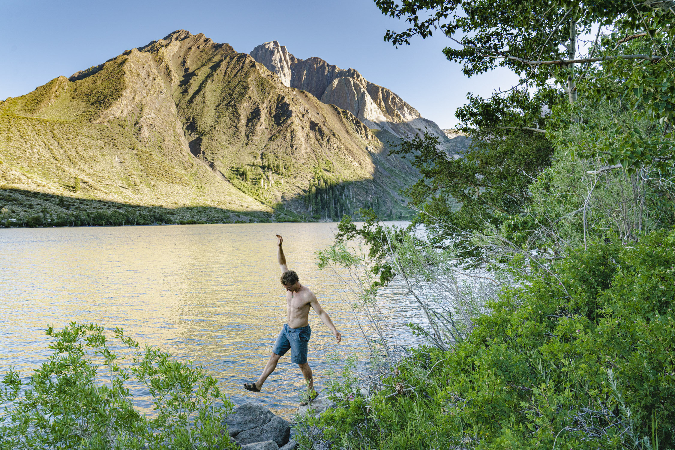

Hike to New Heights: Discover Eastern Sierra Challenging Hiking Gems
Embarking on a challenging hike in the Eastern Sierra is not for the faint of heart. This rugged and majestic region of California offers a plethora of trails that will push your limits and reward you with awe-inspiring views and a profound sense of accomplishment. From towering peaks to alpine lakes and dramatic canyons, the Eastern Sierra presents hikers with a playground of adventure and natural beauty.
Embarking on a challenging hike in the Eastern Sierra is not for the faint of heart. This rugged and majestic region of California offers a plethora of trails that will push your limits and reward you with awe-inspiring views and a profound sense of accomplishment. From towering peaks to alpine lakes and dramatic canyons, the Eastern Sierra presents hikers with a playground of adventure and natural beauty.
The Eastern Sierra offers a variety of challenging hikes for adventurous hikers. Some notable options include Mount Whitney, the highest peak in the contiguous United States; Bishop Pass, with its stunning vistas of surrounding peaks and valleys; and the rugged Taboose Pass trail, offering panoramic views of the John Muir Wilderness.
In this blog we will cover several more difficult hikes in the Eastern Sierra, so lace up your boots, brace yourself for the challenge, and let's dive into the world of challenging hikes in the Eastern Sierra.
Hiking up one of the many challenging hikes in the High Sierra. Photo by Dalton Johnson
Mount Whitney:
The magnificent Mount Whitney, a hike that will test your limits and reward you with breathtaking views. As we ascend this towering peak, get ready to immerse yourself in awe-inspiring vistas that will leave you in utter wonder. From the summit, you'll be treated to a panoramic vista of the rugged Sierra Nevada range, with sweeping views of the Eastern Sierra, deep valleys, and the vast expanse of the surrounding wilderness.
Now, let's delve into the specifics of this extraordinary hike:
Elevation: Mount Whitney stands proudly as the highest summit in the contiguous United States, soaring to an impressive elevation of 14,505 feet (4,421 meters). The sheer magnitude of this elevation adds an extra layer of grandeur to the journey, as you find yourself surrounded by the majestic peaks of the Sierra Nevada.
Distance: The classic route to Mount Whitney via the Whitney Portal covers approximately 22 miles (35 kilometers) round trip. This distance allows you to fully immerse yourself in the changing landscapes, from dense forests to alpine meadows and, eventually, the rocky terrain near the summit. Each step brings you closer to the pinnacle of this majestic mountain.
Time to Hike: Typically, hikers complete the Mount Whitney hike in a day, starting early in the morning to maximize daylight hours. The total hiking time varies depending on individual fitness levels, pace, and the number of breaks taken along the way. It's essential to plan for a full day of hiking to ensure a safe and enjoyable experience.
Difficulty: The hike to Mount Whitney is renowned for its challenging nature, both in terms of elevation gain and overall distance. The high altitude, long trek, and steep sections demand physical endurance, mental resilience, and careful preparation. It's crucial to acclimatize to the altitude, stay well-hydrated, and be prepared for rapid weather changes, as conditions can vary dramatically throughout the day.
So, why go on this awe-inspiring hike to Mount Whitney? The answer lies in the unrivaled sense of accomplishment and the breathtaking beauty that awaits you. Standing atop the highest peak in the contiguous United States is an experience that will leave you humbled and in awe of nature's grandeur. The journey itself tests your physical and mental limits, as you push through the challenges and reach new heights.
Beyond the personal triumph, hiking Mount Whitney offers an intimate connection with the untamed wilderness of the Eastern Sierra. It is a chance to witness the rugged beauty, to breathe in the pure mountain air, and to be surrounded by the awe-inspiring landscapes that have captivated explorers for centuries.
Bishop Pass:
The breathtaking beauty of Bishop Pass is a trail that will immerse you in stunning vistas and unforgettable landscapes. As we make our way through this awe-inspiring hike, get ready to be captivated by panoramic views that stretch as far as the eye can see. From the summit of Bishop Pass, you'll be treated to breathtaking vistas of the surrounding peaks and valleys, where the raw beauty of the Eastern Sierra unfolds before your eyes.
Now, let's explore the specifics of this remarkable hike:
Elevation: Bishop Pass reaches an elevation of approximately 11,972 feet (3,649 meters), making it a high-altitude adventure that allows you to witness the grandeur of the Eastern Sierra from a lofty vantage point. The towering peaks and expansive vistas create a scene of unparalleled beauty.
Distance: The Bishop Pass trail covers a round-trip distance of approximately 9.6 miles (15.5 kilometers). This moderate distance provides a fulfilling hike that takes you through changing landscapes, from dense forests to open alpine meadows. The journey unveils a tapestry of natural wonders that will leave you in awe.
Time to Hike: The time required to hike Bishop Pass varies depending on your pace, the amount of time you spend admiring the scenery, and the number of breaks you take along the way. On average, hikers can complete the hike in around 6 to 8 hours, allowing for plenty of time to soak in the beauty and enjoy the views from the pass.
Difficulty: The hike to Bishop Pass is considered moderate to strenuous, mainly due to the high elevation gain and some steep sections of the trail. It demands physical endurance, proper acclimatization to the altitude, and basic hiking experience. However, the well-defined trail and the awe-inspiring views make it a highly rewarding and achievable adventure for hikers with determination and a moderate level of fitness.
So, why go on this incredible hike to Bishop Pass? The answer lies in the unparalleled views and the sense of accomplishment that awaits you at the summit. Standing atop Bishop Pass, surrounded by towering peaks and vast expanses of untouched wilderness, is an experience that will leave you humbled and in awe of the raw beauty of the Eastern Sierra.
Beyond the visual rewards, hiking Bishop Pass offers a chance to connect with nature in its purest form. The trail takes you through breathtaking landscapes, including serene lakes, pristine meadows, and the rugged beauty of the Eastern Sierra. It's an opportunity to find solace, challenge yourself physically and mentally, and forge a deeper connection with the untamed wilderness.
Taboose Pass:
Hiking Taboose Pass is a trail that will take you through stunning vistas and push your limits. As we embark on this challenging hike, get ready to be captivated by panoramic views that will leave you in awe. From the summit of Taboose Pass, you'll be rewarded with breathtaking vistas of the surrounding peaks and valleys, immersing yourself in the raw beauty of the Eastern Sierra.
Now, let's explore the specifics of this exhilarating hike:
Elevation: Taboose Pass reaches an elevation of approximately 11,375 feet (3,468 meters), making it a high-altitude adventure that allows you to witness the grandeur of the Eastern Sierra from a lofty vantage point. The towering peaks, rugged ridges, and expansive views create a scene of unparalleled beauty.
Distance: The Taboose Pass trail covers a round-trip distance of approximately 14 miles (22.5 kilometers). This challenging distance takes you through diverse landscapes, from desert-like canyons to alpine meadows, showcasing the rich variety of the Eastern Sierra. Each step unveils new wonders that will leave you in awe.
Time to Hike: The time required to hike Taboose Pass varies depending on your pace, the amount of time you spend taking in the scenery, and the number of breaks you take along the way. On average, hikers can complete the hike in around 8 to 10 hours, allowing for ample time to immerse yourself in the beauty and savor the views from the pass.
Difficulty: The hike to Taboose Pass is considered strenuous due to its high elevation gain, rugged terrain, and the long distance covered. It demands physical endurance, proper acclimatization to the altitude, and advanced hiking experience. The trail is challenging, but the incredible views and sense of accomplishment make it a highly rewarding adventure for experienced hikers seeking a thrilling challenge.
So, why go on this exhilarating hike to Taboose Pass? The answer lies in the unrivaled views and the profound sense of achievement that await you at the summit. Standing atop Taboose Pass, surrounded by towering peaks, vast expanses of untouched wilderness, and breathtaking panoramas, is an experience that will leave you humbled and in awe of the raw beauty of the Eastern Sierra.
Beyond the visual rewards, hiking Taboose Pass allows you to immerse yourself in the pristine wilderness of the Eastern Sierra. The trail takes you through diverse landscapes, from lush meadows to rocky ridges, and offers a chance to witness the untouched beauty of this remarkable region. It's an opportunity to push your limits, challenge yourself physically and mentally, and forge a deeper connection with nature.
Sawtooth Pass:
Sawtooth Pass is a trail that offers stunning views and a thrilling adventure. As we make our way through this rugged hike, get ready to be mesmerized by breathtaking vistas that will leave you in awe. From the summit of Sawtooth Pass, you'll be rewarded with panoramic views of the surrounding peaks, dramatic canyons, and the untouched beauty of the Eastern Sierra.
Now, let's explore the specifics of this remarkable hike:
Elevation: Sawtooth Pass reaches an elevation of approximately 11,600 feet (3,536 meters), immersing you in the grandeur of the Eastern Sierra. The towering peaks, rugged ridges, and expansive vistas create a scene of unparalleled beauty.
Distance: The Sawtooth Pass trail covers a round-trip distance of approximately 10 miles (16 kilometers). This moderate distance allows you to fully immerse yourself in the changing landscapes, from dense forests to open alpine meadows. Each step brings you closer to the breathtaking views that await at the pass.
Time to Hike: The time required to hike Sawtooth Pass varies depending on your pace, the amount of time you spend admiring the scenery, and the number of breaks you take along the way. On average, hikers can complete the hike in around 6 to 8 hours, allowing for plenty of time to soak in the beauty and enjoy the views from the pass.
Difficulty: The hike to Sawtooth Pass is considered moderate to strenuous due to its elevation gain and rugged terrain. It demands physical endurance, proper acclimatization to the altitude, and basic hiking experience. While challenging, the rewarding views and sense of accomplishment make it a highly fulfilling adventure for hikers seeking a thrilling and scenic experience.
So, why go on this incredible hike to Sawtooth Pass? The answer lies in the unparalleled views and the opportunity for a thrilling adventure. Standing atop Sawtooth Pass, surrounded by towering peaks and vast expanses of untouched wilderness, is an experience that will leave you humbled and in awe of the raw beauty of the Eastern Sierra.
Beyond the visual rewards, hiking Sawtooth Pass allows you to connect with nature in its purest form. The trail takes you through breathtaking landscapes, including serene lakes, lush meadows, and the rugged beauty of the Eastern Sierra. It's an opportunity to challenge yourself physically and mentally, to find solace in nature's embrace, and to create lasting memories in a remarkable corner of the world.
Palisade Glacier:
Hiking to Palisade Glacier, a trail that promises breathtaking views and an awe-inspiring adventure. As we make our way through this captivating hike, get ready to be mesmerized by the stunning vistas that will leave you in awe. From the trailhead to the grandeur of Palisade Glacier, you'll witness towering peaks, rugged terrain, and a sense of untouched beauty in the heart of the Eastern Sierra.
Now, let's explore the specifics of this remarkable hike:
Elevation: The hike to Palisade Glacier takes you to an elevation of approximately 11,100 feet (3,383 meters), immersing you in the raw beauty of the Eastern Sierra. The towering peaks, dramatic ridges, and the icy expanse of the glacier create a scene of unparalleled grandeur.
Distance: The trail to Palisade Glacier covers a round-trip distance of approximately 15 miles (24 kilometers), allowing you to fully immerse yourself in the changing landscapes. From dense forests to alpine meadows, and eventually the glacier itself, each step brings you closer to the breathtaking views that await.
Time to Hike: The time required to hike to Palisade Glacier varies depending on your pace, the amount of time you spend exploring, and the number of breaks you take along the way. On average, hikers can expect to spend around 10 to 12 hours on the trail, including time to savor the beauty and marvel at the glacier.
Difficulty: The hike to Palisade Glacier is considered strenuous due to its length, elevation gain, and rugged terrain. It demands physical endurance, proper acclimatization to the altitude, and intermediate to advanced hiking experience. The challenging aspects are well worth it, as the rewarding views and the experience of standing before the majestic glacier make it an unforgettable adventure.
So, why go on this incredible hike to Palisade Glacier? The answer lies in the unmatched views and the chance to witness the raw power of nature. Standing before Palisade Glacier, surrounded by towering peaks, icy slopes, and the untouched beauty of the Eastern Sierra, is an experience that will leave you humbled and in awe of the grandeur of the natural world.
Beyond the visual rewards, hiking to Palisade Glacier offers a profound connection with nature. The trail takes you through diverse landscapes, from serene lakes to rocky slopes, showcasing the unspoiled beauty of the Eastern Sierra. It's an opportunity to challenge yourself physically and mentally, to find solace in the remote wilderness, and to witness the resilience of nature in the face of changing climates.
Mount Langley:
Hiking Mount Langley is a trail that promises breathtaking views and a thrilling adventure. As we make our way through this majestic hike, get ready to be mesmerized by the stunning vistas that will leave you in awe. From the summit of Mount Langley, you'll be rewarded with panoramic views of the surrounding peaks, expansive valleys, and the remarkable beauty of the Eastern Sierra.
Now, let's explore the specifics of this remarkable hike:
Elevation: Mount Langley stands proudly as one of the southernmost fourteeners in the Sierra Nevada range, reaching an elevation of 14,026 feet (4,275 meters). As you ascend the trail, you'll find yourself surrounded by towering peaks, rugged ridges, and breathtaking views that extend as far as the eye can see.
Distance: The classic route to Mount Langley covers a round-trip distance of approximately 22 miles (35 kilometers), allowing you to fully immerse yourself in the changing landscapes. From serene lakes to alpine meadows and rocky slopes, each step reveals new wonders that will leave you in awe.
Time to Hike: The time required to hike Mount Langley varies depending on your pace, the amount of time you spend admiring the scenery, and the number of breaks you take along the way. On average, hikers can expect to spend around 12 to 14 hours on the trail, including time to savor the beauty and reach the summit.
Difficulty: The hike to Mount Langley is considered strenuous due to its elevation gain, length, and rugged terrain. It demands physical endurance, proper acclimatization to the altitude, and intermediate to advanced hiking experience. The challenging aspects of the hike are well worth it, as the rewarding views and the accomplishment of summiting a fourteener make it a truly memorable adventure.
So, why go on this incredible hike to Mount Langley? The answer lies in the unparalleled views and the sense of achievement that await you at the summit. Standing atop Mount Langley, surrounded by towering peaks, vast valleys, and the untouched beauty of the Eastern Sierra, is an experience that will leave you humbled and in awe of the raw grandeur of the natural world.
Beyond the visual rewards, hiking Mount Langley offers an opportunity to challenge yourself both physically and mentally. It's a chance to push your limits, conquer a fourteener, and experience the exhilaration of reaching new heights. Additionally, the journey allows you to immerse yourself in the pristine wilderness of the Eastern Sierra, disconnect from the daily routine, and find solace in nature's embrace.
White Mountain Peak:
The exhilarating journey of hiking White Mountain Peak, a trail that promises stunning views and a memorable adventure. As we make our way through this captivating hike, get ready to be awed by the breathtaking vistas that will surround us. From the summit of White Mountain Peak, you'll be treated to panoramic views of the Eastern Sierra, neighboring mountain ranges, and the vast expanse of the surrounding region.
Now, let's delve into the specifics of this remarkable hike:
Elevation: White Mountain Peak stands tall at an elevation of 14,252 feet (4,344 meters), making it one of the towering peaks in the Eastern Sierra. As we ascend the trail, the landscape will transform, revealing the raw beauty of the high alpine environment and the surrounding peaks.
Distance: The hike to White Mountain Peak covers a round-trip distance of approximately 14 miles (22.5 kilometers), allowing us to fully immerse ourselves in the changing landscapes. From arid desert-like terrain to rugged slopes, each step unveils new wonders that will leave us in awe.
Time to Hike: The time required to hike White Mountain Peak varies depending on our pace, the amount of time we spend soaking in the scenery, and the number of breaks we take along the way. On average, hikers can expect to spend around 6 to 8 hours on the trail, including time to savor the beauty and reach the summit.
Difficulty: The hike to White Mountain Peak is considered moderately difficult due to its elevation gain, length, and rugged terrain. It demands physical endurance, proper acclimatization to the altitude, and intermediate hiking experience. While challenging, the incredible views and the accomplishment of summiting a high peak make it a highly rewarding adventure.
So, why go on this incredible hike to White Mountain Peak? The answer lies in the unparalleled views and the sense of accomplishment that await us at the summit. Standing atop White Mountain Peak, surrounded by vast expanses of untouched wilderness, towering peaks, and the endless beauty of the Eastern Sierra, is an experience that will leave us humbled and in awe of the grandeur of the natural world.
Beyond the visual rewards, hiking White Mountain Peak allows us to challenge ourselves both physically and mentally. It's an opportunity to push our limits, conquer a high summit, and experience the exhilaration of reaching new heights. Moreover, the journey allows us to immerse ourselves in the serenity of the high alpine environment, disconnect from the daily hustle, and connect with the awe-inspiring landscapes that make the Eastern Sierra a hiker's paradise.
Piute Pass:
Hiking Piute Pass is another trail that offers breathtaking views and an unforgettable adventure. As we make our way through this captivating hike, get ready to be immersed in stunning vistas that will leave you in awe. From the start of the trail to the summit of Piute Pass, you'll be rewarded with panoramic views of the John Muir Wilderness, Humphreys Basin, and the majestic peaks of the Eastern Sierra.
Now, let's explore the specifics of this remarkable hike:
Elevation: Piute Pass reaches an elevation of approximately 11,423 feet (3,482 meters), allowing you to witness the grandeur of the Eastern Sierra from a lofty vantage point. The towering peaks, alpine lakes, and the vastness of the surrounding wilderness create a scene of unparalleled beauty.
Distance: The Piute Pass trail covers a round-trip distance of approximately 10 miles (16 kilometers), taking you through diverse landscapes and showcasing the natural wonders of the Eastern Sierra. From dense forests to picturesque meadows, each step reveals new breathtaking views.
Time to Hike: The time required to hike Piute Pass varies depending on your pace, the amount of time you spend taking in the scenery, and the number of breaks you take along the way. On average, hikers can complete the hike in around 6 to 8 hours, allowing for ample time to enjoy the beauty and soak in the vistas from the pass.
Difficulty: The hike to Piute Pass is considered moderate in difficulty, making it accessible to hikers with varying experience levels. It involves a gradual ascent, some rocky sections, and moderate elevation gain. With proper preparation and basic hiking skills, it offers a rewarding and enjoyable adventure for hikers seeking a taste of the Eastern Sierra's beauty.
So, why go on this incredible hike to Piute Pass? The answer lies in the unparalleled views and the sense of serenity that await you at the summit. Standing atop Piute Pass, surrounded by majestic peaks, pristine alpine lakes, and the untouched wilderness of the Eastern Sierra, is an experience that will leave you humbled and in awe of the raw beauty of nature.
Beyond the visual rewards, hiking Piute Pass allows you to connect with nature on a profound level. The trail takes you through diverse ecosystems, offering glimpses of wildlife, vibrant wildflowers, and tranquil lakes along the way. It's an opportunity to find solace in the serenity of the wilderness, to disconnect from the noise of everyday life, and to rejuvenate your mind and spirit in the embrace of nature.
Mather Pass:
The exhilarating journey of hiking Mather Pass is a trail that promises stunning views and a thrilling adventure. As we venture on this captivating hike, get ready to be awe-inspired by the breathtaking vistas that will surround us. From the ascent to the top of Mather Pass, you'll be rewarded with panoramic views of the surrounding peaks, alpine lakes, and the raw beauty of the Eastern Sierra.
Now, let's explore the specifics of this remarkable hike:
Elevation: Mather Pass sits at an elevation of approximately 12,100 feet (3,688 meters), allowing us to witness the grandeur of the Eastern Sierra from a lofty vantage point. The towering peaks, deep valleys, and the vastness of the surrounding wilderness create a scene of unparalleled beauty.
Distance: The hike to Mather Pass covers a round-trip distance that varies depending on the starting point. Generally, it ranges from 16 to 20 miles (25 to 32 kilometers). Throughout the hike, we'll encounter diverse landscapes, from lush meadows to rocky slopes, showcasing the remarkable variety of the Eastern Sierra.
Time to Hike: The time required to hike Mather Pass varies depending on our pace, the amount of time we spend admiring the scenery, and the number of breaks we take along the way. On average, hikers can expect to spend around 8 to 12 hours on the trail, including time to savor the beauty and conquer the pass.
Difficulty: The hike to Mather Pass is considered challenging due to its elevation gain, length, and rugged terrain. It demands physical endurance, proper acclimatization to the altitude, and intermediate to advanced hiking experience. The challenging aspects are well worth it, as the rewarding views and the accomplishment of reaching the pass make it an unforgettable adventure.
So, why go on this incredible hike to Mather Pass? The answer lies in the unparalleled views and the sense of achievement that await us at the summit. Standing atop Mather Pass, surrounded by the majestic peaks, alpine lakes, and the untamed beauty of the Eastern Sierra, is an experience that will leave us humbled and in awe of the grandeur of nature.
Beyond the visual rewards, hiking Mather Pass offers an opportunity to challenge ourselves physically and mentally. It allows us to push our limits, conquer a high mountain pass, and experience the exhilaration of reaching new heights. Moreover, the journey allows us to immerse ourselves in the serenity of the wilderness, disconnect from the chaos of daily life, and connect with the awe-inspiring landscapes that make the Eastern Sierra a hiker's paradise.
Lamarck Col:
Lamarck Col is a challenging trail that promises breathtaking views and an unforgettable adventure. As we make our way through this captivating hike, get ready to be awe-inspired by the stunning vistas that will surround us. From the ascent to the top of Lamarck Col, you'll be rewarded with panoramic views of the surrounding peaks, glacial lakes, and the raw beauty of the Eastern Sierra.
Now, let's explore the specifics of this remarkable hike:
Elevation: Lamarck Col reaches an elevation of approximately 12,960 feet (3,950 meters), allowing us to witness the grandeur of the Eastern Sierra from a lofty vantage point. The towering peaks, deep valleys, and the vastness of the surrounding wilderness create a scene of unparalleled beauty.
Distance: The hike to Lamarck Col covers a round-trip distance of approximately 11 miles (17.7 kilometers), taking us through diverse landscapes and showcasing the natural wonders of the Eastern Sierra. From lush meadows to rocky slopes, each step unveils new breathtaking views.
Time to Hike: The time required to hike Lamarck Col varies depending on our pace, the amount of time we spend soaking in the scenery, and the number of breaks we take along the way. On average, hikers can complete the hike in around 7 to 9 hours, allowing for ample time to enjoy the beauty and reach the col.
Difficulty: The hike to Lamarck Col is considered moderately difficult due to its elevation gain, length, and rugged terrain. It demands physical endurance, proper acclimatization to the altitude, and intermediate hiking experience. While challenging, the incredible views and the sense of accomplishment make it a highly rewarding adventure.
So, why go on this incredible hike to Lamarck Col? The answer lies in the unparalleled views and the chance to experience the pristine beauty of the Eastern Sierra. Standing atop Lamarck Col, surrounded by majestic peaks, glacial lakes, and the untouched wilderness, is an experience that will leave us humbled and in awe of the grandeur of the natural world.
Beyond the visual rewards, hiking Lamarck Col allows us to challenge ourselves both physically and mentally. It's an opportunity to push our limits, conquer a high mountain pass, and experience the exhilaration of reaching new heights. Moreover, the journey allows us to immerse ourselves in the serenity of the wilderness, disconnect from the noise of everyday life, and find solace in the awe-inspiring landscapes of the Eastern Sierra.
Enjoying the lakeside view during a morning hike up Kearsarge Pass. Photo by Dalton Johnson
As we conclude our exploration of the challenging hikes in the Eastern Sierra, we leave behind a trail of unforgettable memories, exhilarating adventures, and a deeper connection with the raw and untamed beauty of this remarkable region. From conquering the heights of Mount Whitney to navigating the remote passes and breathtaking vistas, these challenging hikes have tested our limits, rewarded our efforts, and left an indelible mark on our souls.
The Eastern Sierra has proven time and again to be a haven for adventurers seeking thrilling trails, stunning scenery, and a sense of accomplishment. It is a place where we have pushed our boundaries, challenged ourselves physically and mentally, and discovered the incredible resilience within us. With each step, we have been treated to panoramic vistas, hidden alpine lakes, and rugged landscapes that have left us in awe of nature's grandeur.
So, whether you are an experienced hiker looking for your next great challenge or someone seeking to push beyond your comfort zone, the challenging hikes of the Eastern Sierra beckon you. As you navigate the steep trails, rocky terrain, and high altitudes, remember to respect the wilderness, prepare diligently, and stay safe. The rewards are plentiful - breathtaking views, personal triumphs, and a profound connection with the raw and untamed wilderness of the Eastern Sierra.
Discover more of the Eastern Sierra

Your Guide to the Eastern Sierra
Welcome to the breathtaking realm of the Eastern Sierra, a realm where rugged peaks kiss the cerulean sky, crystal-clear lakes mirror the towering majesty of the surrounding mountains, and vast stretches of untamed wilderness beckon adventurers from far and wide. Nestled along the eastern edge of the mighty Sierra Nevada mountain range in California, this enchanting region is a true haven for nature lovers, photographers, hikers, and those seeking solace in the embrace of untouched landscapes.
Welcome to the breathtaking realm of the Eastern Sierra, a realm where rugged peaks kiss the cerulean sky, crystal-clear lakes mirror the towering majesty of the surrounding mountains, and vast stretches of untamed wilderness beckon adventurers from far and wide. Nestled along the eastern edge of the mighty Sierra Nevada mountain range in California, this enchanting region is a true haven for nature lovers, photographers, hikers, and those seeking solace in the embrace of untouched landscapes.
In our comprehensive guide to the Eastern Sierra, we invite you to embark on a journey that will unveil the region's hidden gems, secret trails, and awe-inspiring vistas. Whether you're a seasoned outdoors enthusiast or a first-time visitor eager to explore the wonders of this natural wonderland, our guide will equip you with all the knowledge and inspiration you need to make the most of your time in this captivating region.
Discover the iconic peaks that define the Eastern Sierra, such as the towering Mount Whitney, the highest summit in the contiguous United States, or the majestic spires of the Minarets, which stand as sentinels of the wilderness. Dive into the pristine alpine lakes that dot the landscape, their turquoise waters reflecting the grandeur of their surroundings. Immerse yourself in the vibrant autumn hues that paint the aspen groves and experience the dramatic transformations of the seasons.
Beyond its natural wonders, the Eastern Sierra also boasts charming towns that exude a distinct character and charm. From the artistic community of Mammoth Lakes to the historic town of Bishop, each place offers its own unique blend of local culture, hospitality, and adventure.
Join us as we delve into the multitude of outdoor activities that abound in the Eastern Sierra. From epic hiking trails that traverse high mountain passes to world-class rock climbing routes that challenge even the most seasoned climbers, this region is an adventurer's playground. Delve into the hidden valleys, encounter elusive wildlife, cast your line into sparkling streams, and capture the fleeting beauty of the landscape through your lens.
Whether you're seeking an adrenaline-pumping escapade or a peaceful retreat to rejuvenate your spirit, the Eastern Sierra has it all. Let our guide be your compass, unveiling the secrets of this extraordinary destination and leading you on an unforgettable exploration of its wonders. Get ready to breathe in the crisp mountain air, lose yourself in the grandeur of nature, and create memories that will last a lifetime in the Eastern Sierra.
A crazy sunset over Lone Pine and Mount Whitney seen from the Alabama Hills. Photo by Dalton Johnson
Pros of the Eastern Sierra:
Breathtaking Scenery: The Eastern Sierra boasts stunning landscapes, including majestic peaks, crystal-clear lakes, and dramatic canyons, providing endless opportunities for outdoor adventures and scenic beauty.
Outdoor Recreation: The region offers a wide range of outdoor activities, such as hiking, backpacking, rock climbing, fishing, skiing, and more, catering to all skill levels and interests.
Serene Wilderness: The Eastern Sierra is known for its remote and less crowded wilderness areas, providing opportunities for solitude and a deeper connection with nature.
Diverse Ecosystems: From alpine meadows and ancient forests to high desert and unique geological formations, the Eastern Sierra showcases a rich variety of ecosystems, offering a dynamic and captivating environment.
Wildlife and Bird Watching: The region is home to diverse wildlife, including mule deer, bighorn sheep, bears, and numerous bird species, providing ample opportunities for wildlife enthusiasts and birdwatchers.
Photography Paradise: With its awe-inspiring landscapes, vibrant fall colors, and stunning lakes, the Eastern Sierra offers endless possibilities for capturing breathtaking photographs.
Charming Towns: The towns in the Eastern Sierra, such as Mammoth Lakes, Bishop, and Lone Pine, offer a blend of local charm, hospitality, and amenities, serving as convenient bases for exploration.
Proximity to National Parks: The Eastern Sierra is close to renowned national parks, including Yosemite, Sequoia and Kings Canyon, and Death Valley, providing easy access to iconic destinations.
Rich History and Culture: The region has a rich history, from Native American heritage to the pioneering days of the Gold Rush, with historic sites and cultural attractions that offer glimpses into the past.
Cons of the Eastern Sierra:
Seasonal Access: Some areas of the Eastern Sierra, particularly higher elevation trails and roads, may have limited access or be impassable during winter months due to snow and harsh weather conditions.
Altitude and Acclimatization: The high elevation of the Eastern Sierra can present challenges for visitors who are not accustomed to the thinner air. It is important to acclimate properly and be aware of altitude-related issues.
Limited Services and Amenities: In more remote areas, services and amenities, such as lodging, dining, and fuel stations, may be limited, requiring proper planning and self-sufficiency during outdoor adventures.
Variable Weather: The Eastern Sierra experiences a wide range of weather conditions, from scorching summers to cold winters and sudden weather changes. It is essential to be prepared and check weather forecasts before embarking on outdoor activities.
Wildlife and Safety: While encounters with wildlife are part of the allure, it is important to exercise caution and respect the natural habitats of animals, following proper safety guidelines to avoid potential conflicts.
Crowded Areas: Popular destinations in the Eastern Sierra, especially during peak seasons, can attract a significant number of visitors, resulting in crowded trails, parking limitations, and a less secluded experience.
Limited Cell Reception: Some areas of the Eastern Sierra may have limited or no cell phone reception, making it essential to have alternative means of communication and navigation.
Environmental Responsibility: With its fragile ecosystems, it is important for visitors to practice Leave No Trace principles, respecting and preserving the natural environment to ensure its long-term sustainability.
Where are the Eastern Sierra?
Nestled along the eastern edge of the Sierra Nevada mountain range in California, the Eastern Sierra spans a vast region that stretches from the Owens Valley in the west to the Nevada border in the east. This picturesque area is located to the east of the more well-known destinations of Yosemite National Park and Lake Tahoe, offering a quieter and less crowded alternative for outdoor enthusiasts.
Is lake tahoe part of the Eastern Sierra?
Lake Tahoe is not technically considered part of the Eastern Sierra. It is a large freshwater lake located on the border of California and Nevada. While Lake Tahoe is geographically close to the Eastern Sierra and shares some similarities in terms of natural beauty and outdoor recreation, it is not officially included within the boundaries of the Eastern Sierra region. Lake Tahoe is considered a separate destination, known for its stunning blue waters, picturesque beaches, and world-class skiing resorts.
Is Yosemite part of the eastern sierra?
Yosemite National Park is considered part of the Eastern Sierra region. While Yosemite itself is a distinct and well-known destination, it is located in the eastern portion of the Sierra Nevada mountain range, making it geographically part of the Eastern Sierra. Yosemite National Park is renowned for its iconic granite cliffs, breathtaking waterfalls, ancient sequoia groves, and diverse array of ecosystems. The park offers numerous hiking trails, camping opportunities, and stunning vistas, making it a must-visit destination within the Eastern Sierra region.
Is it “Sierra” or “Sierras”?
When referring to the region as a whole, it is commonly referred to as the Eastern Sierra, using the singular form. However, it is not uncommon to hear people say "Sierras" when referring to the mountain range itself. Both terms are used interchangeably, so don't be surprised if you come across both during your exploration of this stunning area.
What is the High Sierra?
The High Sierra, also known as the High Sierra Region or the High Sierra Country, refers to the elevated region of the Sierra Nevada mountain range in California. It encompasses the higher elevation areas of the Sierra Nevada, typically above 7,000 feet (2,100 meters) in elevation. The High Sierra extends from the southern end of the Sierra Nevada near Sequoia and Kings Canyon National Parks up to the northern reaches near the Yosemite National Park.
The High Sierra is renowned for its majestic granite peaks, alpine lakes, meadows, and pristine wilderness. It is home to iconic landmarks such as Mount Whitney, the highest peak in the contiguous United States, and Yosemite Valley, one of the most famous natural wonders in the world. This region offers abundant outdoor recreational activities, including hiking, backpacking, rock climbing, fishing, and winter sports.
The High Sierra is characterized by its rugged and remote nature, attracting adventurers, nature lovers, and outdoor enthusiasts from around the globe. It provides a stunning backdrop for exploration, offering breathtaking vistas, diverse ecosystems, and the opportunity to immerse oneself in the serenity and grandeur of the Sierra Nevada.
Towns of the Eastern Sierra
Mammoth Lakes: Mammoth Lakes is a vibrant mountain town surrounded by stunning natural beauty. With world-class skiing, incredible hiking trails, and a thriving arts scene, this town offers a perfect blend of outdoor adventure and cultural experiences.
Bishop: Nestled in the heart of the Owens Valley, Bishop is a gateway to the Eastern Sierra. Known for its superb rock climbing, world-class fishing, and access to the stunning Sierra Nevada, Bishop is a paradise for outdoor enthusiasts seeking adventure in a charming small-town setting.
Lone Pine: Situated at the base of Mount Whitney, Lone Pine is a historic town that attracts outdoor enthusiasts and film buffs alike. Its proximity to the Alabama Hills, with its unique rock formations, and its role as a backdrop for numerous Hollywood movies make it a must-visit destination.
Bridgeport: Surrounded by the beauty of the Hoover Wilderness and near the iconic Twin Lakes, Bridgeport is a picturesque town offering access to incredible fishing, hiking, and camping opportunities. Its charming Main Street and historic courthouse add to its appeal.
June Lake: Nestled in a breathtaking alpine setting, June Lake is a tranquil mountain town known for its stunning lakes, hiking trails, and opportunities for fishing and boating. Its peaceful ambiance and beautiful scenery make it an ideal destination for relaxation and outdoor recreation.
Lee Vining: Located near the eastern entrance of Yosemite National Park, Lee Vining is a small town with access to numerous natural wonders. From the otherworldly Mono Lake to the nearby Tioga Pass and its incredible high-country hiking trails, Lee Vining is a haven for nature lovers and photographers.
Bridgeport: Surrounded by the beauty of the Hoover Wilderness and near the iconic Twin Lakes, Bridgeport is a picturesque town offering access to incredible fishing, hiking, and camping opportunities. Its charming Main Street and historic courthouse add to its appeal.
Independence: As the county seat of Inyo County, Independence is rich in history and natural beauty. It serves as a gateway to the stunning Eastern Sierra landscapes, including the nearby Bristlecone Pine Forest and the high peaks of the Sierra Nevada.
Big Pine: Nestled in the Owens Valley, Big Pine is a quaint town offering access to the majestic Eastern Sierra. Outdoor enthusiasts can explore the nearby Ancient Bristlecone Pine Forest, hike in the nearby Sierra Nevada, or go fishing in the surrounding lakes and streams.
Coleville: Situated in the Antelope Valley near the Nevada border, Coleville is a small town surrounded by pristine wilderness. Its proximity to the beautiful West Walker River and its rural charm make it a peaceful destination for outdoor activities and relaxation.
Markleeville: Tucked away in Alpine County, Markleeville is a hidden gem in the Eastern Sierra. The town is known for its beautiful alpine scenery, hot springs, and proximity to the stunning Grover Hot Springs State Park. It's an ideal destination for those seeking a quiet mountain retreat.
Tom's Place: Located along Highway 395, Tom's Place is a popular stop for travelers exploring the Eastern Sierra. Surrounded by towering peaks and offering easy access to fishing in the Owens River, it's a great place to enjoy outdoor activities or relax in the picturesque mountain setting.
Benton: A small and charming town, Benton provides a glimpse into the region's rich history and is surrounded by serene landscapes. Outdoor enthusiasts can explore nearby hot springs, hike in the beautiful Benton Range, or enjoy the tranquility of the region's expansive desert vistas.
Swall Meadows: Situated just south of Bishop, Swall Meadows is a peaceful community nestled in the foothills of the Eastern Sierra. Surrounded by rolling hills and offering panoramic views of the mountains, it's a perfect destination for those seeking a tranquil and scenic retreat.
Crowley Lake: Located south of Mammoth Lakes, Crowley Lake is a recreational haven for fishing, boating, and water sports enthusiasts. With its stunning mountain backdrop and abundant outdoor activities, it's an excellent destination for those seeking adventure on the water.
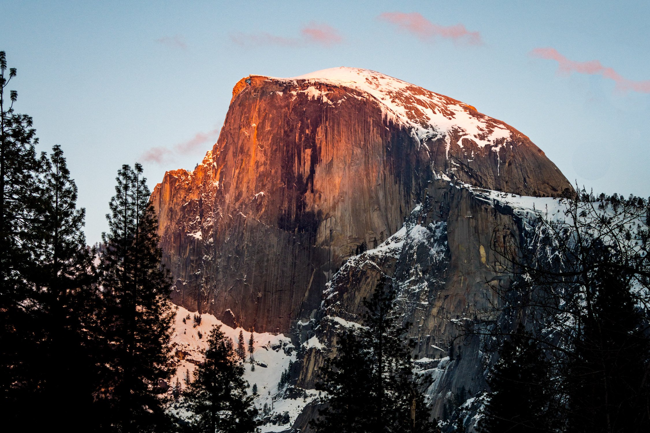
Half Dome glowing in the sunset light. Photo by Dalton Johnson
Eastern Sierra vs Western Sierra
The Sierra Nevada mountain range is vast and can be broadly divided into two main regions: the Eastern Sierra and the Western Sierra. While both regions share the stunning beauty and natural wonders of the Sierra Nevada, there are some notable differences between them.
Geographical Location:
Eastern Sierra: The Eastern Sierra is situated on the eastern side of the Sierra Nevada range, facing the Great Basin and the state of Nevada. It spans from the Owens Valley in the west to the Nevada border in the east.
Western Sierra: The Western Sierra refers to the western side of the Sierra Nevada range, facing the Central Valley of California. It extends from the western slopes of the range to the foothills and valleys on the western side.
Landscape and Scenery:
Eastern Sierra: The Eastern Sierra is known for its dramatic and rugged landscapes. It features towering granite peaks, deep canyons, glacially-carved valleys, and alpine lakes. The scenery in the Eastern Sierra tends to be more dramatic and wild, with high peaks, sharp ridges, and steep canyons.
Western Sierra: The Western Sierra, while still offering stunning landscapes, has a more gentle and rolling terrain compared to the Eastern Sierra. It is characterized by lower peaks, forested slopes, foothills, and expansive valleys. The scenery in the Western Sierra often includes oak woodlands, meadows, and picturesque river systems.
Accessibility and Development:
Eastern Sierra: The Eastern Sierra is generally less developed and less populated compared to the Western Sierra. It offers a more remote and secluded experience, with fewer towns and communities. While there are still amenities and services available in certain areas, the Eastern Sierra is known for its quieter and more serene atmosphere.
Western Sierra: The Western Sierra is more populated and developed, with a greater number of towns, communities, and infrastructure. It is home to popular tourist destinations such as Yosemite National Park, Sequoia and Kings Canyon National Parks, and Lake Tahoe. The Western Sierra tends to have more developed recreational facilities, accommodations, and tourist services.
Outdoor Activities and Recreation:
Eastern Sierra: The Eastern Sierra is renowned for its exceptional outdoor recreational opportunities. It offers extensive hiking trails, world-class rock climbing routes, backcountry skiing, fishing in pristine lakes and rivers, and opportunities for solitude and wilderness exploration.
Western Sierra: The Western Sierra, being home to iconic national parks, attracts a larger number of visitors and offers a wide range of recreational activities. In addition to hiking and climbing, the Western Sierra provides opportunities for camping, wildlife viewing, scenic drives, boating, skiing, and more.
While both the Eastern Sierra and Western Sierra share the awe-inspiring beauty of the Sierra Nevada, each region offers a unique experience. The Eastern Sierra captivates with its wild and rugged landscapes, while the Western Sierra showcases iconic national parks and more developed tourist infrastructure. Exploring both regions provides a comprehensive understanding and appreciation of the remarkable diversity and natural splendor of the Sierra Nevada mountain range.
IV. What to Do in the Eastern Sierra
The Eastern Sierra offers a plethora of activities for nature lovers and adventure seekers alike. Some popular activities include:
Hiking: Explore an extensive network of trails that lead to breathtaking vistas, alpine lakes, and hidden valleys.
Fishing: Cast your line into pristine rivers, streams, and lakes teeming with trout and other fish species.
Rock Climbing: Test your skills on the granite cliffs and crags that attract climbers from around the world.
Photography: Capture the stunning landscapes, vibrant fall colors, and dramatic mountain scenery.
Camping: Set up camp in one of the many campgrounds or find secluded spots for a backcountry adventure.
Wildlife Viewing: Encounter a diverse range of wildlife, including mule deer, bighorn sheep, bears, and migratory birds.
5-Day Road Trip Itinerary LA to Lake Tahoe
Day 1: Los Angeles to Mammoth Lakes
Start your road trip from Los Angeles and head north on Highway 395.
Make a stop at Lone Pine to visit the Alabama Hills and enjoy the unique rock formations.
Continue driving to Mammoth Lakes, a scenic mountain town known for its outdoor activities.
Explore the town, take a stroll around the Village at Mammoth, and enjoy a delicious dinner.
Day 2: Mammoth Lakes to Yosemite National Park
Depart Mammoth Lakes and drive to the eastern entrance of Yosemite National Park.
Spend the day exploring the wonders of Yosemite Valley, including iconic landmarks like Half Dome, Yosemite Falls, and El Capitan.
Take in the breathtaking views and enjoy hiking trails such as the Mist Trail to Vernal and Nevada Falls.
Overnight in Yosemite Valley or nearby accommodations.
Day 3: Yosemite National Park to South Lake Tahoe
Leave Yosemite National Park and drive north to South Lake Tahoe.
Upon arrival, take some time to relax by the pristine shores of Lake Tahoe.
Explore the vibrant town of South Lake Tahoe, visit the Heavenly Village, and indulge in the diverse dining options.
Consider taking a scenic gondola ride to enjoy panoramic views of the lake and surrounding mountains.
Day 4: Exploring Lake Tahoe
Spend the day immersing yourself in the beauty of Lake Tahoe.
Choose from a variety of outdoor activities, such as hiking along the lake's scenic trails, renting a kayak or paddleboard to explore the crystal-clear waters, or simply relaxing on the beach.
Visit Emerald Bay State Park and take a hike to enjoy stunning views of the iconic Emerald Bay.
In the evening, catch a sunset cruise to witness the enchanting colors of the sunset over the lake.
Day 5: Lake Tahoe to Los Angeles
On your final day, depart Lake Tahoe and start your journey back to Los Angeles.
Take a scenic drive along the eastern side of the Sierra Nevada on Highway 395.
Make a stop in the charming town of Bishop and explore its unique shops and eateries.
Continue driving south and enjoy the scenic landscapes along the way.
Arrive back in Los Angeles, completing your memorable road trip from LA to Lake Tahoe.
This 5-day road trip itinerary will take you from the bustling city of Los Angeles to the serene beauty of Lake Tahoe, allowing you to experience the stunning landscapes, outdoor adventures, and iconic destinations along the way.
Popular Photo Locations
Photography in the Eastern Sierra is a dream come true for both amateur and professional photographers. The region offers an abundance of picturesque landscapes, diverse ecosystems, and stunning natural wonders that provide endless opportunities for capturing breathtaking images.
Mono Lake: Capture the otherworldly beauty of the tufa towers rising from the calm waters.
Convict Lake: Frame the majestic mountain backdrop reflected in the mirror-like surface of the lake.
Alabama Hills: Photograph the unique rock formations against the backdrop of the Sierra Nevada peaks.
North Lake: Immortalize the vibrant fall colors reflecting in the tranquil alpine lake.
Ancient Bristlecone Pine Forest: Capture the twisted and weathered bristlecone pines, some of the oldest trees on Earth.
Hiking in the Eastern Sierra Mountains. Photo by Dalton Johnson
Popular Hikes
Embarking on a hiking adventure in the Eastern Sierra is like stepping into a realm of untamed beauty and boundless exploration. This extraordinary region, nestled along the eastern edge of the Sierra Nevada mountain range in California, offers a hiker's paradise with its diverse landscapes, breathtaking vistas, and an extensive network of trails to suit all skill levels. Whether you yearn to conquer towering peaks, discover hidden alpine lakes, or wander through pristine wilderness, hiking in the Eastern Sierra is an immersive experience that allows you to forge a deep connection with nature and unravel the secrets of this captivating wilderness. Lace up your boots, breathe in the crisp mountain air, and let the trails of the Eastern Sierra lead you on an unforgettable journey of discovery, solitude, and awe-inspiring beauty.
Mount Whitney: Embark on a challenging but rewarding hike to the highest summit in the contiguous United States.
The John Muir Trail: Trek a segment of this iconic long-distance trail, offering stunning views and diverse landscapes.
Sabrina Basin: Explore this remote wilderness area with numerous lakes and stunning vistas.
Devils Postpile National Monument: Hike to witness the unique basalt columns formed by volcanic activity.
Little Lakes Valley: Journey through this picturesque valley, passing by a series of stunning alpine lakes.
Popular Mountains to Climb
Ascending the majestic peaks of the Eastern Sierra is a pursuit reserved for those with an unyielding spirit of adventure and a thirst for conquering new heights. These granite sentinels, rising proudly along the eastern edge of the Sierra Nevada range in California, beckon climbers from far and wide to test their mettle and embrace the thrill of mountaineering. From the rugged slopes of Mount Whitney, the highest summit in the contiguous United States, to the striking spires of the Minarets and the awe-inspiring peaks of the Eastern Sierra, this region offers a playground of challenges and rewards for those who dare to venture upward. With each step, climbers are rewarded with breathtaking panoramas, a profound sense of accomplishment, and an indelible connection to the raw power and beauty of the mountains. So gather your gear, summon your courage, and prepare to embark on an extraordinary journey as you explore the heights and conquer the summits of the Eastern Sierra.
Mount Langley: Ascend this majestic peak, known for its panoramic views and accessible routes.
Split Mountain: Challenge yourself with the ascent of this striking peak, offering breathtaking vistas.
Mount Humphreys: Conquer the rugged slopes of this prominent mountain, boasting awe-inspiring views.
Mount Tom: Scale the rocky terrain of this iconic peak, rewarded with sweeping vistas of the Eastern Sierra.
Mount Morrison: Test your mountaineering skills on this remote and lesser-known summit.
Popular Backpacking Routes
Embarking on a backpacking adventure in the Eastern Sierra is an invitation to venture deep into the heart of wilderness, where untamed beauty and rugged landscapes unfold at every step. Spanning a vast region along the eastern edge of the Sierra Nevada mountain range in California, this hiker's paradise beckons intrepid explorers to don their backpacks, leave the comforts of civilization behind, and immerse themselves in a world of awe-inspiring vistas, pristine alpine lakes, and remote valleys. With a network of trails that wind through towering peaks, dense forests, and serene meadows, backpacking in the Eastern Sierra offers a chance to disconnect from the noise of everyday life and connect with the serenity of nature, forging unforgettable memories and discovering the true essence of wilderness. So strap on your pack, set foot on the trail, and let the untamed wilderness of the Eastern Sierra guide you on a transformative journey of self-discovery and exploration.
Pacific Crest Trail (PCT) Section H: Trek through the stunning landscapes of the Eastern Sierra along this renowned long-distance trail.
High Sierra Trail: Embark on a multi-day adventure through the heart of the Sierra Nevada, traversing alpine meadows and crossing high mountain passes.
Bishop Pass to Dusy Basin: Explore the dramatic beauty of the Bishop Pass Trail, leading to the pristine lakes and stunning scenery of Dusy Basin.
Ansel Adams Wilderness Loop: Experience the beauty of this designated wilderness area as you traverse scenic trails and visit enchanting alpine lakes.
Onion Valley to Kearsarge Pass: Journey through the rugged and remote wilderness, crossing the breathtaking Kearsarge Pass.
Popular Lakes
The Eastern Sierra is a realm of shimmering jewels, where crystal-clear lakes dot the landscape like precious gems set amidst the rugged grandeur of the Sierra Nevada. Nestled among towering peaks and sweeping valleys, these alpine lakes beckon with their tranquil beauty, inviting visitors to immerse themselves in their refreshing waters and bask in the serenity of their surroundings. From the iconic Mono Lake with its otherworldly tufa towers to the secluded and pristine gems hidden deep within the wilderness, the lakes of the Eastern Sierra offer a sanctuary for nature lovers, photographers, and adventure seekers alike. Whether you seek a peaceful escape, a fishing haven, or a stunning backdrop for outdoor activities, the lakes of the Eastern Sierra are sure to captivate your heart and ignite a sense of wonder as you discover the natural splendor that awaits.
Convict Lake: Enjoy fishing, kayaking, or simply basking in the serene ambiance of this picturesque alpine lake.
Lake Sabrina: Nestled in the Sierra Nevada, this pristine lake offers spectacular fishing and stunning views.
Mono Lake: Marvel at the otherworldly beauty of this ancient saline lake, known for its tufa towers and unique ecosystem.
Lake Mary: Located near Mammoth Lakes, this scenic lake is perfect for boating, fishing, and picnicking.
Silver Lake: Discover this tranquil alpine lake, surrounded by towering peaks and offering excellent fishing opportunities.
Backpacking Kearsarge Pass in the High Sierra. Photo by Dalton Johnson
The Eastern Sierra is a captivating region that captivates visitors with its pristine landscapes, towering peaks, and endless opportunities for adventure. Whether you're an avid hiker, a nature photographer, or simply seeking solace in the embrace of untouched wilderness, this extraordinary destination has something to offer everyone.
From the charming towns like Mammoth Lakes, Bishop, and Lone Pine, to the iconic peaks such as Mount Whitney and the Minarets, the Eastern Sierra showcases the grandeur of nature at its finest. The region's diverse array of activities, including hiking, fishing, rock climbing, and backpacking, ensure that every outdoor enthusiast will find their passion fulfilled.
The Eastern Sierra's popular photo locations, such as Mono Lake, Convict Lake, and the Alabama Hills, offer endless opportunities to capture stunning images that will leave a lasting impression. Meanwhile, its popular hikes, mountains to climb, backpacking routes, and lakes provide ample chances for exploration and connection with the natural world.
Whether you embark on a 5-day road trip itinerary, follow in the footsteps of John Muir along the John Muir Trail, or simply find your own path of discovery, the Eastern Sierra promises unforgettable experiences and memories that will stay with you long after you leave.
So, lace up your hiking boots, pack your camera, and let the Eastern Sierra guide you on an incredible journey of discovery, awe, and connection with the wonders of nature. Immerse yourself in its majestic landscapes, embrace the serenity of its lakes, and let the spirit of adventure carry you to new heights. The Eastern Sierra awaits, ready to reveal its treasures and leave an indelible mark on your heart.
Discover more of the Eastern Sierra

Microadventures for Spring: Embrace the Season's Beauty
As the flowers bloom and the weather turns warmer, spring invites us to step outside and embark on new adventures. While big trips and long vacations may not always be feasible, microadventures offer the perfect solution to satisfy your wanderlust. These bite-sized experiences are designed to fit into a single day or a weekend, allowing you to explore, discover, and rejuvenate without extensive planning or time commitments.
As the flowers bloom and the weather turns warmer, spring invites us to step outside and embark on new adventures. While big trips and long vacations may not always be feasible, microadventures offer the perfect solution to satisfy your wanderlust. These bite-sized experiences are designed to fit into a single day or a weekend, allowing you to explore, discover, and rejuvenate without extensive planning or time commitments.
Microadventures in the spring offer a myriad of benefits. Firstly, the season showcases nature's vibrant rebirth with blooming flowers, lush greenery, and pleasant weather, creating a picturesque backdrop for outdoor activities. Secondly, spring microadventures allow for quick getaways that fit into busy schedules, providing a refreshing break from daily routines without the need for extensive planning or time commitments. Lastly, embracing microadventures in the spring allows individuals to experience the beauty and rejuvenating effects of nature firsthand, fostering a sense of exploration, connection, and well-being.
In this article, we'll guide you through a selection of delightful microadventures tailored specifically for the spring season. Get ready to embrace the beauty of spring in exciting and memorable ways!
Going for a bike ride along the California Coast. Photograph by Dalton Johnson
Pros:
Beautiful Natural Settings: Spring brings forth colorful blossoms, lush green landscapes, and mild temperatures, creating stunning backdrops for your microadventures. You'll have the opportunity to immerse yourself in the vibrant beauty of nature.
Mild Weather: Spring typically offers pleasant and comfortable weather conditions, making outdoor activities more enjoyable. You can engage in various adventures without extreme heat or cold, allowing you to fully embrace the experience.
Time Efficiency: Microadventures are designed to be short and convenient, fitting into a single day or a weekend. Spring microadventures provide a perfect opportunity to make the most of limited time, allowing you to escape, explore, and rejuvenate without extensive planning or long vacations.
Renewal and Rejuvenation: Spring symbolizes renewal and growth, and immersing yourself in the season's energy can have a positive impact on your well-being. Microadventures in the spring can help you recharge, reduce stress, and increase your overall sense of happiness and contentment.
Cons:
Unpredictable Weather: While spring is generally pleasant, it can also bring unpredictable weather patterns such as sudden rain showers or temperature fluctuations. It's important to stay prepared and pack accordingly to ensure your comfort and safety during your microadventures.
Crowded Locations: Spring is a popular time for outdoor activities, and popular destinations can get crowded, especially during weekends or holidays. You may encounter larger crowds and have to share space with other adventurers, which can impact the tranquility and solitude you seek.
Limited Activities: Depending on your location, certain spring microadventures may have limitations or restrictions. For example, some trails or camping areas may be closed due to weather conditions or conservation efforts. It's essential to research and plan accordingly to ensure the availability of your desired activities.
Allergies and Insects: Springtime can bring an increase in pollen levels, triggering allergies for some individuals. Additionally, insects may become more active during this season. It's advisable to take necessary precautions, such as carrying antihistamines or insect repellent, to mitigate any discomfort caused by allergies or insect bites.
Picnic in the Park:
Pack a delicious picnic basket, grab a blanket, and head to your local park. Spring brings lush greenery, blossoming flowers, and vibrant wildlife, making it an ideal time to connect with nature. Enjoy a leisurely afternoon surrounded by the sights and sounds of the season. Bask in the sun, savor tasty treats, and appreciate the simple joy of being outdoors.
Hiking and Nature Trails:
Spring breathes life into forests, hills, and mountains. Lace up your hiking boots and explore the nearby trails that come alive during this season. Witness the colorful tapestry of wildflowers, listen to the melodies of chirping birds, and breathe in the fresh scent of blooming trees. Choose a trail that suits your fitness level and immerse yourself in the rejuvenating embrace of nature.
Sunrise or Sunset Photography:
Capture the magic of spring's golden hours by engaging in sunrise or sunset photography. Choose a picturesque location, be it a hilltop, a beach, or a serene lake. Watch as the sky transforms into a canvas of vibrant colors, painting a breathtaking backdrop for your photographs. Whether you're a seasoned photographer or a novice with a smartphone, witnessing the beauty of a sunrise or sunset is an experience worth cherishing.
Visit a Botanical Garden:
Botanical gardens are a treasure trove of spring's natural wonders. These carefully curated spaces showcase an array of flowers and plants in full bloom. Take a leisurely stroll along winding pathways, learn about different species, and indulge in the fragrant scents that fill the air. Many botanical gardens also host seasonal exhibitions and events, allowing you to delve deeper into the world of horticulture.


Bike Rides and Cycling:
Dust off your bicycle and hit the road for a springtime cycling adventure. Explore your neighborhood or venture further afield along scenic routes. Feel the cool breeze against your face as you pedal past blossoming trees and fields painted with wildflowers. Cycling not only offers a great workout but also allows you to cover more ground and experience the beauty of spring from a different perspective.
Camping Under the Stars:
Escape the noise and routine of daily life by spending a night under the stars. Spring evenings are often mild and perfect for camping. Pitch your tent in a serene campground, build a cozy campfire, and enjoy the soothing crackle of flames. Gaze at the starry sky, tell stories, and let the peaceful ambiance of nature envelop you. Wake up to the gentle songs of birds and the promise of a new day.
Canoeing or Kayaking:
Take to the water and explore lakes, rivers, or even coastal areas by canoe or kayak. Springtime offers calm waters and picturesque views, perfect for a peaceful and scenic paddling adventure. Navigate through gentle currents, observe wildlife along the shores, and revel in the serenity of being surrounded by nature's beauty. Don't forget to bring your camera to capture memorable moments on the water.
Fruit Picking:
Spring is the season when many fruits start to ripen, offering a fantastic opportunity for fruit picking adventures. Find local orchards or farms that allow visitors to pick their own strawberries, cherries, or other seasonal fruits. Not only will you get to enjoy the delicious flavors of freshly picked produce, but you'll also have a chance to engage in a fun and hands-on activity with family or friends. Support local agriculture and savor the sweet rewards of your harvest.
Nature Photography Scavenger Hunt:
Combine your love for photography and the thrill of a scavenger hunt by organizing a nature photography scavenger hunt. Create a list of specific natural elements or features to capture, such as a blooming flower, a babbling brook, or a curious woodland creature. Head out to a nearby park or nature reserve and embark on a quest to capture as many items on your list as possible. This activity encourages creativity, observation skills, and appreciation for the small wonders of nature.
Outdoor Yoga or Meditation:
Springtime provides the perfect backdrop for a mindful and rejuvenating experience through outdoor yoga or meditation. Find a tranquil spot in a park, garden, or even your backyard. Roll out your yoga mat or simply sit comfortably and let the soothing sounds of nature guide you into a state of relaxation and inner peace. Feel the gentle breeze on your skin, connect with the earth beneath you, and let go of stress as you embrace the present moment.
Explore Local Festivals and Events:
Spring is a season filled with vibrant festivals and events celebrating various cultural, artistic, and natural aspects. Research and explore what's happening in your area during springtime. Whether it's a cherry blossom festival, a music concert, a farmers market, or an outdoor art exhibition, attending these local events can add a touch of excitement and community spirit to your microadventures. Immerse yourself in the festivities, connect with like-minded individuals, and celebrate the unique flavors of spring.
Mental health benefits of springtime microadventures
Microadventuring in the spring offers a multitude of mental health benefits that can greatly enhance your overall well-being. Here are three key reasons why engaging in microadventures during this season can have a positive impact on your mental health:
Connection with Nature: Spring is a time of renewal and awakening in the natural world. By immersing yourself in springtime microadventures, you can foster a deep connection with nature. Research has shown that spending time in natural environments can reduce stress, improve mood, and enhance mental clarity. The vibrant colors, fresh scents, and soothing sounds of spring can have a calming effect on the mind, providing a much-needed respite from the demands of daily life. Connecting with nature during microadventures can promote relaxation, mindfulness, and a sense of peace, ultimately boosting your mental well-being.
Increased Physical Activity: Microadventures often involve physical activities such as hiking, biking, or kayaking. Engaging in these activities during the spring season offers additional benefits for mental health. Physical exercise has been shown to release endorphins, the body's natural mood-boosting chemicals, which can reduce symptoms of anxiety and depression. Spring's mild weather and pleasant temperatures make it an inviting time to engage in outdoor activities, motivating you to move your body and reap the mental health rewards. Whether it's a brisk hike through blooming trails or a leisurely bike ride amidst picturesque landscapes, the physical exertion and exposure to nature will contribute to a healthier mind.
Stress Reduction and Mental Rejuvenation: Microadventures in the spring provide an opportunity to escape the hustle and bustle of everyday life and immerse yourself in a different environment. Stepping away from routine and immersing yourself in the wonders of spring can help reduce stress and rejuvenate your mental state. The change of scenery, combined with the thrill of exploration and discovery, can provide a sense of novelty and excitement, boosting your mood and revitalizing your perspective. Microadventures allow you to break free from the monotony, experience new challenges, and return with a renewed sense of energy, clarity, and resilience.
Microadventures in the spring offer a unique opportunity to enhance your mental health. The connection with nature, increased physical activity, and stress reduction provided by these adventures can significantly improve your overall well-being. By engaging in spring microadventures, you can cultivate a sense of calm, find joy in the beauty of nature, and revitalize your mind, ultimately leading to a happier and more balanced life.
Enjoying an afterwork fishing session before the sun sets. Photograph by Dalton Johnson
Spring is a time of renewal, growth, and boundless beauty. Microadventures allow us to fully immerse ourselves in the wonders of the season, even with limited time and resources. From picnics in the park to camping under the stars, these bite-sized escapades offer endless opportunities to reconnect with nature, discover hidden gems, and create lasting memories. So, make the most of the season and embark on your own microadventures this spring. Embrace the outdoors, revel in the beauty that surrounds you, and let the spirit of adventure ignite your soul. Happy exploring!
Discover more Microadventures


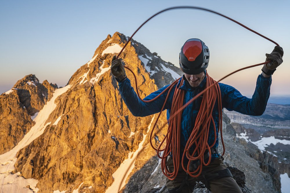
From Couch Potato to Thrill Seeker: How Adventure Travel Can Transform Your Life!
Adventure travel is the latest trend gaining momentum across the globe. It's all about stepping outside your comfort zone, facing challenges, and experiencing the unfamiliar. While adventure travel doesn't necessarily mean you have to engage in extreme sports like bungee jumping or white-water rafting, adventure travel can be as simple as exploring a new culture, trying exotic food, or even learning a foreign language.
Adventure travel is the latest trend gaining momentum across the globe. It's all about stepping outside your comfort zone, facing challenges, and experiencing the unfamiliar. While adventure travel doesn't necessarily mean you have to engage in extreme sports like bungee jumping or white-water rafting, adventure travel can be as simple as exploring a new culture, trying exotic food, or even learning a foreign language.
Adventure travel offers an exhilarating escape from routine, allowing individuals to embrace new challenges and push their limits. It provides an opportunity to explore awe-inspiring landscapes, engage with diverse cultures, and create unforgettable memories. With adventure travel, one can embark on thrilling activities, foster personal growth, and experience a profound sense of fulfillment and self-discovery.
Read on to discover the top nine benefits of adventure travel that will inspire you to book your next adventure trip.
After a long morning approach, we are about to start up the Durance Direct on the Grand Teton. Photo by Dalton Johnson
1. Build Confidence
The first, and perhaps most tangible benefit of adventure travel, is the growth in confidence. Navigating foreign landscapes, tackling unexpected challenges, and finding your way around new cities will inevitably boost your self-esteem. Every successful adventure serves as a testament to your capabilities, reinforcing your belief in yourself. This newfound confidence can permeate all aspects of your life, empowering you to conquer personal and professional hurdles.
Adventure travel offers a unique opportunity to build confidence through a series of exciting and unfamiliar experiences. Stepping outside of your comfort zone and embracing new challenges allows you to develop resilience and adaptability. Overcoming obstacles in unfamiliar environments, such as hiking through rugged terrains or trying out adrenaline-pumping activities, instills a sense of accomplishment and self-assurance.
Moreover, adventure travel encourages self-reliance as you navigate through unknown landscapes or interact with different cultures. Making independent decisions and solving problems on the go enhances your problem-solving skills and fosters a sense of self-reliance. These experiences provide a tangible reminder that you can handle unexpected situations and find solutions, boosting your overall confidence in your abilities.
The confidence gained from adventure travel transcends the trip itself and can positively impact various aspects of your life. The belief in your capabilities can extend to your personal relationships, professional endeavors, and even everyday challenges. With a newfound sense of self-assurance, you may be more inclined to take risks, pursue your goals with determination, and embrace opportunities that come your way.
2. Embrace Personal Challenge
Adventure travel puts you in situations that challenge you both physically and mentally. Whether it's hiking a mountain, sailing through rough seas, or negotiating in a foreign language, these experiences force you to push your limits. Overcoming these challenges not only gives you a sense of accomplishment but also reveals your inner strength and resilience, prompting personal growth.
Engaging in activities like trekking, rock climbing, or whitewater rafting requires you to push beyond your comfort zone and face physical obstacles. The physical demands of these adventures compel you to tap into your inner strength, endurance, and determination, allowing you to discover hidden capabilities you may have doubted or overlooked.
In addition to the physical challenges, adventure travel often exposes you to unfamiliar environments, cultures, and languages. Navigating through foreign cities, communicating with locals, and immersing yourself in different customs can be mentally stimulating and demanding. These encounters stretch your problem-solving abilities, adaptability, and cultural awareness, enabling personal growth and broadening your perspective.
Embracing personal challenges during adventure travel not only provides a sense of accomplishment but also fosters resilience. Overcoming obstacles and surmounting difficult situations instills a belief in your ability to overcome adversity, reinforcing your inner strength. The lessons learned from conquering these challenges become valuable life skills that can be applied to various situations, both during and after the trip.
Furthermore, the personal growth experienced through adventure travel extends beyond the trip itself. The confidence gained from pushing your limits and overcoming challenges can positively impact other areas of your life. It can inspire you to set ambitious goals, face daunting tasks, and pursue personal development with a renewed sense of determination.
In summary, adventure travel offers an opportunity to embrace personal challenges that test your physical and mental boundaries. By pushing yourself beyond comfort, you discover your inner strength, resilience, and potential for growth. These experiences not only provide a sense of accomplishment but also equip you with valuable life skills that can be applied to various aspects of your life, fostering personal development and a mindset of continuous growth.
3. Enhance Mental Health
The benefits of adventure travel aren't just physical; they also contribute significantly to mental health. Being in nature, participating in physical activities, and distancing yourself from the stress of daily life can reduce anxiety and depression. Moreover, the thrill of adventure releases dopamine and endorphins, our brain's "feel-good" chemicals, leading to an improved mood and overall sense of wellbeing.
When you immerse yourself in nature and take part in thrilling activities, it's like a natural remedy for anxiety and depression. Just imagine breathing in the fresh mountain air, feeling the warmth of the sun on your skin, and leaving behind the worries of everyday life. It's like a reset button for your mind!
Engaging in physical activities during adventure travel not only keeps you fit but also boosts your mood. When you're out there, hiking, biking, or exploring, your brain releases those incredible "feel-good" chemicals like dopamine and endorphins. They work their magic, making you feel energized, happy, and alive! It's like a natural high that stays with you throughout your trip and beyond.
But it's not just about the adrenaline rush, my friend. Adventure travel also provides an opportunity to disconnect from the constant hustle and bustle. Away from screens and daily stressors, you can truly relax and recharge. The peace and serenity of nature have a way of soothing your mind and helping you find inner balance.
The best part is that these positive effects on your mental health don't stop when the adventure ends. The memories and experiences you gain during your trip become a source of inspiration and happiness. They serve as a reminder of what you're capable of and the joy that comes from embracing life's adventures.
Friendship is an important part of sustainably traveling and adventuring. Photo by Dalton Johnson
4. Foster Relationship Building
Adventure travel offers ample opportunities to meet like-minded individuals. Shared experiences, particularly those that involve challenges, create strong bonds and long-lasting relationships. Additionally, collaborating to overcome obstacles encourages team-building, leading to enhanced communication and problem-solving skills. These experiences can translate into better interpersonal skills in your personal and professional life.
When you embark on an adventure, you're not just exploring new places, you're also opening the door to meet incredible like-minded individuals. Think about it, you'll be surrounded by fellow adventurers who share your love for thrill and exploration. The camaraderie that forms from sharing these unique experiences is simply unparalleled.
Imagine conquering challenging trails, navigating unfamiliar territories, or facing adrenaline-pumping activities alongside your newfound travel companions. These shared adventures create a strong bond that goes beyond the trip itself. You'll find yourself exchanging stories, supporting each other, and laughing together, creating memories that will last a lifetime.
What's more, working together to overcome obstacles during adventure travel builds teamwork skills. Whether you're coordinating a rock climbing route or navigating through a dense forest, you'll learn to communicate effectively, trust one another, and collaborate as a team. These skills not only enhance your adventure but also translate into better interpersonal relationships in your personal and professional life.
The connections you make during adventure travel often extend beyond the trip itself. You'll find yourself building friendships that endure even after you return home. The shared experiences and the bond formed during these adventures provide a solid foundation for lifelong connections. You might even discover travel buddies for future escapades!


5. Learning New Skills
In the realm of adventure travel, every trip is an opportunity to acquire new skills. This could range from wilderness survival techniques to learning how to scuba dive, rock climb, or even cook a foreign dish. These skills not only add to your life experiences but also increase your adaptability, resourcefulness, and self-reliance.
One of the most amazing aspects of embarking on an adventure is the opportunity it presents to acquire a wide range of new skills. Each trip becomes a gateway to personal growth, as you challenge yourself and learn things that will stay with you long after the adventure is over.
Adventure travel offers a plethora of possibilities to expand your skill set. Imagine immersing yourself in the wilderness and mastering survival techniques like building a shelter, starting a fire, or foraging for food. These invaluable skills not only provide a sense of empowerment but also increase your adaptability and self-reliance, enabling you to navigate unforeseen circumstances in both the great outdoors and everyday life.
But that's just the beginning, my friend! Adventure travel allows you to venture into thrilling activities like scuba diving, rock climbing, kayaking, or even paragliding. Engaging in these exhilarating pursuits not only brings you face to face with adrenaline-pumping experiences but also equips you with technical skills and knowledge. You'll be trained by experts, learn the proper techniques, and acquire a whole new set of capabilities that will leave you feeling accomplished and ready to take on new challenges.
Beyond physical activities, adventure travel also presents opportunities to learn about different cultures and their unique skills. You might find yourself taking a cooking class to master the art of preparing exotic dishes, learning traditional crafts from local artisans, or even picking up a new language to better communicate with the people you encounter along the way. These skills deepen your understanding of diverse cultures and create bridges of connection and appreciation.
The beauty of learning new skills through adventure travel is that they extend far beyond the trip itself. The knowledge and experiences gained become part of your personal growth journey, enriching your life in immeasurable ways. You'll find yourself more adaptable, resourceful, and confident in tackling new challenges, whether they arise during future adventures or in your everyday life.
6. Environmental Awareness
Most adventure travels incorporate elements of sustainability, promoting environmental awareness and responsibility. Experiencing nature's wonders firsthand makes the importance of conservation personal. It inspires a deeper appreciation for the environment and encourages practices that protect our planet.Whether you're hiking through majestic mountains, exploring pristine forests, or diving into crystal-clear waters, the beauty of nature surrounds you, making it impossible to ignore the importance of conservation.
Adventure travel often goes hand in hand with sustainable practices, aiming to minimize negative impacts on the environment and promote responsible tourism. As you embark on these journeys, you'll find yourself in the midst of breathtaking landscapes, witnessing firsthand the wonders of our planet. This immersive experience fosters a deep appreciation for nature and instills a sense of responsibility to protect it for future generations.
By venturing into these pristine environments, you become more aware of the fragility of ecosystems and the delicate balance of life within them. You'll witness the interconnectedness of flora, fauna, and the environment, understanding that our actions have a direct impact on these intricate systems. This newfound awareness becomes a driving force to adopt sustainable practices and minimize our carbon footprint.
Adventure travel often emphasizes Leave No Trace principles, encouraging travelers to tread lightly and minimize their impact on the environment. From properly disposing of waste to respecting wildlife habitats, these practices promote the long-term preservation of natural areas. They also extend to supporting local communities and economies, as responsible travel ensures that the benefits of tourism are shared equitably and contribute to sustainable development.
Moreover, adventure travel provides opportunities to engage with local conservation efforts. You may participate in eco-friendly initiatives like tree planting, wildlife monitoring, or beach clean-ups. These experiences not only allow you to make a tangible difference but also deepen your understanding of the challenges faced by different ecosystems and the importance of conservation efforts.
By immersing yourself in nature through adventure travel, you become an ambassador for environmental awareness. You carry the experiences, knowledge, and passion gained during your adventures, spreading the message of conservation in your everyday life. From making conscious choices to reduce waste to advocating for sustainable practices, you become part of a global movement to protect our planet.
A fisherman in Baja Mexico watching the seagulls swarm before headed out to check his lobster pots. Photo by Dalton Johnson
7. Cultural Immersion
Unlike conventional travel, adventure travel usually involves spending more time in less touristy locations. This gives you a chance to immerse yourself in the local culture. From learning a new language to understanding the customs, traditions, and lifestyle of the local people, cultural immersion provides a broader worldview. It fosters understanding, tolerance, and respect for diversity.
Let's dive into the incredible world of cultural immersion through adventure travel! One of the most amazing things about adventure travel is that it takes you off the beaten path and allows you to explore destinations that are often untouched by mass tourism. This means you'll have the opportunity to truly immerse yourself in the local culture, getting a glimpse into the authentic way of life.
Imagine spending more time in less touristy locations, where you can interact with locals, learn their language, and gain a deeper understanding of their customs, traditions, and lifestyle. You'll have the chance to step out of your comfort zone and embrace new experiences that are deeply rooted in the local culture. Whether it's participating in traditional ceremonies, tasting local delicacies, or learning traditional crafts, each encounter will broaden your worldview and enrich your travel experience.
Cultural immersion through adventure travel goes beyond surface-level interactions. It fosters a genuine appreciation for diversity and a greater understanding of different perspectives. As you connect with local communities, you'll develop empathy, tolerance, and respect for their way of life. It's through these meaningful exchanges that stereotypes are shattered, and true connections are formed.
Furthermore, cultural immersion during adventure travel provides a unique opportunity for personal growth. As you step into unfamiliar cultural settings, you'll be challenged to adapt, communicate, and navigate through different social norms. This process of cultural adaptation enhances your adaptability, open-mindedness, and global awareness. It's like opening a window to the world and expanding your horizons in ways you never thought possible.
8. Encourages Physical Fitness
Adventure activities are often physically demanding. They encourage you to train and stay fit, leading to an overall healthier lifestyle. Whether it's cycling, hiking, or swimming, the physical aspects of adventure travel help to maintain your fitness level and promote good health.
Adventure travel offers a wide range of physically demanding activities that push you beyond your limits. Whether it's hiking up mountains, cycling through scenic trails, or kayaking down rivers, these adventures require strength, endurance, and agility. By participating in these activities, you're not only having a blast, but you're also giving your body a fantastic workout.
Engaging in adventure travel naturally encourages you to prepare and stay fit before embarking on your journey. You'll find yourself motivated to train and improve your physical abilities to ensure you're ready for the challenges ahead. Whether it's hitting the gym, going on regular hikes, or engaging in specific training programs, the anticipation of adventure becomes a catalyst for maintaining and improving your fitness level.
The physical demands of adventure travel contribute to an overall healthier lifestyle. Regular physical activity boosts cardiovascular health, improves strength and flexibility, and increases your energy levels. It's like giving your body a revitalizing experience, as you work muscles you didn't know existed and push yourself to new heights.
Moreover, adventure travel often takes place in awe-inspiring natural landscapes. These environments offer a refreshing change from the monotony of indoor workouts. Imagine hiking up a breathtaking mountain, feeling the burn in your legs while being rewarded with stunning panoramic views. Or picture yourself paddling through pristine waters, strengthening your core and upper body as you immerse yourself in the serenity of nature. These experiences make physical activity feel like a thrilling adventure rather than a chore.
By engaging in physically demanding activities during adventure travel, you're not only reaping the immediate benefits but also cultivating a mindset of prioritizing your health. The habits you develop during these adventures can extend beyond the trip, inspiring you to incorporate regular exercise and physical activity into your daily life.
9. Storytelling
Finally, adventure travel fills your life with fascinating stories. The challenges, experiences, and people you meet along your journey can become cherished memories, anecdotes to share with friends, or even life lessons. These stories can inspire others to embark on their adventures, spreading the benefits of this enriching travel style even further. From the challenges you face to the remarkable people you meet, adventure travel fills your life with unforgettable experiences that become cherished memories and fascinating anecdotes.
Every adventure is a unique chapter in your life's story. Whether it's overcoming a difficult hike, conquering your fear of heights while rock climbing, or navigating through unfamiliar territories, these challenges become transformative moments that shape who you are. The stories that emerge from these experiences hold a special place in your heart, as they are a testament to your resilience, determination, and personal growth.
But it's not just about the challenges you conquer, my friend. Adventure travel introduces you to a diverse array of fascinating individuals along the way. From fellow adventurers to locals you encounter in your travels, each person has a story to share. The connections you make, the friendships you form, and the cultural exchanges you experience become the fabric of your journey. These stories of connection, understanding, and shared humanity inspire and remind us of the beauty of the human experience.
The stories that emerge from adventure travel have a magical quality to them. They have the power to transport listeners to far-off places, ignite a sense of wanderlust, and spark curiosity. Sharing these tales with family, friends, and even strangers not only brings joy but also serves as a source of inspiration. Your stories can inspire others to embark on their own adventures, encouraging them to step out of their comfort zones, embrace new experiences, and discover the transformative power of travel.
Moreover, the stories you collect during adventure travel become invaluable life lessons. They teach you about resilience in the face of adversity, the importance of embracing the unknown, and the beauty of human connection. These stories become a part of your personal narrative, shaping your perspective on life and reminding you of the incredible experiences and lessons learned along the way.
Headed home after a long day of surfing along HWY 1. Photo by Dalton Johnson
Adventure travel offers a broad spectrum of benefits, from boosting confidence and mental health to promoting cultural immersion and environmental awareness. So next time you're planning a trip, consider adding an element of adventure. Step out of your comfort zone, challenge yourself, and experience the world in a whole new way.
Discover more of Adventure Travel

Discovering Davenport: 5 Experiences You Can't Miss
As you embark on an unforgettable road trip along the Pacific Coast Highway (PCH), there are countless breathtaking sights to behold. Amidst the diverse landscapes, charming towns, and stunning vistas, one tiny gem often goes unnoticed - Davenport Landing. While it may lack the fanfare of larger cities, don't make the mistake of overlooking this coastal town. Here, we'll explore why stopping in Davenport Landing should be on your itinerary, allowing you to immerse yourself in its natural beauty, enjoy outdoor activities, and capture stunning photographs.
As you embark on an unforgettable road trip along the Pacific Coast Highway (PCH), there are countless breathtaking sights to behold. Amidst the diverse landscapes, charming towns, and stunning vistas, one tiny gem often goes unnoticed - Davenport Landing. While it may lack the fanfare of larger cities, don't make the mistake of overlooking this coastal town. Here, we'll explore why stopping in Davenport Landing should be on your itinerary, allowing you to immerse yourself in its natural beauty, enjoy outdoor activities, and capture stunning photographs.
Davenport, CA offers a range of activities for visitors to enjoy. Explore the natural beauty by walking along the cliffs and soaking in the stunning ocean views. Engage in thrilling water sports like surfing or capture breathtaking photographs at locations such as Shark Fin Cove and Davenport Pier.
Read on to discover the hidden gems of Davenport Landing, including its natural beauty, coastal hikes, surfing spots, and tips for swimming in the ocean, ensuring an unforgettable experience on your next visit to this captivating coastal town.
Wrapping up a sunset surf in Davenport, CA. Photo by Dalton Johnson
Enjoy the Natural Beauty:
Davenport, CA is blessed with natural beauty that will leave you in awe. The town is nestled along the coastline, offering breathtaking views of rugged cliffs and the majestic Pacific Ocean. Take a leisurely walk along the cliffs, where you can immerse yourself in the tranquility of the surroundings while being mesmerized by the expansive ocean vistas. The combination of crashing waves, dramatic rock formations, and untouched coastal landscapes creates a sense of serenity and connection with nature that is truly remarkable. Whether you're a nature lover, a photography enthusiast, or simply seeking a peaceful escape, the natural beauty of Davenport will captivate your senses and leave a lasting impression.
Walk Along the Cliffs:
Immerse yourself in the tranquility of Davenport Landing by embarking on a scenic walk along the cliffs. Feel the cool ocean breeze on your face as you traverse the well-maintained trails that wind their way along the coastline. The picturesque vistas from these cliffs provide a unique perspective on the power and vastness of the Pacific Ocean, creating a truly memorable experience.
Hiking suggestions:
Davenport Landing Cliffs Trail: This trail offers a stunning coastal hike along the cliffs of Davenport Landing. Enjoy panoramic views of the Pacific Ocean as you traverse the rugged coastline, with opportunities to spot wildlife and capture breathtaking photographs.
Shark Fin Cove Trail: Take a short but rewarding hike to Shark Fin Cove, known for its iconic rock formation resembling a shark's fin. This trail leads you through scenic coastal bluffs and offers a secluded beach where you can relax and soak in the beauty of the surroundings.
Panther Beach Trail: Located just south of Davenport Landing, Panther Beach is a hidden gem worth exploring. Follow the trail down to the beach, where you'll be greeted by golden sands, picturesque rock formations, and crashing waves. The hike itself offers breathtaking views of the coastline and is perfect for capturing memorable photos.
Bonny Doon Beach Trail: Venture north of Davenport Landing to Bonny Doon Beach, where a tranquil coastal hike awaits. This trail takes you through sandy dunes, coastal shrubs, and scenic overlooks, offering glimpses of the stunning beach below. Enjoy the serenity of the surroundings and the rhythmic sound of the waves crashing against the shore.
Wilder Ranch State Park: While not directly in Davenport Landing, Wilder Ranch State Park is a short drive away and offers a variety of coastal hiking trails. Explore the park's rugged cliffs, coastal bluffs, and picturesque coves as you hike along the network of trails, providing diverse vistas of the Pacific Ocean and the surrounding landscapes.
Surfing:
For adventure seekers and surf enthusiasts, Davenport Landing offers excellent surfing opportunities. Its consistent waves and uncrowded breaks make it an ideal spot for both beginners and experienced surfers. Whether you're looking to catch your first wave or want to test your skills, the pristine waters of Davenport Landing are waiting to be explored.
Davenport offers excellent surfing opportunities for all skill levels. The consistent waves attract surfers looking to catch some memorable rides. Whether you're a beginner learning to ride your first wave or an experienced surfer seeking a new spot to test your skills, Davenport has something to offer.
One of the main surf spots in Davenport is Davenport Landing Beach. It provides a sandy beach break with waves suitable for beginners during smaller swells and more challenging waves for advanced surfers during larger swells. The uncrowded nature of the beach allows for ample space to enjoy the waves without feeling crowded.
It's important to note that Davenport's coastal waters can be cold, even during the summer months. Wearing a wetsuit is advisable to stay warm and comfortable while enjoying the waves. Additionally, it's always a good idea to check the surf conditions and tides before heading out. Local surf reports and websites can provide up-to-date information on wave height, wind conditions, and water temperature.
Surfing in Davenport allows you to immerse yourself in the beauty of the coastline while enjoying the thrill of riding the waves. Whether you're a seasoned surfer or new to the sport, the surf breaks in and around Davenport offer a fantastic opportunity to experience the exhilaration of surfing in a picturesque and uncrowded setting.


Photograph Gorgeous Locations:
Davenport Landing is a haven for photography enthusiasts. From the iconic Shark Fin Cove to the picturesque Davenport Pier, this coastal town offers an abundance of stunning locations to capture. Shark Fin Cove, named after its distinctive rock formation, is a photographer's dream, with its secluded beach, dramatic cliffs, and crashing waves. The Davenport Pier provides an excellent vantage point for capturing the scenic beauty of the area, especially during sunrise or sunset. Don't forget to bring your camera and capture these unforgettable moments.
Swim in the Ocean:
Swimming in the ocean around Davenport, CA can be a refreshing and enjoyable experience. Here's more information about swimming in the area:
Where to Swim:
Davenport Landing Beach is a popular spot for swimming. This sandy beach provides a suitable area for taking a dip in the ocean. The beach offers a relatively calm and protected environment, making it a great choice for swimmers of varying skill levels. However, it's always important to assess the conditions and use caution before entering the water.
Safety:
When swimming in the ocean, it's crucial to prioritize safety. Here are a few safety tips to keep in mind:
Be aware of the current conditions and check for any posted warnings or advisories before entering the water.
Pay attention to the tides and understand how they may affect the water's depth and strength of the waves.
If you're not a strong swimmer, consider wearing a life jacket or staying in shallower areas.
Swim with a buddy whenever possible, and keep an eye out for one another.
Things to Know:
The coastal waters around Davenport can be colder than expected, even during the summer months. It's advisable to bring a wetsuit or a swim top to keep yourself comfortable and warm while swimming. Additionally, be mindful of the potential presence of marine life and respect their natural habitat.
Sharks:
While shark encounters are rare, it's important to be aware of the possibility when swimming in the ocean. Sharks are a natural part of the marine ecosystem, and Davenport's coastal waters are no exception. While most shark species are not aggressive towards humans, it's always a good idea to stay informed about any recent shark sightings or activity in the area. If you do encounter a shark, remain calm and slowly and calmly move back toward the shore.
What to Bring:
When swimming in the ocean around Davenport, consider bringing the following items:
Swimwear or wetsuit: Dress appropriately for the water temperature and conditions.
Sunscreen: Protect your skin from the sun's rays, even on cloudy days.
Towel: Dry off and stay warm after your swim.
Water shoes: Some areas may have rocky terrain, so water shoes can provide added protection and comfort.
Water and snacks: Stay hydrated and refuel during your beach visit.
By following safety guidelines, staying informed about local conditions, and respecting the natural environment, you can enjoy a safe and refreshing swimming experience in the beautiful ocean waters around Davenport, CA.
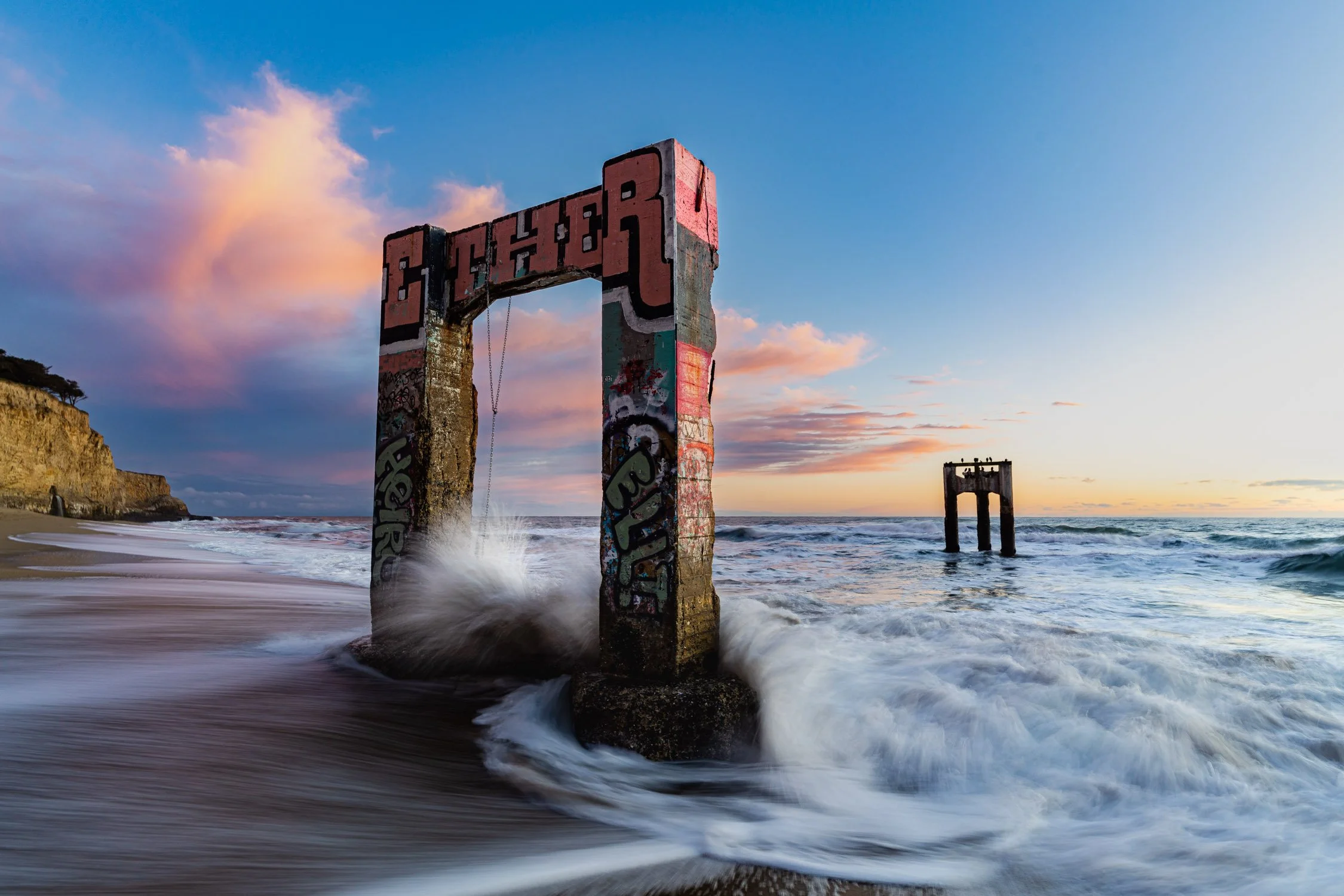
The abandoned pier at Davenport Landing during a cotton candy sunset. Photo by Dalton Johnson
Davenport Landing may be a tiny town, easily missed if you're not paying attention, but it offers an array of experiences that make it worth stopping on your PCH road trip. The natural beauty of the rugged cliffs and mesmerizing ocean views, combined with activities like walking along the cliffs, surfing, photographing scenic locations, and swimming in the ocean, create a truly captivating and immersive experience. So, next time you find yourself driving along the PCH, make sure to include a stop at Davenport Landing to discover the hidden charm and unforgettable beauty that await you there.
Discover more of the Pacific Coast Highway


Top Action-Packed Stops along Your Highway 395 Road Trip
Highway 395 is an adventurer's paradise, providing access to the breathtaking Eastern Sierra Mountains. This scenic road trip route is a playground for outdoor enthusiasts, offering a wide array of activities and attractions along the way. If you're planning a journey along Highway 395 and find yourself unsure of where to stop, this blog is here to help.
Highway 395 is an adventurer's paradise, providing access to the breathtaking Eastern Sierra Mountains. This scenic road trip route is a playground for outdoor enthusiasts, offering a wide array of activities and attractions along the way. If you're planning a journey along Highway 395 and find yourself unsure of where to stop, this blog is here to help.
Road tripping along Highway 395 is a must for nature enthusiasts and outdoor adventurers. This scenic route showcases the stunning beauty of the Eastern Sierra Mountains, offering breathtaking vistas, alpine lakes, and unique geological formations. Whether you're seeking ghost towns, ancient trees, or outdoor activities like hiking, skiing, and fishing, Highway 395 provides an unparalleled experience that will leave you in awe of nature's wonders.
Read on to discover a list of 10 must-stop places that will make your road trip an unforgettable experience.
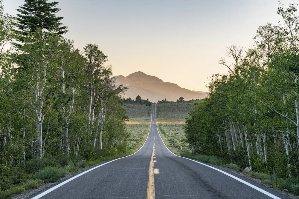
Exploring the backroads off Highway 395. Photo by Dalton Johnson
Pros of Road Tripping Highway 395:
Scenic Beauty: Highway 395 offers stunning natural beauty at every turn. From the majestic Eastern Sierra Mountains to picturesque lakes, you'll be treated to breathtaking vistas and landscapes throughout your journey.
Outdoor Adventure: The highway provides access to numerous outdoor activities. Whether you enjoy hiking, camping, rock climbing, skiing, or simply immersing yourself in nature, Highway 395 offers a wide range of opportunities to indulge in your favorite outdoor pursuits.
Unique Stops: Along Highway 395, you'll encounter charming towns, historic sites, and unique attractions. From exploring the ghost town of Bodie to soaking in natural hot springs, there are plenty of interesting and offbeat stops to add variety and excitement to your road trip.
Less Crowded: Compared to more popular tourist routes, Highway 395 is relatively less crowded. This means you can enjoy a more peaceful and relaxed journey, with fewer traffic jams and shorter lines at attractions, making for a more enjoyable road trip experience.
Cons of Road Tripping Highway 395:
Limited Amenities: While Highway 395 offers breathtaking natural beauty, it may lack the same level of amenities and services found in more populated areas. Remote stretches of the highway can have limited options for gas, food, and accommodations, so it's essential to plan accordingly and be prepared for potential scarcity.
Seasonal Limitations: Certain activities and attractions along Highway 395 are highly seasonal. For example, winter snowfall can limit access to higher elevation areas, and some campsites or hiking trails may be closed during certain times of the year. It's important to check seasonal conditions and plan your trip accordingly to avoid disappointment.
Long Distances: Highway 395 stretches for over 550 miles, which means long driving distances between some of the key attractions. This may require careful planning and consideration of your travel time and energy levels to ensure you have ample time to explore and enjoy each destination without feeling rushed.
Limited Cellular Coverage: In some remote areas along Highway 395, cellular coverage may be limited or non-existent. This can pose challenges for navigation, communication, and accessing online resources. It's advisable to have offline maps and plan your stops and accommodations in advance to mitigate any connectivity issues.
1. Rock Climbing at Owens River Gorge:
If you're an avid rock climber or simply seeking a thrilling challenge, Owens River Gorge is a must-visit destination. This dramatic canyon boasts over 500 climbing routes with varying difficulty levels, making it a paradise for climbers of all skill levels.
10 must climb routes at Owen’s River Gorge:
Fish Crack (5.10a): A classic crack climb with sustained hand jams and finger locks. It's a great introduction to the gorge's crack climbing style.
Pop Rocks (5.10c): This route offers technical face climbing with thin crimps and delicate footwork. It's a test of balance and precision.
Broken Brain (5.11a): A steep and pumpy route with powerful moves on pockets and crimps. It requires endurance and good route-reading skills.
Flower of Power (5.11c): This route features sustained climbing on small edges and pockets. It rewards climbers with intricate sequences and technical footwork.
Perpetual Motion (5.12a): A challenging route with sustained climbing on steep terrain. It demands strength, endurance, and precise movement.
Heinous Cling (5.12b): This route lives up to its name, offering a strenuous series of long reaches and powerful moves. It's a great test for experienced climbers.
Ironman Traverse (5.12c): A traverse that requires strength, finger strength in particular, and careful foot placement. It's a classic testpiece at the gorge.
Loompa (5.12d): A sustained and technical climb with intricate sequences and tricky cruxes. It's a rewarding challenge for advanced climbers.
Flyin' Hawaiian (5.13a): A steep and powerful route featuring big moves between pockets and edges. It demands strength, finger strength, and dynamic movement.
Iron Curtain (5.13b): A demanding and technical climb on overhanging terrain. It requires strength, endurance, and precise footwork.
2. Great Hikes in the Ancient Bristlecone Pine Forest:
Hiking in the Ancient Bristlecone Pine Forest is a truly remarkable experience that takes you into the realm of some of the oldest living trees on Earth. Located in the White Mountains of California, this ancient forest is home to the renowned Bristlecone Pine trees, some of which have been standing for thousands of years. The unique and rugged landscape, combined with the ethereal presence of these ancient trees, creates an atmosphere of awe and wonder that is unmatched.
One of the best parts of hiking in the Ancient Bristlecone Pine Forest is the opportunity to witness these ancient trees up close. As you venture along the trails, you'll encounter gnarled and twisted bristlecone pines, their weathered trunks revealing the stories of centuries past. The Methuselah Trail, named after the oldest known bristlecone pine, offers a moderate hike that showcases the incredible resilience and beauty of these ancient trees. The high altitude and thin air add an extra sense of adventure to your journey, as you navigate the rocky terrain and take in breathtaking views of the surrounding mountains.
If you're a nature enthusiast or simply appreciate the wonders of the natural world, a visit to the Ancient Bristlecone Pine Forest is an absolute must. The combination of stunning vistas, ancient trees, and a serene atmosphere make it a unique destination that will leave a lasting impression. As you walk among these ancient sentinels, you can't help but feel a sense of reverence and connection to the immense timeline of our planet's history. The Ancient Bristlecone Pine Forest is a place that invites reflection, awe, and an appreciation for the beauty and resilience of nature. Don't miss the chance to experience this magical and ancient forest for yourself.
3. Camping Spots at Convict Lake:
For a memorable camping experience, head to Convict Lake. Nestled in a picturesque valley, this serene lake offers a tranquil setting for camping enthusiasts. Set up your tent by the lakeshore, enjoy stunning views of the surrounding peaks, and spend your days fishing, hiking, or simply soaking in the natural beauty of the area.
4. Alabama Hills:
Calling all photography enthusiasts! The iconic Alabama Hills offer a stunning backdrop for capturing breathtaking images. With its majestic rock formations and panoramic views of the Sierra Nevada Mountains, this area has been a favorite location for countless films and photographers. Don't forget your camera as you explore the trails and capture the beauty of this rugged landscape.
Here are four must-visit photo spots in the Alabama Hills:
Mobius Arch: One of the most iconic and photographed arches in the Alabama Hills, Mobius Arch provides a natural frame for the majestic Sierra Nevada Mountains. Capture the sunrise or sunset through the arch, and you'll be rewarded with breathtaking shots. Experiment with different angles and perspectives to create stunning compositions.
Lone Pine Peak Reflection: Head to the eastern end of the Alabama Hills, where you can find reflective pools after rain or snowmelt. This area offers the perfect opportunity to capture the reflection of the towering Lone Pine Peak against the calm waters. The contrast between the rugged mountains and the mirrored surface creates a striking image.
Movie Road Panoramas: Along Movie Road, you'll find several spots that offer expansive panoramas of the Alabama Hills. Look for vantage points where you can capture the vastness of the landscape, the unique rock formations, and the rugged beauty of the surrounding mountains. These panoramic shots are great for showcasing the grandeur of the area.
The Eye of Alabama: Located in the heart of the Alabama Hills, the Eye of Alabama is a distinctive rock formation that resembles an eye. This natural wonder makes for an intriguing subject, especially during golden hour when the warm light bathes the landscape. Experiment with different compositions and perspectives to capture the mystique of this unique formation.
5. Skiing at Mammoth Mountain:
Skiing at Mammoth Mountain is a dream come true for winter sports enthusiasts. Located in the Eastern Sierra Nevada range of California, Mammoth Mountain is renowned for its vast skiable terrain, reliable snowfall, and breathtaking scenery. With over 3,500 acres of skiable terrain, including steep chutes, wide-open bowls, and perfectly groomed runs, there is something for everyone, from beginners to expert skiers and snowboarders.
One of the best parts of skiing at Mammoth Mountain is the sheer variety of terrain it offers. Whether you prefer cruising down long groomed slopes, seeking adrenaline-pumping steeps and moguls, or exploring powder-filled backcountry areas, you'll find it all at Mammoth. The mountain's diverse terrain is complemented by its state-of-the-art lift system, which allows for efficient access to the slopes and minimal wait times. With an average annual snowfall of over 400 inches, Mammoth Mountain ensures excellent snow conditions throughout the winter season.
Aside from the exceptional skiing and snowboarding, Mammoth Mountain boasts stunning alpine vistas that will take your breath away. On clear days, you can enjoy panoramic views of the snow-capped Sierra Nevada Mountains, including the iconic Minarets. The combination of pristine white slopes and the beauty of the surrounding natural landscape creates a truly magical setting for your skiing adventures.
If you're a skiing or snowboarding enthusiast, a trip to Mammoth Mountain is an absolute must. The combination of diverse terrain, reliable snow, and breathtaking scenery makes it a premier destination for winter sports. Whether you're a seasoned pro or a beginner looking to improve your skills, Mammoth Mountain offers an unforgettable experience. So, grab your gear, hit the slopes, and immerse yourself in the exhilarating world of skiing at Mammoth Mountain.
6. Soak in Hot Springs at Travertine:
Treat yourself to a rejuvenating experience at the Travertine Hot Springs. Located just outside of Bridgeport, these natural hot springs offer a serene oasis amidst the Eastern Sierra landscape. Relax in the warm mineral-rich waters while taking in the panoramic views of snow-capped peaks and alpine meadows.
Also, make sure to check out the plethora of hot springs around the Mammoth area like these ones outlined in DISCOVERING HWY 395'S HOT SPRING HAVEN
7. Hiking at Devils Postpile National Monument:
Hiking at Devils Postpile National Monument is a remarkable experience that takes you through a landscape shaped by volcanic activity and reveals the stunning beauty of the unique geological formation known as the Devils Postpile. Located in the Eastern Sierra Nevada of California, this national monument offers a variety of trails that cater to hikers of all skill levels, allowing you to explore the natural wonders and rich history of the area.
One of the best parts of hiking at Devils Postpile National Monument is the opportunity to witness the extraordinary geological formation of the Devils Postpile up close. This rare formation consists of towering hexagonal basalt columns that were formed over thousands of years by volcanic activity. The Main Trail takes you to the base of the formation, allowing you to marvel at the intricacy and symmetry of these natural pillars. It's a sight that will leave you in awe of the forces of nature.
In addition to the Devils Postpile, the area is also home to picturesque waterfalls, tranquil meadows, and dense forests, creating a diverse and scenic hiking environment. The trails in the monument lead you through stunning landscapes, offering opportunities for wildlife spotting, wildflower viewing, and breathtaking views of the surrounding mountains. Whether you choose a short stroll or a longer hike, there is no shortage of natural beauty to discover and enjoy.
8. Explore Bodie State Historic Park:
Explore Bodie State Historic Park and step back in time to the captivating era of the Wild West. Located in the eastern Sierra Nevada Mountains of California, Bodie is a well-preserved ghost town that offers a unique glimpse into the lives and stories of the people who once inhabited this bustling gold-mining community. Designated as a State Historic Park, Bodie provides visitors with an immersive experience, transporting them to the late 19th century and showcasing the town's well-preserved buildings, artifacts, and remnants of a bygone era.
One of the best parts of exploring Bodie State Historic Park is the opportunity to wander through the weathered buildings and imagine what life was like during the town's heyday. From saloons and general stores to homes and schools, the preserved structures offer a fascinating insight into the challenges and triumphs of a thriving mining town. Visitors can explore the interiors, peer into the past through the preserved furnishings, and gain a deeper understanding of the daily lives of the people who lived here.
In addition to the authentic buildings, Bodie's remote location amidst a vast expanse of high desert creates a hauntingly beautiful backdrop. The surrounding landscape, with its rolling hills and expansive vistas, adds to the atmospheric charm of the ghost town. The park also hosts various events and guided tours, providing further opportunities to learn about the history and cultural significance of Bodie.
9. Explore Bishop:
Explore Bishop, a charming town nestled in the Owens Valley of California, and discover a hidden gem for outdoor enthusiasts and nature lovers. Known as a gateway to the stunning Eastern Sierra Nevada Mountains, Bishop offers a unique blend of small-town charm, breathtaking landscapes, and a myriad of outdoor activities. Whether you're seeking adventure or a tranquil retreat, Bishop has something to offer for everyone.
One of the best parts of exploring Bishop is the abundance of outdoor activities available in the surrounding area. From world-class rock climbing in the nearby Owens River Gorge to hiking and backpacking in the stunning Sierra Nevada Mountains, Bishop serves as a basecamp for a wide range of adventures. Cast your fishing line in the pristine waters of the Owens River or nearby alpine lakes, explore the countless hiking trails that lead to breathtaking vistas and hidden gems, or simply soak in the serenity of the natural surroundings.
Beyond its natural beauty, Bishop also boasts a vibrant and welcoming community. Take a leisurely stroll along Main Street and discover a variety of local shops, art galleries, and eateries that showcase the town's unique character. Indulge in delicious baked goods from the world-famous Erick Schat's Bakkerÿ, browse through local boutiques, or engage in conversation with friendly locals who embody the warm hospitality that Bishop is known for.
10. Backpacking in the John Muir Wilderness:
Backpacking in the John Muir Wilderness is a transformative experience that allows you to immerse yourself in the awe-inspiring beauty of one of California's most pristine wilderness areas. Named after the renowned naturalist and conservationist, the John Muir Wilderness encompasses over 581,000 acres of rugged terrain, majestic peaks, crystal-clear lakes, and meandering rivers. With its remote location in the Sierra Nevada Mountains, backpacking in this wilderness provides an opportunity to disconnect from the modern world and reconnect with nature in its purest form.
One of the best parts of backpacking in the John Muir Wilderness is the incredible diversity of landscapes that await you. From towering granite peaks to tranquil alpine meadows, the wilderness offers a variety of ecosystems to explore. Traverse challenging mountain passes, witness dramatic waterfalls, and camp by pristine alpine lakes that reflect the surrounding peaks. The John Muir Trail, which passes through the wilderness, offers an iconic long-distance hiking experience, allowing you to embark on a multi-day journey through some of the most breathtaking scenery in the world.
Beyond the stunning landscapes, backpacking in the John Muir Wilderness provides a sense of solitude and serenity that is increasingly rare in our busy lives. With limited access and strict wilderness regulations, you can find peace and tranquility as you navigate the trails and camp under the star-filled night sky. The wilderness also offers ample opportunities for wildlife encounters, from glimpses of marmots and deer to the possibility of spotting majestic creatures like black bears or bighorn sheep. It's an immersive experience that fosters a deep appreciation for the natural world and a connection to the legacy of conservation that John Muir himself championed.
Backpacking in the Eastern Sierra Mountains. Photo by Dalton Johnson
Highway 395 is a road trip destination that caters to the desires of outdoor enthusiasts and nature lovers alike. From thrilling rock climbing adventures in Owens River Gorge to serene hikes amidst the Ancient Bristlecone Pine Forest, this scenic route offers a plethora of experiences that will leave you in awe.So, pack your bags, hit the road, and let Highway 395 be your guide to adventure and exploration. Discover the hidden gems, embrace the majestic landscapes, and immerse yourself in the rich outdoor offerings of this remarkable region. Whether you're an adrenaline junkie, a nature enthusiast, or a history buff, Highway 395 is sure to captivate your spirit and leave you yearning for more. So, buckle up and get ready for an incredible journey along one of California's most breathtaking highways.
Discover more of Eastern Sierra

How To Vanlife the Pacific Coast Highway
Embarking on a vanlife journey is an exhilarating experience, and when it comes to iconic road trips, few can rival the beauty and allure of the Pacific Coast Highway (PCH). Stretching along the stunning coastline of California, this scenic route offers breathtaking views, charming towns, and unforgettable experiences.
Embarking on a vanlife journey is an exhilarating experience, and when it comes to iconic road trips, few can rival the beauty and allure of the Pacific Coast Highway (PCH). Stretching along the stunning coastline of California, this scenic route offers breathtaking views, charming towns, and unforgettable experiences.
Vanlife the PCH combines the freedom of the open road with the breathtaking beauty of the Pacific Coast. It allows you to wake up to stunning coastal views, explore hidden gems, and create unforgettable memories at your own pace. Vanlife on the PCH offers a unique opportunity to immerse yourself in nature, connect with a vibrant community, and experience the magic of this iconic coastal route.
In this blog post, we'll delve into the magic of vanlife on the Pacific Coast Highway, sharing stories and tips to inspire your own adventure.
Taking in the last few glances of a Big Sur sunrise. Photo by Dalton Johnson
Pros of Vanlife Road Trip Down the PCH:
Flexibility and Freedom: One of the major advantages of vanlife on the Pacific Coast Highway is the freedom it offers. You have the flexibility to set your own itinerary, explore at your own pace, and make spontaneous stops along the way. Whether you want to spend an extra day at a scenic beach or take a detour to a hidden gem, the freedom of vanlife allows you to make those decisions on the fly.
Cost-Effectiveness: Vanlife can be a budget-friendly way to travel the PCH. By having your accommodation and kitchen on wheels, you can save on lodging and dining expenses. You have the option to cook your own meals, reducing the need for eating out constantly. Additionally, many campsites and RV parks along the PCH offer affordable camping options, allowing you to stretch your travel budget further.
Connection with Nature: Vanlife allows you to immerse yourself in nature and enjoy the stunning landscapes along the PCH. Waking up to breathtaking ocean views, falling asleep under starry skies, and having the flexibility to camp in picturesque locations gives you a unique connection to the natural beauty of the coast. You can explore national parks, hike scenic trails, and enjoy outdoor activities in some of the most captivating settings.
Cons of Vanlife Road Trip Down the PCH:
Limited Space: The limited living space in a van can be a challenge, especially if you are traveling with a group or have a lot of gear. Storage can be limited, and it's important to plan and pack efficiently to make the most of the available space. The compact living quarters may require some adjustments and compromises in terms of comfort and convenience.
Basic Amenities: Vanlife often means living with basic amenities compared to traditional accommodations. While modern van conversions can provide certain comforts, such as a bed, a small kitchenette, and portable toilets, they may not offer the same level of convenience as hotels or vacation rentals. Limited bathroom facilities, showers, and the need to be self-sufficient in terms of water and electricity can be a trade-off for the freedom of vanlife.
Driving and Parking Challenges: Navigating the PCH in a van can present some driving and parking challenges. The road can be narrow and winding in certain areas, requiring attentiveness and caution. Finding suitable parking spots for larger vans can sometimes be a challenge, especially in popular tourist destinations or during peak travel periods. It's important to plan ahead, be mindful of local regulations, and be prepared for potentially limited parking options.
Why Vanlife the PCH?
Vanlife on the Pacific Coast Highway offers a unique and immersive experience that allows you to fully embrace the freedom, flexibility, and beauty of the journey. Here are three compelling reasons why vanlife is the perfect way to explore the PCH.
Firstly, traveling in a van provides unparalleled freedom and convenience. With a van, you have the flexibility to set your own pace, stop at scenic viewpoints, and camp in breathtaking locations along the coast. You have the freedom to choose your own schedule and can adjust it as you go, allowing for spontaneous detours and unexpected adventures. Additionally, having your accommodation on wheels means you can wake up to stunning ocean views or fall asleep under starry skies, creating a truly immersive experience with nature.
Secondly, vanlife offers the ideal way to road trip, combining comfort and convenience. A well-equipped van can provide a cozy sleeping area, a small kitchenette for preparing meals, and storage space for your gear. This means you can bring all your essentials with you, have the convenience of cooking your own meals, and save on accommodation costs. With a van, you have the luxury of having everything you need within arm's reach, making it a comfortable and self-contained home on wheels.
Lastly, vanlife on the PCH is an invitation to embrace a simpler and more adventurous lifestyle. It allows you to disconnect from the hustle and bustle of everyday life and reconnect with nature. You can wake up to the sound of crashing waves, chase sunsets along the coast, and immerse yourself in the breathtaking landscapes that the PCH offers. The vanlife community is vibrant and supportive, providing opportunities to meet like-minded adventurers, share stories, and create lasting memories.
How Long Does It Take to Road Trip the PCH?
Embarking on a road trip along the Pacific Coast Highway (PCH) is an adventure that allows you to soak in the stunning coastal landscapes and explore charming towns along the way. The duration of your PCH road trip can vary depending on several factors, including the stops you plan to make, your preferred pace, and the amount of time you have available. Here's a general idea of the time you might need to allocate for your journey.
Full Route: If you aim to cover the entire Pacific Coast Highway, starting from Leggett, California, in the north and ending at Dana Point, near Los Angeles, the distance spans approximately 600 miles. A direct drive from start to finish without any stops would take around 10-12 hours, depending on traffic conditions. However, it is highly recommended to take your time and savor the journey, making stops along the way.
Days Needed: To truly experience the beauty and attractions along the PCH, it's ideal to allocate at least five to seven days for your road trip. This allows for a more relaxed pace, allowing you to explore key destinations, take scenic detours, and engage in activities such as hiking, surfing, and enjoying the local culture.
Highlights and Priorities: If you have limited time, it's essential to prioritize the highlights you wish to experience along the PCH. Identify the must-see attractions, towns, and natural wonders that you don't want to miss and plan your route accordingly. For example, you might choose to focus on exploring Big Sur, Santa Barbara, and the iconic cities of San Francisco and Los Angeles, allowing you to complete the journey in around three to four days.
Flexibility and Side Trips: Keep in mind that road trips are often about flexibility and spontaneity. The PCH offers numerous opportunities for scenic detours, such as visiting the charming coastal towns of Mendocino, Santa Cruz, or Carmel-by-the-Sea. These side trips can extend the duration of your road trip, but they provide unique experiences and hidden gems that are worth exploring if time permits.
Traffic and Seasonal Considerations: It's important to consider the potential impact of traffic and the time of year you plan your PCH road trip. Popular summer months, weekends, and holiday periods may see increased traffic and longer travel times, particularly in more congested areas. Additionally, be aware of any road closures or restrictions due to weather conditions or construction work that could affect your journey.
Ultimately, the length of your PCH road trip is a personal decision based on your preferences and available time. Whether you have a few days or a couple of weeks, embracing the freedom of the open road and immersing yourself in the beauty of the Pacific Coast Highway is an experience that will create lasting memories.
The PCH from the sky. Photo by Dalton Johnson
Planning your Route:
Before hitting the road, it's essential to plan your route along the Pacific Coast Highway. The journey typically begins in the north at Leggett, California, and winds its way down to Dana Point, near Los Angeles, covering approximately 600 miles. Research the highlights you don't want to miss, such as the majestic Redwood National and State Parks, the artistic haven of Big Sur, and the vibrant cities of San Francisco and Los Angeles.
Here's a suggested 10-day itinerary for your vanlife adventure along the Pacific Coast Highway:
Day 1: Start in San Francisco
Explore iconic attractions like the Golden Gate Bridge, Fisherman's Wharf, and Alcatraz Island.
Enjoy the vibrant food scene and cultural landmarks of the city.
Day 2: Drive to Santa Cruz
Visit the Santa Cruz Beach Boardwalk and take a ride on the historic Giant Dipper roller coaster.
Explore the beautiful beaches and go surfing or paddleboarding.
Take a scenic hike in the nearby redwood forests.
Day 3: Explore Big Sur
Drive along the stunning coastal stretch of Big Sur, stopping at viewpoints like Bixby Creek Bridge and McWay Falls.
Hike in Pfeiffer Big Sur State Park or explore Julia Pfeiffer Burns State Park's trails.
Camp at a scenic campground in Big Sur and enjoy the serene surroundings.
Day 4: Arrive in San Simeon and Morro Bay
Visit Hearst Castle in San Simeon for a fascinating glimpse into California's history.
Explore the charming town of Morro Bay, known for its iconic Morro Rock and beautiful waterfront.
Relax on the beach, go kayaking, or take a scenic boat tour.
Day 5: Discover Santa Barbara
Spend the day exploring the Spanish-influenced architecture, vibrant downtown area, and beautiful beaches of Santa Barbara.
Visit the Santa Barbara Mission, stroll along Stearns Wharf, and enjoy the local cuisine and wine scene.
Day 6: Continue to Malibu and Los Angeles
Drive through Malibu and enjoy the stunning coastal scenery.
Arrive in Los Angeles and explore popular attractions like Hollywood Walk of Fame, Griffith Observatory, or Universal Studios.
Experience the vibrant food, art, and cultural scenes of the city.
Day 7: Explore Los Angeles
Visit iconic landmarks such as the Getty Center, Venice Beach, or the Santa Monica Pier.
Explore the trendy neighborhoods of Hollywood, Beverly Hills, and Downtown LA.
Take a hike in Runyon Canyon or visit one of the city's beautiful parks.
Day 8: Head to Orange County
Drive south to Orange County and explore the picturesque beaches and charming towns like Newport Beach and Huntington Beach.
Enjoy surfing, beach activities, and relaxing on the sandy shores.
Indulge in the vibrant dining and shopping scenes of Orange County.
Day 9: Journey to San Diego
Drive to San Diego and explore attractions like Balboa Park, the San Diego Zoo, or Old Town San Diego State Historic Park.
Relax on the beautiful beaches, visit the famous Coronado Island, or take a harbor cruise.
Enjoy the vibrant nightlife and diverse culinary offerings of San Diego.
Day 10: Depart from San Diego
Take your final day to explore any remaining sights in San Diego.
Reflect on your amazing vanlife adventure along the Pacific Coast Highway.
Return the van or continue your travels beyond the PCH.
Remember to adjust the itinerary based on your personal preferences and interests. Allow for flexibility and spontaneous detours along the way to truly enjoy the beauty and surprises the Pacific Coast Highway has to offer.
Sunset at pigeon point lighthouse near Santa Cruz, CA. Photo by Dalton Johnson
Essential Vanlife Preparations:
Vanlife on the Pacific Coast Highway requires careful preparations to ensure a smooth and enjoyable trip. Consider equipping your van with the necessary amenities like a comfortable sleeping area, cooking facilities, and storage solutions. Stock up on camping gear, including a reliable stove, cooler, and camping chairs. Since the route takes you through diverse climates, pack accordingly with layers of clothing, including rain gear.
Essentials:
Driver's license, registration, and insurance documents
Vehicle manuals and maintenance records
Roadside emergency kit (including jumper cables, tire repair kit, and roadside flares)
Spare tire and necessary tools
Camping Gear:
Tent or camper van with a comfortable sleeping setup
Sleeping bags, blankets, and pillows
Camping chairs and a portable table
Lanterns or headlamps for nighttime illumination
Camping stove and fuel
Cookware, utensils, and dishes
Cooler or fridge for storing food and drinks
Portable water container and water purification system
Camping hammock for relaxation
Camping shower and toiletries
Clothing and Personal Items:
Weather-appropriate clothing (including layers, rain gear, and swimwear)
Sturdy hiking shoes or boots
Flip flops or sandals for beach outings
Hat, sunglasses, and sunscreen
Personal hygiene items (toothbrush, toothpaste, soap, etc.)
Towels and washcloths
First aid kit
Insect repellent
Kitchen Supplies:
Food supplies (non-perishable items, snacks, and cooking essentials)
Food storage containers and ziplock bags
Reusable water bottles and travel mugs
Cutting board and knife set
Can opener and bottle opener
Cooking utensils (spatula, tongs, whisk, etc.)
Plates, bowls, and utensils
Coffee maker or portable coffee press
Electronics and Entertainment:
Cell phone and charger
Portable power bank
GPS navigation device or smartphone app
Camera and extra batteries
Portable speakers or Bluetooth speaker
Books, magazines, or e-books
Outdoor games or sporting equipment (frisbee, football, etc.)
Musical instruments, if desired
Miscellaneous Items:
Camping and hiking guidebooks or maps
Travel pillows and blankets for added comfort
Cash and credit cards
Trash bags and recycling bags
Laundry supplies (detergent, clothesline, etc.)
Travel adapters and extension cords
Multi-tool or Swiss Army knife
Firewood and fire starter for campfires (where permitted)
Remember to pack according to your specific needs and preferences. Consider the duration of your trip, the weather conditions, and any specific activities you plan to engage in along the Pacific Coast Highway. Adapt the packing list accordingly and make sure to double-check it before hitting the road for a memorable vanlife adventure!
Camping Spots Along the PCH
Camping along the Pacific Coast Highway (PCH) is an incredible way to fully immerse yourself in the natural beauty of the region and create lasting memories. From beachside campsites to serene forested areas, the PCH offers a wide range of camping spots that cater to different preferences and budgets. Here are a few notable camping spots along the PCH to consider for your road trip:
Jedediah Smith Redwoods State Park (Northern California): Located near Crescent City, Jedediah Smith Redwoods State Park offers a truly magical camping experience amidst towering ancient redwoods. Campgrounds such as Jedediah Smith Campground and Mill Creek Campground provide a serene atmosphere surrounded by lush greenery. Take nature walks, hike among the giants, and enjoy the peaceful ambiance of this pristine park.
Kirk Creek Campground (Big Sur): Perched on a cliff overlooking the Pacific Ocean, Kirk Creek Campground is a popular camping spot in Big Sur. The ocean views and stunning sunsets make it a favorite among visitors. Facilities are basic, but the breathtaking scenery and proximity to iconic attractions like McWay Falls make it a memorable place to spend a night or two.
Carpinteria State Beach (Carpinteria): Just south of Santa Barbara, Carpinteria State Beach offers a beautiful coastal camping experience. With its sandy beach, calm waves, and mild climate, it's an ideal spot for swimming and beach activities. The campground provides picnic tables, fire rings, and modern restroom facilities, making it a comfortable place to stay while enjoying the beauty of the Central Coast.
Crystal Cove State Park (Laguna Beach): Located in Orange County, Crystal Cove State Park offers an enchanting camping experience along the PCH. Choose between tent camping or reserve one of the vintage coastal cottages for a unique glamping experience. Enjoy beachcombing, hiking the park's trails, and stargazing under the clear night sky.
San Elijo State Beach (Encinitas): Situated in the laid-back beach town of Encinitas, San Elijo State Beach offers a picturesque camping setting with direct beach access. The campground sits atop a bluff overlooking the Pacific Ocean, providing stunning ocean views. Surrounded by coastal beauty, you can relax on the beach, go for a surf, or explore the charming town of Encinitas.
Campland on the Bay (San Diego): For those seeking a more resort-like camping experience, Campland on the Bay in San Diego offers a wide array of amenities and activities. Enjoy waterfront camping, access to a marina, swimming pools, recreational activities, and live entertainment. It's a family-friendly option that provides a range of facilities and services to enhance your camping experience.
Pismo State Beach (Pismo Beach): Located in the charming town of Pismo Beach, Pismo State Beach offers a range of camping opportunities. Choose from four campgrounds: North Beach, Oceano, Pismo Sands, and Dunes. Enjoy the sandy beaches, scenic dunes, and the chance to observe wildlife such as snowy plovers and monarch butterflies. Campers can indulge in activities like beachcombing, fishing, and horseback riding.
Leo Carrillo State Park (Malibu): Nestled in the picturesque coastal landscape of Malibu, Leo Carrillo State Park provides a serene camping experience. The campground is shaded by sycamore trees and offers easy access to pristine beaches, tide pools, and breathtaking ocean views. Explore the park's hiking trails, go for a swim, or simply relax and enjoy the natural beauty of the area.
San Mateo Campground (San Onofre State Beach): Situated in San Clemente, San Mateo Campground is part of the larger San Onofre State Beach. This campground offers a tranquil setting with spacious campsites nestled among trees and shrubs. It provides access to beautiful beaches, including Trestles Beach, a renowned surf spot. Enjoy the coastal scenery, go hiking, have a beach picnic, and witness stunning sunsets along this scenic stretch of the PCH.
Remember to check availability and make reservations in advance, especially during peak travel seasons. Additionally, be sure to familiarize yourself with campground regulations, including check-in times, pet policies, and fire restrictions, to ensure a smooth and enjoyable camping experience.
Camping along the PCH allows you to wake up to the sound of crashing waves, enjoy stunning sunsets, and connect with nature in a truly immersive way. So, pack your camping gear, set up your tent or park your camper van, and get ready to enjoy the beauty and tranquility of these coastal camping spots along the Pacific Coast Highway.
Pumping winter surf in Santa Cruz during a vanlife road trip down the PCH. Photo by Dalton Johnson
Surfing Along the PCH
The Pacific Coast Highway (PCH) is not only renowned for its breathtaking scenery but also for its world-class surf breaks. If you're a surfing enthusiast or aspire to catch your first wave, the PCH offers an incredible array of surf spots catering to surfers of all levels. Get ready to paddle out and experience the thrill of surfing along this iconic coastal route.
Santa Cruz:
Known as the surf capital of Northern California, Santa Cruz offers a variety of surf breaks suitable for beginners and advanced surfers alike. Cowell's Beach is an excellent spot for beginners, with its mellow waves and sandy bottom. For a more challenging ride, head to Steamer Lane, where you'll find a powerful reef break that attracts experienced surfers from around the world. Santa Cruz's vibrant surf culture and beautiful coastline make it a must-visit destination for surfers traveling along the PCH.
Malibu:
As you venture further south on the PCH, the iconic surf breaks of Malibu come into view. Malibu's First Point, located at Surfrider Beach, is famous for its long, peeling right-hand waves that offer an ideal canvas for longboarders and stylists. Zuma Beach and Topanga Beach also provide excellent surfing opportunities with a more relaxed atmosphere. Catch a wave against the backdrop of stunning cliffs and mansions that define the Malibu coastline.
Huntington Beach:
Known as Surf City USA, Huntington Beach is a surfing mecca and home to numerous world-class breaks. The iconic Huntington Beach Pier offers consistent waves, making it a great spot for surfers of all levels. Advanced surfers can challenge themselves at the infamous Huntington Beach break known as "The Wedge," which produces massive shore-breaking waves that attract thrill-seekers and photographers alike. With its lively surf culture and annual surfing competitions, Huntington Beach is a must-visit destination for surf enthusiasts.
San Clemente:
Nestled between Los Angeles and San Diego, San Clemente boasts a variety of surf breaks catering to different skill levels. Trestles, located at San Onofre State Beach, is one of the most renowned surf spots in Southern California. Its five main breaks—Cottons, Uppers, Lowers, Middles, and Church—offer consistent waves and a vibrant surf atmosphere. San Clemente's laid-back vibe, beautiful beaches, and surf-friendly community make it a favorite destination among surfers traveling the PCH.
Encinitas:
As you approach San Diego County, Encinitas emerges as a surf haven with a relaxed beach town atmosphere. Swami's Beach is a popular spot known for its long, peeling right-hand waves, making it a favorite among longboarders. Moonlight Beach and Cardiff Reef are also worth exploring, offering excellent waves and a welcoming surf community. After a surf session, explore the charming coastal town of Encinitas, known for its vibrant surf culture and eclectic local shops.
Friends on a chilly Big Sur hike while road tripping the PCH together. Photo by Dalton Johnson
Hiking Along the PCH
For nature enthusiasts and adventure seekers, hiking along the Pacific Coast Highway is an absolute must. The route is lined with numerous hiking trails that offer breathtaking views, diverse ecosystems, and an opportunity to connect with the natural wonders of the region. Lace up your hiking boots and get ready to explore some of the most scenic trails along the PCH.
Point Reyes National Seashore:
Located just north of San Francisco, Point Reyes National Seashore boasts a stunning coastline and an extensive network of hiking trails. The 150-mile trail system offers options for hikers of all levels. Take a leisurely stroll along the Earthquake Trail or challenge yourself with the steep and rewarding trek to the Point Reyes Lighthouse. Marvel at the coastal cliffs, observe diverse wildlife, and soak in the awe-inspiring beauty of this protected natural area.
Big Sur:
Renowned for its rugged cliffs and dramatic landscapes, Big Sur is a hiker's paradise. The region offers a range of trails that cater to different skill levels. One iconic hike is the McWay Falls Trail, leading you to a picturesque waterfall cascading onto a secluded beach. For a more challenging adventure, explore the 19-mile round-trip hike to Cone Peak, the highest coastal mountain in the contiguous United States. As you hike, be prepared to encounter breathtaking vistas of the Pacific Ocean and lush forests that will leave you in awe.
Julia Pfeiffer Burns State Park:
Located in Big Sur, Julia Pfeiffer Burns State Park is home to the renowned McWay Falls and several stunning coastal trails. The Overlook Trail offers a short but rewarding hike with panoramic views of the coastline, while the Ewoldsen Trail takes you deeper into the redwood forest, offering a mesmerizing blend of towering trees and ocean vistas. Don't forget to explore the Partington Cove Trail, a hidden gem that takes you through a tunnel and onto a rocky beach.
Torrey Pines State Natural Reserve:
Situated near San Diego, Torrey Pines State Natural Reserve is a coastal haven featuring unique Torrey Pine trees and breathtaking ocean views. The reserve offers several trails that wind through sandstone canyons and along the bluffs. The Guy Fleming Trail is a popular choice, providing an easy 0.7-mile loop with panoramic vistas of the coastline and the opportunity to spot unique plant and bird species. For a longer and more challenging hike, embark on the Beach Trail, which leads you down to the stunning Torrey Pines State Beach.
Point Lobos State Natural Reserve:
Just south of Carmel, Point Lobos State Natural Reserve is a true gem along the Pacific Coast Highway. The reserve encompasses a variety of hiking trails that meander through coastal cliffs, hidden coves, and lush forests. The Cypress Grove Trail takes you through a grove of majestic Monterey cypress trees, while the Sea Lion Point Trail offers breathtaking views of the ocean and a chance to observe playful sea lions. With its abundant marine life and captivating landscapes, Point Lobos is a paradise for nature lovers and photographers alike.
Snacking and enjoying the view along Highway 1 while vanlife road tripp’n. Photo by Dalton Johnson
Embarking on a vanlife journey along the Pacific Coast Highway is an adventure like no other. From the jaw-dropping natural landscapes to the vibrant coastal towns, this iconic route offers an immersive experience that will leave you with unforgettable memories. Whether you're an outdoor enthusiast, a food lover, or a photography enthusiast, the PCH has something for everyone. So, grab your keys, hit the road, and embrace the freedom and beauty of vanlife on the Pacific Coast Highway. Happy travels!
Discover more of Highway 1
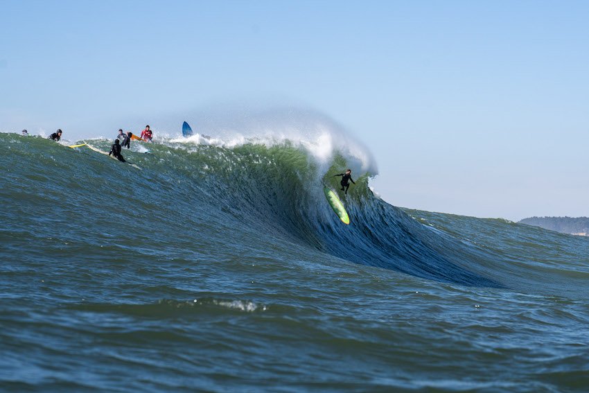
How to Become an Adventure Photographer
Adventure photography combines the thrill of exploration with the artistry of capturing breathtaking moments in nature. If you have a passion for both photography and the great outdoors, becoming an adventure photographer can be a dream come true. This exciting career path allows you to document awe-inspiring landscapes, extreme sports, and the human spirit in its most adventurous form.
Adventure photography combines the thrill of exploration with the artistry of capturing breathtaking moments in nature. If you have a passion for both photography and the great outdoors, becoming an adventure photographer can be a dream come true. This exciting career path allows you to document awe-inspiring landscapes, extreme sports, and the human spirit in its most adventurous form.
To become an adventure photographer, start by developing your photography skills and mastering the fundamentals. Invest in high-quality gear suitable for outdoor conditions, and hone your outdoor skills and physical fitness. Build a diverse portfolio showcasing your best adventure photographs and network with fellow photographers and outdoor enthusiasts. Embrace social media to showcase your work and pursue opportunities for assignments and stock photography. Stay curious, keep exploring, and constantly push your creative boundaries to capture breathtaking moments in nature.
So, if you're ready to embark on an epic journey, here's a guide on how to become an adventure photographer.
Pulling hard through the crux in Wild Iris. Photo by Dalton Johnson
Develop Photography Skills:
Begin by mastering the fundamentals of photography. Learn about composition, exposure, lighting, and post-processing techniques. Experiment with different genres, such as landscape, wildlife, and sports photography, to gain a diverse skill set. Join photography classes, workshops, or online tutorials to enhance your technical knowledge and artistic eye.
Get the Right Gear:
Invest in a good quality camera and lenses suitable for outdoor photography. Consider factors like weather resistance, durability, and portability. As an adventure photographer, you'll be exposed to challenging conditions, so ensure your gear can withstand rugged terrains, water, and extreme temperatures. Carry essential accessories like tripods, filters, and extra batteries to capture the perfect shot even in remote locations.
Hone your Outdoor Skills:
To excel as an adventure photographer, you need to be comfortable in outdoor environments. Develop your skills in hiking, climbing, or water sports, depending on the type of adventures you want to capture. Acquire knowledge about the locations you plan to explore, including weather patterns, safety protocols, and local regulations. Being physically fit and mentally prepared will enable you to endure long hours in challenging terrains and capture unique perspectives.
Build a Diverse Portfolio:
Create a portfolio showcasing your best adventure photographs. Highlight your ability to capture the essence of an adventure, convey emotions, and compose visually captivating images. Emphasize your versatility by including shots from different landscapes, sports, and cultural experiences. Develop a strong storytelling element in your portfolio to engage viewers and transport them into the heart of the action.
Network and Collaborate:
Connect with fellow adventure photographers, outdoor enthusiasts, and athletes through online platforms, photography communities, and social media. Attend photography events, exhibitions, and workshops to meet industry professionals and like-minded individuals. Collaborate with athletes, adventure brands, and travel agencies to gain exposure and expand your portfolio. Building a network will open doors to new opportunities and help you grow as an adventure photographer.
Networking and collaboration play a crucial role in the journey of becoming an adventure photographer. Here are some key points to consider:
Connect with Like-Minded Individuals: Join online photography communities, forums, and social media groups to connect with fellow adventure photographers and outdoor enthusiasts. Engage in discussions, share your work, and seek feedback. Collaborate on projects, exchange tips and techniques, and learn from others' experiences.
Attend Photography Events and Workshops: Participate in photography events, workshops, and conferences focused on adventure photography. These gatherings provide excellent opportunities to meet industry professionals, gain insights from experts, and forge valuable connections. Engage in conversations, exchange business cards, and follow up with individuals who may be potential collaborators or mentors.
Collaborate with Athletes and Outdoor Brands: Reach out to athletes, adventurers, and outdoor brands that align with your photography style and vision. Offer your services to capture their expeditions, outdoor activities, or product campaigns. Collaborating with athletes can lead to unique opportunities to document their adventures and showcase your skills. Working with outdoor brands can result in sponsored trips, equipment support, and exposure to a broader audience.
Explore Partnerships with Travel Agencies: Collaborate with travel agencies specializing in adventure tourism. Your photography can be an asset in their promotional materials, websites, and social media platforms. Building relationships with travel agencies can lead to paid assignments, destination-specific projects, and the chance to document incredible landscapes and experiences.
Build Relationships with Editors and Publications: Reach out to editors of magazines, travel publications, and websites that feature adventure and outdoor content. Submit your work for consideration in their editorial assignments. Develop relationships with these editors by delivering high-quality work, meeting deadlines, and understanding their specific requirements. Building a good rapport can lead to regular assignments, publication opportunities, and exposure to a wider audience.
Collaborate on Personal Projects: Initiate personal projects that align with your interests and vision. These projects can focus on a specific adventure sport, a remote location, or a unique cultural experience. Seek collaboration with fellow photographers, athletes, or even writers to create a multidimensional narrative. These personal projects not only help you grow creatively but also showcase your dedication and passion to potential clients.
Remember, networking and collaboration are about building relationships and supporting each other within the adventure photography community. It's a two-way street, so be open to sharing your knowledge and resources with others as well. By collaborating, you can create powerful visuals, expand your reach, and open doors to exciting opportunities in the world of adventure photography.
Embrace Social Media:
In today's digital age, social media is a powerful tool for promoting your work and building a personal brand. Create a strong online presence by sharing your best adventure photographs on platforms like Instagram, Facebook, and your own photography website. Engage with your audience by sharing stories behind your images, offering photography tips, and connecting with fellow adventurers. Consistency, quality content, and authentic engagement will help you grow your online following and attract potential clients.
Pursue Assignments and Stock Photography:
Reach out to magazines, travel publications, and adventure-focused websites to pitch your work. Submit your photographs for editorial assignments and explore opportunities for stock photography licensing. Building relationships with editors and agencies can lead to regular assignments and publication of your work, allowing you to share your adventures with a wider audience while earning an income.
Pursuing assignments and stock photography can be an excellent way to gain exposure, earn income, and further establish yourself as an adventure photographer. Here's more information on these avenues:
Editorial Assignments: Many magazines, travel publications, and online platforms require captivating adventure photographs to complement their articles and features. Research publications that focus on adventure, outdoor activities, and travel. Familiarize yourself with their content style and guidelines, and pitch your work to their editors. Submitting your photographs for editorial assignments can lead to paid opportunities to showcase your images and tell compelling stories.
Commercial Assignments: In addition to editorial assignments, there are commercial opportunities within the adventure photography field. Outdoor brands, tourism boards, and adventure companies often seek professional photographers to capture their products, services, and experiences. This can involve photographing gear, documenting adventure tours, or creating promotional content. Building relationships with such brands and agencies can lead to recurring assignments and paid work.
Stock Photography: Stock photography involves licensing your images for commercial use. There are numerous stock photography platforms where you can submit your adventure photographs. When choosing a platform, research their submission guidelines, licensing terms, and royalty rates. Ensure that the platform aligns with your goals and offers a fair compensation structure. Stock photography allows your images to be accessible to a wide range of clients, and you can earn royalties each time your photo is licensed.
Portfolio Development: When pursuing assignments and stock photography, it's crucial to curate a strong portfolio that showcases your adventure photography skills. Tailor your portfolio to highlight your versatility, storytelling ability, and technical expertise. Include a variety of adventure genres, such as landscapes, sports, and cultural experiences. A compelling portfolio will attract the attention of potential clients and increase your chances of securing assignments or licensing deals.
Marketing and Promotion: To increase your visibility and attract assignment opportunities, market yourself effectively. Utilize social media platforms, your website, and photography communities to showcase your work and engage with your target audience. Regularly update your portfolio and share behind-the-scenes stories or insights to create a personal connection with your followers. Actively promote your adventure photography services through targeted marketing campaigns and collaborations with relevant influencers or publications.
Professionalism and Reliability: When pursuing assignments, it's crucial to maintain a high level of professionalism and reliability. Be responsive to client inquiries, adhere to deadlines, and deliver work that exceeds expectations. Build a reputation as a dependable and talented adventure photographer, as word-of-mouth recommendations can lead to future assignments and collaborations.
By actively pursuing assignments and exploring stock photography opportunities, you can monetize your passion for adventure photography while gaining exposure and establishing your name in the industry. It's important to continuously improve your skills, stay up to date with industry trends, and maintain a proactive approach to seek new opportunities. With persistence and dedication, you can turn your passion into a fulfilling and rewarding career as an adventure photographer.
Stay Curious and Keep Exploring:
The key to being a successful adventure photographer is to remain curious and constantly seek new adventures. Embrace the unknown, explore uncharted territories, and push your creative boundaries. Continually develop your technical skills and stay updated with the latest trends in photography and adventure sports. Remember, the more you experience, the more opportunities you'll have to capture breathtaking moments and tell compelling stories through your photographs.
Going over the falls at Mavericks in Half Moon Bay. Photo by Dalton Johnson
Becoming an adventure photographer is a thrilling and rewarding journey that combines your love for photography and the outdoors. By developing your photography skills, acquiring the right gear, honing your outdoor skills, building a diverse portfolio, networking, embracing social media, pursuing assignments, and staying curious, you can carve a path towards success in this exciting field. So, grab your camera, pack your bags, and embark on an unforgettable adventure as an adventure photographer.
Discover more of Adventure Photography

The Ultimate Guide to Road Tripping the Pacific Coast Highway
Embarking on a road trip along the Pacific Coast Highway (PCH) is a classic American adventure filled with stunning coastal views, quaint seaside towns, and untouched natural beauty. This iconic highway, also known as Highway 1, stretches over 650 miles along the California coast, from its southern point in Dana Point to its northern terminus in Leggett. It offers a unique perspective of the diverse landscapes and cultures of the Golden State. Whether you're an avid nature lover, a foodie, a history buff, or simply someone looking for an unforgettable journey, a road trip on the Pacific Coast Highway promises a wealth of experiences that will make you fall in love with the Californian coast.
Embarking on a road trip along the Pacific Coast Highway (PCH) is a classic American adventure filled with stunning coastal views, quaint seaside towns, and untouched natural beauty. This iconic highway, also known as Highway 1, stretches over 650 miles along the California coast, from its southern point in Dana Point to its northern terminus in Leggett. It offers a unique perspective of the diverse landscapes and cultures of the Golden State. Whether you're an avid nature lover, a foodie, a history buff, or simply someone looking for an unforgettable journey, a road trip on the Pacific Coast Highway promises a wealth of experiences that will make you fall in love with the Californian coast.
The Pacific Coast Highway offers a visually stunning journey through diverse landscapes from towering redwoods to sun-soaked beaches, each mile bursting with adventure. It's a journey that allows you to explore at your own pace, with numerous opportunities for spontaneous detours and discoveries. Additionally, the PCH is an iconic route steeped in history and culture, offering a unique perspective on the Californian way of life.
Discover the allure of the Pacific Coast Highway and prepare yourself for the road trip of a lifetime in our ultimate guide below.
The rugged Big Sur Coastline looking towards Bixby Bridge. Photograph by Dalton Johnson
Pros:
Breathtaking scenery and diverse landscapes: The PCH takes you through stunning coastal views, towering redwoods, sun-soaked beaches, and more. Each mile offers a visual feast for nature lovers and photography enthusiasts.
Numerous opportunities for outdoor activities: Along the route, you can engage in activities like hiking, surfing, whale watching, and camping, allowing you to immerse yourself in the natural beauty of the California coast.
Rich cultural and historical sites: The PCH is not only a road trip but also a journey through California's history and culture. You can explore charming seaside towns, visit historic landmarks, and learn about the diverse heritage of the region.
An array of delicious food options along the coast: From food trucks to fine dining establishments, the PCH offers a variety of culinary experiences. You can indulge in fresh seafood, farm-to-table delights, and diverse cuisines influenced by the local culture.
Plenty of photo opportunities for photography enthusiasts: The scenic vistas, coastal cliffs, and iconic landmarks along the PCH provide countless opportunities to capture stunning photographs and create lasting memories.
Cons:
Crowded during peak travel seasons: The PCH can get busy during peak travel seasons, so it's important to plan accordingly and be prepared for potential traffic congestion at popular tourist spots.
Some stretches of the highway can be challenging to drive: Certain sections of the PCH have narrow, winding roads, steep cliffs, and sharp curves. It's essential to drive cautiously, follow traffic rules, and be mindful of the challenging road conditions.
Accommodation can be expensive if not planned in advance: The popularity of the PCH means that accommodations along the route can be pricey, especially if you don't book in advance. Planning your accommodations ahead of time will help ensure you have a place to stay within your budget.
The journey may take longer than expected due to frequent stops: The PCH is not just about getting from point A to point B—it's about enjoying the journey and making stops at various points of interest. This means that your travel time may be longer than expected, so it's important to factor in extra time for exploring and taking in the sights.
The History and Significance of the Pacific Coast Highway
The Pacific Coast Highway, also known as the PCH, holds a rich history and significant cultural significance. This iconic highway stretches over 650 miles along the breathtaking California coast, making it one of the most famous and scenic road trip routes in the world. Born out of the early 20th century's boom in automobile culture, the PCH was initially constructed as a coastal road to connect various communities and offer stunning views of the Pacific Ocean. Today, it has become synonymous with the quintessential Californian road trip experience, attracting adventure seekers, nature enthusiasts, and those seeking a taste of the laid-back coastal lifestyle.
The Pacific Coast Highway holds immense importance as more than just a road. It serves as a thread that weaves together California's diverse landscapes, cultures, and history. Driving along the PCH, you'll pass through iconic cities like Los Angeles, San Francisco, and San Diego, as well as charming coastal towns that have preserved their unique identities over the years. Along the way, you'll encounter historic landmarks, such as the famous Bixby Creek Bridge and the enchanting Hearst Castle, offering glimpses into the state's architectural and cultural heritage. The highway's breathtaking vistas and access to stunning natural wonders, like Big Sur and the Redwood Forests, provide an opportunity to appreciate and protect the state's remarkable biodiversity.
The Pacific Coast Highway is more than just a road; it is a symbol of the California dream and a gateway to the Golden State's unparalleled beauty. Its history as a coastal road connects us to the pioneers of early automobile travel and represents the freedom and adventure associated with the open road. The PCH's significance lies not only in its stunning vistas and diverse landscapes but also in the stories and memories that have been etched into its pavement over the years. So, buckle up, embark on this remarkable journey, and prepare to create your own chapter in the colorful history of the Pacific Coast Highway. Just remember, if you spot a breathtaking view, don't forget to pull over and take it all in. And hey, maybe even snap a selfie or two – after all, memories and laughs are the best souvenirs of any road trip adventure!
Timeline for the Creation of the Pacific Coast Highway:
Early 20th Century: The idea of a coastal highway along the California coast begins to take shape as the popularity of automobile travel grows. Visionaries recognize the potential for a scenic road that connects coastal communities and provides access to the stunning Pacific Ocean views.
1919: The State of California officially designates a route along the coastal region as the Pacific Coast Highway, which would later become Highway 1. Initial construction efforts focus on improving existing roads and creating new sections to establish a continuous coastal route.
1928-1937: Construction on the Pacific Coast Highway progresses, with various sections being completed during this period. Challenging terrain, including steep cliffs and rugged coastline, poses significant engineering obstacles, but the determination to create a scenic coastal road keeps the project moving forward.
1937: The completion of the Bixby Creek Bridge in Big Sur marks a significant milestone in the development of the Pacific Coast Highway. This iconic bridge not only enhances the safety and accessibility of the route but also becomes a symbol of the PCH's engineering prowess and aesthetic beauty.
Mid-20th Century: The Pacific Coast Highway gains popularity among travelers as a scenic route that showcases California's natural wonders and coastal charm. The highway becomes an integral part of the state's tourism industry, attracting visitors from around the world and contributing to the local economies of the communities along its path.
Late 20th Century: Preservation efforts and ongoing maintenance ensure the longevity and accessibility of the Pacific Coast Highway. The route's cultural and historical significance is recognized, leading to the inclusion of various landmarks, such as Hearst Castle, in its vicinity.
Present Day: The Pacific Coast Highway remains an iconic road trip route and a symbol of California's natural beauty. It continues to inspire travelers to embark on unforgettable journeys along the picturesque coastline, connecting them to the state's rich history and diverse landscapes.
The creation of the Pacific Coast Highway involved years of planning, engineering feats, and a vision to provide travelers with a scenic coastal road. Today, this historic highway stands as a testament to human ingenuity and the enduring allure of California's breathtaking coastline.
Vanlife and the PCH are a match made in heaven. Photograph by Dalton Johnson
Choosing the Best Time of Year for Your PCH Road Trip
Choosing the best time of year for your Pacific Coast Highway road trip depends on your preferences and the experiences you seek. The PCH offers stunning coastal views, diverse landscapes, and charming towns year-round, but each season brings its own unique charm and considerations. Whether you're looking for pleasant weather, fewer crowds, or specific events, understanding the characteristics of each season will help you plan your ideal PCH adventure.
Winter
Winter along the PCH, spanning from December to February, offers a quieter and more serene experience. While the weather can be cooler and rainier during this time, it also means fewer crowds and lower accommodation rates. You can enjoy the dramatic coastal scenery, witness migratory whale sightings, and explore coastal towns adorned with festive holiday decorations. Just be prepared for potential road closures and check weather conditions before embarking on your journey.
Spring
Spring, from March to May, brings new life and vibrant blooms to the PCH. It's a delightful time to witness wildflowers in full bloom, especially in areas like Big Sur and the Central Coast. The weather is generally mild and pleasant, making it perfect for outdoor activities like hiking and exploring the coastal trails. Spring also offers the opportunity to visit local farmers' markets, where you can taste fresh produce and regional specialties.
Summer
Summer, from June to August, is the peak tourist season along the PCH. The weather is generally warm and sunny, making it ideal for beach visits and water activities. It's a great time to enjoy coastal towns bustling with energy, attend outdoor festivals, and indulge in delicious seafood. However, be prepared for larger crowds, heavier traffic, and higher accommodation prices. Making reservations in advance is highly recommended during this popular travel period.
Fall
Fall, from September to November, brings a sense of tranquility and stunning autumn colors to the PCH. The weather remains pleasant, and you can experience beautiful sunsets and cooler temperatures. Fall is a fantastic time for coastal hikes, exploring vineyards and wineries, and enjoying the fall harvest season. It's also a great time for whale watching as gray whales migrate along the coast. Additionally, with fewer crowds compared to summer, you can enjoy a more relaxed road trip experience.
While I wish I could tell you the best time to hit the road for the PCH, but the reality is the best time for your PCH road trip depends on your preferences and priorities. Winter offers tranquility and lower rates, while spring brings blooming landscapes and milder weather. Summer is perfect for beach lovers and festive atmospheres, but be prepared for crowds. Fall provides a mix of mild weather, vibrant colors, and harvest festivities. Ultimately, any time of year can be an incredible time to explore the PCH, so consider the unique offerings of each season and plan accordingly to create unforgettable memories along the stunning California coastline.
Planning Your PCH Itinerary: Must-See Stops and Hidden Gems
Planning your Pacific Coast Highway itinerary is an exciting part of your road trip adventure. With so much to see and do along the route, it's essential to have a well-thought-out plan that includes both must-see stops and hidden gems. Your itinerary can be customized based on your interests, time constraints, and the pace at which you want to explore. Whether you're interested in natural wonders, cultural landmarks, or charming coastal towns, the PCH offers a wide range of experiences that will leave you in awe of California's beauty and diversity.
List of Stellar Stops:
Dana Point: Start your journey at the southern terminus of the PCH and explore the picturesque Dana Point Harbor.
Laguna Beach: Visit Laguna Beach for its stunning beaches, art galleries, and charming downtown area.
Crystal Cove State Park: Experience coastal hiking trails and a beautiful beach in this preserved natural park.
Huntington Beach: Known as "Surf City USA," Huntington Beach offers a vibrant surfing culture and a lively pier.
Newport Beach: Enjoy the upscale coastal community, Newport Beach, with its yacht-filled harbor and pristine beaches.
Santa Monica: Visit the iconic Santa Monica Pier, explore the lively Third Street Promenade, and soak up the beach vibes.
Malibu: Drive through Malibu and catch glimpses of celebrity homes, beautiful beaches, and the stunning coastline.
Point Mugu State Park: Discover scenic hiking trails, coastal cliffs, and picturesque beaches in this state park.
Santa Barbara: Immerse yourself in the Spanish colonial architecture, visit the Old Mission, and explore the vibrant downtown area.
Solvang: Experience a taste of Denmark in this charming Danish village known for its unique architecture and bakeries.
Pismo Beach: Relax on the beautiful sandy beaches or explore the nearby Pismo Beach Monarch Butterfly Grove.
Hearst Castle: Marvel at the grandeur of Hearst Castle, a historic mansion showcasing opulent architecture and stunning gardens.
Big Sur: Drive along the iconic Big Sur coastline, stopping at McWay Falls and Pfeiffer Beach for breathtaking views.
Monterey: Explore the famous Monterey Bay Aquarium, Cannery Row, and take a scenic drive along the 17-Mile Drive.
Santa Cruz: Enjoy the beach town atmosphere, visit the Santa Cruz Beach Boardwalk, and explore the Santa Cruz Mountains.
These are just a few of the many incredible stops along the PCH. Remember to consider your interests, travel preferences, and available time as you create your personalized itinerary. Don't be afraid to venture off the beaten path and discover hidden gems that make your journey even more memorable.
Surfing near Santa Cruz at sunset while road tripping the PCH with friends. Photograph by Dalton Johnson
Crafting the Perfect Itinerary: Designing Your Ideal Pacific Coast Highway Road Trip Route
Planning a road trip along the Pacific Coast Highway requires careful consideration and thoughtful planning to ensure a smooth and enjoyable journey. Here are some tips and tricks to help you design your ideal PCH road trip itinerary:
Research and prioritize: Start by researching the various attractions, landmarks, and towns along the PCH. Make a list of the must-see stops that align with your interests. Consider both popular tourist destinations and lesser-known hidden gems to get a well-rounded experience.
Determine your travel duration: Decide how much time you have available for your road trip. The length of your journey will impact the number of stops you can make and the pace at which you can travel. Be realistic about how much ground you can cover within your timeframe.
Plan your route: Map out your desired route along the PCH, marking the key stops you want to make. Consider the distance between each stop and factor in driving time. It's important to strike a balance between covering enough ground and allowing ample time for exploration at each destination.
Be flexible: While having a planned itinerary is essential, leave room for flexibility and spontaneity. Be open to detours, unexpected discoveries, and additional stops along the way. Some of the most memorable experiences can come from unplanned adventures.
Consider the seasons: Take into account the time of year you'll be traveling and how it might impact your itinerary. Consider factors such as weather conditions, potential road closures, and the presence of crowds during peak travel seasons. Adjust your plans accordingly to maximize your enjoyment.
Plan for breaks and rest days: Road trips can be tiring, so make sure to plan for breaks and rest days along the way. Allow yourself time to relax, explore local attractions, or simply enjoy the beautiful coastal views without being rushed.
Balance popular and off-the-beaten-path destinations: The PCH offers a mix of popular tourist spots and lesser-known gems. Strike a balance between the two to experience both the iconic attractions and the unique charm of hidden places. This will give you a well-rounded perspective of the region.
Consider your budget: Road trips can involve various expenses, such as accommodation, meals, and activities. Set a budget for your trip and plan accordingly. Look for affordable accommodation options, consider picnics or local eateries for meals, and prioritize the experiences that matter most to you.
Pack strategically: Be mindful of the essentials you'll need during your road trip, such as comfortable clothing, road maps, snacks, and any necessary equipment or gear. Pack efficiently to make the most of your available space.
Leave room for spontaneity: While it's important to have an itinerary, leave some gaps in your schedule for spontaneous adventures. Be open to recommendations from locals, fellow travelers, or chance encounters along the way. Some of the best memories can be made when you allow yourself to go with the flow.
By following these tips and tricks, you can create a well-planned itinerary for your Pacific Coast Highway road trip. Remember to enjoy the journey, take in the stunning coastal scenery, and embrace the freedom of the open road.
Soaking in the beauty at the Bixby Bridge for sunrise while road tripping Highway 1. Photograph by Dalton Johnson
Navigating the Challenging Sections: Tips for Driving Big Sur
Driving through Big Sur along the Pacific Coast Highway is undoubtedly one of the highlights of a road trip on the California coast. However, it's essential to be prepared for the unique challenges that this section of the PCH presents. Here are some tips to help you navigate Big Sur with confidence:
Be aware of road conditions: Big Sur is known for its winding roads, steep cliffs, and narrow sections. Stay informed about road conditions and any closures before your trip by checking official websites or contacting local authorities. Inclement weather, landslides, or construction work can impact the accessibility of certain areas, so it's crucial to stay updated.
Take your time and drive cautiously: Due to the twisting nature of the road and the potential presence of oncoming traffic, it's important to drive at a safe and comfortable speed. Use turnouts to allow faster traffic to pass and always keep a lookout for cyclists and pedestrians. Big Sur's breathtaking scenery can be distracting, so pull over at designated viewpoints to fully enjoy the vistas without compromising safety.
Plan for fuel and supplies: Big Sur has limited services, including gas stations and grocery stores. Fill up your gas tank before entering Big Sur and ensure you have enough supplies, snacks, and water to last until the next available amenities. It's a good idea to stock up on essentials in towns before entering this remote section of the PCH.
Be prepared for limited cell phone reception: In many parts of Big Sur, cell phone reception can be sporadic or nonexistent. Plan your route in advance, carry a printed map or a GPS device, and download offline maps or directions on your mobile device if possible. This will ensure you can navigate the area even without reliable cellular service.
Watch for wildlife: Big Sur is home to a diverse range of wildlife, including deer, elk, and occasionally, California condors. Be alert for animal crossings and take caution when driving during dusk and dawn, as animals are more active during these times. Maintain a safe distance and never approach or feed wildlife.
Pack essentials for emergencies: It's wise to be prepared for unexpected situations. Pack a roadside emergency kit that includes essentials such as a spare tire, jack, jumper cables, flashlight, basic tools, and first aid supplies. Additionally, carry extra water, food, and warm clothing in case of unforeseen delays or emergencies.
By following these tips and exercising caution, you can navigate Big Sur and fully appreciate its stunning beauty and dramatic coastline. Take your time, enjoy the breathtaking views, and create lasting memories along this iconic stretch of the Pacific Coast Highway.
Make sure to stop and go hiking in Big Sur. Photograph by Dalton Johnson
Road Trip Budgeting: Cost-Saving Tips for the PCH
Embarking on a road trip along the Pacific Coast Highway doesn't have to break the bank. With some careful planning and budgeting, you can have an amazing adventure without overspending. Here are some cost-saving tips to help you make the most of your PCH road trip:
Set a budget: Before your trip, determine how much you can afford to spend overall and allocate funds for different categories like accommodation, meals, activities, and fuel. Having a clear budget in mind will help you make informed decisions along the way.
Travel during the shoulder seasons: Consider planning your trip during the shoulder seasons, which are the periods just before and after the peak travel season. This way, you can enjoy milder weather, fewer crowds, and potentially lower prices for accommodations and activities.
Opt for camping or RVing: If you enjoy the outdoors, consider camping or renting an RV instead of staying in hotels. There are several campgrounds and RV parks along the PCH where you can stay at a fraction of the cost. Plus, camping allows you to immerse yourself in nature and enjoy scenic locations.
Prepare your own meals: Eating out for every meal can quickly add up. Save money by packing a cooler with groceries and snacks for the road. Take advantage of picnic areas and beachfront spots to enjoy scenic meals. When you do dine out, look for local eateries or food trucks for affordable and delicious options.
Take advantage of free attractions: Along the PCH, you'll find several free attractions and points of interest. Enjoy the scenic viewpoints, walk along the beaches, explore state parks, and take advantage of hiking trails—all without spending a dime.
Research discounts and deals: Look for discounts or special offers for attractions, activities, and accommodations. Check websites, travel guides, or local visitor centers for coupons, promotional codes, or discounted rates. It's worth doing some research to find the best deals available.
Utilize loyalty programs and memberships: If you have memberships or loyalty programs with hotels, rental car agencies, or other travel-related companies, make sure to take advantage of any discounts, rewards, or perks they offer. These can help reduce your overall expenses.
Share expenses with travel companions: If you're traveling with others, consider sharing costs like accommodations, car rental, and food. Splitting expenses can significantly reduce individual costs and help everyone stay within their budget.
Plan ahead for gas prices: Gas prices can vary along the PCH. Before your trip, research the average fuel prices in different areas and plan your refueling stops accordingly. Also, consider using gas station apps or websites to find the cheapest gas stations along your route.
Be mindful of parking costs: Parking fees can add up, especially in popular tourist areas or city centers. Look for free or lower-cost parking options like street parking or parking lots located slightly farther away from popular attractions. Consider using public transportation or walking when exploring cities to save on parking fees.
Avoid unnecessary souvenirs: While it's tempting to buy souvenirs at every stop, be mindful of your budget. Focus on collecting meaningful and memorable items or take plenty of photos to capture the essence of your journey instead.
Stay hydrated with a reusable water bottle: Rather than buying bottled water throughout your trip, carry a reusable water bottle and refill it at water fountains or from tap water. This small change can save you money and help reduce plastic waste.
By incorporating these budgeting tips into your PCH road trip planning, you can make the most of your experience without overspending. Remember, the journey itself is the ultimate reward, and with some smart financial choices, you can enjoy the beauty of the California coast while staying within your means.
Solo Travel on the PCH: Tips, Safety, and Solo-Friendly Activities
Embarking on a solo road trip along the Pacific Coast Highway (PCH) can be an incredibly rewarding and liberating experience. It allows you to set your own pace, indulge in self-discovery, and fully immerse yourself in the stunning coastal landscapes. Here are some tips, safety measures, and solo-friendly activities to make the most of your solo adventure on the PCH:
Plan and communicate: Before setting off on your journey, make sure to plan your route, research accommodations, and check for any safety advisories. Inform a trusted friend or family member about your travel plans, including your itinerary, accommodations, and estimated arrival times at each destination.
Stay in well-reviewed accommodations: Opt for accommodations with positive reviews and good security measures, especially if you're traveling alone. Look for options with well-lit parking areas, secure entrances, and good guest feedback regarding safety and comfort.
Be aware of your surroundings: While solo traveling, it's important to stay vigilant and aware of your surroundings. Trust your instincts and exercise caution when interacting with strangers. Stay in public, well-populated areas, especially during nighttime.
Solo-friendly activities: The PCH offers a plethora of solo-friendly activities that cater to different interests. Explore picturesque hiking trails, soak up the sun on stunning beaches, visit museums, enjoy photography opportunities, or simply indulge in peaceful moments of self-reflection amidst nature's beauty. Try out some of these ideas:
Coastal Hiking: Explore the numerous coastal hiking trails along the PCH, such as the Point Lobos State Natural Reserve or the Andrew Molera State Park. Enjoy the serenity of nature, breathtaking views, and the chance to spot local wildlife.
Photography Excursions: The PCH offers countless opportunities for photography enthusiasts. Capture the scenic beauty of the coastline, dramatic cliffs, iconic bridges, and vibrant sunsets. Take your time to frame the perfect shot and unleash your creativity.
Beach Meditation and Yoga: Find a secluded spot on one of the beautiful beaches along the PCH and indulge in a serene meditation or yoga session. Listen to the crashing waves, feel the sand beneath your toes, and embrace the tranquility of the coastal environment.
Visit Cultural Landmarks: Explore cultural landmarks like the historic Hearst Castle or the iconic Santa Barbara Mission. Immerse yourself in the rich history and architectural wonders that dot the PCH, allowing for a deeper understanding of the region's heritage.
Wine Tasting in the Central Coast: The Central Coast region along the PCH is known for its exceptional wineries. Embark on a solo wine-tasting adventure, exploring vineyards, tasting exquisite wines, and enjoying the peaceful ambiance of the rolling hills and vine-covered landscapes.
Join organized tours or activities: Consider joining organized tours or activities along the PCH. This allows you to meet fellow travelers and explore the area with knowledgeable guides who can enhance your experience. It also adds an extra layer of safety and companionship during your solo adventure.
Connect with fellow travelers: Solo travel doesn't mean you have to be alone the entire time. Utilize social media platforms or online travel communities to connect with fellow travelers who may be exploring the PCH during the same time. Meeting up for a meal or sharing a portion of your journey with like-minded individuals can add to the richness of your experience.
Practice self-care and self-reflection: Solo travel provides an excellent opportunity for self-care and self-reflection. Take time to engage in activities that bring you joy, such as reading a book on the beach, meditating at a scenic spot, or treating yourself to a spa day. Embrace the solitude and use it as an opportunity for personal growth and rejuvenation.
Prioritize safety on the road: As a solo traveler, ensure your vehicle is in good condition before the trip and have necessary emergency supplies, including a spare tire, jumper cables, and a roadside assistance kit. Take regular breaks during long drives to prevent fatigue and stay hydrated.
Engage with the locals: Interacting with locals can provide valuable insights into the area's culture, history, and hidden gems. Strike up conversations at local establishments, ask for recommendations, and participate in community events or activities.
Trust yourself and be open to new experiences: Solo travel empowers you to make decisions on your own and embrace new experiences. Trust your instincts, step out of your comfort zone, and be open to opportunities that may arise along the journey.
Remember, solo travel on the PCH can be a truly transformative experience. Embrace the freedom, enjoy the breathtaking coastal views, and create memories that are entirely your own. By prioritizing safety, being prepared, and engaging in solo-friendly activities, you'll embark on an unforgettable adventure along one of the most scenic routes in the world.
Road Trip Essentials: What to Pack for Your PCH Adventure
Clothing:
Comfortable and versatile clothing suitable for various weather conditions
Light jackets or sweaters for cooler coastal breezes
Swimwear and beach cover-ups for beach visits
Sturdy walking shoes or hiking boots for outdoor activities
Flip flops or sandals for beach or relaxation
Hat or cap for sun protection
Rain jacket or waterproof outer layer
Toiletries and Personal Care:
Travel-sized toiletries (shampoo, conditioner, soap, toothpaste, etc.)
Toothbrush and toothpaste
Deodorant
Sunscreen (with a high SPF)
Insect repellent
Medications and any necessary prescriptions
First-aid kit with band-aids, pain relievers, and any essential medications
Personal hygiene products
Electronics and Accessories:
Mobile phone and charger
Camera or smartphone for capturing memories
Portable power bank for charging devices on the go
GPS or navigation device (if not using a smartphone)
Adapters for charging devices in the car
Headphones or earphones for entertainment during the journey
Miscellaneous Items:
Road map or printed directions
Reusable water bottle for staying hydrated
Snacks for the journey
Cooler or insulated bag for storing perishable snacks and drinks
Travel pillow and blanket for added comfort during long drives
Cash and cards for emergencies and purchases at places that don't accept cards
Travel guidebooks or information about the PCH
Binoculars for wildlife or scenic viewing
Road Trip Essentials:
Driver's license, identification, and necessary travel documents
Vehicle registration and insurance information
Roadside emergency kit (spare tire, jack, jumper cables, etc.)
Portable tire inflator or air compressor
Car manual and any necessary maintenance tools
Reusable shopping bags for groceries or souvenirs
Travel-sized laundry detergent for washing clothes on the go
Travel umbrella for unexpected rain
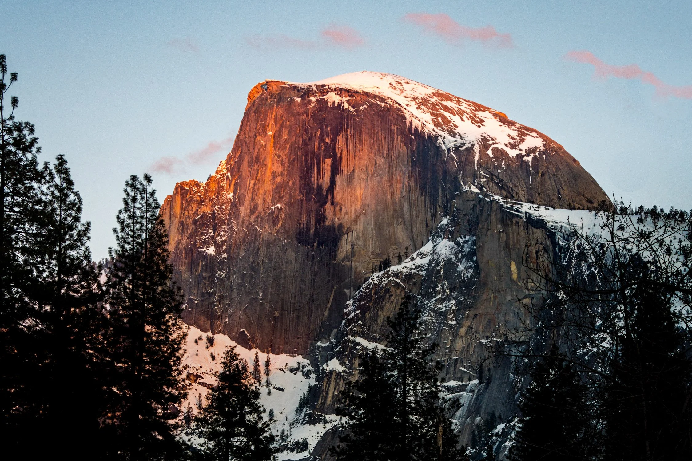
Make a detour to Yosemite Valley if you have the time while you are road tripping the PCH. Photograph by Dalton Johnson
Taking a Detour: Unique Side Trips off the PCH
While the Pacific Coast Highway (PCH) itself offers incredible beauty and countless attractions, don't be afraid to venture off the main road and explore the unique side trips that lie just beyond the PCH. These detours will add depth and diversity to your road trip experience, allowing you to discover hidden gems and off-the-beaten-path destinations. Here are a few ideas for side trips worth considering:
Joshua Tree National Park: Located east of the PCH, Joshua Tree National Park is a desert paradise with unique flora, stunning rock formations, and wide-open spaces. Explore the park's hiking trails, marvel at the iconic Joshua Trees, and enjoy stargazing in one of the best dark sky regions in Southern California.
Channel Islands National Park: Take a detour to the coast near Ventura and embark on a ferry ride to the Channel Islands. These remote islands offer untouched natural beauty, pristine beaches, and abundant marine life. Enjoy activities like hiking, kayaking, snorkeling, and wildlife watching in this tranquil and secluded paradise.
Napa Valley: For wine enthusiasts, a detour to Napa Valley is a must. Located north of San Francisco, this world-renowned wine region boasts picturesque vineyards, charming towns, and exceptional wineries. Take a break from the coastal scenery and indulge in wine tastings, vineyard tours, and gourmet dining experiences.
Yosemite National Park: While not directly off the PCH, Yosemite National Park is worth the detour for its awe-inspiring landscapes. Drive inland from the PCH to experience towering granite cliffs, majestic waterfalls, and breathtaking valleys. Hike to iconic landmarks like Half Dome or explore the valley floor for unparalleled natural beauty.
Santa Ynez Valley: Located near Santa Barbara, the Santa Ynez Valley offers a tranquil retreat filled with rolling hills, vineyards, and quaint towns. Enjoy wine tasting at local wineries, savor farm-to-table cuisine, and soak in the relaxed atmosphere of this charming wine country region.
Point Reyes National Seashore: Just north of San Francisco, Point Reyes National Seashore beckons with its rugged coastline, dramatic cliffs, and diverse wildlife. Take a detour to explore the park's scenic trails, visit historic lighthouses, and spot seals and whales along the shore.
Lake Tahoe: Venture inland from the PCH to the magnificent Lake Tahoe, situated in the Sierra Nevada Mountains. This stunning alpine lake offers crystal-clear waters, sandy beaches, and numerous outdoor recreational activities. Enjoy swimming, boating, hiking, or simply relax and take in the breathtaking mountain scenery.
Hearst San Simeon State Park: Pay a visit to Hearst San Simeon State Park, located near San Simeon. Explore the rugged coastline, walk along the sandy beaches, and witness the fascinating Elephant Seal Rookery, where you can observe these massive creatures in their natural habitat.
Redwood National and State Parks: Take a detour to experience the towering giants of the Redwood National and State Parks. Located in Northern California, these ancient forests are home to some of the world's tallest trees. Hike among the majestic redwoods, visit Fern Canyon, and immerse yourself in the peacefulness of this remarkable natural wonder.
Monterey Bay Aquarium and Cannery Row: Make a stop at Monterey Bay to visit the renowned Monterey Bay Aquarium, known for its stunning exhibits showcasing marine life. Explore Cannery Row, lined with shops, restaurants, and historic buildings, offering a glimpse into the area's rich maritime heritage.
Remember to plan your side trips in advance, considering the time and distance it will take to reach these destinations. Be prepared for varying road conditions and check for any specific permits or reservations required. These detours will offer unique experiences and a deeper appreciation for the diverse landscapes and attractions that lie beyond the PCH.
Sam Coffey airing out at Steamer Lane for the camera. Photograph by Dalton Johnson
Outdoor Adventures: Hiking, Surfing, and Wildlife Spotting
One of the greatest joys of embarking on a Pacific Coast Highway (PCH) road trip is the opportunity to engage in thrilling outdoor adventures. From hiking along scenic trails to catching epic waves and spotting diverse wildlife, the PCH offers an array of activities for nature enthusiasts. Here's a deeper dive into the exciting outdoor adventures you can experience along the PCH:
Hiking:
The PCH is dotted with numerous hiking trails that showcase the natural beauty of California's coastline. In Big Sur, explore the renowned McWay Falls Trail or venture into Julia Pfeiffer Burns State Park to witness breathtaking coastal views. In Point Reyes National Seashore, hike the Tomales Point Trail for a chance to spot tule elk or explore the Alamere Falls Trail, which culminates in a stunning waterfall cascading onto the beach. The PCH also grants access to hiking trails in Redwood National and State Parks, where you can immerse yourself in the enchanting redwood forests and feel dwarfed by their towering presence. Make sure to check out these hiking trails:
McWay Falls Trail (Big Sur): This short but stunning trail in Julia Pfeiffer Burns State Park leads you to a picturesque waterfall cascading onto a pristine beach, offering breathtaking coastal views.
Tomales Point Trail (Point Reyes National Seashore): Embark on this scenic hike to Tomales Point, where you can spot tule elk grazing amidst coastal grasslands and enjoy panoramic views of the Pacific Ocean.
Fern Canyon Trail (Redwood National and State Parks): Walk through a lush, narrow canyon adorned with ferns and moss-covered walls in this enchanting trail, immersing yourself in the magical ambiance of the redwood forest.
Devil's Slide Trail (Montara): Enjoy panoramic ocean views along this converted stretch of the historic Highway 1. This pedestrian and bike-friendly trail provides a safe and scenic route with interpretive signs highlighting local history and wildlife.
Solstice Canyon Trail (Malibu): Explore the picturesque Solstice Canyon, home to a shaded creek, cascading waterfalls, and remnants of a historical ranch. This trail offers a mix of natural beauty and cultural history.
Surfing:
The California coast is renowned for its world-class surf breaks, and the PCH is no exception. Surfers of all levels can find waves suited to their abilities along the route. From iconic breaks like Malibu, where you can catch long rides in a classic Californian setting, to Santa Cruz, known for its consistent surf and vibrant surf culture, there are plenty of spots to paddle out and ride the waves. Other notable surf breaks along the PCH include Rincon Point, Pismo Beach, and Pleasure Point. Whether you're a seasoned surfer or eager to try it for the first time, the PCH offers an unforgettable surfing experience. Make sure to check out these spots as well:
Malibu Surfrider Beach (Malibu): Known for its long, peeling waves and iconic pier, Malibu is a classic surf spot that caters to surfers of all skill levels. Its consistent waves and picturesque setting make it a favorite among locals and visitors alike.
Pleasure Point (Santa Cruz): Located in the heart of Santa Cruz, Pleasure Point is renowned for its consistent surf breaks and fun, rippable waves. It offers a mix of reef and beach breaks, making it suitable for various surfing styles.
Rincon Point (Carpinteria): Widely considered one of the best right-hand point breaks in California, Rincon Point offers long rides and world-class waves. It attracts experienced surfers seeking epic rides along its rocky bottom point break.
Mavericks (Half Moon Bay): Mavericks is legendary in the world of big-wave surfing. Known for its massive, powerful waves that can reach up to 60 feet, it is a destination for skilled and experienced big-wave surfers seeking a thrilling challenge.
County Line Beach (Malibu): Located near the Ventura-Los Angeles county line, this popular surf spot offers consistent waves suitable for beginners and intermediate surfers. It's a great place to catch fun and manageable waves while enjoying the scenic coastline.
Wildlife Spotting:
The PCH provides ample opportunities for wildlife enthusiasts to observe a diverse range of species. Along the coastline, keep an eye out for sea otters, harbor seals, and dolphins frolicking in the waves. Whale watching is particularly popular during migration seasons, with gray whales and humpback whales frequently spotted from various viewpoints. In the Channel Islands National Park, take a boat tour to witness sea lions, seals, and seabird colonies up close. Additionally, Point Reyes National Seashore is home to an abundance of wildlife, including Tule elk, foxes, and migratory birds.
As you embark on these outdoor adventures, ensure you prioritize safety and adhere to any regulations or guidelines in place. Carry appropriate gear, such as hiking boots, wetsuits, or binoculars, depending on the activity. Research local conditions, tides, and weather forecasts to make informed decisions. Respect wildlife and their habitats, keeping a safe distance at all times. By immersing yourself in these outdoor experiences, you'll create lifelong memories and gain a deeper appreciation for the natural wonders along the Pacific Coast Highway.

Once you make it to San Diego, make sure to stop at the Scripps Pier for sunset. Photograph by Dalton Johnson
Capturing the Beauty: Photography Tips for the Pacific Coast Highway
The Pacific Coast Highway (PCH) is a photographer's dream, offering endless opportunities to capture the breathtaking beauty of the California coastline. Whether you're a professional photographer or an amateur enthusiast, here are some tips to help you make the most of your photography journey along the PCH:
Golden Hour Magic: Take advantage of the soft, warm light during the golden hours, which occur shortly after sunrise and before sunset. The stunning coastal landscapes along the PCH are bathed in golden hues during these times, creating a magical atmosphere for your photographs. Plan your shoots accordingly to capture the best lighting conditions.
Experiment with Composition: The PCH offers a diverse range of subjects and landscapes, from dramatic cliffs to secluded beaches. Experiment with different compositions to create visually striking images. Use leading lines, such as the curves of the road or the edges of the cliffs, to draw the viewer's eye into the frame. Include interesting foreground elements to add depth and scale to your photos.
Capture the Coastal Majesty: The PCH is renowned for its breathtaking coastal views. Use wide-angle lenses to capture the grandeur of the expansive vistas. Look for interesting rock formations, crashing waves, or patterns in the sand to add visual interest. Play with different perspectives, such as shooting from a low angle to emphasize the height of cliffs or from higher vantage points to showcase the sweeping coastline.
Long Exposures for Dynamic Shots: Experiment with long exposure photography to create dynamic and ethereal images. Capture the motion of crashing waves or flowing rivers by using a tripod and setting a slow shutter speed. This technique can add a sense of movement and create a dreamy atmosphere in your photos.
Seek Unique Perspectives: Don't hesitate to explore off-the-beaten-path locations or viewpoints to find unique perspectives. Venture down less-traveled trails, climb hills, or explore hidden coves to discover hidden gems. Look for opportunities to shoot from high viewpoints or get up close to capture the intricate details of seashells, flora, or wildlife.
Capture Local Life and Culture: While the landscapes steal the spotlight, don't forget to capture the local life and culture along the PCH. Photograph charming seaside towns, vibrant street scenes, or local events to showcase the authentic California coastal experience. Engage with locals, learn their stories, and capture candid moments that reflect the region's unique charm.
Pack Essential Gear: Ensure you have the necessary photography gear for your PCH journey. Along with your camera body and lenses, bring a sturdy tripod for stability, neutral density filters for long exposures, lens filters for managing light and reflections, and extra memory cards and batteries. Protect your gear from the coastal elements by using weather-sealed equipment or carrying protective covers.
Embrace Post-Processing: Post-processing is an integral part of digital photography. Once you've captured your images, use editing software to enhance and fine-tune your photos. Adjust the exposure, contrast, and colors to bring out the best in your images while maintaining a natural and balanced look.
Most importantly, enjoy the process of capturing the beauty along the Pacific Coast Highway. Take your time to soak in the stunning vistas, embrace the coastal ambiance, and let your creativity guide you in capturing images that truly reflect the awe-inspiring landscapes and unforgettable moments of your PCH journey.
Family-Friendly Activities and Attractions for Kids on the PCH
Embarking on a Pacific Coast Highway road trip with your family is an exciting adventure filled with opportunities for creating lifelong memories. From stunning natural wonders to interactive museums, the PCH offers a plethora of family-friendly activities and attractions that will delight kids of all ages. Here are some highlights to consider when planning a family trip along the PCH:
Monterey Bay Aquarium (Monterey): Dive into the wonders of the ocean at the Monterey Bay Aquarium, a world-class facility that showcases a diverse range of marine life. Kids can marvel at the mesmerizing exhibits featuring playful sea otters, colorful fish, and majestic sharks. Interactive touch pools and educational presentations make it a memorable experience for children.
Santa Cruz Beach Boardwalk (Santa Cruz): Let the kids unleash their inner thrill-seekers at the Santa Cruz Beach Boardwalk, one of California's oldest amusement parks. From classic rides like the Ferris wheel and carousel to exhilarating roller coasters, there's something for every age. Enjoy arcade games, cotton candy, and the sandy beach just steps away.
Natural Bridges State Beach (Santa Cruz): Visit Natural Bridges State Beach to explore fascinating rock formations and witness a natural bridge created by the crashing waves. Kids will love exploring tide pools teeming with marine life, spotting shorebirds, and enjoying a picnic on the beach. Keep an eye out for migrating monarch butterflies in the winter months.
Point Lobos State Natural Reserve (Carmel): Take a family-friendly hike at Point Lobos State Natural Reserve, where breathtaking coastal views and abundant wildlife await. Explore easy trails like the Cypress Grove Trail or the Bird Island Trail, where kids can spot seals, sea lions, and numerous bird species. Don't forget to bring binoculars for a closer look.
Children's Discovery Museum (San Jose): Make a stop at the Children's Discovery Museum in San Jose, offering hands-on exhibits and interactive learning experiences. Kids can engage in imaginative play, experiment with science, explore a pretend farmer's market, and even climb a giant jungle gym.
Santa Barbara Zoo (Santa Barbara): Let the little ones get up close with exotic animals at the Santa Barbara Zoo. This small and family-friendly zoo offers a variety of species, including giraffes, lions, and elephants. Kids can enjoy a train ride, feed the giraffes, and learn about wildlife conservation.
Charles Paddock Zoo (Atascadero): Visit the Charles Paddock Zoo, a small yet charming zoo nestled in the Central Coast. Kids will delight in seeing animals like lemurs, meerkats, and reptiles up close. The zoo also features a playground and picnic areas for added family fun.
The Tech Interactive (San Jose): Spark curiosity and creativity at The Tech Interactive, a science and technology museum in San Jose. Interactive exhibits, virtual reality experiences, and hands-on workshops make it an engaging destination for kids of all ages.
Hearst Castle (San Simeon): Take a guided tour of Hearst Castle, the opulent estate of media tycoon William Randolph Hearst. Kids will be fascinated by the grandeur of the castle and its vast collection of art and artifacts. Explore the beautiful gardens and learn about the castle's history during a family-friendly tour.
Santa Monica Pier (Santa Monica): End your PCH journey with a visit to the iconic Santa Monica Pier. Kids can enjoy amusement rides, play games at the arcade, and indulge in sweet treats like cotton candy and ice cream. The sandy beach provides an opportunity for some family fun in the sun.
These family-friendly activities and attractions along the PCH ensure that kids will have a blast throughout the journey. From engaging museums and thrilling amusement parks to captivating wildlife encounters and natural wonders, the Pacific Coast Highway offers a wealth of experiences that will leave lasting impressions on children of all ages.
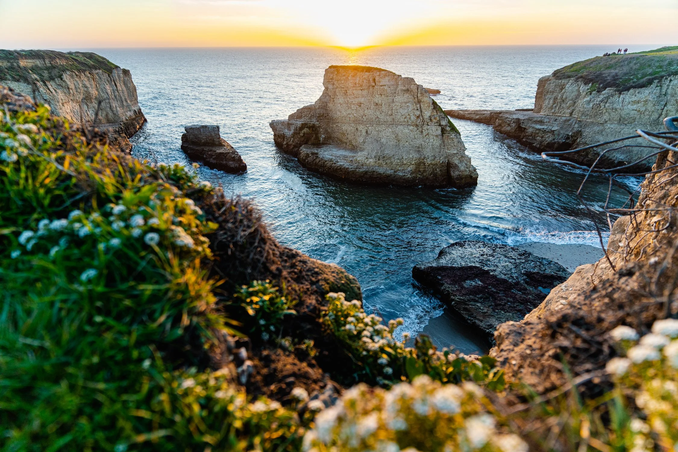
One of the best hidden gems along the PCH is Shark Fin Cove photographed here. Photograph by Dalton Johnson
Exploring the Natural Wonders Along the PCH: Beaches, Redwoods, and More
A road trip along the Pacific Coast Highway presents an incredible opportunity to immerse yourself in the natural wonders of the California coast. From pristine beaches to towering redwood forests and everything in between, the PCH showcases a diverse array of breathtaking landscapes. Here's a closer look at the natural wonders you can explore along the PCH:
Stunning Beaches: The PCH is famous for its stunning beaches, each offering its own unique charm. From the golden sands of Malibu to the rugged shores of Big Sur, you'll find an abundance of picturesque spots to relax, play, and soak up the sun. Don't miss iconic beaches like Zuma Beach, Pfeiffer Beach, and Carmel Beach, where you can unwind, stroll along the shoreline, or catch breathtaking sunsets over the Pacific Ocean.
Majestic Redwood Forests: Venture inland from the PCH to discover the majestic beauty of the towering redwood forests. These ancient giants, some of the tallest trees on Earth, create an enchanting atmosphere that is simply awe-inspiring. Visit places like Redwood National and State Parks, where you can walk among these magnificent trees, hike scenic trails, and witness the serene beauty of the forest.
Breathtaking Coastal Cliffs: The PCH winds along dramatic coastal cliffs, offering stunning vistas that will leave you breathless. From the rugged cliffs of Big Sur to the iconic Bixby Bridge, the coastline boasts awe-inspiring views at every turn. Don't forget to stop at viewpoints like Point Lobos or Julia Pfeiffer Burns State Park to marvel at the rugged beauty of the cliffs and the crashing waves below.
Scenic Coastal Drives: The PCH itself is a scenic wonder, providing countless opportunities for awe-inspiring drives. The winding road hugs the coastline, offering panoramic views of the Pacific Ocean. Cruise along the cliffside stretch between Carmel and San Simeon, known as the Big Sur Coast, where every bend reveals a new postcard-worthy view. Be prepared to stop at turnouts, soak in the vistas, and capture the beauty of the coastline.
Vibrant Wildlife: The Pacific Coast Highway is home to a diverse array of wildlife, both on land and at sea. Keep an eye out for seals and sea lions sunbathing on rocks, dolphins playing in the surf, and whales breaching offshore during migration seasons. Explore tide pools teeming with colorful marine life, or visit areas like the Channel Islands National Park, where you can witness seabird colonies and spot seals, sea lions, and possibly even whales up close.
Coastal State Parks: The PCH is dotted with coastal state parks that offer a chance to experience the natural beauty of the California coast. Places like Point Reyes National Seashore, Andrew Molera State Park, and Crystal Cove State Park provide opportunities for hiking, picnicking, wildlife spotting, and immersing yourself in the coastal environment.
Immerse yourself in the natural wonders along the PCH, from the tranquil beaches and rugged cliffs to the ancient redwood forests and vibrant wildlife. Take the time to explore these remarkable landscapes, engage in outdoor activities, and capture the awe-inspiring beauty of the California coast. The natural wonders along the PCH are sure to create unforgettable moments and leave you with a deep appreciation for the incredible diversity of the Golden State's landscapes.
Preparing for Unexpected Situations: Emergency Preparedness on the PCH
When embarking on a road trip along the Pacific Coast Highway (PCH), it's essential to be prepared for unexpected situations that may arise during your journey. While the PCH offers breathtaking views and memorable experiences, it's important to prioritize safety and be equipped to handle emergencies. Here are ten tips to help you prepare for unforeseen circumstances on the PCH:
Roadside Emergency Kit: Pack a well-stocked roadside emergency kit that includes essentials such as a spare tire, jack, jumper cables, flashlight, basic tools, and a reflective triangle. Familiarize yourself with how to use these items and be prepared to handle minor vehicle issues if they occur.
Vehicle Maintenance: Before setting off on your PCH adventure, ensure your vehicle is in good working condition. Check the tires, brakes, fluid levels, and lights. If needed, get a thorough inspection from a trusted mechanic. This can help prevent breakdowns and keep you safe on the road.
Communication and Navigation: Make sure you have reliable communication tools such as a charged mobile phone and car charger. Consider downloading offline maps or a GPS navigation app to ensure you can navigate even if you encounter areas with limited or no cell service. Carry a physical road map as a backup.
Weather Awareness: Stay informed about weather conditions along your route, especially if you're traveling during seasons when storms or extreme weather are possible. Check weather forecasts regularly and be prepared to adjust your plans or seek shelter if needed. Pay attention to any road condition advisories or closures due to inclement weather.
First Aid Kit and Medications: Pack a well-stocked first aid kit that includes bandages, antiseptic ointment, pain relievers, and any necessary prescription medications. Familiarize yourself with basic first aid procedures. If you or your travel companions have specific medical needs, ensure you have an ample supply of necessary medications.
Emergency Contacts and Travel Documents: Carry a list of emergency contact numbers, including roadside assistance and local authorities along the PCH. Keep a copy of your driver's license, identification, vehicle registration, and insurance documents in a secure place. It's also a good idea to have digital copies stored on your phone or in cloud storage.
Stay Hydrated and Stocked with Essentials: Keep a supply of drinking water and non-perishable snacks in your vehicle. Staying hydrated and having nourishing food available is important, especially if you encounter unexpected delays or find yourself in remote areas without immediate access to amenities.
Be Aware of Your Surroundings: While the PCH is renowned for its beauty, it's important to be aware of your surroundings and take necessary precautions. Park in well-lit areas, lock your vehicle when unattended, and be cautious of your belongings. Stay on designated trails when hiking and respect wildlife habitats.
Stay Updated on Local Regulations and Guidelines: Familiarize yourself with local regulations and guidelines along the PCH, including camping restrictions, beach rules, and wildlife protection measures. Observe posted signs and practice responsible tourism to ensure the safety of both yourself and the environment.
Trust Your Instincts and Seek Help if Needed: If you encounter an emergency or feel unsafe, trust your instincts and seek assistance. Call emergency services or roadside assistance if necessary. Don't hesitate to reach out to local authorities or fellow travelers for help or guidance if you require assistance.
By being prepared and taking necessary precautions, you can better handle unexpected situations and ensure a safer and more enjoyable journey along the Pacific Coast Highway. Remember to prioritize safety, stay vigilant, and embrace the adventure while being ready for any challenges that may come your way.

Embracing the wild times the PCH has to offer on a side hike in Big Sur. Photograph by Dalton Johnson
Embarking on a road trip along the Pacific Coast Highway is an adventure that promises stunning natural beauty, captivating landscapes, and unforgettable experiences. From the pristine beaches and towering redwoods to the charming coastal towns and vibrant cultural attractions, the PCH showcases the best of what California has to offer. This ultimate guide has provided you with insights into the diverse landscapes, family-friendly activities, photography tips, emergency preparedness, and so much more.
As you plan your journey along the PCH, remember to consider the best time of year to travel, take detours to explore hidden gems, and craft the perfect itinerary that suits your interests. Be prepared for challenging sections, budget wisely, and prioritize safety at all times. Whether you're traveling solo, with friends, or as a family, there are countless opportunities for adventure, relaxation, and discovery along the way.
Capture the beauty of the PCH with your camera, savor the culinary delights, and immerse yourself in the rich history and culture that make this route so special. Embrace the breathtaking views, the soothing sound of crashing waves, and the warmth of the coastal communities you encounter. The memories made on this iconic highway will stay with you for a lifetime.
As you hit the open road, keep in mind the essence of a road trip – the freedom to explore, the joy of spontaneity, and the opportunity to create lasting connections with the people and places you encounter. Let the Pacific Coast Highway be your gateway to adventure, inspiration, and a deeper appreciation for the natural wonders and diverse tapestry of California's coastal beauty.
So, buckle up, set your playlist, and embark on an extraordinary journey along the Pacific Coast Highway. Let the allure of the open road guide you as you create cherished memories and experience the undeniable magic of this classic American adventure. The Pacific Coast Highway awaits, ready to reveal its wonders and make your road trip dreams come true.
Discover more of Highway One

Visitor's Guide to Convict Lake
Nestled in the Sherwin Range of the Sierra Nevada, Convict Lake, with its turquoise-blue waters and dramatic mountain scenery, is a remarkable destination for nature lovers and adventurers alike. Its name, steeped in an intriguing history of convicts and shootouts, adds an element of mystery to its natural beauty. Carved out by glaciers, the lake is among the deepest in the Sierra Nevada mountains and is enveloped by a box canyon set in the mountains. The landscape is dominated by light-colored granite, the result of a deep geological history involving magma, sedimentary rocks, and extreme heat and pressure. Moreover, the lake holds cultural significance as well, being known as Wit-sa-nap to the Paiute Indians, whose legends fill the place with a spiritual ambiance.
Nestled in the Sherwin Range of the Sierra Nevada, Convict Lake, with its turquoise-blue waters and dramatic mountain scenery, is a remarkable destination for nature lovers and adventurers alike. Its name, steeped in an intriguing history of convicts and shootouts, adds an element of mystery to its natural beauty. Carved out by glaciers, the lake is among the deepest in the Sierra Nevada mountains and is enveloped by a box canyon set in the mountains. The landscape is dominated by light-colored granite, the result of a deep geological history involving magma, sedimentary rocks, and extreme heat and pressure. Moreover, the lake holds cultural significance as well, being known as Wit-sa-nap to the Paiute Indians, whose legends fill the place with a spiritual ambiance.
Visit Convict Lake for its breathtaking natural beauty, encompassing turquoise-blue waters and dramatic mountain vistas. Experience the thrill of fishing in one of the most popular spots in the Eastern Sierra, stocked with Rainbow and German Brown trout. Immerse yourself in the rich history of the area, from Native American legends to tales of 19th-century convicts, that will make your visit more than just a scenic retreat.
Read on to Discover More about What Makes Convict Lake a Must-Visit Destination!
Kayaking on Convict Lake for sunrise. Photo by Dalton Johnson
Pros:
Stunning natural beauty with turquoise-blue waters and mountains
Rich fishing opportunities with a fantastic stock of trout
Variety of recreational activities like hiking and horseback riding
Intriguing local history and folklore
Cons:
Can get crowded during peak seasons
Limited amenities, as it's in a rural area
High altitude may not be suitable for everyone
The History of Convict Lake
Convict Lake, located in Mono County in the eastern Sierra Nevada range of California, is steeped in fascinating history that dates back to the late 19th century. The name "Convict Lake" comes from an event involving a group of escaped convicts, which adds a dramatic note to its history.
In 1871, a group of convicts escaped from a prison in Carson City, Nevada. They traveled south into the Owens Valley of California, which was at that time a relatively unsettled area. When a local posse tracked down the convicts near what is now Convict Lake, a shootout occurred. Robert Morrison, a Benton merchant and deputy sheriff in the posse, was killed in the encounter, and several others were injured.
The convicts were eventually captured, and two of them were hung without trial in the nearby town of Bridgeport. The lake, originally known as Monte Diablo (or "Devil Mountain") after the nearby peak, was renamed in memory of this event.
Adding to the lake's dramatic aura are the geological features that surround it. It's framed by the Sherwin Range of mountains, and Mount Morrison, named after the fallen deputy sheriff, looms above it. Convict Lake is known for its deep-blue, crystal-clear waters and the stunningly stark, almost vertical slopes of the mountains that encircle it.
The lake later became a popular spot for recreation. In the early 20th century, access was improved with the construction of the Sherwin Grade of Highway 395. In the mid-century, the Convict Lake Resort was established, offering amenities like a marina, cabins, and a restaurant. Today, the area continues to attract visitors from around the world with its natural beauty, outdoor activities, and captivating history.
Camping near Convict Lake
Camping around Convict Lake offers a memorable experience that allows visitors to immerse themselves in the natural beauty of the Eastern Sierra Nevada. The area offers various options for campers, from the well-equipped Convict Lake Campground to dispersed camping opportunities in the nearby national forest. Here are some details to help you plan your camping trip:
Convict Lake Campground: Located just a short walk from the lake, the campground is nestled among aspen and pine trees, offering campers an idyllic setting with easy access to the lake's activities. The campground features over 80 single-family campsites that accommodate tents, RVs, and trailers. Each site is equipped with a picnic table, fire ring, and food storage locker. Drinking water, flush toilets, and a dump station are available on-site. Reservations can be made in advance, although some sites are available on a first-come, first-served basis. The campground is typically open from May through October, weather permitting.
Convict Lake Resort: If you're looking for a more comfortable experience, the nearby Convict Lake Resort offers a range of cozy cabins, some of which have full kitchens, living rooms, and outdoor decks. The resort also has a general store, a restaurant, and a marina for boat rentals and fishing supplies. Staying at the resort provides you with the comforts of home while being surrounded by the scenic beauty of Convict Lake.
Dispersed Camping: For a more primitive and secluded experience, dispersed camping is allowed in certain areas of the Inyo National Forest, which surrounds Convict Lake. It's important to check with the local ranger station for the specific regulations, permits, and guidelines for dispersed camping, as well as fire restrictions. Keep in mind that there are no facilities or amenities provided, so campers must practice Leave No Trace principles and pack out all trash.
Camping at Convict Lake provides a great opportunity to unplug from daily life and immerse yourself in the serenity of nature. The area's majestic scenery, abundance of outdoor activities, and clear night skies make it an ideal destination for a memorable camping experience.
Best time of year to visit Convict Lake
Spring at Convict Lake
As the icy grip of winter loosens, spring brings a welcome renewal to Convict Lake. Blossoming wildflowers paint the landscape in a vibrant palette of colors, contrasting beautifully against the still snow-capped mountains in the backdrop. The lake thaws and is alive with activity, as rainbow trout start biting - a delight for anglers. The days are longer and the temperatures are milder, perfect for boating or lakeside picnics. Birdwatchers would also be thrilled to witness a variety of migratory birds returning to the area.
Summer at Convict Lake
Summertime is when Convict Lake truly comes alive. The azure lake is a sight to behold, mirroring the sky and surrounding Sierra Nevada peaks. It's a haven for outdoor enthusiasts, with activities such as kayaking, paddle boarding, fishing, and swimming taking the spotlight. Hiking is a popular pastime, with the three-mile trail around the lake providing breath-taking views and opportunities to spot local wildlife like mule deer and black bears. The longer days and warm temperatures make it a perfect time for camping under the stars. It's also a great season for horseback riding, exploring the myriad trails that radiate out from the lake into the surrounding wilderness.
Autumn at Convict Lake
Fall ushers in a season of serene beauty at Convict Lake. The surrounding aspen trees transform into brilliant shades of yellow, gold, and orange, creating a picturesque autumn scenery. The cooler temperatures and fewer visitors make this a great time for peaceful hikes and tranquil fishing excursions. This is also the ideal season for photographers seeking that perfect shot of the reflection of the fall colors on the still surface of the lake. In the evenings, the crisp air is perfect for gathering around a campfire and sharing stories of the day’s adventures.
Winter at Convict Lake
Winter brings a quiet, solemn beauty to Convict Lake. The lake might freeze over, and the surrounding mountains and trees are blanketed in snow, creating a mesmerizing winter wonderland. It's a perfect location for winter sports such as cross-country skiing, snowshoeing, and ice fishing. Wildlife sightings can be scarce, but you might catch glimpses of resilient species like coyotes and bobcats. Winter evenings can be spent in cozy cabins, sipping hot cocoa by the fire. And if you're lucky, you might experience the Northern Lights painting the night sky above the lake, capping off the magical winter spectacle.
Throughout the year, Convict Lake's stunning beauty and array of outdoor activities make it an unforgettable destination for nature lovers, adventure seekers, and peace seekers alike.
Fishing at Convict Lake
Fishing at Convict Lake is a favorite activity for many visitors due to the lake's abundant trout population and picturesque surroundings. Whether you're an experienced angler or a beginner, you're bound to have an enjoyable experience.
Types of Fish: Convict Lake is best known for its excellent trout fishing. It's stocked regularly with rainbow trout, and you might also hook German brown trout or a cutthroat trout. The lake's deep, clear water makes it an ideal habitat for these species.
Season: The fishing season typically runs from the last Saturday in April until the 15th of November. The lake often sees the most fishing activity on the opener weekend, and during fishing derbies that are organized throughout the season.
Fishing Spots: You can fish from the shore, where there are many accessible spots along the lake's 3-mile perimeter, or from a boat. The lake's marina offers a boat launch ramp and boat rentals, including motorboats and pontoons.
Equipment and Bait: If you don't have your own gear, the marina's general store sells a variety of fishing equipment, as well as live bait and tackle. Popular bait choices for Convict Lake include nightcrawlers and PowerBait, while commonly used lures include Thomas Buoyants and Panther Martins.
Licenses and Regulations: Anyone over the age of 16 needs a California state fishing license, which can be purchased online or at the marina store. Be sure to familiarize yourself with the state's fishing regulations, including the daily bag and possession limits.
Fishing Derbies: Convict Lake hosts several fishing derbies throughout the season, including the popular Round Up at the Lake and Ambush at the Lake derbies. These events offer anglers a chance to win cash and prizes for catching the largest fish.
Fishing at Convict Lake is a wonderful way to relax, enjoy the beautiful scenery, and possibly reel in a nice trout for dinner. Whether you're casting your line from the shore, a boat, or wading in the cool water, you're sure to have a memorable experience.
Hiking Trails around Convict Lake
Convict Lake offers some excellent hiking trails that allow you to experience the stunning natural beauty of the Eastern Sierra Nevada. Trails around Convict Lake range from easy, family-friendly walks to more challenging hikes into the surrounding mountains. Here are some popular trails to consider:
Convict Lake Loop Trail: This is a 3-mile loop trail that circles the lake and is relatively flat, making it ideal for hikers of all skill levels, including families with young children. The trail offers magnificent views of Convict Lake and the towering peaks that surround it. You'll also pass through groves of aspen trees, which are particularly breathtaking in the fall when their leaves turn to gold.
Convict Creek Trail: For a more challenging hike, the Convict Creek Trail takes you into the John Muir Wilderness, climbing steadily up the canyon alongside Convict Creek. The trail is about 8 miles round trip with an elevation gain of over 1,700 feet. Along the way, you'll pass through a variety of terrains, including meadows, aspen groves, and rocky areas, with beautiful views of the creek, lake, and mountains. Be prepared for a strenuous hike, but the views are worth the effort.
Laurel Lakes Trail: This is a difficult trail due to its steepness and the need for a four-wheel-drive vehicle to reach the trailhead. The trail is about 10 miles round trip and climbs over 2,000 feet to the beautiful Laurel Lakes, located high in the Sierra. The hike offers outstanding views of the surrounding mountains, valleys, and Convict Lake far below.
Before you set out on any hike in the Convict Lake area, make sure you're adequately prepared. Check the local weather forecast, pack plenty of water and high-energy snacks, and ensure you have a map of the area. Also, remember to practice Leave No Trace principles to keep the trails as pristine as possible for future visitors. Happy hiking!
Different Ways of Enjoying the Waters of Convict Lake
With its crystal-clear, azure waters, Convict Lake is a haven for water enthusiasts. Whether you're interested in fishing, boating, or simply relaxing by the water's edge, there's something for everyone. Here's how you can enjoy the water at Convict Lake:
Fishing: As mentioned earlier, Convict Lake is well-known for its abundant trout population. You can rent a boat or fish from the shore. The lake is regularly stocked with rainbow trout, making it a popular destination for both novice and experienced anglers.
Boating: The Convict Lake Marina offers a variety of boats for rent, including motor boats, pontoon boats, and row boats. This is a wonderful way to explore the lake and enjoy the stunning mountain scenery from a different perspective. The marina also provides life jackets and other safety equipment. Please note that personal watercraft, like jet skis, are not allowed on the lake.
Kayaking and Canoeing: You can bring your own canoe or kayak to Convict Lake. Paddling around the lake allows you to navigate the tranquil waters at your own pace, and it's a peaceful way to enjoy the natural beauty of the area.
Swimming: Although the lake's water can be quite chilly, swimming is allowed. There are no lifeguards on duty, so swimmers should exercise caution.
Picnicking by the Lake: There are several picnic areas around the lake where you can enjoy a meal with a view. These spots are perfect for relaxing, soaking up the sun, and watching the lake's activity.
Wildlife Watching: The lake is home to a variety of bird species, and you may also spot mule deer, black bears, or even a bobcat near the water's edge.
Photography: The lake's clear waters, which reflect the stunning mountainous backdrop, make it a favorite spot for photography. Whether you're capturing the sunrise, sunset, or the vibrant colors of fall, the lake's beauty offers endless photo opportunities.
Remember to respect the lake's environment and follow all posted rules and guidelines, including practicing Leave No Trace principles. This ensures that the lake and its surroundings remain beautiful and accessible for all to enjoy.
Enjoying the sunrise view while kayaking on Convict Lake. Photo by Dalton Johnson
Photographing at Convict Lake
Photographing at Convict Lake is a delight for professional and amateur photographers alike. The pristine lake, with the dramatic backdrop of the Sierra Nevada, provides a wealth of stunning natural scenery to capture. Here are some tips and ideas for photographing at Convict Lake:
Sunrise and Sunset: Like many landscapes, Convict Lake is particularly photogenic during the golden hours at sunrise and sunset. These times provide soft, warm lighting and the potential for spectacular colors in the sky. During sunrise, the mountains are beautifully lit with an alpenglow. Meanwhile, sunsets can cast amazing colors on both the sky and the surface of the lake.
Reflections: The lake's clear, calm waters offer incredible opportunities to capture reflections of the surrounding mountains and forests. Try photographing early in the morning when the water is usually at its calmest.
Wildlife: Keep an eye out for local wildlife to add a dynamic element to your photos. Birds in flight, deer drinking at the water's edge, and other animals can make for excellent subjects.
Stars and Milky Way: On clear nights, Convict Lake is an excellent place for astrophotography. With minimal light pollution, you can capture the Milky Way arching over the lake and mountains, or make long exposures to capture star trails.
Seasons: The changing seasons at Convict Lake offer diverse landscapes to photograph. Spring brings wildflowers, summer offers a vibrant, lush landscape, autumn brings spectacular fall colors, and winter covers the scene in a blanket of white snow.
Aerial Photography: If you have a drone (and the necessary permissions to fly it), aerial photography can provide a unique perspective on the lake and its surroundings.
Long Exposure: For a more artistic shot, try a long exposure to smooth out the water and clouds, creating a dreamy effect.
Remember, when photographing in natural environments like Convict Lake, it's essential to respect the environment and wildlife. Stick to paths and public areas, don't disturb animals or their habitats, and follow all rules and regulations regarding drone usage and other activities.
Above all, take your time to enjoy the serene beauty of Convict Lake and let this inspire your photography.
Packing Essentials for Road Trippers
If you're planning a road trip to Convict Lake, you'll want to pack essentials that will make your trip more comfortable, safe, and enjoyable. Here's a list of items to consider:
1. Clothing and Footwear:
Layered Clothing: Weather can change quickly in the mountains, so be prepared with layers, including a waterproof and windproof jacket.
Hiking Boots: If you plan on hiking, quality hiking boots will provide the necessary support and comfort.
Swimwear: Don't forget your swimwear if you're planning on swimming in the lake during the summer months.
Hat, Sunglasses, and Sunscreen: Protect yourself from the strong mountain sun.
Gloves, Scarves, and Warm Hats: If you're visiting during the colder months, pack these items to keep warm.
2. Camping and Outdoor Gear:
Tent, Sleeping Bags, and Sleeping Pads: If you're camping, make sure you have appropriate gear for the temperatures you'll be encountering.
Camp Chairs and Table: These will come in handy for relaxing at your campsite.
Cooking Gear: A portable stove, cookware, utensils, and a cooler for keeping food items.
Flashlights or Headlamps: And don't forget the extra batteries.
First-Aid Kit: Include band-aids, antiseptic wipes, tweezers, bug spray, and any necessary medications.
3. Food and Water:
Snacks: Pack high-energy snacks for hiking like trail mix, energy bars, and fruit.
Water: Bring plenty of water for drinking, cooking, and washing up. If you plan to get water from a natural source, you'll need a reliable water purification method.
4. Hiking Essentials:
Backpack: To carry your essentials during hikes.
Map and Compass: Even if you plan to use a GPS, it's a good idea to have a physical map and compass as a backup.
Multi-tool: Can be handy in a variety of situations.
5. Fishing Gear:
Fishing Rod and Reel: If you plan to fish, bring along your gear. You can also rent or buy gear at Convict Lake.
Fishing License: Anyone over 16 will need a California state fishing license.
6. Photography Gear:
Camera: Whether it's a DSLR, mirrorless, or just your smartphone, don't forget your camera to capture the beautiful landscapes.
Extra Memory Cards and Batteries: You'll be taking lots of photos, so make sure you have enough storage and power.
Tripod: Useful for landscape, sunset, sunrise, and nighttime photography.
7. Entertainment:
Books, Card Games, Portable Speakers: For relaxation during your downtime.
8. Miscellaneous:
Trash Bags: To ensure you leave no trace at your campsite or picnic spot.
Cell Phone and Charger: For communication and emergencies. Remember that service may be spotty in remote areas.
Paper Towels and Toilet Paper: For cleaning and personal hygiene.
Remember, the weather and activities you plan to do will influence what you need to pack. Always check the weather forecast before you leave and adjust your packing list accordingly. Safe travels and enjoy your trip to Convict Lake!
Hiking along the beach of Convict Lake looking for a place to swim. Photo by Dalton Johnson
Convict Lake, with its blend of natural beauty, recreational opportunities, and rich history, is a unique destination that caters to a wide range of interests. Whether you're an adventurer, a nature lover, a history enthusiast, or a fisherman, Convict Lake has something to offer you. So plan your trip, and let the journey to this extraordinary destination begin!
Discover more of Eastern Sierra

Discover the Hidden Gem: Shark Fin Cove - Where Photography and Nature Collide
If you're seeking a destination that combines natural beauty, unique rock formations, and captivating landscapes, then Shark Fin Cove is an absolute must-visit. This hidden gem, nestled along the rugged coastline north of Santa Cruz, offers an enchanting backdrop that is truly a photographer's paradise. From the iconic rock formation resembling a shark fin rising from the ocean to the dramatic cliffs and serene beach, Shark Fin Cove provides an abundance of opportunities to capture awe-inspiring shots. Whether you're an amateur or a seasoned professional, the combination of golden hour lighting, stunning natural features, and a tranquil atmosphere make Shark Fin Cove an irresistible destination for photographers looking to create breathtaking images.
If you're seeking a destination that combines natural beauty, unique rock formations, and captivating landscapes, then Shark Fin Cove is an absolute must-visit. This hidden gem, nestled along the rugged coastline north of Santa Cruz, offers an enchanting backdrop that is truly a photographer's paradise. From the iconic rock formation resembling a shark fin rising from the ocean to the dramatic cliffs and serene beach, Shark Fin Cove provides an abundance of opportunities to capture awe-inspiring shots. Whether you're an amateur or a seasoned professional, the combination of golden hour lighting, stunning natural features, and a tranquil atmosphere make Shark Fin Cove an irresistible destination for photographers looking to create breathtaking images.
Discover the hidden beauty of Shark Fin Cove, a secluded coastal paradise north of Santa Cruz. With its iconic rock formation, dramatic cliffs, and serene beach, Shark Fin Cove offers photographers a captivating backdrop for their creativity. Explore the breathtaking landscapes, capture the golden hour magic, and unlock your artistic vision at this picturesque location. Plan your visit to Shark Fin Cove and indulge in a photography experience like no other.
In this blog post, we'll explore the pros and cons of visiting Shark Fin Cove, reasons why someone would visit, and answer some frequently asked questions. We'll also give you tips on photographing this beautiful location.

A magical sunset at Shark Fin Cove filled with wildflowers. Photograph by Dalton Johnson
Pros:
The cove is a hidden gem, so it's not as crowded as other popular destinations.
The rock formation looks like a shark fin and makes for a unique and striking photo subject.
The beach is secluded and peaceful, making it a great spot for a picnic or to enjoy the sunset.
The surrounding cliffs and rock formations provide a stunning backdrop for photos.
Cons:
The beach can be difficult to access as there is a steep path down to the cove.
There are no facilities, so visitors need to bring everything they need with them, including water, food, and sunscreen.
The weather can be unpredictable, so it's important to check the forecast and dress accordingly.
Why Visit Shark Fin Cove?
Shark Fin Cove is a great destination for anyone who loves nature, photography, or just wants to get away from the crowds. The cove's secluded location and striking natural beauty make it an ideal spot for a day trip. Visitors can hike down to the cove and enjoy a picnic on the beach, explore the surrounding cliffs, or simply soak in the stunning views.
If you're a photographer, Shark Fin Cove offers a wealth of opportunities. The unique rock formation and surrounding cliffs provide an ever-changing backdrop for stunning landscape shots. Whether you're a professional photographer or just starting out, Shark Fin Cove is a must-visit location.
Photographing Shark Fin Cove
When it comes to photography, Shark Fin Cove offers a plethora of captivating subjects and compositions. Here's a closer look at what you can expect when photographing this stunning location:
Gear Needed: To capture the beauty of Shark Fin Cove, it's recommended to bring a few essential pieces of photography gear. A wide-angle lens is particularly useful for capturing the expansive scenery and incorporating the impressive rock formation into your shots. Additionally, a tripod will help you achieve stable and sharp images, especially during low-light conditions or long exposure shots. Consider using a polarizing filter to reduce glare and enhance colors, particularly when photographing the ocean and surrounding cliffs.
Best Time of Day: Timing is crucial for landscape photography, and Shark Fin Cove is no exception. The golden hour, which refers to the hour before sunset or after sunrise, offers magical lighting conditions with warm, soft hues that can elevate your photos to another level. During this time, the sun casts a gentle glow, casting long shadows and creating a dreamy atmosphere. Take advantage of the golden hour to capture the cove in its most enchanting state.
Note: Sunset is better, but the shadows can be harsh and there will be more people
What is There to Photograph: Shark Fin Cove presents a diverse range of photographic opportunities. The focal point of the cove is undoubtedly the rock formation that resembles a shark fin rising from the ocean. This unique feature can serve as a captivating centerpiece for your compositions. Additionally, the surrounding cliffs, rugged coastline, and dramatic waves crashing against the rocks offer stunning elements to incorporate into your frames. Don't forget to explore the beach itself, as it provides a tranquil foreground against the backdrop of the majestic cliffs and horizon.
Different Spots to Photograph: While the rock formation is an iconic subject, don't limit yourself to a single perspective. Explore the various vantage points available at Shark Fin Cove to unleash your creativity. Consider shooting from different angles along the beach, experimenting with low and high angles to highlight different aspects of the cove. Venture up to the cliffs to capture breathtaking panoramic views of the coastline or find elevated positions that offer unique perspectives. Remember, each spot offers its own charm and can result in distinctive and captivating photographs.
By taking advantage of the right gear, timing, and exploring the different photography spots, you'll be able to capture the awe-inspiring beauty of Shark Fin Cove. Let your artistic vision guide you as you compose your shots, and don't be afraid to experiment with different techniques to create truly remarkable images. Ultimately, Shark Fin Cove's natural splendor provides a fantastic canvas for photographers to express their creativity and capture breathtaking moments in time.
FAQ
Where is Shark Fin Cove?
Shark Fin Cove is located north of Santa Cruz in the small town of Davenport along Highway One.
What to Do at Shark Fin Cove?
Visitors can hike down to the cove and enjoy a picnic on the beach, explore the surrounding cliffs, or take photographs of the stunning scenery.
What Do I Need to Visit Shark Fin Cove?
Visitors need to bring everything they need with them, including water, food, and sunscreen. Comfortable hiking shoes are also recommended.
Is Shark Fin Cove Free?
Yes, Shark Fin Cove is free to visit.
Can I Camp at Shark Fin Cove?
No, camping is not allowed at Shark Fin Cove.
Is the Hike Hard to Shark Fin Cove?
The hike down to the cove can be steep and challenging, so comfortable hiking shoes and caution are recommended.
Is Shark Fin Cove Family Friendly?
Yes, Shark Fin Cove is family-friendly, but young children should be supervised due to the steep paths and cliffs.
Can You Surf at Shark Fin Cove?
Yes, surfers can access the beach at Shark Fin Cove, but the conditions can be unpredictable and this spot is rarely ever surfed.
Sunset Picnic Packing List
When preparing for a sunset picnic at Shark Fin Cove, it's essential to pack the right items to ensure a comfortable and enjoyable experience. Here's a packing list to help you make the most of your time:
Picnic Blanket or Beach Towel: A comfortable blanket or beach towel to sit on will provide a cozy spot to relax and enjoy the sunset.
Portable Chairs: If you prefer a bit of back support, consider bringing lightweight, foldable chairs for added comfort.
Food and Drinks: Pack a delicious assortment of snacks, sandwiches, fruits, and finger foods. Don't forget to bring plenty of water or other refreshing beverages to stay hydrated.
Picnic Utensils and Plates: Disposable or reusable plates, cups, cutlery, and napkins will make it easy to enjoy your picnic treats.
Sunscreen and Sun Protection: Shield yourself from harmful UV rays with sunscreen, sunglasses, and hats. The coastal breeze can be deceiving, so ensure you're adequately protected.
Warm Clothing and Blankets: Evenings can get chilly near the coast, so bring layers such as sweaters, jackets, and cozy blankets to keep warm as the sun sets.
Camera and Tripod: Don't forget your camera gear to capture the stunning sunset and scenic beauty of Shark Fin Cove. A tripod will help steady your shots, especially during low-light conditions.
Trash Bags: Help keep the area clean by bringing small trash bags to dispose of any waste properly.
Extra Essentials: It's always a good idea to bring some additional items like a first aid kit, wet wipes, hand sanitizer, and a portable phone charger.
Remember to pack light and be mindful of your surroundings, as there are no trash or recycling bins available at Shark Fin Cove. Leave no trace and take all your belongings and trash with you when you leave.
Embracing the beauty of Shark Fin Cove with a playful cartwheel. Photograph by Dalton Johnson
Shark Fin Cove is a hidden gem for landscape photography, located north of Santa Cruz in Davenport, California. With its unique rock formation, stunning cliffs, and secluded beach, it offers a wealth of opportunities for photographers and nature enthusiasts alike. While the hike down to the cove may be challenging, the reward of capturing breathtaking photos and enjoying the peaceful surroundings makes it well worth the effort. So grab your camera, pack your gear, and head to Shark Fin Cove for an unforgettable photography experience.
Discover more of Highway One
Sunset Lovers, Rejoice! These HWY 1 Destinations Will Take Your Breath Away
Embarking on a memorable road trip down Highway 1, also known as the Pacific Coast Highway, is a dream for adventure travelers seeking scenic beauty and captivating experiences. As you wind your way along the breathtaking California coastline, one of the highlights of your journey will undoubtedly be witnessing the stunning sunsets.
Embarking on a memorable road trip down Highway 1, also known as the Pacific Coast Highway, is a dream for adventure travelers seeking scenic beauty and captivating experiences. As you wind your way along the breathtaking California coastline, one of the highlights of your journey will undoubtedly be witnessing the stunning sunsets.
When it comes to the best places to watch the sunset on a Pacific Coast Highway (PCH) road trip, there are several standout locations. One of them is Pfeiffer Beach in Big Sur, where you can witness the sun sinking behind the famous Keyhole Rock, casting a warm glow on the golden sand. Another remarkable spot is Morro Bay, where the setting sun beautifully illuminates the iconic Morro Rock, creating a breathtaking scene. Lastly, head to Santa Monica Pier in Los Angeles for a quintessential California sunset experience, as the sun dips below the horizon, painting the sky in vibrant colors above the picturesque coastal scenery.
In this blog, we will unveil some of the most remarkable sunset locations along HWY 1, offering you the opportunity to create unforgettable memories against the backdrop of nature's breathtaking artistry.

Scripps Pier glowing in the sunset lighting while on a road trip down Highway One. Photograph by Dalton Johnson
San Francisco Golden Gate Bridge:
Starting your HWY 1 road trip in San Francisco, be sure to visit the iconic Golden Gate Bridge. Not only does this landmark offer unparalleled views during the day, but it also transforms into a magical sight as the sun sets. Watch as the bridge's vibrant orange hue contrasts with the colorful sky, creating a picture-perfect moment to capture.
Located in the vibrant city of San Francisco, the Golden Gate Bridge is an architectural marvel that has become an iconic symbol of the city and a must-visit destination for travelers from around the world. Spanning 1.7 miles across the entrance to the San Francisco Bay, this majestic suspension bridge connects the city to Marin County and offers awe-inspiring views of the surrounding natural beauty.
When it comes to catching a memorable sunset, the Golden Gate Bridge is a prime location. As the sun descends towards the horizon, the bridge takes on a mesmerizing glow, transforming the already breathtaking scenery into a true spectacle. The combination of the bridge's vibrant orange-red hue, the shimmering waters of the bay, and the stunning backdrop of the city skyline creates a picturesque setting for witnessing nature's colorful farewell to the day. Whether you choose to view the sunset from one of the nearby parks or from a vantage point on the bridge itself, the experience is guaranteed to be unforgettable.
San Francisco Ocean Beach:
Continuing along the coast, San Francisco's Ocean Beach is another fantastic sunset destination. Nestled on the western edge of San Francisco, Ocean Beach is a stunning stretch of coastline that spans approximately three miles. This scenic beach offers a perfect escape from the hustle and bustle of the city, providing a serene atmosphere and breathtaking views of the Pacific Ocean. With its golden sands, crashing waves, and a backdrop of rugged cliffs, Ocean Beach is a paradise for nature lovers and beach enthusiasts alike.
Ocean Beach is renowned as a fantastic sunset location, and for good reason. As the sun begins its descent into the horizon, the vast expanse of Ocean Beach becomes a canvas for nature's spectacular show. The combination of the unobstructed view of the ocean and the dramatic cliffs along the shoreline creates a picturesque setting for witnessing the vibrant colors that illuminate the sky during sunset. Whether you choose to sit on the sand, take a leisurely stroll along the water's edge, or find a cozy spot on one of the nearby dunes, Ocean Beach offers the perfect vantage point to witness the captivating transformation of the sky as day transitions into twilight.
If you're seeking a memorable and tranquil sunset experience in San Francisco, a visit to Ocean Beach is highly recommended. The beach's natural beauty, combined with the soothing sound of crashing waves, offers a serene and rejuvenating atmosphere that is perfect for unwinding and connecting with nature. Whether you're a photographer looking to capture stunning sunset shots, a couple seeking a romantic evening, or simply a traveler in search of a peaceful retreat, Ocean Beach has something for everyone. So, don't miss the opportunity to witness the magical convergence of land, sea, and sky as the sun paints a vibrant masterpiece over the mesmerizing waters of the Pacific Ocean.

Cotton Candy clouds act as the backdrop to a splashing evening at Davenport Landing. Photograph by Dalton Johnson
Davenport Landing:
As you make your way south, Davenport Landing, located just north of Santa Cruz, is a hidden gem. This serene beach offers a peaceful escape from the crowds, allowing visitors to immerse themselves in the beauty of the rugged coastline. With its expansive shoreline, picturesque cliffs, and secluded atmosphere, Davenport Landing provides a unique and intimate setting for those seeking a tranquil beach experience.
Davenport Landing is an exceptional sunset location that should not be missed. As the sun begins its descent, the wide-open vistas of this secluded beach become awash with the warm hues of the evening sky. The unobstructed view of the horizon, framed by the rugged cliffs that flank the beach, creates a breathtaking scene. Whether you choose to sit on the sand, perch atop the cliffs, or explore the tide pools, you'll have a front-row seat to witness the dramatic display as the sun gracefully dips below the Pacific Ocean, casting a mesmerizing glow on the surrounding landscape.
For those in search of a serene and picturesque sunset experience, Davenport Landing is a destination that promises to captivate your senses. Its tranquil ambiance, coupled with the stunning coastal scenery, offers a peaceful respite and an opportunity to reconnect with nature. Whether you're an avid photographer, a couple looking for a romantic moment, or simply someone who appreciates the beauty of a sunset, Davenport Landing invites you to witness the magic unfold before your eyes. So, venture off the beaten path and discover the hidden beauty of this coastal gem that promises to leave you with unforgettable memories and a deep appreciation for the natural wonders of the California coast.
Big Sur:
No HWY 1 road trip is complete without a stop in Big Sur. This legendary stretch of coastline is renowned for its dramatic cliffs, pristine beaches, and awe-inspiring sunsets. From McWay Falls to Pfeiffer Beach, you'll encounter numerous viewpoints that showcase the splendor of the setting sun casting its golden rays on the vast Pacific Ocean. As you traverse the winding roads of Highway 1, you'll encounter numerous spectacular sunset locations throughout the Big Sur region. This enchanting stretch of coastline offers a myriad of vantage points, each showcasing the dramatic meeting of land, sea, and sky as the sun sets over the Pacific Ocean.
Big Sur is renowned for being a great sunset location due to its unique topography and unobstructed views of the horizon. From popular spots like McWay Falls to hidden gems like Pfeiffer Beach, there are countless opportunities to witness nature's magnificent spectacle. As the sun descends, the cliffs and rock formations of Big Sur are bathed in warm, golden light, creating a mesmerizing contrast against the deep blue waters. Whether you choose to watch the sunset from a cliffside viewpoint or sink your toes into the soft sands of a beach, you'll be treated to a captivating display of colors and a sense of tranquility that only Big Sur can offer.
Embarking on a road trip through Big Sur presents an unparalleled opportunity to witness unforgettable sunsets and create lifelong memories. The sheer beauty and serenity of this region make it a must-visit destination for nature lovers and adventure seekers. Whether you're a photography enthusiast looking to capture stunning shots, a couple seeking a romantic evening, or simply someone who appreciates the awe-inspiring beauty of nature, Big Sur's sunset vistas will leave you spellbound. So, make sure to include Big Sur in your road trip itinerary and immerse yourself in the magical allure of this coastal paradise. Prepare to be captivated by the vibrant colors, the dramatic landscapes, and the sense of awe that only a Big Sur sunset can inspire.
Low light colors at Morro Rock near Pismo Beach, CA. Photograph by Dalton Johnson
Morro Rock:
Further south, near Morro Bay, stands the majestic Morro Rock. As evening approaches, head to the bay's shores to witness the unique sight of the setting sun illuminating the rock's distinctive silhouette. The combination of the massive rock formation and the vivid sunset hues creates a remarkable spectacle that photographers and nature lovers alike will relish. Towering at 576 feet, this massive volcanic plug stands majestically at the entrance of the bay, creating a captivating focal point for visitors. As you embark on your road trip, stopping at Morro Rock offers a unique and picturesque sunset location that combines the tranquility of the ocean, the rugged beauty of the rock, and the vibrant colors of the sky.
Morro Rock is an exceptional sunset location due to its strategic positioning and stunning natural surroundings. As the sun begins its descent, it casts a warm and golden glow over the Pacific Ocean, illuminating the waters and creating a breathtaking reflection. The silhouette of Morro Rock against the vibrant sky adds a sense of drama and grandeur to the scene, making it an ideal spot for photographers and nature enthusiasts alike. Whether you choose to witness the sunset from the beach, the harbor, or atop the nearby Embarcadero, you'll be treated to an awe-inspiring display of colors and a sense of serenity that is truly unmatched.
A visit to Morro Rock during sunset is an experience that should not be missed on your road trip adventure. The captivating beauty, the tranquil atmosphere, and the majestic presence of Morro Rock combine to create a truly memorable moment. Whether you're seeking a romantic evening, a peaceful escape, or simply a chance to reconnect with nature, Morro Rock offers it all. Additionally, the charming town of Morro Bay provides a welcoming setting with its waterfront shops, delicious seafood restaurants, and picturesque harbor. So, make sure to include Morro Rock in your road trip itinerary and be prepared to witness the magic of a sunset that will leave you in awe of nature's incredible beauty.
Santa Monica Mountains
Venturing towards Malibu, take a detour into the Santa Monica Mountains for an enchanting sunset experience. The rolling hills, dotted with vibrant wildflowers, provide a picturesque backdrop as the sun descends. Be sure to bring your camera to capture the captivating blend of colors in the sky, casting a warm glow over the idyllic landscape. This expansive mountain range stretches along the California coast, providing a breathtaking backdrop for sunset viewing. As you embark on your road trip through this scenic region, you'll discover numerous hidden spots and scenic viewpoints that showcase the stunning convergence of mountains, valleys, and the vibrant colors of the setting sun.
The Santa Monica Mountains serve as a great sunset location due to their elevated terrain and panoramic vistas. As the sun dips below the horizon, the mountains become bathed in a warm, golden glow, creating a captivating display of light and shadow. Whether you choose to watch the sunset from one of the many hiking trails, hilltop viewpoints, or even from the comfort of your car along the scenic drives, you'll be treated to a breathtaking spectacle. The rolling hills, rugged canyons, and the expanse of the Pacific Ocean in the distance provide a picturesque backdrop for witnessing nature's artistry at its finest.
A visit to the Santa Monica Mountains during sunset is an experience that will leave you in awe of the region's natural beauty and tranquility. As you immerse yourself in the breathtaking views, you'll be reminded of the importance of finding moments of serenity amidst the bustling city life. The mountains offer a welcome escape, allowing you to reconnect with nature, rejuvenate your soul, and witness the magical transformation of the sky as the sun bids farewell to the day. So, whether you're an adventure traveler, a nature enthusiast, or simply someone seeking a peaceful retreat, the Santa Monica Mountains beckon you to discover their stunning sunsets and create unforgettable memories. Don't miss the opportunity to be captivated by the beauty of this picturesque mountain range and let the tranquility of the setting sun wash over you.
Scripps Pier in San Diego:
While not technically on HWY 1, Scripps Pier in San Diego is worth mentioning due to its exceptional sunset vistas. This historic pier stretches 1,090 feet into the Pacific Ocean, offering visitors a unique vantage point to witness the breathtaking sunsets that grace the Southern California skies. As you embark on your road trip, stopping at Scripps Pier provides an opportunity to immerse yourself in the beauty of the ocean, feel the gentle ocean breeze, and witness nature's stunning display of colors.
Scripps Pier is a fantastic sunset location for several reasons. Its location jutting out into the ocean provides an unobstructed view of the horizon, allowing you to witness the full glory of the setting sun. The combination of the pier's rustic charm, the crashing waves, and the vibrant sky creates a captivating scene that is perfect for photographers, nature enthusiasts, and anyone seeking a moment of tranquility. Whether you choose to stroll along the pier, sit on the nearby sandy beach, or perch on the rocks, you'll be treated to a front-row seat to the mesmerizing transformation of the sky as the sun casts its golden hues over the ocean.
Visiting Scripps Pier during sunset is an experience that will leave you with lasting memories. The breathtaking beauty of the scenery, the soothing sound of the waves, and the vibrant colors that paint the sky make it a destination worth exploring. As the sun descends, the pier takes on a magical quality, providing a picturesque backdrop for capturing stunning photographs or simply enjoying the serene ambiance. Additionally, the surrounding area of La Jolla offers a charming coastal town with art galleries, boutique shops, and delectable seafood restaurants, providing ample opportunities to extend your visit and make the most of your road trip experience. So, don't miss the chance to witness the captivating sunsets at Scripps Pier, allowing yourself to be enchanted by the natural beauty and tranquility that this Southern California gem has to offer.

Shark Fin Cove at sunset along Highway One during a road trip. Photograph by Dalton Johnson
A road trip down HWY 1 presents an extraordinary opportunity to witness some of the world's most breathtaking sunsets. From the iconic Golden Gate Bridge to the serene shores of Davenport Landing and the rugged beauty of Big Sur, each location along the way offers its unique charm and captivating sunset views. So, pack your bags, hit the road, and prepare to be awe-inspired as you chase the mesmerizing sunsets along the California coast.
Discover more of Highway one

Exit Glacier and Harding Icefield Hike | Hike Alaska
The Exit Glacier and Harding Icefield hike is a one-two hit combo in the Kenai Fjord National Park just outside of Seward, Alaska. Most hikers decide to day hike to Exit Glacier to see this massive frozen river up close, but few push onward and upward to the Harding Icefield. If you have the time and energy, you should hike up the switchbacks to the Harding Icefield so you can soak in the United States largest icefield.
The Exit Glacier and Harding Icefield hike is a one-two hit combo in the Kenai Fjord National Park just outside of Seward, Alaska. Most hikers decide to day hike to Exit Glacier to see this massive frozen river up close, but few push onward and upward to the Harding Icefield. If you have the time and energy, you should hike up the switchbacks to the Harding Icefield so you can soak in the United States largest icefield.
Hiking Exit Glacier and the Harding Icefield offers an unparalleled opportunity to immerse yourself in the breathtaking beauty of Alaska's Kenai Fjords National Park. The experience allows you to witness the immense power and wonder of glacial landscapes up close, surrounded by towering peaks and pristine wilderness. The journey rewards you with awe-inspiring views, a deeper appreciation for nature's forces, and a chance to create lasting memories in one of the most remarkable natural settings on Earth.
Discover the awe-inspiring beauty of Alaska's Kenai Fjords National Park as you delve into the essential guide for hiking Exit Glacier and the Harding Icefield, unlocking a world of breathtaking landscapes and unforgettable wilderness adventures.
Hiking Exit Glacier with my Dad. Photo by Dalton Johnson
EXIT GLACIER AND HARDING ICEFIELD HIKE OVERVIEW:
Distance: 9.2 miles round trip
Time needed: 6-7 hours
Elevation change: 3,600 feet
Type of terrain: Maintained trail
Difficulty of hike: Hard
WHERE IS EXIT GLACIER AND HARDING ICEFIELD?
Exit Glacier is located within Kenai Fjords National Park, which is situated in the state of Alaska, United States. The park is located on the Kenai Peninsula, near the town of Seward. Exit Glacier is easily accessible from the Seward Highway (Alaska Route 9) and is approximately 12 miles (19 kilometers) northwest of the town of Seward. The glacier is nestled within the ruggedly beautiful Kenai Mountains and is a prominent feature of the park's landscape.
Click here for direction to Exit Glacier and Harding Icefield Trailhead
HOW LONG DOES IT TAKE TO HIKE EXIT GLACIER AND HARDING ICEFIELD?
The duration of the hike to Exit Glacier and the Harding Icefield can vary depending on several factors, including individual fitness levels, pace, weather conditions, and the chosen route. Here is a general estimate of the time it may take to complete the hike:
Exit Glacier: The hike to Exit Glacier itself is relatively short, with a round trip distance of approximately 2.8 miles (4.5 kilometers). Most hikers can complete this portion of the hike in about 1 to 2 hours, including time spent exploring viewpoints and taking in the scenery. However, if you decide to extend your exploration or take additional side trails, it may take longer.
Harding Icefield: The hike to the Harding Icefield is a more challenging endeavor. The round trip distance is approximately 8.2 miles (13.2 kilometers), and the trail involves a steep incline. The average time needed to complete the Harding Icefield hike is around 6 to 8 hours. However, it's important to consider your physical fitness, hiking experience, and the pace at which you feel comfortable. Some hikers may take longer, especially if they want to spend additional time enjoying the panoramic views at the top.
Keep in mind that these time estimates are approximate and can vary depending on the factors mentioned earlier. It's essential to plan accordingly, allowing for breaks, rest stops, and time to appreciate the remarkable scenery along the way. It is also crucial to consider daylight hours, especially if you're hiking during the shorter days of winter or if you plan to start the hike late in the day.
Need to Know Before You Go:
Hiking through the rugged wilderness of Kenai Fjords National Park to witness the stunning beauty of Exit Glacier and the Harding Icefield is a memorable adventure for outdoor enthusiasts. However, before setting foot on the trails, there are important things to know to ensure a safe and enjoyable experience such as:
Trail Conditions: Before embarking on your hike, it is essential to check the current trail conditions and any advisories issued by Kenai Fjords National Park. Weather and trail conditions can change rapidly, so it is crucial to be prepared and informed.
Permits: No permits are required for day hiking to Exit Glacier or the Harding Icefield. However, if you plan to camp overnight in the backcountry, you will need to obtain a backcountry camping permit from the park's visitor center.
Safety Precautions: Hiking in remote areas such as Exit Glacier and the Harding Icefield requires proper preparation. Notify someone about your hiking plans, carry a map and compass (or GPS device), and be aware of your limitations. Remember that weather conditions can be unpredictable, and the terrain can be challenging. Always prioritize safety and be prepared to turn back if conditions become unfavorable.
Leave No Trace: Kenai Fjords National Park is a pristine wilderness area, and it is essential to practice Leave No Trace principles. Pack out all trash, respect wildlife and their habitats, and stay on designated trails to minimize your impact on the environment.
Bear Safety: Kenai Fjords National Park is home to black bears and occasionally brown bears. Carry bear spray, make noise while hiking to alert bears of your presence, and be familiar with proper bear encounter protocols. It is advisable to hike in groups and stay vigilant, especially in areas with dense vegetation or where visibility is limited.
Hiking with Children: While the hike to Exit Glacier is generally considered kid-friendly, the hike to the Harding Icefield is more challenging and may not be suitable for younger children or inexperienced hikers. Assess your children's hiking abilities, endurance, and overall fitness before attempting the longer and more strenuous Harding Icefield hike.
Visitor Center: Make a stop at the Kenai Fjords National Park Visitor Center in Seward before your hike. The knowledgeable park rangers can provide up-to-date information on trail conditions, safety tips, and any specific recommendations for your hiking plans.


IS EXIT GLACIER AND HARDING ICEFIELD hike kid friendly?
The Exit Glacier and Harding Icefield hike is a popular and breathtaking adventure located in Kenai Fjords National Park in Alaska. While the hike offers incredible views and an opportunity to witness the awe-inspiring beauty of the Harding Icefield, it is important to consider its suitability for children.
The hike to Exit Glacier is generally considered kid-friendly. The trail leading to the glacier is well-maintained and offers various viewpoints along the way, allowing hikers of all ages to appreciate the glacier's majesty. Children can learn about the glacial landscape, witness the effects of climate change firsthand, and explore the area's unique flora and fauna. The trail is relatively short, with a round trip distance of approximately 2.8 miles (4.5 kilometers), making it manageable for most children.
However, it's important to note that the hike to the Harding Icefield is significantly more challenging and may not be suitable for younger children or those who are inexperienced hikers. The trail to the icefield is strenuous, with a steep incline and a total round trip distance of about 8.2 miles (13.2 kilometers). The hike typically takes several hours to complete and involves navigating rocky terrain and potentially encountering adverse weather conditions. Therefore, it is advisable to assess your children's hiking abilities, endurance, and overall fitness before attempting this hike with them.
What to bring while hiking EXIT GLACIER AND HARDING ICEFIELD?
When embarking on a hike to Exit Glacier and the Harding Icefield in Kenai Fjords National Park, it is important to come prepared with the right gear and supplies. Here is a list of essential items to bring along:
Hiking boots or sturdy footwear: Choose comfortable, well-fitting hiking boots or shoes that provide good ankle support and traction on varied terrain.
Hat and sunglasses: Protect your face and eyes from the sun's rays and glare off the snow and ice. A wide-brimmed hat can also provide shade during sunny weather.
Backpack: Carry a lightweight backpack to store your essentials and distribute the weight evenly. Ensure it has a comfortable fit and adjustable straps.
Water and snacks: Stay hydrated throughout the hike by carrying an adequate supply of water. Pack energy-boosting snacks such as granola bars, nuts, and dried fruits to keep your energy levels up.
Sunscreen and insect repellent: Apply a broad-spectrum sunscreen with a high SPF to protect your skin from the sun's rays. Use insect repellent to ward off mosquitoes and other bugs, especially during the summer months.
First aid kit: Pack a basic first aid kit containing bandages, antiseptic wipes, pain relievers, blister pads, and any necessary prescription medications.
Extra clothing and rain gear: Bring an extra set of clothing in case of unexpected weather changes or if you get wet. A lightweight, waterproof rain jacket and pants can protect you from rain or wind.
Camera and binoculars: Capture the stunning scenery and wildlife sightings along the way. Binoculars can enhance your experience by allowing you to observe distant wildlife or details of the landscape.
Trekking poles: Consider bringing trekking poles to provide stability and reduce strain on your knees and joints, especially during the more challenging sections of the hike.
Remember, safety is paramount when hiking in remote areas. Be aware of your limitations, check weather conditions, and inform someone about your plans before heading out. Enjoy the beauty of Exit Glacier and the Harding Icefield while respecting the environment and leaving no trace behind.
Other Adventures Near EXIT GLACIER AND HARDING ICEFIELD Hike:
Flightseeing Tours: Hop on a small aircraft or seaplane for a flightseeing tour that offers breathtaking aerial views of the Kenai Peninsula's glaciers, fjords, and mountains. Capture unforgettable photos and experience the vastness of this pristine wilderness.
Camping and Backcountry Exploration: The Kenai Peninsula offers numerous camping opportunities amidst stunning natural landscapes. Set up camp in one of the designated campgrounds or venture into the backcountry for a more rugged and immersive experience.
Fishing: The Kenai Peninsula is renowned for its world-class fishing opportunities. Whether it's salmon, halibut, trout, or other species, embark on a fishing excursion and try your luck in the region's abundant rivers, lakes, and coastal waters.
ATV and Off-Roading: Discover the rugged terrain and explore remote areas of the Kenai Peninsula on an ATV or off-road adventure. Ride through forests, climb hills, and revel in the sense of freedom and exploration.
Kayaking and Canoeing: In addition to glacier kayaking, there are other waterways on the Kenai Peninsula that are perfect for kayaking and canoeing. Paddle along the peaceful lakes, rivers, and coastal areas, taking in the breathtaking scenery and wildlife.
Birdwatching: The Kenai Peninsula is a haven for birdwatching enthusiasts. Visit the Kenai National Wildlife Refuge or other designated birding spots to observe a wide variety of bird species in their natural habitats.
Rock Climbing: For those seeking vertical adventures, the Kenai Peninsula offers excellent rock climbing opportunities. Scale the cliffs and granite walls while surrounded by stunning scenery.
Scenic Drives: Enjoy the scenic beauty of the Kenai Peninsula through a leisurely drive along the Seward Highway or other picturesque routes. Marvel at the coastal views, towering mountains, and charming small towns along the way.
Enjoying the wildlife around Seward before hiking to Exit Glacier. Photo by Dalton Johnson
Hiking Exit Glacier and the Harding Icefield in Kenai Fjords National Park is an extraordinary experience that brings you face-to-face with the raw power and splendor of nature. From the stunning vistas and fascinating glacial formations to the sense of adventure and connection with the pristine wilderness, this journey offers a profound appreciation for Alaska's natural wonders. By following the provided information and embracing the necessary preparations, you can embark on a safe and rewarding hiking adventure, creating memories that will last a lifetime. So, lace up your boots, immerse yourself in the beauty of Exit Glacier and the Harding Icefield, and let the magic of this remarkable corner of the world leave an indelible mark on your soul.
Discover more of Alaska


Day Hike the Panorama Trail
For those who are motivated for a full-day of hiking there’s arguably not a better trail to showcase the park’s natural treasures. There are several ways to enjoy this trail. For a moderate hike, start at Glacier Point and hike down to the Valley Floor. For a personal challenge, hike the Panorama trail from the Yosemite Valley floor out and back for a total of 18 miles, often taking all day. Regardless of how you hike this trail, the panoramic views of Yosemite Valley give the Panorama Trail its namesake.
For those who are motivated for a full-day of hiking there’s arguably not a better trail to showcase the park’s natural treasures. There are several ways to enjoy this trail. For a moderate hike, start at Glacier Point and hike down to the Valley Floor. For a personal challenge, hike the Panorama trail from the Yosemite Valley floor out and back for a total of 18 miles, often taking all day. Regardless of how you hike this trail, the panoramic views of Yosemite Valley give the Panorama Trail its namesake.
Hiking the Panorama Trail in Yosemite offers breathtaking panoramic views of the park's iconic landmarks, including Half Dome, Nevada Fall, and Yosemite Valley. The trail showcases the stunning beauty of the wilderness, with cascading waterfalls, lush meadows, and towering granite cliffs. It provides an unforgettable adventure, allowing hikers to immerse themselves in the awe-inspiring natural wonders of Yosemite National Park.
Embark on the Panorama Trail in Yosemite National Park for a captivating journey through breathtaking vistas, iconic landmarks, and the awe-inspiring beauty of nature.
Immerse yourself in incredible views when you day hike Panoramic Trail in Yosemite Valley. Photograph by Dalton Johnson
HOW LONG IS THE PANORAMA TRAIL DAY HIKE?
The Panorama Trail is approximately 8.5 miles (13.7 kilometers) long if hiked one way, starting from Glacier Point and ending at the Yosemite Valley floor. It involves a descent of about 3,200 feet (975 meters). The trail is primarily downhill when hiked from Glacier Point to the valley, which can make the hike somewhat easier in terms of effort required. However, keep in mind that you will need to climb uphill if you choose to hike back up to Glacier Point.
HOW LONG DOES IT TAKE TO DAY HIKE THE PANORAMA TRAIL?
The Panorama Trail day hike typically takes around 6-8 hours to complete, depending on your pace and the time you spend enjoying the viewpoints and attractions along the way. It's essential to plan accordingly and allocate enough time for breaks, rest, and taking in the scenery.
HOW HARD IS THE PANORAMA TRAIL DAY HIKE?
Panorama Trail day hike can be considered moderately to strenuously difficult, especially if you choose to hike it one way from Glacier Point to the Yosemite Valley. It requires a decent level of physical fitness, endurance, and a willingness to tackle some steep sections. Proper preparation, including wearing comfortable hiking shoes, carrying sufficient water and supplies, and being mindful of safety precautions, is crucial for a successful and enjoyable hike.
Steep Sections:
While the trail is not consistently steep, there are sections that involve significant elevation changes. The initial descent from Glacier Point can be quite steep, requiring careful footing. Additionally, if you decide to include the optional side trip to the top of Nevada Fall via the Mist Trail, you will encounter a steep and strenuous ascent with many steps.
Trail Conditions:
The trail conditions can vary throughout the year, and certain sections may be more challenging depending on weather conditions. In spring, you might encounter wet and slippery areas due to melting snow or increased water flow from the waterfalls. It's essential to check with the park authorities for current trail conditions before embarking on the hike.
Eight, Yes 8, Reasons WHY day HIKE THE PANORAMA Trail?
Hiking the Panorama Trail in Yosemite National Park offers a remarkable and immersive experience, showcasing the awe-inspiring beauty of the park's natural wonders. Here are several compelling reasons why you should consider hiking the Panorama Trail:
Spectacular Views: The Panorama Trail lives up to its name, offering breathtaking panoramic vistas of Yosemite Valley, Glacier Point, Half Dome, Yosemite Falls, and other iconic landmarks. As you ascend higher on the trail, you'll be treated to ever-expanding views of the surrounding granite cliffs, lush meadows, cascading waterfalls, and the expansive wilderness of the park.
Iconic Landmarks: The trail takes you past some of Yosemite's most famous landmarks, allowing you to see them from unique perspectives. You'll witness the grandeur of Half Dome as you hike along the Illilouette Ridge, and you'll get an incredible view of Yosemite Falls, the highest waterfall in North America, as it plunges down from above.
Diverse Terrain: The Panorama Trail traverses a variety of terrains, providing a dynamic hiking experience. You'll trek through shady forests of fir and pine trees, traverse rocky slopes, and walk across open meadows blanketed with vibrant wildflowers during the summer months. This diversity adds to the visual appeal of the hike.
Waterfalls and Streams: Along the trail, you'll encounter several enchanting waterfalls and streams, including Illilouette Fall, Nevada Fall, and Vernal Fall. The rushing waters create a refreshing atmosphere, and you'll have opportunities to rest and enjoy the serenity of these natural features.
Wildlife Encounters: Yosemite National Park is renowned for its rich biodiversity. While hiking the Panorama Trail, you may encounter a variety of wildlife, such as mule deer, black bears, coyotes, and a plethora of bird species. Keep your eyes peeled for these fascinating creatures as you explore the trail.
Photography Opportunities: If you're an avid photographer or simply enjoy capturing the beauty of nature, the Panorama Trail offers numerous opportunities to capture stunning photographs. The ever-changing vistas, dramatic cliffs, waterfalls, and vibrant flora make for compelling subjects to create lasting memories.
Challenging and Rewarding: The Panorama Trail is a moderate to strenuous hike, depending on your fitness level and the direction you choose. It covers approximately 8.5 miles (13.7 kilometers) if hiked one way, starting from Glacier Point and ending at the Yosemite Valley floor. The trail includes both uphill and downhill sections, making it a challenging but immensely rewarding endeavor.
Connecting Trails: The Panorama Trail is part of a network of trails in Yosemite, and you can easily connect it with other popular hikes in the area. For instance, you can continue on from the end of the Panorama Trail to reach the Mist Trail, leading to the top of Vernal Fall and Nevada Fall. This allows you to extend your adventure and explore more of Yosemite's natural wonders.


WHAT TO SEE ALONG THE PANORAMA trail?
The Panorama Trail in Yosemite offers a plethora of breathtaking sights and natural wonders to behold. Here are some notable attractions and viewpoints you can expect to encounter along the trail:
Glacier Point: If you start your hike from Glacier Point, you'll be treated to stunning panoramic views of Yosemite Valley, Half Dome, Yosemite Falls, and the surrounding peaks. Glacier Point is an iconic overlook that provides a fantastic vantage point to appreciate the grandeur of the park.
Illilouette Falls: As you descend from Glacier Point, you'll catch glimpses of Illilouette Falls in the distance. This waterfall cascades down the Illilouette Creek, creating a beautiful and picturesque sight.
Panoramic Point: Located along the Illilouette Ridge, Panoramic Point lives up to its name. It offers sweeping views of Yosemite Valley, including El Capitan, Half Dome, and the Merced River winding its way through the landscape. This viewpoint is an excellent spot to take a break and soak in the breathtaking scenery.
Nevada Fall: If you choose to include the optional side trip to Nevada Fall via the Mist Trail, you'll witness the thunderous beauty of this iconic waterfall. Nevada Fall drops approximately 594 feet (181 meters) and is surrounded by towering granite cliffs. Prepare for a steep and challenging ascent to the top, rewarded by magnificent views.
Vernal Fall: Another optional side trip from the Panorama Trail leads to Vernal Fall, the smaller but equally impressive sibling of Nevada Fall. This waterfall plunges about 317 feet (96 meters) and offers a closer and more intimate experience with the cascading waters. The Mist Trail takes you right to the base of Vernal Fall, where you can feel the refreshing spray and marvel at its power.
Yosemite Valley Views: As you near the end of the Panorama Trail, you'll descend into Yosemite Valley. Along the way, you'll be treated to ever-changing views of the valley floor, the meandering Merced River, and the towering granite cliffs that surround the valley. The trail offers numerous viewpoints where you can pause and appreciate the beauty of this iconic valley from different angles.
Flora and Fauna: Throughout the hike, you'll have the opportunity to appreciate Yosemite's diverse flora and fauna. Keep an eye out for wildflowers, including lupines, Indian paintbrush, and dogwood blooms during the spring and summer months. You may also spot wildlife such as mule deer, black bears, squirrels, and various bird species along the trail.
Essentials for Hiking the Panorama Trail
When embarking on the Panorama Trail hike in Yosemite National Park, it's important to be prepared and bring essential items to ensure a safe and enjoyable experience. Here's a list of essentials to consider bringing:
Hiking Backpack: A comfortable backpack to carry all your essential items during the hike.
Water: Sufficient water to stay hydrated throughout the trail. Carry at least 2-3 liters of water per person, as water sources along the trail may be limited or unreliable.
Snacks/Energy Food: Pack lightweight, high-energy snacks like trail mix, energy bars, and fruits to keep you fueled during the hike.
Maps and Navigation Tools: Carry a detailed map or guidebook of the trail, and consider bringing a compass or GPS device for navigation assistance.
Sun Protection: Protect yourself from the sun's rays with sunscreen, sunglasses, and a wide-brimmed hat to shield your face and neck.
Clothing Layers: Dress in layers to accommodate changing weather conditions. Bring a moisture-wicking base layer, insulating mid-layer, and a waterproof and windproof outer layer. Consider packing extra clothing in case of emergencies or unexpected weather changes.
Sturdy Hiking Shoes: Wear comfortable, well-fitting hiking shoes with good traction to navigate the varied terrain of the trail.
First Aid Kit: Carry a basic first aid kit with essentials such as band-aids, antiseptic ointment, pain relievers, and any necessary personal medications.
Trekking Poles: Optional but highly recommended for stability and reducing strain on your knees and joints during the hike, especially during steep sections or descents.
Headlamp/Flashlight: A lightweight headlamp or flashlight is crucial if you plan to hike during low-light conditions or if the hike takes longer than expected.
Extra Batteries/Power Bank: If you rely on electronic devices such as a smartphone or GPS, bring spare batteries or a portable power bank to ensure they stay charged.
Multi-tool/Knife: A versatile tool or knife can be handy for various tasks or emergencies.
Remember to check the weather forecast, trail conditions, and any park regulations before your hike. Always prioritize safety and be prepared for unexpected situations by carrying necessary supplies.
Enjoying the sunrise views at Glacier Point before starting the Panoramic Hike. Photograph by Dalton Johnson
Hiking the Panorama Trail in Yosemite National Park is a captivating and rewarding experience that offers a captivating journey through some of nature's most awe-inspiring landscapes. From the breathtaking vistas at Glacier Point to the thunderous waterfalls of Nevada and Vernal Falls, every step along this trail unveils new wonders and panoramic views of Yosemite Valley. The diverse terrain, abundant wildlife, and the opportunity to connect with other iconic trails make the Panorama Trail an unforgettable adventure for hikers of varying skill levels. Whether you seek the challenge of a strenuous hike or simply wish to immerse yourself in the beauty of Yosemite's natural wonders, the Panorama Trail promises a remarkable journey filled with jaw-dropping vistas, serene moments, and an unmatchable sense of awe.
Discover More of Yosemite Valley


Discover This Hot Spring Haven Along Highway 395
From Lake Tahoe to Alabama Hills, Highway 395 has become a destination for adventure seekers, offering stunning landscapes and thrilling outdoor activities. But what do you do with all those sore muscles after a long day of hiking, skiing, or exploring? Fortunately, sprinkled throughout the 215-mile stretch of road and mountains, you'll find six different mineral-rich hot springs waiting to soothe and rejuvenate your adventure-beaten body.
From Lake Tahoe to Alabama Hills, Highway 395 has become a destination for adventure seekers, offering stunning landscapes and thrilling outdoor activities. But what do you do with all those sore muscles after a long day of hiking, skiing, or exploring? Fortunately, sprinkled throughout the 215-mile stretch of road and mountains, you'll find six different mineral-rich hot springs waiting to soothe and rejuvenate your adventure-beaten body.
The hot springs along Highway 395 offer a natural sanctuary for travelers seeking relaxation and rejuvenation amidst their adventures. From the picturesque Travertine Hot Springs near Bridgeport to the secluded Hilltop Hot Springs overlooking the Owens Valley, each hot spring along this route offers a unique and therapeutic experience. Soaking in these mineral-rich waters while surrounded by breathtaking landscapes is a perfect way to unwind and connect with nature along the scenic Highway 395.
Join us as we embark on a journey along HWY 395, exploring these natural wonders that make it a hot springers paradise.
Enjoying Wild Willy Hot Spring on a cold fall day along Highway 395. Photograph by Dalton Johnson
Travertine Hot Springs:
Located just outside the town of Bridgeport, California, the Travertine Hot Springs offer breathtaking views of the Sierra Nevada Mountains. These natural pools are formed by the flow of geothermal waters over mineral-rich rocks, creating a unique blend of hot water and scenic beauty. Soak in the warm waters while taking in the panoramic vistas, making this a popular stop for locals and travelers alike.
Pros of Travertine Hot Springs:
Breathtaking Views: One of the major pros of Travertine Hot Springs is the stunning views it offers. Located near Bridgeport, California, these hot springs provide a picturesque backdrop of the Sierra Nevada Mountains, enhancing the overall experience of relaxation and tranquility.
Natural Beauty: The hot springs at Travertine are naturally formed and surrounded by beautiful rock formations, creating a visually appealing environment. This natural setting adds to the charm and uniqueness of the hot springs, making it an attractive destination for nature enthusiasts.
Accessibility: Travertine Hot Springs are easily accessible, as they are located just outside the town of Bridgeport. Visitors can conveniently reach the hot springs, making it a popular stop for both locals and travelers exploring Highway 395.
Cons of Travertine Hot Springs:
Crowded at Times: Due to its popularity and accessibility, Travertine Hot Springs can get crowded, especially during peak seasons or weekends. The limited space and high visitor volume might reduce the privacy and tranquility of the experience.
Variable Water Temperature: The water temperature in the pools at Travertine Hot Springs can vary, ranging from hot to warm. While some may enjoy the variety, others might prefer consistent temperatures for a more controlled and predictable soaking experience.
Limited Amenities: The facilities at Travertine Hot Springs are relatively basic, with minimal amenities available. Visitors should be prepared for rustic conditions, such as no changing rooms or showers, which may be less comfortable for those seeking more convenience and amenities during their hot springs experience.
Buckeye Hot Springs:
Continuing south along HWY 395, you'll find Buckeye Hot Springs nestled in the Toiyabe National Forest near the town of Bridgeport. These rustic pools are surrounded by lush greenery and provide a tranquil escape from the bustling world. The combination of the soothing hot water and the serene surroundings creates an idyllic experience that will leave you feeling refreshed and revitalized.
Pros of Buckeye Hot Springs:
Serene Natural Setting: Buckeye Hot Springs is known for its serene and peaceful atmosphere. Surrounded by lush greenery and nestled in the Toiyabe National Forest near Bridgeport, California, the hot springs offer a tranquil escape from the hustle and bustle of daily life, allowing visitors to fully relax and unwind in a beautiful natural setting.
Rustic Charm: Buckeye Hot Springs exudes a rustic charm that appeals to nature enthusiasts and those seeking an authentic hot springs experience. The pools are more natural and less developed, giving a sense of immersion in the wilderness. This simplicity can enhance the connection to nature and provide a unique and raw hot springs experience.
Lower Crowds: Compared to some other hot springs along Highway 395, Buckeye Hot Springs tends to attract fewer crowds. Its location and less commercialized nature make it a more secluded and peaceful spot to enjoy the hot springs, allowing visitors to have a more private and intimate soaking experience.
Cons of Buckeye Hot Springs:
Variable Water Temperature: The temperature of the hot springs at Buckeye can vary, which may not be ideal for those who prefer a consistent and predictable soaking experience. It's recommended to test the waters before fully immersing yourself to find a comfortable spot.
Limited Facilities: Buckeye Hot Springs has minimal facilities and amenities available. There are no changing rooms or showers, and visitors should be prepared for the rustic conditions that come with a more undeveloped hot springs site. This lack of amenities might be a downside for those who prefer more convenience and comfort during their hot springs visit.
Challenging Access: Getting to Buckeye Hot Springs may require some effort and hiking. The trail to the hot springs can be rocky and uneven, and it's important to be cautious while navigating the terrain. The challenging access might make it less accessible for individuals with mobility issues or those seeking a more easily reachable hot springs experience.
Crab Cooker Hot Spring:
If you're looking for a unique hot spring experience, make sure to include Crab Cooker Hot Spring on your HWY 395 adventure. Located near Mammoth Lakes, this hot spring gets its name from its distinctive rock formation resembling a crab cooker. While smaller in size compared to other hot springs, it compensates with its bubbling and geyser-like qualities. The water temperature can vary, so be prepared for a mix of hot and cooler pockets. This hidden gem provides a fun and memorable soak, surrounded by the rugged beauty of the Eastern Sierra landscape.
Pros of Crab Cooker Hot Spring:
Unique Rock Formation: Crab Cooker Hot Spring stands out for its distinct rock formation that resembles a crab cooker. This unique feature adds a sense of novelty and intrigue to the hot springs experience, making it a memorable destination for visitors looking for something out of the ordinary.
Bubbling and Geyser-Like Qualities: Unlike traditional hot springs, Crab Cooker Hot Spring has bubbling and geyser-like qualities. The dynamic nature of the hot spring, with intermittent bursts of water and steam, adds an element of excitement and unpredictability to the soaking experience, making it a thrilling and immersive adventure.
Scenic Eastern Sierra Landscape: Located near Mammoth Lakes, Crab Cooker Hot Spring offers breathtaking views of the Eastern Sierra landscape. As you soak in the hot springs, you'll be surrounded by rugged mountains, majestic forests, and stunning natural beauty, providing a picturesque backdrop that enhances the overall experience.
Cons of Crab Cooker Hot Spring:
Size and Capacity: Crab Cooker Hot Spring is relatively small compared to other hot springs in the area. Its limited size may lead to crowding, especially during peak times, which can diminish the privacy and tranquility of the experience for those seeking a more secluded and intimate soak.
Fluctuating Water Temperature: The water temperature at Crab Cooker Hot Spring can vary, ranging from hot to cooler pockets. While some visitors may enjoy the mix of temperatures, others may find it less comfortable or prefer a more consistent and controlled soaking experience.
Challenging Accessibility: Accessing Crab Cooker Hot Spring may require some effort and caution. The terrain leading to the hot spring can be rough and uneven, requiring careful navigation. Visitors should be prepared for a potentially challenging hike or climb to reach the hot spring, which may limit its accessibility for individuals with mobility issues or those seeking easier-to-reach hot springs.
Wild Willy's Hot Springs:
Tucked away in the volcanic region of the Long Valley Caldera near Mammoth Lakes, Wild Willy's Hot Springs offer a unique experience for hot spring enthusiasts. These hot pools emerge from the ground, providing an opportunity to soak in the warm waters while gazing at the stunning mountain scenery. Despite their remote location, these natural springs attract adventurers seeking a truly immersive and unforgettable experience.
Pros of Wild Willy's Hot Springs:
Unique Geothermal Experience: Wild Willy's Hot Springs offer a distinctive geothermal experience due to their location in the volcanic region of the Long Valley Caldera near Mammoth Lakes. The hot pools emerge from the ground, creating a natural and raw hot springs experience that connects visitors with the geothermal activity of the area.
Scenic Mountain Views: Nestled in a picturesque setting, Wild Willy's Hot Springs provide breathtaking mountain views. Soaking in the warm waters while surrounded by stunning natural landscapes adds to the overall relaxation and enjoyment of the hot springs, making it a perfect spot for nature lovers.
Adventurous and Remote Location: Wild Willy's Hot Springs are known for their remote location, attracting adventurous travelers who are willing to explore off-the-beaten-path destinations. This secluded nature allows for a more intimate and immersive hot springs experience, away from the crowds and closer to the untamed beauty of the Eastern Sierra.
Cons of Wild Willy's Hot Springs:
Limited Amenities and Facilities: Due to its remote location, Wild Willy's Hot Springs have limited facilities and amenities. Visitors should be prepared for a more rustic experience, without conveniences such as changing rooms, showers, or well-maintained paths. It's important to be self-sufficient and respectful of the natural surroundings while visiting.
Variable Water Conditions: The water conditions at Wild Willy's Hot Springs can be unpredictable, with changing temperatures and water levels. The availability and comfort of the hot springs can be affected by natural factors, such as weather and seasonal variations. Visitors should exercise caution and adaptability when visiting to ensure a safe and enjoyable experience.
Challenging Access: Getting to Wild Willy's Hot Springs may require navigation through uneven terrain and potentially challenging hiking conditions. The journey to reach the hot springs can be demanding, and visitors should be prepared with proper footwear, supplies, and navigation tools. This limited accessibility may not be suitable for everyone, particularly individuals with mobility issues or those seeking easier-to-reach hot springs.
Hilltop Hot Springs:
Continuing southward, you'll discover Hilltop Hot Springs near the small town of Mammoth Lakes. Situated high above the Owens Valley, these secluded hot springs provide a serene and intimate setting for relaxation. As you soak in the mineral-rich waters, you'll be rewarded with awe-inspiring views of the surrounding mountains and valleys, making it a perfect spot to unwind and connect with nature.
Pros of Hilltop Hot Springs:
Spectacular Views: Hilltop Hot Springs offer breathtaking panoramic views of the surrounding mountains and valleys. The elevated location provides a vantage point to immerse yourself in the natural beauty of the Eastern Sierra landscape while enjoying a relaxing soak. The scenic vistas enhance the overall experience and create a serene atmosphere.
Secluded and Tranquil: Hilltop Hot Springs are known for their secluded and intimate setting. Unlike some of the more popular hot springs along HWY 395, Hilltop offers a quieter and more serene experience. This seclusion allows visitors to enjoy a sense of tranquility and privacy, making it an ideal spot for relaxation and introspection.
Natural Connection: The Hilltop Hot Springs offer a raw and unadulterated hot springs experience, blending harmoniously with the natural surroundings. The pools are not heavily developed, preserving the natural integrity of the site. Visitors can connect with nature on a deeper level, immersing themselves in the therapeutic mineral-rich waters while being enveloped by the beauty of the Eastern Sierra.
Cons of Hilltop Hot Springs:
Limited Accessibility: Accessing Hilltop Hot Springs can be challenging, as it requires a hike and some navigation through potentially rugged terrain. The trail leading to the hot springs may not be suitable for individuals with mobility issues or those seeking an easily accessible hot springs experience. Proper planning, adequate footwear, and physical preparedness are necessary to reach the destination.
Basic Facilities: Hilltop Hot Springs have limited facilities and amenities available. Visitors should come prepared with their own supplies, such as water, towels, and suitable clothing, as there are no changing rooms or showers. The rustic conditions may not cater to those seeking more convenience and comfort during their hot springs visit.
Weather Dependency: The conditions at Hilltop Hot Springs can be influenced by weather and seasonal variations. Changes in weather, such as rain or snowfall, can affect the accessibility and comfort of the hot springs. Visitors should stay informed about the weather forecast and be prepared for potential alterations to their plans based on the prevailing conditions.
Keough Hot Springs:
As you venture further south, just outside of Bishop, California, lies Keough Hot Springs. With its inviting geothermal pools and well-maintained facilities, this hot spring is a favorite among locals and visitors. Whether you're seeking relaxation or therapeutic benefits, Keough Hot Springs has it all. Soak in the warm mineral-rich waters, indulge in a massage, or unwind in the sauna, and let the stress of the day melt away.
Pros of Keough Hot Springs:
Natural Mineral Springs: Keough Hot Springs is known for its natural mineral-rich waters, which are believed to have therapeutic properties. The mineral content, including sulfur, can provide potential health benefits such as relaxation, improved circulation, and relief from muscle aches and pains.
Well-Maintained Facilities: Keough Hot Springs offers well-maintained facilities, including clean changing rooms, showers, and restroom facilities. Visitors can enjoy the convenience and comfort of modern amenities while indulging in the hot springs experience.
Variety of Soaking Options: Keough Hot Springs provides a range of soaking options to suit different preferences. The hot springs feature a large main pool, private soaking tubs, and a cool plunge pool, allowing visitors to customize their experience and find the perfect temperature and setting for relaxation.
Cons of Keough Hot Springs:
Crowded During Peak Times: Keough Hot Springs can get crowded, especially during weekends or peak seasons. The popularity of the hot springs may result in a higher number of visitors, reducing the overall tranquility and privacy of the experience.
Paid Admission: Unlike some natural hot springs, Keough Hot Springs requires paid admission for entry. While this helps maintain the facilities and amenities, it may be a downside for visitors seeking free or more budget-friendly hot springs options.
Limited Natural Surroundings: Keough Hot Springs are located in a more developed area, which means the immediate surroundings may lack the untouched beauty and wilderness found in some other hot springs along HWY 395. The focus here is more on the amenities and facilities rather than a remote and natural setting.
Hot Spring Etiquette: Ensuring a Respectful and Enjoyable Experience
When visiting hot springs, it's essential to practice proper etiquette to ensure a respectful and enjoyable experience for everyone. Here are some guidelines to follow:
Respect Nature and the Environment: Hot springs are often located in pristine natural settings. Help preserve the beauty of these areas by leaving no trace behind. Avoid littering and dispose of any trash properly. Respect any posted signs or guidelines that are in place to protect the environment and wildlife.
Maintain Personal Hygiene: Before entering a hot spring, it's customary to rinse off any lotions, oils, or perfumes that can contaminate the water. This helps to maintain the natural purity of the hot spring and ensures a more enjoyable experience for everyone. Additionally, bathing suits or appropriate swimwear are generally required, so be mindful of cultural norms and any specific rules at the particular hot spring you are visiting.
Be Mindful of Others: Hot springs can attract a diverse group of people seeking relaxation and tranquility. Respect the space and privacy of others by keeping noise levels down and refraining from disruptive activities. Remember that hot springs can be a place of serenity and reflection for many, so be considerate of the atmosphere and respect the desire for a peaceful experience.
Follow Safety Guidelines: Hot springs can vary in temperature and depth, so exercise caution and adhere to any safety guidelines provided. Avoid submerging your head in the water, as hot springs may contain bacteria that can cause infections. Keep an eye on children and ensure their safety at all times.
Practice Leave No Trace Principles: Leave the hot springs and surrounding areas as you found them. Avoid damaging vegetation, disturbing rocks, or altering the natural landscape. Take any personal belongings with you when you leave and refrain from carving or marking rocks or trees.
Be Mindful of Soaking Duration: To allow others to enjoy the hot springs, be mindful of your soaking time. If the hot springs are crowded, consider limiting your stay to a reasonable duration, allowing others the opportunity to experience the healing waters.
By adhering to these hot spring etiquette guidelines, you can contribute to a positive and respectful atmosphere for all visitors. Remember, the goal is to preserve the natural beauty of these magical places and create a harmonious environment where everyone can enjoy the serenity and therapeutic benefits of the hot springs.
What to Bring for a Comfortable Soaking Experience
When planning a visit to hot springs, it's important to pack the essentials to ensure a comfortable and enjoyable soaking experience. Here are some items to consider bringing:
Towels and Robes: Pack a large towel or two to dry off after soaking in the hot springs. Opt for quick-drying towels that are lightweight and compact for easier transportation. Additionally, bringing a robe or a comfortable cover-up can provide added warmth and privacy while moving between pools or changing areas.
Swimsuits or Swim Trunks: Most hot springs require appropriate swimwear. Pack your favorite swimsuit or swim trunks to ensure you can fully enjoy the therapeutic waters while adhering to any dress code or cultural norms. Consider bringing an extra swimsuit in case the one you're wearing gets wet or for hygiene purposes.
Footwear: Wear comfortable and sturdy footwear suitable for walking on various terrains. Hot springs are often located in natural settings, so having proper footwear can protect your feet from sharp rocks or uneven surfaces when navigating around the pools or trails leading to the hot springs.
Water and Snacks: Stay hydrated during your hot springs visit by bringing a water bottle. Soaking in hot water can cause dehydration, so it's important to drink plenty of fluids. Additionally, pack some light snacks or energy bars to keep yourself nourished and energized while enjoying the hot springs.
Sun Protection: If the hot springs are outdoors and exposed to the sun, it's crucial to protect your skin. Pack sunscreen with a high SPF to apply before soaking. Don't forget to bring a wide-brimmed hat, sunglasses, and a lightweight cover-up to shield yourself from harmful UV rays.
Personal Care Items: Consider bringing personal care items such as biodegradable soap, shampoo, and conditioner if you plan to rinse off after soaking. Some hot springs have shower facilities, so having these items on hand can enhance your post-soak cleanliness. Don't forget to bring a waterproof bag to carry wet items back with you.
Extra Layers and Blankets: Even if the hot springs are warm, it's a good idea to bring extra layers of clothing or a cozy blanket for when you finish soaking. The temperature can drop as the day progresses or during cooler seasons, and having something warm to wrap yourself in will help maintain comfort.
Cash or Card: Some hot springs may charge an admission fee or offer additional services such as towel rentals or concessions. Bring cash or a credit card to cover any expenses you may encounter during your visit.
Remember to check the specific requirements and amenities of the hot springs you plan to visit, as they can vary. Packing these essentials will help ensure you have a comfortable and enjoyable time while soaking in the healing waters of the hot springs.
Enjoying one of the many hot springs along Highway 395 after a long day of driving. Photograph by Dalton Johnson
Highway 395 is not just a road for adventure seekers; it's a treasure trove of natural hot springs that provide solace and relaxation to weary travelers and wellness seekers. Whether you're seeking healing properties or simply a place to unwind, these seven hot springs along HWY 395 offer a range of experiences, from scenic vistas to secluded retreats and even unique formations like Crab Cooker Hot Spring. So, next time you embark on an adventure along this iconic highway, don't forget to take a dip in one of these mineral-rich pools and discover the paradise that awaits you.