
Five Iconic California Vacations You Need To Do
For the thrill-seekers, outdoor lovers, photographers, and overall rad humans, California unveils a realm of exhilarating adventures and breathtaking landscapes that go far beyond the typical tourist trail. Fake cough... fake cough... I'm talking about the thought of California as a big long sandy beach. There is a ton more! From the tallest peak in the lower 48 to capturing the perfect shot of a cascading waterfall, California can be a dream destination for anyone. Here are five iconic California vacations that will satisfy your craving for both adrenaline and awe-inspiring scenery.
For the thrill-seekers, outdoor lovers, photographers, and overall rad humans, California unveils a realm of exhilarating adventures and breathtaking landscapes that go far beyond the typical tourist trail. Fake cough... fake cough... I'm talking about the thought of California as a big long sandy beach. There is a ton more! From the tallest peak in the lower 48 to capturing the perfect shot of a cascading waterfall, California can be a dream destination for anyone. Here are five iconic California vacations that will satisfy your craving for both adrenaline and awe-inspiring scenery.

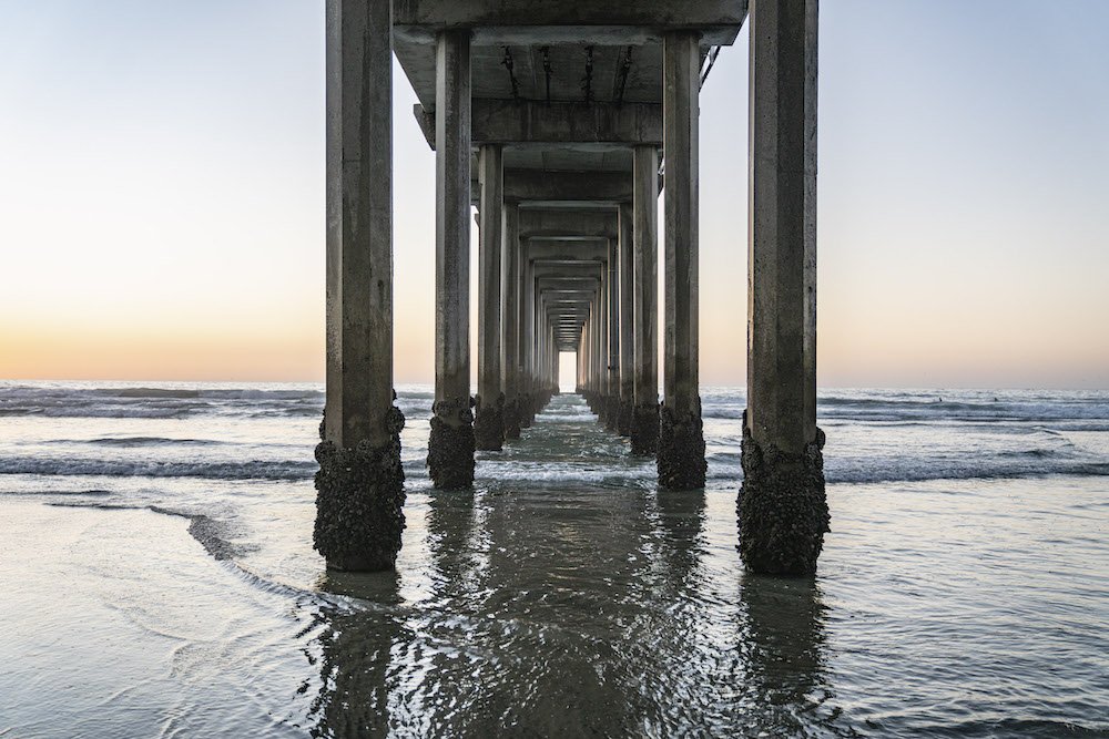
A sunset kayak along the rocky east shore of Lake Tahoe. Photo by Dalton Johnson
Summiting Mount Whitney
For those who thrive on the adrenaline rush of high-altitude challenges and possess a passion for photography, conquering Mount Whitney is the ultimate thrill. The journey to the summit offers not only a physical challenge but also a visual feast for the camera lens. Capture the play of light on alpine meadows, the rugged beauty of rocky slopes, and the sheer triumph of reaching the highest point in the contiguous United States.
As a photographer, Mount Whitney provides a canvas of ever-changing landscapes. From sunrise to sunset, the interplay of colors against the dramatic backdrop of the Sierra Nevada range creates a photographer's paradise. The sense of accomplishment and the stunning visuals make this adventure a must for those who seek both physical and artistic fulfillment.
Kayaking and Hiking in Lake Tahoe
Lake Tahoe, with its crystal-clear waters and mountainous surroundings, is a paradise for thrill-seekers with a penchant for photography. Paddle through hidden coves, capturing reflections of snow-capped peaks on the serene surface of the lake. The juxtaposition of water and mountains provides endless opportunities for dynamic and captivating shots.
Venture onto the Tahoe Rim Trail, where alpine vistas and dense forests become the backdrop for your photographic explorations. As you hike along the rim, seize the chance to capture the changing light on the landscape, from the vibrant hues of wildflowers to the soft glow of twilight over the lake. Lake Tahoe is not just a destination; it's a canvas for outdoor enthusiasts with a camera in hand.
Road Trip Highway 1
Embark on a road trip along California's iconic Highway 1, and every turn reveals a new opportunity to capture the raw beauty of the Pacific coastline. From the historic Bixby Creek Bridge to the misty cliffs of Big Sur, the coastal majesty unfolds before your camera lens. Whether you're chasing the perfect sunset or capturing the rugged landscapes in the soft glow of dawn, Highway 1 is a photographer's dream.
The quaint coastal towns, hidden coves, and dramatic seascapes provide endless subjects for your lens. Set up your tripod at one of the many overlooks, feel the salty breeze, and let your camera tell the story of your journey along this scenic route. Highway 1 is not just a road trip; it's a visual adventure that beckons photographers to capture the essence of California's coastal grandeur.


Backpack the Lost Coast
For thrill-seekers who crave the solitude of remote landscapes, backpacking the Lost Coast is an adventure that promises both challenge and photographic reward. The rugged coastline, untouched by development, becomes a blank canvas for your camera. Capture the wild beauty of secluded beaches, towering cliffs, and the rhythmic dance of the tides.
As you trek through this untouched wilderness, document the raw power of the ocean meeting the land, the intricate details of tidepools, and the untouched beauty of a landscape that remains largely unexplored. The Lost Coast is not just a backpacking trip; it's a visual journey into the heart of California's untamed and untouched nature.
Explore Waterfalls Around Mount Shasta
For those who find inspiration in the soothing sounds of waterfalls and the challenge of capturing their ethereal beauty, the waterfalls around Mount Shasta offer a symphony of photographic opportunities. From the iconic McCloud Falls to the hidden gems like Hedge Creek Falls, each cascade becomes a muse for your lens.
Embark on a waterfall-hopping adventure, framing the dynamic flow of water against the majestic backdrop of Mount Shasta. Experiment with long exposures to capture the silky movement of water or focus on the intricate details of moss-covered rocks. The waterfalls around Mount Shasta are not just natural wonders; they are moments frozen in time through the lens of an adventurous photographer.
Kristin sitting and enjoying one of the many waterfalls around Mount Shasta. Photo by Dalton Johnson
California's diverse landscapes provide the perfect playground for outdoor enthusiasts who thrive on thrills. Whether you're summiting Mount Whitney, cruising along Highway 1, paddling through Lake Tahoe, trekking the Lost Coast, or capturing the symphony of waterfalls around Mount Shasta, each adventure is an opportunity to blend the thrill of the outdoors with the artistry of photography. So, pack your camera gear, embrace the adrenaline, and embark on a visual journey through the exhilarating landscapes of California.
Discover More Destinations

How To Successfully Climb Mount Whitney In a Day
The tallest mountain in the Lower 48, Mount Whitney is a heavily sought-after hike to the summit that often takes between 20 to 23 hours. While most would likely prefer to tackle this peak over several days, the difficulty with permitting, established for conservation purposes, prevents many from overnight trips.
The tallest mountain in the Lower 48, Mount Whitney is a heavily sought-after hike to the summit that often takes between 20 to 23 hours. While most would likely prefer to tackle this peak over several days, the difficulty with permitting, established for conservation purposes, prevents many from overnight trips.
To climb Mount Whitney in a day, start early from the Whitney Portal trailhead, ensuring you have the necessary permits. Hike at a steady pace, taking short breaks for water and snacks, and maintain proper hydration and nutrition throughout. Be prepared for the physical demands, variable weather, and altitude effects, and carefully monitor your body for signs of altitude sickness.
Read on to discover everything you need to know about scaling the tallest peak in the lower 48.
Pros
Time efficiency: Climbing Mount Whitney in a day allows you to experience the challenge and beauty of the mountain without the need for an overnight stay, saving time and logistical planning.
Cost savings: By completing the climb in a day, you can avoid the expenses associated with camping or staying overnight, such as campground fees, permits, and additional gear.
Physical accomplishment: Climbing Mount Whitney in a day is a demanding physical challenge that can provide a great sense of achievement and personal fulfillment.
Flexibility: One-day climbs offer more flexibility in terms of scheduling, as you can choose a date that works best for you without the need for overnight camping reservations.
Less equipment needed: Since you won't be camping overnight, you can carry a lighter pack without the need for camping gear, making the ascent slightly easier.
Cons
Physical demands: Climbing Mount Whitney in a day requires a high level of fitness and endurance. The steep ascent and long-distance hiking can be physically taxing, especially if you're not adequately prepared.
Altitude-related risks: The rapid ascent to high altitude increases the risk of altitude sickness, such as headache, nausea, and dizziness. The limited time at altitude may not allow for proper acclimatization, making it important to monitor your body's response closely.
Limited time for enjoyment: Climbing Mount Whitney in a day leaves less time for leisurely exploration, rest breaks, or taking in the scenery. The focus is primarily on the ascent, which can be physically and mentally demanding.
Increased risk of accidents: The rush to complete the climb in a day may lead to a higher risk of slips, falls, and injuries, especially on the steep and rocky sections of the trail.
Standard Route:
Mount Whitney Trail
6,600 feet of vertical gain
21 miles round-trip
Hiking trail
Trailhead:
Los Angeles (LA) to Whitney Portal:
Take I-5 North to CA-14 North (Antelope Valley Freeway).
Continue on CA-14 North until you reach Mojave.
In Mojave, merge onto CA-14 North/US-395 North.
Stay on US-395 North for approximately 135 miles.
Take the exit toward CA-136 West/CA-190 West towards Lone Pine.
Merge onto CA-136 West/CA-190 West and continue for about 60 miles.
You will reach Lone Pine. From there, follow Whitney Portal Road (West Whitney Portal Road) for approximately 13 miles to reach Whitney Portal.
Bay Area to Whitney Portal:
From the Bay Area, take I-580 East or I-880 South to I-5 South.
Continue on I-5 South until you reach CA-14 North (in Santa Clarita).
Take CA-14 North/US-395 North towards Mojave.
Stay on US-395 North for approximately 135 miles.
Take the exit toward CA-136 West/CA-190 West towards Lone Pine.
Merge onto CA-136 West/CA-190 West and continue for about 60 miles.
You will reach Lone Pine. From there, follow Whitney Portal Road (West Whitney Portal Road) for approximately 13 miles to reach Whitney Portal.
Las Vegas to Whitney Portal:
Take I-15 North from Las Vegas.
Continue on I-15 North for approximately 125 miles.
Take exit 248 for CA-127 towards Death Valley/Jean/Riverside County.
Merge onto CA-127 North and continue for about 105 miles.
In Shoshone, turn left onto CA-178 West and continue for approximately 38 miles.
Turn right onto CA-127 North/CA-190 West and continue for about 26 miles.
In Lone Pine, turn left onto CA-136 West/CA-190 West and continue for approximately 12 miles.
Follow Whitney Portal Road (West Whitney Portal Road) for about 13 miles to reach Whitney Portal.
Lake Tahoe to Whitney Portal:
Take US-50 West from Lake Tahoe.
Continue on US-50 West for approximately 220 miles, passing through Placerville and Sacramento.
In West Sacramento, merge onto I-5 South.
Continue on I-5 South until you reach CA-14 North (in Santa Clarita).
Take CA-14 North/US-395 North towards Mojave.
Stay on US-395 North for approximately 135 miles.
Take the exit toward CA-136 West/CA-190 West towards Lone Pine.
Merge onto CA-136 West/CA-190 West and continue for about 60 miles.
You will reach Lone Pine. From there, follow Whitney Portal Road (West Whitney Portal Road) for approximately 13 miles to reach Whitney Portal.
Average Time to Climb:
1 day, typically taking 18-22 hours
Red Tape:
Permits for the Whitney Zone are a lottery system, so apply and cross your fingers you get something. Because of the permitting system, most people are forced to day hike this trail, as overnight permits are rare to win in the lottery.
If you don't win the lottery, you can always try for a “same-day” (or "walk-up") permit. The name of these permits is somewhat misleading as they're released the Sunday before online at recreation.gov.
Tentative Schedule for Climbing whitney in a day
Here's a sample schedule for climbing Mount Whitney in a single day. Please note that individual preferences, fitness levels, and trail conditions may vary, so it's important to adapt the schedule based on your own needs and abilities. This schedule assumes a starting point at Whitney Portal.
Early Morning Start:
2:00 AM: Arrive at Whitney Portal parking area, prepare gear, and ensure you have all necessary supplies.
2:30 AM: Begin hiking.
Ascent:
2:30 AM - 8:00 AM: Hike steadily and maintain a consistent pace during the ascent. Take short breaks for water, snacks, and to adjust layers if needed.
Trail Crest and Summit Push:
8:00 AM - 9:30 AM: Reach Trail Crest, the point where the trail crosses over to the east side of the ridge. Take a short break to rest, refuel, and enjoy the panoramic views.
9:30 AM - 11:30 AM: Begin the final push to the summit from Trail Crest. Ascend the switchbacks and traverse the ridge to reach the summit of Mount Whitney.
Summit Time:
11:30 AM - 12:30 PM: Spend time on the summit, taking in the views, capturing photos, and celebrating your achievement. Remember to adhere to Leave No Trace principles and respect the environment.
Descent:
12:30 PM - 4:00 PM: Start the descent from the summit, retracing your steps back along the trail. Be cautious and maintain a steady pace while descending to avoid accidents.
Return to Whitney Portal:
4:00 PM - 7:00 PM: Continue descending from the higher elevations, passing through Trail Crest, and descending the switchbacks. Take breaks as needed but aim to maintain a steady pace.
After the Climb:
7:00 PM - 8:00 PM: Arrive back at Whitney Portal. Take off your gear, change into comfortable clothes, and celebrate your successful climb.
8:00 PM onwards: Return to your accommodations or proceed with your onward travel plans.
Remember that this schedule is just a guideline, and individual factors such as fitness level, weather conditions, and altitude acclimatization should be taken into account. It's crucial to prioritize safety, listen to your body, and make adjustments as needed throughout the climb.
Gear List for a single day climb of mount whitney
Here's a quick and dirty essentials gear list for climbing Mount Whitney in a day:
Backpack: A comfortable and sturdy backpack to carry your gear.
Hiking Boots: Proper hiking boots with ankle support for traction and stability on the trail.
Layered Clothing: Dress in layers to accommodate changing weather conditions. Include moisture-wicking base layers, insulating mid-layers, and a waterproof and windproof outer layer.
Hat and Sunglasses: Protect yourself from the sun with a hat that shades your face and neck, and wear sunglasses with UV protection to shield your eyes.
Gloves: Lightweight gloves to protect your hands from cold temperatures and wind.
Headlamp: A reliable headlamp with extra batteries for early morning or late evening hiking.
Water and Hydration System: Carry enough water to stay hydrated throughout the hike. Consider a hydration bladder or water bottles with a filtration system.
Food and Snacks: Pack high-energy snacks and meals to fuel your climb, such as trail mix, energy bars, and sandwiches.
Navigation Tools: Bring a detailed map of the area, a compass, and/or a GPS device to navigate the trail.
Sunscreen: Apply sunscreen with a high SPF to protect your skin from the sun's rays.
First Aid Kit: Carry a basic first aid kit with essentials such as bandages, blister treatments, pain relievers, and any necessary personal medications.
Trekking Poles: Optional but beneficial for added stability and reducing strain on your knees and legs.
Emergency Supplies: Pack emergency items like a whistle, signaling mirror, emergency blanket, and a lightweight emergency shelter.
Portable Phone Charger: Ensure your phone is fully charged and carry a portable charger for emergencies. (optional)
Personal Items: Include essentials such as a camera, personal identification, cash, and a small trash bag for Leave No Trace principles.
Remember to check the weather forecast and trail conditions before your climb and adjust your gear accordingly. It's important to strike a balance between carrying essential items and keeping your pack as lightweight as possible for a comfortable climb.


What is the best time of year to climb Mount Whitney in a day?
The best time of year to climb Mount Whitney in a day is typically during the summer months, specifically from late June to early October. This period offers the most favorable weather conditions and reduced risk of snow and ice on the trail. However, it's essential to keep in mind that weather in the Sierra Nevada can be unpredictable, even during summer, so it's crucial to monitor forecasts and plan accordingly.
What are the risks and challenges of climbing Mount Whitney in a day?
Climbing Mount Whitney in a day presents several risks and challenges that climbers should be aware of:
Altitude sickness: Rapid ascent to high altitudes can increase the risk of altitude-related illnesses such as acute mountain sickness (AMS), high altitude pulmonary edema (HAPE), and high altitude cerebral edema (HACE). Symptoms can include headache, nausea, dizziness, fatigue, and difficulty breathing. Adequate acclimatization and proper monitoring of symptoms are essential to mitigate these risks.
Physical demands: Climbing Mount Whitney in a day requires a high level of physical fitness and endurance. The trail is steep, with significant elevation gain, and covers a long distance. The strenuous nature of the climb can lead to fatigue, muscle strains, and overall physical exhaustion.
Weather conditions: The Sierra Nevada Mountains are known for rapidly changing weather patterns. Thunderstorms, strong winds, and sudden drops in temperature can occur, especially in the afternoon. Being exposed to adverse weather conditions can increase the risk of hypothermia, lightning strikes, and hazardous trail conditions.
Time constraints: Attempting to complete the climb in a day means there is limited time to reach the summit and descend safely before darkness falls. Time pressure can lead to rushing, which can increase the risk of slips, falls, and accidents.
Lack of acclimatization time: Climbing Mount Whitney in a day does not provide ample time for proper acclimatization to the high altitude. This increases the risk of altitude sickness and can affect physical and cognitive abilities during the climb.
Crowded trail: Mount Whitney is a popular destination, and attempting a one-day climb means encountering a significant number of hikers on the trail. This can result in congestion, delays, and difficulty finding suitable resting spots along the way.
Technical sections: Certain sections of the trail, such as the infamous "97 Switchbacks," may present technical challenges. Steep and exposed sections can be challenging to navigate, especially for those without experience in alpine environments.
Limited access to emergency assistance: Climbing Mount Whitney in a day means there is limited access to immediate assistance in case of emergencies or injuries. It's essential to have proper communication devices, first aid supplies, and the necessary knowledge and skills to handle emergencies effectively.
To mitigate these risks and challenges, climbers should ensure they are adequately prepared physically, mentally, and in terms of equipment. They should have a solid understanding of the route, be knowledgeable about high-altitude risks, and closely monitor their own well-being throughout the climb.
Are there any alternative routes to consider for climbing Mount Whitney in a day?
Mountaineer's Route: This is a more challenging and less crowded route than the traditional Whitney Portal Trail. It involves scrambling and navigating steep slopes, but it provides a more adventurous experience for experienced climbers.
North Fork Lone Pine Creek: This route begins at the North Fork Trailhead and follows the North Fork of Lone Pine Creek. It offers scenic views and a less crowded experience compared to the Whitney Portal Trail. However, it requires navigation skills and can be more technically challenging.

Climbing Mount Whitney in a single day is a challenging and rewarding endeavor that requires careful planning, physical fitness, and an understanding of the risks involved. By following a well-prepared schedule, being aware of the potential challenges and hazards, and ensuring you have the appropriate gear and supplies, you can increase your chances of a safe and successful climb. Remember to prioritize safety, listen to your body, and make informed decisions throughout the journey, ultimately making your one-day ascent of Mount Whitney a memorable and fulfilling experience.
Discover more Mountain Adventures


Hike to New Heights: Discover Eastern Sierra Challenging Hiking Gems
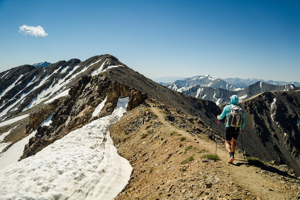
Embarking on a challenging hike in the Eastern Sierra is not for the faint of heart. This rugged and majestic region of California offers a plethora of trails that will push your limits and reward you with awe-inspiring views and a profound sense of accomplishment. From towering peaks to alpine lakes and dramatic canyons, the Eastern Sierra presents hikers with a playground of adventure and natural beauty.
Embarking on a challenging hike in the Eastern Sierra is not for the faint of heart. This rugged and majestic region of California offers a plethora of trails that will push your limits and reward you with awe-inspiring views and a profound sense of accomplishment. From towering peaks to alpine lakes and dramatic canyons, the Eastern Sierra presents hikers with a playground of adventure and natural beauty.
The Eastern Sierra offers a variety of challenging hikes for adventurous hikers. Some notable options include Mount Whitney, the highest peak in the contiguous United States; Bishop Pass, with its stunning vistas of surrounding peaks and valleys; and the rugged Taboose Pass trail, offering panoramic views of the John Muir Wilderness.
In this blog we will cover several more difficult hikes in the Eastern Sierra, so lace up your boots, brace yourself for the challenge, and let's dive into the world of challenging hikes in the Eastern Sierra.
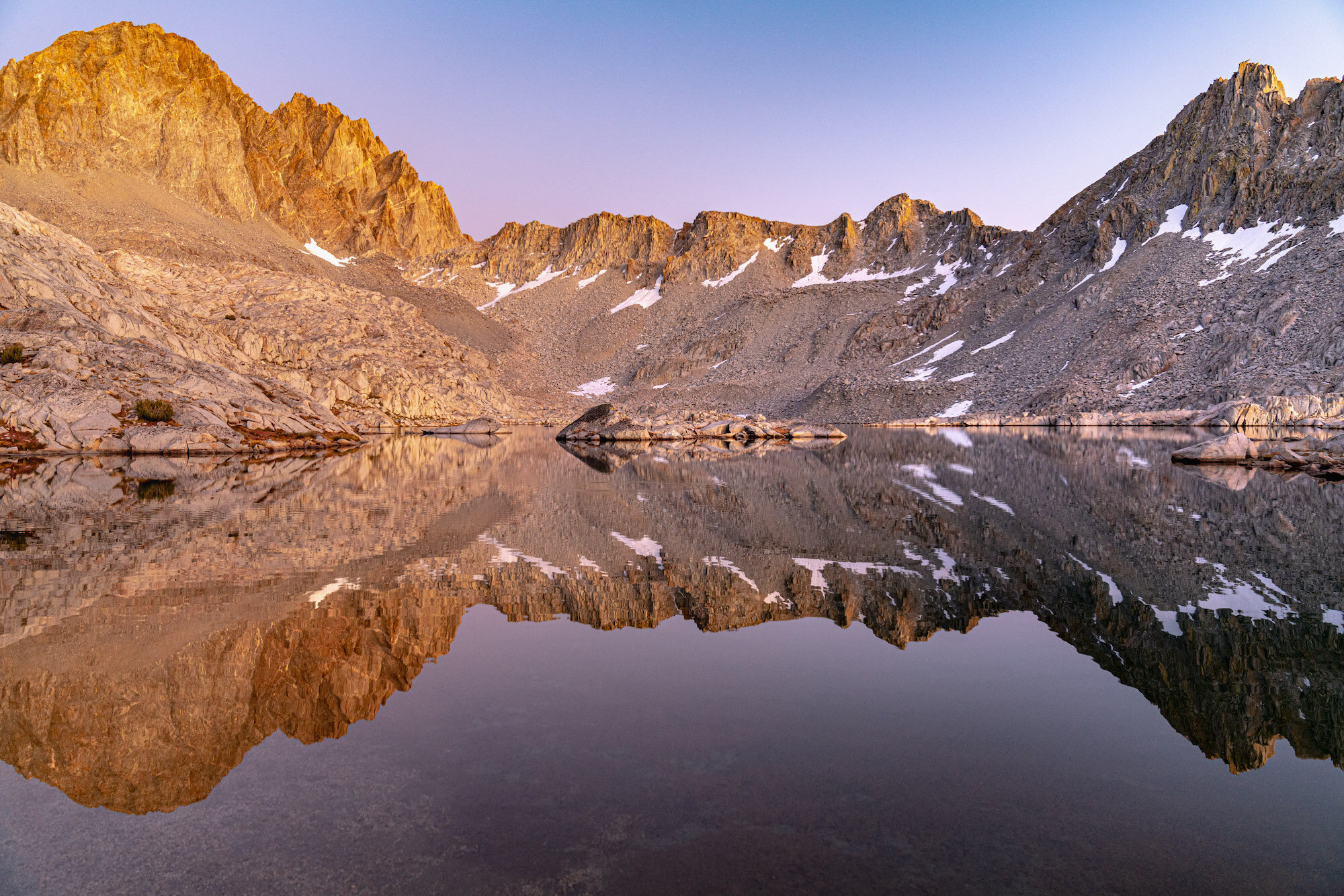
Hiking up one of the many challenging hikes in the High Sierra. Photo by Dalton Johnson
Mount Whitney:
The magnificent Mount Whitney, a hike that will test your limits and reward you with breathtaking views. As we ascend this towering peak, get ready to immerse yourself in awe-inspiring vistas that will leave you in utter wonder. From the summit, you'll be treated to a panoramic vista of the rugged Sierra Nevada range, with sweeping views of the Eastern Sierra, deep valleys, and the vast expanse of the surrounding wilderness.
Now, let's delve into the specifics of this extraordinary hike:
Elevation: Mount Whitney stands proudly as the highest summit in the contiguous United States, soaring to an impressive elevation of 14,505 feet (4,421 meters). The sheer magnitude of this elevation adds an extra layer of grandeur to the journey, as you find yourself surrounded by the majestic peaks of the Sierra Nevada.
Distance: The classic route to Mount Whitney via the Whitney Portal covers approximately 22 miles (35 kilometers) round trip. This distance allows you to fully immerse yourself in the changing landscapes, from dense forests to alpine meadows and, eventually, the rocky terrain near the summit. Each step brings you closer to the pinnacle of this majestic mountain.
Time to Hike: Typically, hikers complete the Mount Whitney hike in a day, starting early in the morning to maximize daylight hours. The total hiking time varies depending on individual fitness levels, pace, and the number of breaks taken along the way. It's essential to plan for a full day of hiking to ensure a safe and enjoyable experience.
Difficulty: The hike to Mount Whitney is renowned for its challenging nature, both in terms of elevation gain and overall distance. The high altitude, long trek, and steep sections demand physical endurance, mental resilience, and careful preparation. It's crucial to acclimatize to the altitude, stay well-hydrated, and be prepared for rapid weather changes, as conditions can vary dramatically throughout the day.
So, why go on this awe-inspiring hike to Mount Whitney? The answer lies in the unrivaled sense of accomplishment and the breathtaking beauty that awaits you. Standing atop the highest peak in the contiguous United States is an experience that will leave you humbled and in awe of nature's grandeur. The journey itself tests your physical and mental limits, as you push through the challenges and reach new heights.
Beyond the personal triumph, hiking Mount Whitney offers an intimate connection with the untamed wilderness of the Eastern Sierra. It is a chance to witness the rugged beauty, to breathe in the pure mountain air, and to be surrounded by the awe-inspiring landscapes that have captivated explorers for centuries.
Bishop Pass:
The breathtaking beauty of Bishop Pass is a trail that will immerse you in stunning vistas and unforgettable landscapes. As we make our way through this awe-inspiring hike, get ready to be captivated by panoramic views that stretch as far as the eye can see. From the summit of Bishop Pass, you'll be treated to breathtaking vistas of the surrounding peaks and valleys, where the raw beauty of the Eastern Sierra unfolds before your eyes.
Now, let's explore the specifics of this remarkable hike:
Elevation: Bishop Pass reaches an elevation of approximately 11,972 feet (3,649 meters), making it a high-altitude adventure that allows you to witness the grandeur of the Eastern Sierra from a lofty vantage point. The towering peaks and expansive vistas create a scene of unparalleled beauty.
Distance: The Bishop Pass trail covers a round-trip distance of approximately 9.6 miles (15.5 kilometers). This moderate distance provides a fulfilling hike that takes you through changing landscapes, from dense forests to open alpine meadows. The journey unveils a tapestry of natural wonders that will leave you in awe.
Time to Hike: The time required to hike Bishop Pass varies depending on your pace, the amount of time you spend admiring the scenery, and the number of breaks you take along the way. On average, hikers can complete the hike in around 6 to 8 hours, allowing for plenty of time to soak in the beauty and enjoy the views from the pass.
Difficulty: The hike to Bishop Pass is considered moderate to strenuous, mainly due to the high elevation gain and some steep sections of the trail. It demands physical endurance, proper acclimatization to the altitude, and basic hiking experience. However, the well-defined trail and the awe-inspiring views make it a highly rewarding and achievable adventure for hikers with determination and a moderate level of fitness.
So, why go on this incredible hike to Bishop Pass? The answer lies in the unparalleled views and the sense of accomplishment that awaits you at the summit. Standing atop Bishop Pass, surrounded by towering peaks and vast expanses of untouched wilderness, is an experience that will leave you humbled and in awe of the raw beauty of the Eastern Sierra.
Beyond the visual rewards, hiking Bishop Pass offers a chance to connect with nature in its purest form. The trail takes you through breathtaking landscapes, including serene lakes, pristine meadows, and the rugged beauty of the Eastern Sierra. It's an opportunity to find solace, challenge yourself physically and mentally, and forge a deeper connection with the untamed wilderness.
Taboose Pass:
Hiking Taboose Pass is a trail that will take you through stunning vistas and push your limits. As we embark on this challenging hike, get ready to be captivated by panoramic views that will leave you in awe. From the summit of Taboose Pass, you'll be rewarded with breathtaking vistas of the surrounding peaks and valleys, immersing yourself in the raw beauty of the Eastern Sierra.
Now, let's explore the specifics of this exhilarating hike:
Elevation: Taboose Pass reaches an elevation of approximately 11,375 feet (3,468 meters), making it a high-altitude adventure that allows you to witness the grandeur of the Eastern Sierra from a lofty vantage point. The towering peaks, rugged ridges, and expansive views create a scene of unparalleled beauty.
Distance: The Taboose Pass trail covers a round-trip distance of approximately 14 miles (22.5 kilometers). This challenging distance takes you through diverse landscapes, from desert-like canyons to alpine meadows, showcasing the rich variety of the Eastern Sierra. Each step unveils new wonders that will leave you in awe.
Time to Hike: The time required to hike Taboose Pass varies depending on your pace, the amount of time you spend taking in the scenery, and the number of breaks you take along the way. On average, hikers can complete the hike in around 8 to 10 hours, allowing for ample time to immerse yourself in the beauty and savor the views from the pass.
Difficulty: The hike to Taboose Pass is considered strenuous due to its high elevation gain, rugged terrain, and the long distance covered. It demands physical endurance, proper acclimatization to the altitude, and advanced hiking experience. The trail is challenging, but the incredible views and sense of accomplishment make it a highly rewarding adventure for experienced hikers seeking a thrilling challenge.
So, why go on this exhilarating hike to Taboose Pass? The answer lies in the unrivaled views and the profound sense of achievement that await you at the summit. Standing atop Taboose Pass, surrounded by towering peaks, vast expanses of untouched wilderness, and breathtaking panoramas, is an experience that will leave you humbled and in awe of the raw beauty of the Eastern Sierra.
Beyond the visual rewards, hiking Taboose Pass allows you to immerse yourself in the pristine wilderness of the Eastern Sierra. The trail takes you through diverse landscapes, from lush meadows to rocky ridges, and offers a chance to witness the untouched beauty of this remarkable region. It's an opportunity to push your limits, challenge yourself physically and mentally, and forge a deeper connection with nature.
Sawtooth Pass:
Sawtooth Pass is a trail that offers stunning views and a thrilling adventure. As we make our way through this rugged hike, get ready to be mesmerized by breathtaking vistas that will leave you in awe. From the summit of Sawtooth Pass, you'll be rewarded with panoramic views of the surrounding peaks, dramatic canyons, and the untouched beauty of the Eastern Sierra.
Now, let's explore the specifics of this remarkable hike:
Elevation: Sawtooth Pass reaches an elevation of approximately 11,600 feet (3,536 meters), immersing you in the grandeur of the Eastern Sierra. The towering peaks, rugged ridges, and expansive vistas create a scene of unparalleled beauty.
Distance: The Sawtooth Pass trail covers a round-trip distance of approximately 10 miles (16 kilometers). This moderate distance allows you to fully immerse yourself in the changing landscapes, from dense forests to open alpine meadows. Each step brings you closer to the breathtaking views that await at the pass.
Time to Hike: The time required to hike Sawtooth Pass varies depending on your pace, the amount of time you spend admiring the scenery, and the number of breaks you take along the way. On average, hikers can complete the hike in around 6 to 8 hours, allowing for plenty of time to soak in the beauty and enjoy the views from the pass.
Difficulty: The hike to Sawtooth Pass is considered moderate to strenuous due to its elevation gain and rugged terrain. It demands physical endurance, proper acclimatization to the altitude, and basic hiking experience. While challenging, the rewarding views and sense of accomplishment make it a highly fulfilling adventure for hikers seeking a thrilling and scenic experience.
So, why go on this incredible hike to Sawtooth Pass? The answer lies in the unparalleled views and the opportunity for a thrilling adventure. Standing atop Sawtooth Pass, surrounded by towering peaks and vast expanses of untouched wilderness, is an experience that will leave you humbled and in awe of the raw beauty of the Eastern Sierra.
Beyond the visual rewards, hiking Sawtooth Pass allows you to connect with nature in its purest form. The trail takes you through breathtaking landscapes, including serene lakes, lush meadows, and the rugged beauty of the Eastern Sierra. It's an opportunity to challenge yourself physically and mentally, to find solace in nature's embrace, and to create lasting memories in a remarkable corner of the world.
Palisade Glacier:
Hiking to Palisade Glacier, a trail that promises breathtaking views and an awe-inspiring adventure. As we make our way through this captivating hike, get ready to be mesmerized by the stunning vistas that will leave you in awe. From the trailhead to the grandeur of Palisade Glacier, you'll witness towering peaks, rugged terrain, and a sense of untouched beauty in the heart of the Eastern Sierra.
Now, let's explore the specifics of this remarkable hike:
Elevation: The hike to Palisade Glacier takes you to an elevation of approximately 11,100 feet (3,383 meters), immersing you in the raw beauty of the Eastern Sierra. The towering peaks, dramatic ridges, and the icy expanse of the glacier create a scene of unparalleled grandeur.
Distance: The trail to Palisade Glacier covers a round-trip distance of approximately 15 miles (24 kilometers), allowing you to fully immerse yourself in the changing landscapes. From dense forests to alpine meadows, and eventually the glacier itself, each step brings you closer to the breathtaking views that await.
Time to Hike: The time required to hike to Palisade Glacier varies depending on your pace, the amount of time you spend exploring, and the number of breaks you take along the way. On average, hikers can expect to spend around 10 to 12 hours on the trail, including time to savor the beauty and marvel at the glacier.
Difficulty: The hike to Palisade Glacier is considered strenuous due to its length, elevation gain, and rugged terrain. It demands physical endurance, proper acclimatization to the altitude, and intermediate to advanced hiking experience. The challenging aspects are well worth it, as the rewarding views and the experience of standing before the majestic glacier make it an unforgettable adventure.
So, why go on this incredible hike to Palisade Glacier? The answer lies in the unmatched views and the chance to witness the raw power of nature. Standing before Palisade Glacier, surrounded by towering peaks, icy slopes, and the untouched beauty of the Eastern Sierra, is an experience that will leave you humbled and in awe of the grandeur of the natural world.
Beyond the visual rewards, hiking to Palisade Glacier offers a profound connection with nature. The trail takes you through diverse landscapes, from serene lakes to rocky slopes, showcasing the unspoiled beauty of the Eastern Sierra. It's an opportunity to challenge yourself physically and mentally, to find solace in the remote wilderness, and to witness the resilience of nature in the face of changing climates.
Mount Langley:
Hiking Mount Langley is a trail that promises breathtaking views and a thrilling adventure. As we make our way through this majestic hike, get ready to be mesmerized by the stunning vistas that will leave you in awe. From the summit of Mount Langley, you'll be rewarded with panoramic views of the surrounding peaks, expansive valleys, and the remarkable beauty of the Eastern Sierra.
Now, let's explore the specifics of this remarkable hike:
Elevation: Mount Langley stands proudly as one of the southernmost fourteeners in the Sierra Nevada range, reaching an elevation of 14,026 feet (4,275 meters). As you ascend the trail, you'll find yourself surrounded by towering peaks, rugged ridges, and breathtaking views that extend as far as the eye can see.
Distance: The classic route to Mount Langley covers a round-trip distance of approximately 22 miles (35 kilometers), allowing you to fully immerse yourself in the changing landscapes. From serene lakes to alpine meadows and rocky slopes, each step reveals new wonders that will leave you in awe.
Time to Hike: The time required to hike Mount Langley varies depending on your pace, the amount of time you spend admiring the scenery, and the number of breaks you take along the way. On average, hikers can expect to spend around 12 to 14 hours on the trail, including time to savor the beauty and reach the summit.
Difficulty: The hike to Mount Langley is considered strenuous due to its elevation gain, length, and rugged terrain. It demands physical endurance, proper acclimatization to the altitude, and intermediate to advanced hiking experience. The challenging aspects of the hike are well worth it, as the rewarding views and the accomplishment of summiting a fourteener make it a truly memorable adventure.
So, why go on this incredible hike to Mount Langley? The answer lies in the unparalleled views and the sense of achievement that await you at the summit. Standing atop Mount Langley, surrounded by towering peaks, vast valleys, and the untouched beauty of the Eastern Sierra, is an experience that will leave you humbled and in awe of the raw grandeur of the natural world.
Beyond the visual rewards, hiking Mount Langley offers an opportunity to challenge yourself both physically and mentally. It's a chance to push your limits, conquer a fourteener, and experience the exhilaration of reaching new heights. Additionally, the journey allows you to immerse yourself in the pristine wilderness of the Eastern Sierra, disconnect from the daily routine, and find solace in nature's embrace.
White Mountain Peak:
The exhilarating journey of hiking White Mountain Peak, a trail that promises stunning views and a memorable adventure. As we make our way through this captivating hike, get ready to be awed by the breathtaking vistas that will surround us. From the summit of White Mountain Peak, you'll be treated to panoramic views of the Eastern Sierra, neighboring mountain ranges, and the vast expanse of the surrounding region.
Now, let's delve into the specifics of this remarkable hike:
Elevation: White Mountain Peak stands tall at an elevation of 14,252 feet (4,344 meters), making it one of the towering peaks in the Eastern Sierra. As we ascend the trail, the landscape will transform, revealing the raw beauty of the high alpine environment and the surrounding peaks.
Distance: The hike to White Mountain Peak covers a round-trip distance of approximately 14 miles (22.5 kilometers), allowing us to fully immerse ourselves in the changing landscapes. From arid desert-like terrain to rugged slopes, each step unveils new wonders that will leave us in awe.
Time to Hike: The time required to hike White Mountain Peak varies depending on our pace, the amount of time we spend soaking in the scenery, and the number of breaks we take along the way. On average, hikers can expect to spend around 6 to 8 hours on the trail, including time to savor the beauty and reach the summit.
Difficulty: The hike to White Mountain Peak is considered moderately difficult due to its elevation gain, length, and rugged terrain. It demands physical endurance, proper acclimatization to the altitude, and intermediate hiking experience. While challenging, the incredible views and the accomplishment of summiting a high peak make it a highly rewarding adventure.
So, why go on this incredible hike to White Mountain Peak? The answer lies in the unparalleled views and the sense of accomplishment that await us at the summit. Standing atop White Mountain Peak, surrounded by vast expanses of untouched wilderness, towering peaks, and the endless beauty of the Eastern Sierra, is an experience that will leave us humbled and in awe of the grandeur of the natural world.
Beyond the visual rewards, hiking White Mountain Peak allows us to challenge ourselves both physically and mentally. It's an opportunity to push our limits, conquer a high summit, and experience the exhilaration of reaching new heights. Moreover, the journey allows us to immerse ourselves in the serenity of the high alpine environment, disconnect from the daily hustle, and connect with the awe-inspiring landscapes that make the Eastern Sierra a hiker's paradise.
Piute Pass:
Hiking Piute Pass is another trail that offers breathtaking views and an unforgettable adventure. As we make our way through this captivating hike, get ready to be immersed in stunning vistas that will leave you in awe. From the start of the trail to the summit of Piute Pass, you'll be rewarded with panoramic views of the John Muir Wilderness, Humphreys Basin, and the majestic peaks of the Eastern Sierra.
Now, let's explore the specifics of this remarkable hike:
Elevation: Piute Pass reaches an elevation of approximately 11,423 feet (3,482 meters), allowing you to witness the grandeur of the Eastern Sierra from a lofty vantage point. The towering peaks, alpine lakes, and the vastness of the surrounding wilderness create a scene of unparalleled beauty.
Distance: The Piute Pass trail covers a round-trip distance of approximately 10 miles (16 kilometers), taking you through diverse landscapes and showcasing the natural wonders of the Eastern Sierra. From dense forests to picturesque meadows, each step reveals new breathtaking views.
Time to Hike: The time required to hike Piute Pass varies depending on your pace, the amount of time you spend taking in the scenery, and the number of breaks you take along the way. On average, hikers can complete the hike in around 6 to 8 hours, allowing for ample time to enjoy the beauty and soak in the vistas from the pass.
Difficulty: The hike to Piute Pass is considered moderate in difficulty, making it accessible to hikers with varying experience levels. It involves a gradual ascent, some rocky sections, and moderate elevation gain. With proper preparation and basic hiking skills, it offers a rewarding and enjoyable adventure for hikers seeking a taste of the Eastern Sierra's beauty.
So, why go on this incredible hike to Piute Pass? The answer lies in the unparalleled views and the sense of serenity that await you at the summit. Standing atop Piute Pass, surrounded by majestic peaks, pristine alpine lakes, and the untouched wilderness of the Eastern Sierra, is an experience that will leave you humbled and in awe of the raw beauty of nature.
Beyond the visual rewards, hiking Piute Pass allows you to connect with nature on a profound level. The trail takes you through diverse ecosystems, offering glimpses of wildlife, vibrant wildflowers, and tranquil lakes along the way. It's an opportunity to find solace in the serenity of the wilderness, to disconnect from the noise of everyday life, and to rejuvenate your mind and spirit in the embrace of nature.
Mather Pass:
The exhilarating journey of hiking Mather Pass is a trail that promises stunning views and a thrilling adventure. As we venture on this captivating hike, get ready to be awe-inspired by the breathtaking vistas that will surround us. From the ascent to the top of Mather Pass, you'll be rewarded with panoramic views of the surrounding peaks, alpine lakes, and the raw beauty of the Eastern Sierra.
Now, let's explore the specifics of this remarkable hike:
Elevation: Mather Pass sits at an elevation of approximately 12,100 feet (3,688 meters), allowing us to witness the grandeur of the Eastern Sierra from a lofty vantage point. The towering peaks, deep valleys, and the vastness of the surrounding wilderness create a scene of unparalleled beauty.
Distance: The hike to Mather Pass covers a round-trip distance that varies depending on the starting point. Generally, it ranges from 16 to 20 miles (25 to 32 kilometers). Throughout the hike, we'll encounter diverse landscapes, from lush meadows to rocky slopes, showcasing the remarkable variety of the Eastern Sierra.
Time to Hike: The time required to hike Mather Pass varies depending on our pace, the amount of time we spend admiring the scenery, and the number of breaks we take along the way. On average, hikers can expect to spend around 8 to 12 hours on the trail, including time to savor the beauty and conquer the pass.
Difficulty: The hike to Mather Pass is considered challenging due to its elevation gain, length, and rugged terrain. It demands physical endurance, proper acclimatization to the altitude, and intermediate to advanced hiking experience. The challenging aspects are well worth it, as the rewarding views and the accomplishment of reaching the pass make it an unforgettable adventure.
So, why go on this incredible hike to Mather Pass? The answer lies in the unparalleled views and the sense of achievement that await us at the summit. Standing atop Mather Pass, surrounded by the majestic peaks, alpine lakes, and the untamed beauty of the Eastern Sierra, is an experience that will leave us humbled and in awe of the grandeur of nature.
Beyond the visual rewards, hiking Mather Pass offers an opportunity to challenge ourselves physically and mentally. It allows us to push our limits, conquer a high mountain pass, and experience the exhilaration of reaching new heights. Moreover, the journey allows us to immerse ourselves in the serenity of the wilderness, disconnect from the chaos of daily life, and connect with the awe-inspiring landscapes that make the Eastern Sierra a hiker's paradise.
Lamarck Col:
Lamarck Col is a challenging trail that promises breathtaking views and an unforgettable adventure. As we make our way through this captivating hike, get ready to be awe-inspired by the stunning vistas that will surround us. From the ascent to the top of Lamarck Col, you'll be rewarded with panoramic views of the surrounding peaks, glacial lakes, and the raw beauty of the Eastern Sierra.
Now, let's explore the specifics of this remarkable hike:
Elevation: Lamarck Col reaches an elevation of approximately 12,960 feet (3,950 meters), allowing us to witness the grandeur of the Eastern Sierra from a lofty vantage point. The towering peaks, deep valleys, and the vastness of the surrounding wilderness create a scene of unparalleled beauty.
Distance: The hike to Lamarck Col covers a round-trip distance of approximately 11 miles (17.7 kilometers), taking us through diverse landscapes and showcasing the natural wonders of the Eastern Sierra. From lush meadows to rocky slopes, each step unveils new breathtaking views.
Time to Hike: The time required to hike Lamarck Col varies depending on our pace, the amount of time we spend soaking in the scenery, and the number of breaks we take along the way. On average, hikers can complete the hike in around 7 to 9 hours, allowing for ample time to enjoy the beauty and reach the col.
Difficulty: The hike to Lamarck Col is considered moderately difficult due to its elevation gain, length, and rugged terrain. It demands physical endurance, proper acclimatization to the altitude, and intermediate hiking experience. While challenging, the incredible views and the sense of accomplishment make it a highly rewarding adventure.
So, why go on this incredible hike to Lamarck Col? The answer lies in the unparalleled views and the chance to experience the pristine beauty of the Eastern Sierra. Standing atop Lamarck Col, surrounded by majestic peaks, glacial lakes, and the untouched wilderness, is an experience that will leave us humbled and in awe of the grandeur of the natural world.
Beyond the visual rewards, hiking Lamarck Col allows us to challenge ourselves both physically and mentally. It's an opportunity to push our limits, conquer a high mountain pass, and experience the exhilaration of reaching new heights. Moreover, the journey allows us to immerse ourselves in the serenity of the wilderness, disconnect from the noise of everyday life, and find solace in the awe-inspiring landscapes of the Eastern Sierra.
Enjoying the lakeside view during a morning hike up Kearsarge Pass. Photo by Dalton Johnson
As we conclude our exploration of the challenging hikes in the Eastern Sierra, we leave behind a trail of unforgettable memories, exhilarating adventures, and a deeper connection with the raw and untamed beauty of this remarkable region. From conquering the heights of Mount Whitney to navigating the remote passes and breathtaking vistas, these challenging hikes have tested our limits, rewarded our efforts, and left an indelible mark on our souls.
The Eastern Sierra has proven time and again to be a haven for adventurers seeking thrilling trails, stunning scenery, and a sense of accomplishment. It is a place where we have pushed our boundaries, challenged ourselves physically and mentally, and discovered the incredible resilience within us. With each step, we have been treated to panoramic vistas, hidden alpine lakes, and rugged landscapes that have left us in awe of nature's grandeur.
So, whether you are an experienced hiker looking for your next great challenge or someone seeking to push beyond your comfort zone, the challenging hikes of the Eastern Sierra beckon you. As you navigate the steep trails, rocky terrain, and high altitudes, remember to respect the wilderness, prepare diligently, and stay safe. The rewards are plentiful - breathtaking views, personal triumphs, and a profound connection with the raw and untamed wilderness of the Eastern Sierra.
Discover more of the Eastern Sierra


Your Guide to the Eastern Sierra
Welcome to the breathtaking realm of the Eastern Sierra, a realm where rugged peaks kiss the cerulean sky, crystal-clear lakes mirror the towering majesty of the surrounding mountains, and vast stretches of untamed wilderness beckon adventurers from far and wide. Nestled along the eastern edge of the mighty Sierra Nevada mountain range in California, this enchanting region is a true haven for nature lovers, photographers, hikers, and those seeking solace in the embrace of untouched landscapes.
Welcome to the breathtaking realm of the Eastern Sierra, a realm where rugged peaks kiss the cerulean sky, crystal-clear lakes mirror the towering majesty of the surrounding mountains, and vast stretches of untamed wilderness beckon adventurers from far and wide. Nestled along the eastern edge of the mighty Sierra Nevada mountain range in California, this enchanting region is a true haven for nature lovers, photographers, hikers, and those seeking solace in the embrace of untouched landscapes.
In our comprehensive guide to the Eastern Sierra, we invite you to embark on a journey that will unveil the region's hidden gems, secret trails, and awe-inspiring vistas. Whether you're a seasoned outdoors enthusiast or a first-time visitor eager to explore the wonders of this natural wonderland, our guide will equip you with all the knowledge and inspiration you need to make the most of your time in this captivating region.
Discover the iconic peaks that define the Eastern Sierra, such as the towering Mount Whitney, the highest summit in the contiguous United States, or the majestic spires of the Minarets, which stand as sentinels of the wilderness. Dive into the pristine alpine lakes that dot the landscape, their turquoise waters reflecting the grandeur of their surroundings. Immerse yourself in the vibrant autumn hues that paint the aspen groves and experience the dramatic transformations of the seasons.
Beyond its natural wonders, the Eastern Sierra also boasts charming towns that exude a distinct character and charm. From the artistic community of Mammoth Lakes to the historic town of Bishop, each place offers its own unique blend of local culture, hospitality, and adventure.
Join us as we delve into the multitude of outdoor activities that abound in the Eastern Sierra. From epic hiking trails that traverse high mountain passes to world-class rock climbing routes that challenge even the most seasoned climbers, this region is an adventurer's playground. Delve into the hidden valleys, encounter elusive wildlife, cast your line into sparkling streams, and capture the fleeting beauty of the landscape through your lens.
Whether you're seeking an adrenaline-pumping escapade or a peaceful retreat to rejuvenate your spirit, the Eastern Sierra has it all. Let our guide be your compass, unveiling the secrets of this extraordinary destination and leading you on an unforgettable exploration of its wonders. Get ready to breathe in the crisp mountain air, lose yourself in the grandeur of nature, and create memories that will last a lifetime in the Eastern Sierra.
A crazy sunset over Lone Pine and Mount Whitney seen from the Alabama Hills. Photo by Dalton Johnson
Pros of the Eastern Sierra:
Breathtaking Scenery: The Eastern Sierra boasts stunning landscapes, including majestic peaks, crystal-clear lakes, and dramatic canyons, providing endless opportunities for outdoor adventures and scenic beauty.
Outdoor Recreation: The region offers a wide range of outdoor activities, such as hiking, backpacking, rock climbing, fishing, skiing, and more, catering to all skill levels and interests.
Serene Wilderness: The Eastern Sierra is known for its remote and less crowded wilderness areas, providing opportunities for solitude and a deeper connection with nature.
Diverse Ecosystems: From alpine meadows and ancient forests to high desert and unique geological formations, the Eastern Sierra showcases a rich variety of ecosystems, offering a dynamic and captivating environment.
Wildlife and Bird Watching: The region is home to diverse wildlife, including mule deer, bighorn sheep, bears, and numerous bird species, providing ample opportunities for wildlife enthusiasts and birdwatchers.
Photography Paradise: With its awe-inspiring landscapes, vibrant fall colors, and stunning lakes, the Eastern Sierra offers endless possibilities for capturing breathtaking photographs.
Charming Towns: The towns in the Eastern Sierra, such as Mammoth Lakes, Bishop, and Lone Pine, offer a blend of local charm, hospitality, and amenities, serving as convenient bases for exploration.
Proximity to National Parks: The Eastern Sierra is close to renowned national parks, including Yosemite, Sequoia and Kings Canyon, and Death Valley, providing easy access to iconic destinations.
Rich History and Culture: The region has a rich history, from Native American heritage to the pioneering days of the Gold Rush, with historic sites and cultural attractions that offer glimpses into the past.
Cons of the Eastern Sierra:
Seasonal Access: Some areas of the Eastern Sierra, particularly higher elevation trails and roads, may have limited access or be impassable during winter months due to snow and harsh weather conditions.
Altitude and Acclimatization: The high elevation of the Eastern Sierra can present challenges for visitors who are not accustomed to the thinner air. It is important to acclimate properly and be aware of altitude-related issues.
Limited Services and Amenities: In more remote areas, services and amenities, such as lodging, dining, and fuel stations, may be limited, requiring proper planning and self-sufficiency during outdoor adventures.
Variable Weather: The Eastern Sierra experiences a wide range of weather conditions, from scorching summers to cold winters and sudden weather changes. It is essential to be prepared and check weather forecasts before embarking on outdoor activities.
Wildlife and Safety: While encounters with wildlife are part of the allure, it is important to exercise caution and respect the natural habitats of animals, following proper safety guidelines to avoid potential conflicts.
Crowded Areas: Popular destinations in the Eastern Sierra, especially during peak seasons, can attract a significant number of visitors, resulting in crowded trails, parking limitations, and a less secluded experience.
Limited Cell Reception: Some areas of the Eastern Sierra may have limited or no cell phone reception, making it essential to have alternative means of communication and navigation.
Environmental Responsibility: With its fragile ecosystems, it is important for visitors to practice Leave No Trace principles, respecting and preserving the natural environment to ensure its long-term sustainability.
Where are the Eastern Sierra?
Nestled along the eastern edge of the Sierra Nevada mountain range in California, the Eastern Sierra spans a vast region that stretches from the Owens Valley in the west to the Nevada border in the east. This picturesque area is located to the east of the more well-known destinations of Yosemite National Park and Lake Tahoe, offering a quieter and less crowded alternative for outdoor enthusiasts.
Is lake tahoe part of the Eastern Sierra?
Lake Tahoe is not technically considered part of the Eastern Sierra. It is a large freshwater lake located on the border of California and Nevada. While Lake Tahoe is geographically close to the Eastern Sierra and shares some similarities in terms of natural beauty and outdoor recreation, it is not officially included within the boundaries of the Eastern Sierra region. Lake Tahoe is considered a separate destination, known for its stunning blue waters, picturesque beaches, and world-class skiing resorts.
Is Yosemite part of the eastern sierra?
Yosemite National Park is considered part of the Eastern Sierra region. While Yosemite itself is a distinct and well-known destination, it is located in the eastern portion of the Sierra Nevada mountain range, making it geographically part of the Eastern Sierra. Yosemite National Park is renowned for its iconic granite cliffs, breathtaking waterfalls, ancient sequoia groves, and diverse array of ecosystems. The park offers numerous hiking trails, camping opportunities, and stunning vistas, making it a must-visit destination within the Eastern Sierra region.
Is it “Sierra” or “Sierras”?
When referring to the region as a whole, it is commonly referred to as the Eastern Sierra, using the singular form. However, it is not uncommon to hear people say "Sierras" when referring to the mountain range itself. Both terms are used interchangeably, so don't be surprised if you come across both during your exploration of this stunning area.
What is the High Sierra?
The High Sierra, also known as the High Sierra Region or the High Sierra Country, refers to the elevated region of the Sierra Nevada mountain range in California. It encompasses the higher elevation areas of the Sierra Nevada, typically above 7,000 feet (2,100 meters) in elevation. The High Sierra extends from the southern end of the Sierra Nevada near Sequoia and Kings Canyon National Parks up to the northern reaches near the Yosemite National Park.
The High Sierra is renowned for its majestic granite peaks, alpine lakes, meadows, and pristine wilderness. It is home to iconic landmarks such as Mount Whitney, the highest peak in the contiguous United States, and Yosemite Valley, one of the most famous natural wonders in the world. This region offers abundant outdoor recreational activities, including hiking, backpacking, rock climbing, fishing, and winter sports.
The High Sierra is characterized by its rugged and remote nature, attracting adventurers, nature lovers, and outdoor enthusiasts from around the globe. It provides a stunning backdrop for exploration, offering breathtaking vistas, diverse ecosystems, and the opportunity to immerse oneself in the serenity and grandeur of the Sierra Nevada.
Towns of the Eastern Sierra
Mammoth Lakes: Mammoth Lakes is a vibrant mountain town surrounded by stunning natural beauty. With world-class skiing, incredible hiking trails, and a thriving arts scene, this town offers a perfect blend of outdoor adventure and cultural experiences.
Bishop: Nestled in the heart of the Owens Valley, Bishop is a gateway to the Eastern Sierra. Known for its superb rock climbing, world-class fishing, and access to the stunning Sierra Nevada, Bishop is a paradise for outdoor enthusiasts seeking adventure in a charming small-town setting.
Lone Pine: Situated at the base of Mount Whitney, Lone Pine is a historic town that attracts outdoor enthusiasts and film buffs alike. Its proximity to the Alabama Hills, with its unique rock formations, and its role as a backdrop for numerous Hollywood movies make it a must-visit destination.
Bridgeport: Surrounded by the beauty of the Hoover Wilderness and near the iconic Twin Lakes, Bridgeport is a picturesque town offering access to incredible fishing, hiking, and camping opportunities. Its charming Main Street and historic courthouse add to its appeal.
June Lake: Nestled in a breathtaking alpine setting, June Lake is a tranquil mountain town known for its stunning lakes, hiking trails, and opportunities for fishing and boating. Its peaceful ambiance and beautiful scenery make it an ideal destination for relaxation and outdoor recreation.
Lee Vining: Located near the eastern entrance of Yosemite National Park, Lee Vining is a small town with access to numerous natural wonders. From the otherworldly Mono Lake to the nearby Tioga Pass and its incredible high-country hiking trails, Lee Vining is a haven for nature lovers and photographers.
Bridgeport: Surrounded by the beauty of the Hoover Wilderness and near the iconic Twin Lakes, Bridgeport is a picturesque town offering access to incredible fishing, hiking, and camping opportunities. Its charming Main Street and historic courthouse add to its appeal.
Independence: As the county seat of Inyo County, Independence is rich in history and natural beauty. It serves as a gateway to the stunning Eastern Sierra landscapes, including the nearby Bristlecone Pine Forest and the high peaks of the Sierra Nevada.
Big Pine: Nestled in the Owens Valley, Big Pine is a quaint town offering access to the majestic Eastern Sierra. Outdoor enthusiasts can explore the nearby Ancient Bristlecone Pine Forest, hike in the nearby Sierra Nevada, or go fishing in the surrounding lakes and streams.
Coleville: Situated in the Antelope Valley near the Nevada border, Coleville is a small town surrounded by pristine wilderness. Its proximity to the beautiful West Walker River and its rural charm make it a peaceful destination for outdoor activities and relaxation.
Markleeville: Tucked away in Alpine County, Markleeville is a hidden gem in the Eastern Sierra. The town is known for its beautiful alpine scenery, hot springs, and proximity to the stunning Grover Hot Springs State Park. It's an ideal destination for those seeking a quiet mountain retreat.
Tom's Place: Located along Highway 395, Tom's Place is a popular stop for travelers exploring the Eastern Sierra. Surrounded by towering peaks and offering easy access to fishing in the Owens River, it's a great place to enjoy outdoor activities or relax in the picturesque mountain setting.
Benton: A small and charming town, Benton provides a glimpse into the region's rich history and is surrounded by serene landscapes. Outdoor enthusiasts can explore nearby hot springs, hike in the beautiful Benton Range, or enjoy the tranquility of the region's expansive desert vistas.
Swall Meadows: Situated just south of Bishop, Swall Meadows is a peaceful community nestled in the foothills of the Eastern Sierra. Surrounded by rolling hills and offering panoramic views of the mountains, it's a perfect destination for those seeking a tranquil and scenic retreat.
Crowley Lake: Located south of Mammoth Lakes, Crowley Lake is a recreational haven for fishing, boating, and water sports enthusiasts. With its stunning mountain backdrop and abundant outdoor activities, it's an excellent destination for those seeking adventure on the water.
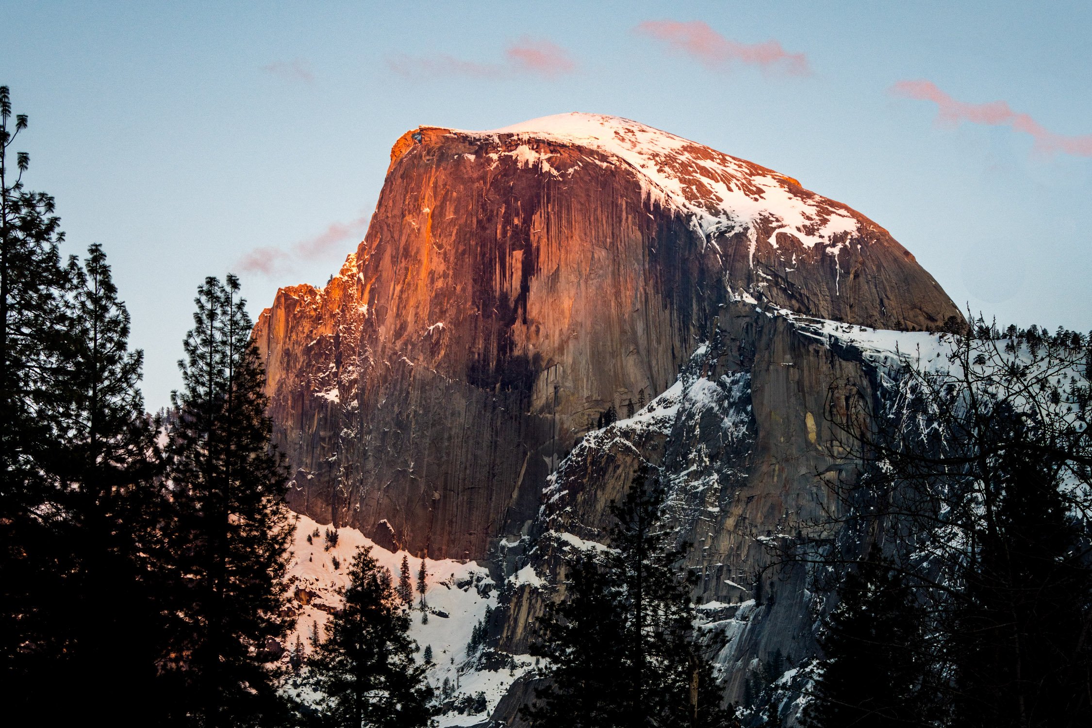
Half Dome glowing in the sunset light. Photo by Dalton Johnson
Eastern Sierra vs Western Sierra
The Sierra Nevada mountain range is vast and can be broadly divided into two main regions: the Eastern Sierra and the Western Sierra. While both regions share the stunning beauty and natural wonders of the Sierra Nevada, there are some notable differences between them.
Geographical Location:
Eastern Sierra: The Eastern Sierra is situated on the eastern side of the Sierra Nevada range, facing the Great Basin and the state of Nevada. It spans from the Owens Valley in the west to the Nevada border in the east.
Western Sierra: The Western Sierra refers to the western side of the Sierra Nevada range, facing the Central Valley of California. It extends from the western slopes of the range to the foothills and valleys on the western side.
Landscape and Scenery:
Eastern Sierra: The Eastern Sierra is known for its dramatic and rugged landscapes. It features towering granite peaks, deep canyons, glacially-carved valleys, and alpine lakes. The scenery in the Eastern Sierra tends to be more dramatic and wild, with high peaks, sharp ridges, and steep canyons.
Western Sierra: The Western Sierra, while still offering stunning landscapes, has a more gentle and rolling terrain compared to the Eastern Sierra. It is characterized by lower peaks, forested slopes, foothills, and expansive valleys. The scenery in the Western Sierra often includes oak woodlands, meadows, and picturesque river systems.
Accessibility and Development:
Eastern Sierra: The Eastern Sierra is generally less developed and less populated compared to the Western Sierra. It offers a more remote and secluded experience, with fewer towns and communities. While there are still amenities and services available in certain areas, the Eastern Sierra is known for its quieter and more serene atmosphere.
Western Sierra: The Western Sierra is more populated and developed, with a greater number of towns, communities, and infrastructure. It is home to popular tourist destinations such as Yosemite National Park, Sequoia and Kings Canyon National Parks, and Lake Tahoe. The Western Sierra tends to have more developed recreational facilities, accommodations, and tourist services.
Outdoor Activities and Recreation:
Eastern Sierra: The Eastern Sierra is renowned for its exceptional outdoor recreational opportunities. It offers extensive hiking trails, world-class rock climbing routes, backcountry skiing, fishing in pristine lakes and rivers, and opportunities for solitude and wilderness exploration.
Western Sierra: The Western Sierra, being home to iconic national parks, attracts a larger number of visitors and offers a wide range of recreational activities. In addition to hiking and climbing, the Western Sierra provides opportunities for camping, wildlife viewing, scenic drives, boating, skiing, and more.
While both the Eastern Sierra and Western Sierra share the awe-inspiring beauty of the Sierra Nevada, each region offers a unique experience. The Eastern Sierra captivates with its wild and rugged landscapes, while the Western Sierra showcases iconic national parks and more developed tourist infrastructure. Exploring both regions provides a comprehensive understanding and appreciation of the remarkable diversity and natural splendor of the Sierra Nevada mountain range.
IV. What to Do in the Eastern Sierra
The Eastern Sierra offers a plethora of activities for nature lovers and adventure seekers alike. Some popular activities include:
Hiking: Explore an extensive network of trails that lead to breathtaking vistas, alpine lakes, and hidden valleys.
Fishing: Cast your line into pristine rivers, streams, and lakes teeming with trout and other fish species.
Rock Climbing: Test your skills on the granite cliffs and crags that attract climbers from around the world.
Photography: Capture the stunning landscapes, vibrant fall colors, and dramatic mountain scenery.
Camping: Set up camp in one of the many campgrounds or find secluded spots for a backcountry adventure.
Wildlife Viewing: Encounter a diverse range of wildlife, including mule deer, bighorn sheep, bears, and migratory birds.
5-Day Road Trip Itinerary LA to Lake Tahoe
Day 1: Los Angeles to Mammoth Lakes
Start your road trip from Los Angeles and head north on Highway 395.
Make a stop at Lone Pine to visit the Alabama Hills and enjoy the unique rock formations.
Continue driving to Mammoth Lakes, a scenic mountain town known for its outdoor activities.
Explore the town, take a stroll around the Village at Mammoth, and enjoy a delicious dinner.
Day 2: Mammoth Lakes to Yosemite National Park
Depart Mammoth Lakes and drive to the eastern entrance of Yosemite National Park.
Spend the day exploring the wonders of Yosemite Valley, including iconic landmarks like Half Dome, Yosemite Falls, and El Capitan.
Take in the breathtaking views and enjoy hiking trails such as the Mist Trail to Vernal and Nevada Falls.
Overnight in Yosemite Valley or nearby accommodations.
Day 3: Yosemite National Park to South Lake Tahoe
Leave Yosemite National Park and drive north to South Lake Tahoe.
Upon arrival, take some time to relax by the pristine shores of Lake Tahoe.
Explore the vibrant town of South Lake Tahoe, visit the Heavenly Village, and indulge in the diverse dining options.
Consider taking a scenic gondola ride to enjoy panoramic views of the lake and surrounding mountains.
Day 4: Exploring Lake Tahoe
Spend the day immersing yourself in the beauty of Lake Tahoe.
Choose from a variety of outdoor activities, such as hiking along the lake's scenic trails, renting a kayak or paddleboard to explore the crystal-clear waters, or simply relaxing on the beach.
Visit Emerald Bay State Park and take a hike to enjoy stunning views of the iconic Emerald Bay.
In the evening, catch a sunset cruise to witness the enchanting colors of the sunset over the lake.
Day 5: Lake Tahoe to Los Angeles
On your final day, depart Lake Tahoe and start your journey back to Los Angeles.
Take a scenic drive along the eastern side of the Sierra Nevada on Highway 395.
Make a stop in the charming town of Bishop and explore its unique shops and eateries.
Continue driving south and enjoy the scenic landscapes along the way.
Arrive back in Los Angeles, completing your memorable road trip from LA to Lake Tahoe.
This 5-day road trip itinerary will take you from the bustling city of Los Angeles to the serene beauty of Lake Tahoe, allowing you to experience the stunning landscapes, outdoor adventures, and iconic destinations along the way.
Popular Photo Locations
Photography in the Eastern Sierra is a dream come true for both amateur and professional photographers. The region offers an abundance of picturesque landscapes, diverse ecosystems, and stunning natural wonders that provide endless opportunities for capturing breathtaking images.
Mono Lake: Capture the otherworldly beauty of the tufa towers rising from the calm waters.
Convict Lake: Frame the majestic mountain backdrop reflected in the mirror-like surface of the lake.
Alabama Hills: Photograph the unique rock formations against the backdrop of the Sierra Nevada peaks.
North Lake: Immortalize the vibrant fall colors reflecting in the tranquil alpine lake.
Ancient Bristlecone Pine Forest: Capture the twisted and weathered bristlecone pines, some of the oldest trees on Earth.
Hiking in the Eastern Sierra Mountains. Photo by Dalton Johnson
Popular Hikes
Embarking on a hiking adventure in the Eastern Sierra is like stepping into a realm of untamed beauty and boundless exploration. This extraordinary region, nestled along the eastern edge of the Sierra Nevada mountain range in California, offers a hiker's paradise with its diverse landscapes, breathtaking vistas, and an extensive network of trails to suit all skill levels. Whether you yearn to conquer towering peaks, discover hidden alpine lakes, or wander through pristine wilderness, hiking in the Eastern Sierra is an immersive experience that allows you to forge a deep connection with nature and unravel the secrets of this captivating wilderness. Lace up your boots, breathe in the crisp mountain air, and let the trails of the Eastern Sierra lead you on an unforgettable journey of discovery, solitude, and awe-inspiring beauty.
Mount Whitney: Embark on a challenging but rewarding hike to the highest summit in the contiguous United States.
The John Muir Trail: Trek a segment of this iconic long-distance trail, offering stunning views and diverse landscapes.
Sabrina Basin: Explore this remote wilderness area with numerous lakes and stunning vistas.
Devils Postpile National Monument: Hike to witness the unique basalt columns formed by volcanic activity.
Little Lakes Valley: Journey through this picturesque valley, passing by a series of stunning alpine lakes.
Popular Mountains to Climb
Ascending the majestic peaks of the Eastern Sierra is a pursuit reserved for those with an unyielding spirit of adventure and a thirst for conquering new heights. These granite sentinels, rising proudly along the eastern edge of the Sierra Nevada range in California, beckon climbers from far and wide to test their mettle and embrace the thrill of mountaineering. From the rugged slopes of Mount Whitney, the highest summit in the contiguous United States, to the striking spires of the Minarets and the awe-inspiring peaks of the Eastern Sierra, this region offers a playground of challenges and rewards for those who dare to venture upward. With each step, climbers are rewarded with breathtaking panoramas, a profound sense of accomplishment, and an indelible connection to the raw power and beauty of the mountains. So gather your gear, summon your courage, and prepare to embark on an extraordinary journey as you explore the heights and conquer the summits of the Eastern Sierra.
Mount Langley: Ascend this majestic peak, known for its panoramic views and accessible routes.
Split Mountain: Challenge yourself with the ascent of this striking peak, offering breathtaking vistas.
Mount Humphreys: Conquer the rugged slopes of this prominent mountain, boasting awe-inspiring views.
Mount Tom: Scale the rocky terrain of this iconic peak, rewarded with sweeping vistas of the Eastern Sierra.
Mount Morrison: Test your mountaineering skills on this remote and lesser-known summit.
Popular Backpacking Routes
Embarking on a backpacking adventure in the Eastern Sierra is an invitation to venture deep into the heart of wilderness, where untamed beauty and rugged landscapes unfold at every step. Spanning a vast region along the eastern edge of the Sierra Nevada mountain range in California, this hiker's paradise beckons intrepid explorers to don their backpacks, leave the comforts of civilization behind, and immerse themselves in a world of awe-inspiring vistas, pristine alpine lakes, and remote valleys. With a network of trails that wind through towering peaks, dense forests, and serene meadows, backpacking in the Eastern Sierra offers a chance to disconnect from the noise of everyday life and connect with the serenity of nature, forging unforgettable memories and discovering the true essence of wilderness. So strap on your pack, set foot on the trail, and let the untamed wilderness of the Eastern Sierra guide you on a transformative journey of self-discovery and exploration.
Pacific Crest Trail (PCT) Section H: Trek through the stunning landscapes of the Eastern Sierra along this renowned long-distance trail.
High Sierra Trail: Embark on a multi-day adventure through the heart of the Sierra Nevada, traversing alpine meadows and crossing high mountain passes.
Bishop Pass to Dusy Basin: Explore the dramatic beauty of the Bishop Pass Trail, leading to the pristine lakes and stunning scenery of Dusy Basin.
Ansel Adams Wilderness Loop: Experience the beauty of this designated wilderness area as you traverse scenic trails and visit enchanting alpine lakes.
Onion Valley to Kearsarge Pass: Journey through the rugged and remote wilderness, crossing the breathtaking Kearsarge Pass.
Popular Lakes
The Eastern Sierra is a realm of shimmering jewels, where crystal-clear lakes dot the landscape like precious gems set amidst the rugged grandeur of the Sierra Nevada. Nestled among towering peaks and sweeping valleys, these alpine lakes beckon with their tranquil beauty, inviting visitors to immerse themselves in their refreshing waters and bask in the serenity of their surroundings. From the iconic Mono Lake with its otherworldly tufa towers to the secluded and pristine gems hidden deep within the wilderness, the lakes of the Eastern Sierra offer a sanctuary for nature lovers, photographers, and adventure seekers alike. Whether you seek a peaceful escape, a fishing haven, or a stunning backdrop for outdoor activities, the lakes of the Eastern Sierra are sure to captivate your heart and ignite a sense of wonder as you discover the natural splendor that awaits.
Convict Lake: Enjoy fishing, kayaking, or simply basking in the serene ambiance of this picturesque alpine lake.
Lake Sabrina: Nestled in the Sierra Nevada, this pristine lake offers spectacular fishing and stunning views.
Mono Lake: Marvel at the otherworldly beauty of this ancient saline lake, known for its tufa towers and unique ecosystem.
Lake Mary: Located near Mammoth Lakes, this scenic lake is perfect for boating, fishing, and picnicking.
Silver Lake: Discover this tranquil alpine lake, surrounded by towering peaks and offering excellent fishing opportunities.
Backpacking Kearsarge Pass in the High Sierra. Photo by Dalton Johnson
The Eastern Sierra is a captivating region that captivates visitors with its pristine landscapes, towering peaks, and endless opportunities for adventure. Whether you're an avid hiker, a nature photographer, or simply seeking solace in the embrace of untouched wilderness, this extraordinary destination has something to offer everyone.
From the charming towns like Mammoth Lakes, Bishop, and Lone Pine, to the iconic peaks such as Mount Whitney and the Minarets, the Eastern Sierra showcases the grandeur of nature at its finest. The region's diverse array of activities, including hiking, fishing, rock climbing, and backpacking, ensure that every outdoor enthusiast will find their passion fulfilled.
The Eastern Sierra's popular photo locations, such as Mono Lake, Convict Lake, and the Alabama Hills, offer endless opportunities to capture stunning images that will leave a lasting impression. Meanwhile, its popular hikes, mountains to climb, backpacking routes, and lakes provide ample chances for exploration and connection with the natural world.
Whether you embark on a 5-day road trip itinerary, follow in the footsteps of John Muir along the John Muir Trail, or simply find your own path of discovery, the Eastern Sierra promises unforgettable experiences and memories that will stay with you long after you leave.
So, lace up your hiking boots, pack your camera, and let the Eastern Sierra guide you on an incredible journey of discovery, awe, and connection with the wonders of nature. Immerse yourself in its majestic landscapes, embrace the serenity of its lakes, and let the spirit of adventure carry you to new heights. The Eastern Sierra awaits, ready to reveal its treasures and leave an indelible mark on your heart.
Discover more of the Eastern Sierra

Astrophotography and Stargazing in Alabama Hills, CA: A Celestial Adventure
The night sky has always fascinated humanity, beckoning us to gaze up in awe at the vast expanse of stars and galaxies. If you're an avid stargazer or an aspiring astrophotographer, there's a hidden gem nestled in the heart of California that you simply cannot miss: Alabama Hills. This remarkable location offers a captivating celestial experience that will leave you breathless. So, discover the wonders of astrophotography and stargazing in Alabama Hills, CA by immersing yourself in the captivating beauty of the night sky, capturing breathtaking images and witnessing celestial wonders.
The night sky has always fascinated humanity, beckoning us to gaze up in awe at the vast expanse of stars and galaxies. If you're an avid stargazer or an aspiring astrophotographer, there's a hidden gem nestled in the heart of California that you simply cannot miss: Alabama Hills. This remarkable location offers a captivating celestial experience that will leave you breathless. So, discover the wonders of astrophotography and stargazing in Alabama Hills, CA by immersing yourself in the captivating beauty of the night sky, capturing breathtaking images and witnessing celestial wonders.
Alabama Hills is an exceptional place to witness the brilliance of the night sky. Its remote location and minimal light pollution create ideal conditions for stargazing. The unique rock formations in the area also provide an incredible foreground for astrophotography, making it a dream destination for both amateur and professional astronomers alike.
In this blog, we will delve into the captivating world of astrophotography and stargazing in Alabama Hills, CA, providing you with valuable insights and tips to make the most out of your celestial adventure.
A little human (me) soaking in the Milky Way views in the Alabama Hills, CA. Photograph by Dalton Johnson
Pros of Astrophotography and Stargazing in Alabama Hills:
Dark Skies: Alabama Hills benefits from relatively low light pollution, providing a darker sky compared to urban areas. This allows for clearer views of stars, constellations, and deep-sky objects, enhancing the astrophotography and stargazing experience.
Unique Landscape: Alabama Hills' distinctive rock formations create a stunning foreground for astrophotography compositions. The juxtaposition of the rugged natural features against the night sky adds depth and visual interest to your images.
Remote Location: Being situated in the Eastern Sierra Nevada region, Alabama Hills offers a remote and peaceful environment for stargazing and astrophotography. Away from the hustle and bustle of urban areas, you can enjoy a tranquil experience in nature.
Varied Compositions: Alabama Hills provides a range of compositions for astrophotography, including arches, boulders, and picturesque vistas. This versatility allows for creativity and the opportunity to capture unique and captivating images.
Celestial Events: The location of Alabama Hills offers unobstructed views of the night sky, making it an ideal spot to witness and photograph celestial events like meteor showers, eclipses, and planetary alignments. These events provide exciting opportunities for astrophotography.
Cons of Astrophotography and Stargazing in Alabama Hills:
Weather Conditions: Like any outdoor activity, the weather can be unpredictable, and conditions may not always be favorable for astrophotography and stargazing. Cloud cover, high humidity, or strong winds can limit visibility and impact the quality of your images.
Limited Amenities: Alabama Hills is a relatively remote location with limited amenities. Visitors should come prepared with their own food, water, and necessary equipment, as services may be minimal or unavailable in the immediate area.
Distance from Urban Centers: While the remote location is a benefit in terms of reduced light pollution, it also means that Alabama Hills may require some travel time to reach, especially for those residing in urban centers. Planning and logistics should be considered to ensure a smooth and enjoyable trip.
Wildlife and Natural Hazards: As with any outdoor setting, there is a potential for encounters with wildlife, including snakes and nocturnal animals. Visitors should be aware of their surroundings, respect the natural environment, and take appropriate precautions to stay safe.
Limited Accessibility at Night: Exploring Alabama Hills at night can present challenges due to reduced visibility and uneven terrain. It's important to exercise caution and use adequate lighting to navigate safely in the dark.
1. The Perfect Spot:
When it comes to finding the perfect spot for stargazing and astrophotography in Alabama Hills, CA, you'll be spoiled for choice. Here are some key locations that offer breathtaking views of the night sky:
Movie Road: This iconic road within Alabama Hills offers numerous pull-offs and wide-open spaces that provide unobstructed views of the starry expanse. Its accessibility makes it a popular choice for both stargazers and astrophotographers.
Mobius Arch: The Mobius Arch is a natural rock arch that creates a captivating frame for the night sky. It's a favorite spot for photographers, as it allows them to capture stunning compositions of the Milky Way or other celestial objects framed within the arch.
Whitney Portal Road: Located nearby, Whitney Portal Road offers higher elevation and darker skies. It provides a different perspective for stargazers and astrophotographers, showcasing the vastness of the universe against the backdrop of the towering Sierra Nevada mountains.
Lone Pine Campground: If you prefer a more immersive stargazing experience, consider camping at Lone Pine Campground. With its proximity to Alabama Hills, you'll have the advantage of easy access to the prime stargazing locations mentioned above.
Remember, finding the perfect spot also depends on factors like weather conditions and moon phases. Checking weather forecasts, cloud cover, and moonrise/moonset times can greatly enhance your chances of capturing awe-inspiring celestial moments. Additionally, exploring different spots within Alabama Hills will allow you to discover your own favorite locations and compositions, adding a personal touch to your stargazing and astrophotography adventures.
2. Essential Equipment:
When venturing into astrophotography and stargazing in Alabama Hills, having the right equipment is crucial for capturing stunning images and immersing yourself in the celestial beauty. Here's a closer look at the essential equipment you'll need:
Camera: Invest in a camera with manual settings and a good low-light performance. DSLR or mirrorless cameras are popular choices among astrophotographers, as they allow for interchangeable lenses and advanced control over settings like ISO, aperture, and shutter speed.
Lens: A wide-angle lens with a low aperture (f/2.8 or lower) is ideal for capturing expansive views of the night sky and incorporating the stunning rock formations of Alabama Hills in your compositions. Popular lens choices include 14-24mm, 24mm, or 35mm lenses.
Tripod: A sturdy tripod is essential to keep your camera stable during long exposure shots. Look for a tripod that is lightweight, yet sturdy enough to withstand wind and uneven terrain. This will ensure sharp and detailed images without any camera shake.
Remote Shutter Release (optional): A remote shutter release or an intervalometer allows you to trigger the camera without physically touching it, minimizing the risk of introducing vibrations. This is especially important for long exposures or star trail photography.
Headlamp or Flashlight: Navigating in the dark requires a reliable light source. A headlamp with a red light mode is recommended as it helps preserve night vision while allowing you to see your camera controls and equipment.
Extra Batteries and Memory Cards: Extended astrophotography sessions can quickly drain your camera battery. Carry extra fully charged batteries and ample memory cards to ensure you don't miss out on capturing magical moments.
Star Chart or Mobile Apps: Familiarize yourself with the night sky by using a star chart or mobile apps that help identify stars, constellations, and other celestial objects. These tools can enhance your understanding and appreciation of the cosmic wonders above.
Remember, these are just the essentials, and depending on your level of expertise and specific interests, you may consider additional equipment such as filters, a telescope, or a portable tracking mount to enhance your astrophotography capabilities.
3. Camera Settings and Techniques:
Master the art of astrophotography by understanding the optimal camera settings and techniques. From long exposures to star trail photography, we'll provide you with valuable tips to bring out the best in your celestial shots.
Location and Timing:
Choose a location with minimal light pollution, such as Alabama Hills, to ensure a dark sky.
Research celestial events, moon phases, and weather conditions to find the optimal time for stargazing and astrophotography.
Equipment Preparation:
Set up your camera on a sturdy tripod to eliminate camera shake during long exposures.
Attach a wide-angle lens with a low aperture (e.g., f/2.8 or lower) to capture a wide field of view and maximize light gathering.
Ensure your camera battery is fully charged, and have spare batteries and memory cards on hand.
Camera Settings:
Switch to manual mode to have complete control over camera settings.
Set the ISO to a lower value (e.g., ISO 800 or lower) to minimize noise.
Choose a wide aperture (e.g., f/2.8 to f/4) to allow more light to reach the sensor.
Experiment with different shutter speeds, starting with 10 to 30 seconds for pinpoint stars or longer for star trails.
Focus:
Switch your lens to manual focus.
Use the camera's live view and zoom in on a bright star or distant light source.
Adjust the focus ring until the stars appear as sharp points of light.
Composition:
Consider incorporating the unique rock formations or other interesting elements as a foreground in your composition.
Experiment with different angles, perspectives, and framing to create visually pleasing compositions.
Exposure:
Use a remote shutter release or timer delay to minimize camera shake when pressing the shutter button.
Take test shots and review the results on the camera's LCD screen to fine-tune exposure settings.
Adjust ISO, aperture, and shutter speed as necessary to achieve the desired exposure and balance between foreground and sky.
Review and Refine:
Regularly review your images on the camera's LCD screen to check for focus, exposure, and composition.
Make adjustments to camera settings or composition as needed.
Take multiple exposures and experiment with different techniques to capture a variety of shots.
Remember, astrophotography is a blend of technical skills, creativity, and patience. Each photography session presents unique challenges and opportunities. Don't be afraid to experiment, learn from your experiences, and develop your own style. With practice and persistence, you'll capture breathtaking astrophotos that showcase the wonders of the night sky.


4. Planning and Preparation:
Planning and preparation are essential for a successful astrophotography and stargazing experience in Alabama Hills. Here's a closer look at the key aspects to consider:
Research the Location:
Familiarize yourself with Alabama Hills and its surrounding areas. Study maps, online resources, and guides to identify prime stargazing spots and potential foreground elements for your compositions.
Look for information about local regulations, permits, and any specific rules or restrictions that may apply to photography or camping in the area.
Weather Conditions:
Check weather forecasts before your trip to ensure favorable conditions for astrophotography. Look for clear skies, low humidity, and minimal cloud cover.
Monitor changes in weather patterns and be prepared for sudden shifts. Flexibility is crucial, as weather conditions can greatly impact the visibility of stars and the overall quality of your images.
Moon Phases and Celestial Events:
Consult a lunar calendar to plan your astrophotography sessions around moon phases. New moon and crescent moon phases offer darker skies, allowing for better visibility of stars and deep-sky objects.
Keep track of celestial events like meteor showers, eclipses, or planetary alignments that can add extra interest to your astrophotos. Plan your trips accordingly to witness and capture these special phenomena.
Timing:
Arrive at your chosen location well before sunset to set up your equipment and scout for potential compositions.
Plan to start shooting during astronomical twilight when the sky is dark enough to reveal stars but still retains some residual light for landscape details.
Be aware of the optimal time for capturing specific celestial objects or phenomena. For example, the Milky Way is best seen during certain months and specific hours of the night.
Scouting and Composition:
Visit the location during daylight hours to scout for potential compositions, interesting foreground elements, and possible obstructions like trees or buildings.
Take note of the direction of the Milky Way or other prominent celestial objects to plan your compositions accordingly.
Consider using smartphone apps or software like Stellarium to visualize the position of stars and constellations at specific times and dates.
5. Light Pollution and Dark Sky Conservation:
One of the remarkable features of Alabama Hills is its relatively low light pollution, making it an excellent location for stargazing and astrophotography. While it's impossible to completely escape light pollution, Alabama Hills benefits from its remote location in the Eastern Sierra Nevada region, offering relatively dark skies compared to urban areas. The absence of major cities nearby contributes to reduced artificial light interference and enhances the visibility of celestial objects.
Due to its remote location and limited development, Alabama Hills enjoys a natural shield against excessive light pollution. The absence of large-scale commercial establishments and urban infrastructure in the immediate vicinity helps maintain the darkness of the night sky. However, it's worth noting that nearby towns, such as Lone Pine, do emit some light pollution. Nevertheless, the overall impact is significantly lower compared to densely populated areas, allowing for a more immersive stargazing experience.
When exploring Alabama Hills for stargazing and astrophotography, it's advisable to choose a location within the area that provides a clear line of sight away from any direct sources of light pollution. This way, you can maximize the visibility of stars, constellations, and other celestial wonders that adorn the night sky.
Whether you're an avid stargazer or an astrophotographer seeking pristine dark skies, Alabama Hills offers a remarkable opportunity to appreciate the beauty of the cosmos without the overwhelming effects of excessive light pollution.
6. Safety and Practical Tips:
Ensuring safety is paramount when venturing into Alabama Hills for astrophotography and stargazing at night. While it offers a unique and captivating experience, being prepared and aware of potential risks is essential. Here are some safety tips to keep in mind:
Familiarize Yourself with the Area: Before heading out at night, become familiar with the layout of Alabama Hills during daylight hours. Identify landmarks, trails, and any potential hazards to navigate safely in the dark.
Share Your Plans: Inform someone trustworthy about your astrophotography excursion, including your intended location and estimated return time. It's always a good idea to have a reliable point of contact who can check in on you if needed.
Dress Appropriately: Wear suitable clothing and footwear for the outdoor environment. Layering is recommended to adapt to changing temperatures throughout the night. Be prepared for cooler temperatures and potential wind, even during warmer months.
Carry Essential Gear: Ensure you have a headlamp or flashlight with fresh batteries to navigate in the dark. Opt for a headlamp with a red light mode to preserve your night vision and minimize disruption for other stargazers. Additionally, pack essentials such as water, snacks, insect repellent, and a first aid kit.
Be Mindful of Wildlife: Alabama Hills is home to various wildlife, including snakes and nocturnal creatures. Stay alert and avoid disturbing or approaching wildlife. Be cautious while moving around the area and use a flashlight to scan the ground ahead.
Watch Your Step: Pay attention to your surroundings and watch out for uneven terrain, rocks, and potential tripping hazards. It can be challenging to see obstacles in the dark, so proceed with caution and take your time when navigating the area.
Stay on Designated Trails: Stick to established trails to minimize your impact on the natural environment and reduce the risk of getting lost. Straying from designated paths may lead to encountering delicate ecosystems or encountering unexpected hazards.
Be Respectful of Others: If you're sharing the space with other astrophotographers or stargazers, be considerate and respectful. Avoid shining bright lights or using flash photography that may disrupt their experience. Maintain a peaceful and quiet atmosphere to preserve the serenity of the night sky.
The Milky Way over one of the many dirt roads in the Alabama Hills. Photograph by Dalton Johnson
Astrophotography and stargazing in Alabama Hills, CA, offer an extraordinary opportunity to witness the grandeur of the cosmos. Whether you're an amateur photographer or a seasoned stargazer, this captivating destination provides the perfect canvas for capturing awe-inspiring celestial moments. By following our tips and delving into the enchanting world of astrophotography and stargazing, you'll create memories that will last a lifetime. So grab your camera, pack your gear, and embark on an unforgettable celestial adventure in the stunning Alabama Hills.
Discover more of the eastern Sierra
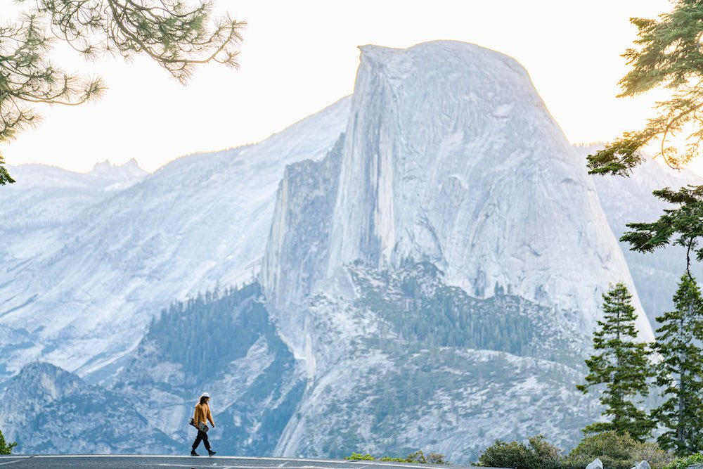
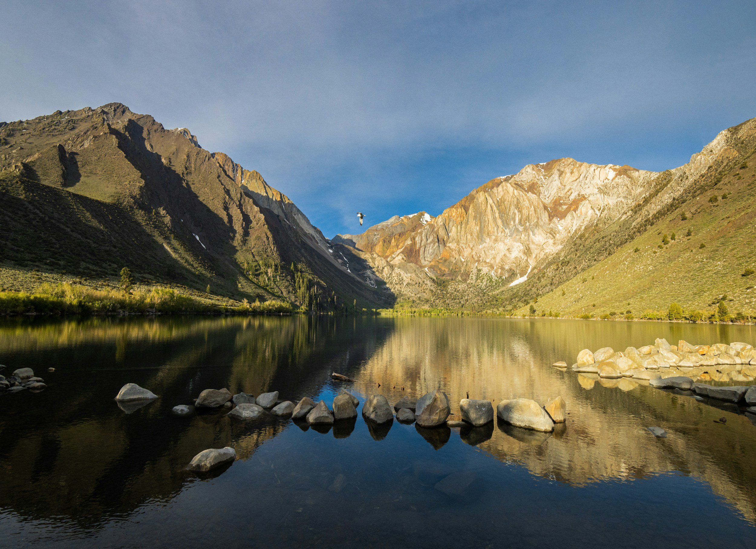


What To Do When You Visit Alabama Hills In California
Welcome to Alabama Hills, a hidden gem nestled in the heart of California's breathtaking Eastern Sierra Nevada range. This rugged and picturesque landscape has captivated visitors for decades with its unique rock formations, stunning vistas, and rich cinematic history. Whether you're an outdoor enthusiast, a photography enthusiast, or simply seeking a peaceful getaway, Alabama Hills offers an array of experiences to satisfy every traveler's wanderlust. In this blog, we will guide you through the must-see attractions and activities that make Alabama Hills an unforgettable destination.
Welcome to Alabama Hills, a hidden gem nestled in the heart of California's breathtaking Eastern Sierra Nevada range. This rugged and picturesque landscape has captivated visitors for decades with its unique rock formations, stunning vistas, and rich cinematic history. Whether you're an outdoor enthusiast, a photography enthusiast, or simply seeking a peaceful getaway, Alabama Hills offers an array of experiences to satisfy every traveler's wanderlust. In this article, we will guide you through the must-see attractions and activities that make Alabama Hills an unforgettable destination.
Discover a world of natural wonders, stunning rock formations, and rich cinematic history. Explore the iconic Mobius Arch, embark on outdoor adventures through scenic trails, and capture breathtaking photos of the Sierra Nevada mountains. Immerse yourself in Hollywood nostalgia along Movie Road and visit the Lone Pine Film History Museum. Set up camp and stargaze under the dazzling night sky, or venture to nearby attractions like Mount Whitney and Death Valley National Park.
Read on to learn more about what to do in Alabama Hills, CA and plan your next adventure!
Andrew Muse kicking into the morning at Mobius Arch. Photograph by Dalton Johnson
Pros of Visiting Alabama Hills:
Breathtaking Natural Beauty: Alabama Hills boasts stunning landscapes with unique rock formations, majestic mountains, and expansive vistas. The picturesque beauty of this destination is perfect for photography, outdoor exploration, and relaxation.
Rich Cinematic History: Film buffs and history enthusiasts will appreciate Alabama Hills' significant role in the film industry. Walking along Movie Road and visiting the Lone Pine Film History Museum allows you to immerse yourself in the nostalgia and learn about the area's extensive movie-making legacy.
Outdoor Activities: Alabama Hills offers a wide range of outdoor activities. From hiking and rock climbing to camping and stargazing, there are endless opportunities for adventure and connecting with nature. The diverse trails cater to different skill levels, ensuring everyone can find a suitable outdoor experience.
Nearby Attractions: Being in close proximity to attractions like the Mobius Arch Trail, Mount Whitney, Death Valley National Park, and the Ancient Bristlecone Pine Forest provides additional opportunities for exploration and discovering the wonders of the Eastern Sierra Nevada region.
Tranquility and Solitude: Alabama Hills provides a serene and peaceful environment, making it an ideal escape from the hustle and bustle of city life. The wide-open spaces and uncrowded trails allow visitors to unwind, recharge, and enjoy a sense of tranquility amidst nature.
Cons of Visiting Alabama Hills:
Remote Location: Alabama Hills is situated in a relatively remote area, which means it may require a longer drive to reach major cities or amenities. Visitors should plan accordingly and ensure they have everything they need for their stay.
Limited Services: Due to its remote location, amenities and services in Alabama Hills are limited. There are only a few small stores and restaurants nearby, so visitors should come prepared with necessary supplies, food, and water.
Extreme Temperatures: Alabama Hills experiences a desert climate, resulting in high temperatures during summer months. It is crucial to plan activities accordingly, stay hydrated, and be prepared for hot weather conditions. Similarly, winter temperatures can be cold, so proper clothing and gear are essential for outdoor adventures during colder seasons.
Lack of Cell Phone Reception: The remote nature of Alabama Hills means that cell phone reception can be unreliable or non-existent in certain areas. Visitors should be prepared for limited connectivity and plan accordingly for communication needs.
Limited Accommodation Options: While camping is a popular choice for visitors, Alabama Hills has limited accommodation options beyond campsites. Those seeking alternative lodging may need to look for accommodations in nearby towns like Lone Pine.
1. Marvel at the Majestic Rock Formations:
One of the main attractions in Alabama Hills is its remarkable rock formations. Spend hours exploring the mesmerizing shapes, arches, and textures of the rocks that have been sculpted over millions of years. Famous formations like the Mobius Arch and the Eye of Alabama provide fantastic opportunities for photography, framing the stunning Sierra Nevada mountains in the background.
A few of iconic ROck Formations of ALabama hills:
Mobius Arch: This iconic rock formation is one of the most famous in Alabama Hills. Its unique shape creates a natural arch framing the stunning views of the Sierra Nevada mountains in the background. It is a popular spot for photography, especially during sunrise and sunset.
Lathe Arch: Resembling a massive doorway, Lathe Arch stands tall and proud, inviting visitors to explore its grandeur. It offers a magnificent backdrop for photographs and a sense of awe as you stand beneath its towering presence.
Cyclops Rock: Aptly named, Cyclops Rock is a massive boulder with a distinct eye-like formation. It's a fascinating sight that sparks imagination and curiosity. Visitors often marvel at its size and the intricate patterns carved by time.
The Alabama Dome: This prominent rock formation is known for its dome-like shape and offers a variety of climbing routes. Rising proudly from the desert landscape, it attracts climbers and hikers who seek adventure and panoramic views from its summit.
The Mushroom: A standout among the rock formations, The Mushroom resembles a gigantic mushroom cap perched on a slender stalk. Its unique shape and the contrast against the surrounding landscape make it a captivating sight.
The Whale: As the name suggests, this rock formation resembles the silhouette of a whale emerging from the ground. It's an impressive natural sculpture that showcases the wonders of erosion and geological forces.
The Heart: Nestled amidst the rugged terrain, The Heart is a heart-shaped rock formation that evokes a sense of romance and enchantment. It offers a romantic backdrop for photographs and a tranquil spot for contemplation.

Movie Road pointing to the mountains. Photograph by Dalton Johnson
2. Capture the Magic of Movie Road:
Alabama Hills has served as a backdrop for numerous iconic films and TV shows. Take a self-guided tour along Movie Road, which winds through the hills, and discover the exact locations where famous Western movies were filmed. Immerse yourself in the history and nostalgia of the silver screen as you walk in the footsteps of Hollywood legends.
3. Embark on Outdoor Adventures:
Adventure awaits in Alabama Hills! Lace up your hiking boots and explore the many trails that traverse this stunning landscape. From easy walks suitable for all ages to more challenging treks that lead to breathtaking viewpoints, there's a trail for every level of experience. Don't miss the rewarding hike to the top of Whitney Portal, the gateway to Mount Whitney, the tallest peak in the contiguous United States.
Here is a short list of what Alabama Hills has to offer for Outdoor Adventures:
Wildlife Viewing and Nature Exploration: Alabama Hills is home to a variety of wildlife, including birds, reptiles, and small mammals. Nature enthusiasts can observe and appreciate the unique flora and fauna that thrive in this desert ecosystem. Keep an eye out for birds of prey, lizards, jackrabbits, and even the occasional bighorn sheep.
Off-Roading and OHV Trails: If you're an off-roading enthusiast, Alabama Hills offers designated OHV (Off-Highway Vehicle) trails where you can explore the rugged terrain on your ATV, dirt bike, or other off-road vehicles. Enjoy the adrenaline rush and navigate through diverse landscapes.
Photography and Scenic Drives: Alabama Hills presents endless opportunities for photographers. Capture stunning landscapes, unique rock formations, and breathtaking views of the Sierra Nevada mountains. Take a scenic drive along Movie Road, which winds through the heart of the area, offering picturesque vistas at every turn.
Mountain Biking: Alabama Hills features rugged terrain and wide-open spaces, making it an excellent destination for mountain biking enthusiasts. Ride along dirt trails, explore scenic vistas, and experience the thrill of off-road cycling amidst stunning natural surroundings.
Hiking and Trail Exploration: Alabama Hills is home to numerous hiking trails that cater to different skill levels. From leisurely walks to more challenging treks, there's something for everyone. The trails wind through stunning rock formations, scenic canyons, and desert landscapes, providing opportunities to discover hidden gems and breathtaking vistas.

4. Set Up Camp and Stargaze:
Alabama Hills is a paradise for camping enthusiasts. Find your ideal spot among the numerous campsites nestled among the rocks and under the starry night sky. As evening falls, witness the celestial spectacle that awaits you. Alabama Hills is renowned for its exceptional stargazing opportunities, providing an awe-inspiring display of constellations and the Milky Way.
Feeling timid about getting to stargazing? I wrote a beginners guide to stargazing to help you ease that hesitation, check it out.
Best Places to see the stars in Alabama Hills:
Movie Flat Road: Movie Flat Road offers wide-open spaces with minimal light pollution, making it an excellent spot for stargazing. Find a comfortable spot along the road, away from the headlights of passing vehicles, and enjoy the breathtaking views of the night sky.
Mobius Arch: The iconic Mobius Arch not only provides a stunning foreground for astrophotography but also offers a clear view of the night sky. Set up your camera and capture mesmerizing shots of the arch framing the stars above.
Whitney Portal: Located nearby, Whitney Portal offers a higher elevation and darker skies. Drive up to Whitney Portal and find a suitable spot to lay back, relax, and marvel at the brilliance of the stars above. The absence of city lights enhances the stargazing experience.
Alabama Hills Recreation Area Campgrounds: The campgrounds within Alabama Hills Recreation Area provide a convenient option for stargazing. Set up camp and step outside your tent to witness the dazzling night sky. Away from the city lights, you'll have an uninterrupted view of the stars above.
Arch Loop Trail: Take a nighttime stroll along the Arch Loop Trail, which leads you through a variety of rock formations. As you walk, look up and witness the wonders of the cosmos. The unique rock formations create a captivating backdrop for stargazing.
5. Discover the Historic Movie Museum:
Immerse yourself in the rich history of Alabama Hills by visiting the Lone Pine Film History Museum. Learn about the area's extensive movie-making legacy, featuring exhibits that showcase the films shot in the region. Delve into the stories behind the scenes, admire the authentic props and costumes, and gain a deeper appreciation for the cinematic significance of Alabama Hills.
6. Engage in Rock Climbing and Bouldering:
For those seeking a thrilling vertical adventure, Alabama Hills offers excellent opportunities for rock climbing and bouldering. The unique formations and varied routes cater to climbers of all skill levels. So grab your gear, challenge yourself on the granite faces, and enjoy the exhilaration of conquering these natural wonders.
A few Climbing areas to check out:
Lone Pine Peak - Rising above the Alabama Hills, Lone Pine Peak offers a mix of traditional and alpine climbing routes. With stunning views and a variety of route options, it provides a memorable climbing experience for intermediate to advanced climbers.
The Alabama Dome - This prominent dome-shaped rock formation offers a selection of moderate to challenging traditional and sport climbing routes. It is known for its excellent friction and crack climbing opportunities.
The Cave - As the name suggests, The Cave is a unique bouldering area within the Alabama Hills. It offers a range of problems for all skill levels, with numerous pockets, slopers, and overhangs to tackle.
The Hot Tub - Another popular bouldering spot, The Hot Tub features an assortment of high-quality problems. It offers a mix of technical face climbing and powerful moves, providing a great challenge for boulder enthusiasts.
Mystery Towers - Located near the Whitney Portal, Mystery Towers offer adventurous multi-pitch trad climbs. The area has a collection of intriguing rock formations, providing a unique climbing experience for those seeking a bit of exploration.
The Movie Road Boulders - Scattered along Movie Road, these boulders offer a convenient bouldering experience for climbers of all levels. The area provides a mix of small to medium-sized boulders with a variety of interesting features and holds.
7. Explore Nearby Natural Wonders:
When visiting Alabama Hills, you'll find yourself surrounded by an abundance of natural wonders that are well worth exploring. Here are a few nearby attractions that will add even more excitement and beauty to your adventure:
Mobius Arch Trail: Located just a short distance from Alabama Hills, the Mobius Arch Trail is a must-visit destination for photographers and nature enthusiasts alike. This easy, 0.6-mile hike leads you to the iconic Mobius Arch, a natural rock formation that frames the majestic Sierra Nevada mountains perfectly. Capture breathtaking photos as the arch beautifully frames the towering peaks, creating a picture-perfect moment.
Mount Whitney: For the avid hikers and mountaineers, a trip to Alabama Hills presents an excellent opportunity to explore the legendary Mount Whitney. Rising to an elevation of 14,505 feet (4,421 meters), Mount Whitney is the tallest peak in the contiguous United States. While reaching the summit requires careful planning and a permit, you can still enjoy the stunning scenery and embark on shorter hikes in the surrounding area. Whitney Portal, the starting point for many Mount Whitney expeditions, offers picturesque trails with cascading waterfalls and panoramic vistas.
Death Valley National Park: If you're up for a slightly longer excursion, consider visiting the otherworldly landscapes of Death Valley National Park. Roughly two hours away from Alabama Hills, Death Valley is known for its dramatic desert scenery, vast salt flats, towering sand dunes, and unique geological formations. Explore Badwater Basin, the lowest point in North America, or marvel at the vibrant colors of Artist's Palette. Be sure to visit Mesquite Flat Sand Dunes, a photographer's paradise, where endless dunes create an ever-changing canvas of light and shadow.
Manzanar National Historic Site: Immerse yourself in a different aspect of history by visiting the Manzanar National Historic Site, located approximately 10 miles north of Lone Pine. This site serves as a reminder of a dark chapter in American history—the internment of Japanese Americans during World War II. Explore the preserved remnants of the internment camp, visit the museum to gain insight into the lives of those who were incarcerated, and reflect on the importance of preserving civil liberties.
Ancient Bristlecone Pine Forest: Venture into the Ancient Bristlecone Pine Forest, a hidden treasure located high in the White Mountains. A scenic two-hour drive from Alabama Hills, this forest is home to some of the world's oldest living trees, including the renowned Methuselah, which is estimated to be over 4,800 years old. Take a leisurely stroll along the Discovery Trail and marvel at the twisted, gnarled trunks that have withstood the test of time.
Owens Lake: A short drive from Alabama Hills, Owens Lake is a stunning body of water surrounded by the majestic Eastern Sierra Nevada range. While the lake has historically been mostly dry due to water diversions, recent restoration efforts have resulted in the return of some water and the revival of bird populations. Visit the lake during the fall and spring migration seasons to witness a variety of bird species, including elegant shorebirds and graceful waterfowl.
Sierra Nevada Scenic Byway: If you're a fan of scenic drives, don't miss the opportunity to traverse the Sierra Nevada Scenic Byway. This breathtaking route takes you through towering mountain passes, alpine meadows, and lush forests. Experience the changing landscapes as you wind your way through picturesque towns like Bishop and Mammoth Lakes, all while being surrounded by the awe-inspiring beauty of the Sierra Nevada range.
Where are the Alabama Hills?
Alabama Hills is located in the eastern part of California, near the town of Lone Pine. Specifically, it is situated in Inyo County, in the southern portion of the state. The Alabama Hills are nestled at the foot of the majestic Sierra Nevada mountain range, offering breathtaking views of the surrounding peaks and valleys. Despite its name, Alabama Hills is not actually in Alabama but takes its name from a Confederate warship, the CSS Alabama, which was honored by local miners during the American Civil War.
How to Get to Alabama Hills?
1. From Los Angeles:
The most common way to reach Alabama Hills from Los Angeles is by car. Take the I-5 North to the CA-14 North, then continue on US-395 North. The total driving distance is approximately 230 miles, and the journey takes around 3.5 to 4 hours, depending on traffic conditions. Follow signs for Lone Pine, and you'll arrive at Alabama Hills.
2. From Las Vegas:
If you're coming from Las Vegas, you'll take I-15 North towards Los Angeles. After crossing the Nevada-California state line, continue on I-15 until you reach the town of Baker. From there, take CA-127 North, which will merge onto US-395 North. Continue on US-395 until you reach Lone Pine, and follow signs to Alabama Hills. The total driving distance is approximately 200 miles, and the journey takes around 3.5 to 4 hours.
3. From San Francisco:
From San Francisco, you'll take I-580 East towards Oakland, then merge onto I-205 East towards Tracy. Continue on I-205, which will merge onto I-5 South. Take the exit for CA-120 East towards Manteca/Sonora, and continue on CA-120 East until you reach US-395 South. Follow US-395 South all the way to Lone Pine, and then follow signs to Alabama Hills. The total driving distance is approximately 375 miles, and the journey takes around 6 to 7 hours, depending on traffic and road conditions.
4. From Lake Tahoe:
To reach Alabama Hills from Lake Tahoe, start by taking US-50 West from South Lake Tahoe. Continue on US-50 West until you reach the town of Placerville. From there, take CA-49 South towards Jackson, and then merge onto CA-88 East. Stay on CA-88 East until you reach the junction with CA-89 South, and follow CA-89 South towards Markleeville and Monitor Pass. Continue on CA-89 South until you reach US-395 South, and then follow US-395 South to Lone Pine. Once in Lone Pine, you'll see signs directing you to Alabama Hills. The total driving distance is approximately 225 miles, and the journey takes around 4.5 to 5 hours, depending on traffic and road conditions.
A panoramic view of the Alabama Hills and the Eastern Sierra Mountains at sunset. Photograph by Dalton Johnson
Alabama Hills, CA, is a hidden gem that offers a wealth of experiences for nature lovers, outdoor enthusiasts, and photographers alike. From its majestic rock formations and stunning vistas to its rich history and diverse recreational activities, Alabama Hills has something for everyone. Whether you're seeking adventure through hiking and rock climbing, immersing yourself in the tranquility of stargazing, or simply capturing the beauty of the landscape through photography, this unique destination promises to leave you awe-inspired. So, pack your bags, hit the road, and discover the wonders of Alabama Hills. Let the rugged beauty and serene environment transport you to a place where natural splendor and outdoor adventures collide. Alabama Hills is waiting to be explored, and the memories you create here will last a lifetime.
Discover more of the Eastern Sierra
Type 2 Fun | A Cinematic Adventure
Now that we understand what type 2 fun is, where does inspiration come from behind this video? My adventures. Since 2016, I have dedicated my life to adventures that range from the grand to the micro. Just the idea of adventure get’s me excited and I often read books about adventures just to get the ideas flowing.
Type 2 Fun Script
I have no idea why I keep going on these adventures. Half the time I am asking myself, “what the hell am I doing?”
Things are always breaking, often I am shivering alone in a sleeping bag, pedaling into a horrific head wind, or puking my guts out from altitude sickness… Like, does that even sound fun to you?
If it does, I think you are kinda messed up. But, the good kind of messed up because it means you and I are alike.
Ehhh then again, maybe that’s a bad thing. Does the world really need two of us?
We are the weirdos. Lovers of monotony. Freaks of nature who fancy a good a ole fashioned suffer fest.
Pedaling down dirt roads in search of something, anything really. If we are lucky, it’ll be a hot spring or a pretty view, but most of the time it, is nothing more than some flat ground to lay our heads.
Even if that’s the case, you’ll find me dancing like a fool. It’s just one of those things that brings me joy.
The funny part of these trips, I hate them. Like really, I don’t enjoy it. Yet, I love them once the trip is over and find myself asking, “what stupid thing is next?”
A trip to the mountains, another bike packing trip, endurance trail run, who knows?
For now, I’ll just keep scrolling though the memory bank, happy I elected to suffer for week.
I guess that is why they call it type two fun.
Idea Behind the Video
As a lover of type 2 fun, the script above landed on a piece of paper as I journaled one morning. Most of the video content had already been shot, so I just needed to have the editing work done, but where did the inspiration come from? First, let’s answer the basic question, what is type 2 fun?
Type 2 fun occurs when a task is difficult at the time, but feels rewarding afterward, often because it challenges the practitioner to test their limits and grow.
Now that we understand what type 2 fun is, where does inspiration come from behind this video? My adventures. Since 2016, I have dedicated my life to adventures that range from the grand to the micro. Just the idea of adventure get’s me excited and I often read books about adventures just to get the ideas flowing.
Yet, this video predominantly comes from a semi-recent supported bikepacking adventure that I did from Lake Tahoe to Mount Whitney, where I bikepacked and tried to hike to the summits of both peaks.
Shooting the Video
I wish I could say that this was filmed on a high end camera, but the reality is I used a GoPro because I didn’t want to carry much weight, as this trip was a personal project. The content for this video was shot during a supported bikepacking trip from Freel Peak to Mount Whitney. Honestly, this video was kind of one of those “what do I do with this footage” kind of videos, which gives the video its raw and authentic feeling.
In many ways, some of the best adventure movies in the world are created this way.
The goal with this video was to take the content from the trip and showcase the spirit of type 2 fun, aka the suffering an adventurer goes through on an adventure. Mostly, this is a mental battle, but sometimes this is a physical one as well. In my case for this trip, it was both.
Discover More Creative Works By Dalton
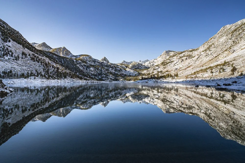

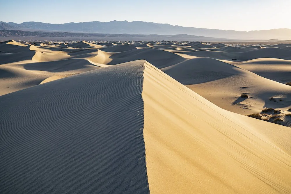
10 Must Summit Mountains of the Eastern Sierra
Are you looking to stand on the summit of a mountain in the Eastern Sierra on your next road trip? Perfect! You found the right place for a tick list. Below you will find 10 peaks, some obvious, some not so much, that have been challenging, enjoyable, and made my list of “Must Summit” peaks. Most of these peaks can be done in a single day of hiking, but are often made more enjoyable if you have the time for a backpacking trip. Regardless, park your vehicle at the trailhead and get started, the Eastern Sierra is calling!

The Eastern Sierra skyline just outside of Bishop, CA. Photo by Dalton Johnson
Are you looking to stand on the summit of a mountain in the Eastern Sierra on your next road trip? Perfect! You found the right place for a tick list. Below you will find 10 peaks, some obvious, some not so much, that have been challenging, enjoyable, and made my list of “Must Summit” peaks. Most of these peaks can be done in a single day of hiking, but are often made more enjoyable if you have the time for a backpacking trip. Regardless, park your vehicle at the trailhead and get started, the Eastern Sierra is calling!
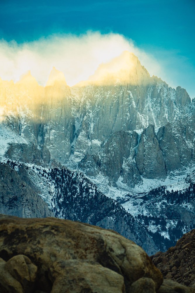
Mount Whitney
Boasting as the highest summit in the lower 48, Mount Whitney, is an obvious first choice. The catch… permits. While you can play the permit game, and I could talk poorly about the permit system, just know that you have options; go outside of the permit season, play the permit game, take the chance of getting the ticket, and many more. It’s your choice. However, before I go too deep down that wormhole, I’m going to catch myself and turn the corner.
Why should Mount Whitney be on the list of Must Summit Mountains in the Eastern Sierra?
Mount Whitney is the tallest mountain in the lower 48, so if you are chasing summits… do it
You can rock climb, scramble, or walk to the top of Mount Whitney
If you decide to summit Mount Whitney, over a couple of days, this backpacking trip will be one you will remember for the rest of your life
At the top, there is a hut that is historical, well built, and worth checking out… like how did they build this?!
The summit views provide a glimpse into all that the Eastern Sierra have to offer
How to climb Mount Whitney:
Option one: hike to the top
Option two: Mountaineers Route
Options three: The Regular Route (5.6)… it’s a classic
Scott making the final moves towards the summit of Mount Emerson in the Eastern Sierra. Photo by Dalton Johnson
Mount Emerson
Do you like easy free solos? Well, if you do, this is your peak! Located a stone’s throw to Bishop, CA — no really you could throw a rock from the top and hit the town square of Bishop —Mount Emerson is a part of the skyline I’ve grown to love and cherish. For most, this peak is a half-day outing that can take a full day with route finding. The piece of resistance is the top! Several rock features will blow your mind, at least they blew mine while climbing Mount Emerson. Especially the knife’s edge! Take your time while scrambling this peak. If it is outside of your free soloing, bring a rope with you and take a full day! Climbing Mount Emerson is a fun adventure.
Why should Mount Emerson be on the list of Must Summit Mountains in the Eastern Sierra?
If you spend enough time in Bishop, CA you will often look at this peak along the skyline
The technical rock climbing is 200 feet in total, so it is very accessible to free-solo
You can bring a rope and protect all of the technical climbing
Climbing Mount Emerson’s takes a half day
How to climb Mount Emerson:
Option one: Free Solo
Option two: Bring a rope, 5.6 chimney and 4th class ridge traverse
Approach views of Matterhorn Peak (in the back) while on a climbing trip in the Eastern Sierra. Photo by Dalton Johnson
Matterhorn Peak
Okay, we all wish that this was the real Matterhorn, but California climbers just can’t have it all in the Eastern Sierra. The approach hike will definitely kick your butt, so think about turning this climb into a two, or three, day backing trip while sleeping at the lake below the moraine. Once you are here and are thinking about climbing, go do it! If you have the skills to trad climb, get after it! This peak is only a few pitches with a crux of 5.7. If you are a peak bagger, head up the gully, around the backside, and walk to the top! Either way, this peak is one any peak bagger should dream of summiting. Not because the climbing is epic, head over to the Incredible Hulk for that. This peak is wonderful because of its historic connection with the Beatniks, as featured in the book The Dharma Bums by Jack Kerouac. Kerouac and Gary Snyder climb this peak. Pretty cool right?
Why should Matterhorn Peak be on the list of Must Summit Mountains in the Eastern Sierra?
This peak has historical context for the Beatnik community… arguably a foundational movement which paved the way for the modern “dirtbag”
Technical rock climbing on Matterhorn Peak is short; 4-6 pitches
You can easily break this climb into a 2 or 3 day backpacking climb
How to climb Matterhorn Peak:
Option one: Regular Route (5.7)
Option two: 3rd class gully
Scott and I scrambling to the top of Bear Creek Spire on a climbing trip in the Eastern Sierra. Photo by Dalton Johnson
Bear Creek Spire
History at its finest. The traditional route up Bear Creek Spire was first ascended by Galen Rowel. For those who are unfamiliar with Rowel, he was a pioneer in climbing photography and the Eastern Sierra. Maybe, most known today as Jimmy Chin’s mentor. Unfortunately, Rowel has passed, however he left behind a plethora of first ascents throughout the Eastern Sierra, including Bear Creek Spire. As you climb this buttress to the peak, just think about doing it in boots! Such incredible climbers they must have been back in the day, I surely tip my hat to them all.
Why should Bear Creek Spire be on the list of Must Summit Mountains in the Eastern Sierra?
A historical tick that you earn
A long and winding climb, a good place to simul-climb
The pitch after the crux is really fun! You will climb through a keyhole, which is rad
How to climb Bear Creek Spire:
Option one: Regular Route 5.8
Option two: Scramble the descent gully (not recommended)
Looking back at Mount LaConte in the Eastern Sierra while linking with Mount Mallory and Mount Irvine. Photo by Dalton Johnson
Mount LeConte
When you climb Mount Langley, you will stare at this peak and think to yourself, “I should be over there, climbing that!” Mount LeConte is a 4th class scramble, that is often overlooked because of its position and trailhead being located in the same parking lot as Mount Whitney. Climbing Mount LeConte, you will find a memorial plaque for someone who slipped while scrambling. Please, pay your respects and climb carefully! The route is 4th class, but it is a real 4th class route defined in the High Sierra bible as, “4th class is like climbing a ladder where a fall would result in death.” Okay, enough of the scary talk.
Climbing Mount LeConte, and the link up with Mount Mallory and Mount Irvine is one of my favorites in the Eastern Sierra. You will be alone, as people typically do not venture out there. There is a grouping of lakes you can sleep at that almost always has permits available. And lastly, the scramble leaves you engaged! Moreover, the descent, often on moderate snow patches will keep you focused until you are celebrating your summits with a skinny dip in the snow-fed lake!
Why should Mount LeConte be on the list of Must Summit Mountains in the Eastern Sierra?
Climbing Mount LeConte in a day is a great fitness test
Linking Mount LeConte with nearby peaks makes for a stellar outing!
You will likely be alone
This peak is often overlooked, yet it is fun and accessible to avid peak bagger
How to climb Mount LeConte:
Option one: 4th class gully
Option two: link up with Mount Mallory and Mount Irvine
Grabbing some water and taking a short break before heading up the snow slope to Mount Sill in the Eastern Sierra. Photo by Dalton Johnson
Mount Sill
Want to feel like an alpinist? Climbing Mount Sill is a full-value climb that “requires”* a variety of skills to reach the top. Because of this, climbing Mount Sill holds a special place in my heart. As you approach the climb, you’ll jump through the moraine of house-sized boulders, then ascend a snow slope of a glacier to gain another snow slope. At this point, several hours have passed and you might be asking yourself, “Where the heck does this climb start?” And then, out of nowhere, you pull around an arete to a hunk of climbable rock. That is the start! Quite honestly, I am not sure we were on the correct route, but the climbing was fun regardless.
*You should be familiar with and know how to use crampons and an ice ax, this will keep you safe, especially on the descent. Also, knowing the basics of a glacier and glacial travel should be in the back of your mind. I put quotes around requires because the requirement is more of a STRONG recommendation around snow. You can work through this without much skill, but it will be sketchy.
Why should Mount Sill be on the list of Must Summit Mountains in the Eastern Sierra?
You will feel like an alpinist
Great technical climbing on quality rock
Mount Sill will test your alpine rock climbing route finding skills
How to climb Mount Sill:
Option one: Swiss Arete (5.7)
Option two: 4th class route
Option three: Palisade Traverse
Climbing Middle Palisade on an Eastern Sierra peak bagging road trip. Photo by Dalton Johnson
Middle Palisade
Tucked away with limited access in the Eastern Sierra, Middle Palisade is a peak that is often overlooked, unless you are hunting for 14,000-foot summits. At the end of the day, climbing Middle Palisade has a history of confusing people. Hell, even Alex Honnold and Cedar Wright climbed the wrong peak in Sufferfest 2. Middle Palisade can easily be accessed from the John Muir Trail, however, to get there would be heinous. So, most access the climbing routes of Middle Palisade via the South Fork and ascend a 4th class gully to the summit. I suggest a helmet, as the rock fall is high, especially if somebody else is there. Other than locating the correct peak on the horizon, climbing Middle Palisade is straightforward. Go up the gully and scramble to the top. Celebrate, then come back down.
I’ll admit, this Eastern Sierra peak was hard for me. I struggled to get to the top and I don’t think it was the altitude. Middle Palisade, while on paper, can be done in a day, I took three. The summit day still kicked my butt. The approach is long and the amount of time one is focused on the scramble is long. During our climb, we came across two other parties (note, in the summit register, our parties were the first to summit Middle Palisade in over three years), so rock fall was happening all of the time. Adding to the stress, we didn’t have helmets.
In the end, everyone was super kind and we all exchanged phone numbers, one guy even gave me a Phish CD!
Why should Middle Palisade be on the list of Must Summit Mountains in the Eastern Sierra?
Middle Palisade is a test of endurance and fitness
Off trail route finding skills for beginners will be tested
A mental test of comfortability around prolonged exposure
How to climb Middle Palisade:
Option one: hike to the top
Option two: there are rock climbing routes, check them out on Mount Project
Mount Williamson reflecting in the morning light while approaching the peak to climb on an Eastern Sierra mountain climbing trip. Photo by Dalton Johnson
Mount Williamson
As the second tallest peak in the Eastern Sierra, Mount Williamson was on my list of summits to climb. I was interested in linking both Mount Williamson and Mount Tyndall together, in a day. Turns out, that was ambitious and 48 hours was a better option. Climbing Mount Williamson in the Eastern Sierra is a fun climb. The traditional route takes you through variety of lakes, to a gully. At the bottom, this gully is loose and could dislodge large blocks. As you progress upward, the rock gets good and you are scrambling on solid granite. Eventually, you ascend a 4th class chimney to gain the ridge which takes you to the summit of Mount Williamson.
*Strangely enough, you get really good service on the top of Mount Williamson if you have Verizon. I only know this because I forgot to turn my phone on airplane mode and was bombarded with messages when I got to the top, taking away from the nature experience. Make sure to turn your phone to airplane mode.
Why should Mount Williamson be on the list of Must Summit Mountains in the Eastern Sierra?
Mount Williamson is the 2nd highest peak in the Eastern Sierra
The chain of lakes at its base are gorgeous
The climbing is a good introduction to harder, technical climbs
How to climb Mount Williamson:
Option one: The 4th class gully
Option two: Link with Mount Tyndall for an epic 4th class adventure
Thunderbolt Peak
When I look back at some of my favorite summits in the Eastern Sierra, Thunderbolt peak might be the highest on the list. Why? Climbing Thunderbolt Peak has one of the coolest top outs as well as fun route finding throughout the climb. If you take your time to climb this peak, aka sleep at the lake below, summit, then pack out, climbing Thunderbolt Peak in the Eastern Sierra is a gem. For the most part, if coming from the North Lake trailhead, the climbing route is fourth class, up a gully, for a wild finish. Some have argued that the last 200 feet are low fifth class, so just be heads up.
Climbing peaks in the Eastern Sierra has a way of smacking you with reality. I was struggling at the start, as the route covers a good amount of vertical terrain and Thunderbolt peak was an early season summit for me—aka I was out of shape! Along the route, I met up with another group who were summiting all the 14ers in California and were just having a blast! Together, we bagged this summit and headed to Starlight peak the following day for another successful summit.
Why should Thunderbolt Peak be on the list of Must Summit Mountains in the Eastern Sierra?
The climbing is engaging
The exposure for the top out gets the heart fluttering
You are likely have the summit to yourself
The summit block top out is something you will never forget
How to climb Thunderbolt Peak:
Option one: Hike and climb from North Lake trailhead via gully
Option two: Come across the massif doing the Sill to Thunderbolt traverse
The approach to climb Mount Langley in the Eastern Sierra Mountains on a climbing road trip. This is the Ashram approach. Photo by Dalton Johnson
Mount Langley
I put Mount Langley on this Eastern Sierra tick list for those who are just starting out. While I don’t think this peak is very exciting, it is for a first time peak bagger. To summit Mount Langley, you have to be ready for a slog. Not in a bad way, it just is a long, long ways for a single day push. So, if you are just bagging this peak to claim all the 14ers in California, then let’s face it, this peak blows. However, if you are trying to climb your first 14,000 foot peak in the Eastern Sierra, Mount Langley is a great place to start. To enjoy this, I would suggest doing it in two days, maybe three, so that you can have fun with friends. Bring some celebratory drinks, roast some s’mores, and reconnect with nature as you build those quads and glutes when hiking to the top via the standard route.
Why should Mount Langley be on the list of Must Summit Mountains in the Eastern Sierra?
Non-technical 14,000 foot peak that is accessible to most
Great summit views
Wonderful two or three day camping trip while staying at lakes along trail
A challenge for anyone doing this peak out and back in a day!
How to climb Mount Langley:
Option one: Hike to the top
Option two: Scramble past the Ashram
The Eastern Sierra have been nicknamed the Range of Light for many reasons, one of which being the rainbows often seen during and after a storm. Photo by Dalton Johnson
To Conclude
Summiting mountains in the Eastern Sierra is a blast. Along the way, make sure to enough the wild flower blooms, wildlife, and take in the summit views. If you are seeking a physical or mental challenge, chasing summits in the Eastern Sierra the place for that. If you have goals of climbing in the greater ranges (the Andes, Alaska, Himalayas) the Eastern Sierra Mountains are a formidable training ground. The best part of all these places listed above, even if you don’t reach the summit, the treks out are well worth the adventure.
Please note: Climbing of any kind is dangerous and I do not assume responsibility for any of your actions. These accounts are from my personal experience. The overall rock quality is good, but do be careful. All of these routes are to be respected, even the half day climbs. Make your own judgement calls, understand your limits, and be safe.


